Download as PDF, PPTX


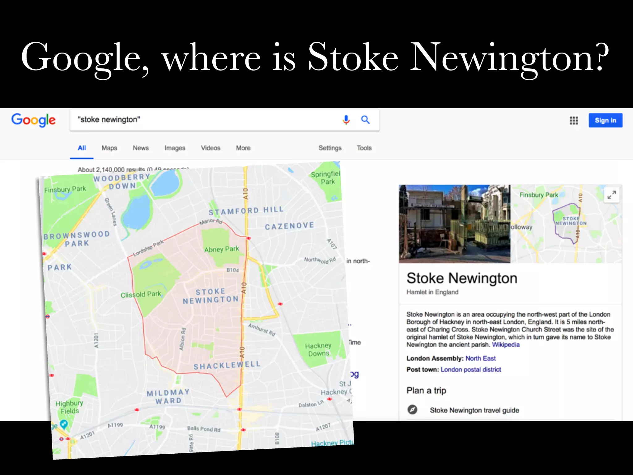

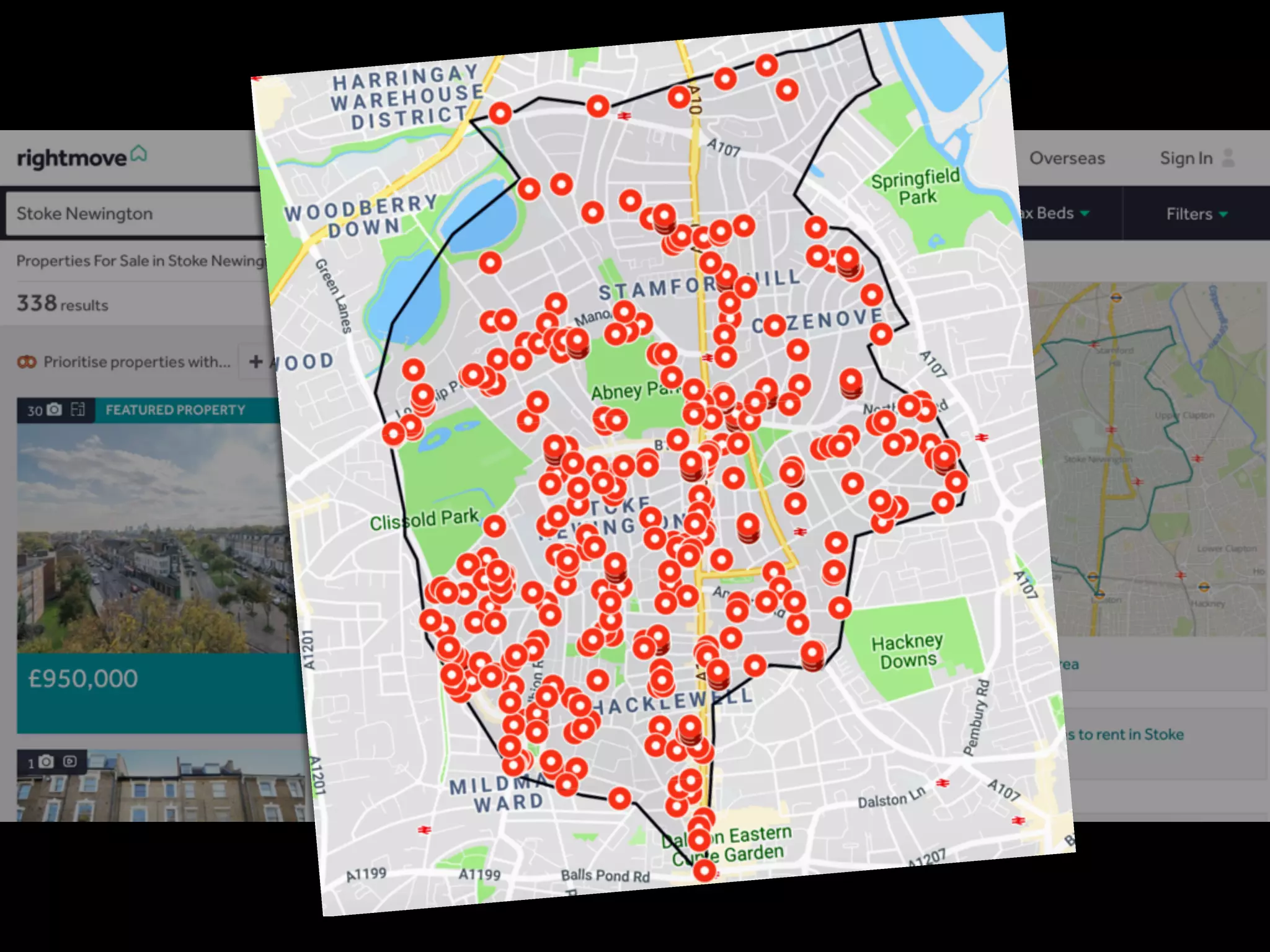
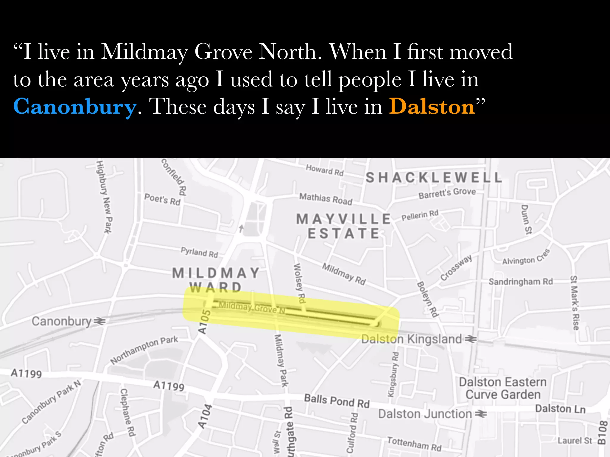

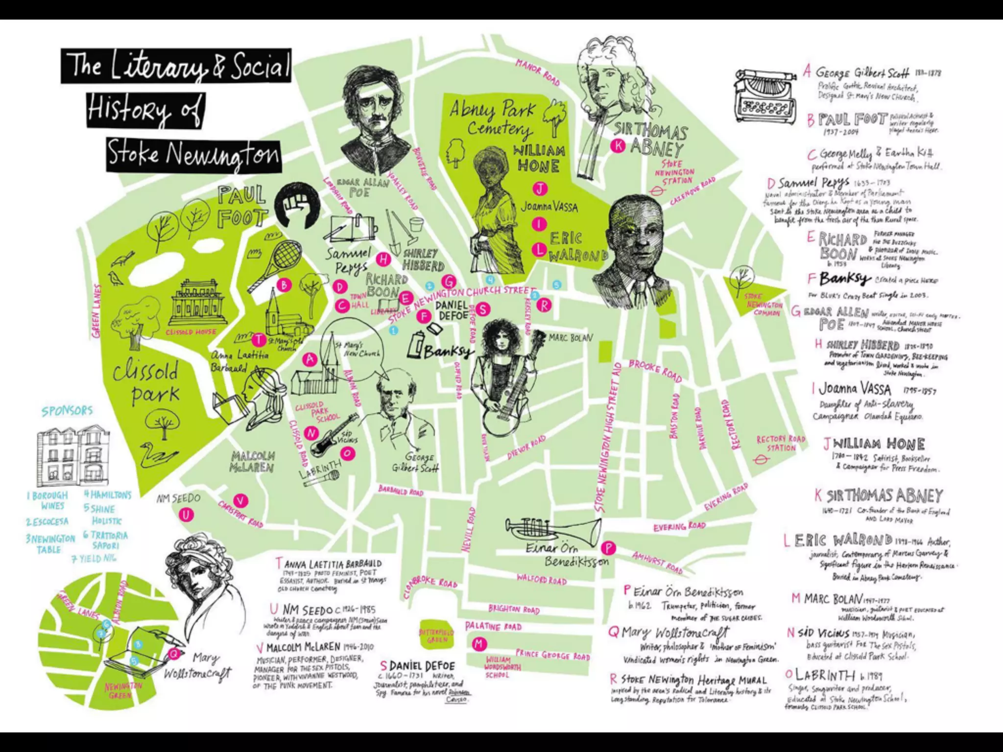


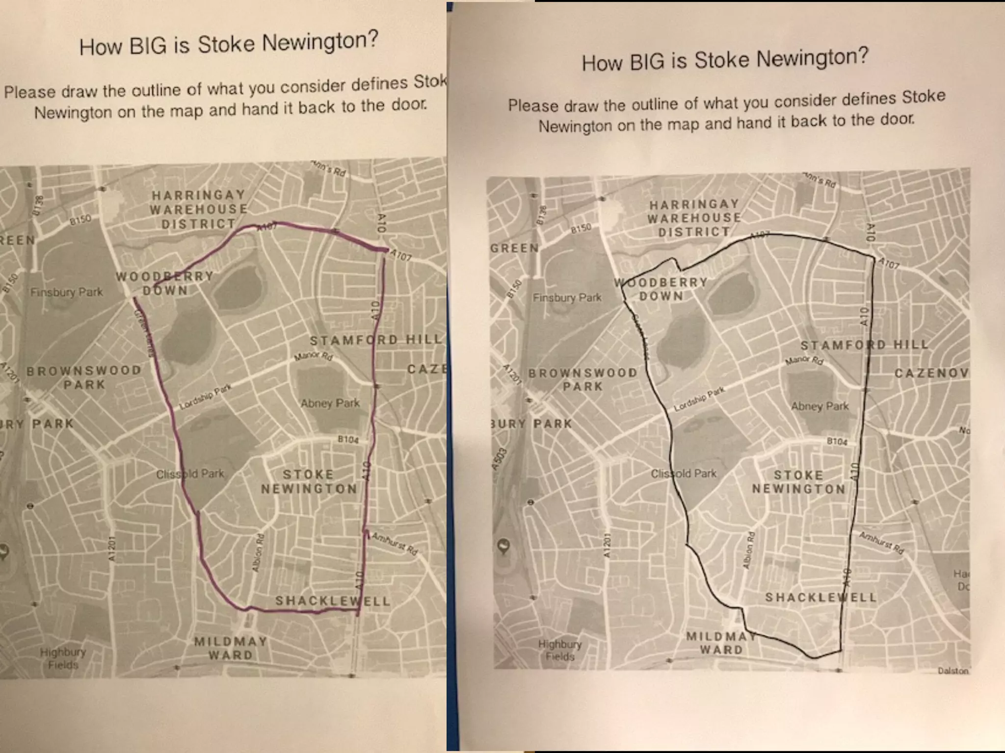
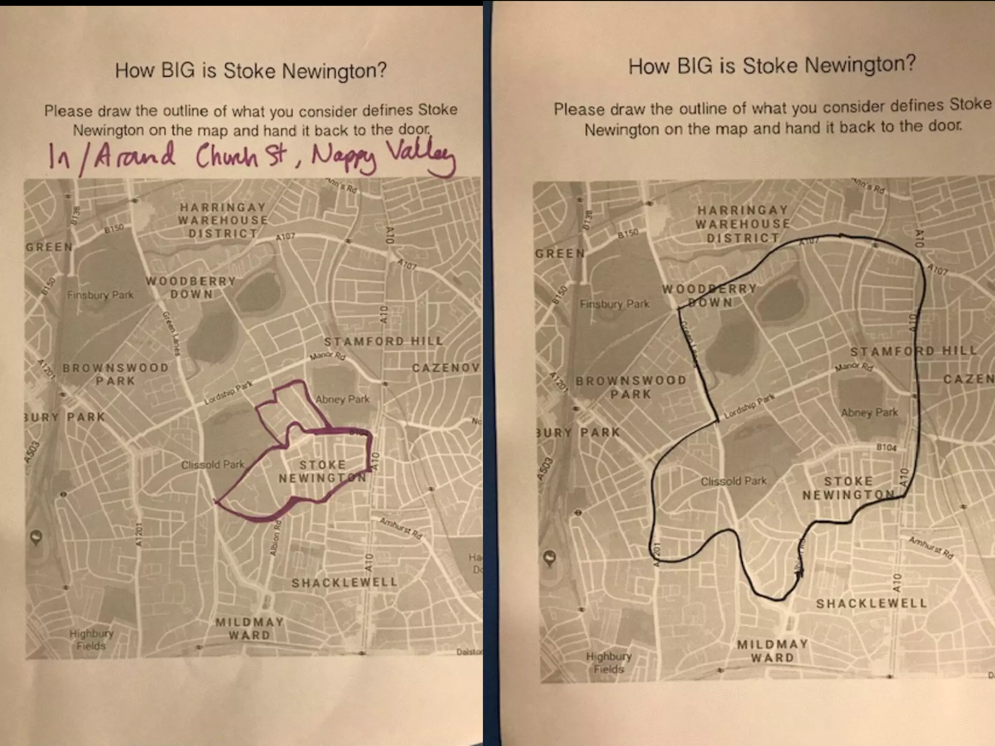
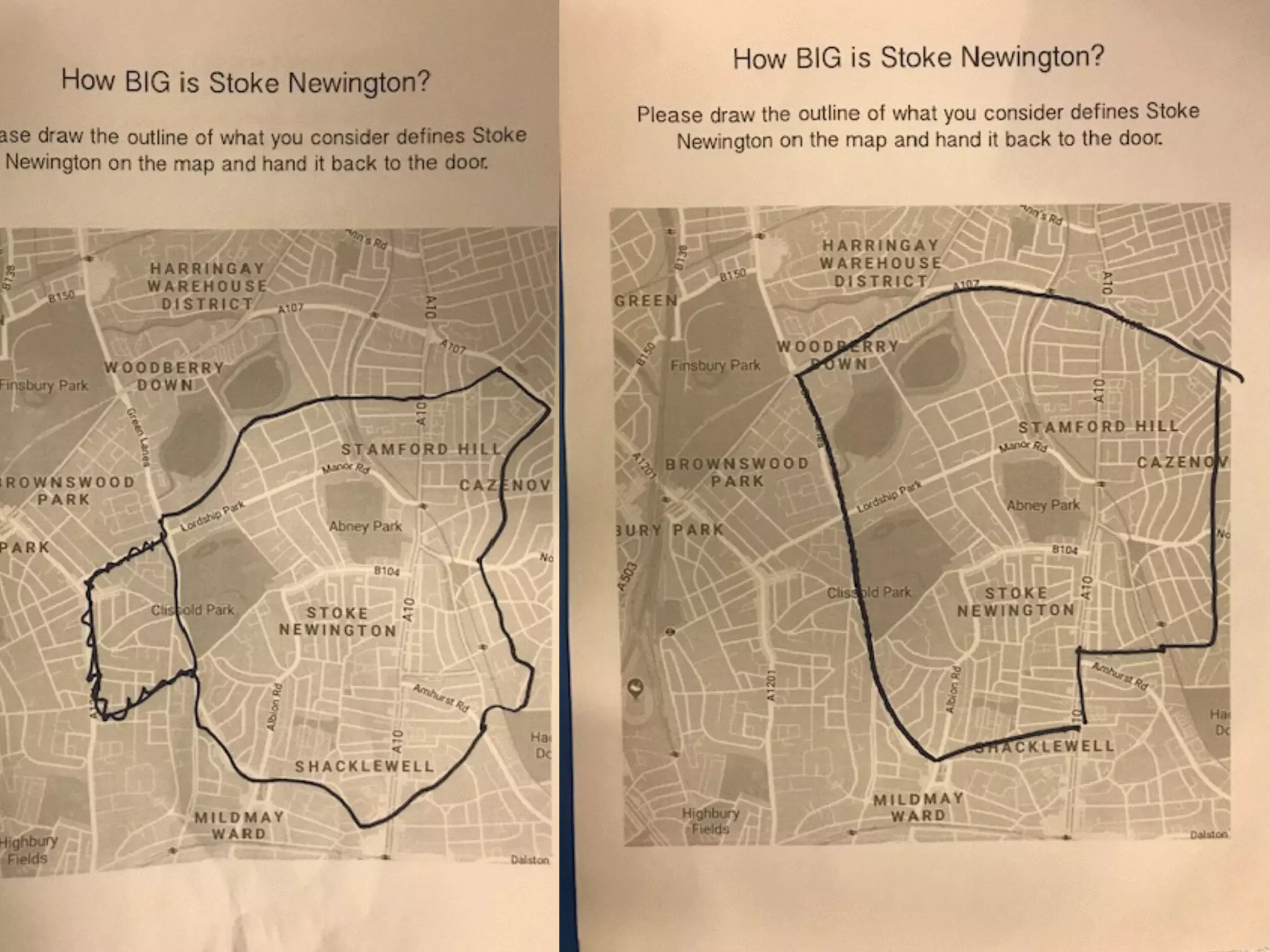
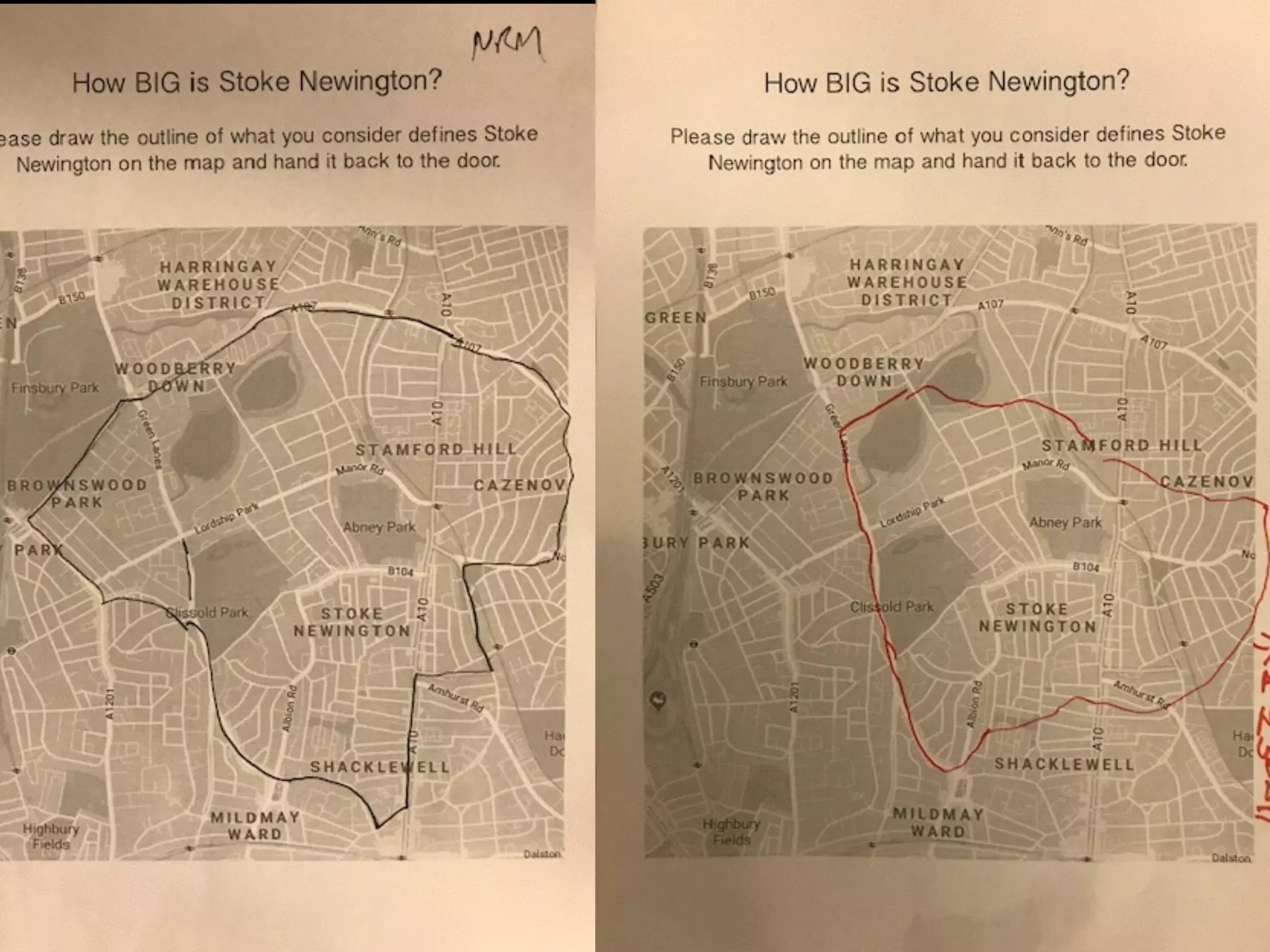


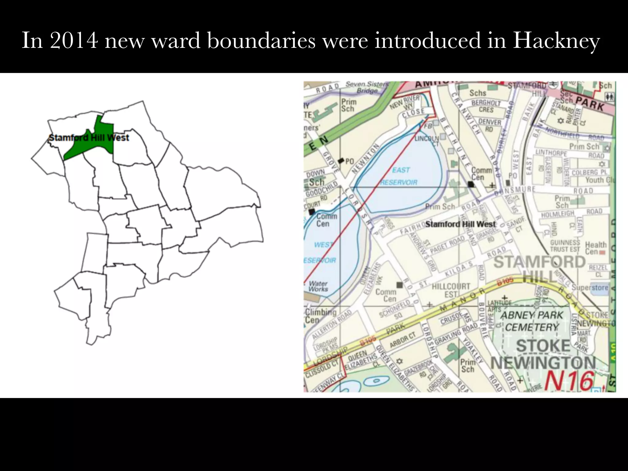
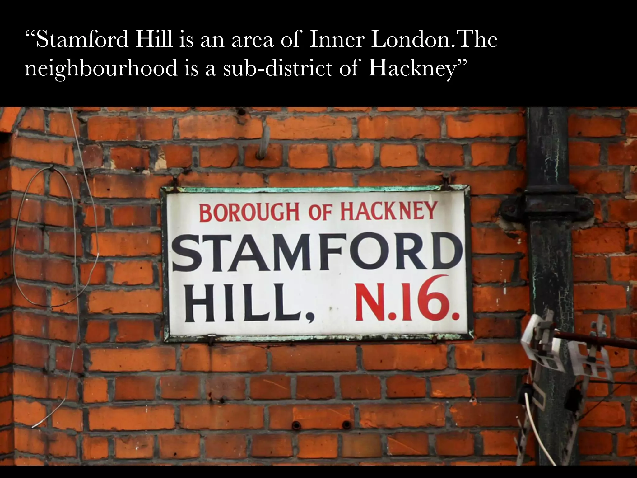


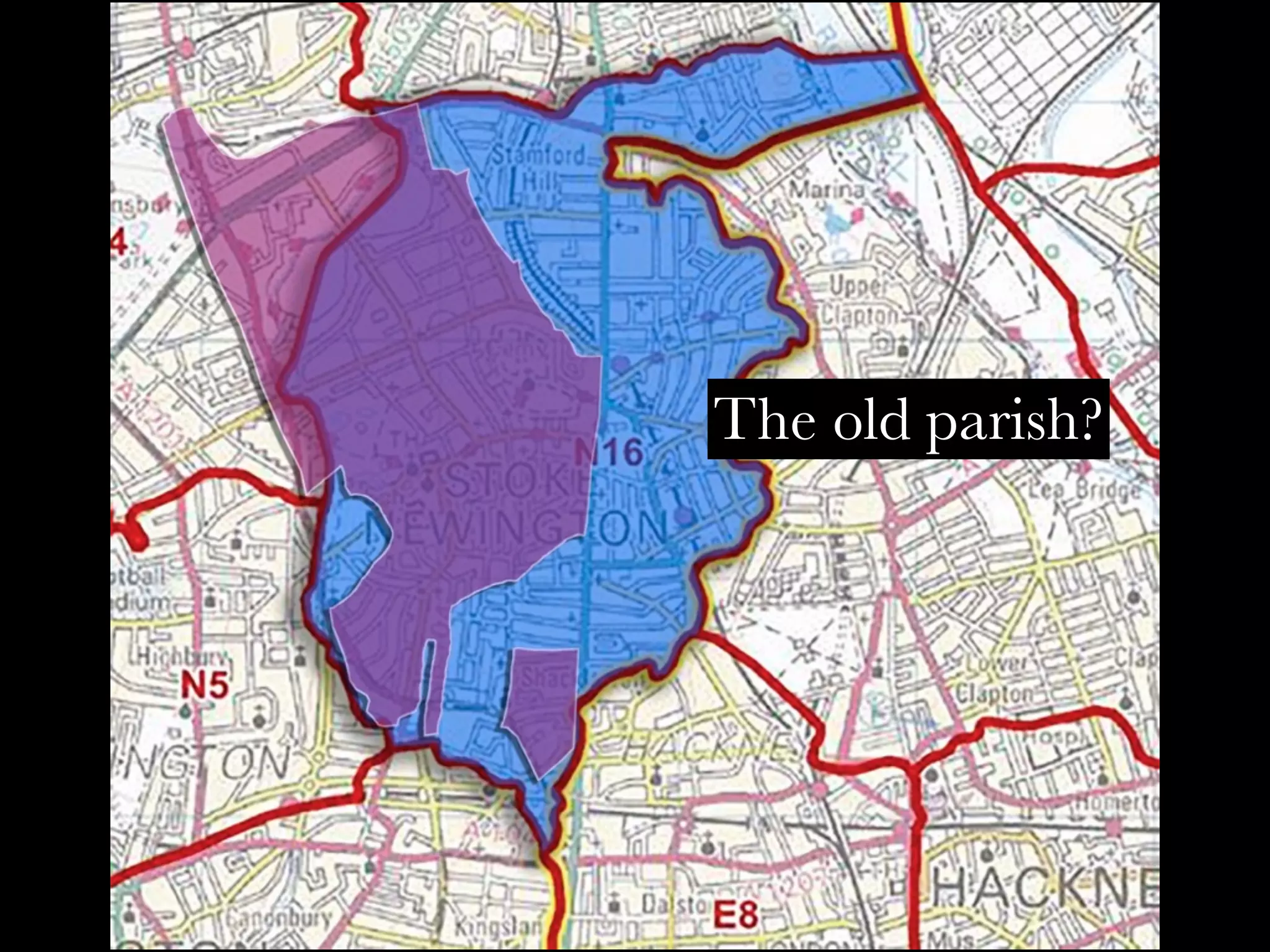
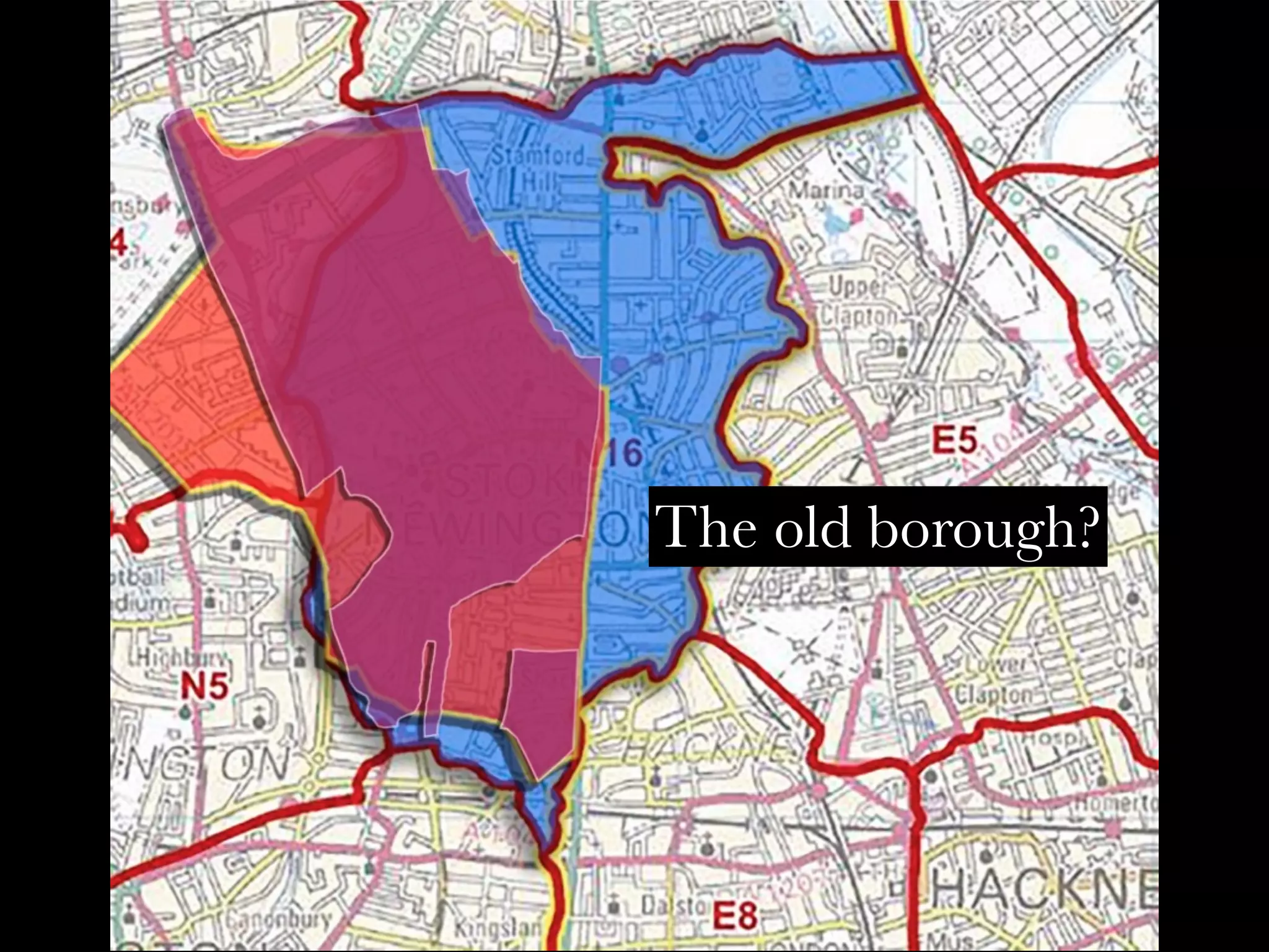
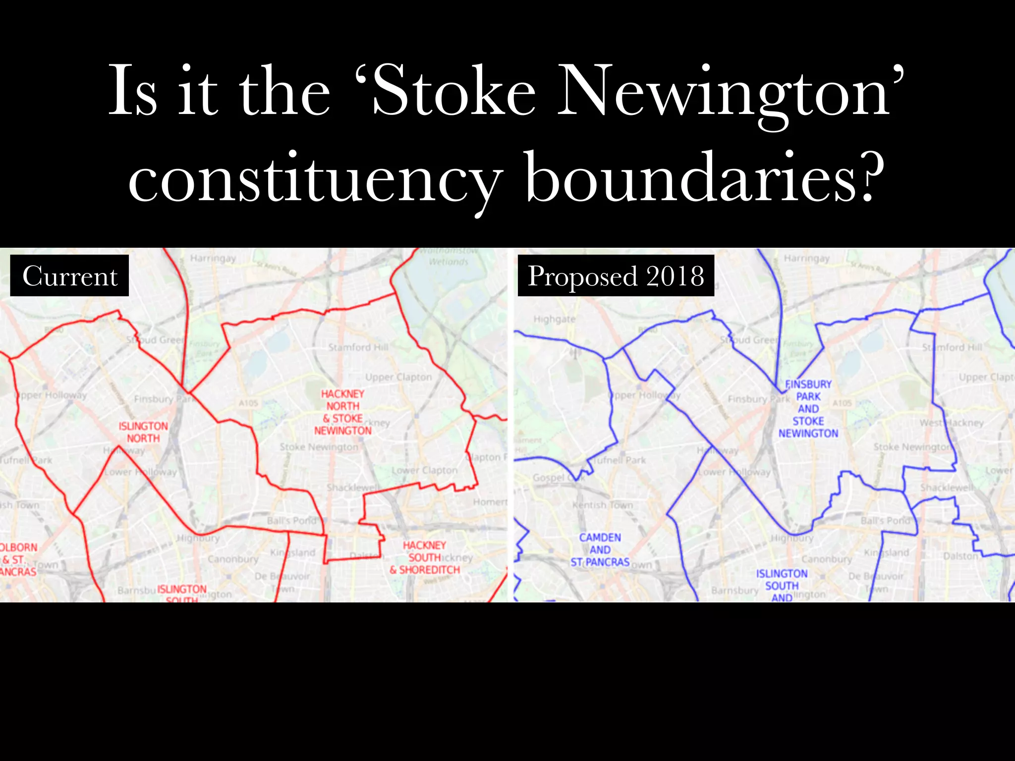

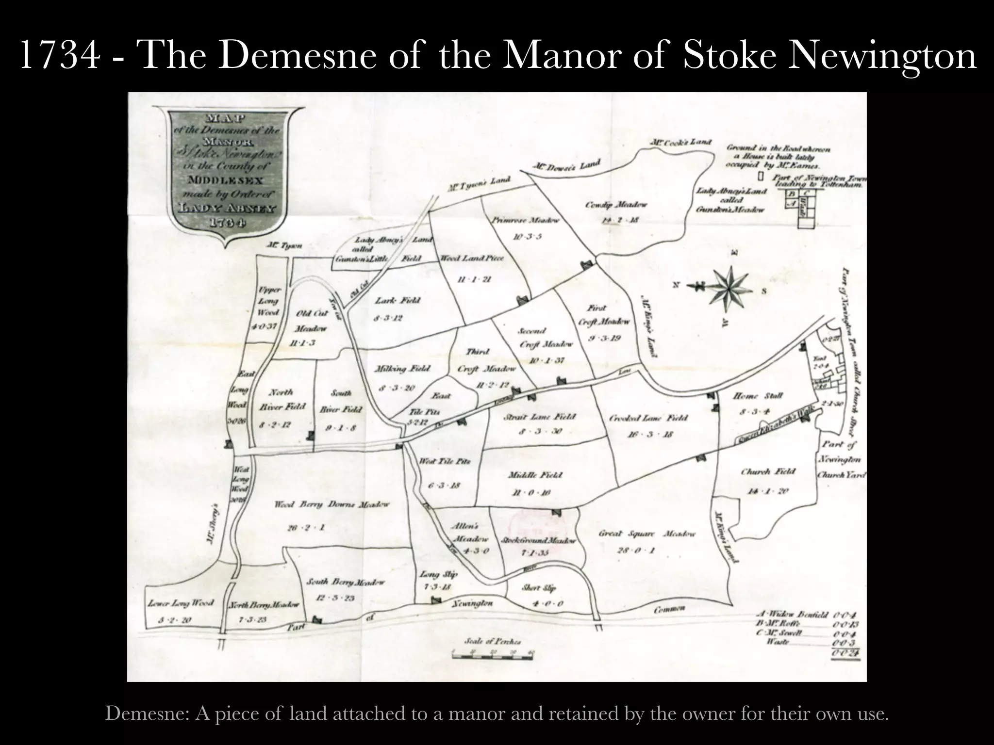
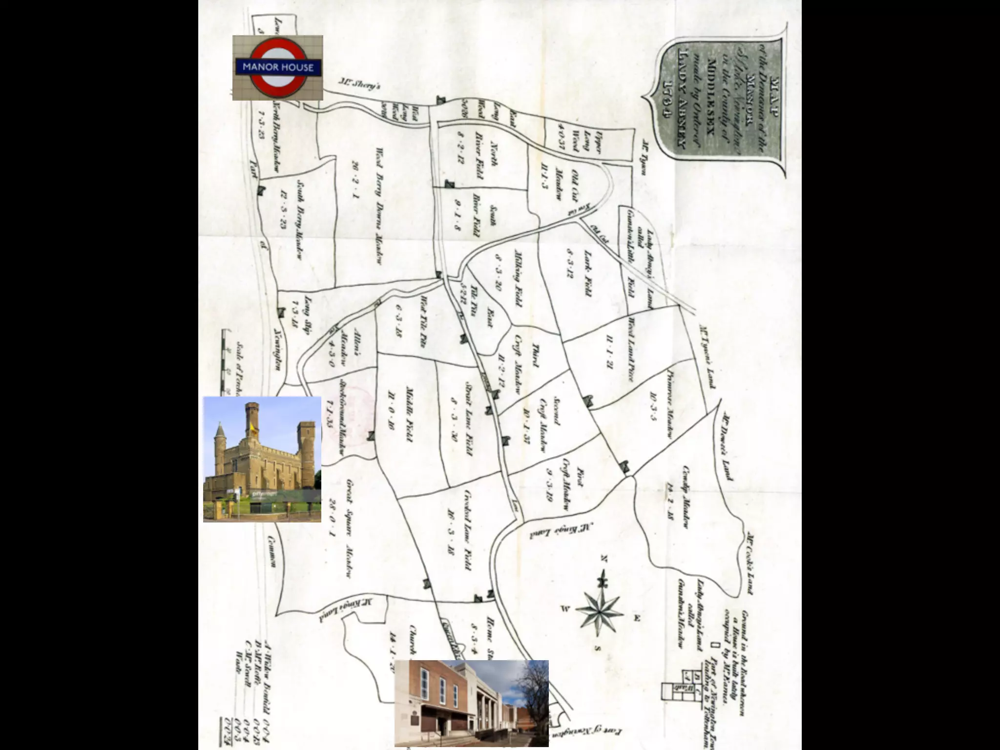
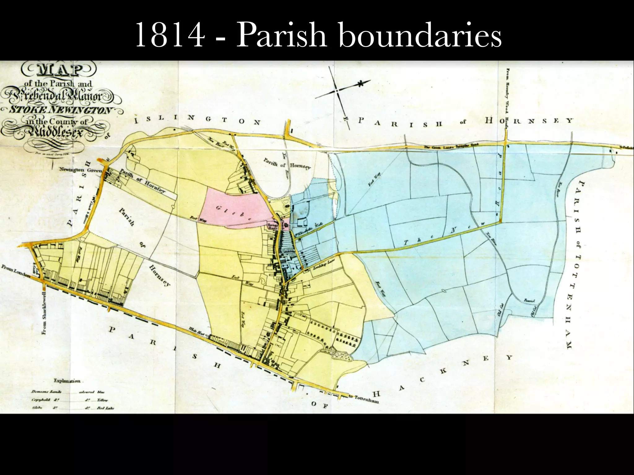
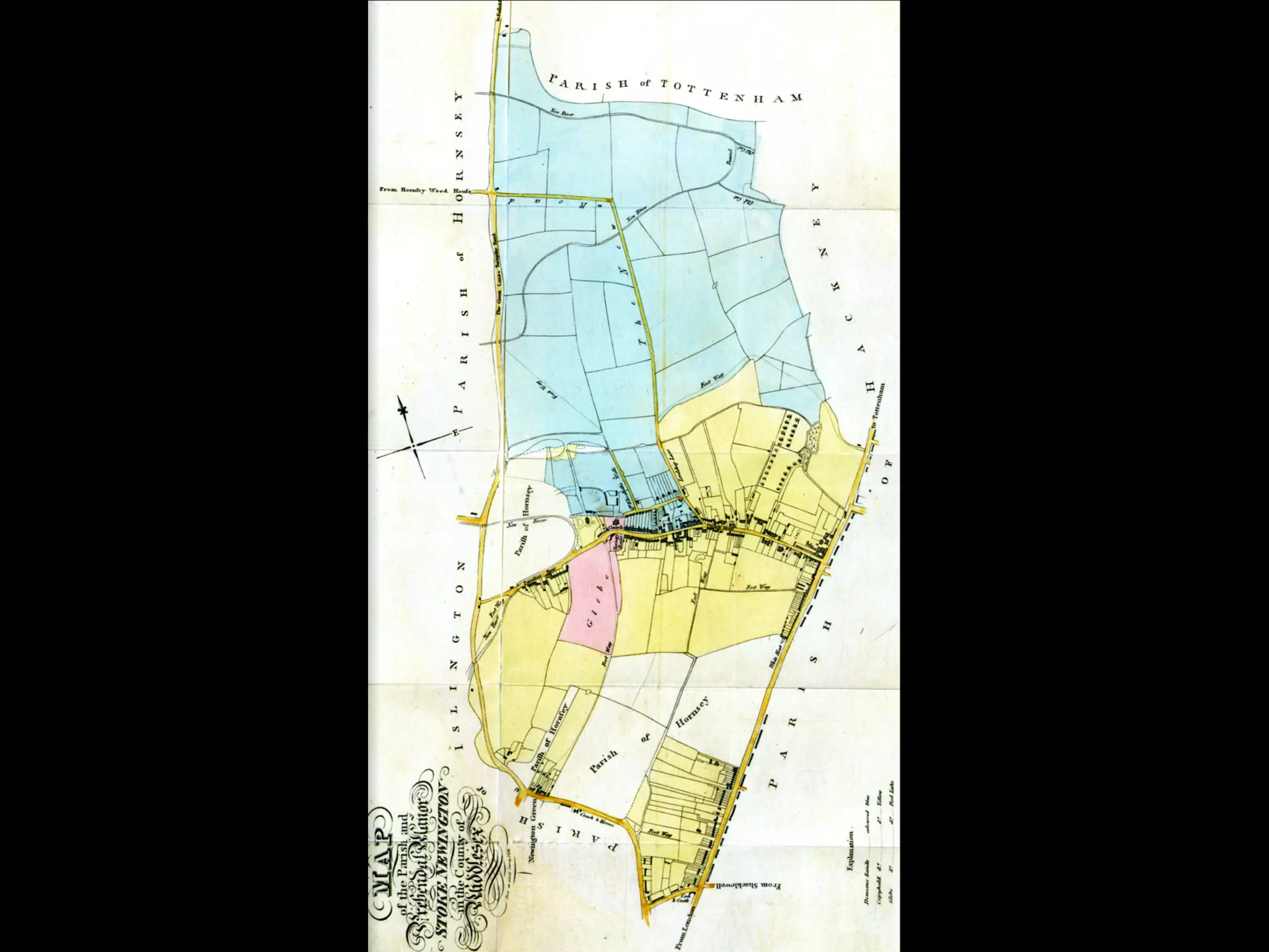
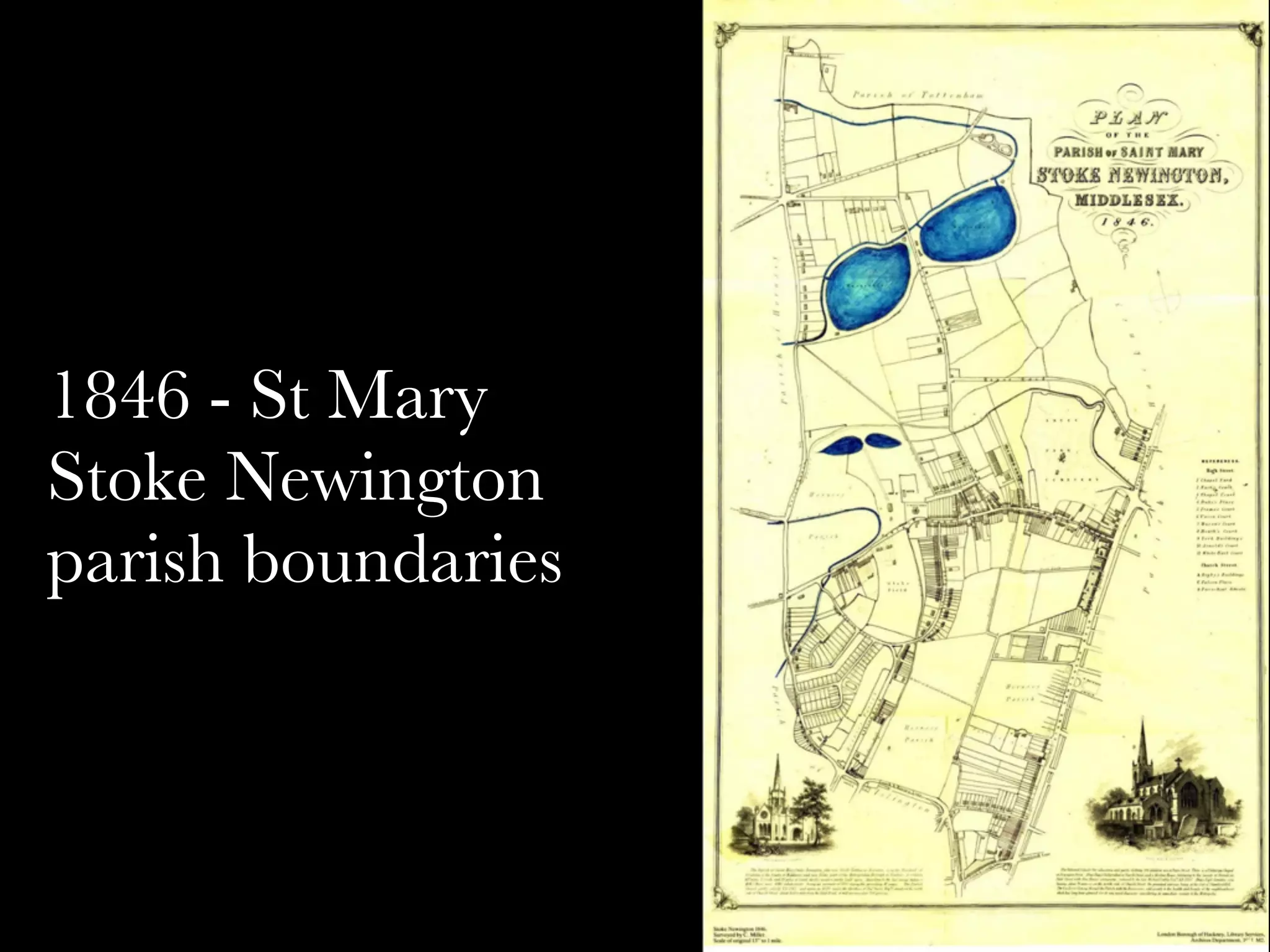
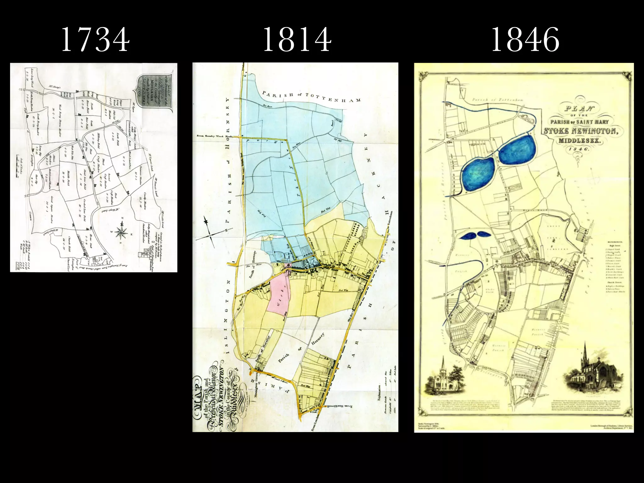
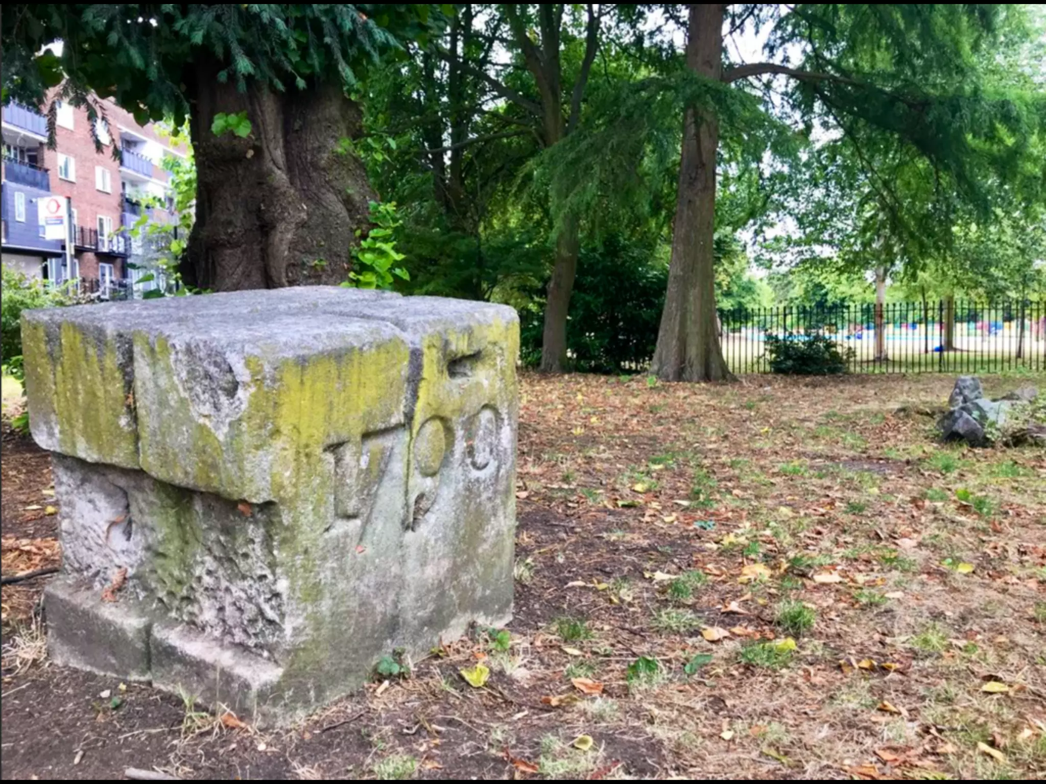


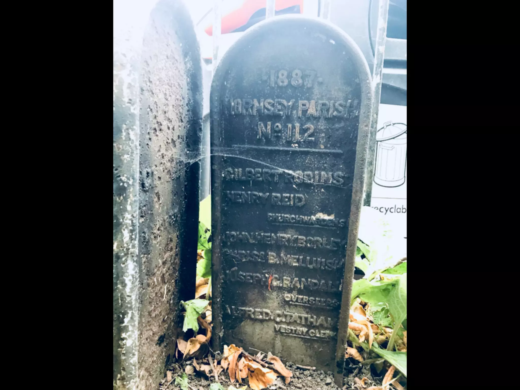


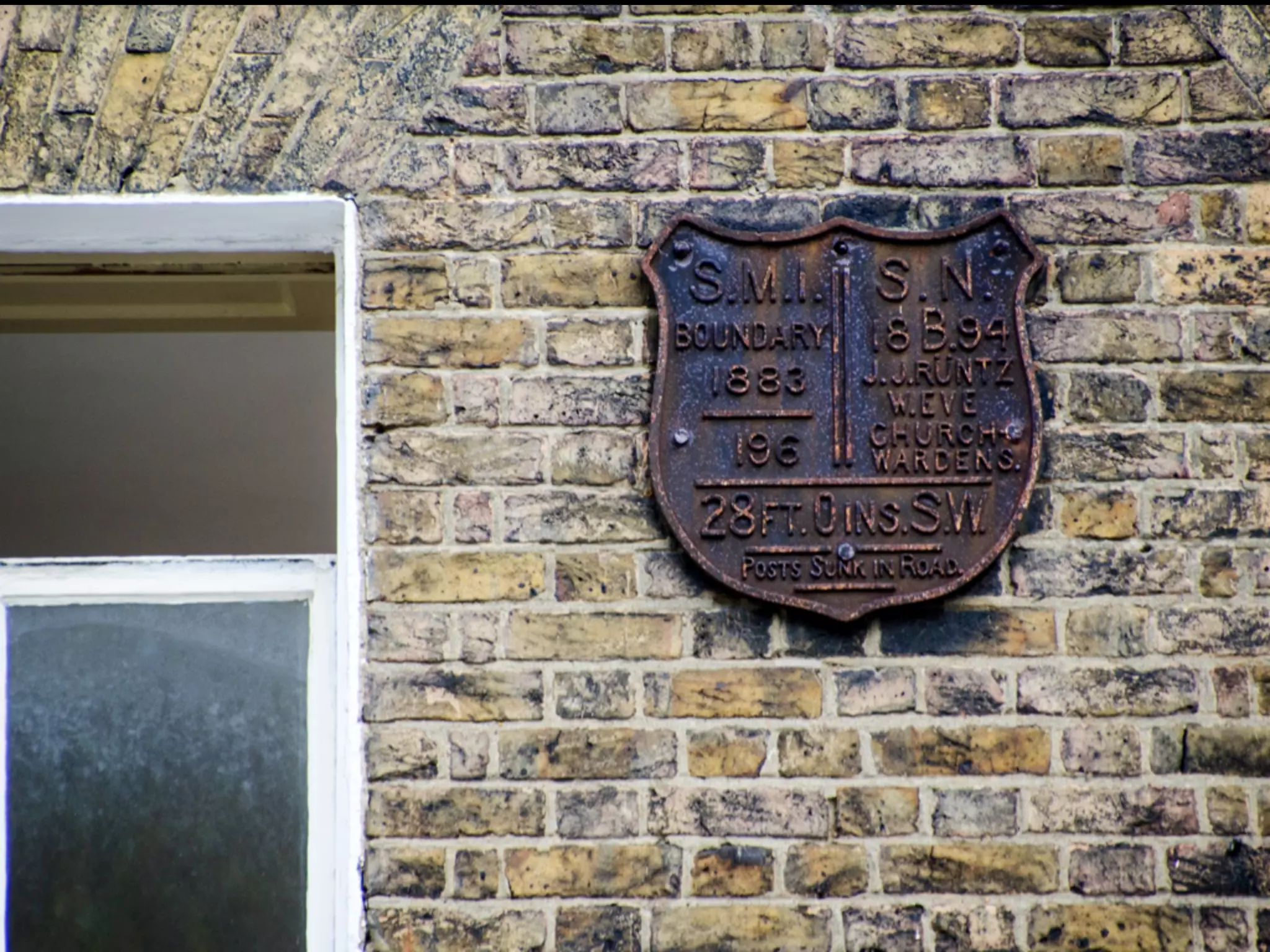
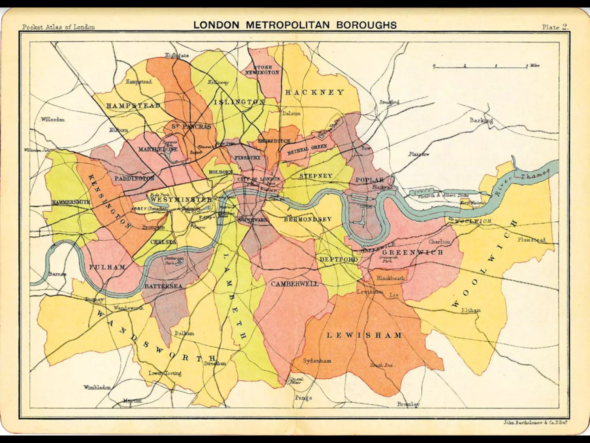
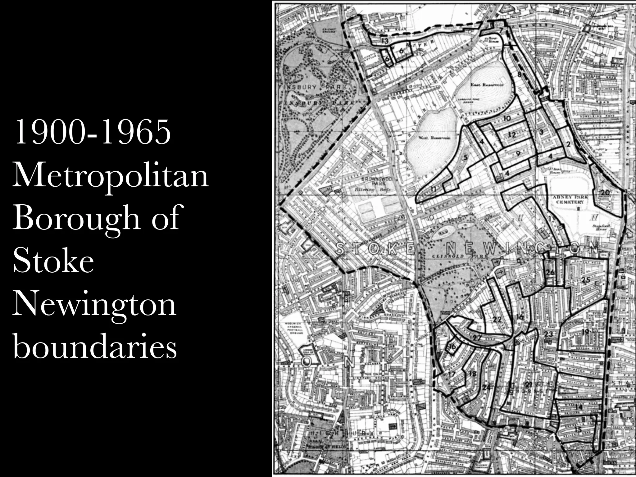
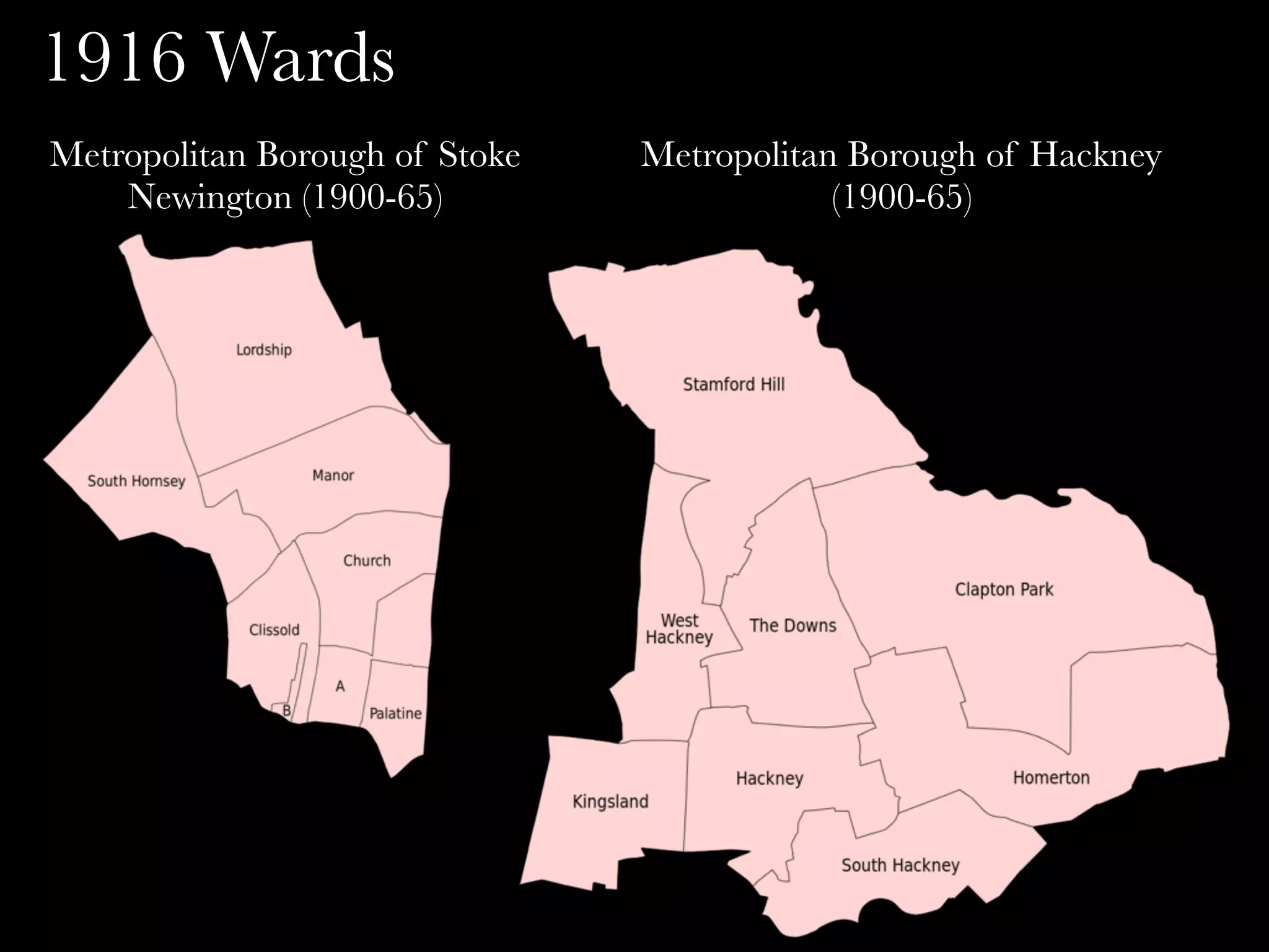
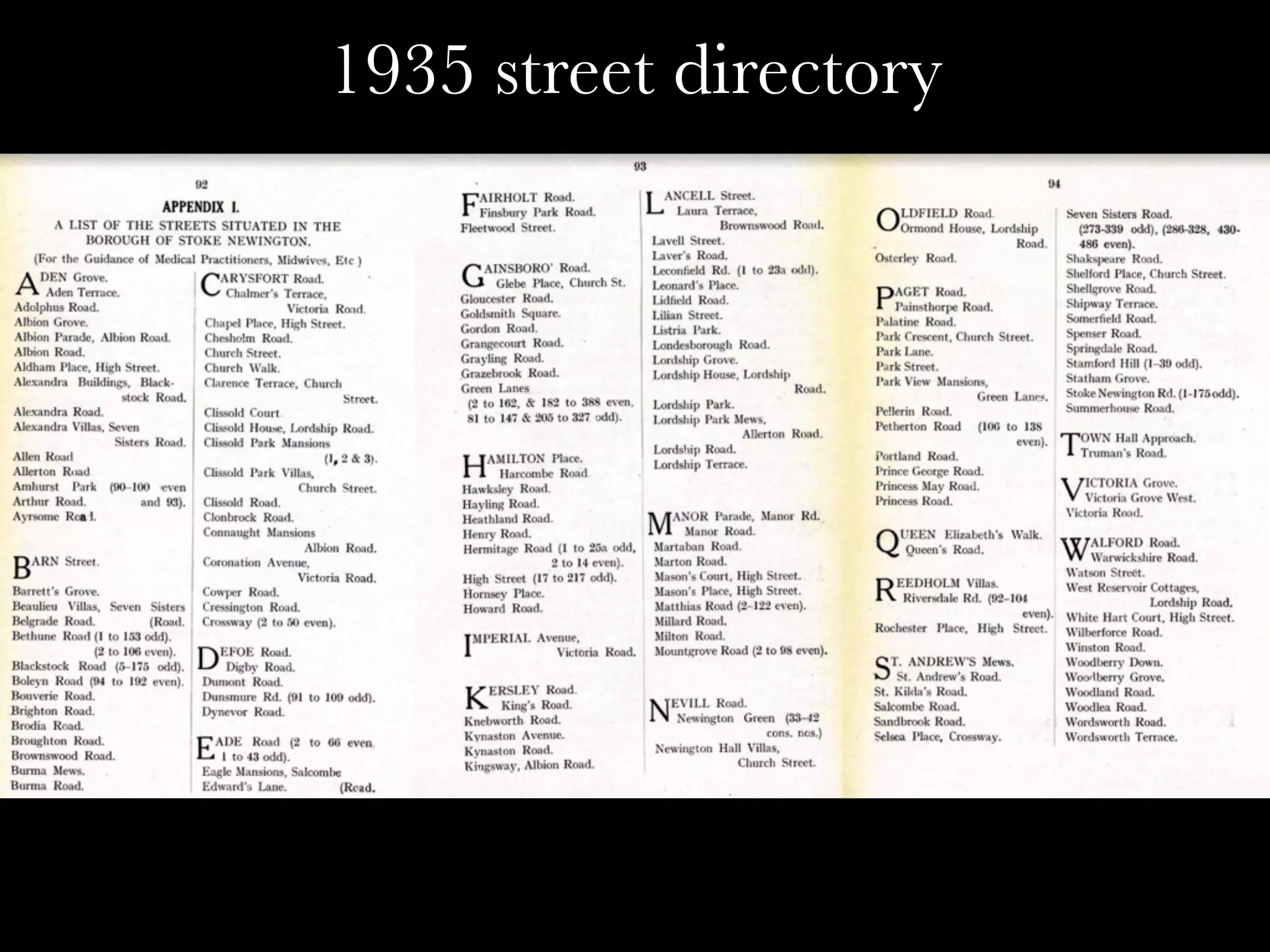
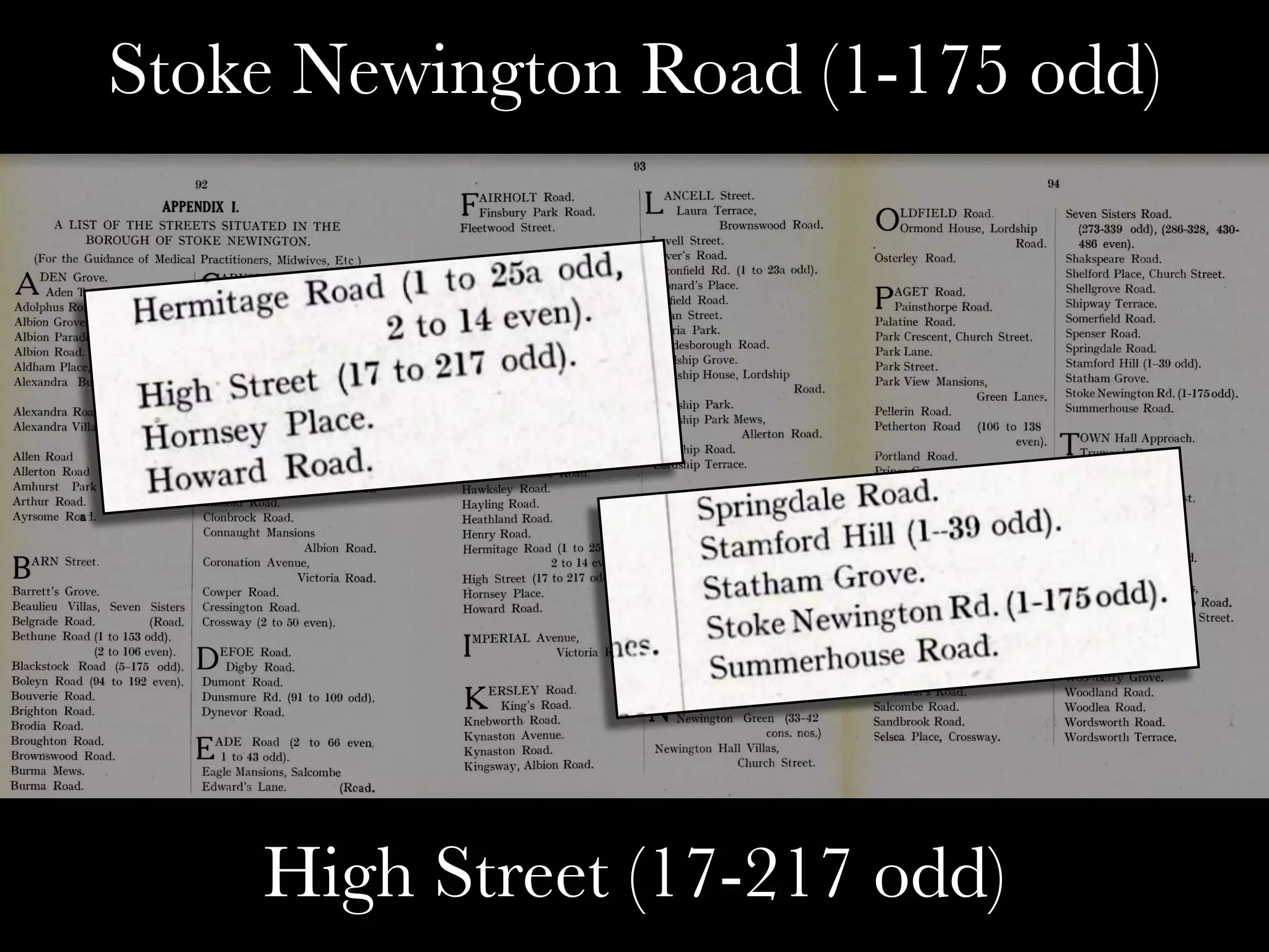
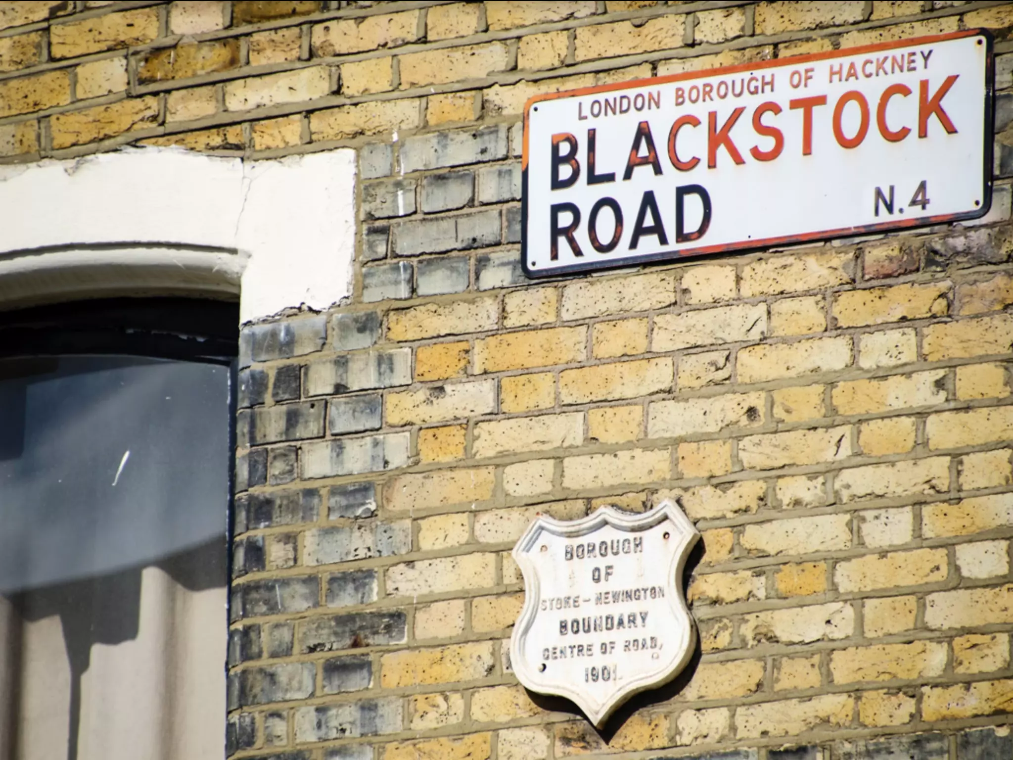
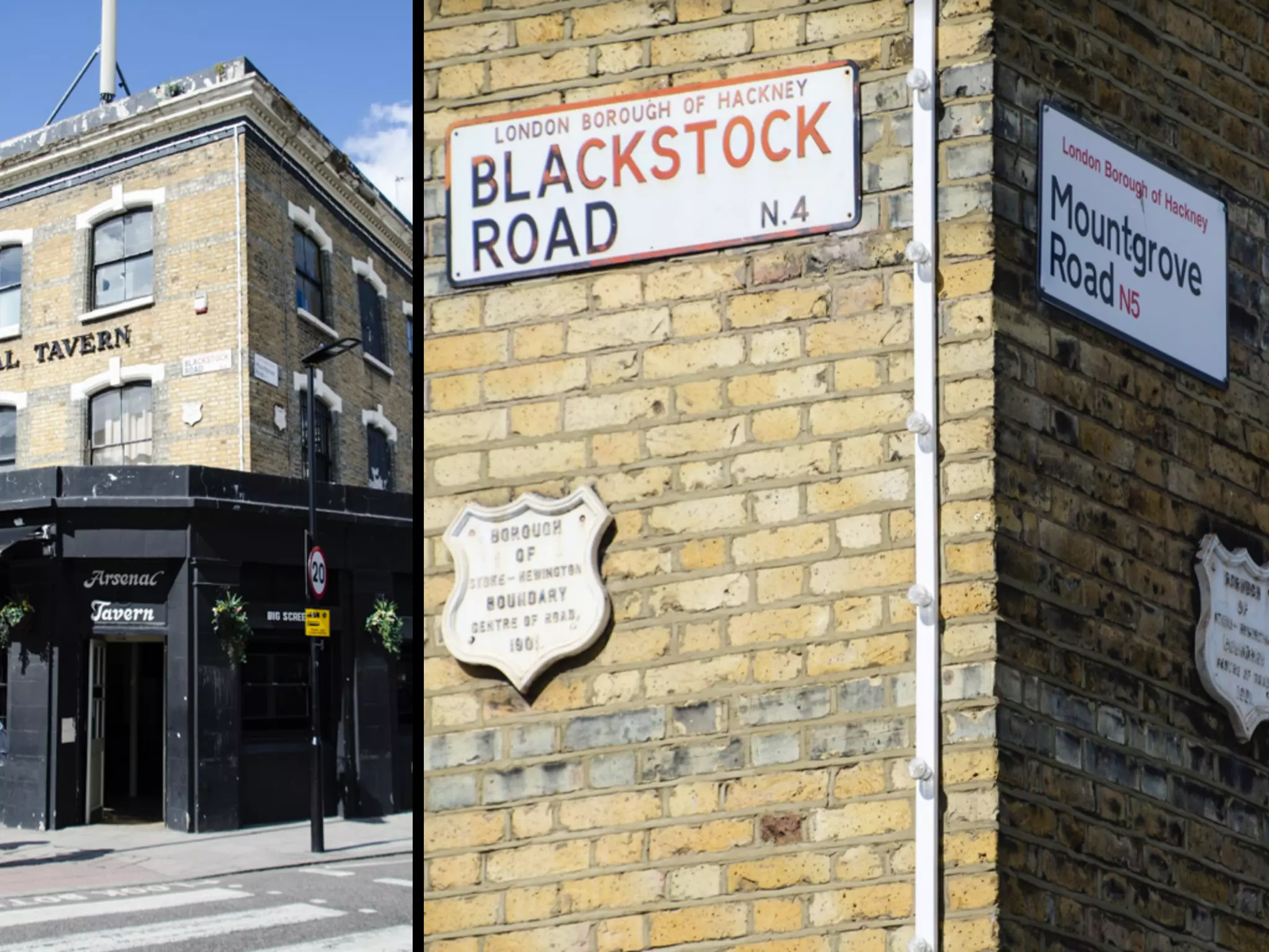

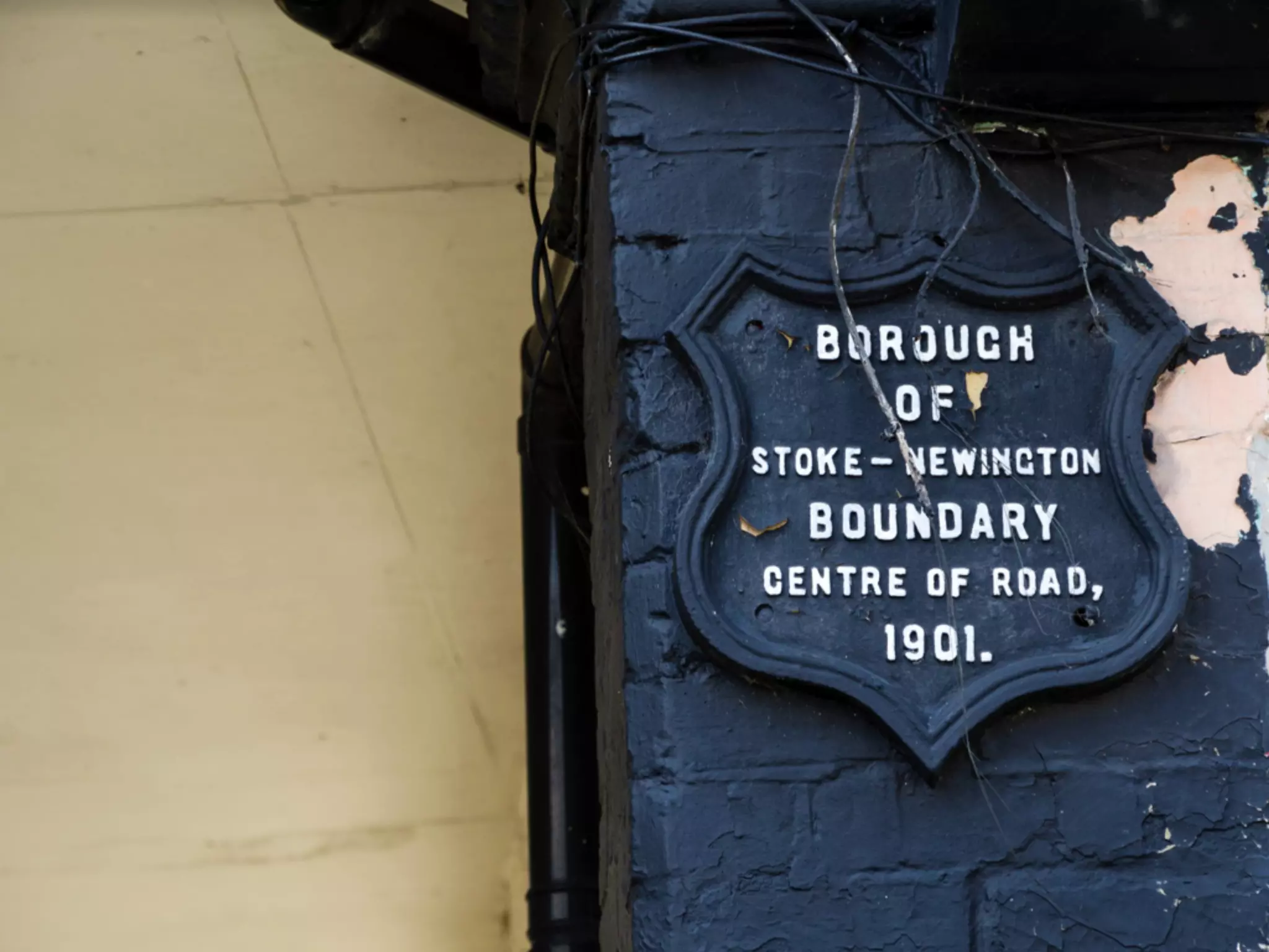
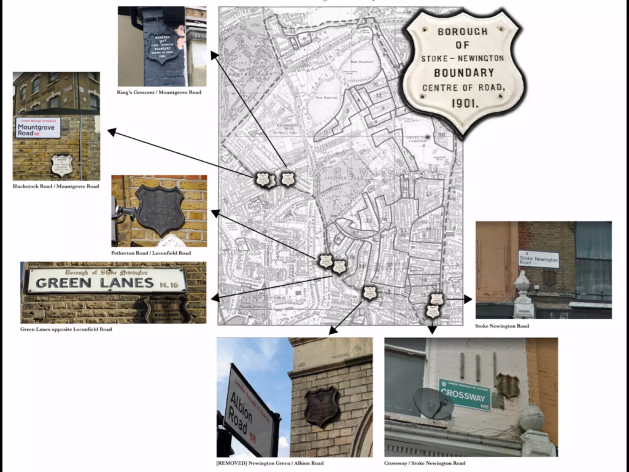


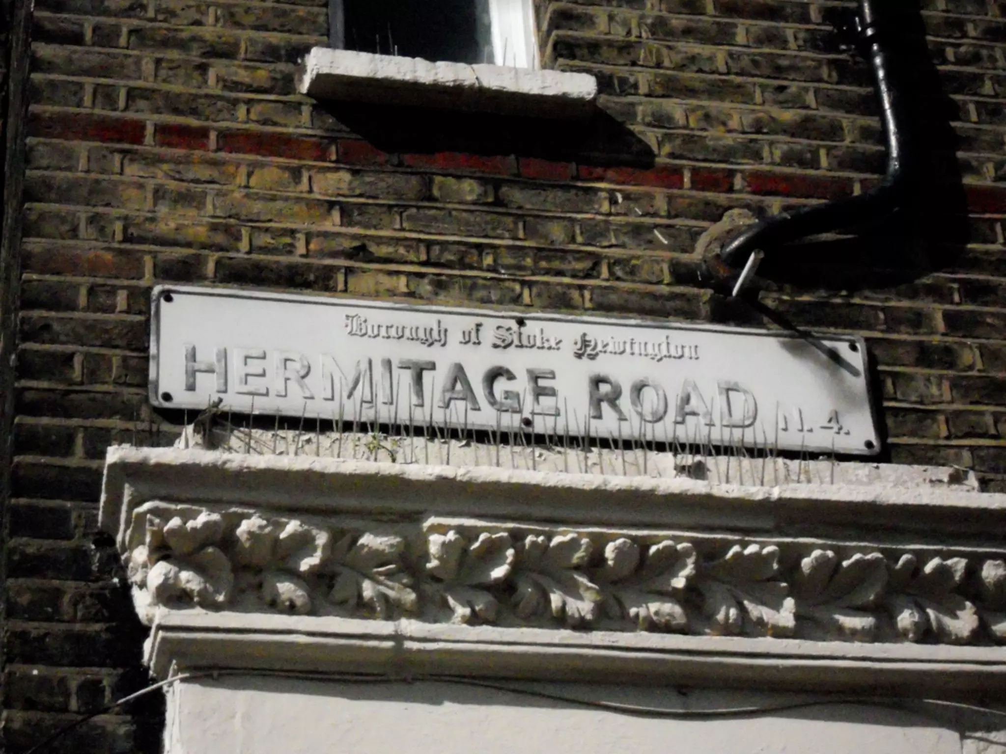
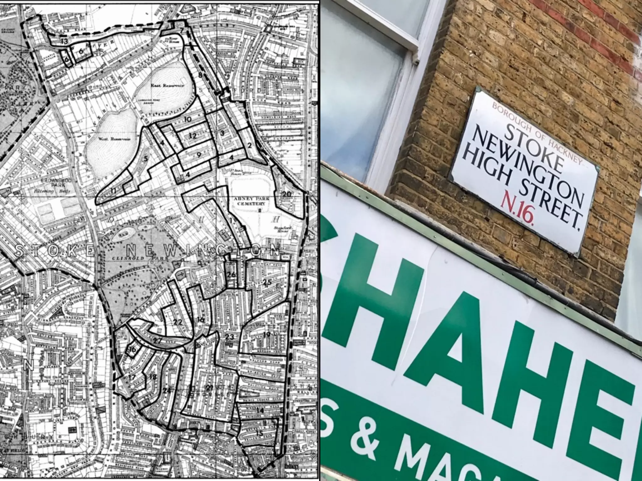
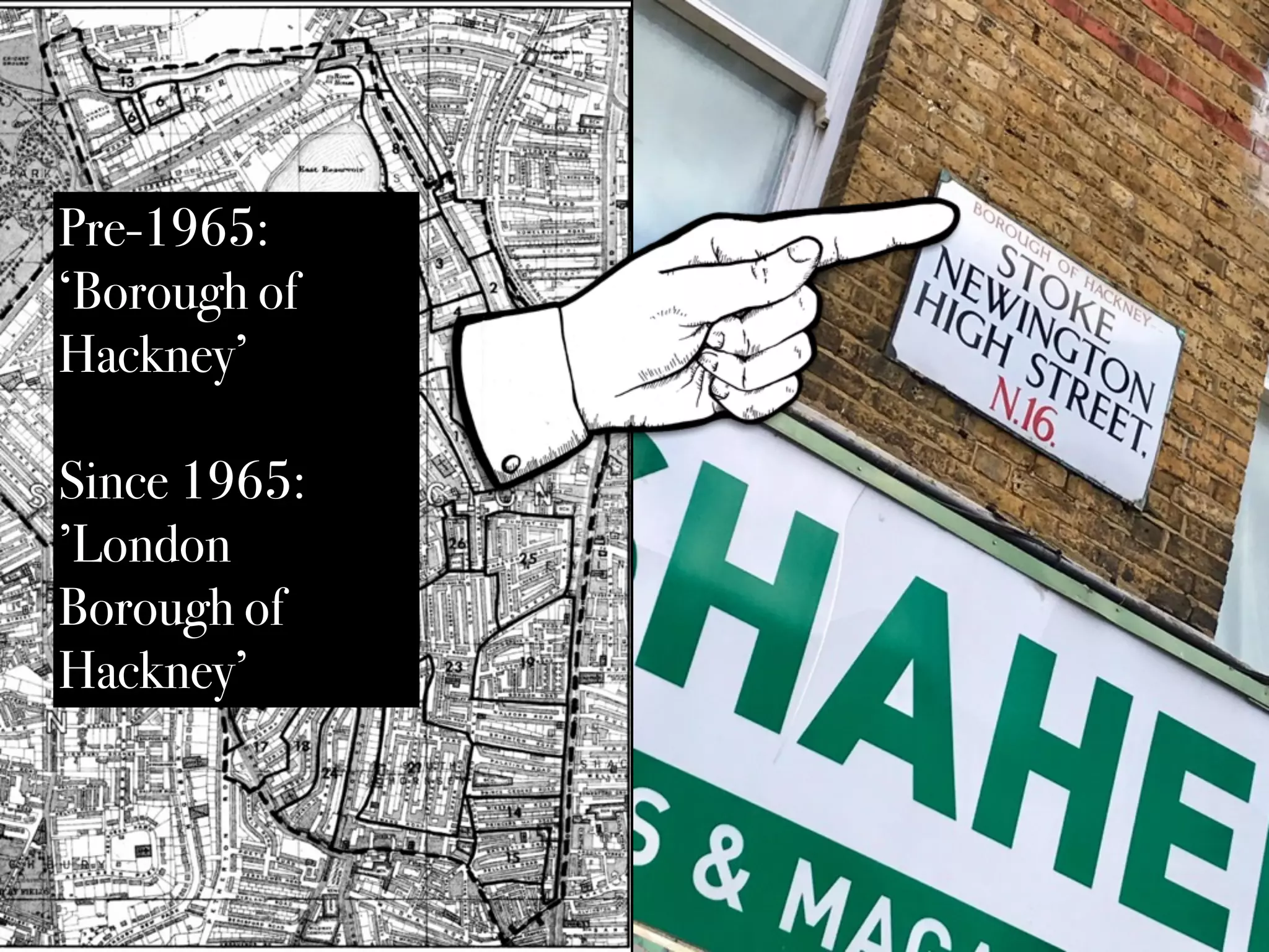
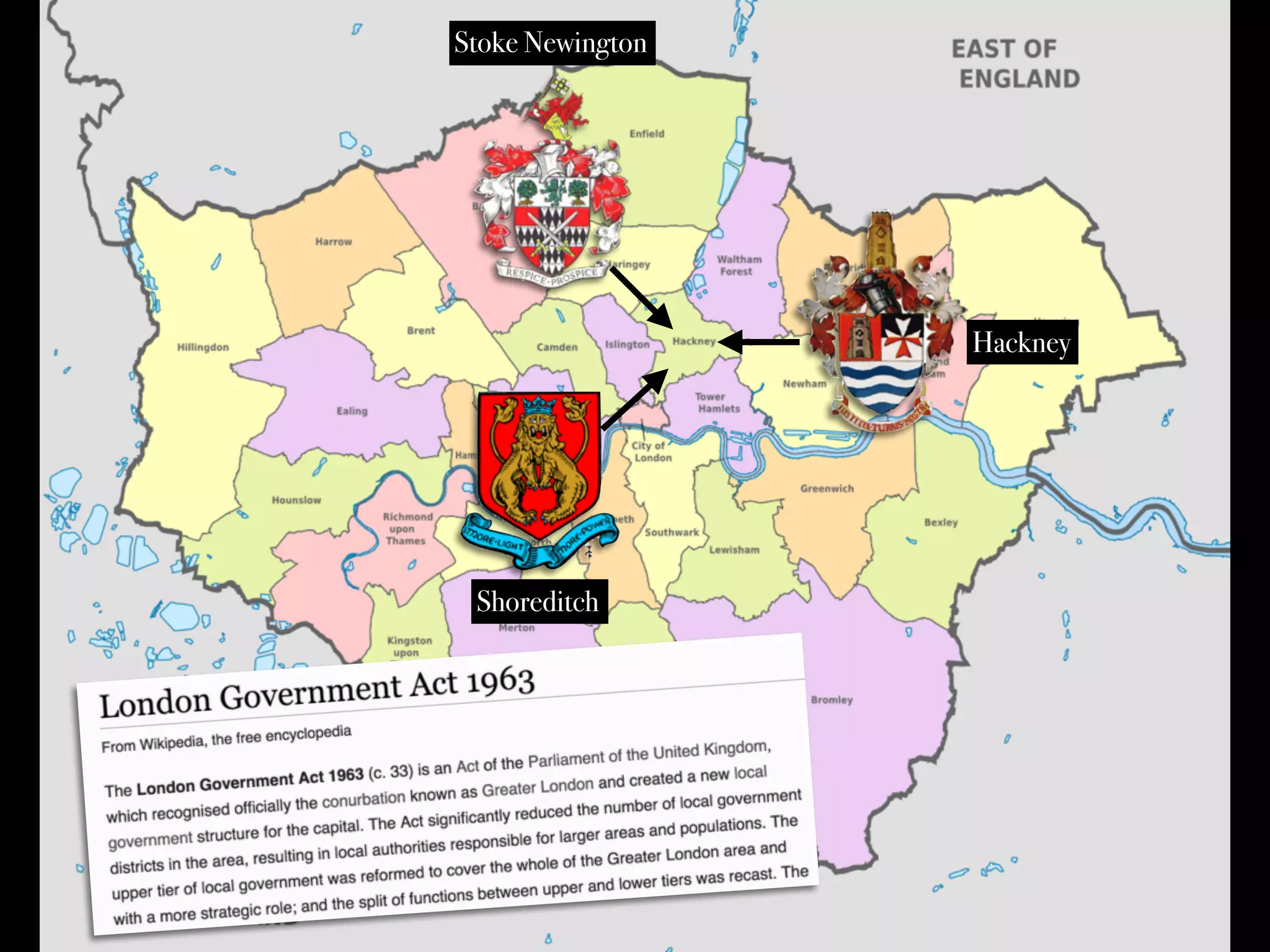


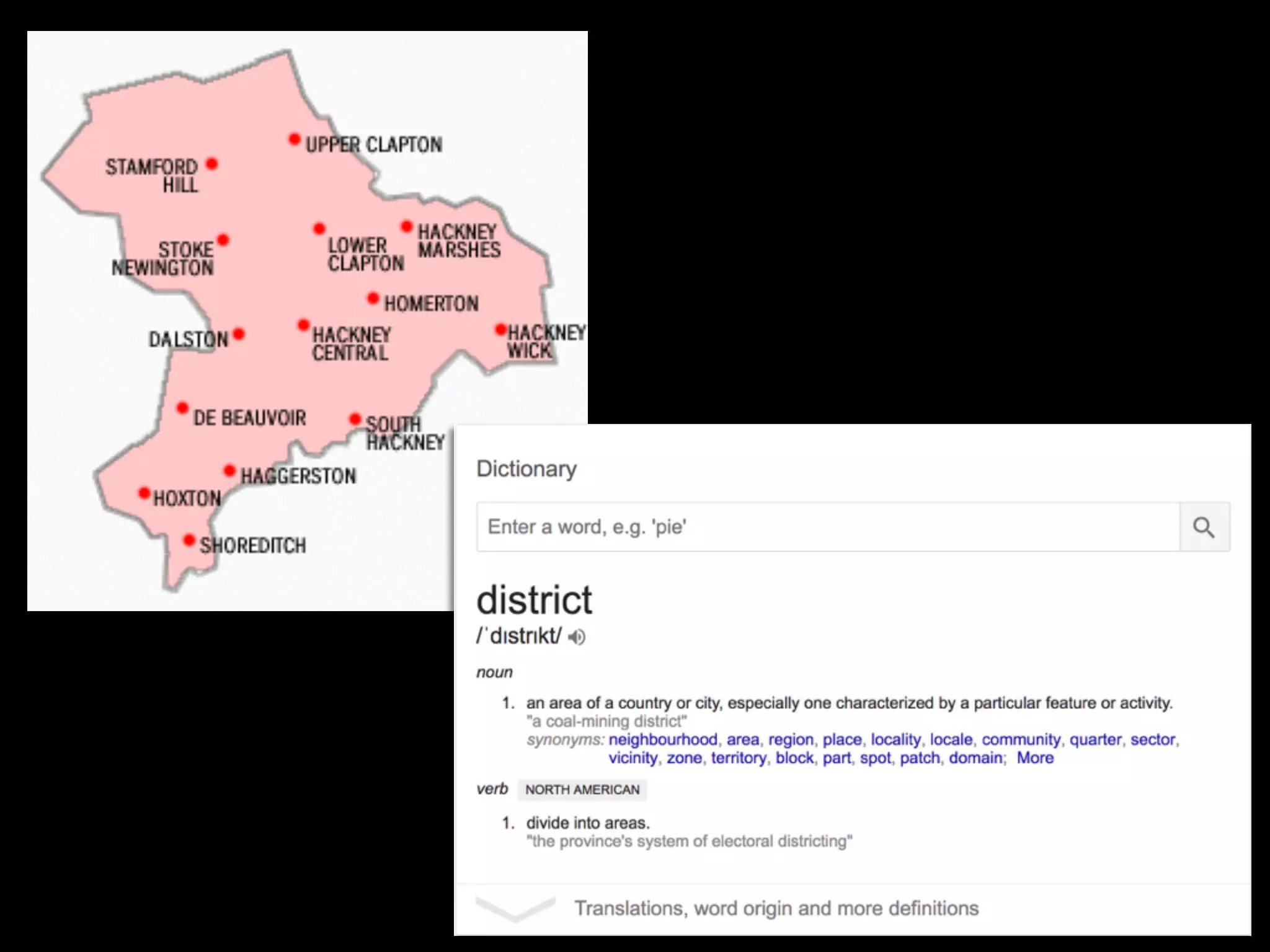

The document explores the evolving boundaries of Stoke Newington, highlighting historical changes in local governance and community identity. It discusses how residents perceive their location in relation to changing ward and parish definitions, as well as the impact of boundary reforms over the years. Key milestones include the establishment of various administrative structures, notably from 1734 to the present day.


