SlideShare a Scribd company logo
1 of 26
Download to read offline
Lakeside Wayfinding Report
Produced by:
Landwise Landscape Design 								
CITY OF LAKESIDE, OREGON
APRIL 2016
City of Lakeside, Oregon
i
Acknowledgments
Advisory Group
CITY OF LAKESIDE
Curt Kelling, City Recorder/ Manager
Dean Warner, Mayor
Mike Mader, Watershed Coordinator
ODOT
John McDonald, Development Review Planner
Jeff Waddington, ODOT District 7
LOCAL BUSINESS OWNERS
Mike Smalley, Owner Osprey Point RV Resort
Dee Drummond, Owner North Lake RV Resort and Marina
John Reiss, Owner Ringo’s Lakeside Marina
Wayfinding Planning and Report
LANDWISE LANDSCAPE DESIGN
Greg Oldson, Principle/Designer
Wayfinding Report
ii
TABLE OF CONTENTS
A. INTRODUCTION ......................................................................... 1
B. STRENGTHS AND CHALLENGES .............................................. 2
C. RELATIONSHIP TO EXISTING DOCUMENTS ......................... 4
D. RECOMMENDED ACTION AREAS ............................................ 6
	 I. GETTING STARTED .............................................................. 7
1.	 FORM A COLLABORATIVE WAYFINDING COMMITTEE ............................. 8
2.	 DEVELOP CITYWIDE BRAND AND STYLE GUIDELINES ............................ 9
	 II. ESTABLISHING A SYSTEM ................................................. 10
3.	 DEVELOP ATTRACTIVE GATEWAYS ON HIGHWAY 101 AT THE
	 INTERSECTION OF 8TH ST. AND AIRPORT WAY .............................................11
4.	 ESTABLISH LOCATION(S) FOR LOCAL ADVERTISING
	 AND EVENTS SIGNAGE .......................................................................................12
5.	 ENHANCEMENTS ON MAJOR VEHICULAR AND PEDESTRIAN ROUTES ... 13
6.	 REDUCE SIGN CLUTTER ................................................................................... 14
	 III. REFINING EXISTING SYSTEM ......................................... 15
7.	 MAXIMIZE BANNER SYSTEM ........................................................................... 16
8.	 UTILIZE PUBLIC ART TO PROMOTE WAYFINDING ..................................... 17
E. MAPS ............................................................................................. 18
F. APPENDICES ................................................................................. 22
I. POTENTIAL FUNDING SOURCES ..................................... 23
	 II. ADDITIONAL RESOURCES ............................................... 23
1
City of Lakeside, Oregon
A. INTRODUCTION
Purpose
The purpose of this project is to analyze Lakeside’s existing wayfinding system and provide
an action plan for its improvement. This report looks at Lakeside’s road and signage
infrastructure, along with current wayfinding strengths and challenges, and provides
specific action areas on which to build and improve. Building upon past planning
documents, this action plan can serve as a guide to the City of Lakeside as it moves
toward implementation of an effective wayfinding system.
Landwise Landscape Design has inventoried Lakeside’s existing signage and key
destinations and worked with the City of Lakeside and ODOT representatives to refine
project goals and recommendations.
Goals
The following goals form the essence of this project and guide the recommendations:
1.	 Create a welcoming sense of arrival along Highway 101
2.	 Develop connectivity between Highway 101 and Lakeside’s downtown
business district.
3.	 Improve navigation throughout the downtown business district and to
businesses along North Lake Road.
4.	 Provide strategies for local business and annual event advertising
5.	 Strengthen Lakeside’s identity and sense of place
6.	 Promote economic growth and tourism
2
Wayfinding Report
1. A Consolidated Downtown Business District.
The majority of businesses in the City of Lakeside are
situated along 8th Street. The downtown business
district provides ample parking, accessible sidewalks,
and provides services within walking distance of Tenmile
Lake.
2.Existing Downtown Banner System
The downtown business district’s banner system adds character as well
as being informative to Lakeside’s tourist population. The banner system
is also effective at delineating the downtown district.
3. Work Has Already Been Done
The City of Lakeside has already taken steps to address current
wayfinding challenges. Both Lakeside’s “101” Vision document and the
Culture/Arts Initiative developed by the Lundquist School of Business at
the University of Oregon provide insight into Lakeside’s branding and
wayfinding. The current wayfinding report can build on the valuable
information provided by these documents.
4. A Community of Artists
As a creative community, Lakeside can
embrace some of its artist residents
by reserving space for local art that
provides identity and aesthetic interest
to visitors and residents alike.
I. STRENGTHS
B. STRENGTHS AND CHALLENGES
3
City of Lakeside, Oregon
II. CHALLENGES
1. Underdeveloped Highway 101 Gateways
The primary gateways off 101 need clarity and significance, and should provide a
representational aesthetic and feeling for the City of Lakeside. Currently there are no
consistent identifying welcome
signs at the major gateways
on highway 101. In addition,
signage at both 8th St. and
Airport Way is cluttered with
a combination of directional
signs, advertisements, and
old and current Lakeside
identification signs.
2. Disconnect Between Gateways and Downtown Business District
The downtown business district of Lakeside is located approx. 1 mile from highway 101. Access
via 8th Street and Airport Way take visitors through residential neighborhoods and meandering
shore pine forest before intersecting and entering the business district.
3. Branding the City of Lakeside/
Inconsistent Image Through Signage
Having a strong identity creates a
positive relationship between a city and
its visitors. Part of this identity is created
by signage. From the major gateways
into town, to each individual destination,
inviting and consistent signage will add
to a visitor’s experience. Currently, the
city has a variety of logos and signs that
visitor’s see as they enter into and travel
through the City of Lakeside. Most of
these signs convey the communities
regard for Tenmile Lake, but lack a
consistent identifying design or logo.
4. Lack a Location for Business and Event Advertising
The separation of the Lakeside downtown business district from the major through-way of
Highway 101 has led to businesses posting their own advertising and directional signs along
101 at 8th Street and Airport Way. Both of these locations have become cluttered with a
variety of signs that are posted at these locations.
4
Wayfinding Report
C. RELATIONSHIP TO EXISTING DOCUMENTS
In order to create a cohesive and forward-looking document, this report builds upon ideas
and goals established in existing documents prepared for the City of Lakeside.
City of Lakeside Comprehensive Plan Vol II (updated 2013)
	 Lakeside’s Comprehensive Plan does not directly propose any goals or policies to
improve wayfinding. It does, however, state multiple city policies relating to pedestrian
and bicycle infrastructure. These improvements will enhance connectivity and the
overall character of Lakeside, impacting how wayfinding goals are addressed in the
future.
STATEWIDE PLANNING GOAL 8: RECREATIONAL NEEDS
City policies
1. Consider recreational opportunities and encourage a pedestrian-friendly environment by
supporting bike lanes and sidewalks in new subdivisions and other private development.
2. As funding is available, consider all opportunities for developing public walking paths and/
or bike lanes in order to enhance the wellbeing and recreational opportunities of citizens and
visitors.
	
	 d. Encourage maintenance and development of the Oregon Coast Bike Route along High	
		 way 101 within and to the west of the City of Lakeside.
16. Encourage the development of a combined rest stop and information center along Highway
101 in cooperation with Oregon Department of Transportation (ODOT) that will disseminate
information about Lakeside and the South Coast region.
STATEWIDE PLANNING GOAL 12: TRANSPORTATION
City policies
6. Encourage businesses and residents to upgrade sidewalks and streets within the city’s
residential and commercial areas for a healthy population and for safety.
5
City of Lakeside, Oregon
RELATIONSHIP TO EXISTING DOCUMENTS CONTINUED...
Lakesides “101” Vision (December 1996)
Lakeside’s “101” Vision document provides a laundry list of improvements to the
Highway 101 corridor running past the town of Lakeside. Many of the suggestions in the
“101” vision are aimed at enhancing the overall identity of Lakeside as an attractive
destination community. The plan designates an entire chapter to “existing signs and
suggested sign improvements” along 101. Some of the key issues addressed in the “101”
vision include:
Improve North and South Entrances
•	 Landscape the North and South Entrances.
•	 Create a “sense of arrival”.
•	 Improve entrance signs... The signs should encourage visitors to explore the town and
create an awareness of the hidden opportunities for food, lodging, R.V.’s, boating and
camping.
•	 Develop pull-over areas in conjunction with the entrance signs.
•	 Light entrance signs at night.
“When signing issues are to be addressed, it will be important to get everyone to the table
to find out what can and cannot be done.   Players will include the City of Lakeside, the
Lakeside Chamber of Commerce, Oregon Travel Information Council, Oregon Department of
Transportation, Oregon State Parks, the Oregon Dunes National Recreation Area, Coos County
Parks, Interested Lakeside civic organizations and private businesses.”
Culture/Arts Initiative
The Culture/Arts Initiative, created by the Lundquist School of Business at the University
of Oregon provides some foundational actions to brand and strengthen the identity
of Lakeside. This document does not directly suggest wayfinding improvements, but
does help strengthen some of Lakeside’s key destinations. The actions suggested in the
initiative support the need for a more effective wayfinding system to increase a tourist
economy in Lakeside’s Downtown Business District.
6
Wayfinding Report
I. GETTING STARTED
1.	 FORM A COLLABORATIVE WAYFINDING COMMITTEE
2.	 DEVELOP CITYWIDE BRAND AND STYLE GUIDELINES
II. ESTABLISHING A SYSTEM
3.	 DEVELOP ATTRACTIVE GATEWAYS ON HIGHWAY 101 AT THE
INTERSECTION OF 8TH ST. AND AIRPORT WAY
4.	 ESTABLISH LOCATION(S) FOR LOCAL ADVERTISING AND EVENTS
SIGNAGE
5.	 ENHANCEMENTS ON MAJOR VEHICULAR AND PEDESTRIAN ROUTES
6.	 REDUCE SIGN CLUTTER
III. REFINING EXISTING SYSTEM
7.	 MAXIMIZE BANNER SYSTEM
8.	 UTILIZE PUBLIC ART TO PROMOTE WAYFINDING
D. RECOMMENDED ACTION AREAS
7
City of Lakeside, Oregon
I. GETTING STARTED
1.	 FORM A COLLABORATIVE WAYFINDING COMMITTEE
2.	 DEVELOP CITYWIDE BRAND AND STYLE GUIDELINES
8
Wayfinding Report
1.	 FORM A COLLABORATIVE WAYFINDING COMMITTEE
The first step toward implementing an
effective wayfinding system is to form a team
of stakeholders that have a vested interest in
the long-term goals of the community.
A wayfinding committee should use this
report along with the guidance of existing
documents to prioritize goals and strategies.
City leadership is imperative to the success of
this project.
Some of the necessary stakeholders
might include representatives from:
•	 City Council
•	 Planning commission
•	 Chamber of Commerce
•	 Oregon Department of Transportation
(ODOT)
•	 Coos County Parks and Recreation
•	 Local businesses
Actions
•	 Identify key stakeholders who have an
interest in Lakeside’s wayfinding system.
•	 Form a steering committee headed by
the city that meets regularly throughout
the duration of the wayfinding project.
Develop a clear purpose for the
committee.
9
City of Lakeside, Oregon
Wayfinding is an essential branding tool that can influence a sense
of place or a person’s experience within a city. Signage is not
only informational, but also carries a distinct message about the
character of the city and its assets through its style and choice of
destinations featured.
Before any individual signs are designed and fabricated, decisions
should be made between city leaders and the wayfinding
committee to determine guidelines
for future city-wide branding. Specific
actions including; website, social
media and community development
have already been laid out in the Arts
and Culture Initiative developed by
the Lundquist School of Business. As
Lakeside grows, a cohesive image
for branding and wayfinding will
help reinforce Lakeside’s identity for
residents and visitors.
Lakeside’s strong identity with Tenmile
Lake and overall strength as an
outdoor recreation destination should
continue to be emphasized.
2. DEVELOP CITYWIDE BRAND AND STYLE GUIDELINES
Actions
•	 Undergo a collaborative, City-sponsored process to
establish a citywide brand and style guidelines that
take into consideration the prior work done to brand
the downtown.
•	 Adopt style guidelines for all City-sponsored materials
including printed and digital documents, website and
social media, temporary and permanent signage,
and public art.
•	 Develop wayfinding sign designs that are highly
functional but also reflect the unique character
of the place. It is recommended to hire an outside
contractor to develop final signage designs.
10
Wayfinding Report
II. ESTABLISHING A SYSTEM
3. DEVELOP ATTRACTIVE GATEWAYS ON HIGHWAY 101 AT THE INTERSECTION 	
	 OF 8TH ST. AND AIRPORT WAY
4. ESTABLISH LOCATION(S) FOR LOCAL ADVERTISING AND EVENTS SIGNAGE
5. ENHANCE MAJOR VEHICULAR AND PEDESTRIAN ROUTES
6. REDUCE SIGN CLUTTER
11
City of Lakeside, Oregon
Improving the gateways along highway 101 is imperative to identifying Lakeside, and
orienting travelers to Lakeside’s downtown business district. Each gateway should have a
prominant welcoming sign directing visitors to the downtown business district, in addition to
well-maintained landscape emhancements. All signage should have consistent logos and
branding as determined by a wayfinding committee. The City of Lakeside must follow ODOT
Entrance Program and MUTCD guidelines and should work with ODOT and Highway 101
business owners to enhance these areas. Lakeside’s “101” Vision provides various strategies
and design ideas for the improvement of these
two primary entries into town. Actions
•	 Install prominant Lakeside
welcome signage and landscape
enhancements at 8th Street and
Airport Way to improve sense of
arrival and support Lakeside’s
unique identity.
•	 Consider prior work done in
Lakeside’s “101 Vision” document
to improve gateways and the
overall appearance of the 101
corridor
•	 Remove unnecessary signage
•	 Work with ODOT/property owners
North Gateway (Highway 101 and 8th Street)
North Gateway Conceptual Rendering
South Gateway (Highway 101 and Airport Way)
3. DEVELOP ATTRACTIVE GATEWAYS ON HIGHWAY 101 AT THE INTERSECTION
OF 8TH STREET AND AIRPORT WAY
City of Lakeside
Lakeside Business District
12
Wayfinding Report
Actions
•	 Install information Kiosks at strategic
locations
•	 Use Tourist Oriented or Specific Ser-
vice signs
4. ESTABLISH LOCATIONS FOR LOCAL ADVERTISING AND EVENTS SIGNAGE
Kiosks
The installation of
informational kiosks
can provide directional
information while also
displaying advertising for
local businesses, annual
events, and additional area
attractions. These kiosks
should be located in high
visibility, public areas (see
Strategy Implementation
map).
Digital sign boards and QR codes
City officials have expressed interest in digital sign
boards and other technology on signage. LED
sign boards and QR codes can be incorporated
into kiosks to provide additional wayfinding and
advertising information.
Tourist oriented directional signage
Tourist oriented directional signs can be used along
highway 101 for businesses to advertise. Consolidating
directional and destination signage at major decision
points will help eliminate signage clutter. More can be
found on TOD signs and specific service signs on Oregon
Travel Experiences website: http://ortravelexperience.
com/for-businesses/sign-programs/.
http://www.propelstudio.com/project/lents-grown-kiosk/
13
City of Lakeside, Oregon
There are various ways that the major routes (see Strategy
Implementation map) people enter into and travel through
Lakeside can orient visitors while also strengthening the
identity of the community. The recent investment in
sidewalk construction, and the installation of lights and a
banner system in the downtown business district, provide a
more lively and accessible feel.
As funding is available, projects that promote pedestrian
and bicycle travel along all the major routes should be
implemented. The addition of sidewalks along Park Avenue
and North Lake Rd., between 8th and 11th streets, will
create a greater connection between downtown and the
major attraction of
TenMile Lake County
Park. Likewise, it will
be worthwhile to
invest in bicycle lanes
that connect the downtown to highway 101 and to
Osprey and Northlake RV parks. As the Oregon Coast
Bike Route is promoted it will be beneficial to get
Lakeside recognized as a “need to see” destination.
While sidewalks and bicycle lanes promote more
accessible travel within town, repetitive plantings
and placement of sculptures or other local art can
act as landmarks to orient travelers along these major
routes. Artistic site interventions, like sculptures should
be designed to help promote Lakesides
uniquecreativeidentity.Alldecisionsmade
for landmark art, design and placement,
should be reviewed and passed by the
wayfinding committee.
Actions
•	 Improve pedestrian and bicycle access
as funding is available
•	 Use aesthetically pleasing community
artwork along routes for orientation
•	 Install uniform roadside plantings
5. ENHANCE MAJOR VEHICULAR AND PEDESTRIAN ROUTES
Recent investment in downtown
sidewalks and banner system adds a
welcoming feel.
Park Avenue is a primary connection between
the downtown business district and Tenmile
Lake.
14
Wayfinding Report
Actions
•	 Establish thresholds or limits for the
number of signs at key intersections.
•	 Remove temporary and redundant
signage.
•	 Consolidate signage using combined
Tourist Oriented, Community Wayfinding
and Destination guide signage.
Since the development of the Lakeside 101 Vision, some progress has been made to remove
unnecessary signage. There continues to be repetitive and cluttered signage along 101 and
at key decision points within the downtown business district. Some of the ideas mentioned in
the local events and business advertising section of this
report may help consolidate signage and eliminate
some of this clutter. With the introduction of any new
signage for key destinations, consideration is needed
in signage design and placement to ensure that major
decision points do not continue to become cluttered
with signs. The map for key destinations and decision
points locates major intersections where signage is
most important and yet should be limited.
The City should identify thresholds or limits for how many
signs can be at intersections. They should work with local
businesses to assure that alternative advertising options
are available so as to not clutter major intersections.
All temporary advertising signage should be removed.
It is important to note that too much signage can be
counterproductive
to good wayfinding,
making it more
confusing and thus
difficult for visitors and
residents to find their
way to their intended
destination.
6. REDUCE SIGN CLUTTER
Examples of existing sign clutter at major decision
making intersections
Example of combined destination
guide signage
South Gateway at Airport Way
Intersection of 8th Street and Airport Way
15
City of Lakeside, Oregon
III. REFINING EXISTING SYSTEM
7. MAXIMIZE BANNER SYSTEM
8. UTILIZE PUBLIC ART TO PROMOTE WAYFINDING
16
Wayfinding Report
7. MAXIMIZE BANNER SYSTEM
A robust banner system can reinforce identity, promote
events, provide wayfinding directions, and generally
strengthen the aesthetic of downtown Lakeside. Popular
events like the Lakeside Brewfest and Crawdad Festival
should be promoted with the banner system.
Actions
•	 Utilize banners to advertise events and
attractions. For example, the Lakeside
Brewfest and Crawdad Festival.
17
City of Lakeside, Oregon
8. UTILIZE PUBLIC ART TO PROMOTE WAYFINDING
Actions
•	 Identify key areas to use public art
for wayfinding purposes.
•	 Include public art support in
wayfinding funding proposals.
•	 Collaborate with local artists to
create wayfinding public art
projects.
Wayfinding structures and public art can go hand-in-hand. Lakeside is a unique, creative
community and has an opportunity to use public art to enrich its wayfinding system. Explicit
directional information or simple imagery evocative of the place can be integrated into public
art to reinforce a person’s sense of place. A well located wayfinding mural on a building
or sculptural landmarks along major routes, signifying entryways or denoting thresholds are
examples of combining wayfinding and public art. Using public art for these wayfinding
projects also opens up additional funding opportunities.
These examples illustrate how public art can be used
for wayfinding while also adding creative interest and
enhancing a sense of place.
18
Wayfinding Report
E. MAPS
I. MAP OF KEY DESTINATIONS AND DECISION POINTS
II. MAP OF EXISTING SIGNAGE
III. MAP OF ACTION AREAS
19
City of Lakeside, Oregon
101
Hall
Lake
Tenmile
LAKE
NORTH
TENMILE
Canal
Lakeside
Res.
EEL
LAKE
LAKE
TENMILE
C
reek
Tenmile
Blacks
Arm
500
Feet
2,0001,0000
Downtown Business District
Public Open Space
Lakeside City LImits
Gateways
Decision Points
Government Services
Recreation areas and
businesses
N
Fire Station
John Dellenback Dunes Trailhead
Spinreel Dune Buggy and
ATV Rental
Eek Creek Campground
Oregon Dunes National
Recreation Area
Tugman State Park
Post Office
Water District
City Hall
Library
Tenmile Lake County Park/
Wulfy Beach
Osprey Point RV Park
Ringo’s Lakeside Marina
Lakeshore Lodge
North Lake Resort and Marina RV Park
Mountain View Farms
Airport Way
North Lake Rd.
Park Ave.
8thStreet
I. MAP OF KEY DESTINATIONS AND DECISION POINTS
20
Wayfinding Report
101
Hall
Lake
Tenmile
LAKE
NORTH
TENMILE
Canal
Lakeside
Res.
EEL
LAKE
LAKE
TENMILE
C
reek
Tenmile
Blacks
Arm
500
Feet
2,0001,0000
Entering Lakeside
Entering Lakeside
Tourist Map
Map
The Sunset Coast of Coos County
Welcome to the City of Lakeside
Tenmile Lakes Watersed Council
Lakeside Community Church
Lakeside Women’s Club
Eel Tenmile Step Salmon Trout Enhancement Program
Lakeside Public Library
Lakeside Chamber of Commerce
Welcome to the City of Lakeside
Tenmile Lakes Watersed Council
Lakeside Community Church
Lakeside Women’s Club
Eel Tenmile Step Salmon Trout Enhancement Program
Lakeside Public Library
Lakeside Chamber of Commerce
Lakeside Next Right
Lakeside
City Center
Welcome to Lakeside
City Center
Welcome to Lakeside
Home of Tenmile Lakes
Lakeside 1
Tenmile Lakes Rec. Area
Library
Lakeside 1
Tenmile Lakes Rec. Area
Airport
John Dellenback Dunes Trailhead
Next Right
John Dellenback Dunes Trailhead
Oregon Dunes National Recreation Area
Eel Creek Campground
Gas Right 1/4 Mile
Tree Acres
Lakeside
TenMile Lakes Recreation Area Left 1/2 Mile
Tenmile Lakes County Park
and Recreation Area
Tenmile Lakes County Park and
Recreation Area
Tenmile Lakes County Park
and Recreation Area
Tenmile Lakes County Park
and Recreation Area
General Information Signs
Directional Signs
Tenmile Lakes County Park
Ringo’s Lakeside Marina
Boat Rental
Ringo’s Lakeside Marina Boat Rental
Fire Station
Osprey Point
North Lake Resert and
Marina RV Park
Camping Next Right
(North Lake Resort and Marina RV Park
1 1/2MI/ Osprey Point RV Resort 1 1/4MI)
Camping Next Right
(North Lake Resort and Marina RV Park/
Osprey Point RV Resort)
Camping 13/4 MI
North Lake Resort and Marina RV Park
Camping 1 1/2 MI
Osprey Point RV Resort
Camping Next Right
(North Lake Resort and Marina RV Park/
Osprey Point RV Resort)
N
* Other signs are present that are not included on this map. These signs include: High-
way warning and regulatory signs, local advertising, event boards, and other temporary
signage.
Downtown Business District
Public Open SpaceLakeside City LImits
Airport Way
North Lake Rd.
Park Ave.
8thStreet
II. MAP OF EXISTING SIGNAGE
21
City of Lakeside, Oregon
101
Hall
Lake
Tenmile
LAKE
NORTH
TENMILE
Canal
Lakeside
Res.
EEL
LAKE
LAKE
TENMILE
C
reek
Tenmile
Blacks
Arm
500
Feet
2,0001,0000
Downtown Business District
Public Open Space
Lakeside City LImits
Decision Points
Major vehicular and pedestri-
an routes
Gateway Signs
Landscape Enhancements
Potential Kiosk Location
N
Tree Acres vicinity
ACTIONS (Gateways)
- Place prominant Lakeside welcome
signage directing visitors to the downtown
business district.
- Install and maintain attractive landscape
enhancements around welcome sign.
- Remove all temporary and redundant
signage and consolidate directional and
destination signage as appropriate.
ACTIONS (Decision points)
- Install and maintain attractive landscape
enhancements.
- Remove all temporary and redundant
signage and consolidate directional and
destination signage as appropriate.
ACTIONS (Major vehicular and pedestrian
routes)
- Improve pedestrian and bicycle access as
funding is available
- Use aesthetically pleasing community
artwork along routes for orientation
- Install uniform roadside plantings
In front of restroom area at TenMile Lake County Park
Along 8th Street at McKay’s Market
Airport Way
North Lake Rd.
Park Ave.
8thStreet
III. MAP OF ACTION AREAS
22
Wayfinding Report
F. APPENDICES
I. POTENTIAL FUNDING SOURCES
II. ADDITIONAL RESOURCES
23
City of Lakeside, Oregon
I. Potential Funding Sources
•	 Oregon Department of Transportation (ODOT)
•	 Travel Oregon
http://industry.traveloregon.com/industry-resources/matching-grants-program/
•	 Ford Family Foundation Grants
http://www.tfff.org/what-we-do/vital-rural-communities/community-economic-develop-
ment/community-development
•	 Oregon Community Foundation Grants
•	 Oregon Arts Commission Grants
•	 Transient Room Tax
•	 Federal Transportation Administration funds
•	 Community Development Block Grants (CDBG)
II. Additional Resources
•	 Oregon Travel Experiences
http://ortravelexperience.com/for-businesses/sign-programs/
•	 League of Oregon Cities
http://www.orcities.org/CityResources/FundingGrantOpportunities/tabid/847/Default.
aspx
•	 Rural Development Initiatives
http://www.rdiinc.org/

More Related Content

Similar to FINAL_LakesideWayfindingReport_041516

Orange Avenue Overlay Final Report
Orange Avenue Overlay Final ReportOrange Avenue Overlay Final Report
Orange Avenue Overlay Final ReportBrendan O'Connor
 
60% draft las vegas final report march_8_2016_low res
60% draft las vegas final report march_8_2016_low res60% draft las vegas final report march_8_2016_low res
60% draft las vegas final report march_8_2016_low resDarin Dinsmore
 
Document Finished
Document FinishedDocument Finished
Document FinishedGregg Boyd
 
Lake+Wales+Envisioned+Summary+Booklet.pdf
Lake+Wales+Envisioned+Summary+Booklet.pdfLake+Wales+Envisioned+Summary+Booklet.pdf
Lake+Wales+Envisioned+Summary+Booklet.pdfDoverKohl
 
Strategic plan poster final
Strategic plan poster finalStrategic plan poster final
Strategic plan poster finalVanessa Baratta
 
Kick off mtng the future of 35th ave ne (feb-final)
Kick off mtng the future of 35th ave ne (feb-final)Kick off mtng the future of 35th ave ne (feb-final)
Kick off mtng the future of 35th ave ne (feb-final)Wedgwood Community Council
 
Carbondale Comp Plan - Overview
Carbondale Comp Plan - OverviewCarbondale Comp Plan - Overview
Carbondale Comp Plan - OverviewMikePierceall
 
RDL Presents Upcycling St. Clair
RDL Presents Upcycling St. ClairRDL Presents Upcycling St. Clair
RDL Presents Upcycling St. ClairRDL Architects
 
O&A Bio-Sketch
O&A Bio-SketchO&A Bio-Sketch
O&A Bio-SketchRaulOcampo
 
Ontario Place for All - Presentation by Ken Greenberg
Ontario Place for All - Presentation by Ken GreenbergOntario Place for All - Presentation by Ken Greenberg
Ontario Place for All - Presentation by Ken GreenbergWaterfront for All
 
Finalontarioplaceslides 190113190136
Finalontarioplaceslides 190113190136Finalontarioplaceslides 190113190136
Finalontarioplaceslides 190113190136StefanPodgrabinski
 
Curry ford visionplan via City of Orlando
Curry ford visionplan via City of OrlandoCurry ford visionplan via City of Orlando
Curry ford visionplan via City of OrlandoBrendan O'Connor
 
Big Spring Downtown Concept Plan, Part One
Big Spring Downtown Concept Plan, Part OneBig Spring Downtown Concept Plan, Part One
Big Spring Downtown Concept Plan, Part Onevoxo
 
Newport Peninsula Urban Design Plan
Newport Peninsula Urban Design PlanNewport Peninsula Urban Design Plan
Newport Peninsula Urban Design Planfredglick.1
 
Newport Peninsula Urban Design Plan
Newport Peninsula Urban Design PlanNewport Peninsula Urban Design Plan
Newport Peninsula Urban Design Planfredglick.1
 
Broadway 360 Opening Presentation
Broadway 360 Opening PresentationBroadway 360 Opening Presentation
Broadway 360 Opening PresentationGordon Holtslander
 
Conneaut Charrette
Conneaut Charrette Conneaut Charrette
Conneaut Charrette ksuCUDC
 

Similar to FINAL_LakesideWayfindingReport_041516 (20)

Orange Avenue Overlay Final Report
Orange Avenue Overlay Final ReportOrange Avenue Overlay Final Report
Orange Avenue Overlay Final Report
 
60% draft las vegas final report march_8_2016_low res
60% draft las vegas final report march_8_2016_low res60% draft las vegas final report march_8_2016_low res
60% draft las vegas final report march_8_2016_low res
 
Document Finished
Document FinishedDocument Finished
Document Finished
 
D3 Overcoming Provincialism
D3 Overcoming ProvincialismD3 Overcoming Provincialism
D3 Overcoming Provincialism
 
Corpus Christi, TX R/UDAT Project: The Harbor Bridge
Corpus Christi, TX R/UDAT Project: The Harbor BridgeCorpus Christi, TX R/UDAT Project: The Harbor Bridge
Corpus Christi, TX R/UDAT Project: The Harbor Bridge
 
Lake+Wales+Envisioned+Summary+Booklet.pdf
Lake+Wales+Envisioned+Summary+Booklet.pdfLake+Wales+Envisioned+Summary+Booklet.pdf
Lake+Wales+Envisioned+Summary+Booklet.pdf
 
Strategic plan poster final
Strategic plan poster finalStrategic plan poster final
Strategic plan poster final
 
Kick off mtng the future of 35th ave ne (feb-final)
Kick off mtng the future of 35th ave ne (feb-final)Kick off mtng the future of 35th ave ne (feb-final)
Kick off mtng the future of 35th ave ne (feb-final)
 
Carbondale Comp Plan - Overview
Carbondale Comp Plan - OverviewCarbondale Comp Plan - Overview
Carbondale Comp Plan - Overview
 
RDL Presents Upcycling St. Clair
RDL Presents Upcycling St. ClairRDL Presents Upcycling St. Clair
RDL Presents Upcycling St. Clair
 
IndesignFile
IndesignFileIndesignFile
IndesignFile
 
O&A Bio-Sketch
O&A Bio-SketchO&A Bio-Sketch
O&A Bio-Sketch
 
Ontario Place for All - Presentation by Ken Greenberg
Ontario Place for All - Presentation by Ken GreenbergOntario Place for All - Presentation by Ken Greenberg
Ontario Place for All - Presentation by Ken Greenberg
 
Finalontarioplaceslides 190113190136
Finalontarioplaceslides 190113190136Finalontarioplaceslides 190113190136
Finalontarioplaceslides 190113190136
 
Curry ford visionplan via City of Orlando
Curry ford visionplan via City of OrlandoCurry ford visionplan via City of Orlando
Curry ford visionplan via City of Orlando
 
Big Spring Downtown Concept Plan, Part One
Big Spring Downtown Concept Plan, Part OneBig Spring Downtown Concept Plan, Part One
Big Spring Downtown Concept Plan, Part One
 
Newport Peninsula Urban Design Plan
Newport Peninsula Urban Design PlanNewport Peninsula Urban Design Plan
Newport Peninsula Urban Design Plan
 
Newport Peninsula Urban Design Plan
Newport Peninsula Urban Design PlanNewport Peninsula Urban Design Plan
Newport Peninsula Urban Design Plan
 
Broadway 360 Opening Presentation
Broadway 360 Opening PresentationBroadway 360 Opening Presentation
Broadway 360 Opening Presentation
 
Conneaut Charrette
Conneaut Charrette Conneaut Charrette
Conneaut Charrette
 

FINAL_LakesideWayfindingReport_041516

  • 1. Lakeside Wayfinding Report Produced by: Landwise Landscape Design CITY OF LAKESIDE, OREGON APRIL 2016
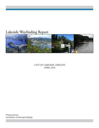
  • 2. City of Lakeside, Oregon i Acknowledgments Advisory Group CITY OF LAKESIDE Curt Kelling, City Recorder/ Manager Dean Warner, Mayor Mike Mader, Watershed Coordinator ODOT John McDonald, Development Review Planner Jeff Waddington, ODOT District 7 LOCAL BUSINESS OWNERS Mike Smalley, Owner Osprey Point RV Resort Dee Drummond, Owner North Lake RV Resort and Marina John Reiss, Owner Ringo’s Lakeside Marina Wayfinding Planning and Report LANDWISE LANDSCAPE DESIGN Greg Oldson, Principle/Designer
  • 3. Wayfinding Report ii TABLE OF CONTENTS A. INTRODUCTION ......................................................................... 1 B. STRENGTHS AND CHALLENGES .............................................. 2 C. RELATIONSHIP TO EXISTING DOCUMENTS ......................... 4 D. RECOMMENDED ACTION AREAS ............................................ 6 I. GETTING STARTED .............................................................. 7 1. FORM A COLLABORATIVE WAYFINDING COMMITTEE ............................. 8 2. DEVELOP CITYWIDE BRAND AND STYLE GUIDELINES ............................ 9 II. ESTABLISHING A SYSTEM ................................................. 10 3. DEVELOP ATTRACTIVE GATEWAYS ON HIGHWAY 101 AT THE INTERSECTION OF 8TH ST. AND AIRPORT WAY .............................................11 4. ESTABLISH LOCATION(S) FOR LOCAL ADVERTISING AND EVENTS SIGNAGE .......................................................................................12 5. ENHANCEMENTS ON MAJOR VEHICULAR AND PEDESTRIAN ROUTES ... 13 6. REDUCE SIGN CLUTTER ................................................................................... 14 III. REFINING EXISTING SYSTEM ......................................... 15 7. MAXIMIZE BANNER SYSTEM ........................................................................... 16 8. UTILIZE PUBLIC ART TO PROMOTE WAYFINDING ..................................... 17 E. MAPS ............................................................................................. 18 F. APPENDICES ................................................................................. 22 I. POTENTIAL FUNDING SOURCES ..................................... 23 II. ADDITIONAL RESOURCES ............................................... 23
  • 4. 1 City of Lakeside, Oregon A. INTRODUCTION Purpose The purpose of this project is to analyze Lakeside’s existing wayfinding system and provide an action plan for its improvement. This report looks at Lakeside’s road and signage infrastructure, along with current wayfinding strengths and challenges, and provides specific action areas on which to build and improve. Building upon past planning documents, this action plan can serve as a guide to the City of Lakeside as it moves toward implementation of an effective wayfinding system. Landwise Landscape Design has inventoried Lakeside’s existing signage and key destinations and worked with the City of Lakeside and ODOT representatives to refine project goals and recommendations. Goals The following goals form the essence of this project and guide the recommendations: 1. Create a welcoming sense of arrival along Highway 101 2. Develop connectivity between Highway 101 and Lakeside’s downtown business district. 3. Improve navigation throughout the downtown business district and to businesses along North Lake Road. 4. Provide strategies for local business and annual event advertising 5. Strengthen Lakeside’s identity and sense of place 6. Promote economic growth and tourism
  • 5. 2 Wayfinding Report 1. A Consolidated Downtown Business District. The majority of businesses in the City of Lakeside are situated along 8th Street. The downtown business district provides ample parking, accessible sidewalks, and provides services within walking distance of Tenmile Lake. 2.Existing Downtown Banner System The downtown business district’s banner system adds character as well as being informative to Lakeside’s tourist population. The banner system is also effective at delineating the downtown district. 3. Work Has Already Been Done The City of Lakeside has already taken steps to address current wayfinding challenges. Both Lakeside’s “101” Vision document and the Culture/Arts Initiative developed by the Lundquist School of Business at the University of Oregon provide insight into Lakeside’s branding and wayfinding. The current wayfinding report can build on the valuable information provided by these documents. 4. A Community of Artists As a creative community, Lakeside can embrace some of its artist residents by reserving space for local art that provides identity and aesthetic interest to visitors and residents alike. I. STRENGTHS B. STRENGTHS AND CHALLENGES
  • 6. 3 City of Lakeside, Oregon II. CHALLENGES 1. Underdeveloped Highway 101 Gateways The primary gateways off 101 need clarity and significance, and should provide a representational aesthetic and feeling for the City of Lakeside. Currently there are no consistent identifying welcome signs at the major gateways on highway 101. In addition, signage at both 8th St. and Airport Way is cluttered with a combination of directional signs, advertisements, and old and current Lakeside identification signs. 2. Disconnect Between Gateways and Downtown Business District The downtown business district of Lakeside is located approx. 1 mile from highway 101. Access via 8th Street and Airport Way take visitors through residential neighborhoods and meandering shore pine forest before intersecting and entering the business district. 3. Branding the City of Lakeside/ Inconsistent Image Through Signage Having a strong identity creates a positive relationship between a city and its visitors. Part of this identity is created by signage. From the major gateways into town, to each individual destination, inviting and consistent signage will add to a visitor’s experience. Currently, the city has a variety of logos and signs that visitor’s see as they enter into and travel through the City of Lakeside. Most of these signs convey the communities regard for Tenmile Lake, but lack a consistent identifying design or logo. 4. Lack a Location for Business and Event Advertising The separation of the Lakeside downtown business district from the major through-way of Highway 101 has led to businesses posting their own advertising and directional signs along 101 at 8th Street and Airport Way. Both of these locations have become cluttered with a variety of signs that are posted at these locations.
  • 7. 4 Wayfinding Report C. RELATIONSHIP TO EXISTING DOCUMENTS In order to create a cohesive and forward-looking document, this report builds upon ideas and goals established in existing documents prepared for the City of Lakeside. City of Lakeside Comprehensive Plan Vol II (updated 2013) Lakeside’s Comprehensive Plan does not directly propose any goals or policies to improve wayfinding. It does, however, state multiple city policies relating to pedestrian and bicycle infrastructure. These improvements will enhance connectivity and the overall character of Lakeside, impacting how wayfinding goals are addressed in the future. STATEWIDE PLANNING GOAL 8: RECREATIONAL NEEDS City policies 1. Consider recreational opportunities and encourage a pedestrian-friendly environment by supporting bike lanes and sidewalks in new subdivisions and other private development. 2. As funding is available, consider all opportunities for developing public walking paths and/ or bike lanes in order to enhance the wellbeing and recreational opportunities of citizens and visitors. d. Encourage maintenance and development of the Oregon Coast Bike Route along High way 101 within and to the west of the City of Lakeside. 16. Encourage the development of a combined rest stop and information center along Highway 101 in cooperation with Oregon Department of Transportation (ODOT) that will disseminate information about Lakeside and the South Coast region. STATEWIDE PLANNING GOAL 12: TRANSPORTATION City policies 6. Encourage businesses and residents to upgrade sidewalks and streets within the city’s residential and commercial areas for a healthy population and for safety.
  • 8. 5 City of Lakeside, Oregon RELATIONSHIP TO EXISTING DOCUMENTS CONTINUED... Lakesides “101” Vision (December 1996) Lakeside’s “101” Vision document provides a laundry list of improvements to the Highway 101 corridor running past the town of Lakeside. Many of the suggestions in the “101” vision are aimed at enhancing the overall identity of Lakeside as an attractive destination community. The plan designates an entire chapter to “existing signs and suggested sign improvements” along 101. Some of the key issues addressed in the “101” vision include: Improve North and South Entrances • Landscape the North and South Entrances. • Create a “sense of arrival”. • Improve entrance signs... The signs should encourage visitors to explore the town and create an awareness of the hidden opportunities for food, lodging, R.V.’s, boating and camping. • Develop pull-over areas in conjunction with the entrance signs. • Light entrance signs at night. “When signing issues are to be addressed, it will be important to get everyone to the table to find out what can and cannot be done. Players will include the City of Lakeside, the Lakeside Chamber of Commerce, Oregon Travel Information Council, Oregon Department of Transportation, Oregon State Parks, the Oregon Dunes National Recreation Area, Coos County Parks, Interested Lakeside civic organizations and private businesses.” Culture/Arts Initiative The Culture/Arts Initiative, created by the Lundquist School of Business at the University of Oregon provides some foundational actions to brand and strengthen the identity of Lakeside. This document does not directly suggest wayfinding improvements, but does help strengthen some of Lakeside’s key destinations. The actions suggested in the initiative support the need for a more effective wayfinding system to increase a tourist economy in Lakeside’s Downtown Business District.
  • 9. 6 Wayfinding Report I. GETTING STARTED 1. FORM A COLLABORATIVE WAYFINDING COMMITTEE 2. DEVELOP CITYWIDE BRAND AND STYLE GUIDELINES II. ESTABLISHING A SYSTEM 3. DEVELOP ATTRACTIVE GATEWAYS ON HIGHWAY 101 AT THE INTERSECTION OF 8TH ST. AND AIRPORT WAY 4. ESTABLISH LOCATION(S) FOR LOCAL ADVERTISING AND EVENTS SIGNAGE 5. ENHANCEMENTS ON MAJOR VEHICULAR AND PEDESTRIAN ROUTES 6. REDUCE SIGN CLUTTER III. REFINING EXISTING SYSTEM 7. MAXIMIZE BANNER SYSTEM 8. UTILIZE PUBLIC ART TO PROMOTE WAYFINDING D. RECOMMENDED ACTION AREAS
  • 10. 7 City of Lakeside, Oregon I. GETTING STARTED 1. FORM A COLLABORATIVE WAYFINDING COMMITTEE 2. DEVELOP CITYWIDE BRAND AND STYLE GUIDELINES
  • 11. 8 Wayfinding Report 1. FORM A COLLABORATIVE WAYFINDING COMMITTEE The first step toward implementing an effective wayfinding system is to form a team of stakeholders that have a vested interest in the long-term goals of the community. A wayfinding committee should use this report along with the guidance of existing documents to prioritize goals and strategies. City leadership is imperative to the success of this project. Some of the necessary stakeholders might include representatives from: • City Council • Planning commission • Chamber of Commerce • Oregon Department of Transportation (ODOT) • Coos County Parks and Recreation • Local businesses Actions • Identify key stakeholders who have an interest in Lakeside’s wayfinding system. • Form a steering committee headed by the city that meets regularly throughout the duration of the wayfinding project. Develop a clear purpose for the committee.
  • 12. 9 City of Lakeside, Oregon Wayfinding is an essential branding tool that can influence a sense of place or a person’s experience within a city. Signage is not only informational, but also carries a distinct message about the character of the city and its assets through its style and choice of destinations featured. Before any individual signs are designed and fabricated, decisions should be made between city leaders and the wayfinding committee to determine guidelines for future city-wide branding. Specific actions including; website, social media and community development have already been laid out in the Arts and Culture Initiative developed by the Lundquist School of Business. As Lakeside grows, a cohesive image for branding and wayfinding will help reinforce Lakeside’s identity for residents and visitors. Lakeside’s strong identity with Tenmile Lake and overall strength as an outdoor recreation destination should continue to be emphasized. 2. DEVELOP CITYWIDE BRAND AND STYLE GUIDELINES Actions • Undergo a collaborative, City-sponsored process to establish a citywide brand and style guidelines that take into consideration the prior work done to brand the downtown. • Adopt style guidelines for all City-sponsored materials including printed and digital documents, website and social media, temporary and permanent signage, and public art. • Develop wayfinding sign designs that are highly functional but also reflect the unique character of the place. It is recommended to hire an outside contractor to develop final signage designs.
  • 13. 10 Wayfinding Report II. ESTABLISHING A SYSTEM 3. DEVELOP ATTRACTIVE GATEWAYS ON HIGHWAY 101 AT THE INTERSECTION OF 8TH ST. AND AIRPORT WAY 4. ESTABLISH LOCATION(S) FOR LOCAL ADVERTISING AND EVENTS SIGNAGE 5. ENHANCE MAJOR VEHICULAR AND PEDESTRIAN ROUTES 6. REDUCE SIGN CLUTTER
  • 14. 11 City of Lakeside, Oregon Improving the gateways along highway 101 is imperative to identifying Lakeside, and orienting travelers to Lakeside’s downtown business district. Each gateway should have a prominant welcoming sign directing visitors to the downtown business district, in addition to well-maintained landscape emhancements. All signage should have consistent logos and branding as determined by a wayfinding committee. The City of Lakeside must follow ODOT Entrance Program and MUTCD guidelines and should work with ODOT and Highway 101 business owners to enhance these areas. Lakeside’s “101” Vision provides various strategies and design ideas for the improvement of these two primary entries into town. Actions • Install prominant Lakeside welcome signage and landscape enhancements at 8th Street and Airport Way to improve sense of arrival and support Lakeside’s unique identity. • Consider prior work done in Lakeside’s “101 Vision” document to improve gateways and the overall appearance of the 101 corridor • Remove unnecessary signage • Work with ODOT/property owners North Gateway (Highway 101 and 8th Street) North Gateway Conceptual Rendering South Gateway (Highway 101 and Airport Way) 3. DEVELOP ATTRACTIVE GATEWAYS ON HIGHWAY 101 AT THE INTERSECTION OF 8TH STREET AND AIRPORT WAY City of Lakeside Lakeside Business District
  • 15. 12 Wayfinding Report Actions • Install information Kiosks at strategic locations • Use Tourist Oriented or Specific Ser- vice signs 4. ESTABLISH LOCATIONS FOR LOCAL ADVERTISING AND EVENTS SIGNAGE Kiosks The installation of informational kiosks can provide directional information while also displaying advertising for local businesses, annual events, and additional area attractions. These kiosks should be located in high visibility, public areas (see Strategy Implementation map). Digital sign boards and QR codes City officials have expressed interest in digital sign boards and other technology on signage. LED sign boards and QR codes can be incorporated into kiosks to provide additional wayfinding and advertising information. Tourist oriented directional signage Tourist oriented directional signs can be used along highway 101 for businesses to advertise. Consolidating directional and destination signage at major decision points will help eliminate signage clutter. More can be found on TOD signs and specific service signs on Oregon Travel Experiences website: http://ortravelexperience. com/for-businesses/sign-programs/. http://www.propelstudio.com/project/lents-grown-kiosk/
  • 16. 13 City of Lakeside, Oregon There are various ways that the major routes (see Strategy Implementation map) people enter into and travel through Lakeside can orient visitors while also strengthening the identity of the community. The recent investment in sidewalk construction, and the installation of lights and a banner system in the downtown business district, provide a more lively and accessible feel. As funding is available, projects that promote pedestrian and bicycle travel along all the major routes should be implemented. The addition of sidewalks along Park Avenue and North Lake Rd., between 8th and 11th streets, will create a greater connection between downtown and the major attraction of TenMile Lake County Park. Likewise, it will be worthwhile to invest in bicycle lanes that connect the downtown to highway 101 and to Osprey and Northlake RV parks. As the Oregon Coast Bike Route is promoted it will be beneficial to get Lakeside recognized as a “need to see” destination. While sidewalks and bicycle lanes promote more accessible travel within town, repetitive plantings and placement of sculptures or other local art can act as landmarks to orient travelers along these major routes. Artistic site interventions, like sculptures should be designed to help promote Lakesides uniquecreativeidentity.Alldecisionsmade for landmark art, design and placement, should be reviewed and passed by the wayfinding committee. Actions • Improve pedestrian and bicycle access as funding is available • Use aesthetically pleasing community artwork along routes for orientation • Install uniform roadside plantings 5. ENHANCE MAJOR VEHICULAR AND PEDESTRIAN ROUTES Recent investment in downtown sidewalks and banner system adds a welcoming feel. Park Avenue is a primary connection between the downtown business district and Tenmile Lake.
  • 17. 14 Wayfinding Report Actions • Establish thresholds or limits for the number of signs at key intersections. • Remove temporary and redundant signage. • Consolidate signage using combined Tourist Oriented, Community Wayfinding and Destination guide signage. Since the development of the Lakeside 101 Vision, some progress has been made to remove unnecessary signage. There continues to be repetitive and cluttered signage along 101 and at key decision points within the downtown business district. Some of the ideas mentioned in the local events and business advertising section of this report may help consolidate signage and eliminate some of this clutter. With the introduction of any new signage for key destinations, consideration is needed in signage design and placement to ensure that major decision points do not continue to become cluttered with signs. The map for key destinations and decision points locates major intersections where signage is most important and yet should be limited. The City should identify thresholds or limits for how many signs can be at intersections. They should work with local businesses to assure that alternative advertising options are available so as to not clutter major intersections. All temporary advertising signage should be removed. It is important to note that too much signage can be counterproductive to good wayfinding, making it more confusing and thus difficult for visitors and residents to find their way to their intended destination. 6. REDUCE SIGN CLUTTER Examples of existing sign clutter at major decision making intersections Example of combined destination guide signage South Gateway at Airport Way Intersection of 8th Street and Airport Way
  • 18. 15 City of Lakeside, Oregon III. REFINING EXISTING SYSTEM 7. MAXIMIZE BANNER SYSTEM 8. UTILIZE PUBLIC ART TO PROMOTE WAYFINDING
  • 19. 16 Wayfinding Report 7. MAXIMIZE BANNER SYSTEM A robust banner system can reinforce identity, promote events, provide wayfinding directions, and generally strengthen the aesthetic of downtown Lakeside. Popular events like the Lakeside Brewfest and Crawdad Festival should be promoted with the banner system. Actions • Utilize banners to advertise events and attractions. For example, the Lakeside Brewfest and Crawdad Festival.
  • 20. 17 City of Lakeside, Oregon 8. UTILIZE PUBLIC ART TO PROMOTE WAYFINDING Actions • Identify key areas to use public art for wayfinding purposes. • Include public art support in wayfinding funding proposals. • Collaborate with local artists to create wayfinding public art projects. Wayfinding structures and public art can go hand-in-hand. Lakeside is a unique, creative community and has an opportunity to use public art to enrich its wayfinding system. Explicit directional information or simple imagery evocative of the place can be integrated into public art to reinforce a person’s sense of place. A well located wayfinding mural on a building or sculptural landmarks along major routes, signifying entryways or denoting thresholds are examples of combining wayfinding and public art. Using public art for these wayfinding projects also opens up additional funding opportunities. These examples illustrate how public art can be used for wayfinding while also adding creative interest and enhancing a sense of place.
  • 21. 18 Wayfinding Report E. MAPS I. MAP OF KEY DESTINATIONS AND DECISION POINTS II. MAP OF EXISTING SIGNAGE III. MAP OF ACTION AREAS
  • 22. 19 City of Lakeside, Oregon 101 Hall Lake Tenmile LAKE NORTH TENMILE Canal Lakeside Res. EEL LAKE LAKE TENMILE C reek Tenmile Blacks Arm 500 Feet 2,0001,0000 Downtown Business District Public Open Space Lakeside City LImits Gateways Decision Points Government Services Recreation areas and businesses N Fire Station John Dellenback Dunes Trailhead Spinreel Dune Buggy and ATV Rental Eek Creek Campground Oregon Dunes National Recreation Area Tugman State Park Post Office Water District City Hall Library Tenmile Lake County Park/ Wulfy Beach Osprey Point RV Park Ringo’s Lakeside Marina Lakeshore Lodge North Lake Resort and Marina RV Park Mountain View Farms Airport Way North Lake Rd. Park Ave. 8thStreet I. MAP OF KEY DESTINATIONS AND DECISION POINTS
  • 23. 20 Wayfinding Report 101 Hall Lake Tenmile LAKE NORTH TENMILE Canal Lakeside Res. EEL LAKE LAKE TENMILE C reek Tenmile Blacks Arm 500 Feet 2,0001,0000 Entering Lakeside Entering Lakeside Tourist Map Map The Sunset Coast of Coos County Welcome to the City of Lakeside Tenmile Lakes Watersed Council Lakeside Community Church Lakeside Women’s Club Eel Tenmile Step Salmon Trout Enhancement Program Lakeside Public Library Lakeside Chamber of Commerce Welcome to the City of Lakeside Tenmile Lakes Watersed Council Lakeside Community Church Lakeside Women’s Club Eel Tenmile Step Salmon Trout Enhancement Program Lakeside Public Library Lakeside Chamber of Commerce Lakeside Next Right Lakeside City Center Welcome to Lakeside City Center Welcome to Lakeside Home of Tenmile Lakes Lakeside 1 Tenmile Lakes Rec. Area Library Lakeside 1 Tenmile Lakes Rec. Area Airport John Dellenback Dunes Trailhead Next Right John Dellenback Dunes Trailhead Oregon Dunes National Recreation Area Eel Creek Campground Eel Creek Campground Gas Right 1/4 Mile Tree Acres Lakeside TenMile Lakes Recreation Area Left 1/2 Mile Tenmile Lakes County Park and Recreation Area Tenmile Lakes County Park and Recreation Area Tenmile Lakes County Park and Recreation Area Tenmile Lakes County Park and Recreation Area General Information Signs Directional Signs Tenmile Lakes County Park Ringo’s Lakeside Marina Boat Rental Ringo’s Lakeside Marina Boat Rental Fire Station Osprey Point North Lake Resert and Marina RV Park Camping Next Right (North Lake Resort and Marina RV Park 1 1/2MI/ Osprey Point RV Resort 1 1/4MI) Camping Next Right (North Lake Resort and Marina RV Park/ Osprey Point RV Resort) Camping 13/4 MI North Lake Resort and Marina RV Park Camping 1 1/2 MI Osprey Point RV Resort Camping Next Right (North Lake Resort and Marina RV Park/ Osprey Point RV Resort) N * Other signs are present that are not included on this map. These signs include: High- way warning and regulatory signs, local advertising, event boards, and other temporary signage. Downtown Business District Public Open SpaceLakeside City LImits Airport Way North Lake Rd. Park Ave. 8thStreet II. MAP OF EXISTING SIGNAGE
  • 24. 21 City of Lakeside, Oregon 101 Hall Lake Tenmile LAKE NORTH TENMILE Canal Lakeside Res. EEL LAKE LAKE TENMILE C reek Tenmile Blacks Arm 500 Feet 2,0001,0000 Downtown Business District Public Open Space Lakeside City LImits Decision Points Major vehicular and pedestri- an routes Gateway Signs Landscape Enhancements Potential Kiosk Location N Tree Acres vicinity ACTIONS (Gateways) - Place prominant Lakeside welcome signage directing visitors to the downtown business district. - Install and maintain attractive landscape enhancements around welcome sign. - Remove all temporary and redundant signage and consolidate directional and destination signage as appropriate. ACTIONS (Decision points) - Install and maintain attractive landscape enhancements. - Remove all temporary and redundant signage and consolidate directional and destination signage as appropriate. ACTIONS (Major vehicular and pedestrian routes) - Improve pedestrian and bicycle access as funding is available - Use aesthetically pleasing community artwork along routes for orientation - Install uniform roadside plantings In front of restroom area at TenMile Lake County Park Along 8th Street at McKay’s Market Airport Way North Lake Rd. Park Ave. 8thStreet III. MAP OF ACTION AREAS
  • 25. 22 Wayfinding Report F. APPENDICES I. POTENTIAL FUNDING SOURCES II. ADDITIONAL RESOURCES
  • 26. 23 City of Lakeside, Oregon I. Potential Funding Sources • Oregon Department of Transportation (ODOT) • Travel Oregon http://industry.traveloregon.com/industry-resources/matching-grants-program/ • Ford Family Foundation Grants http://www.tfff.org/what-we-do/vital-rural-communities/community-economic-develop- ment/community-development • Oregon Community Foundation Grants • Oregon Arts Commission Grants • Transient Room Tax • Federal Transportation Administration funds • Community Development Block Grants (CDBG) II. Additional Resources • Oregon Travel Experiences http://ortravelexperience.com/for-businesses/sign-programs/ • League of Oregon Cities http://www.orcities.org/CityResources/FundingGrantOpportunities/tabid/847/Default. aspx • Rural Development Initiatives http://www.rdiinc.org/