David Coleman presentation at SDI Summit 2014, Calgary, Canada, 17-19 Sept 2014
LiDAR_ Best_Practice_Final (3)
1. LIDAR ACQUISITION TEAM BEST PRACTICE
Page 1
BACKGROUND
The September 2013 Colorado flood and landslide event impacted rivers and streams in various
watersheds throughout the state. The stream geo-morphology has changed significantly in
particular areas. Specific rivers, streams and tributaries have lost the ability to convey water
and some have limited capacity within the floodplain. Timely decisions to acquire high-
resolution 3D topographic data were identified as a critical need and vital tool to quickly
analyze the data and determine any
unknown natural hazard vulnerabilities.
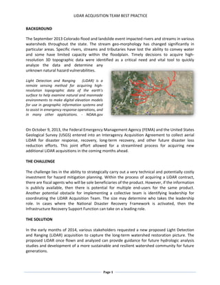
Light Detection and Ranging (LiDAR) is a
remote sensing method for acquiring high-
resolution topographic data of the earth’s
surface to help examine natural and manmade
environments to make digital elevation models
for use in geographic information systems and
to assist in emergency response operations, and
in many other applications. - NOAA.gov
On October 9, 2013, the Federal Emergency Management Agency (FEMA) and the United States
Geological Survey (USGS) entered into an Interagency Acquisition Agreement to collect aerial
LiDAR for disaster response, recovery, long-term recovery, and other future disaster loss
reduction efforts. This joint effort allowed for a streamlined process for acquiring new
additional LiDAR acquisitions in the coming months ahead.
THE CHALLENGE
The challenge lies in the ability to strategically carry out a very technical and potentially costly
investment for hazard mitigation planning. Within the process of acquiring a LiDAR contract,
there are fiscal agents who will be sole beneficiaries of the product. However, if the information
is publicly available, then there is potential for multiple end-users for the same product.
Another potential obstacle for implementing a collective team is identifying leadership for
coordinating the LiDAR Acquisition Team. The size may determine who takes the leadership
role. In cases where the National Disaster Recovery Framework is activated, then the
Infrastructure Recovery Support Function can take on a leading role.
THE SOLUTION
In the early months of 2014, various stakeholders requested a new proposed Light Detection
and Ranging (LiDAR) acquisition to capture the long-term watershed restoration picture. The
proposed LiDAR once flown and analyzed can provide guidance for future hydrologic analysis
studies and development of a more sustainable and resilient watershed community for future
generations.
2. LIDAR ACQUISITION TEAM BEST PRACTICE
Page 2
After close coordination with state and Federal agencies, GIS analysis was provided by U.S.
Army Corps of Engineers to the working group for their input into what stretches of streams to
be flown for fall 2014. After the development of the initial contract agreement, there was a
need for a collective group involved in the acquisition to collaborate and discuss desired
outcomes, priorities, and expectations.
The key component the LAT included was a LiDAR Acquisition Team Coordinator. The LAT
Coordinator was the focal point to engage with all partners involved and ensure the continued
flow of accurate information was being shared. Sharing the desired goals of the group with
various stakeholders throughout the process involved community input for priority needs as
well as desired expectations to have the product delivered on a specified timeline. The LiDAR
Acquisition Team (LAT) was assembled to discuss a three-phased approach. The first phase is
the acquisition phase. This phase involves the formulation of the contract agreement and the
scope of work to be outlined. Also discussed, was the prioritization of the processing of the
data collected.
Several components during this phase were
examined:
Discussing options for data
processing and data sharing
Coordinating with other agencies for
other acquisitions occurring at or
near the same time-frame
Limiting duplication of efforts
Getting the most use of the data
This group organization concept was applied
to 4145-DR-CO severe storms, flooding,
landslides and mudslides. The LAT demonstrated collaborative efforts in minimizing costs,
prioritizing needs, and getting the information out to the communities. During the
development stages of the acquisition several challenges emerged involving federal funding,
priority areas for data processing and state law procedures.
Phase two involves the data processing phase. The key component the LAT included a LiDAR
Acquisition Team (LAT) Coordinator. Under the lead coordinating agency, the coordinator
provided continued engagement with all partners involved. Monitoring the project quality
assurance, quality control and a timely transition into phase three confirmed a final delivery to
the end-user.
And finally, phase three includes the implementation phase of the product once the final
delivery from the contractor to the state or federal agency is completed. This phase is critical
for timely execution for restoration projects. The implementation of the LiDAR product will
provide technical data for the projects identified by local communities and local governments.
3. LIDAR ACQUISITION TEAM BEST PRACTICE
Page 3
The ability to have the data processed with established priorities, local jurisdictions could
obtain the data processed sooner to begin the rebuilding process. Coordinating these critical
elements can increase the value of the end product, in turn, assisting the end user more
quickly.
Another important factor for measuring a successful product once completed is acquiring the
local stakeholder input in the beginning, in the planning stages. Having the local municipalities
and other stakeholders provide their needs benefits the overall project. Once aerial acquisition
is completed and the data is collected, the project goes into what is called the processing
phase. LiDAR requires a lengthy process to analyze all the data collected, some of the data
cannot come soon enough with time-sensitive project planning on the door step.
THE OUTCOME
Having an established team that is collectively discussing and agreeing upon desired outcomes
will help streamline the process for future contracts. Establishing roles for everyone is essential
for each organization that benefits from the end product. The beginning stages of the contract
development stages should have every partner present to ensure a continued partnership
throughout a year or longer project. Having an organized team to help shape the foundation for
continued partnership and collaboration among the GIS community to share data and
ultimately yield the best use out of the LiDAR product.
Develop a coordination team to discuss the following:
overlapping costs
local community priorities
state directives
Federal agency benefits
ways to expand the effectiveness of the tool