The document summarizes evidence found at Gympie, Australia that suggests pre-colonial Chinese settlements from the 15th century, including:
- Coins dated 1385-1400 AD found at the Gympie Pyramid site
- A Chinese "teapot" and jade jewelry found nearby, dating to the Ming period
- Similarities to structures and artifacts from South America, China, and other ancient cultures
- Local Aboriginal stories describing "strange gods" mining for gold, consistent with possible Chinese explorer visits
- Maps and historical records providing evidence that Chinese fleets under Admiral Zheng He explored the Australian coast in the 15th century
dusjagr & nano talk on open tools for agriculture research and learning
China's global maritime expansion reaches Australia in 1400 A.D.
1. Pre-Colonial Chinese Settlements in Australia: New Evidence at
Gympie adds credence to Zheng He's explorations
by Bruce L. Raphael / September 20 2004
To: Beijing University: Research Dept. Fellows in Archaeology/ref:
Admiral Admiral Zhong He
Overview: I have been conducting active research in Australia since 1984 to
further a position that the Chinese were one of several pre-colonial cultures
who founded temporary settlements along Australia's coastlines. More and
more evidence in Australia demonstrates that in pre-colonial Australasia
(before 1770) maritime nations knew about Australia and made visits and
temporary habitation there.
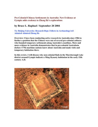
In this review, I will discuss why non-colonial finds in the Maryborough Lake
district around Gympie indicate a Ming Dynasty habitation in the early 15th
century A.D.
2. The ethnography of the Gympie area near Fraser Island has been preserved
by the Green family who demonstrated a well organized archive of local
Aboriginal stories and in-situ evidence that was largely unspoiled when the
first wave of Europeans arrived in the 1860's. Brett Green comments: " My
great-great grandfather had a propensity to studying ancient cultures and
came from England to pursue his dream. He arrived in Maryborough and
settled in Gympie during the search for gold. Subsequently, he found a
pristine temple and mound complex and noted the ideograms and structures
in his sketches." I first visited the Gympie Pyramid site in 1984 and studied
the copious notes with Brett for years to come. Recently he brought to my
attention the newest find at Gympie:
Denga coins on the site that would be dated to 1385-1400 A.D.
My Background: I minored in Asian Studies in college at Connecticut College
in New London in 1974. I majored in Oceanographic Studies at the Bermuda
Biological Station for Research through the University of Hartford in the
USA in 1975. For as long as I can remember I have been a keen collector and
student of rock art and joined AURA in Australia, Rock Art Research
Association headed by Robert Bednarik. He mentored me in my study of
cyclons, an arcane area of Aboriginal artifacts that are sacred to the clans of
N.S.W.. It was my hypothesis that the engraving on the conical long stones
were not of Aboriginal origin, as the Aboriginals do not engrave or carve
linguistics, but use painted icons for lifestyle management: food gathering
and sacred places for meetings.
I continued my study of epigraphy with the help of Yale graduate , Charles
Boyle who was familiar with the scripts on the cyclons. He was a teacher in
epigraphy and geology. His life pursuit was documenting in situ evidence in
New England of pre-colonial settlements of North Sea migrations from
Ireland circa 700 A.D..
My work in Australia continued in 1984 when I was introduced to the
Gympie site. In later years I was given field notes on anomalous megalithic
structures that are found throughout Australia.
My co-writer and mentor Rush Allen had made further inroads to the
Gympie location in so far as it's latitude and longitude for studying the
motion of the Milky Way from 700 BC to 1400 AD based on the movement of
Sirius at the Summer Solstice. (see Australian grid map #3)
3. In 1993 I focused on Far North Queensland, where clan elders directed to me
to a certain site in a canyon near Port Douglas. Many field trips were taken to
the canyon where I studied the megalithic array of stone pillars called
menhirs. My first task was to set up a grid and focus on the zenith and the
ecliptic at this latitude and longitude. I found the placement of the menhirs to
describe one constellation that was most important to the Chinese navigator
and that was CARINA, the keel of the great ship Argo Navis. The lead star of
Carina is CANOPUS, called Lao Jen. The shape fit the cast of the keel.
Canopus was positioned at the place where the greatest stone of all the 7 was
placed, high on Lighthouse Mountain visible for 4 kilometres in any
direction!. Canopus was the lighthouse star for positioning charts in southern
waters by latitude.
4. Rush Allen further refined the latitude and longitude zenith circa 3200 BCE
that would reveal more star stories and importance to the latitude and
longitude. (see photo 1)
.
In November 1985, I conducted a three week dig on a mound near Cooktown
where Middle Eastern artifacts were found to include a Mycenaean pottery
shard and a miniature carved Horus figurine in limestone. The project was
under the guidance of an Australian field researcher Marilyn Pye from
Sydney. (see photo of Lost Pyramid Story Australia #4)
Larger
5. The owner of the land became impatient and asked us to conclude our
activities and move on.. An unusual feature of this mound was that it was
positioned exactly due north from the Canopus stone at a distance of about
68.68 nautical miles. The Canopus stone had another feature that linked it to
the same latitude as the Temple Platform of Tiahuanco currently dated to
around 800 BCE.
My education continued with my association with Brett Green, South
Queensland resident and regional ethnographer who in the tradition of his
great, great grandfather upheld the local Aboriginal folk lore and stories
brought to him by the Gaba-speaking clans of the Lake District.
In 1984 when I visited the site, it was overgrown in high grass, with a
retaining wall still in tack, large stone bowl at the summit, artifacts and an
anomalous Ape Statue that were all found on the land. Brett Green's great
grandfather had first unspoiled viewing of the mound pyramid complex and
kept detailed notes and drawings. When Brett received the copious files in
1974 he saw for the first time a temple court yard with unusual carvings and
animal motifs and obelisk like columns. There were also entry ways into the
mound. The Aboriginal clan held this site as taboo and stayed clear of the
area.
Brett Green took great care from his youth to study the regional histories that
involved the anthropology of Frazer Island, a key gateway for maritime
journeymen seeking fresh water and access to landfall from within the coral
reef. Out-of-place artifacts have been catalogued over the years by Mr. Green
and detailed with the local Aboriginal histories in his book Mystery of the
Gympie Pyramid.
6. In December 2004, two New South Wales prospectors searching for gold
unearthed unidentified ancient coins amongst rocks in the northeastern
quadrant of the Gympie Pyramid site. They were found under 9 inches of soil
amidst other metallic debris. Brett Green's organization the Dhamurian
historical Research Society was alerted to the discovery by an E-bay auction
in late January 2005. The society obtained the coin for their archives and the
search for information on the coin began.
The coin joined a growing folder of lost-and-found artifacts also discovered
over the past 100 years at Gympie:
1. unusual statues of Hindu origin 2. 600 year old lead fishing weight found at
nearby Fraser's island, identified as a 16th century item from North of Spain
3. evidence of wood remains of pre-colonial ships that were awash in sand and
surf 4. curved sword blade 5. and an antimony mine located near the pyramid
complex that was 're-opened' and examined in 1950.
By January 2005 the results of the society's investigations were in. a
consensus was reached by 5 professional organizations to include: The
Russian Numismatic Society, The Pskov Museum, the Canadian Society for
the study of Egyptian Antiquities, numismatic experts from England and
America and an Australian Archaeologist from the Q.I.T in Brisbane,
confirmed the coin as a "15th century A.D. silver "DENGA" and is quite
rare.
7. The ethnography on these coins :
It comes from the Feudal State "Kingless" period in Russian history 1389 -
1462 A.D. ,
when the Mongol-Chinese controlled the borders of early Russia Pskov
Russia was where
the coins were minted c. 1400-1500 A.D. The alphabet signage on the coin is a
"Cyrillic" form of "old Church Slavic and it appears to display a mint-
makers mark.
The obverses of all coins for the Pskov period are the same and depict a head
8. with a 'crowned' head and a sword. The symbolism depicts an image of an
earlier Prince named Dovmont-Timothy of Pskov, "The Saint". The size of
the pure silver coin is also consistent with the European dark ages and that
size is like a three pence. Importance lies in the set silver weight size for such
coins evolved on a pattern set for early coin/weight sizes.
The legend on the coin according to linguists reads by line: a) Den b) Gapsk
c) Ovsk d)AIA
e) the final line is not identified. It then reads: "DENGA of PSKOV" or
Den'ga Pskovskaya in Russian. Pskov was an ancient trading city so its
coinage moved all over the world with other trading nations. The "DENGA"
and other silver coins became currency anywhere in the world. It is well
established that the early Russian provinces traded with China extensively in
those days (14-16th centuries) and that silver was more valuable than gold in
many parts of Asia.
The Society sees a strong connection between the coin, the sword, the lead
weight and other artifacts all being connected to the period of 1389 - 1462.
The official gold rush in Australia specifically in Gympie began around 1857 -
1900. Russian immigrants and Chinese mine workers arrived around that
time. The Aborigines of the Gympie Lakes region were cannibalistic and kept
many foreigners from venturing from the camps.
The Admiral Zheng He connection
The society with my help wishes to confirm some important information. The
map found in Macao brought a closer inspection of the Chinese explorations
of Emperor Zhu Di's Admiral Zheng He and his fleets of oceangoing ships. I
posted the map depicting the Far North Queensland coast with Chinese
scripts on my website in 1996 and created the World Tree Database to file my
findings and sketches. The map is part of the Chui Hiao ('Atlas of Foreign
Countries" and other sixth-century scrolls telling of voyages of junks to
Australia. Also details are provided in the Classics of Shan Hai Jing.
The importance of the Frasier Island and Tin Can Bay area is that it would
provide freshwater resources for one of Zheng He's admirals Zhou Mann
whose long distance maritime trips to Australia required , food provisions
and with the feature of Gympie being saturated with gold veins an important
locale for mining exploration. Could the Aboriginal stories talking about
'strange gods' who dug for the 'yellow stone' and 'cooked tree leaves'
(eucalypt) have any connection to the Chinese fleets' arrival on these shores?
9. To this story the Society has added in support of this research another find of
an ancient
a) Chinese 'teapot' found on the shoreline east of Gympie 20 years ago. It has
a "green dragon" copper design from the Ming period. It has 3 legs
suggesting it is a wine pot, not a teapot. Copper or bronze was used for easy
warming of the wine over heat.
b) the remnants of an old jade necklace and two jade carved objects were
found amongst the stone ruins in bush land near Tin Can bay in the late
1990's. Does the jade necklace resemble those worn by those captains who
were in the Admiral's fleet? The captains of his navy are said to have been
Taoist priests who wore such necklaces.
c) Is there a connection of the 'Antimony mine' and the Chinese? Yes. In use
more than gold.
d) Was Zheng He descended from the Mongols of Eastern Russia? Answer:
The Admirals forebears
were Persians who migrated from Syria to Bokhara in the 8th century A.D..
They remained there until Genghis Khan sacked the city. Then they migrated
to Yunnan.
e) The last Mongol stronghold in 1402 was in Yunnan at the fortress of
Hunyang. Emporor Zhu Di had captured Kunyang and has Zheng He and his
family castrated.
f) Was the term "Denge" used for early Chinese coinage? Yes-it is Mongolian
for 'money' and is in use in Central Asia today.
Mr. Green is a bona fide ethnographer and detailed in his book, Spirit
Warrior, the oral legends of the 'cultural heroes' who had over time visited
the shores near Fraser Island. In one of them they describe large vessels that
appeared from the clouds. The heroes were dressed in unusual clothing with
helmets and fire power to shoot down birds.
Much of the supporting evidence for China's great exploration of world
cartography is now found in the book 1421 by Gavin Menzies. Gavin Menzies
is a naval commander of the British fleet and began accruing data on China's
cross cultural fertilization of plants and animals during their stopovers in
hundreds of ports worldwide. In the early years of research Marilyn Pye,
suggested that there were some features of the Gympie Pyramid complex that
had South American features, namely the original sandstone-wall that was
numbered and re-erected around the Unitarian Church originally came from
the mound site. Many of the stones have a feature of the 11 angle stone design
known by the Incas at Cuzco and Macchu Pichu. From the evidence of iron
smelting at Sarina, Queensland
10. I am suggesting that the wall construction could have been part of Mycenaean
maritime exploits. Further Brett Green noted that stone statues of a creature
that appeared as part dog, part monster were found and photographed near
the Gympie Pyramid Hill. They resembled the now extinct mylodon. This
gentle herbivore was very large and was found in Australia and in Peru
during the time of the Moche habitation and during the maritime
explorations of Zheng He circa 1420 A.D..
I saw a clay facsimile of this creature at the Beijing Museum featuring
Peruvian collections.
Gavin Menzies adds an important piece of missing data on the Chinese
voyages to Australia in the 15th century. was it reserved for just the scientific
fleet's exploration? Descriptions of common journeys were described as "the
north coast of the Great South Land of Chui hiao" was described as lying
thirty thousand li, about twelve thousand miles from China and being in the
south temperate zone, where seasons are opposed to those in the northern
hemisphere. It was inhabited by a race of small black people identified by
Australian anthropologist Norman B. Tyndale as Aborigines from the
mountains above Cairns in north Queensland.
(see: K.G. McIntyre's The Secret Discovery of Australia, Souvenir,
Melbourne, 1977)
Connecting the Dots: If I could describe my field investigation and the
timelines that connect Australia to secret places in the world, I would mention
South Yemen, East India, Southwestern China and Egypt. These places are
connected to mysteries of the world between 2300 BCE and 700 A.D.
My fascination for the Ming Dynasty started a few years ago while I began
studying Buddhism of Japan in the 14th century A.D.. I found an artifact in a
New York Chinese collector's shop of antiquities of China that were being
brought over from China for museums and collectors.
Mr. Yu Ming of Yu Ming Antiques on 28th Street had displayed these clay
figures from the Ming Governor’s homestead. The same were displayed in
his window measuring about 8 inches high and 13 inches long. This
marvelous dragon/dog became the mystical power behind my entire story.
Mr. Ming the owner of the shop describes this clay piece as the protector of
the governor's house as many of them were positioned along the roofs highest
edge from north to south.. He showed me one of the governor's residences
being dismantled during a development project. It was said that these icons
were able to move around on another dimension and report back to the
Emperor of events that were going to happen. The rider was wearing a hat
11. that resembled the Mongolian style fashion worn by the governor's men.
Current to this story, is Brett Green's luck to find evidence of a iron foundry
on the Gympie Pyramid Site. Sadly the government decided to place a 4 lane
highway through the mound site, but the recent find has put a slow-down to
the final destruction of the Gympie mystery. .
The challenge continues to grow as I have recently found strong evidence of a
Chinese 15th century Script used on the stele's at Gympie. They are
called NAXI and were used by the Chinese People who inhabited southeast
China near Guangzhou. It was in April 2006 that I decided to take up long
standing invitation by my friend Hao Dan Wu to come to Beijing.
In early November 2006, I had the unexpected joy to visit Baoding home to
the the 2000 year old famous tomb of Prince Liusheng and his Princess Wan.
The region in the summer is a resplendent Eden of waterfalls, caves and
orchards. The tomb entrance was discovered by accident during a search for
water on a local mountain top. The tomb was said to have taken 30 years to
construct and used stone and molten copper to seal the entrance (see photos
of Baoding's famous tomb of the Eastern Han District circa 200 BCE).
Bruce L. Raphael
brura2718@yahoo.com
Archivist, writer and explorer
for World Tree 2000 and Eye of Siloam.net
Publications: Let the Truth Be Known ^ A True Story of Cosmic
Proportions
footnote 1:
Columbus reaches America with Chinese Nautical Chart: (from People's
China Daily July 28, 2006
In his book entitled "The 1421 Heresy, An Investigation into the Ming
Chinese Maritime Survey Of the World", U.S. historian Chao Chien presents
historical evidence and points out that Chinese fleets had circumnavigated
12. and charted the earth long before Europeans. European Navigators including
Christopher Columbus used Chinese nautical charts to make sea journeys.
Chao Chien was born in China and later worked for the Jet Propulsion
Laboratory. He spent 2 years collecting nautical charts and maritime logs
from major libraries and universities. Evidence indicates that the strength of
the Chinese maritime fleets began long distance journeys during the Song
Dynasty around 1100 AD.
Footnote 2:
At my geocities website I show a map that was transcribed by Portugeuse
Monks in Macao around 1630 during the studies and work of Chinese culture
by the Ricci Monastry. This Chinese map shows the exact topography and
coastline of Far North Queensland south of Cape Tribulation.
Footnote 3:
For Naxi Scripts: http://www.ancientscripts.com/naxi.html