All
•
1 like•295 views

The document provides information about laws related to paddling rivers in Central Texas. Some key points include: - Rivers are considered public if they are "navigable in fact" meaning useful to the public, or if the streambed averages 30 feet or more in width. Perennial streams in some counties may also be public. - The streambed is defined as the land between the "gradient boundaries" on each bank, which is located midway between the lower and higher water levels. - The public has the right to boat, fish, picnic, camp and more in public rivers and lakes, but not private lakes or streams without permission. - Various agencies regulate activities in public rivers

Recommended
Recommended
More Related Content
What's hot
What's hot (7)
Similar to All
Similar to All (17)
All
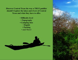
- 1. Discover Central Texas the way a TRUE paddler should! Explore the lakes and rivers of Central Texas and what they have to offer. • Difficulty level • Topography • Camping sites • Rapids • Parking • and More!
- 2. The Paddling Atlas of Central Texas Adailin L Bengochea • Ryan Zucker • Sean Burns
- 3. GEO 4411/5417 SPRING 2016 Dr. Alberto Giordano
- 4. The Paddling Atlas of Central Texas Adailin L Bengochea • Ryan Zucker • Sean Burns
- 5. 5 Atlas Content Introduction 8 - 10 Key to Map Symbols 11 Texas River Laws 11 - 14 Blanco River 15 - 20 Map 17 - 18 Temperatures 19 Endangered Species & Fishing 20 Colorado River 21 - 26 Map 23 - 24 Temperatures 25 Endangered Species & Fishing 26 Comal River 27 - 32 Map 29 - 30 Temperatures 31 Endangered Species & Fishing 32 Guadalupe River 33 - 40 Lower Guadalupe River Map 35 - 36 Upper Guadalupe River Map 37 - 38 Temperatures 39 Endangered Species & Fishing 40 Medina River 41 -46 Map 43 - 44 Temperatures 45 Endangered Species & Fishing 46 Pedernales River 47 - 52 Map 49 - 50 Tempartures 51 Endangered Species & Fishing 52
- 6. 6 Atlas Content San Antonio River 53 - 58 Map 55 - 56 Temperatures 57 Endangered Species & Fishing 58 San Gabriel River 59 - 64 Map 61 - 62 Temperatures 63 Endangered Species & Fishing 64 San Marcos River 65 - 70 Map 67 - 68 Temperatures 69 Endangered Species & Fishing 70 Footnotes 71 - 72 Acknowledgement 73 - 74 Credits 75 - 78
- 7. 7 Introduction The Paddling Atlas of Central Texas is designed to cover nine rivers* in Central Texas: the Blanco, the Colorado, the Comal, the Guadalupe (Upper and Lower), the Medina, the Pedernales, the San Antonio, and the San Marcos River (see Fig. 1). We have mapped out everything a person would need to know when kayaking, canoeing, or paddle boarding these rivers. Each map addresses all the physical aspects of the rivers and surrounding areas, while other useful information is presented in tables, charts, and/or text. This atlas includes maps for the selected ten rivers. Each map shows entry and exit points in and out of the rivers as well as public boat ramps (if information is available). The maps will illustrate public parking areas for paddlers who commute to these locations since parking is often not obvious to tourists. Because much of the land along the ten rivers is privately owned or is part of state and/or city parks we will be indicating which plots of land are private and public. We also include dam locations in the selected rivers; knowing dam locations are important to paddlers for safety reasons and planning strategies. Each map shows the location of rapids and their level of difficulty; this information is vital to paddlers for their safety. Big rapids that should not be paddled through, unless the paddler is trained and experienced, so they will be differentiated from smaller rapids which can be paddled through. * Note: Only popular sections of the
- 8. 8 We also show points of interests, including public restrooms, camping sites, historical markers and notes. Data that cannot be mapped are presenterd in charts, tables, text, and/or diagrams. This information includes monthly stream flow averages which can inform the reader which months have the most flow and the lowest flow, or even if the river runs dry. Monthly gauge height averages are presented in order to give the reader insight on river depth and flow information. Monthly rainfall averages are documented to supplement stream flow data and gage height data. Monthly water temperatures and air temperatures will are presented in tables in order to prepare the reader as well as enable them to plan for an ideal paddling experience. Wildlife information is also presented in order to educate our audience and ensure the safety of our readers and that of wildlife. Endangered species found in each section of the river are presented in text and illustrations. Fishing information is provided for our angler audience. Water laws and trespassing laws are also noted. Finally, rental locations will be noted for readers who wish to rent canoes, kayaks, and/or paddle boards. Introduction selected rivers will be mapped.
- 9. 9 Introduction Figure 2: State of Texas with River Locations selected by county. Figure 1: State of Texas with River Locations selected by county.
- 10. 10 Key to Map Symbols Access Point River Access and Entry Points Public Restroom Parking Picnic Dam Rapids (High Difficulty) Parks Points of Interest Rapids (Medium Difficulty) River Minor Roads Fishing Locations USGS Gage Location Major Roads Rapids (Low Difficulty) Camping Rental Locations
- 11. 11 Texas River Laws A list of Questions and Answers addressed by the Texas Parks and Wildlife Department concerning River Laws will now be provided. This information is vital to paddlers in case of any legal confrontations. Please read the following in order to gain basic concepts of Texas River Laws and Guidelines. Q: What is considered a public stream? A: In Texas a stream is public if it is “navigable in fact,”or” navigable by statute.” There is no precise test for whether a stream is navigable in fact. The term is based on the idea of public utility. One court has observed that “[w]aters, which in their natural state are useful to the public for a considerable portion of the year are navigable.”1 A stream is navigable by statute if it retains an average width of 30 feet from the mouth up.2 It is important to understand that the entire stream bed is to be included in the width, not just the area covered by water on a given day. A navigable stream may be dry part of the year, but does not lose its character as a navigable stream. To complicate matters, some Texas land titles originated with Spanish or Mexican land grants, and the law of Spain and Mexico did not distinguish public and private streams on the basis of navigability. Streams were valued primarily as a source of water for household use and for irrigation, rather than a way to move people and goods. So when the sovereign granted land, perennial streams were retained for public use, regardless of navigability, so as to make as much land as possible capable of settlement.3 A stream is perennial if it flows most or all of the year. In determining the rights of holders of title under Mexican grants, the laws of Mexico in effect when the grants were made control.4 So in counties that contain Spanish or Mexican land grants, there are an unknown number of perennial streams which are public streams, even though they may not be navigable. Q: How do I determine the boundary of a streambed? A: The Texas Supreme Court has stated that the bed of a stream is “that portion of its soil which is alternately covered and left bare as there may be an increase or diminution in the supply of water, and which is adequate to contain it at its average and mean stage during an entire year, without reference to the extra freshets of the winter or spring or the extreme drouths of the summer or autumn.5” Not clear? Again, the Texas Supreme Court: The streambed is that land between the “gradient boundary” on each bank. The gradient boundary is defined as “a gradient of the flowing water in the stream, and is located midway between the lower level of the flowing water that just reaches the cut bank and the higher level of it that just does not overtop the cut bank.6” Clear as mud? Blame it on those civil judges. Q: What if the stream is dry? A: A navigable stream does not lose its public character during
- 12. 12 Texas River Laws periods of low water. A stream is navigable if the bed of the stream averages 30 feet wide from the mouth up, regardless of the actual water level on a given day. Q: What is a public lake? A: The typical public lake in Texas was created by building a dam on a navigable stream. When a navigable stream is dammed, the resulting lake is a public lake, and the public may boat and fish on all of the lake’s waters, not just that part directly above the streambed. Therefore, a property owner may not fence off any portion of such a lake.7 For other lakes, the test is whether the lake is navigable. Typically, the small natural lakes in Texas are held to be non-navigable, and therefore subject to private ownership and control. Manmade stock tanks and flood control ponds are usually non-navigable as well. The public has no right to boat, fish, or hunt in or on the waters of private lakes,8 and hunting or fishing without landowner consent is a crime.9 In order to encourage outdoor recreation, the legislature has limited the liability of landowners who allow the public to use their property for recreational purposes.10 Q: But doesn’t the state own the waters of ALL lakes and flowing streams, plus the fish that live there? A: Yes, the state does own the water of every lake and natural stream, and the fish that live there.11 But that does not give the public the right to fish or boat in private lakes or streams.12 Q: Some landowners in my county have deeds to the riverbed. Can they exclude the public from their part of the river? A: Not if the river is navigable. The policy of the government of Texas, expressed in statute since the days of the Republic, has been to retain the beds of navigable streams as public property.13 However, the state surveyors did not always adhere to this law, and some land grants purported to include the beds of navigable streams. To remedy this situation, in a 1929 law known as the Small Bill, the state relinquished to the adjoining landowners certain property rights in the beds of some navigable streams. However, this statute declared that it did not impair the rights of the general public and the state in the waters of the streams.14 So even if a landowner’s deed includes the bed of a navigable stream, and taxes are being paid on the bed, the public retains its right to use it as a navigable stream. It is a fairly common myth that a person boating along a “Small Bill” stream may not set foot on the streambed if the landowner forbids it. This is based on the notion that a person who steps into the streambed has entered onto private property within the meaning of the criminal trespass law.15 This may have some applicability when the waters of a stream leave its banks and a boater navigates out of the streambed and steps onto the adjacent private lands, or on coastal land when tide waters cover private property. But the general public has the right to walk within the boundaries of any navigable streambed, even if there are private ownership rights under the Small Bill.16
- 13. 13 Texas River Laws Q: What is it legal to do in a public lake/stream? A: Texas courts have recognized that a member of the public may engage in a variety of activities in, on, and along a public lake or stream. Besides boating, persons may swim, float, walk, wade, picnic, camp, and (with a license) fish.17 These activities must be confined to the waters of the lake or stream and the streambed. The public does not have the right to cross private property to get to or from public water.18 In fact, that can constitute criminal trespass, if the other elements of the offense are present. With some exceptions, driving a motor vehicle in the bed of a navigable stream is prohibited, other than the Canadian River and the Prairie Dog Town Fork of Red River.19 Q: May a boater on a navigable stream lawfully go onto private land to check out or portage around an obstruction or hazard? A: Navigable streams will sometimes have obstructions or hazards such as dams or log jams. For safety’s sake, a boater must get out and scout to see if there is a safe route through. And sometimes it is necessary to portage the hazard or obstruction - carry the boat and gear around it on a reasonable, safe route.24 Navigation of the state’s inland and coastal waters is one of several “public rights and duties” declared by the Texas Constitution.25 A right of portage has been recognized as a necessary part of the right of navigation in some other states, but there is no clear authority in Texas. The portage issue implicates the criminal trespass statute, and possibly the defense of necessity.26 Q: How can I tell whether a stream/lake is public or pri- vate? A: Texas courts have the final say over this question, and there have been several cases recognizing particular streams as navigable or perennial, and therefore public. But there is no master list. Somewhere in the courthouse there’s probably a map showing the original surveys of your county. From this map you should be able to tell which if any land grants were made by Spain or Mexico. Within these grants, remember that all perennial streams are public, regardless of navigability. Also, if a survey stops at a stream’s bank and does not cross it, this means the original surveyor believed that the stream was to re- main public, as a navigable or perennial stream. The reverse is not true, however, since as mentioned above in many cases the surveyor failed to stop at the bank of a navigable stream even though the law directed him to do so. In regards to statutory navigability, for some streams it may be fairly straightforward to look in the vicinity of several stream crossings and estimate whether the streambed averages 30 feet or more in width. The sheriff, landowners, one of your prede- cessors, or a local game warden may know whether the body of water has historically been treated as public or private. You could also check with prosecutors upstream and downstream. Sometimes a state agency (like TCEQ, the General Land Office, or Parks and Wildlife) will have made some kind of determination of navigability as part of its
- 14. 14 Texas River Laws responsibility to administer some law or program. Sometimes it’s helpful to do a word search in the cases and A.G. opinions for the name of the stream. Although this is a state issue, the federal courts occasionally issue an opinion containing helpful information about a stream, so take a look at the federal cases too. Q: Can a marina operator or lakeside landowner keep boaters away from his docks? A: Not on public water. If a lake is public water, the public has the right to boat the entire lake, and to fish from a boat (subject to regulation by government entities).31 A person who interferes with a lawful boater may be committing the crime of obstructing a waterway and/or harassment. Both are Class B misdemeanors.32 By the same token, a boater who unreasonably obstructs access to or from a dock or boat slip may be guilty of obstructing a waterway. Q: What agency/agencies have regulatory authority over activities that take place in and on the public streams of this state? A: The legislature has retained much of this regulatory power for itself, and delegated out some functions in a piecemeal fashion. TCEQ regulates water pollution, the building of dams, and diversion of water.33 Local river authorities may own water rights and exercise other specific powers granted by statute. The General Land Office regulates crossing easements and mineral development in public streambeds, and has some authority to remove unauthorized or dangerous structures from state-owned land.34 Texas Parks and Wildlife Department regulates fishing and hunting, as well as the removal of sand and gravel from public streambeds.35 Placement of dredged or fill material into the waters of the United States is under the jurisdiction of the U.S. Army Corps of Engineers. Construction or other work in the 100-year floodplain may require approval by the Federal Emergency Management Agency, whose authority is usually delegated to the county or other local Floodplain Administrator. Local government entities have some authority to regulate boating on public waters.36 - Texas Parks and Wildlife Department (June 2007) * See footnotes on pages 71 - 72..
- 15. 15 Blanco River The Blanco River rises in northeast Kendall County, then flows approximately 87 miles southeast through Blanco and Hays Counties, where it joins the San Marcos River. The upper section of the Blanco is noted for containing historic Indian mounds and unusual geologic formations. The lower section passes between bald cypress-lined banks and through areas of scenic beauty. -Texas Parks and Wildlife
- 16. 16 Blanco River
- 18. 18 Blanco River You can swim, float or paddle upstream of the dam or wade or do some horizontal immersing on the rocks downstream. Be- low the dam can be a nice low water area if the locals tend to their dogs. Above the dam is a fairly large pool where you can swim or float around and just relax. -Hill Country Outdoor Guide Five Mile Dam
- 19. 19 Blanco River Temperatures for the Blanco River Streamflow Data
- 20. 20 Blanco River Fishing in the Blanco River The Blanco River is located in the Blanco State Park. The Blanco State Park offers shoreline access along the river; when fishing from a pier or any man made structure within the State Park, a limit of two fishing poles per person is enforced. All paddlers are welcomed in the Blanco State Park; however, powered boats are prohibited. Species of fish found on the Blanco River are: • Catfish • Guadalupe bass • Largemouth bass • Rainbow Trout • Sunfish Endangered Species of the Blanco River The Blanco River is home to two species of fish wish are considered rare and potentially in threat of endangerment: the Headwater Catfish (Ictalurus lupus) and the Guadalupe Bass (Micropterus treculii). Other endangered species found in the Blanco County, home of the Blanco River, are: the Black-capped Vireo (Vireo atricapilla), the Golden-cheeked Warbler (Setophaga chrysoparia), the Gray wolf (Canis lupus), the Red wolf (Canis rufus), and the Whooping Crane (Grus americana). Guadalupe Bass, Micropterus treculii Headwater Catfish, Ictalurus lupus Photo by: Chad Thomas, TX State University Photo by: Thomas, Bonner, and Whiteside 2007 Licenses and Restrictions: A fishing license is not required to fish within the boundaries of a state park. When fishing from a pier or other man-made structure within a state park, there is a limit of two fishing poles per person. -TPWD
- 21. 21 Colorado River The Colorado River has its beginning in Dawson County in West Texas. Flowing about 600 miles southeast to Matagorda Bay on the Gulf, the Colorado passes through a rolling prairie terrain until it reaches the rugged Hill Country in San Saba County. Here, the river flows through beautiful canyons until it issues from the Balcones Escarpment of Austin. Below Austin, the Colorado becomes a slow meandering river. -Texas Parks and Wildlife
- 24. 24 Colorado River Barton Springs Pool Red Bud Isle River River
- 25. 25 Colorado River Temperatures for the Colorado River Streamflow Data
- 26. 26 Colorado River Fishing in the Colorado River Our section of the Colorado River is located in Travis County. Anglers can enjoy a peaceful fishing experience in an uncrowded environment. The River offers miles of fresh underutilized water perfect for paddlers and anglers. Species of fish found on the Colorado River are: • Channel catfish • Crappie • Guadalupe bass • Largemouth bass • Sunfish Endangered Species of the Colorado River Currently in the Colorado River there is one species in the Endangered Species List: the Smalleye shiner ( Notropis buccula). The Guadalupe Bass (Micropterus tre- culii) is listed as a rare species close to becoming en- dangered. Other endangered species found in Travis County, where our section of the river resides, are: the Austin blind salamander (Eurycea waterlooensis), the Barton Springs salamander (Eurycea sosorum), the Black- capped Vireo (Vireo atricapilla), the Golden-cheeked Warbler (Setophaga chrysoparia), the Red Wolf (Canis rufus), and the Whooping Crane (Grus americana). Guadalupe Bass, Micropterus treculii Smalleye shiner, Notropis buccula Photo by: Chad Thomas, TX State University Photo by: Thomas, Bonner, and Whiteside 2007 When to fish Fishing can be good year-round, but the river is uncooperative during the chilly winter months. At other times of the year, gamefish are abundant in shady areas under tree limbs or next to brush piles. What to use For best results, use a fly rod or light spinning tackle with 6- or 8-pound test line. Catfish cannot resist earthworms or grasshoppers, and plastic versions of these items will trick bass and bluegill. Bass also like topwater plugs and short plastic worms. For Guadalupe bass, probe the swift water as it flows over boulders or shallow flats. River regulars keep a ready supply of in-line spinners in their tackle boxes. -LCRA
- 27. 27 Comal River
- 28. 28 Comal River Flowing through the city of New Braunfels in the Comal River known as the shortest river (2 and one-half miles) in Texas. This highly utilized waterway has been found to be suitable for most types of recreational usage almost year round since there is always an adequate water supply from the hill country springs located within the city. -Texas Parks and Wildlife
- 30. 30 Comal River Schlitterbahn Water Park Schlitterbahn is a family-owned and operated company based in New Braunfels, Texas. They typically operate from late April to mid-September. The first of the parks was in New Braunfels, TX and opened in 1979. The park was named "slippery road" in German because of the local area's German heritage. It originally consisted of four waterslides. As of 2014, the park had won Amusement Today's Golden Ticket Award for 15 years straight. - Wikipedia (2014)
- 31. 31 Comal River Temperatures for the Comal River Streamflow Data
- 32. 32 Comal River Fishing in the Comal River Our section of the Comal River is located in Comal County. Anglers will find a variety of fish whether your baitcasting or spinning chances of catching a fish are excellent. Common species of fish found on the Comal River are: • Blue Catfish • Bluegill • Bowfin • Bream • Brook Trout Endangered Species of the Comal River Currently in the Comal River there is one species in the Endangered Species List: the Fountain darter ( Etheostoma fonticola). The Guadalupe Bass (Micropterus treculii) is listed as a rare species close to becoming endangered. Other endangered species found in Comal County, where our section of the river resides, are: the Black-capped Vireo (Vireo atricapilla), the Golden-cheeked Warbler (Setophaga chrysoparia), the Jaguarundi (Herpailurus yaguarondi), the Red Wolf (Canis rufus), and the Whooping Crane (Grus americana). Guadalupe Bass, Micropterus treculii Fountain darter, Etheostoma fonticola Photo by: Thomas, Bonner, and Whiteside 2007 Photo by: Thomas, Bonner, and Whiteside 2007 Information on Bait and Lure Based on the water body records reported by the Texas Parks and Wildlife department for the Comal River the following baits or lure are proven to work against the following species of fish: Species Bait or Lure (Method) Bluegill Worm (Rod and Reel) Catfish Hank Shear (Bow & Arrow) -TPWD
- 33. 33 Guadalupe River The Guadalupe River is one of the most popular rivers in Texas. Rising it its North and South Forks in Kerr County, the spring-fed stream flows eastward into Kendall and Comal Counties where it then turns and flows south to the Gulf of Mexico. Its total length is approximately 250 miles. The river is extremely scenic, and a sufficient water flow for recreational use exists throughout its entire length, with the exception of the extreme upper reaches. -Texas Parks and Wildlife
- 36. 36 Guadalupe River River Faust Street Bridge This bridge was built in 1887, it used to be the main route that crossed the Guadalupe River when traveling between Austin and San Marcos.
- 38. 38 Guadalupe River River Established in 1971, Guadalupe Canoe Livery is committed to your safe and enjoyable river experience. We offer six canoe, kayak, raft or tube trips on the Upper Guadalupe River above Canyon Lake from FM 3351 to Rebecca Creek Road. Guadalupe Canoe Livery
- 39. 39 Guadalupe River Temperatures for the Guadalupe River Gage Height and Discharge
- 40. 40 Guadalupe River Fishing in the Guadalupe River Our section of the Guadalupe River runs through the following counties: Kendall, Comal, and Guadalupe . The Guadalupe River is one of the most popular rivers in Central Texas. The river is very scenic and has sufficient water flow for recreational activities year round. The Guadalupe River is stocked annually with trout for recreational fishing. Species of fish found on the Colorado River are: • Brown trout • Guadalupe bass • Largemouth bass • Rio Grande perch • Rainbow trout • Smallmouth bass • Sunfish Endangered Species of the Guadalupe River Currently in this section of the Guadalupe River there are two species of fish listed as a rare species close to becoming endangered: the Guadalupe Bass (Micropterus treculii) and the Headwater Catfish (Ictalurus lupus). Other endangered species found in our selected area of the Guadalupe River are: the Black-capped Vireo (Vireo atricapilla), the Golden-cheeked Warbler (Setophaga chrysoparia), the Gray Wolf (Canis lupus), the Jaguarundi (Herpailurus yaguarondi), the Red Wolf (Canis rufus), and the Whooping Crane (Grus americana). Guadalupe Bass, Micropterus treculii Headwater Catfish, Ictalurus lupus Guadalupe River Restrictions In Comal County from the second bridge crossing on River Road upstream to the easternmost bridge crossing on FM Road 306, rainbow and brown trout may not be retained when taken by any method except artificial lures. Artificial lures cannot contain or have attached either whole or portions, living or dead, of organisms such as fish, crayfish, insects (grubs, larvae or adults) or worms, any other animal or vegetable material, or synthetic scented materials. This does not prohibit the use of artificial lures that contain components of hair or feathers. It is an offense to possess rainbow or brown trout while fishing with any other device in that part of the Guadalupe River defined in this paragraph. For rainbow and brown trout, minimum length limit=18 inches and daily bag=1 fish. -Angler Guide, Texas Photo by: Chad Thomas, TX State University Photo by: Thomas, Bonner, and Whiteside 2007
- 41. 41 Medina River
- 42. 42 Medina River The Medina River is formed in northwest Bandera County and flows southeast through Medina and Bexar Counties where it joins the San Antonio River. The Medina is spring-fed and is a typical Hill Country river, containing crystal clear waters, bald cypress lined banks, and limestone outcroppings. It is a small river with an average width of approximately 30 to 40 feet. However, since the Medina has its origins in springs, it normally has a sufficient flow of water for recreational use. -Texas Parks and Wildlife
- 44. 44 Medina River River Bandera, Texas
- 45. 45 Medina River Temperatures for the Medina River Gage Height and Discharge
- 46. 46 Medina River Fishing in the Medina River Our section of the Medina River is located in Bexar County. The Medina River is a well-known fishing spot in Texas, having an abundance in Largemouth bass anglers will not leave unsatisfied. There are over twenty five species of fish found on the Medina River, the most common fish are: • Catfish • Crappie • Hybrid Striped Bass • Largemouth Bass • Smallmouth Bass • White Bass Endangered Species of the Medina River Currently in the Medina River the Guadalupe Bass (Micropterus treculii) is listed as a rare species close to becoming endangered. Other endangered species found in Bexar County, where our section of the river resides, are: the Black-capped Vireo (Vireo atricapilla), the Golden-cheeked Warbler (Setophaga chrysoparia), the Gray wolf (Canis lupus) the Red Wolf (Canis rufus), and the Whooping Crane (Grus americana). The Black bear (Ursus americanus) and the Red knot (Calidris canutus rufa) are listed as Threatened species in Bexar County. Tips & Tactics For largemouth bass, try fishing deep drop-offs near points in the warmer months using jigs or shad imitating lures. Smallmouth bass can be found around rocky outcrops using crawfish-colored crankbaits and jigs. Hybrid striped bass have been concentrating around open water points and humps and in deep water near the dam. Troll spoons or rattle traps in deep water with down-riggers or use chicken liver for bait. White bass can be caught using small spoons or shad imitating jigs off open water points. Look for schools breaking the surface and throw topwater lures past the school and drag your lure through with a fast retrieve. For catfish, use chicken liver, blood bait, or shad in deep coves that have feeder creeks (even if the creeks are not currently flowing). -TPWD Guadalupe Bass, Micropterus treculii Photo by: Thomas, Bonner, and Whiteside 2007
- 47. 47 Pedernales River Totaling approximately 106 miles in length, the Pedernales River rises in Kimble County and flows southeast through Gillespie, Blanco, Hays, and Travis Counties where it meets the Colorado River. The backwaters of Lake Travis are formed on the last few miles of the Pedernales. The river is spring-fed, free-flowing, and has many outstanding scenic qualities. -Texas Parks and Wildlife
- 51. 51 Pedernales River Temperatures for the Pedernales River Gage Height and Discharge
- 52. 52 Pedernales River Fishing in the Pedernales River Our section of the Pedernales River is located in Blanco, Travis, and a small section of Hays County. The Pedernales River offers anglers a quiet scenic place to relax. Anglers most commonly catch: • Bass • Catfish • Carp • Sunfish Endangered Species of the Pedernales River Currently in the Pedernales River the Guadalupe Bass (Micropterus treculii) is listed as a rare species close to becoming endangered. Other endangered species found in Blanco and Travis County, where our section of the river resides, are: the Black-capped Vireo (Vireo atricapilla), the Golden-cheeked Warbler (Setophaga chrysoparia), the Gray wolf (Canis lupus) the Red Wolf (Canis rufus), and the Whooping Crane (Grus americana). The Black bear (Ursus americanus) and the Red knot (Calidris canutus rufa) are listed as Threatened species in Blanco and Travis County. Information on Bait and Lure Based on the water body records reported by the Texas Parks and Wildlife department for the Pedernales River the following baits or lure are proven to work against the following species of fish: Species Bait and Lure (Method) Bass Spinner, Minnow (Rod and Reel) Catfish Cut Shad (Fly Rod, Rod, and Reel) Carp (Fly Rod and Bow & Arrow) Sunfish (Rod and Reel) -TPWD Guadalupe Bass, Micropterus treculii Photo by: Thomas, Bonner, and Whiteside 2007
- 54. 54 San Antonio River The San Antonio River has its beginning in large springs within the corporate limits of San Antonio. The river flows approximately 180 miles across the Coastal Plains to junc- tion with the Guadalupe River near San Antonio Bay. The upper reaches of the San Anto- nio River are suitable for recreational use at any time because of the many large springs within San Antonio. The river has developed into a scenic parkway in San Antonio. -Texas Parks and Wildlife
- 55. 55 San Antonio River San Antonio River
- 56. 56 San Antonio River San Antonio River Espada Dam
- 57. 57 San Antonio River Temperatures for the San Antonio River Gage Height and Discharge
- 58. 58 San Antonio River Fishing in the San Antonio River Our section of the San Antonio River is located in Bexar County. The San Antonio River crosses the city of San Antonio and is well known for the San Antonio River walk, a local and tourist attraction. Anglers can find a variety of fish in the San Antonio River, the most commonly caught fish are: • Bass • Catfish • Cichlid • Rainbow trout * • Sunfish * Rainbow trout are stocked yearly during winter months. Endangered Species of the San Antonio River Currently in the San Antonio River there are two spe- cies of fish listed in the threatened list: the Widemouth blindcat (Satan eurystomus) and the Toothless blindcat (Trogloglanis pattersoni). The Guadalupe Bass (Micropterus treculii) is listed as a rare species close to becoming endangered. Other endangered species found in Bexar County, where our section of the river resides, are: the Black-capped Vireo (Vireo atricapilla), the Golden-cheeked Warbler (Setophaga chrysoparia), the Gray wolf (Canis lupus), the Red Wolf (Canis rufus), and the Whooping Crane (Grus americana). The Black bear (Ursus americanus) and the Red knot (Calidris canutus rufa) are listed as Threatened species in Bexar County. Guadalupe Bass, Micropterus treculii Photo by: Thomas, Bonner, and Whiteside 2007 Photo by: Garold W. Sneegas Widemouth blindcat, Satan eurystomus Toothless blindcat, Trogloglanis pattersoni Photo by: Garold W. Sneegas Fun Fact: Rainbow trout released in area lakes and rivers during the winter are the next-best thing to shooting fish in a barrel. On the release days, more than a dozen anglers often are lined up and waiting on the banks. Some catch trout within minutes. -My San Antonio
- 59. 59 San Gabriel River The San Gabriel River is formed at Georgetown by the union of its North and the South Forks. The scenery along the main stream of the San Gabriel is varied, with heavy vegetation on the banks and periodic bluffs. Water levels fluctuate for the entire length of the river; however, except during the dry summer periods, there is normally sufficient water for recreational use. -Texas Parks and Wildlife
- 62. 62 San Gabriel River an Gabriel River
- 63. 63 San Gabriel River Temperatures for the San Gabriel River Gage Height and Discharge
- 64. 64 San Gabriel River Fishing in the San Gabriel River Our section of the San Gabriel River is located in Williamson County. Fishing in the San Gabriel River may seem slow due to over fishing, however good anglers can guarantee a catch with the proper bait or lure. Anglers can find a variety of fish in the San Gabriel River, the most commonly cought fish are: • Bass • Catfish • Carp • Longnose Gar • Sunfish Endangered Species of the San Gabriel River Currently in the San Gabriel River there are two species of fish listed in the endangered list: the Smalleye shiner (Notropis buccula) and the Sharpnose shiner (Notropis oxyrhynchus). The Guadalupe Bass (Micropterus treculii) is listed as a rare species close to becoming endangered. Other endangered species found in Williamson County, where our section of the river resides, are: the Black-capped Vireo (Vireo atri- capilla), the Golden-cheeked Warbler (Setophaga chrys- oparia), the Red Wolf (Canis rufus), and the Whooping Crane (Grus americana). The Red knot (Calidris canutus rufa) is listed as Threatened species in Williamson County. Guadalupe Bass, Micropterus treculii Smalleye shiner, Notropis buccula Photo by: Chad Thomas, TX State University Photo by: Thomas, Bonner, and Whiteside 2007 Photo by: Chad Thomas, TX State University Sharpnose shiner, Notropis oxyrhynchus Tips/Tactics: Black bass: use "ZOOM" watermelon/red U-tails, on a Texas rig. Yellow rooster tails work really well when worked slowly (the smaller the better). You can catch crappie in the southern part of the river (by Taylor and Granger) or by lake Georgetown spillway. Catfish: you can't go wrong with beef liver, small live perch, crawdads, cut shad, worms, and big red and brand flakes. Also where the law allows it, several nice spots are incredible for bow-fishing. San Gabriel Park: Park starts right were the north and south San Gabriel Rivers meet. For Bass: fish a curly tail worm very slow. Fish all boulders, debris, brush and cliffs very hard, it might take several passes for a fish to hit it. Catfish: use perch, blood bait or white bread. Carp: use white bread. For Perch: use either worms or small rooster tail type lures. -Anglerweb.com
- 65. 65 San Marcos River The San Marcos River is one of the most popular recreation- al rivers in Texas. The river rises at Aquarena Springs within the city limits of San Marcos, flowing approximately 75 miles through heavily wooded banks to join the Guadalupe River. A wide variety of water types, including a few rapids, many small riffles and an abundance of clear, quiet pools are present. Aver- age width of the stream is 30 feet; however, it narrows between steep banks in its lower reaches. -Texas Parks and Wildlife
- 67. 67 San Marcos River San Marcos
- 68. 68 San Marcos River River Spring Lake Dam This dam was originally built during the Civil War era. Today it is the topic of much debate because the dams' structural integrity is in question due to flooding events in history.
- 69. 69 San Marcos River Temperatures for the San Marcos River Gage Height and Discharge
- 70. 70 San Marcos River Fishing in the San Marcos River Our section of the San Marcos River is located in Hays County. Fishing in the San Marcos River offers anglers a unique and pleasant fishing experience. One can count on encountering a variety of wildlife in the San Marcos River, such as deer and bobcats. Anglers can find a variety of fish in the San Marcos River, the most commonly caught fish are: • Bass • Bream • Catfish • Cichlid Endangered Species of the San Marcos River Currently in the San Marcos River there are two species of fish listed in the endangered list: the San Marcos gambusia (Gambusia georgei) and the Fountain darter (Etheostoma fonticola). The Guadalupe Bass (Micropterus treculii) and Ironcolor shiner (Notropis chalybaeus) are listed as a rare species close to becoming endangered. Other endangered species found in Hays County, where our section of the river resides, are: the Black-capped Vireo (Vireo atricapilla), the Golden-cheeked Warbler (Setophaga chrysoparia), the Red Wolf (Canis rufus), the Texas Blind Salamander (Eurycea rathbuni), and the Whooping Crane (Grus americana). Guadalupe Bass, Micropterus treculii Photo by: Thomas, Bonner, and Whiteside 2007 Photo by: Chad Thomas, TX State University Ironcolor shiner, Notropis chalybaeus Photo by: Thomas, Bonner, and Whiteside 2007 Fountain darter, Etheostoma fonticola Photo by: TPWD San Marcos gambusia, Gambusia georgei Tips and Tactics For stuff like lily pads and elephant ears use weedless topwater frogs and Texas Rigs. If choosing a Texas Rig throw it into the thickest stuff you can find with a heavy weight. Sometimes you will get a strike when your worm is on the lily pad because the fish think it is a snake, lizard, or a worm. Another option for tackling vegetation is using the Texas Rig without the weight and work it over the top, just under the lily pads. Other useful baits are the basic bass lures like crankbaits, spinnerbaits, jerkbaits, lipless crankbaits, and topwater lures. *Line can be extremely important as with the rod you are using here, because if you fish thick vegetation, you will want very heavy line and a stout rod - anywhere from 30-50 lb. braid with a medium-heavy to a heavy action rod. Watch out For The main thing you will want to watch out for is the water. The San Marcos River has many waterfalls and shoots of rapids that can be dangerous if you are not capable of running the rapids (never attempt to run a waterfall). Make sure you always have on your life jacket and everything in your kayak or canoe floats, or is attached to something that floats. If you do see a section of rapids, I recommend that you first check to see if you can run it, then double check to make sure everything is secured and safe, including you (wear your life jacket). -Texas Kayak Fisher
- 71. 71 Footnotes 1. Welder v. State, 196 S.W. 868 at 873 (Tex. Civ. App. - Austin 1917, writ ref'd) 2. Nat. Res. Code Sec. 21.001 3. Motl v. Boyd, 286 S.W. 458 (Tex. 1926) 4. Manry v. Robinson, 56 S.W.2d 438 (Tex. 1932) 5. Motl v. Boyd, 286 S.W. 458 at 467 (Tex. 1926) 6. Diversion Lake Club v. Heath, 86 S.W.2d 441 (Tex. 1935). For a thorough discussion of the history and development of the gradient boundary and the method of applying it on the ground, see "The Gradient Boundary - The Line Between Texas and Oklahoma Along the Red River" by Arthur A. Stiles, 30 Tex. Law Rev. 305 (1952). 7. Diversion Lake Club v. Heath, 86 S.W.2d 441 (Tex. 1935); Hix v. Robertson, 211 S.W.2d 423 (Tex.App. - Waco 2006) 8. Taylor Fishing Club v. Hammett, 88 S.W.2d 127 (Tex. Civ. App. - Waco 1935, writ dism'd); Reed v. State, 175 S.W.2d 473 (Tex. Civ. App. - Eastland 1943, no writ) 9. Parks and Wild. Code Secs. 61.022 and 66.002 10. Tex. Civ. Prac. and Rem. Code Ch. 75 11. Water Code Sec. 11.021; Parks and Wild. Code Sec. 1.011 12. Taylor Lake Fishing Club v. Hammett, 88 S.W.2d 127 (Tex. Civ. App. - Waco 1935, writ dism'd) 13. Nat. Res. Code Sec. 21.012; State v. Bradford, 50 S.W.2d 1065 (Tex. 1932) 14. Tex. Civ. Stat. Art. 5414a 15. Penal Code Sec. 30.05 16. A.G. Op. S-208 (1956) 17. See Tex. A.G. Op. S-208 (1956) and cases cited therein. 18. Diversion Lake Club v. Heath, 86 S.W.2d 441 (Tex. 1935) 19. Parks and Wild. Code Secs. 90.002 and 90.003 20. Parks and Wild. Code Secs. 82.712, 82.722, 82.732, 82.762, 114.011, 130.013, 134.041, 136.012, 143.023, 202.031, 246.012, 258.011, 272.051, 283.022, 284.001, and 350.001 21. Parks and Wild. Code Sec. 62.0121 22. Parks and Wild. Code Sec. 62.011 23. Parks and Wild. Code Sec. 62.002
- 72. 72 Footnotes 24. Parks and Wild. Code Sec. 90.007 25. Tex. Const. Art. XVI, Sec. 59 26. Penal Code Secs. 30.05 and 9.22 27. Port Acres Sportsman's Club v. Mann, 541 S.W.2d 847 (Tex. Civ. App.-Beaumont 1976, writ ref'd n.r.e.); A.G. Op. S-208 (1956) 28. Parks and Wild. Code Sec. 90.008 29. Penal Code Sec. 42.03 30. Parks and Wild. Code Secs. 66.008 and 66.012 31. Diversion Lake Club v. Heath, 86 S.W.2d 441 (Tex. 1935) 32. Penal Code Sec. 42.03; Parks and Wild. Code Sec. 62.0125 33. Water Code Sec. 11.121 34. Nat. Res. Code Sec. 51.3021 and Ch. 52, Subch. C 35. Parks and Wild. Code Ch. 61 and Ch. 86 36. Parks and Wild. Code Sec. 31.092 37. U.S. v. Louisiana, 363 U.S. 1 (1960); Nat. Res. Code Secs. 11.012 and 11.013 38. Employers Mut. Cas. Co. v. Samuels, 407 S.W.2d 839 (Tex. Civ. App. - San Antonio 1966, writ ref'd n.r.e.) 39. Nat. Res. Code Sec. 11.012 40. See A.G. Op. M-1210 (1972) 41. A.G. Letter Op. 97-079 (1997); A.G. Op. DM-169 (1992) 42. A.G. Letter Op. 98-117 (1998) 43. Parks and Wild. Code Sec. 62.002
- 73. 73 Acknowledgements “About Us | Guadalupe Canoe Livery.” About Us | Guadalupe Canoe Livery. N.p., n.d. Web. 01 May 2016. http://www.guadalupecanoelivery.com/about. php “Bandera Texas | BanderaCowboyCapital.com.” Bandera Texas | BanderaCowboyCapital.com. N.p., n.d. Web. 01 May 2016. http://www.banderacowboy- capital.com/index.cfm “CAPCOG » Data, Maps, and Reports.” CAPCOG » Data, Maps, and Reports. N.p., n.d. Web. 01 May 2016. http://www.capcog.org/data-maps-and-re- ports/geospatial-data/ “Comal River Fishing near New Braunfels, Texas.” HookandBullet.com: Fishing Charters, Guides & Trips, Hunting Trips, and Fishing Spots. N.p., n.d. Web. 01 May 2016. http://www.hookandbullet.com/fishing-comal-river-new-braunfels-tx/ “Fishing | In New Braunfels.” Local in New Braunfels. N.p., n.d. Web. 01 May 2016. http://innewbraunfels.com/local/play/fishing/ “Fishing and Exploring the San Marcos River - The Guides of Texas.” The Guides of Texas. N.p., 16 May 2014. Web. 01 May 2016. https://guidesoftexas. com/fishing-san-marcos-river-2/ “Five Mile Dam.” Hill Country Outdoor Guide RSS. N.p., n.d. Web. 01 May 2016. http://hillcountryoutdoorguide.com/location/five-mile-dam/ “GIS Data.” Home. N.p., n.d. Web. 01 May 2016. http://www.twdb.texas.gov/mapping/gisdata.asp “GIS Data Downloads.” - Texas Parks & Wildlife Department. N.p., n.d. Web. 01 May 2016. https://tpwd.texas.gov/gis/data “Guadalupe River RV Park & Campgrounds.” Guadalupe River RV Park & Campgrounds. N.p., n.d. Web. 01 May 2016. http://www.guadaluperv.com/ “LCRA.” Fishing. N.p., n.d. Web. 01 May 2016. http://www.lcra.org/community-services/community-and-economic-development/colorado-river-trail/ pages/fishing.aspx “Lower Guadalupe River Map.” Lower Guadalupe River Map. N.p., n.d. Web. 01 May 2016. http://www.texasoutside.com/guadalupe-river/guadalupe-riv- er-lower-section.html “Maps and GIS Data.” Water Resources. N.p., n.d. Web. 01 May 2016. http://water.usgs.gov/maps.html “Master the Guadalupe River with Action Angler Guide Services.” Master the Guadalupe River with Action Angler Guide Services. N.p., n.d. Web. 01 May 2016. http://actionangler.net/TheRivers/GuadalupeRiver/tabid/110/Default.aspx “Medina River, Texas.” Medina River, Texas. N.p., n.d. Web. 01 May 2016. http://southwestpaddler.com/docs/medina.html “Rivermont Subdivision in Spring Branch, TX | Clement Home Team.” Clement Home Team. N.p., n.d. Web. 01 May 2016. http://www.clementhome- team.com/rivermont-subdivision/
- 74. 74 Acknowledgements “San Antonio River (Brackenridge Park) Fishing Reports.” FishingScout. N.p., n.d. Web. 01 May 2016. https://www.fishing-crew.com/fishing-reports/tex- as/san-antonio-river-brackenridge-park-tx?section=species#tabs_section “San Gabriel River.” Where Do You Want To Fish? N.p., n.d. Web. 01 May 2016. http://www.anglerweb.com/fishing_spots/san-gabriel-river--7 “Schlitterbahn.” Wikipedia. Wikimedia Foundation, n.d. Web. 01 May 2016. https://en.wikipedia.org/wiki/Schlitterbahn “Texas Fishing Reports: Guadalupe River Fishing Report.” Texas Fishing Reports: Guadalupe River Fishing Report. N.p., n.d. Web. 01 May 2016. http:// www.anglerguide.com/Texas/index.cfm?TR_ID=2437 “Texas Flyfishing.” Texas Flyfishing. N.p., n.d. Web. 01 May 2016. http://www.texasflyfishing.com/rivers/blanco.htm “The Guadalupe River.” Guadalupe River. N.p., n.d. Web. 01 May 2016. http://www.texasoutside.com/guadaluperiver.html “The Other Place.” The Other Place. N.p., n.d. Web. 01 May 2016. http://theotherplaceresort.com/ “Upper Guadalupe River Map.” Upper Guadalupe River Map. N.p., n.d. Web. 01 May 2016. http://www.texasoutside.com/guadalupe-river/upper-guada- lupe-river “Weekly Fishing Reports.” Freshwater & SaltwaterFishing Reports. N.p., n.d. Web. 01 May 2016. http://tpwd.texas.gov/fishboat/fish/recreational/fishre- port.phtml Goodspeed, John. “Fishing for Feisty Trout Fun, Easy and Close to Home.”San Antonio Express-News. My San Antonio, n.d. Web. 01 May 2016. http:// www.mysanantonio.com/sports/outdoors/article/Fishing-for-feisty-trout-fun-easy-and-close-to-5149815.php Taylor, Tom. “FLW Fishing: Articles.” FLW Fishing. N.p., n.d. Web. 01 May 2016. http://www.flwfishing.com/tips/2001-02-21-destinations-blanco-riv- er-texas3
- 75. 75 Credits America Pink. Pedernales Falls State Park. Americapink.com. Web. http://america.pink/pedernales-falls-state-park_3449605.html Andrade, Elias. Longhorn Dam Side View. 2011. Austin. Flickr.com. Web. https://www.flickr.com/photos/elias_andrade/5416424340/in/photolist- 4dYUbH-9fyGC4-4e41id-4e3Z3E-4dYVqc-4e43Qb-4dZ2CH-4e3WwN-4e3XNo-9fCAfy-auWd57-akAviX-abFxF1-dEa8x6-ae6PjS-7RaNKE-9Zjsm9- 9ZjpPG-xGPJbV-aaDFx6-9MdkBB-6uq2dL-9Hb1ss-ae411M-g9urST-aecwaS-dEfwWj-zB1VR4 Canoes Boats Paddling Silhouettes Sea Recreation. 2014. ClkerFreeVectorImages. Pixabay.com. Web. https://pixabay.com/en/canoes-boats-paddling-sil- houettes-294561/ ClkerFreeVectorImages. Pixabay.com. Web. https://pixabay.com/en/canoes-boats-paddling-silhouettes-294561/ DiBona, Joanne. Joanne DiBona Photography. 2016. sandiegoscenicphotos.com. Web. http://www.sandiegoscenicphotos.org/US-Destinations/Texas/San-Antonio-Texas/i-gj5Wd6H Discover Blue Hole Regional Park. 2015. Wimberley. Hillcountryoutdoors.com. Web. https://hillcountryoutdoors.com/2015/09/20/no-time-to-rest-2/ Dugan-Rodriguez, Alyssa. Spring Lake Dam Feb 16. 2016. Texas State, San Marcos. Stat.txstate.edu. Web. https://star.txstate.edu/2016/02/29/civil-war- era-spring-lake-dam-to-be-restored/ Ellis, Roscoe. My River Gray. 2007. San Antonio. Flickr.com. Web. https://www.flickr.com/photos/roscoe/429740821/ Galano, Jessica. Hamilton Pool. 2016. Instagram.com. Web. https://www.instagram.com/p/BFNSjE2uP1F/?taken-by=jgalano Grif, Shelly. San Gabriel River. 2016. Georgetown. Instagram.com. Web. https://www.instagram.com/p/BFH5HL7CvSq/?taken-by=shelly_grif.jpg Guadalupe Canoe Livery. N.d.Http://hillcountryoutdoorguide.com/. Web. http://hillcountryoutdoorguide.com/wp-content/uploads/2010/03/guadalupe-ca- noe-livery.jpg Guadalupe River of Texas IMG 0500. 2009. Wikipedia.WikimediaCommons.org. Web. https://commons.wikimedia.org/wiki/File:Guadalupe_River_of_ Texas_IMG_0500.JPG Holth, Nathan. Faust Street Bridge. 2008. New Braunfels. Historicbridges.org/. Web. http://historicbridges.org/bridges/browser/?bridgebrowser=texas/ faust/#photosvideos
- 76. 76 Credits Ingram, David. Barton Springs -summer 2009. 2009. Austin. Flickr.com. Web. https://www.flickr.com/photos/dingatx/4323934619/in/photolist-7A6i7T- 85UEJi-96zX9p-dhc2EZ-96CP79-6MXmH9-85UEda-6aiSgY-6MUrvH-6RFaJm-96CQMb-87tPDF-96CTVf-86CKrD-96zN84-96CTn7-96zQoP-cYD- KKG-6MT8rn-96zPW6-fuY96e-bwQui5-96CSh1-6MXntC-6aeHNH-bKJnba-96zLGn-oVQV2m-dhc2kC-6RB63Z-87RNB7-dhc2Nt-pYYuxk-dNz52v- dhc2bN-dhc28u-6MXhcL-pJoubt-6C9FNT-6RFcZm-dNz4aP-6MXqzj-8oR6F2-6yPHZo-ppNkWV-96CMfC-bKJkwZ-acJdvo-7f3EvE-96CM3Y Kayak Sea Man Person Paddling Hand Hello Paddler. N.d.OpenClipArtVectors. Pixabay.com. Web. https://pixabay.com/en/kayak-sea-man-person-pad- dling-158583/ Kiechle, Bryan. P5290047. 2009. New Braunfels. Flickr.com. Web. https://www.flickr.com/photos/geneticmemories/3599437802/in/photolist-6u54ss- 2xjE7Z-2xjJa2-4NADuh-2xjH3a-2xp5b5-4NADku-4NADFC-6u54Df-aajFxX-2xp6Gf-4NADLj-2xjFtZ-tfFzD-4LSSYx-aajPBZ-4NwqxM-4NwjBB- 4LSQNK-4LZQ14-2xjBV6-2xp9nG-aajE7i-aajQfz-4LWh2e-aanxGy-4M1sR3-tfFhS-4LSRme-4LSQXe-2xjD6e-4NAAX9-2xjHj6-2y5CMF-6tZV2K- 4Nwsbc-aanq4W-2xjJQe-6AP1hd-6ANZKY-6ANZZh-4LWgVR-2y5KWP-aanqTj-6tZVeV-4NwqbK-2y9Vej-aajKeV-2xp7fA-4NwmfV Kiechle, Bryan. P5300115. 2009. New Braunfels. Flickr.com. Web. https://www.flickr.com/photos/geneticmemories/3598631265/in/photolist-6tZVGD- 2xp4TS-6EqaBX-2xp5Ts-2xjC4D-tfFMz-2xjHJV-2xjJhZ-aaopXE-2xjCX6-6u55iw-2xjGbZ-4M1r3W-aajNYD-aajDkt-6tZV9z-2xjFVR-8es6Dq-2xjCE2- 2xp5zG-2xp52y-6P36PF-2xp6Y3-4LX5iN-2xjJqr-2xp8m3-4NAAc1-2xp2h7-2xjJ1z-tfGyy-aajCxz-2xjEgn-aajGhM-tfFHi-2xjEqc-4NwrkZ-6u54y1-6Eu- hV9-2xp7H5-aanwTA-6tZUWD-aantXh-2ya7k7-2xjFBr-2xjEyp-2xp4Ad-2y5Juc-4Nwmb4-b55UKr-4LSUj8 Kuru. Blanco River Texas. 2006. Wikipedia, Blanco.WikimediaCommons.org. Web. https://commons.wikimedia.org/wiki/File:BlancoRiver_Texas.jpg Lewis, Patrick. Tom Miller Dam on Town Lake. 2009. Austin. Flickr.com. Web. https://www.flickr.com/photos/paddymurphy/3257600773/in/photolist- 5XS4dz-fPxNm2-618ctN-j366bw-dcci7Y-ZyGeu-hPqgTa-fMPpcm-29i7hJ-8mMJ6S-29dFyk-8LzwVH-2AXy7-29hXS9-2AXAz-2AXD5-29i3LU- 29dALt-29dCJH-2bx98-bBFuME-6qavs5-6qarF3-6okgBy-6okt8h-6q6kfM-6q6hKZ-6qajXN-6q6ouF-6qayeq-6q6meX-6qaqg5-6qaGSN-6og5YH-6qa- zeL-6q6v2z-6q6x3D-6q6g4c-6qakub-6qansS-6ogbYD-6q6cRZ-6ogfBD-6oktGJ-6q6jdX-6qaHg1-6q6vzZ-6okqYC-6qaG5b-6q6xp8 Llewellin, Charlie. San Gabriel River. 2015. Georgetown. Flickr.com. Web. https://www.flickr.com/photos/charliellewellin/16941460039 McCord, Emily A. Georgetown. 2014. Weekend Adventures: Georgetown, Georgetown. Theorangeslate.com. Web. http://www.theorangeslate.com/ wp-content/uploads/2014/10/Georgetown17.jpg Mlhradio. Medina River. 2009. Flickr.com. Web. https://www.flickr.com/photos/matthigh/4189922186/in/photolist-6okBNE-GHDN2-p5i2wB-p5vXJS- p5y2PV-7ofrTG-6QPi5z-6QTkKd-9PV421-9PV8nU-9wfqj6-9PSeSX-88qdGM-88qdxc-88tsCY-88tsrm-88tspb-88qdrH-88tsjG-88tsmh-8ryLaX-8ryJVe- 6QTorq-7YYTuL-7ofrBE-7YYUmh-8ryKJx-9wipDw-8rBQ69-8rBRmd-8ryJFR-9PSeuZ-7YVFvM-7YVG74-8ryLgB-7YYU49-9PSed8-9wfmiT-tsx3x- fL1J6w-9jWuBv-6ogsfX-7YVFei-peXbG8-6okC9W-peUDdk-6uxiix-e9f4r4-e9f5Ce-e9eYYH Montgomery, Andrew. QndJcW1KTUg. 2015. Hayward. Unsplash.comWeb. https://unsplash.com/photos/QndJcW1KTUg/info Mount Bonnell 2008. 2008. Wikipedia, Austin. WikimediaCommons.org. Web. https://commons.wikimedia.org/wiki/File:Mount_Bonnell_2008.jpg Paddles Crossed Canoe Sport Silhouettes Black. N.d.ClkerFreeVectorImages. Pixabay.com. Web. https://pixabay.com/en/paddles-crossed-canoe-
- 77. 77 sport-310574/ Row Boat Rowing Boat Dream Lake Tranquil Calm. 2014. Unsplash. Pixabay.com. Web. https://pixabay.com/en/row-boat-rowing-boat-dream- lake-381223/ San Marcos Gambusia. N.d. TPWD, San Marcos. Http://tpwd.texas.gov/. Web. http://tpwd.texas.gov/huntwild/wild/species/sanmarcosgambusia/ Schulte, Don J. Sunset on the Pedernales River. 2014. Flickr.com. Web. https://www.flickr.com/photos/oxherder/14225924766/in/photolist-nF6zNW- o9F9z9-dxVmXo-dc7vKj-8rSrEF-nMDXbY-eDXSFi-dM5tRM-e7YYZi-7LMLze-8d2GBx-eDXQip-eDY73Z-dxPSFv-e7YVZz-A1634g-fyWvja-muL- QUH-duo8ut-mf782p-dZKfFb-e85F6o-bsfmtB-dYgW9Z-e85CMW-nskMJ7-Ep8Euz-e7YVmM-dxPS2z-9vooB9-e85Ahj-2LYUfS-bsfkQZ-4GYmF8- pLFyzL-e7YXqV-j1ZSDS-e7YUMH-psteXa-8d2FUg-dUvHCt-4Avbtz-qJRwqa-agYefq-dFx4EF-9YxNy4-dyEL3e-e7YV4Z-hv1dH9-b56SHg Singh, Arya. Five Mile Dam Park. 2015. San Marcos. Trover.com. Web. http://www.trover.com/d/t6sp-five-mile-dam-park-san-marcos-texas Sneegas, Garold W. WidemouthBlindcat. N.d. Florida Museum of Natural History, San Antonio. Flmnh.ufl.edu. Web. http://www.flmnh.ufl.edu/catfish/ic- taluridae/widemouthblindcat.htm Sneegas, Garold W. Trogloglanis. N.d. Tree of Life Web Project, San Antonio. Http://tolweb.org/. Web. http://tolweb.org/onlinecontributors/app;jsession- id=337F792B1E1AA507A60E96677B071DD2?page=ViewImageData&service=external&sp=14158 Stillman, Kevin. Mission: Kayak. 2015. texashighways.com Web. http://www.texashighways.com/travel/item/7765-mission-kayak Thomas, Bonner, and Whiteside. fountain darter. 2007. Texas State University, San Marcos. Http://txstate.fishesoftexas.org. Web. http://txstate.fishesoft- exas.org/etheostoma%20fonticola.htm Thomas, Bonner, and Whiteside. Guadalupe Bass. 2007. Texas State University, San Marcos. Http://txstate.fishesoftexas.org. Web. http://txstate.fishesoft- exas.org/micropterus%20treculii.htm Thomas, Chad. Headwater Catfish. N.d. Texas State University, San Marcos. Http://txstate.fishesoftexas.org. Web. http://txstate.fishesoftexas.org/ictal- urus%20lupus.htm Thomas, Chad. ironcolor shiner. N.d. Texas State University, San Marcos. Http://txstate.fishesoftexas.org. Web. http://txstate.fishesoftexas.org/notro- pis%20chalybaeus.htm Thomas, Chad. sharpnose shiner. N.d. Texas State University, San Marcos. Http://txstate.fishesoftexas.org. Web. http://txstate.fishesoftexas.org/notro- pis%20oxyrhynchus.htm TravelingOtter. Comal River - New Braunfels, Texas. 2010. New Braunfels. Flickr.com. Web. https://www.flickr.com/photos/travelingotter/5317991447/ in/photolist-96W6zH-gHZ38n-bCWXXn-62814u-3GYRd-fAW9at-2jVwJD-eZ6vag-faDVJ3-27LDQA-avnyXf-27LFhy-27GgQn-9e1Mu6-72q3Gr-bZL- rtG-4XfMSD-7puy2t-9YASHM-dVGaic-2Yqmsh-98by-6YqacH-27GhBX-PEcgp-9uesE5-atWSn7-FMkrL-85Nb4N-8teZSa-f8avS6-3xaYAR-a9CKri- Credits
- 78. 78 a9FVpb-hhP1u-iAMfr-8tf17v-3fPw84-a9DQje-56ewvY-a9FETJ-9pQ5d3-7QXcHE-atWSyq-3fTV2N-acMVwr-acMVSZ-6dzopM-Gxqvu-anJgNa/ Zimmer, Manfred Antranias. Leisure Canoeing Kayak Paddle Paddler Canoeist. 2014. Antranias. Pixabay.com. Web. https://pixabay.com/en/leisure-ca- noeing-kayak-paddle-368487/ Credits