INTRODUCTION
Relevancy of GIStoday’s world
• Urban Planning:
Designing sustainable and efficient urban spaces.
It aids in zoning, infrastructure planning, and analyzing population trends.
• Transportation and Logistics:
Helps in route planning, traffic management, and logistics.
It enhances efficiency in supply chain management and delivery services.
3.
INTRODUCTION
Relevancy of GIStoday’s world
• Environmental Management:
Monitor and manage natural resources.
Ecological modeling, conservation planning, and assessing the impact of human activities on
the environment.
• Agriculture:
Precision farming leverages GIS to optimize crop yield.
It assists in soil analysis, crop monitoring, and water resource management, leading to
sustainable agricultural practices.
4.
INTRODUCTION
Relevancy of GIStoday’s world
• Resource Management:
It helps in sustainable resource utilization and biodiversity conservation.
• Social Sciences:
GIS is applied in sociology, anthropology, and demography to study
population distribution, migration patterns, and social phenomena.
It aids in understanding the spatial aspects of human behavior.
5.
INTRODUCTION
Relevancy of GIStoday’s world
• Disaster Management:
Emergency response and recovery efforts.
map affected areas, plan evacuation routes, and allocate resources efficiently.
• Public Health:
Tracking disease outbreaks, managing healthcare resources, and analyzing the spatial
distribution of health issues.
It contributes to better-informed decision-making in public health.
6.
INTRODUCTION
Relevancy of GIStoday’s world
• Energy Sector:
Planning and maintenance of energy infrastructure.
Site selection of renewable energy projects, optimizing power distribution, and
managing utility networks.
• Defense and Security:
Strategic planning, intelligence analysis, and border surveillance.
It enhances situational awareness and supports decision-making in defense operations.
7.
INTRODUCTION
Preamble
• A geographicinformation system (GIS) is simply computer-based system
designed to capture, store, manipulate, analyze, manage, and present all types of
spatial or geographical data.
• GIS is a technology comprising set of tools for converting spatial/geographical
( data comprise of spatial reference i.e. long and latitude) data into information.
• Sometimes the term GIS is used for Geospatial sciences or Geographical
Information Science.
8.
Preamble…
• In ageneral sense, the Information System describes any information system
that integrates, stores, edits, analyzes, shares, and displays information.
• Whilst Geographical Information Systems allows the transformation of data
into information via: structuring, formatting, conversion and modeling GIS:
transforms data with a spatial component.
• A spatial components here refer to location- based data, with coordinates
(Latitude and longitude), on, below or above earths surface. The data with the
“where”
9.
Preamble…
What GIS helpsto solve
• Every day you ask questions with a spatial component. Whether you are at work, studying or
at leisure you probably ask spatial questions.
• Many of these questions you answer for yourself without reference to a map or a GIS, but both
of these tools could help.
• GIS helps to understand, analyze, interpret and visualize the earth in several dimensions.
• GIS is useful when you need to answer questions about location, patterns, trends, conditions
and implications such as those explained in the next slides;
10.
What is GIS?
•There has been quite a lot of definitions in attempt to define GIS but it’s still
difficult to offer a definition that will provide the meaning of GIS exhaustively.
• Given the complexity of the term GIS, definitions given tend to differ depending
on who defines it based on their view points, backgrounds, disciplinary
perceptions, technological change and how they apply GIS.
11.
The following arevarious definition of GIS offered by different
authors;
Rhind (1989:28) proposes that GIS is a computer system that can hold
and use data describing places on the Earth’s surface.
Burrough (1986:6): a set of tools for collecting, storing, retrieving at
will, transforming, and displaying spatial data from the real world
for a particular set of purposes.
Defining GIS …
12.
The Departmentof the Environment (1987: 132): a system for capturing, storing,
checking, integrating, manipulating, analysing and displaying data which are
spatially referenced to the Earth, fall into this category.
NCGIA (1990): GIS is a system of hardware, software and procedures to
facilitate the management, manipulation, analysis, modelling, representation
and display of georeferenced data to solve complex problems regarding
planning and management of resources.
Defining GIS ….
13.
• Generally, GISis system of integrated computer base tools for end to end
processing (capture, storage, retrieval, display and analysis) of spatially
referenced data (using explicit location on the earth’s surface) to relate data
aimed at decision support as well as various operations going on i.e. planning,
management, development and humanitarian solutions”.
Defining GIS ...
14.
The key conceptsthat are derived from the definitions of GIS are;
1. The computerized system i.e. hardware, software and the appropriate.
2. GIS uses spatially referenced data or geographic data.
3. GIS manages and performs the analysis task of spatial or geographic data
Understanding GIS definition…
15.
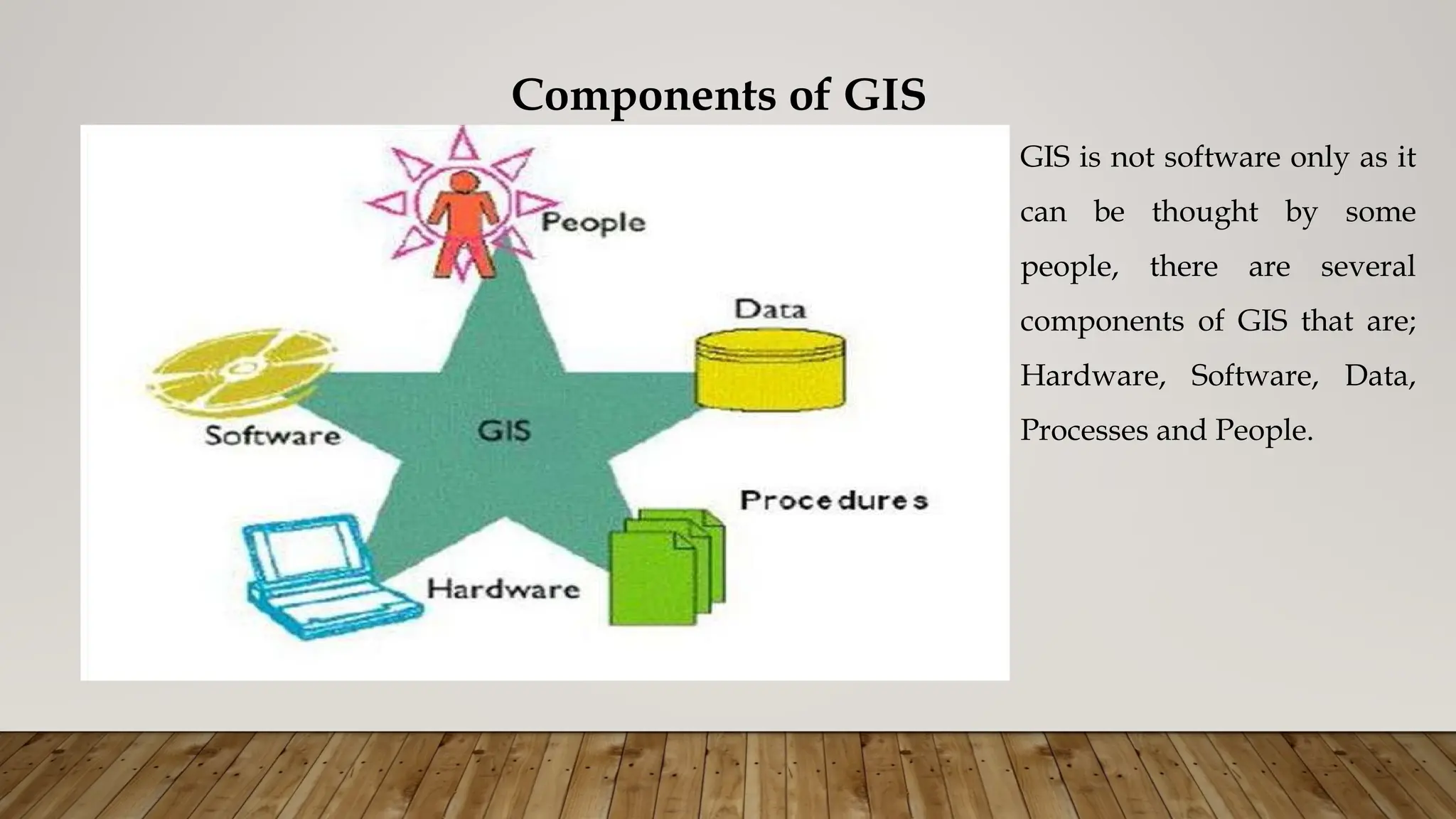
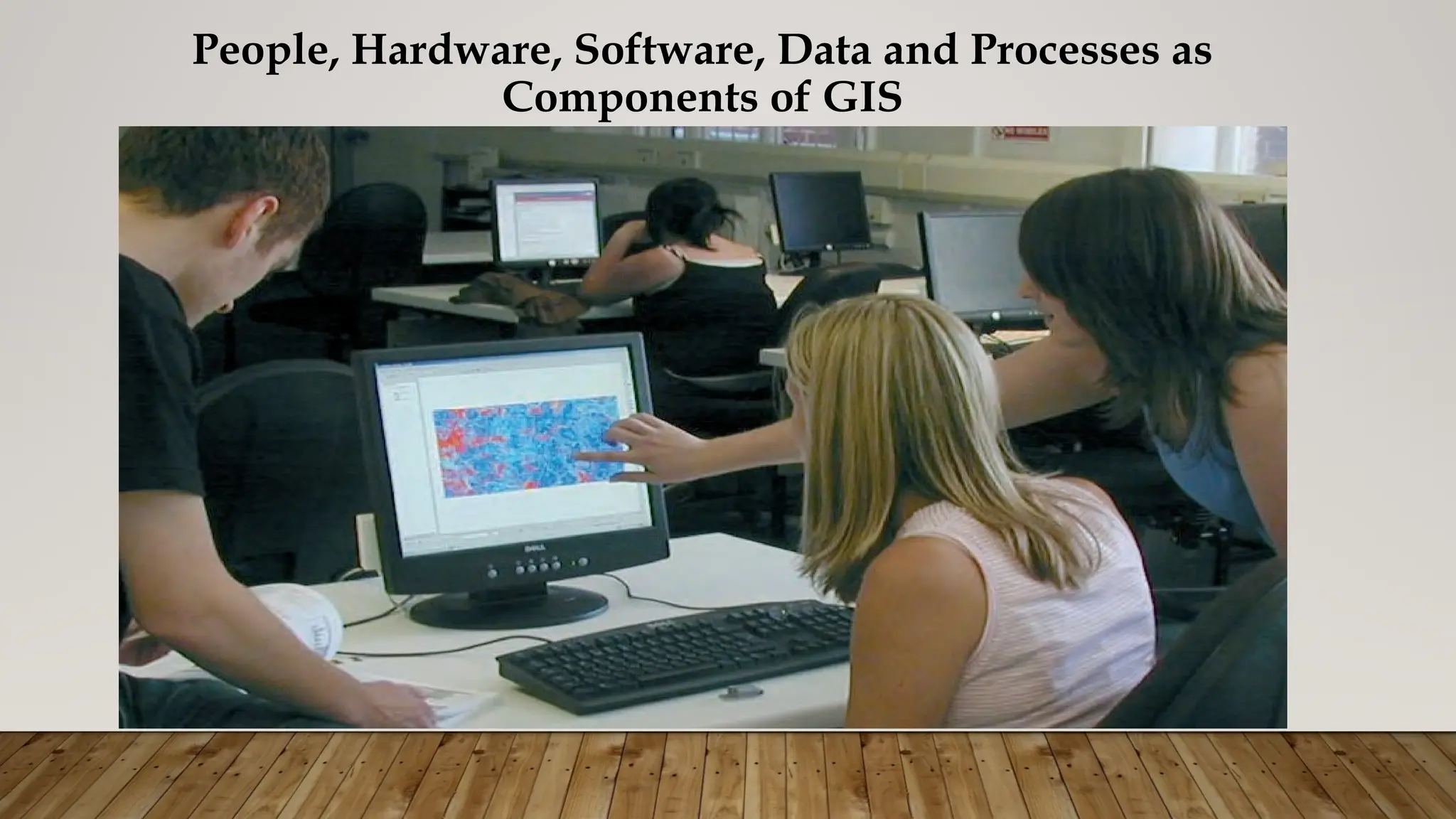
Components of GIS
GISis not software only as it
can be thought by some
people, there are several
components of GIS that are;
Hardware, Software, Data,
Processes and People.
16.
Components of GIS
Hardware:
Hardware is the computer system on which a GIS operates.
GIS operates from whole range of computer spectrum ranging from Portable Personal
Computers (PCs) and Multi-User Super-Computers.
Physical device used as a part of a computer system needed to support GIS. These
computer devices are divided into Central Processing Unit (CPU) and Peripheral devices.
CPU=Heart of the Computer. Peripheral devices i.e. mouse, scanners, plotters, screen,
keyboard etc.
17.
Components of GIS…
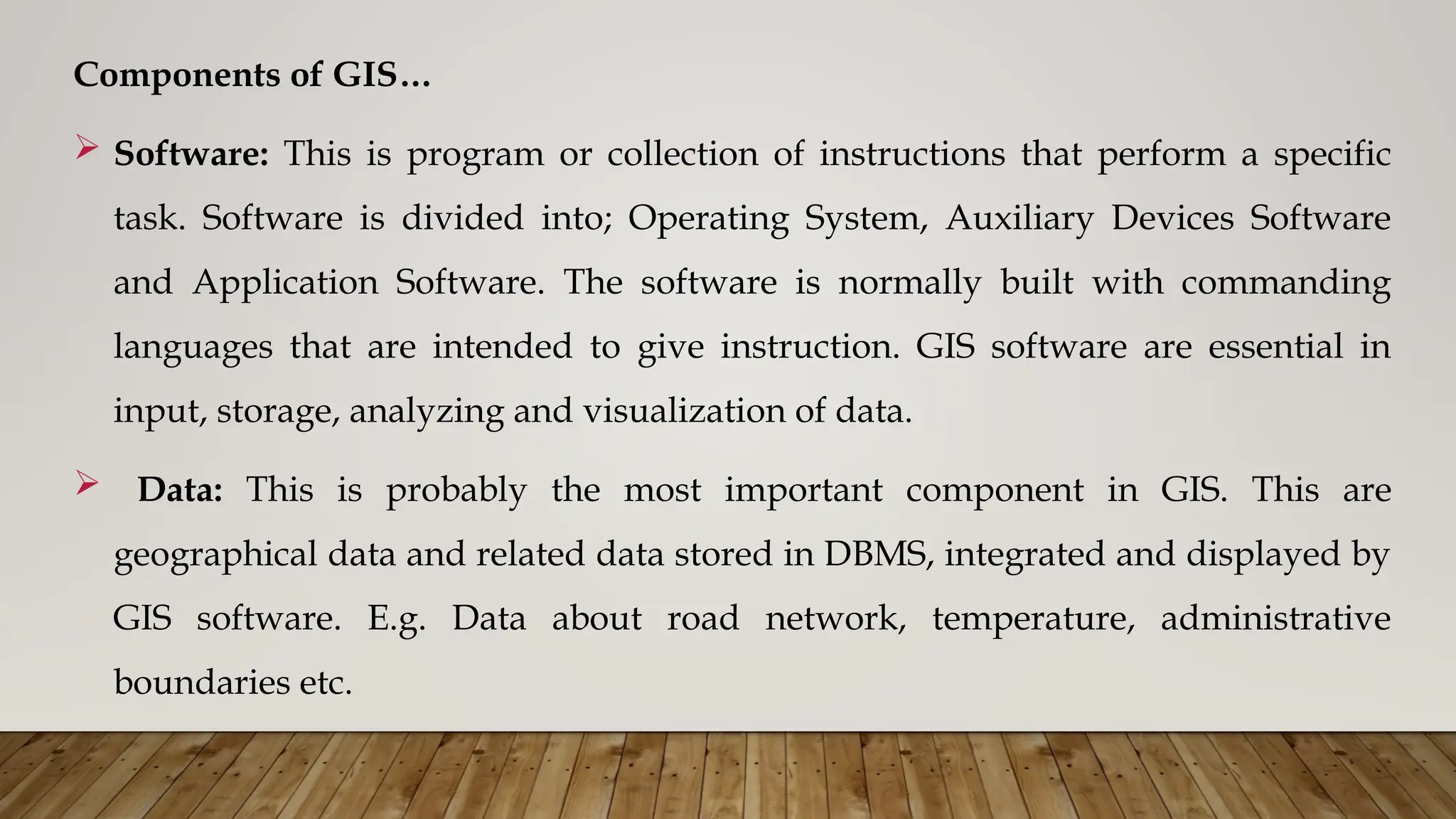
Software: This is program or collection of instructions that perform a specific
task. Software is divided into; Operating System, Auxiliary Devices Software
and Application Software. The software is normally built with commanding
languages that are intended to give instruction. GIS software are essential in
input, storage, analyzing and visualization of data.
Data: This is probably the most important component in GIS. This are
geographical data and related data stored in DBMS, integrated and displayed by
GIS software. E.g. Data about road network, temperature, administrative
boundaries etc.
18.
Components of GIS…
Processes/Methods: Data management and analysis procedures. A successful
GIS operates according to a well-designed implementation plan and business
rules, which are the models and operating practices unique to each
organization.
People: GIS technology would not without the people who manage the system
and develop plans for applying it to real world problems. GIS users range from
technical specialists who design and maintain the system to those who use it to
help them perform their everyday work. Its people who make decisions based
on the outcome.
History of GIS
Thehistory of GIS is divided into seven phases namely; Orthodox
development of GIS ideas, Development of Geographical Information
Systems, Commercialization of GIS, Expansion and Integration, Internet
and Open Source GIS, Mobile and Cloud-based Services and Current
Development(Modern GIS and AI Integration).
21.
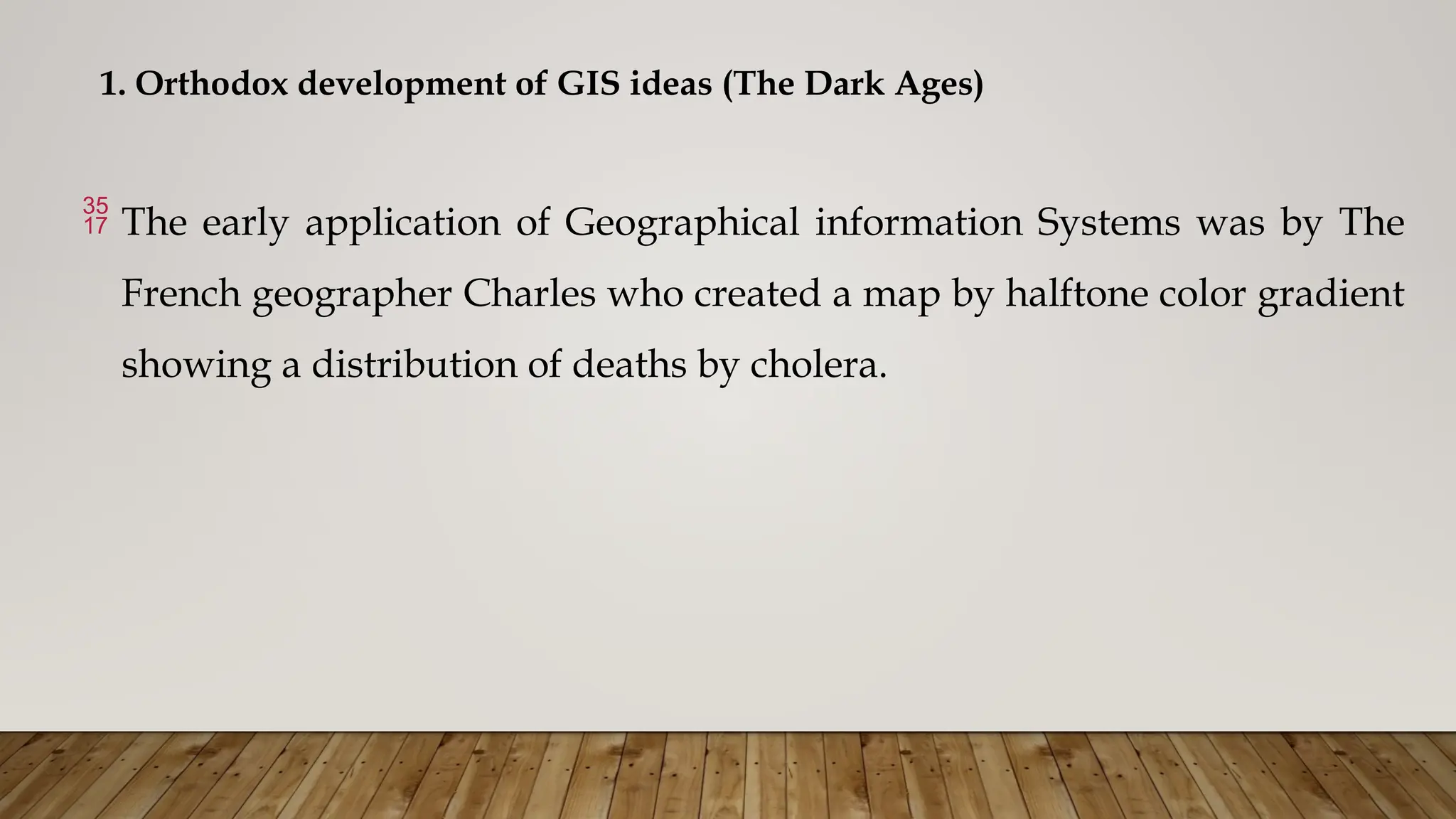
1. Orthodox developmentof GIS ideas (The Dark Ages)
The early application of Geographical information Systems was by The
French geographer Charles who created a map by halftone color gradient
showing a distribution of deaths by cholera.
22.
Orthodox development ofGIS ideas…
In 1854 John Snow determined the source of a cholera outbreak in London
by marking points on a map depicting where the cholera victims lived, and
connecting the cluster that he found with a nearby water source.
While the basic elements of topography and theme existed previously
in cartography , the John Snow map was unique, using cartographic
methods not only to depict but also to analyze clusters of
geographically dependent phenomena.
23.
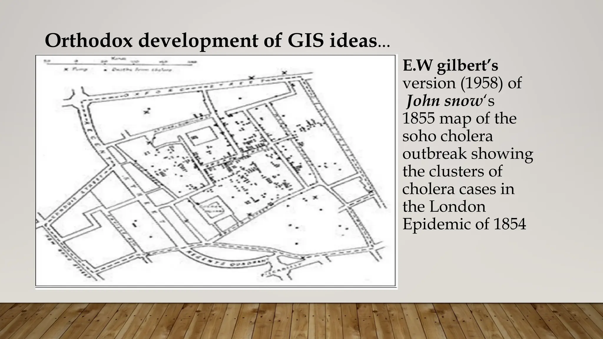
Orthodox development ofGIS ideas…
E.W gilbert’s
version (1958) of
John snow‘s
1855 map of the
soho cholera
outbreak showing
the clusters of
cholera cases in
the London
Epidemic of 1854
24.
Orthodox development ofGIS ideas…
Previously, one of the first applications of spatial analysis in epidemiology is the
1832.
The French geographer Charles Picquet represented the 48 districts of the city of
Paris by halftone color gradient according to the percentage of deaths by cholera
per 1,000 inhabitants.
In the early 20th century developed a is the photographic process developed by
Sir Henry James known as photo zincography was developed which allowed
maps to be split into layers e.g. one layer for vegetation and another for water.
25.
Orthodox development ofGIS ideas…
This was particularly used for printing contours. Drawing these maps were a
labor-intensive task but having them on a separate layer meant they could be
worked on without the other layers to confuse the draftsman.
The use of layers much later became one of the main typical features of a
contemporary GIS, however the photographic process is not considered to be a
GIS in itself – as the maps were just images with no database to link them to.
26.
2. Development ofGeographical Information Systems (GIS Pioneering)
The first known use of the term "geographic information system " was by
Roger Tomlinson in the year 1968 in his paper "A Geographic Information
System for Regional Planning".
Tomlinson is also acknowledged as the “ father of GIS"
GIS is built on the knowledge of geography, cartography, computer science
and mathematics.
27.
2. Development ofGeographical Information Systems (GIS Pioneering)… 1960S-1970S
In this period there are some notable developments came together with
advancements in technology:
• Map graphics as outputs using line printers.
• Advances in data storage with mainframe computers.
• Recording coordinates as data input.
28.
Development of GIS…
In the 1960s after the invention of computers, Canadians and Americans developed interest
in applying computers to produce maps and for analyzing spatial data.
During Roger Tomlinson’s tenure with the Canadian government in the 1960s, he initiated,
planned, and directed the development of the Canadian Geographic System (CGIS).
This was a key time in the history of GIS because many consider CGIS as the roots of
Geographic Information Systems. CGIS was unique because it adopted a layer approach
system to map handling.
Many people in the mapping sciences in Canada and US started in the 1970s writing
programs for drawing maps and producing maps using primitive printers and plotters.
29.
They needed computersto produce maps in order to:
• 1. Automate cartographic task thus makes maps quickly
• 2. Increase cartographic accuracy and visual quality
• 3. Facilitate map making and updating when data are in digital format.
• 4. Facilitate analysis of data that demand interaction between statistical
analyses and mapping.
• 5. To minimize maps as a means of data storage
30.
Early mapproducing software includes SURFACE II, CAM and SYMAP but they could
not be called GIS software because they were designed for map display purpose only.
This software had capability of animating diagrams and producing automatic hill
shades.
But mapping remained to be an important activity of the early software (Brassel 1977).
The second generation of the mapping software fulfilled the second functions of GIS
that is analysis.
The software that was capable performing variety of application developed into the true
GIS software.
31.
• A surveyin 1974 by the International geographical union identified several
software in mapping science that had broad range of applications
• Another contribution was made Harvard Laboratory -While at Northwestern
University in 1964, Howard Fisher created one of the first computer mapping
software programs known as SYMAP.
In 1965, he established the Harvard Laboratory for Computer Graphics. While
some of the first computer map-making software was created and refined at
the Lab, it also became a research center for spatial analysis and visualization.
Development of GIS software persisted in into the 1980s after the
development of Personal Computers (PC) in 1982.
32.
In thelate 1970s, memory size and graphics capabilities were improving.
New computer cartography products were developed included GIMMS
(Geographic Information Making and Management Systems), MAPICS,
SURFACE, GRID, IMGRID, GEOMAP, and MAP.
33.
3. 1980s: Commercializationand Academic Growth.
The 1980s marked a shift toward desktop GIS with the development of software like
ARC/INFO by Environmental Systems Research Institute (ESRI). This era saw increased
accessibility and use of GIS in various fields
This was the period GIS Software Commercialization. In the late 1980s, there was an
increasing range of GIS software vendors in this segment of GIS history.
In 1969, Jack Dangermond—a member of the Harvard Lab—and his wife Laura founded
Environmental Systems Research Institute, Inc. (ESRI)
One of these GIS software vendors was ESRI – which is now the largest GIS software
company in the world. In 1981, ESRI launched ARC/INFO for minicomputers.
34.
4. 1990s: Expansionand Integration
Integration with other systems, such as remote sensing and GPS (Global
Positioning System), which enabled more accurate and real-time data
collection.
GIS applications broadened beyond land management to fields like urban
planning, health, environmental monitoring, and transportation.
User-friendly interfaces and GUI-based software helped expand GIS’s
accessibility.
35.
5. 2000s: Internetand Open Source GIS
The internet transformed GIS by enabling data sharing and online mapping.
The 2000s saw the rise of open-source GIS software, with projects like
Quantum GIS (QGIS) gaining popularity.
Web mapping applications, such as Google Maps, brought GIS functionality to
a broader audience.
36.
6. 2010s: CloudGIS and Mobile Mapping
The 2010s witnessed the emergence of cloud-based GIS platforms, allowing
users to store and analyze spatial data in the cloud.
Mobile mapping applications became more prevalent, providing location-based
services on smartphones and tablets.
GPS and the digital map bring geographic positioning to the palm of your hand.
With web-GIS the technology transcended from being Desktop software to
become a Cloud GIS.
37.
7. Modern GISand AI Integration (2020s)
Today, GIS is integrating with AI and machine learning to analyze large
datasets, automate spatial analysis, and produce predictive models.
GIS applications are being used in smart cities, climate change analysis,
and social justice mapping.
Advances in 3D GIS, augmented reality, and virtual reality are also
pushing GIS capabilities further, allowing more immersive spatial
experiences.
38.
Conclusion
GIS hasevolved from basic mapping tools to sophisticated systems capable of
handling complex spatial data.
Today, GIS is integral to various industries, including urban planning,
environmental science, healthcare, transportation, and disaster management.
The technology continues to advance, with ongoing developments in data
visualization, spatial analytics, and the integration of emerging technologies.