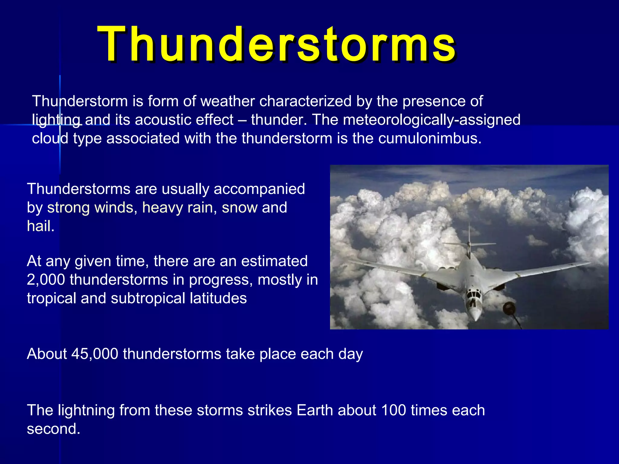
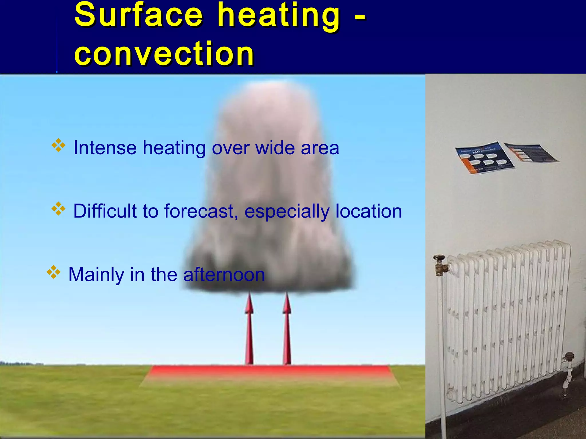
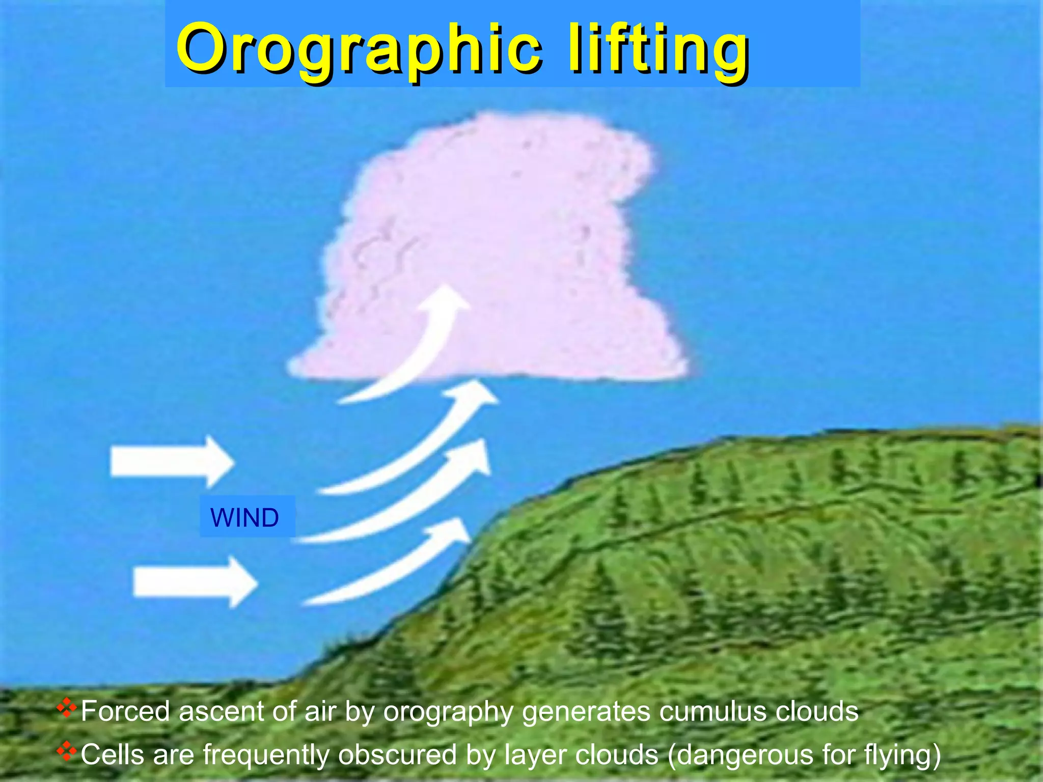
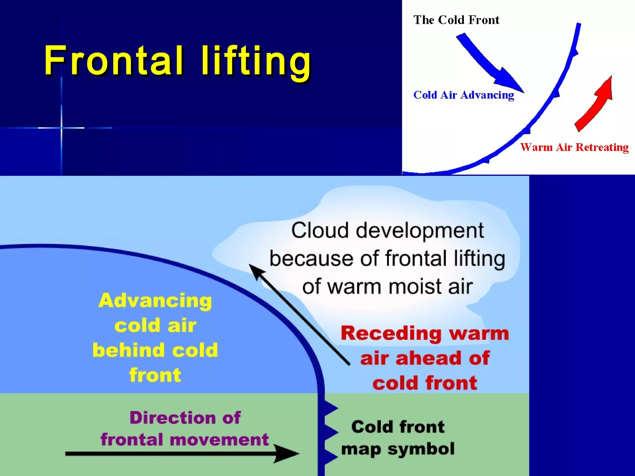
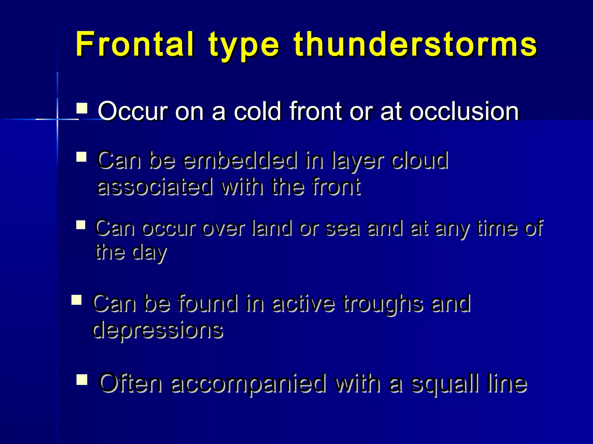
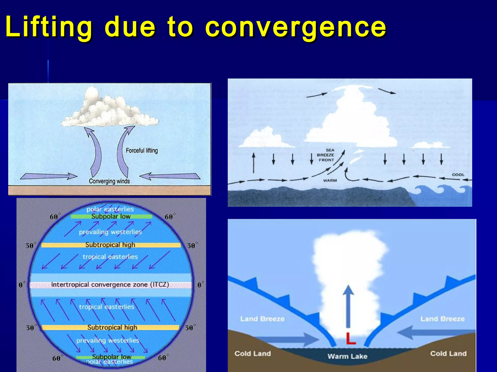
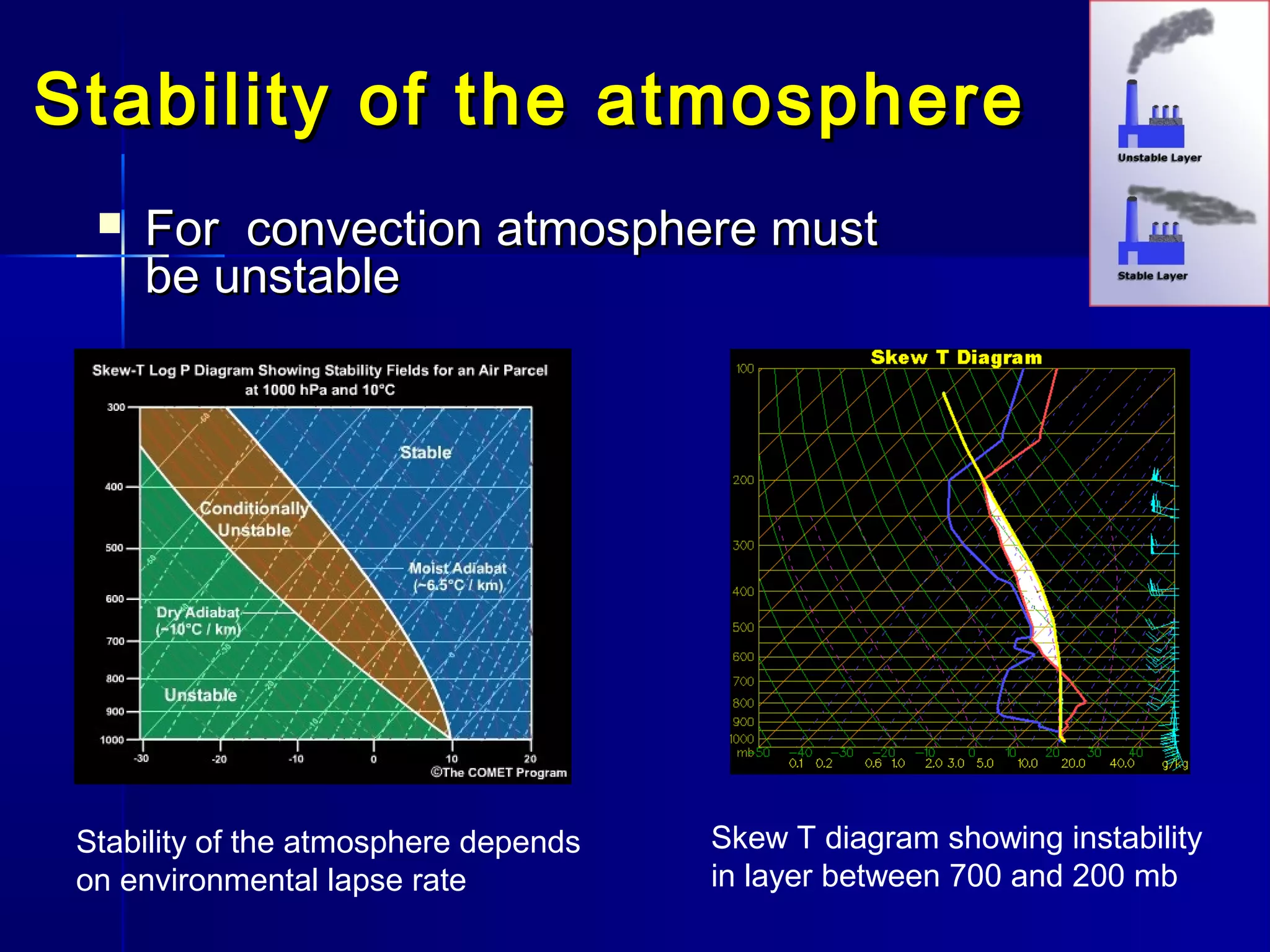
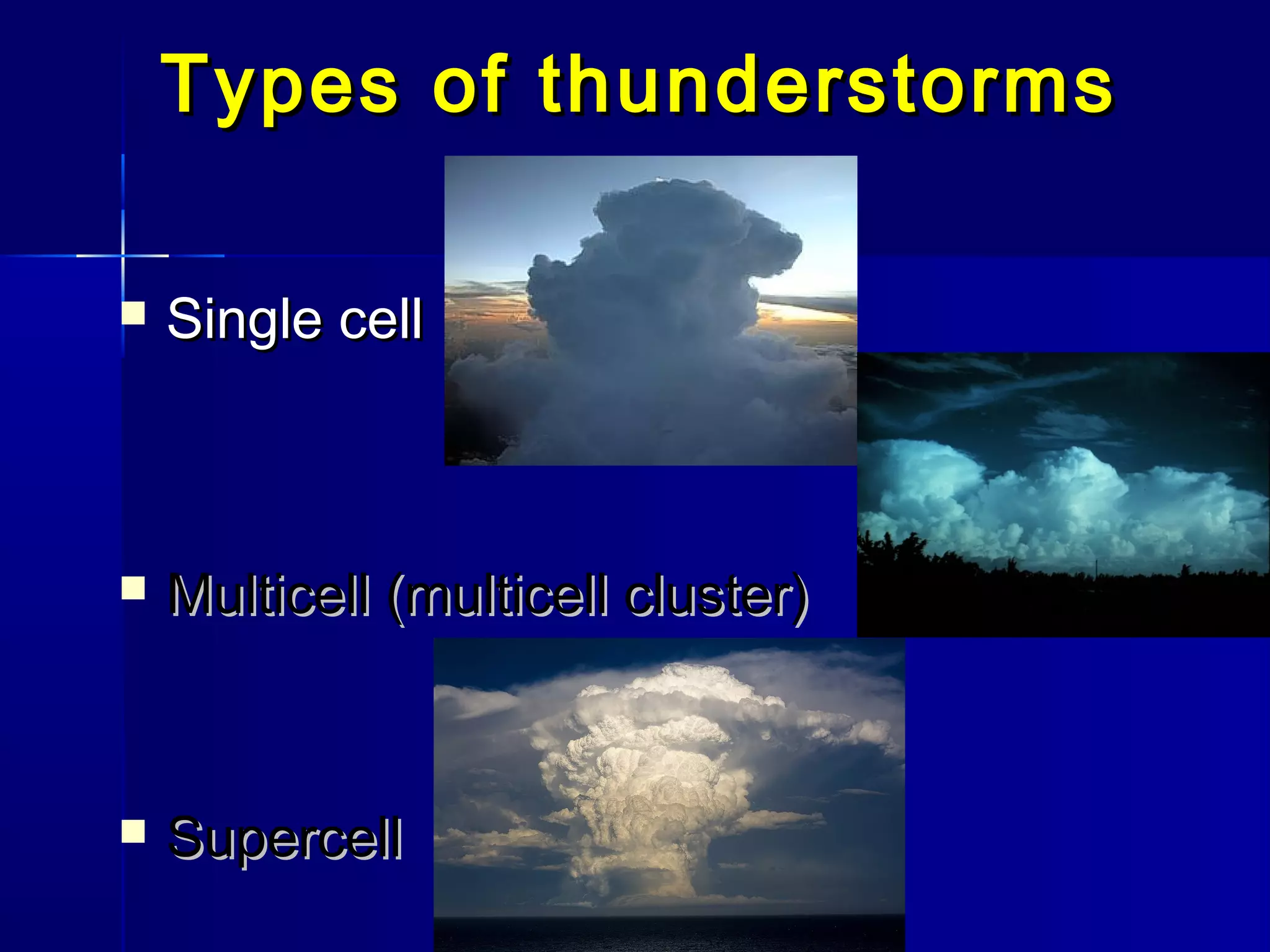
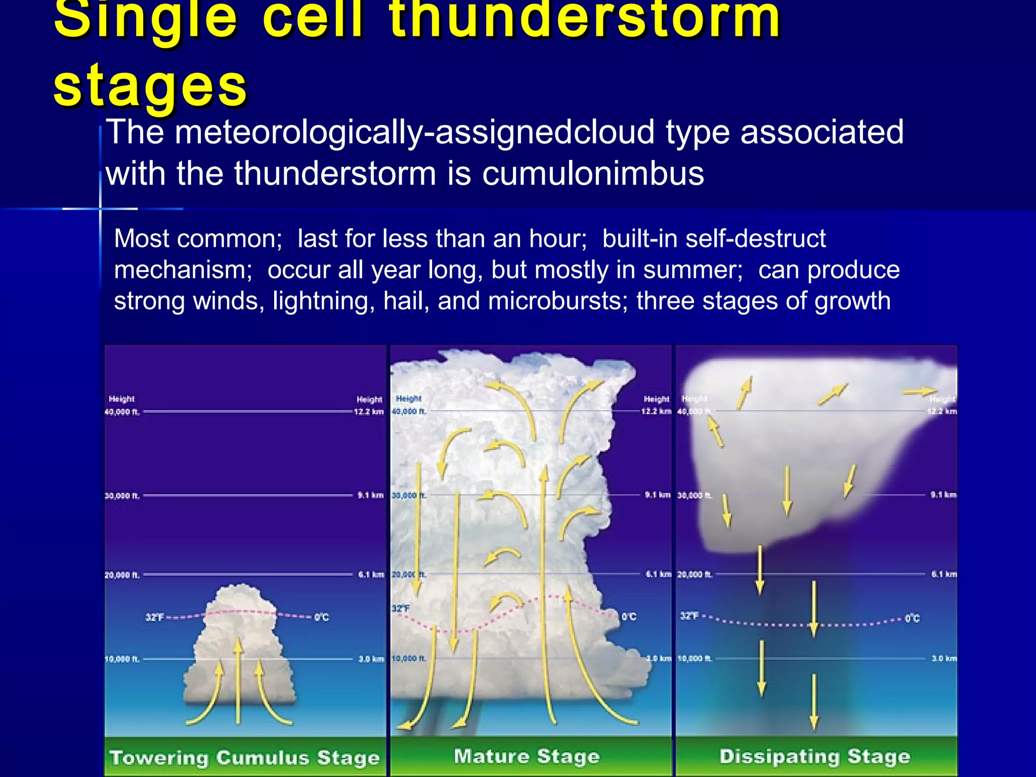
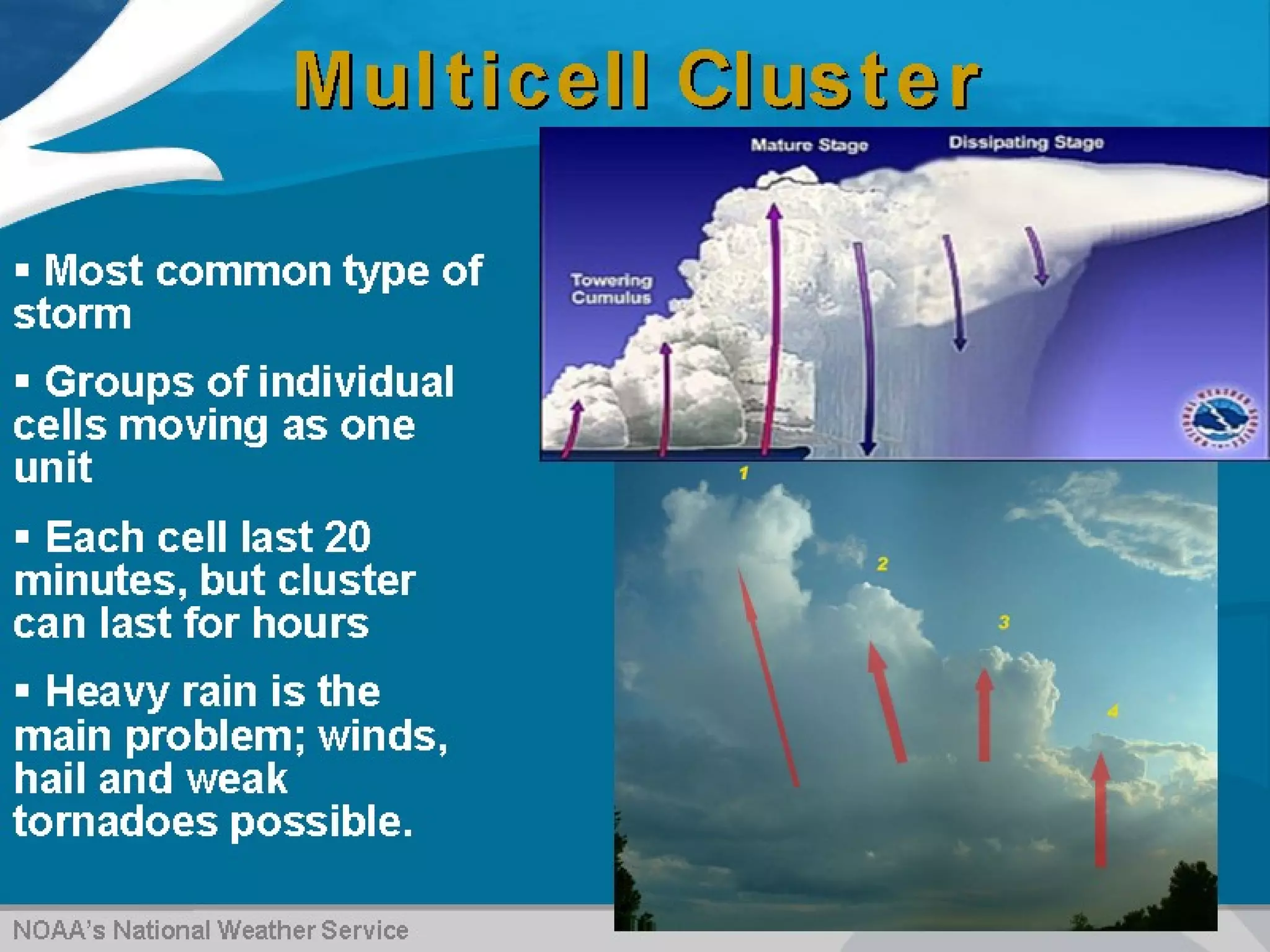
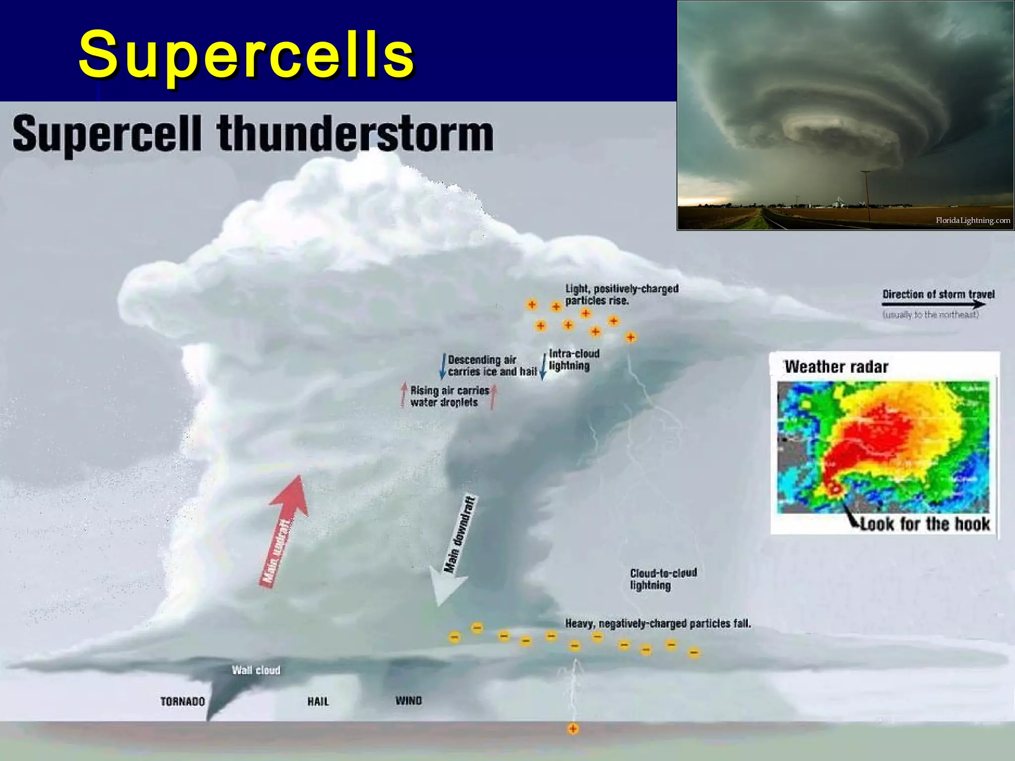
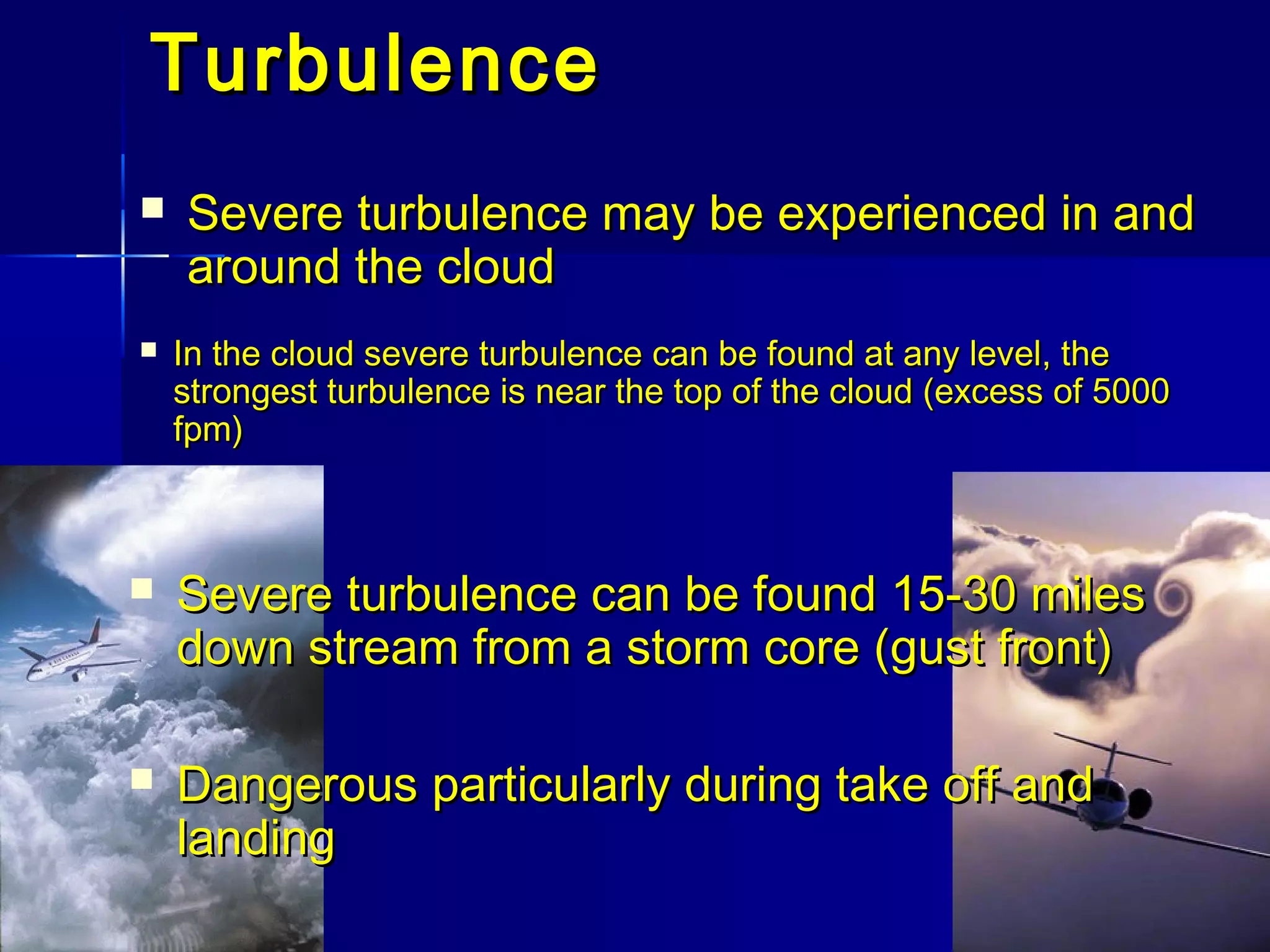
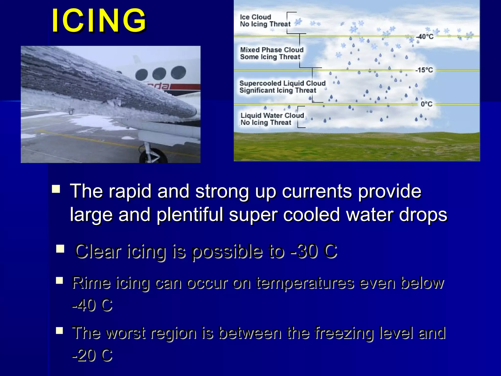
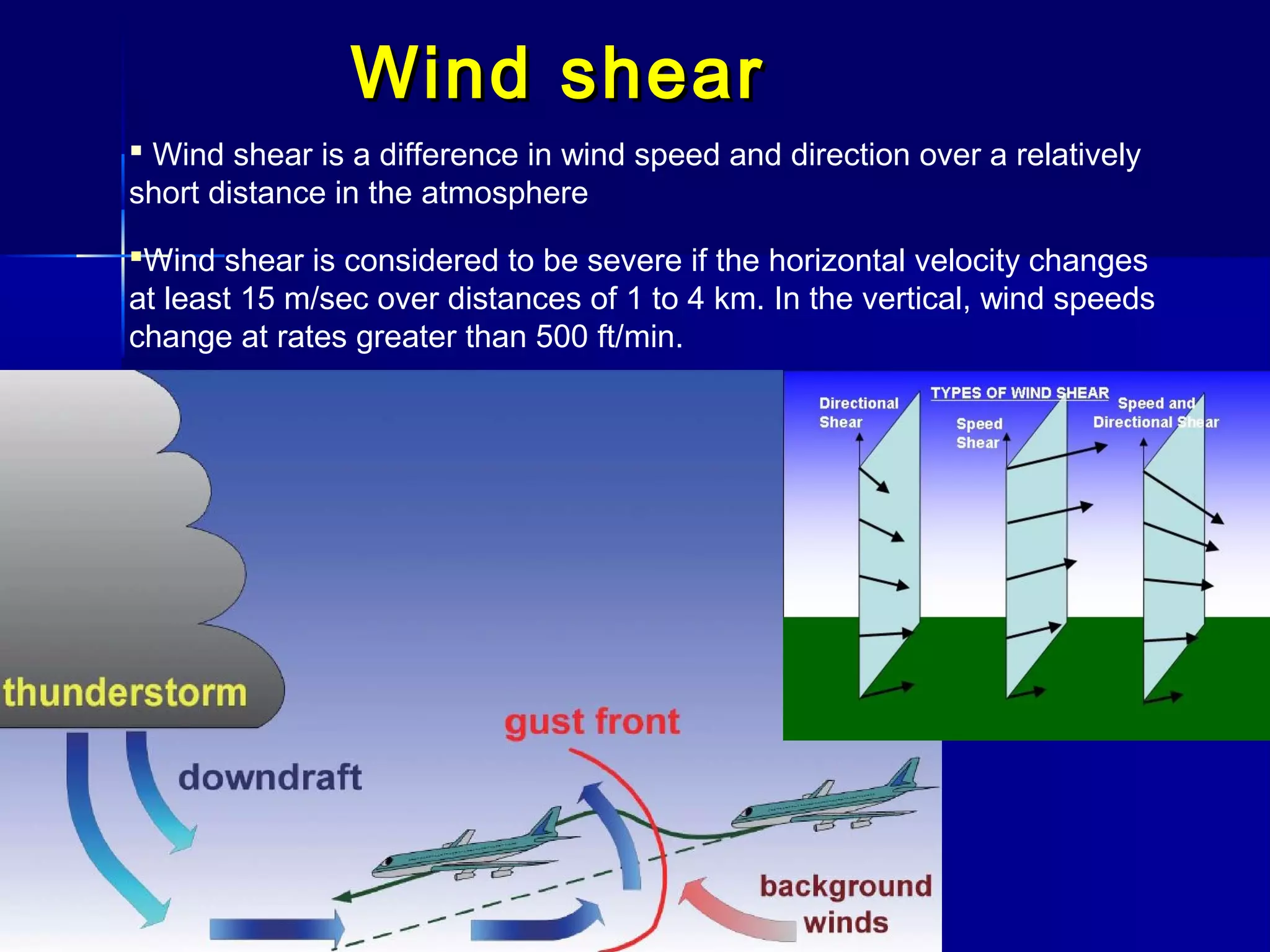
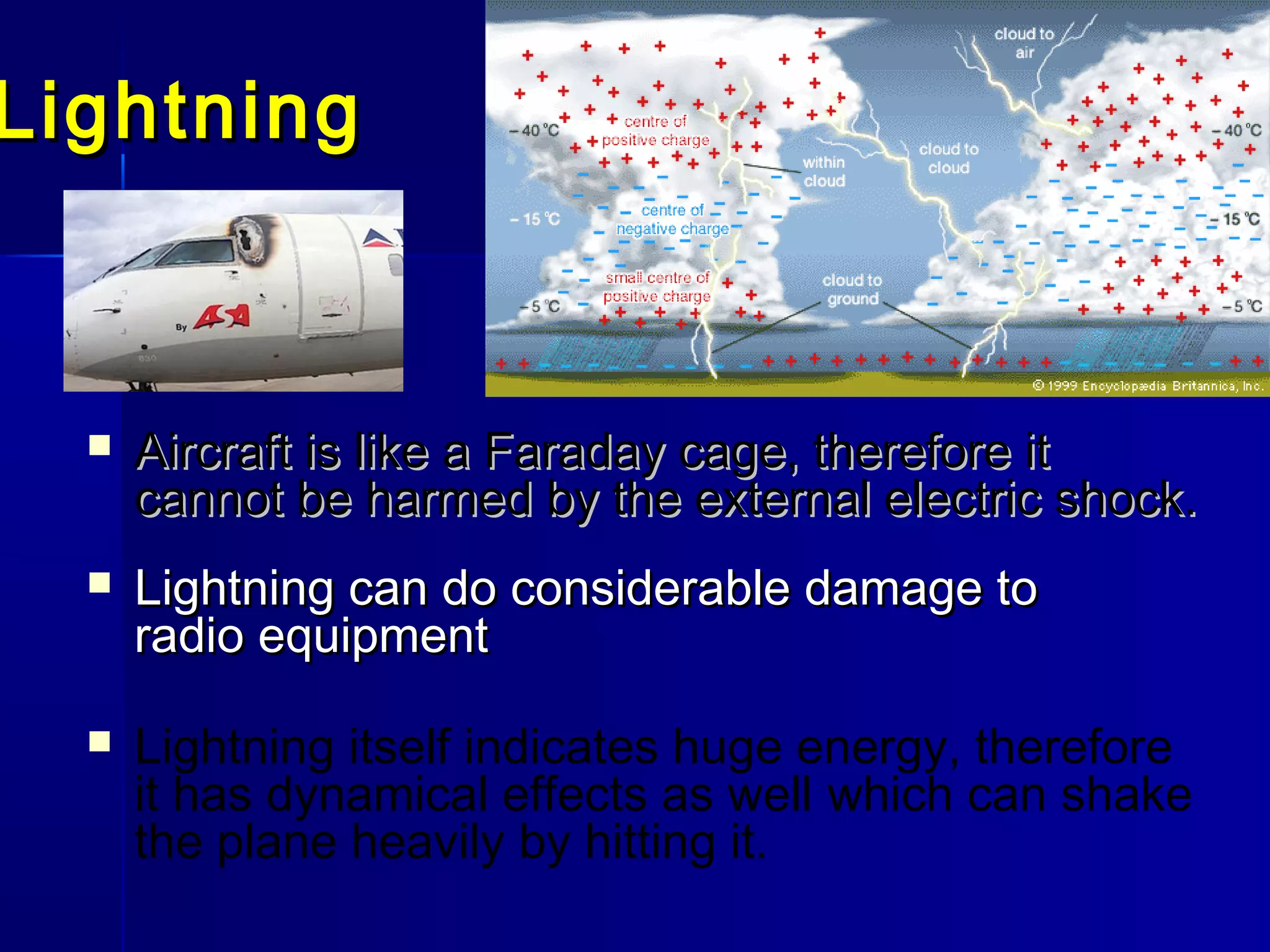
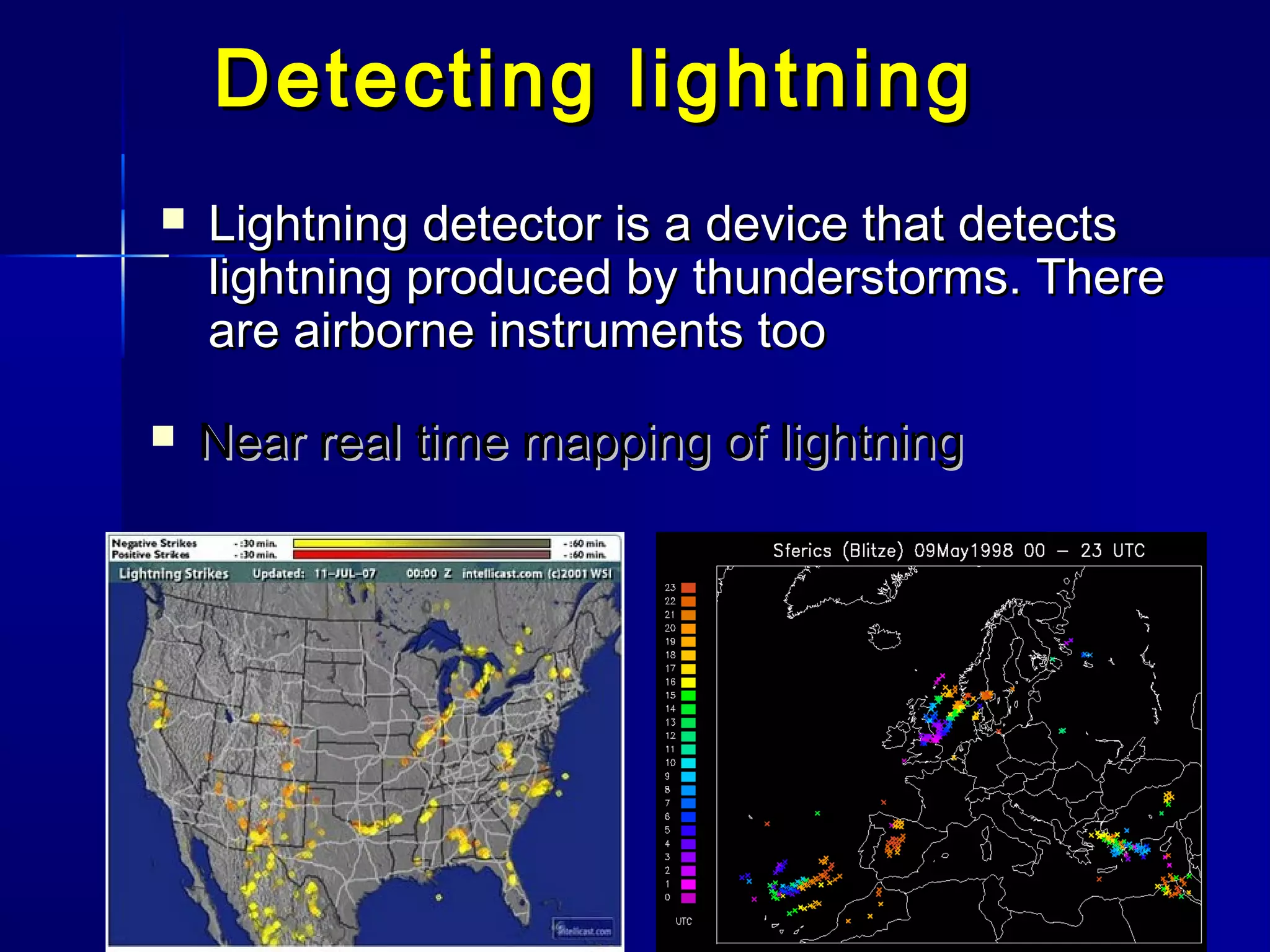
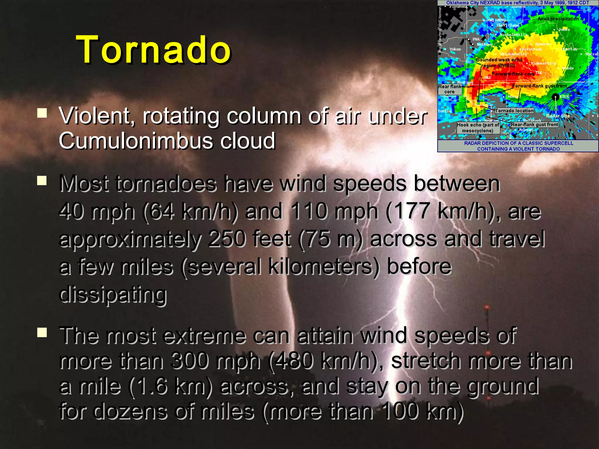
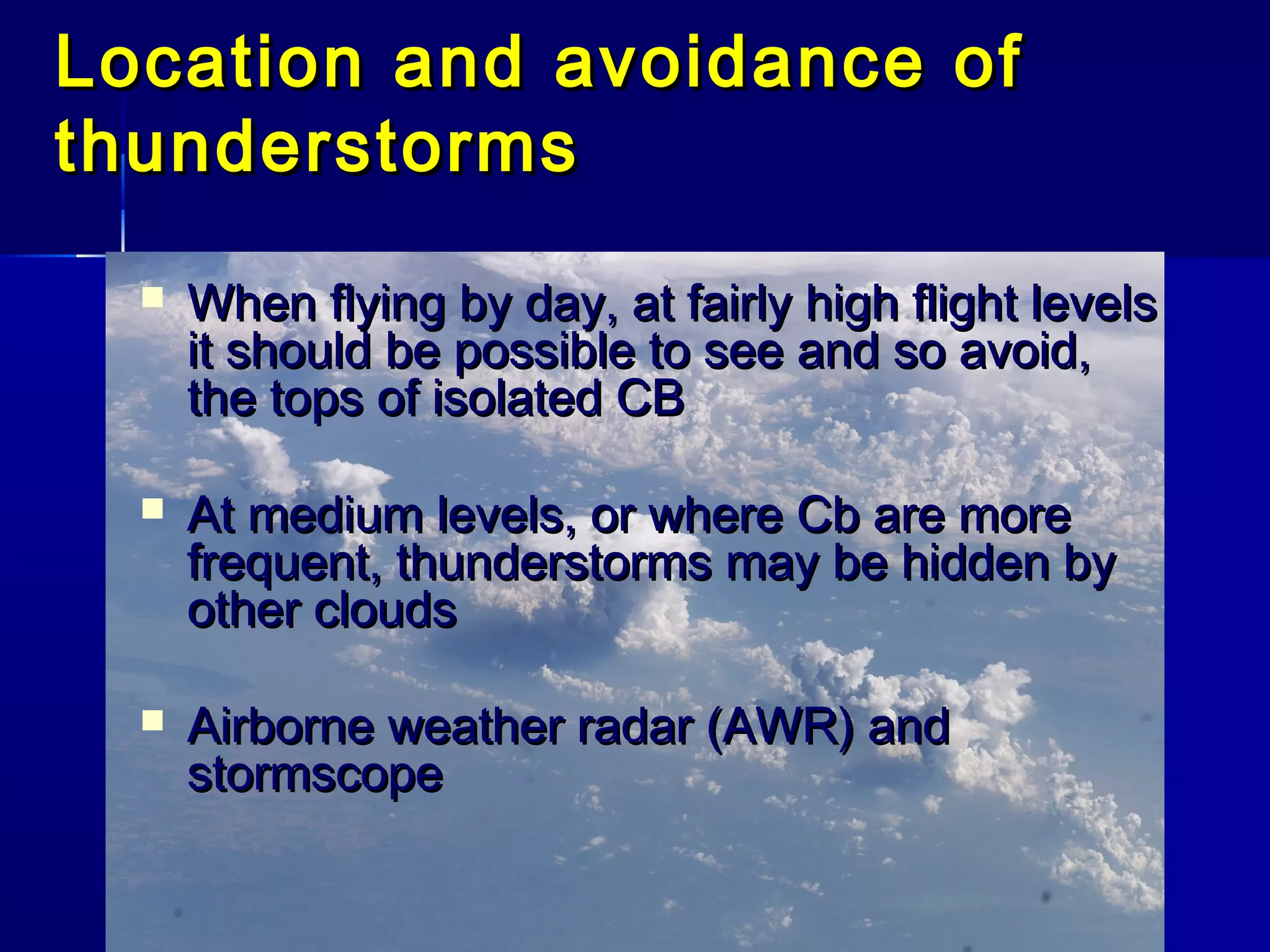
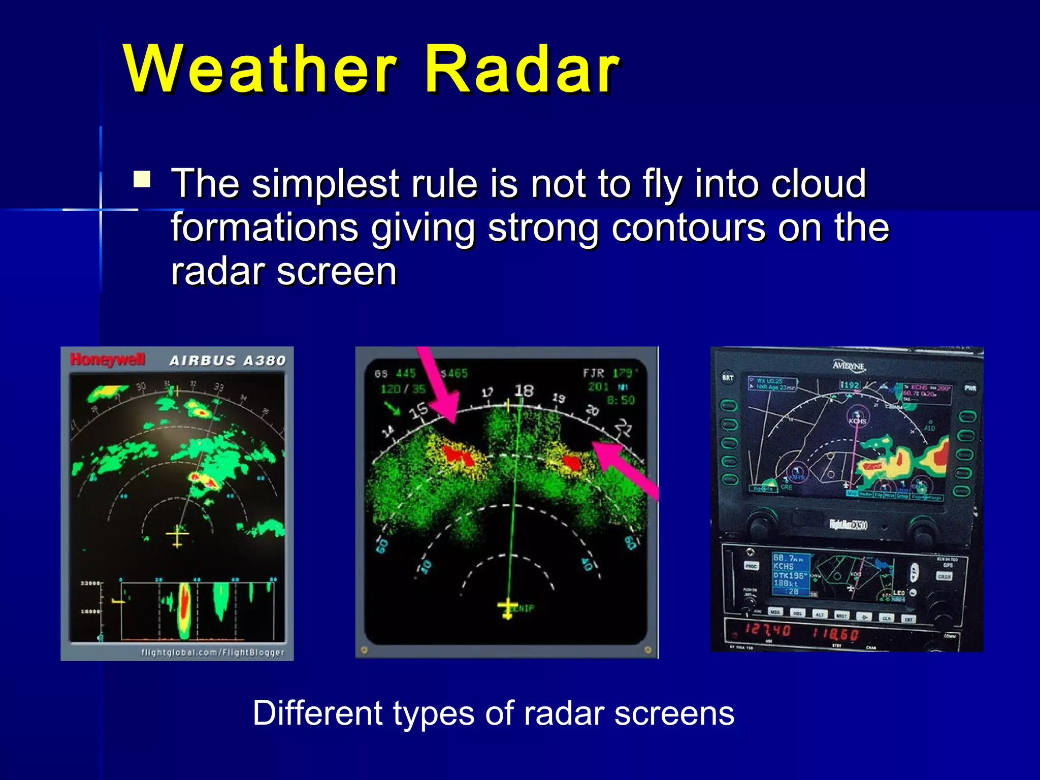
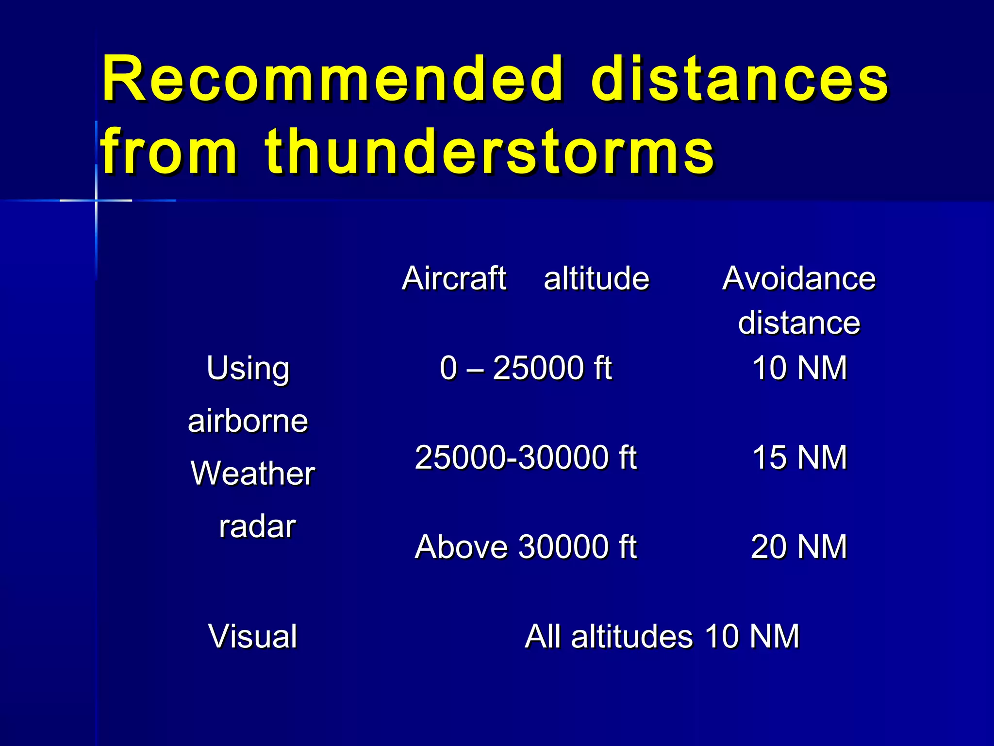
ThunderstormsThunderstorms
Thunderstorm is form of weather characterized by the presence of
lighting and its acoustic effect – thunder. The meteorologically-assigned
cloud type associated with the thunderstorm is the cumulonimbus.
Thunderstorms are usually accompanied
by strong winds, heavy rain, snow and
hail.
About 45,000 thunderstorms take place each day
The lightning from these storms strikes Earth about 100 times each
second.
At any given time, there are an estimated
2,000 thunderstorms in progress, mostly in
tropical and subtropical latitudes
Development of theDevelopment of the
thunderstormsthunderstorms
Lapse rate greater than saturated adiabatic lapse rate
extending well above the freezing level
Sufficient water vapor to form and maintain the cloud
A trigger action to produce the ascent of the air and
cloud formation
Necessary conditions
Trigger actions for thunderstorms
Orographic lifting
Frontal lifting
Lifting due to convergence
Surface heating - convection
Surface heating -Surface heating -
convectionconvection
 Difficult to forecast, especially location
 Mainly in the afternoon
 Intense heating over wide area
Orographic liftingOrographic lifting
WIND
Forced ascent of air by orography generates cumulus clouds
Cells are frequently obscured by layer clouds (dangerous for flying)
Frontal liftingFrontal lifting
Frontal type thunderstormsFrontal type thunderstorms
 Occur on a cold front or at occlusionOccur on a cold front or at occlusion
 Can be embedded in layer cloudCan be embedded in layer cloud
associated with the frontassociated with the front
 Can occur over land or sea and at any time ofCan occur over land or sea and at any time of
the daythe day
 Can be found in active troughs andCan be found in active troughs and
depressionsdepressions
 Often accompanied with a squall lineOften accompanied with a squall line
Lifting due to convergenceLifting due to convergence
Stability of the atmosphereStability of the atmosphere
 For convection atmosphere mustFor convection atmosphere must
be unstablebe unstable
Skew T diagram showing instability
in layer between 700 and 200 mb
Stability of the atmosphere depends
on environmental lapse rate
Types of thunderstormsTypes of thunderstorms
 Single cellSingle cell
 Multicell (multicell cluster)Multicell (multicell cluster)
 SupercellSupercell
Single cell thunderstormSingle cell thunderstorm
stagesstages
The meteorologically-assignedcloud type associated
with the thunderstorm is cumulonimbus
Most common; last for less than an hour; built-in self-destruct
mechanism; occur all year long, but mostly in summer; can produce
strong winds, lightning, hail, and microbursts; three stages of growth
SupercellsSupercells
Thunderstorm hazardsThunderstorm hazards
 TurbulenceTurbulence
 IcingIcing
 Rain and snow (water ingestion)Rain and snow (water ingestion)
 HailHail
 Down-drought / MicroburstDown-drought / Microburst
 Wind shearWind shear
 LightningLightning
 TornadoesTornadoes
TurbulenceTurbulence
 Severe turbulence may be experienced in andSevere turbulence may be experienced in and
around the cloudaround the cloud
 Severe turbulence can be found 15-30 milesSevere turbulence can be found 15-30 miles
down stream from a storm core (gust front)down stream from a storm core (gust front)
 In the cloud severe turbulence can be found at any level, theIn the cloud severe turbulence can be found at any level, the
strongest turbulence is near the top of the cloud (excess of 5000strongest turbulence is near the top of the cloud (excess of 5000
fpm)fpm)
 Dangerous particularly during take off andDangerous particularly during take off and
landinglanding
ICINGICING
 The rapid and strong up currents provideThe rapid and strong up currents provide
large and plentiful super cooled water dropslarge and plentiful super cooled water drops
 Clear icing is possible to -30 CClear icing is possible to -30 C
 Rime icing can occur on temperatures even belowRime icing can occur on temperatures even below
-40 C-40 C
 The worst region is between the freezing level andThe worst region is between the freezing level and
-20 C-20 C
Rain / water ingestionRain / water ingestion
 Large quantities of water can be present inLarge quantities of water can be present in
Cb down to temperatures as low as -30 CCb down to temperatures as low as -30 C
 Sudden ingestion of this water by a turbineSudden ingestion of this water by a turbine
engine can cause flame-out or damageengine can cause flame-out or damage
 High liquid waterHigh liquid water
content can affectcontent can affect
aircraft pressureaircraft pressure
instrumentsinstruments
HailHail
 Hail may fall from the overhang of a Cb anvil into clear air belowHail may fall from the overhang of a Cb anvil into clear air below
 Severe structural damage can result fromSevere structural damage can result from
hail encounterhail encounter
 The largest recorded hail – about 150 mm (6”) in diameterThe largest recorded hail – about 150 mm (6”) in diameter
 TheThe 3/4" size limit for hail is based on a study
of the "smallest size of hailstones that cause
significant damage at airplane speeds between
200 and 300 mph."
Down drought / gust frontDown drought / gust front
 Precipitation from thunderstorm is likely to bePrecipitation from thunderstorm is likely to be
accompanied by a marked down draughtaccompanied by a marked down draught
 GGust frontust front -- the leading edge of cool air rushingthe leading edge of cool air rushing
down and out from adown and out from a thunderstormthunderstorm
Microburst (downburst)Microburst (downburst)
MMicrobursticroburst is a very localized column of sinking air, producingis a very localized column of sinking air, producing
damaging divergent anddamaging divergent and straight-line windsstraight-line winds at the surfaceat the surface
Two types of microburst: Wet and dry microburst
Diameter of microburst: < 5 km
Wind shearWind shear
 Wind shear is a difference in wind speed and direction over a relatively
short distance in the atmosphere
Wind shear is considered to be severe if the horizontal velocity changes
at least 15 m/sec over distances of 1 to 4 km. In the vertical, wind speeds
change at rates greater than 500 ft/min.
LightningLightning
 Lightning can do considerable damage toLightning can do considerable damage to
radio equipmentradio equipment
 Aircraft is likeAircraft is like a Faraday cage, therefore ita Faraday cage, therefore it
cannot be harmed by the external electric shock.cannot be harmed by the external electric shock.
 Lightning itself indicates huge energy, therefore
it has dynamical effects as well which can shake
the plane heavily by hitting it.
Detecting lightningDetecting lightning
 LLightning detector is a device that detectsightning detector is a device that detects
lightning produced bylightning produced by thunderstorms. Therethunderstorms. There
are airborne instruments tooare airborne instruments too
 Near real time mapping of lightningNear real time mapping of lightning
TornadoTornado
 VViolent, rotating column of airiolent, rotating column of air underunder
Cumulonimbus cloudCumulonimbus cloud
 Most tornadoes have wind speeds betweenMost tornadoes have wind speeds between
40 mph (64 km/h) and 110 mph (177 km/h), are40 mph (64 km/h) and 110 mph (177 km/h), are
approximately 250 feet (75 m) across and travelapproximately 250 feet (75 m) across and travel
a few miles (several kilometers) beforea few miles (several kilometers) before
dissipatingdissipating
 The most extreme can attain wind speeds ofThe most extreme can attain wind speeds of
more than 300 mph (480 km/h), stretch more thanmore than 300 mph (480 km/h), stretch more than
a mile (1.6 km) across, and stay on the grounda mile (1.6 km) across, and stay on the ground
for dozens of miles (more than 100 km)for dozens of miles (more than 100 km)
Location and avoidance ofLocation and avoidance of
thunderstormsthunderstorms
 When flying by day, at fairly high flight levelsWhen flying by day, at fairly high flight levels
it should be possible to see and so avoid,it should be possible to see and so avoid,
the tops of isolated CBthe tops of isolated CB
 At medium levels, or where Cb are moreAt medium levels, or where Cb are more
frequent, thunderstorms may be hidden byfrequent, thunderstorms may be hidden by
other cloudsother clouds
 Airborne weather radar (AWR) andAirborne weather radar (AWR) and
stormscopestormscope
Weather RadarWeather Radar
 The simplest rule is not to fly into cloudThe simplest rule is not to fly into cloud
formations giving strong contours on theformations giving strong contours on the
radar screenradar screen
Different types of radar screens
Recommended distancesRecommended distances
from thunderstormsfrom thunderstorms
Aircraft altitudeAircraft altitude AvoidanceAvoidance
distancedistance
UsingUsing
airborneairborne
WeatherWeather
radarradar
0 – 25000 ft0 – 25000 ft 10 NM10 NM
25000-30000 ft25000-30000 ft 15 NM15 NM
Above 30000 ftAbove 30000 ft 20 NM20 NM
VisualVisual All altitudes 10 NMAll altitudes 10 NM

Thunderstorms

  • 1.
    ThunderstormsThunderstorms Thunderstorm is formof weather characterized by the presence of lighting and its acoustic effect – thunder. The meteorologically-assigned cloud type associated with the thunderstorm is the cumulonimbus. Thunderstorms are usually accompanied by strong winds, heavy rain, snow and hail. About 45,000 thunderstorms take place each day The lightning from these storms strikes Earth about 100 times each second. At any given time, there are an estimated 2,000 thunderstorms in progress, mostly in tropical and subtropical latitudes
  • 2.
    Development of theDevelopmentof the thunderstormsthunderstorms Lapse rate greater than saturated adiabatic lapse rate extending well above the freezing level Sufficient water vapor to form and maintain the cloud A trigger action to produce the ascent of the air and cloud formation Necessary conditions
  • 3.
    Trigger actions forthunderstorms Orographic lifting Frontal lifting Lifting due to convergence Surface heating - convection
  • 4.
    Surface heating -Surfaceheating - convectionconvection  Difficult to forecast, especially location  Mainly in the afternoon  Intense heating over wide area
  • 5.
    Orographic liftingOrographic lifting WIND Forcedascent of air by orography generates cumulus clouds Cells are frequently obscured by layer clouds (dangerous for flying)
  • 6.
  • 7.
    Frontal type thunderstormsFrontaltype thunderstorms  Occur on a cold front or at occlusionOccur on a cold front or at occlusion  Can be embedded in layer cloudCan be embedded in layer cloud associated with the frontassociated with the front  Can occur over land or sea and at any time ofCan occur over land or sea and at any time of the daythe day  Can be found in active troughs andCan be found in active troughs and depressionsdepressions  Often accompanied with a squall lineOften accompanied with a squall line
  • 8.
    Lifting due toconvergenceLifting due to convergence
  • 9.
    Stability of theatmosphereStability of the atmosphere  For convection atmosphere mustFor convection atmosphere must be unstablebe unstable Skew T diagram showing instability in layer between 700 and 200 mb Stability of the atmosphere depends on environmental lapse rate
  • 10.
    Types of thunderstormsTypesof thunderstorms  Single cellSingle cell  Multicell (multicell cluster)Multicell (multicell cluster)  SupercellSupercell
  • 11.
    Single cell thunderstormSinglecell thunderstorm stagesstages The meteorologically-assignedcloud type associated with the thunderstorm is cumulonimbus Most common; last for less than an hour; built-in self-destruct mechanism; occur all year long, but mostly in summer; can produce strong winds, lightning, hail, and microbursts; three stages of growth
  • 13.
  • 14.
    Thunderstorm hazardsThunderstorm hazards TurbulenceTurbulence  IcingIcing  Rain and snow (water ingestion)Rain and snow (water ingestion)  HailHail  Down-drought / MicroburstDown-drought / Microburst  Wind shearWind shear  LightningLightning  TornadoesTornadoes
  • 15.
    TurbulenceTurbulence  Severe turbulencemay be experienced in andSevere turbulence may be experienced in and around the cloudaround the cloud  Severe turbulence can be found 15-30 milesSevere turbulence can be found 15-30 miles down stream from a storm core (gust front)down stream from a storm core (gust front)  In the cloud severe turbulence can be found at any level, theIn the cloud severe turbulence can be found at any level, the strongest turbulence is near the top of the cloud (excess of 5000strongest turbulence is near the top of the cloud (excess of 5000 fpm)fpm)  Dangerous particularly during take off andDangerous particularly during take off and landinglanding
  • 16.
    ICINGICING  The rapidand strong up currents provideThe rapid and strong up currents provide large and plentiful super cooled water dropslarge and plentiful super cooled water drops  Clear icing is possible to -30 CClear icing is possible to -30 C  Rime icing can occur on temperatures even belowRime icing can occur on temperatures even below -40 C-40 C  The worst region is between the freezing level andThe worst region is between the freezing level and -20 C-20 C
  • 17.
    Rain / wateringestionRain / water ingestion  Large quantities of water can be present inLarge quantities of water can be present in Cb down to temperatures as low as -30 CCb down to temperatures as low as -30 C  Sudden ingestion of this water by a turbineSudden ingestion of this water by a turbine engine can cause flame-out or damageengine can cause flame-out or damage  High liquid waterHigh liquid water content can affectcontent can affect aircraft pressureaircraft pressure instrumentsinstruments
  • 18.
    HailHail  Hail mayfall from the overhang of a Cb anvil into clear air belowHail may fall from the overhang of a Cb anvil into clear air below  Severe structural damage can result fromSevere structural damage can result from hail encounterhail encounter  The largest recorded hail – about 150 mm (6”) in diameterThe largest recorded hail – about 150 mm (6”) in diameter  TheThe 3/4" size limit for hail is based on a study of the "smallest size of hailstones that cause significant damage at airplane speeds between 200 and 300 mph."
  • 19.
    Down drought /gust frontDown drought / gust front  Precipitation from thunderstorm is likely to bePrecipitation from thunderstorm is likely to be accompanied by a marked down draughtaccompanied by a marked down draught  GGust frontust front -- the leading edge of cool air rushingthe leading edge of cool air rushing down and out from adown and out from a thunderstormthunderstorm
  • 20.
    Microburst (downburst)Microburst (downburst) MMicrobursticroburstis a very localized column of sinking air, producingis a very localized column of sinking air, producing damaging divergent anddamaging divergent and straight-line windsstraight-line winds at the surfaceat the surface Two types of microburst: Wet and dry microburst Diameter of microburst: < 5 km
  • 21.
    Wind shearWind shear Wind shear is a difference in wind speed and direction over a relatively short distance in the atmosphere Wind shear is considered to be severe if the horizontal velocity changes at least 15 m/sec over distances of 1 to 4 km. In the vertical, wind speeds change at rates greater than 500 ft/min.
  • 22.
    LightningLightning  Lightning cando considerable damage toLightning can do considerable damage to radio equipmentradio equipment  Aircraft is likeAircraft is like a Faraday cage, therefore ita Faraday cage, therefore it cannot be harmed by the external electric shock.cannot be harmed by the external electric shock.  Lightning itself indicates huge energy, therefore it has dynamical effects as well which can shake the plane heavily by hitting it.
  • 23.
    Detecting lightningDetecting lightning LLightning detector is a device that detectsightning detector is a device that detects lightning produced bylightning produced by thunderstorms. Therethunderstorms. There are airborne instruments tooare airborne instruments too  Near real time mapping of lightningNear real time mapping of lightning
  • 24.
    TornadoTornado  VViolent, rotatingcolumn of airiolent, rotating column of air underunder Cumulonimbus cloudCumulonimbus cloud  Most tornadoes have wind speeds betweenMost tornadoes have wind speeds between 40 mph (64 km/h) and 110 mph (177 km/h), are40 mph (64 km/h) and 110 mph (177 km/h), are approximately 250 feet (75 m) across and travelapproximately 250 feet (75 m) across and travel a few miles (several kilometers) beforea few miles (several kilometers) before dissipatingdissipating  The most extreme can attain wind speeds ofThe most extreme can attain wind speeds of more than 300 mph (480 km/h), stretch more thanmore than 300 mph (480 km/h), stretch more than a mile (1.6 km) across, and stay on the grounda mile (1.6 km) across, and stay on the ground for dozens of miles (more than 100 km)for dozens of miles (more than 100 km)
  • 25.
    Location and avoidanceofLocation and avoidance of thunderstormsthunderstorms  When flying by day, at fairly high flight levelsWhen flying by day, at fairly high flight levels it should be possible to see and so avoid,it should be possible to see and so avoid, the tops of isolated CBthe tops of isolated CB  At medium levels, or where Cb are moreAt medium levels, or where Cb are more frequent, thunderstorms may be hidden byfrequent, thunderstorms may be hidden by other cloudsother clouds  Airborne weather radar (AWR) andAirborne weather radar (AWR) and stormscopestormscope
  • 26.
    Weather RadarWeather Radar The simplest rule is not to fly into cloudThe simplest rule is not to fly into cloud formations giving strong contours on theformations giving strong contours on the radar screenradar screen Different types of radar screens
  • 27.
    Recommended distancesRecommended distances fromthunderstormsfrom thunderstorms Aircraft altitudeAircraft altitude AvoidanceAvoidance distancedistance UsingUsing airborneairborne WeatherWeather radarradar 0 – 25000 ft0 – 25000 ft 10 NM10 NM 25000-30000 ft25000-30000 ft 15 NM15 NM Above 30000 ftAbove 30000 ft 20 NM20 NM VisualVisual All altitudes 10 NMAll altitudes 10 NM

Editor's Notes

  • #12 Cumulus Stage: The cumulus stage is the initial stage in the development of thunderstorm formation.  This stage is dominated by updrafts, which are caused by saturated air that &amp;quot;streams&amp;quot; upward throughout the cloud.  As each new surge of warm air rises higher than the last, the height of the cloud increases.  It only takes about 15 minutes for the tops of the cumulus clouds to reach altitudes of 8,000 to 10,000 meters.  Since the updrafts are strong enough to suspend water droplets and ice crystals in the air, precipitation does not occur during the cumulus stage.  When the accumulation of the precipitation in the cloud becomes too heavy for the cloud to support, it begins to fall causing a drag on the air.  This initiates a downdraft. Mature Stage:  The mature stage begins once the precipitation hits the earth&amp;apos;s surface.  This stage is the most active period of a thunderstorm.  Updrafts exist side by side with down drafts during this stage, which causes the cloud to continue to grow.  Before the actual precipitation reaches the ground, the cool down draft leaves the base of the cloud and spreads horizontally at the surface to create the gust front.  The updrafts spread horizontally as the cloud grows to the top of the unstable region (usually located at the base of the warmer stratosphere) and the &amp;quot;anvil top&amp;quot; forms.   This anvil top is made up of mostly ice-laden cirrus clouds which are eventually spread downwind by rapid winds aloft.  Toward the end of the mature stage, the cell reaches it&amp;apos;s maximum intensity.  During this time rain is the heaviest, hail and strong surface winds may develop. Dissipating Stage:  Once the downdrafts begin to dominate throughout the thunderstorm cloud the dissipating stage is formed.  Thunderstorm activity ceases as the influx of colder air and the cooling effect of falling precipitation occur.  During this stage, subsiding air replaces the updraft throughout the cloud.  This cuts off the supply of moisture provided by the updraft, causing the cloud to eventually evaporate.
  • #16 Turbulence - METAR not applicable. Reports are submitted as a PIREP.
  • #19 Hail is precipitation that is formed when updrafts in thunderstorms carry raindrops upward into extremely cold areas of the atmosphere and freezes into ice. Hailstones grow by colliding with supercooled water drops. Thunderstorms that have a strong updraft keep lifting the hailstones up to the top of the cloud so they continue to grow. The hail falls when the thunderstorm&amp;apos;s updraft can no longer support the weight of the ice. The stronger the updraft, the larger the hailstone can grow. Hail - METAR GR (Small hail is GS along with snow pellets)
  • #20 A gust front is the leading edge of cool air rushing down and out from a thunderstorm. There are two main reasons why the air flows out of some thunderstoms so rapidly. The primary reason is the presence of relatively dry (low humidity) air in the lower atmosphere. This dry air causes some of the rain falling through it to evaporate, which cools the air. Since cool air sinks (just as warm air rises), this causes a down-rush of air that spreads out at the ground. The edge of this rapidly spreading cool pool of air is the gust front. The second reason is that the falling precipitation produces a drag on the air, forcing it downward. If the wind following the gust front is intense and damaging, the windstorm is known as a downburst.
  • #21 Microburst - no METAR code, reported by PIREPS and can be put in the remarks section of speci [sic] weather reports A type of weather phenomenon called microbursts can produce extremely strong windshear. As a downdraft spreads down and outward from a cloud, it creates an increasing headwind over the wings of an oncoming aircraft causing a sudden leap in airspeed, and the plane lifts. Pilots may react by reducing engine power. However, as the plane passes through the shear, the wind quickly becomes a downdraft and then a tailwind. This reduces the speed of air over the wings, and the extra lift and speed vanish. Because the plane is now flying on reduced power, it is vulnerable to sudden loss of airspeed and altitude.
  • #23 Lightning - Reports submitted by PIREPs and Weather offices with live lightening trackers.The greatest incidence of lightning strikes is normally between +10C and -10C (within 5000ft of the freezing level)
  • #25 Tornadoes - METAR FC for funnel clouds, tornadoes or water spouts
  • #27 More modern, advanced radars will also detect turbulence