SlideShare a Scribd company logo
1 of 13
Download to read offline
Following the American
frontier for 3000 miles through
Native American Country
D O N P O L L A C K
P A I N T I N G S
I N S T A L L A T I O N
P E R F O R M A N C E
N O T E M P T YT H I S L A N D I S
DON POLLACK
THIS LAND IS NOT EMPTY
P A I N T I N G S
I N S T A L L A T I O N
P E R F O R M A N C E
Following the American
frontier for 3000 miles through
Native American Country
September 9 – October 22, 2016
Bridgeport Art Center
Circle Line Gallery
1200 W. 35th St. 5th Floor
Chicago, IL 60609
773.843.9000
This work comes from a 3000 mile journey traveled
from Lake Michigan to the Pacific coast. Moving
through this landscape, the presence of history
saturated the experience. In these works in oil on
canvas, performance, and installation,— past
traumas and revelations speak to the violent conflict
on perspectives of the land, the spaces we inhabit,
inextricably forget that we are a part of, we conquer,
and we picture. Through a physical journey, the
measures of this exhibition attempts to make a space
for knowing the North American landscape.
2
Taking Measure Across The American Landscape: Frontiers, Borders, & Barriers
CROSSING THE GREAT DIVIDE
I L L I N O I S I O W A M I N N E S O T A S O U T H D A K O T A
NORTH DAKOTA MONTANA IDAHO WASHINGTON OREGON
[top]
CROSSING THE GREAT DIVIDE ROUTE
Lake Michigan to
Pacific Ocean
June 20- August 18
[above]
Beaverhead Co.,Montana
2015
T H I S L A N D I S N O T E M P T Y
POTAWATOMI
MISHGAMAW
SAUK
FOX
DAKOTA
PONCA
ARIKARA
LAKOTA
HIDATSA
CHEYENNE
SHOSHONE
CROW
NEZ PERCE
NUMU
CHINOOK
MENOMINEE
SALISH
WAILEPTU
3
CROSSING THE GREAT DIVIDE, began as a North American landscape project
dedicated to taking history to heart. Traveling for 2 months from Chicago at
Lake Michigan to the Pacific Ocean, the journey followed the paths of Lewis
and Clark and Lieutenant Colonel George Armstrong Custer among others. In
order to be more connected and intimate with the landscapes, histories and
local cultures, a small team and I decided to take this journey under human
power,— we traveled via bicycle for over 3000 miles. Leaving from Rogers
Avenue in Chicago or Indian Boundary Line (1816) at Lake Michigan, we ar-
rived at Cape Disappointment, Washington by the Pacific Ocean 2 months
later. ‘CROSSING THE GREAT DIVIDE’ involved both crossing the physical
landmass of the Rocky Mountains and the cultural divide that stands between
people and the historic trauma with Native America.
As I moved westward, I found myself confronting the violent legacy of Manifest
Destiny,—the 19th century belief that U.S. expansion throughout the continent
was inevitable and justified by Darwinist reasoning. It led to war with Mexico
and endorsed a policy of total annihilation of Native American tribes. This im-
perial policy met with political dissension and internal conflict in the United
States. Continental expansion meant an expansion of slavery and the vehe-
ment displacement of Native peoples. In 1824, the War Department created
the Bureau of Indian Affaires which set the tone for aggressive treatment of
Native people. A history of broken treaties and massacres proclaimed as hon-
orable battles ensued. To eliminate the Native American presense on valued
land, genocide of the original people became policy. The term, ‘final solution’
meaning total anihilatation [of the Native population] was first coined by
General William Tecumseh Sherman. The ensuing tragedies and holocaust
must not be forgotten.
I set out to re write my relationship to this history by Re-Surveying the U.S.
as a landscape for tolerance. Each Re-Survey marker is a benchmark mark
dedicated to undoing the destructive policies and attitudes of the 19th, 20th,
and 21st centuries treatement of Native peoples. Beginning in Chicago and
moving westward, 15 locations were GPS recorded and marked at historic
sites of trauma along the Missouri, Yellowstone, Tongue, Bighorn, Little Bighorn,
4
Powder Rivers, and the Pacific Ocean. [Places like the remote conjunction
of the Powder River and the Yellowstone in eastern Montana for example is
where Custer staged his assault into Lakota Sioux territory.]
In order to extend this work, I am asking people to take one of the clay survey
markers as part of the global database of the people listed as allies to the of
Re-Surveying project of North America. In order to ‘Cross the Great Divide’,
I kindly ask for your participation and would be greatly honored if you would
accept one of these markers. – 6.12.16 www.CrossingTheGreatDivide.net
MEASURE OF TOLERANCE
BENCHMARK, TREATY ROCK
Survey marker
Indian Boundary Park,*
Chicago
2016
L A K E M I C H I G A N
Indian
B
oundary
Line
C H I C A G O
Ft.Dearborn
Illinois River
39 miles
Chi
cago
River
Rogers Avenue
O T T A W A C H I P P E W A
P O T A W A T O M I
U
N
I
T
E
D
S
T
A
T
E
S
1
8
1
6
C R O S S I N G T H E G R E A T D I V I D E
*
route
MENOMINEE HONORING
DANCE, TREATY ROCK
Indian Boundary Park,*
Chicago
2016
5
1. Indian Boundary Line, Peterson Garden Project site, Rogers Avenue and
	 W. Birchwood, Chicago
	 42.0188N, 87.6712W, 586.39’ altitude
Site of Indian Boundary Line, the border between Native America and the US in 1816.
Our journey of reconciliation begins at this location of the ‘Peterson Community Garden’ where the seeds of
the ‘Three Sisters’ (corn, beans squash) were planted. The planting of these three main crops important to
native peoples was done as a sign of growth and a gesture of reconciliation with all peoples. Indian Bound-
ary Line was a survey whose goal was to give Lake Michigan access to non Native people. Cutting through
Potawatomi, Objibwa, and Ottawa country, it was later rescinded after Chief Black Hawk’s war and Illinois’
statehood. All Illinois Native peoples were then relocated west of the Mississippi. Some of these same seeds
from the garden were hand carried across the country in an East-West gesture of healing along a 3000 mile
path of the American frontier.
2. Indian Boundary Park, Chicago, IL
	 42.0091N, 87.6922W, 599.93’ altitude
Site of the treaty stone that marks Indian Boundary Park in Chicago. The border on Rogers Avenue was sur-
veyed by George Rogers Clark and his brother, William Clark. William earlier had co-captained the Corps of
Discovery with Meriwether Lewis and was responsible for mapping and opening up the west to development.
Unfortunately, the Native spirit of hospitality was met with antagonism and bloodshed within 50 years of
their first encounter with the Corps. This site symbolically marks the beginning of our cross country journey
of reconciliation.
3. Reconciliation Park, Mankato, MN
	 44.1674N, 94.0030W, 825.58’ altitude
This site in Mankato, Minnesota is the location of the hanging of 38 Dakota people after the uprising of 1862.
The Dakotas were being starved out by unscrupulous government agents managing their physical survival
and internal affairs when conflict broke out on the plains and several hundred settlers were killed. Eventu-
ally captured, 38 Dakotas and later 2 more were hung and all other innocent Native tribes were forcibly
removed from the state. This site of heartbreak and tragedy marks the largest US mass execution and has
become a sacred place of healing for Native and non Native people. It reminds us of its mission with the
inscribed words: ‘forgive everyone everything’.
4. La Framboise Island, Missouri River, Pierre, SD
	 44.3612N, 100.3618W, 1426.13’ altitude
This site marks the journey of reconciliation at the Lewis and Clark trail by Pierre, South Dakota. Pierre is
situated near the mouth of the Bad and the Missouri Rivers and it is here where Lewis and Clark had their
first encounter with the Lakota Sioux. That first meeting as well a second nearly broke out into warfare due
to a lack of a good interpreter on the part of the Corps.
5. Ft. Abraham Lincoln, Bismarck, ND
	 44.3612N, 100.3618W, 1426.13’ altitude
Colonel George Armstrong Custer utilized this location as a staging area for the war against the Lakota
Sioux in 1876. Lewis and Clark also passed through this area in 1804 and encountered the Mandan people
on a high bluff overlooking the Missouri River. The Mandan had lived at this location for nearly four centu-
ries but were nearly wiped out in 1781 by a Smallpox epidemic.
6. Yellowstone River, Glendive, MT
	 47.1082N, 104.7176W, 2060.37’ altitude
In January of 2015 approximately 30,000 gallons of crude oil spilled into the Yellowstone River at this his-
toric location of the Lewis and Clark trail due to a leeking
pipeline.
7. Yellowstone and Powder River confluence, west of Terry, MT
	 46.7386N, 105.4283W, 2225.63’ altitude
Lewis and Clark camped at this area on their return trip as well as Colonel George Armstrong Custer in his
pursuit of the Lakota Sioux and their leaders, Sitting Bull and Crazy Horse. This location was the staging
area for the six year war against the Lakotas in the 1870’s.
	 SURVEY MARKER SITES
	 MEASURE OF TOLERANCE
	 	
6
1. Indian Boundary Line,
Peterson Garden Project site,
Rogers Avenue and W. Birch-
wood, Chicago
42.0188N, 87.6712W,
586.39’ altitude
2. Indian Boundary Park,
Chicago, IL
42.0091N, 87.6922W,
599.93’ altitude
3. Reconciliation Park, Mankato, MN
44.1674N, 94.0030W,
825.58’ altitude
B L AC K H AW K WA R S
DA KO TA U P R I S I N G
I L L I N O I S
F T. D E A R B O R N
B L AC K H AW K WA R S
K E L L O G ’ S G R O V E ,
S T E P H E N S O N C O.
I N D I A N C R . M A S S AC R E ,
L A S A L L E C O.
I O WA
S P I R I T L A K E
B L AC K H AW K WA R S ,
TA M A C O.
E I G H T S ,
A S A L L E C O.
A R
E
M I N N E S O TA
A N O K A C O.
B I G S TO N E C O.
B L U E E A R T H C O.
B R O W N C O.
C A R V E R C O.
C H I P P E WA C O.
C H I S AG O C O.
C O T TO N W O O D C O.
C R O W W I N G C O.
DA KO TA C O.
D O D G E C O.
FA R I B AU LT C O.
F I L M O R E C O.
F R E E B O R N C O.
G O O D H U E C O.
G R A N T C O.
H E N N E P I N C O.
H O U S TO N C O.
J AC K S O N C O.
K A N D I Y O H I C O.
L AC Q U I PA R L E C O.
L E S U E U R C O.
L I N C O L N C O.
M C C L E O D C O.
M E E K E R C O.
M O W E R C O.
M U R R AY C O.
N I C O L L E T C O.
O L M S T E A D C O.
O T T E R TA I L C O.
P O P E C O.
R A M S E Y C O.
R E D W O O D C O.
R E N V I L L E C O.
R I C E C O.
S C O T T C O.
S I B L E Y C O.
S T E A R N S C O.
S T E E L C O.
T R AV E R S E C O.
WA B A S H A C O.
WA S E C A C O.
WA S H I N G TO N C O.
WATO N WA N C O.
W I L I K I N C O.
W I N O N A C O.
W R I G H T C O.
Y E L L O W M E D I C I N E C O.
S O U T H DA KO TA
C R O W B U T T E S
B L AC K H I L L S
C A M P C L A R K B R I D G E
C A M P C O L L E R
C A M P C O O K
C A M P S H E R I DA N
C A M P S T U R G I S
C A M P W H I T N E Y
H O R S E M E AT M A R C H
C U S T E R B AT T L E F I E L D H W Y
D U L L K N I F E ’ S R A I D
I N D I A N B AT T L E S
WA R O F T H E O U T B R E A K
O TA
U
O L A K E
H I L L
N E L B U T T E
M O N TA N A
A L K A L I C R .
D RY C R .
H AY F I E L D F I G H T
1 6 M I L E C R .
M A R I A S M A S S AC R E
B I G H O R N
P O W D E R R .
R O S E B U D
L I T T L E B I G H O R N
C E DA R C R .
W O L F M T.
M U D DY C R .
B I G H O L E
C A N Y O N C R .
B E A R PAW
P U M K P I N C R .
M I L K R .
P O P L A R R .
C R O W AG E N C Y
S I O U X WA R S
R E D C L O U D ’ S WA R S
M A R I A S C R .
C U S T E R & Y E L L O W S TO N E
G R E AT S I O U X WA R S
N E Z P E R C E WA R
S I O U X WA R S
S I O U X WA R S
S I O U X WA R S
C R O W WA R
O R E G O N
R O G U E WA R R O G U E VA L L E Y
M O D O C WA R
N E Z P E R C E WA R WA L L O WA VA L L E Y
B A N N O C K WA R C A M A S VA L L E Y
C AY U S E WA R W I L L A M E T T E
VA L L E Y
N
.
WA R
S AC R E
A L L U P R .
M I S S I O N
A I R I E
T P R A I R I E
A I R I E
S S AC R E
A L L A
C O L U M B I A & YA K I M A R .
TO P P E N I S H
P U G E T S O U N D
C A S C A D E M T S .
YA K I M A VA L L E Y
A H TA N U M C R .
AU B U R N
F R E N C H TO W N
P U G E T S O U N D
W H I T E R
C H O P C R .
T H E DA L L E S
WA L L A WA L L A
G R E E N R .
P U G E T S O U N D
I S T O F C O N F L I C T S I T E S W I T H N AT I V E A M E R I C A
4. La Framboise Island,Missouri River, Pierre, SD
44.3612N, 100.3618W,
1426.13’ altitude
5. Ft.Abraham Lincoln,Bismarck, ND
44.3612N, 100.3618W,
1426.13’ altitude
6.Yellowstone River, Glendive,
MT
47.1082N, 104.7176W,
2060.37’ altitude
7.Yellowstone and Powder River
confluence,west of Terry, MT
46.7386N, 105.4283W,
2225.63’ altitude
G R E AT S I O U X WA R S
G E N E R A L G. A . C U S T E R C A M PA I G N R O U T E
L A KO TA C O N F L I C T S
L E W I S & C L A R K
W E S T WA R D R O U T E
B L AC K H I L L S
M I N N E S O TA
A N O K A C O.
B I G S TO N E C O.
H E N N E P I N C O.
H O U S TO N C O.
R E D W O O D C O.
R E N V I L L E C O.
S O U T H DA KO TA
C R O W B U T T E S
B L AC K H I L L S
N O R T H DA KO TA
G R A N D C O T E AU
B I G M O U N D
M O N TA N A
A L K A L I C R .
D RY C R .
H AY F I E L D F I G H T
1 6 M I L E C R .
M A R I A S M A S S AC R E
B I G H O R N
P O W D E R R .
R O S E B U D
L I T T L E B I G H O R N
C E DA R C R .
W O L F M T.
M U D DY C R .
B I G H O L E
C A N Y O N C R .
B E A R PAW
P U M K P I N C R .
M I L K R .
P O P L A R R .
C R O W AG E N C Y
S I O U X WA R S
R E D C L O U D ’ S WA R S
M A R I A S C R .
C U S T E R & Y E L L O W S TO N E
G R E AT S I O U X WA R S
N E Z P E R C E WA R
S I O U X WA R S
S I O U X WA R S
S I O U X WA R S
C R O W WA R
O R E G O N
R O G U E WA R R O G U E VA L L E Y
M O D O C WA R
N E Z P E R C E WA R WA L L O WA VA L L E Y
B A N N O C K WA R C A M A S VA L L E Y
C AY U S E WA R W I L L A M E T T E
VA L L E Y
WA S H I N G TO N
YA K I M A WA R
TO P P E N I S H C R .
P U G E T S O U N D WA R
W H I T E R . M A S S AC R E
W H I T E R . , P U YA L L U P R .
U N I O N G A P
T W I N B U T T E S
S T. J O S E P H ’ S M I S S I O N
B R E N N A N ’ S P R A I R I E
WA L L A WA L L A
S E AT T L E
M U C K L E S H O O T P R A I R I E
C O N N E L L’ S P R A I R I E
C A S C A D E S M A S S AC R E
S AT U S C R .
2 N D WA L L A WA L L A
C H I E F L E S C H
P O R T G A M B E E
C O L U M B I A & YA K I M A R .
TO P P E N I S H
P U G E T S O U N D
C A S C A D E M T S .
YA K I M A VA L L E Y
A H TA N U M C R .
AU B U R N
F R E N C H TO W N
P U G E T S O U N D
W H I T E R
C H O P C R .
T H E DA L L E S
WA L L A WA L L A
G R E E N R .
P U G E T S O U N D
PA R T I A L L I S T O F C O N F L I C T S I T E S W I T H N AT I V E A M E R I C A
ROUTE
marker sites
eastern section
2016
MEASURE OF TOLERANCE
BENCHMARK
Survey marker
Bridgeport Art Center,
Chicago
2016
1
2
3
4
56
7
7
8. Little Bighorn Battlefield National Monument, Crow Agency, Montana.
	 45.5664N, 107.4249W, 3231.63’ altitude
The “Peace Through Unity” Indian Memorial honors Native Americans who fought to preserve the land and
a way of life and also those who died on the sacred ground on June 25 and 26, 1876. “If this memorial is to
serve its total purpose, it must not only be a tribute to the dead; it must contain a message for the living...
power through unity...” ~ Enos Poor Bear, Sr., Oglala Lakota Elder
9. Little Bighorn River, Sarpy Creek Rd., MT
	 45.7353N, 107.5665W, 2732.94’ altitude
The Little Bighorn Battlefield takes its name from the river by the Lakota campsite where Colonel George
Armstrong Custer met his demise at the hands of the Lakota, Cheyenne and Arapaho forces led by Crazy
Horse, Sitting Bull, and Gall. Though a Native victory was realized, it marked the beginning of the end for this
last generation of Native people to live freely on the Great Plains.
10. Bozeman Pass, MT
	 45.6671N, 110.8109W, 5630.16’ altitude
Captains Meriwether Lewis and William Clark relied on the generosity of the Native tribes and Sacajawea
(Shoshone). In 1806 on the return journey from the Pacific, Sacajawea led Clark’s group over this old buffalo
path frequented by the local native peoples. By 1860 gold seekers had moved onto Indian land illeagaly and
Native objection were seen as an impediment to progress. Local tribes were classified as hostile and the
Pass was eventually named after an early entrepreneur frontiersman, John Bozeman.
11. Big Hole Pass, MT
	 45.3292N, 113.3284W, 7402.80’ altitude
Chief Joseph of the Nez Perce escaped through this Pass on the way to Canada attempting to avoid conflict
with General Gibbons and the US Army. Gold was discovered on Nez Perce Reservation and the tribe was
given 30 days to move onto a reservation 10% of its original size. Any Natives unaware of this policy or in
direct disagreement with its tenants were considered hostile and subject to military force.
12. Nez Perce Big Hole National Battlefield, MT
	 45.6361N, 113.6438W, 6297.99’ altitude
Chief Joseph negotiated with the US to stay in his homeland but a reversal in policy created a hostile
environment for the tribe. While trying to avoid conflict with the US Army by moving to Canada, the Nez
Perce encountered a predawn surprise attack on their village by General Gibbons. It didn’t stop their escape
but it yielded tremendous losses to the tribe however with a greater proportion of those being women and
children.
13. Lolo Trail-Nez Perce Trail, MT-ID
	 46.7464N, 114.1710W, 3174.85’ altitude
This route was passable only with the prior aid and knowledge of Native American elders who assisted Lewis
and Clark on their journey west. The Nez Perce’s generosity was mentioned in the journals and was critical
to the explorer’s survival. Late in the nineteenth century, Chief Joseph saw to it that his people vow never to
make war on the incoming settlers. They never broke their promise and unfortunately 50 years after Lewis
and Clark passed through this area, the Nez Perce were being hunted down in their own country. The dis-
covery of gold on their Reservation forced the Nez Perce to evacuate their homeland while simultaneously
fleeing attacks from the US Army.
14. Portland, OR
	 45.56227N, 122.8529W, 258.22’ altitude
This is the coordinates for the west coast Geannopoulos garden that received the seeds of the ‘Three Sisters’
(corn, beans squash). These were hand carried from the ‘Peterson Community Garden’, Chicago in the spirit
of unity across country as an East-West gesture of healing along a 3000mile American frontier.
15. Cape Disappointment, WA
	 46.2817N, 124.0571W, 58.69’ altitude
This is the Pacific Ocean endpoint camp for Lewis and Clark and site of the Chinook ‘Walk to the Cedars’.
The Chinook Native people in this area were very friendly and hospitable to Lewis and Clark’s Corps but
contact with outsiders extracted a steep price. Later, an outbreak of smallpox and influenza devastated the
Chinook for which they had no natural immunities.
8
7.Yellowstone and Powder River
confluence,west of Terry, MT
46.7386N, 105.4283W,
2225.63’ altitude
8. Little Bighorn Battlefield National Monument,
Crow Agency, Montana.
45.5664N, 107.4249W,
3231.63’ altitude
9. Little Bighorn River, Sarpy Creek Rd.,MT
45.7353N, 107.5665W,
2732.94’ altitude
10. Bozeman Pass, MT
45.6671N, 110.8109W,
5630.16’ altitude
11. Big Hole Pass, MT
45.3292N, 113.3284W,
7402.80’ altitude
12. Nez Perce Big Hole
National Battlefield, MT
45.6361N, 113.6438W,
6297.99’ altitude
13. Lolo Trail-Nez Perce Trail, MT-ID
46.7464N, 114.1710W,
3174.85’ altitude
15. Cape Disappointment,WA
46.2817N, 124.0571W,
58.69’ altitude
14. Portland,OR
45.56227N, 122.8529W,
258.22’ altitude
G R E AT S I O U X WA R S
N E Z P E R C E WA R S
L E W I S & C L A R K R E T U R N R O U T E
R E D C L O U D ’ S WA R S
C R O W WA R S
L E W I S & C L A R K R O U T E
PAC I F I C O C E A N C A M P : C A P E D I S A P P O I N T M E N T
I L L I N O I S
F T. D E A R B O R N
B L AC K H AW K WA R S
K E L L O G ’ S G R O V E ,
S T E P H E N S O N C O.
I N D I A N C R . M A S S AC R E ,
L A S A L L E C O.
I O WA
S P I R I T L A K E
B L AC K H AW K WA R S ,
TA M A C O.
W I S C O N S I N
W I S C O N S I N H E I G H T S ,
DA N E C O.
I N D I A N C R . L A S A L L E C O.
W I N N E B AG O WA R
B A D A X E L A K E
M I N N E S O TA
A N O K A C O.
B I G S TO N E C O.
B L U E E A R T H C O.
B R O W N C O.
C A R V E R C O.
C H I P P E WA C O.
C H I S AG O C O.
C O T TO N W O O D C O.
C R O W W I N G C O.
DA KO TA C O.
D O D G E C O.
FA R I B AU LT C O.
F I L M O R E C O.
F R E E B O R N C O.
G O O D H U E C O.
G R A N T C O.
H E N N E P I N C O.
H O U S TO N C O.
J AC K S O N C O.
K A N D I Y O H I C O.
L AC Q U I PA R L E C O.
L E S U E U R C O.
L I N C O L N C O.
M C C L E O D C O.
M E E K E R C O.
M O W E R C O.
M U R R AY C O.
N I C O L L E T C O.
O L M S T E A D C O.
O T T E R TA I L C O.
P O P E C O.
R A M S E Y C O.
R E D W O O D C O.
R E N V I L L E C O.
R I C E C O.
S C O T T C O.
S I B L E Y C O.
S T E A R N S C O.
S T E E L C O.
T R AV E R S E C O.
WA B A S H A C O.
WA S E C A C O.
WA S H I N G TO N C O.
WATO N WA N C O.
W I L I K I N C O.
W I N O N A C O.
W R I G H T C O.
Y E L L O W M E D I C I N E C O.
S O U T H DA KO TA
C R O W B U T T E S
B L AC K H I L L S
C A M P C L A R K B R I D G E
C A M P C O L L E R
C A M P C O O K
C A M P S H E R I DA N
C A M P S T U R G I S
C A M P W H I T N E Y
H O R S E M E AT M A R C H
C U S T E R B AT T L E F I E L D H W Y
D U L L K N I F E ’ S R A I D
I N D I A N B AT T L E S
WA R O F T H E O U T B R E A K
N O R T H DA KO TA
G R A N D C O T E AU
B I G M O U N D
D E A D B U F FA L O L A K E
S TO N Y L A K E
W H I T E S TO N E H I L L
K I L L D E A R M T.
B A D L A N D S
M I N O T
K I D D E R C O.
B U R L E I G H C O.
D I C K E Y C O.
D U N N C O.
M E D O R A S E N I N E L B U T T E
M O N TA N A
A L K A L I C R .
D RY C R .
H AY F I E L D F I G H T
1 6 M I L E C R .
M A R I A S M A S S AC R E
B I G H O R N
P O W D E R R .
R O S E B U D
L I T T L E B I G H O R N
C E DA R C R .
W O L F M T.
M U D DY C R .
B I G H O L E
C A N Y O N C R .
B E A R PAW
P U M K P I N C R .
M I L K R .
P O P L A R R .
C R O W AG E N C Y
S I O U X WA R S
R E D C L O U D ’ S WA R S
M A R I A S C R .
C U S T E R & Y E L L O W S TO N E
G R E AT S I O U X WA R S
N E Z P E R C E WA R
S I O U X WA R S
S I O U X WA R S
S I O U X WA R S
C R O W WA R
O R E G O N
R O G U E WA R R O G U E VA L L E Y
M O D O C WA R
N E Z P E R C E WA R WA L L O WA VA L L E Y
B A N N O C K WA R C A M A S VA L L E Y
C AY U S E WA R W I L L A M E T T E
VA L L E Y
WA S H I N G TO N
YA K I M A WA R
TO P P E N I S H C R .
P U G E T S O U N D WA R
W H I T E R . M A S S AC R E
W H I T E R . , P U YA L L U P R .
U N I O N G A P
T W I N B U T T E S
S T. J O S E P H ’ S M I S S I O N
B R E N N A N ’ S P R A I R I E
WA L L A WA L L A
S E AT T L E
M U C K L E S H O O T P R A I R I E
C O N N E L L’ S P R A I R I E
C A S C A D E S M A S S AC R E
S AT U S C R .
2 N D WA L L A WA L L A
C H I E F L E S C H
P O R T G A M B E E
C O L U M B I A & YA K I M A R .
TO P P E N I S H
P U G E T S O U N D
C A S C A D E M T S .
YA K I M A VA L L E Y
A H TA N U M C R .
AU B U R N
F R E N C H TO W N
P U G E T S O U N D
W H I T E R
C H O P C R .
T H E DA L L E S
WA L L A WA L L A
G R E E N R .
P U G E T S O U N D
PA R T I A L L I S T O F C O N F L I C T S I T E S W I T H N AT I V E A M E R I C A
15. Cape Disappointment,WA
46.2817N, 124.0571W,
58.69’ altitude
14. Portland,OR
45.56227N, 122.8529W,
258.22’ altitude
L E W I S & C L A R K R O U T E
PAC I F I C O C E A N C A M P : C A P E D I S A P P O I N T M E N T
PA R T I A L L I S T O F C O N F L I C T S I T E S W I T H N AT I V E A M E R I C A
ROUTE
marker sites
western section
2016
[L]
ALONG ROUTE
Lolo Pass,
Nez Perce Trail, Idaho
[R]
WOOD FIRING
Survey markers
[for distribution]
2016
10
11
9
8
12
13
14
15
9
The American frontier is a landscape historically rooted in archetypal west-
erns and traumatic change. These spaces still hold that memory and the
historic evidence is very much alive in places such as Big Hole, Montana.
Here, I was met with a magnanimous Nez Perce greeting. It beckons all by
suggesting that there are no strangers in their homeland,—and states we are
all here together and honoring the ancestors and listening to their stories.
It is in simple places such as these and at Crow Agency where I saw that the
connections between peoples must be taken care of with great patience and
understanding. This is a relationship that holds a reciprocity and it is fragile.
It is not only a reciprocity between ourselves but between our perspectives,
each other, and our relationship to the landscape.
A PHOTOGRAPH OF GRAND TETON, WYOMING
ENCOUNTERS A NATIVE AMERICAN BLANKET.
A stripe gives way to a triangle that abstracts a mountain, and I wrap myself
with wool. My body is warm and I am surrounded by the beauty of a weaving
and am captivated by the mountain symbols that engulf me. The blanket is
a document and an article of clothing that protects me from the cold. I am
somehow inside the landscape and again under the gaze of the mountain. The
photograph of the Teton Range also shifts my space but my creative process
moves me differently. I see the two dimensional representation and it ap-
pears similar to the outside picture. By looking, I eventually gravitate towards
the dichotomies that form their own natural conclusions, such as,—how the
notion of ‘wilderness’ contains within it the notion of ‘containment’ and how
a reverential depiction of nature depends on technique; and how all of this
reveals that I have created nature in my own image. I find that it is possible to
mistake this landscape for an empty space free of origninal inhabitants. This
Land is not Empty.
CHANGING SENTIMENTS AT THE LITTLE BIGHORN BATTLEFIELD where
Native warriors fell are now honored alongside 7th calvary soldiers. Next
10
to the white marble headstones in Montana are now red marble headstones
inscribed with statements such as, ‘Elk Stands On Top, Sans Arc Sioux,—fell
here while defending his homeland and the Sioux way of Life’. It is time to
rewrite a new history and to survey a new landscape of respect, inclusion,
and tolerance. Tolerance is also a survey term that I gladly accept as meta-
phor,—it is term used to connote an aspect of truth in the measurement of
a map in order to gain a higher standard. It is here in this new map where
I wish to achieve the higher standard of tolerance by extending this project
beyond me. I am asking allied people locally and around the world for their
participation by accepting an unfired clay survey marker.
MARKER CASE
glass, wool, felt,
leather, clay, wood
2016
MARKERS
clay
[for distribution]
Bridgeport Art Center
2016
11
RED EARTH WHEEL
red earth clay
Bridgeport Art Center
2016
THE MAP OF THE EMPIRE NO LONGER SATISFIED
performance,
with Gunther’s Survey Chain
and grid projections based on, ‘Museum,
On Exactitude in Science’, by Jorge Borges
Bridgeport Art Center:
Julia Pollack, Anders Pollack, Don Pollack
SOUND
performance, Anders Pollack
2016
12
RED EARTH, SITES
Kellog’s Grove [IL]		 Sauk, Blackhawk
Bad Axe River [WI] 	 Sauk, Blackhawk
Mankato [MN]		 Santee Sioux
New Ulm [MN]		 Santee Sioux
Medicine Rock [MT]	 Sioux, Sitting Bull
Dead Buffalo Lake [SD]	 Santee, Yankton, Yanktonai and Teton Sioux
Stony Lake [SD]		 Santee, Yankton, Yanktonai and Teton Sioux
Powder River [MT]		 Cheyenne, Sioux
Fort Smith [MT]		 Sioux, Red Cloud
Killdear Mountain [ND]	 Sioux, Gall, Sitting Bull
Crow Agency [MT]		 Crow, Sword Bearer
Bighorn [MT]		 Crow
Little Bighorn [MT]		 Sioux, Cheyenne, Arapaho, Sitting Bull, Crazy Horse, Gall
Big Hole [MT]		 Nez Perce, Chief Joseph
Clearwater [ID]		 Nez Perce, Chief Joseph, Looking Glass
Walla Walla [WA]		 Cayuse, Yakima
The Dalles [WA]		 Cayuse
Forgive Eveyone Everything
13
[opposite above]
THOMAS INSTRUCTED ME TO TAKE
COPIOUS NOTES, BERNHEIM, KY
oil on canvas, 48x48”
2016
[opposite below]
I COULD BARELY SEE THE SKY ,
BERNHEIM, KY
oil on canvas, 48x48”
2016
	 LANDSCAPE AND MEMORY
	 COLONIAL DIRECTION OF TRAVEL
image
landscape
June 20
Lake Michigan
stripes
landscape
August 18
Pacific Ocean
melting
landscape
July 17
Little Bighorn
←←
Native
west
European
east
14 15
[2 months process drawing on oak] 	
INSTALLATION
Bridgeport Art Center
2016
16
OAK ROBE FIRST PHASE ,
[2 months process drawing on oak]
oil, mixed media on canvas, 58x96”
2016
17
VISION QUEST
oil on canvas, 58x96”
2016
18
ELK DREAM UPPER MISSOURI
oil and gunpowder on canvas, 58x96”
2016
19
MONTANA
oil on canvas, 36x48”
2016
MAP 1
graphic, paper, on canvas, 18x24”
2016
20
FRONTIER MAP
graphic, paper, and mixed media
on board, 18x48”
2016
MAP 2
graphic, paper, on canvas, 18x24”
2016
21
DON POLLACK
M.F.A., Ohio State University Columbus, Ohio B.F.A., University of Illinois Urbana, Illinois
SELECTED SOLO EXHIBITIONS
2016	 Bridgeport Art Center, “This Land is not Empty”, Chicago, Illinois
	 Carnegie Museum for Art and History, Bernheim Arboretum, New Albany, Indiana
2013	 Perimeter Gallery, “34 Days to Washington”, Chicago, Illinois
2011	 Newzones Gallery, “Far from Home”, Calgary, Alberta, Canada
	 Marcia Wood Gallery, “Far from Home”, Atlanta, Georgia
2010	 Perimeter Gallery, “Mysterious Island”, Chicago, Illinois	
	 Marquette University Law Library, laying the foundation [a Lincoln Portrait], Milwaukee, Wisconsin
2009	 Abraham Lincoln Presidential Library and Museum, “The Lincoln Project”, Springfield, Illinois	
	 The Union League Club, “The Lincoln Project”, Chicago, Illinois
2007	 Newzones Gallery, “The Sheltering Sky”, Calgary, Alberta, Canada
	 Merwin and Wakeley Galleries, Illinois Wesleyan University, American Inheritance, retrospective],
		Bloomington, Illinois
	 Marcia Wood Gallery, “Night”, Atlanta, Georgia
2006	 Margaret Thatcher Projects, “American Gothic, Past Imperfect”, New York, New York
	 Perimeter Gallery, “Improvisation”, Chicago, Illinois
SELECTED GROUP EXHIBITIONS
2015	 Architectural biennial, Brininstool and Lynch, Chicago, Illinois
2014 “Black and White”, Perimeter Gallery- Chicago, Chicago, Illinois
2012	 Art Miami, Perimeter Gallery- Chicago, Miami, Florida
	 Group Show, Perimeter Gallery, Chicago, Illinois
2011	 Art Chicago, The Merchandise Mart, Perimeter Gallery, Chicago, Illinois
	 Group Show, Kenise Barnes Gallery, Larchemont, New York
2010 “Pull”, Marcia Wood Gallery, Atlanta, Georgia
“Memory is a Metaphor”, Kenise Barnes Gallery, Larchmont, New York
2009 “Nature Satisfies by its Loveliness”, Kenise Barnes Gallery, Larchmont, New York
“The Exquisite Corpse”, Renaissance Society, University of Chicago, Chicago, Illinois
2008 “This Just In”, Marcia Wood Gallery, Atlanta Georgia
“Curator’s Choice”, Contemporary Art Institute of Detroit, Detroit, Michigan
“Art Chicago”, The Merchandise Mart, Perimeter Gallery, Chicago, Illinois
SELECTED AWARDS
2016	 Enrichment grant, School of the Art Institute of Chicago, Chicago, Illinois
2015	 Sabbatical grant, Illinois Institute of Art, Chicago, Illinois
2014	 Bernheim Arboretum, Artist Residency, Louisville, Kentucky
2012	 Illinois Institute of Art, Faculty of the Year award, Chicago, Illinois
2010	 Marquette University Law Library, commission award, Milwaukee, Wisconsin
	 Sabbatical grant, Illinois Institute of Art-Chicago, Chicago, Illinois
2009	 Order of Lincoln, bicentennial edition, State of Illinois award, Springfield, Illinois
	 School of the Art Institute of Chicago, faculty grant, Chicago, Illinois
[above]
INSTALLATION
Bridgeport Art Center
2016
22
SELECTED PUBLIC COLLECTIONS
Philbrook Museum of Art, Tulsa, Oklahoma
Fidelity, Charlotte, North Carolina
Allston & Bird, Washington, D.C.
Corboy, Demetrio, and Clifford, Chicago, Illinois
Poco Petroleum, Calgary, Alberta, Canada
Burnett, Duckworth, and Palmer, Calgary, Alberta, Canada
Evans, Martin, and Wilson, Calgary, Alberta, Canada
Metropolitian Life Insurance Company, New York, New York
American Telephone and Telegraph Company, Chicago, Illinois
SELECTED BIBLIOGRAPHY
Jenna Esarey, bernheim art on display at Carnegie Center, Courier-Journal, February 6, 2016
Lauren Viera, “Don Pollack, Mysterious Island, Chicago Tribune, March 5, 2010
Jason Mojica, “Don Pollack: Improvisation”, Time Out Chicago, February 2-9, 2006
Edward Gomez, “Reimagining the Landscape”, Art and Antiques, Atlanta, Georgia, October, 2003
Alan Artner, “Don Pollack”, Chicago Tribune, March 21, 2003
SELECTED PUBLICATIONS
2013 “34 days to Washington”, Perimeter Gallery, Chicago, Illinois, catalog
2012	 Perimeter Gallery, Chicago, Illinois, catalog
2010	 Art Chicago International Exposition, Mart Center, Chicago, Illinois, catalog
“Marquette Law Review”, vol. 93, number 4, Marquette University, Milwaukee, Wisconsin, catalog
2009 “The Lincoln Project”, Abraham Lincoln Presidential Library & Museum, Springfield, Illinois, catalog
“Design School Confidential, Extraordinary Class Projects from International Design Schools,
		 Steven Heller & Lita Talarico, Rockport Publishers, Beverly Massachusetts
TEACHING
School of the Art Institute of Chicago, Chicago, Illinois, Adjunct Associate Professor, Visual Communications
		 Design Department, September 2005-present
LECTURES
Northwestern University, Slivka College, Evanston, Illinois,“Crossing the Great Divide”,
		 February 1, 2016
Bronx, City College of New York, Bronx, New York, “Crossing the Great Divide”, December 10, 2015
Fluid, Society for Literature, Science, & Art Conference, Southern Methodist University, Dallas, Texas
“Crossing the Great Divide, Trying to Understand the Collage of My Landscape”,
		 October 9, 2014 - October 12, 2014
Postnatural, Society for Literature, Science, & Art Conference, Notre Dame University, South Bend, Indiana
“34 Days to Washington”, October 3, 2013 - October 6, 2013
INTERVIEWS
WCTV, Addison, Illinois, “The Lincoln Project”, February 7, 2013
KYW News Radio 1060, Philadelphia, Pennsylvania, “Taking Measure Across America”, August 9, 2010
Fox/NBC, Philadelphia, Pennsylvania, “Taking Measure Across America”, August 9, 2010
WGRZ NBC Buffalo, New York, “Taking Measure Across America”, July 28, 2010
WTTW, Chicago, Illinois, arts across illinois, “Looking for Lincoln”, June 19 & 21, 2009
WFLD-Fox News Chicago, Springfield, Illinois, “The Lincoln Project”, February 12, 2009
WAND-NBC News Decatur, Springfield, Illinois, “The Lincoln Project”, February 8, 2009
WCIA-CBS News Champaign, Springfield, Illinois, “The Lincoln Project” February 7, 2009
WICS-ABC News Springfield, Springfield, Illinois, “The Lincoln Project”, February 7, 2009
23

More Related Content

Viewers also liked

Empresa de asesoría g & z consultores gerenciales. caso
Empresa de asesoría  g & z consultores gerenciales. casoEmpresa de asesoría  g & z consultores gerenciales. caso
Empresa de asesoría g & z consultores gerenciales. casogzconsultoresgerenciales
 
Profile and CV Martin C. Michel
Profile and CV Martin C. MichelProfile and CV Martin C. Michel
Profile and CV Martin C. MichelMartin C. Michel
 
Presentación Transportes Corsario
Presentación Transportes CorsarioPresentación Transportes Corsario
Presentación Transportes CorsarioFox Foxuelo
 
Ejercicios algoritmos 1
Ejercicios  algoritmos 1 Ejercicios  algoritmos 1
Ejercicios algoritmos 1 martina aggio
 
Aproximaciones creatividad en educacion
Aproximaciones creatividad en educacionAproximaciones creatividad en educacion
Aproximaciones creatividad en educacionpocholon
 
13 Things Every Girl Deserves From A Relationship
13 Things Every Girl Deserves From A Relationship13 Things Every Girl Deserves From A Relationship
13 Things Every Girl Deserves From A RelationshipEver After Dating
 
I anáilisis e implementación de datos
I anáilisis e implementación de datosI anáilisis e implementación de datos
I anáilisis e implementación de datosYeni Castillon Puma
 
Curriculum oculto
Curriculum ocultoCurriculum oculto
Curriculum ocultonuria2512
 
Richard branson learning
Richard branson learningRichard branson learning
Richard branson learningN Pandya
 

Viewers also liked (17)

Empresa de asesoría g & z consultores gerenciales. caso
Empresa de asesoría  g & z consultores gerenciales. casoEmpresa de asesoría  g & z consultores gerenciales. caso
Empresa de asesoría g & z consultores gerenciales. caso
 
Profile and CV Martin C. Michel
Profile and CV Martin C. MichelProfile and CV Martin C. Michel
Profile and CV Martin C. Michel
 
Presentación Transportes Corsario
Presentación Transportes CorsarioPresentación Transportes Corsario
Presentación Transportes Corsario
 
Teorias administrativas
Teorias administrativasTeorias administrativas
Teorias administrativas
 
Ejercicios algoritmos 1
Ejercicios  algoritmos 1 Ejercicios  algoritmos 1
Ejercicios algoritmos 1
 
Aproximaciones creatividad en educacion
Aproximaciones creatividad en educacionAproximaciones creatividad en educacion
Aproximaciones creatividad en educacion
 
13 Things Every Girl Deserves From A Relationship
13 Things Every Girl Deserves From A Relationship13 Things Every Girl Deserves From A Relationship
13 Things Every Girl Deserves From A Relationship
 
Switi sranan
Switi srananSwiti sranan
Switi sranan
 
Programación gz 2015
Programación gz 2015Programación gz 2015
Programación gz 2015
 
I anáilisis e implementación de datos
I anáilisis e implementación de datosI anáilisis e implementación de datos
I anáilisis e implementación de datos
 
Steve down
Steve downSteve down
Steve down
 
Curriculum oculto
Curriculum ocultoCurriculum oculto
Curriculum oculto
 
Presentation
PresentationPresentation
Presentation
 
Richard branson learning
Richard branson learningRichard branson learning
Richard branson learning
 
Tarea4
Tarea4Tarea4
Tarea4
 
Semana Santa
Semana SantaSemana Santa
Semana Santa
 
Presentación olimar zambrano
Presentación olimar zambranoPresentación olimar zambrano
Presentación olimar zambrano
 

Similar to 3000-Mile Journey Through Native Lands

From Reparticiòn to Partition_ A History of the Mora Land Grant.pdf
From Reparticiòn to Partition_ A History of the Mora Land Grant.pdfFrom Reparticiòn to Partition_ A History of the Mora Land Grant.pdf
From Reparticiòn to Partition_ A History of the Mora Land Grant.pdfSGB Media Group
 
My trip to colorado (1)
My trip to colorado (1)My trip to colorado (1)
My trip to colorado (1)JuJu Joseph
 
Dr Lazin's San Pedro
Dr Lazin's San PedroDr Lazin's San Pedro
Dr Lazin's San PedroUCLA
 
Today in the old west
Today in the old westToday in the old west
Today in the old westani667
 
project part
project partproject part
project partmalexana
 
History of Rancho San Pedro
History of Rancho San PedroHistory of Rancho San Pedro
History of Rancho San PedroDr Olga Lazin
 
NostalgicOutdoors™- Natchez Trace Parkway - Emerald Mound
NostalgicOutdoors™- Natchez Trace Parkway - Emerald MoundNostalgicOutdoors™- Natchez Trace Parkway - Emerald Mound
NostalgicOutdoors™- Natchez Trace Parkway - Emerald MoundNostalgicOutdoors™
 
Westward Expansion
Westward ExpansionWestward Expansion
Westward Expansionmabest
 
Unit One_ NC Geography & Settlement.pptx
Unit One_ NC Geography & Settlement.pptxUnit One_ NC Geography & Settlement.pptx
Unit One_ NC Geography & Settlement.pptxVirajKothari10
 

Similar to 3000-Mile Journey Through Native Lands (12)

From Reparticiòn to Partition_ A History of the Mora Land Grant.pdf
From Reparticiòn to Partition_ A History of the Mora Land Grant.pdfFrom Reparticiòn to Partition_ A History of the Mora Land Grant.pdf
From Reparticiòn to Partition_ A History of the Mora Land Grant.pdf
 
Trailblazers
TrailblazersTrailblazers
Trailblazers
 
My trip to colorado (1)
My trip to colorado (1)My trip to colorado (1)
My trip to colorado (1)
 
Dr Lazin's San Pedro
Dr Lazin's San PedroDr Lazin's San Pedro
Dr Lazin's San Pedro
 
Today in the old west
Today in the old westToday in the old west
Today in the old west
 
project part
project partproject part
project part
 
History of Rancho San Pedro
History of Rancho San PedroHistory of Rancho San Pedro
History of Rancho San Pedro
 
webquest USA
webquest USAwebquest USA
webquest USA
 
NostalgicOutdoors™- Natchez Trace Parkway - Emerald Mound
NostalgicOutdoors™- Natchez Trace Parkway - Emerald MoundNostalgicOutdoors™- Natchez Trace Parkway - Emerald Mound
NostalgicOutdoors™- Natchez Trace Parkway - Emerald Mound
 
Westward Expansion Essay
Westward Expansion EssayWestward Expansion Essay
Westward Expansion Essay
 
Westward Expansion
Westward ExpansionWestward Expansion
Westward Expansion
 
Unit One_ NC Geography & Settlement.pptx
Unit One_ NC Geography & Settlement.pptxUnit One_ NC Geography & Settlement.pptx
Unit One_ NC Geography & Settlement.pptx
 

3000-Mile Journey Through Native Lands

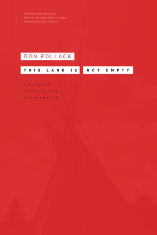
  • 1. Following the American frontier for 3000 miles through Native American Country D O N P O L L A C K P A I N T I N G S I N S T A L L A T I O N P E R F O R M A N C E N O T E M P T YT H I S L A N D I S
  • 2. DON POLLACK THIS LAND IS NOT EMPTY P A I N T I N G S I N S T A L L A T I O N P E R F O R M A N C E Following the American frontier for 3000 miles through Native American Country September 9 – October 22, 2016 Bridgeport Art Center Circle Line Gallery 1200 W. 35th St. 5th Floor Chicago, IL 60609 773.843.9000
  • 3. This work comes from a 3000 mile journey traveled from Lake Michigan to the Pacific coast. Moving through this landscape, the presence of history saturated the experience. In these works in oil on canvas, performance, and installation,— past traumas and revelations speak to the violent conflict on perspectives of the land, the spaces we inhabit, inextricably forget that we are a part of, we conquer, and we picture. Through a physical journey, the measures of this exhibition attempts to make a space for knowing the North American landscape. 2 Taking Measure Across The American Landscape: Frontiers, Borders, & Barriers CROSSING THE GREAT DIVIDE I L L I N O I S I O W A M I N N E S O T A S O U T H D A K O T A NORTH DAKOTA MONTANA IDAHO WASHINGTON OREGON [top] CROSSING THE GREAT DIVIDE ROUTE Lake Michigan to Pacific Ocean June 20- August 18 [above] Beaverhead Co.,Montana 2015 T H I S L A N D I S N O T E M P T Y POTAWATOMI MISHGAMAW SAUK FOX DAKOTA PONCA ARIKARA LAKOTA HIDATSA CHEYENNE SHOSHONE CROW NEZ PERCE NUMU CHINOOK MENOMINEE SALISH WAILEPTU 3
  • 4. CROSSING THE GREAT DIVIDE, began as a North American landscape project dedicated to taking history to heart. Traveling for 2 months from Chicago at Lake Michigan to the Pacific Ocean, the journey followed the paths of Lewis and Clark and Lieutenant Colonel George Armstrong Custer among others. In order to be more connected and intimate with the landscapes, histories and local cultures, a small team and I decided to take this journey under human power,— we traveled via bicycle for over 3000 miles. Leaving from Rogers Avenue in Chicago or Indian Boundary Line (1816) at Lake Michigan, we ar- rived at Cape Disappointment, Washington by the Pacific Ocean 2 months later. ‘CROSSING THE GREAT DIVIDE’ involved both crossing the physical landmass of the Rocky Mountains and the cultural divide that stands between people and the historic trauma with Native America. As I moved westward, I found myself confronting the violent legacy of Manifest Destiny,—the 19th century belief that U.S. expansion throughout the continent was inevitable and justified by Darwinist reasoning. It led to war with Mexico and endorsed a policy of total annihilation of Native American tribes. This im- perial policy met with political dissension and internal conflict in the United States. Continental expansion meant an expansion of slavery and the vehe- ment displacement of Native peoples. In 1824, the War Department created the Bureau of Indian Affaires which set the tone for aggressive treatment of Native people. A history of broken treaties and massacres proclaimed as hon- orable battles ensued. To eliminate the Native American presense on valued land, genocide of the original people became policy. The term, ‘final solution’ meaning total anihilatation [of the Native population] was first coined by General William Tecumseh Sherman. The ensuing tragedies and holocaust must not be forgotten. I set out to re write my relationship to this history by Re-Surveying the U.S. as a landscape for tolerance. Each Re-Survey marker is a benchmark mark dedicated to undoing the destructive policies and attitudes of the 19th, 20th, and 21st centuries treatement of Native peoples. Beginning in Chicago and moving westward, 15 locations were GPS recorded and marked at historic sites of trauma along the Missouri, Yellowstone, Tongue, Bighorn, Little Bighorn, 4 Powder Rivers, and the Pacific Ocean. [Places like the remote conjunction of the Powder River and the Yellowstone in eastern Montana for example is where Custer staged his assault into Lakota Sioux territory.] In order to extend this work, I am asking people to take one of the clay survey markers as part of the global database of the people listed as allies to the of Re-Surveying project of North America. In order to ‘Cross the Great Divide’, I kindly ask for your participation and would be greatly honored if you would accept one of these markers. – 6.12.16 www.CrossingTheGreatDivide.net MEASURE OF TOLERANCE BENCHMARK, TREATY ROCK Survey marker Indian Boundary Park,* Chicago 2016 L A K E M I C H I G A N Indian B oundary Line C H I C A G O Ft.Dearborn Illinois River 39 miles Chi cago River Rogers Avenue O T T A W A C H I P P E W A P O T A W A T O M I U N I T E D S T A T E S 1 8 1 6 C R O S S I N G T H E G R E A T D I V I D E * route MENOMINEE HONORING DANCE, TREATY ROCK Indian Boundary Park,* Chicago 2016 5
  • 5. 1. Indian Boundary Line, Peterson Garden Project site, Rogers Avenue and W. Birchwood, Chicago 42.0188N, 87.6712W, 586.39’ altitude Site of Indian Boundary Line, the border between Native America and the US in 1816. Our journey of reconciliation begins at this location of the ‘Peterson Community Garden’ where the seeds of the ‘Three Sisters’ (corn, beans squash) were planted. The planting of these three main crops important to native peoples was done as a sign of growth and a gesture of reconciliation with all peoples. Indian Bound- ary Line was a survey whose goal was to give Lake Michigan access to non Native people. Cutting through Potawatomi, Objibwa, and Ottawa country, it was later rescinded after Chief Black Hawk’s war and Illinois’ statehood. All Illinois Native peoples were then relocated west of the Mississippi. Some of these same seeds from the garden were hand carried across the country in an East-West gesture of healing along a 3000 mile path of the American frontier. 2. Indian Boundary Park, Chicago, IL 42.0091N, 87.6922W, 599.93’ altitude Site of the treaty stone that marks Indian Boundary Park in Chicago. The border on Rogers Avenue was sur- veyed by George Rogers Clark and his brother, William Clark. William earlier had co-captained the Corps of Discovery with Meriwether Lewis and was responsible for mapping and opening up the west to development. Unfortunately, the Native spirit of hospitality was met with antagonism and bloodshed within 50 years of their first encounter with the Corps. This site symbolically marks the beginning of our cross country journey of reconciliation. 3. Reconciliation Park, Mankato, MN 44.1674N, 94.0030W, 825.58’ altitude This site in Mankato, Minnesota is the location of the hanging of 38 Dakota people after the uprising of 1862. The Dakotas were being starved out by unscrupulous government agents managing their physical survival and internal affairs when conflict broke out on the plains and several hundred settlers were killed. Eventu- ally captured, 38 Dakotas and later 2 more were hung and all other innocent Native tribes were forcibly removed from the state. This site of heartbreak and tragedy marks the largest US mass execution and has become a sacred place of healing for Native and non Native people. It reminds us of its mission with the inscribed words: ‘forgive everyone everything’. 4. La Framboise Island, Missouri River, Pierre, SD 44.3612N, 100.3618W, 1426.13’ altitude This site marks the journey of reconciliation at the Lewis and Clark trail by Pierre, South Dakota. Pierre is situated near the mouth of the Bad and the Missouri Rivers and it is here where Lewis and Clark had their first encounter with the Lakota Sioux. That first meeting as well a second nearly broke out into warfare due to a lack of a good interpreter on the part of the Corps. 5. Ft. Abraham Lincoln, Bismarck, ND 44.3612N, 100.3618W, 1426.13’ altitude Colonel George Armstrong Custer utilized this location as a staging area for the war against the Lakota Sioux in 1876. Lewis and Clark also passed through this area in 1804 and encountered the Mandan people on a high bluff overlooking the Missouri River. The Mandan had lived at this location for nearly four centu- ries but were nearly wiped out in 1781 by a Smallpox epidemic. 6. Yellowstone River, Glendive, MT 47.1082N, 104.7176W, 2060.37’ altitude In January of 2015 approximately 30,000 gallons of crude oil spilled into the Yellowstone River at this his- toric location of the Lewis and Clark trail due to a leeking pipeline. 7. Yellowstone and Powder River confluence, west of Terry, MT 46.7386N, 105.4283W, 2225.63’ altitude Lewis and Clark camped at this area on their return trip as well as Colonel George Armstrong Custer in his pursuit of the Lakota Sioux and their leaders, Sitting Bull and Crazy Horse. This location was the staging area for the six year war against the Lakotas in the 1870’s. SURVEY MARKER SITES MEASURE OF TOLERANCE 6 1. Indian Boundary Line, Peterson Garden Project site, Rogers Avenue and W. Birch- wood, Chicago 42.0188N, 87.6712W, 586.39’ altitude 2. Indian Boundary Park, Chicago, IL 42.0091N, 87.6922W, 599.93’ altitude 3. Reconciliation Park, Mankato, MN 44.1674N, 94.0030W, 825.58’ altitude B L AC K H AW K WA R S DA KO TA U P R I S I N G I L L I N O I S F T. D E A R B O R N B L AC K H AW K WA R S K E L L O G ’ S G R O V E , S T E P H E N S O N C O. I N D I A N C R . M A S S AC R E , L A S A L L E C O. I O WA S P I R I T L A K E B L AC K H AW K WA R S , TA M A C O. E I G H T S , A S A L L E C O. A R E M I N N E S O TA A N O K A C O. B I G S TO N E C O. B L U E E A R T H C O. B R O W N C O. C A R V E R C O. C H I P P E WA C O. C H I S AG O C O. C O T TO N W O O D C O. C R O W W I N G C O. DA KO TA C O. D O D G E C O. FA R I B AU LT C O. F I L M O R E C O. F R E E B O R N C O. G O O D H U E C O. G R A N T C O. H E N N E P I N C O. H O U S TO N C O. J AC K S O N C O. K A N D I Y O H I C O. L AC Q U I PA R L E C O. L E S U E U R C O. L I N C O L N C O. M C C L E O D C O. M E E K E R C O. M O W E R C O. M U R R AY C O. N I C O L L E T C O. O L M S T E A D C O. O T T E R TA I L C O. P O P E C O. R A M S E Y C O. R E D W O O D C O. R E N V I L L E C O. R I C E C O. S C O T T C O. S I B L E Y C O. S T E A R N S C O. S T E E L C O. T R AV E R S E C O. WA B A S H A C O. WA S E C A C O. WA S H I N G TO N C O. WATO N WA N C O. W I L I K I N C O. W I N O N A C O. W R I G H T C O. Y E L L O W M E D I C I N E C O. S O U T H DA KO TA C R O W B U T T E S B L AC K H I L L S C A M P C L A R K B R I D G E C A M P C O L L E R C A M P C O O K C A M P S H E R I DA N C A M P S T U R G I S C A M P W H I T N E Y H O R S E M E AT M A R C H C U S T E R B AT T L E F I E L D H W Y D U L L K N I F E ’ S R A I D I N D I A N B AT T L E S WA R O F T H E O U T B R E A K O TA U O L A K E H I L L N E L B U T T E M O N TA N A A L K A L I C R . D RY C R . H AY F I E L D F I G H T 1 6 M I L E C R . M A R I A S M A S S AC R E B I G H O R N P O W D E R R . R O S E B U D L I T T L E B I G H O R N C E DA R C R . W O L F M T. M U D DY C R . B I G H O L E C A N Y O N C R . B E A R PAW P U M K P I N C R . M I L K R . P O P L A R R . C R O W AG E N C Y S I O U X WA R S R E D C L O U D ’ S WA R S M A R I A S C R . C U S T E R & Y E L L O W S TO N E G R E AT S I O U X WA R S G R E AT S I O U X WA R S G R E AT S I O U X WA R S G R E AT S I O U X WA R S G R E AT S I O U X WA R S G R E AT S I O U X WA R S N E Z P E R C E WA R N E Z P E R C E WA R N E Z P E R C E WA R S I O U X WA R S S I O U X WA R S S I O U X WA R S C R O W WA R O R E G O N R O G U E WA R R O G U E VA L L E Y M O D O C WA R N E Z P E R C E WA R WA L L O WA VA L L E Y B A N N O C K WA R C A M A S VA L L E Y C AY U S E WA R W I L L A M E T T E VA L L E Y N . WA R S AC R E A L L U P R . M I S S I O N A I R I E T P R A I R I E A I R I E S S AC R E A L L A C O L U M B I A & YA K I M A R . TO P P E N I S H P U G E T S O U N D C A S C A D E M T S . YA K I M A VA L L E Y YA K I M A VA L L E Y YA K I M A VA L L E Y A H TA N U M C R . AU B U R N F R E N C H TO W N P U G E T S O U N D W H I T E R C H O P C R . T H E DA L L E S WA L L A WA L L A G R E E N R . P U G E T S O U N D I S T O F C O N F L I C T S I T E S W I T H N AT I V E A M E R I C A 4. La Framboise Island,Missouri River, Pierre, SD 44.3612N, 100.3618W, 1426.13’ altitude 5. Ft.Abraham Lincoln,Bismarck, ND 44.3612N, 100.3618W, 1426.13’ altitude 6.Yellowstone River, Glendive, MT 47.1082N, 104.7176W, 2060.37’ altitude 7.Yellowstone and Powder River confluence,west of Terry, MT 46.7386N, 105.4283W, 2225.63’ altitude G R E AT S I O U X WA R S G E N E R A L G. A . C U S T E R C A M PA I G N R O U T E L A KO TA C O N F L I C T S L E W I S & C L A R K W E S T WA R D R O U T E B L AC K H I L L S M I N N E S O TA A N O K A C O. B I G S TO N E C O. H E N N E P I N C O. H O U S TO N C O. R E D W O O D C O. R E N V I L L E C O. S O U T H DA KO TA C R O W B U T T E S B L AC K H I L L S N O R T H DA KO TA G R A N D C O T E AU B I G M O U N D M O N TA N A A L K A L I C R . D RY C R . H AY F I E L D F I G H T 1 6 M I L E C R . M A R I A S M A S S AC R E B I G H O R N P O W D E R R . R O S E B U D L I T T L E B I G H O R N C E DA R C R . W O L F M T. M U D DY C R . B I G H O L E C A N Y O N C R . B E A R PAW P U M K P I N C R . M I L K R . P O P L A R R . C R O W AG E N C Y S I O U X WA R S R E D C L O U D ’ S WA R S M A R I A S C R . C U S T E R & Y E L L O W S TO N E G R E AT S I O U X WA R S G R E AT S I O U X WA R S G R E AT S I O U X WA R S G R E AT S I O U X WA R S G R E AT S I O U X WA R S G R E AT S I O U X WA R S N E Z P E R C E WA R N E Z P E R C E WA R N E Z P E R C E WA R S I O U X WA R S S I O U X WA R S S I O U X WA R S C R O W WA R O R E G O N R O G U E WA R R O G U E VA L L E Y M O D O C WA R N E Z P E R C E WA R WA L L O WA VA L L E Y B A N N O C K WA R C A M A S VA L L E Y C AY U S E WA R W I L L A M E T T E VA L L E Y WA S H I N G TO N YA K I M A WA R TO P P E N I S H C R . P U G E T S O U N D WA R W H I T E R . M A S S AC R E W H I T E R . , P U YA L L U P R . U N I O N G A P T W I N B U T T E S S T. J O S E P H ’ S M I S S I O N B R E N N A N ’ S P R A I R I E WA L L A WA L L A S E AT T L E M U C K L E S H O O T P R A I R I E C O N N E L L’ S P R A I R I E C A S C A D E S M A S S AC R E S AT U S C R . 2 N D WA L L A WA L L A C H I E F L E S C H P O R T G A M B E E C O L U M B I A & YA K I M A R . TO P P E N I S H P U G E T S O U N D C A S C A D E M T S . YA K I M A VA L L E Y YA K I M A VA L L E Y YA K I M A VA L L E Y A H TA N U M C R . AU B U R N F R E N C H TO W N P U G E T S O U N D W H I T E R C H O P C R . T H E DA L L E S WA L L A WA L L A G R E E N R . P U G E T S O U N D PA R T I A L L I S T O F C O N F L I C T S I T E S W I T H N AT I V E A M E R I C A ROUTE marker sites eastern section 2016 MEASURE OF TOLERANCE BENCHMARK Survey marker Bridgeport Art Center, Chicago 2016 1 2 3 4 56 7 7
  • 6. 8. Little Bighorn Battlefield National Monument, Crow Agency, Montana. 45.5664N, 107.4249W, 3231.63’ altitude The “Peace Through Unity” Indian Memorial honors Native Americans who fought to preserve the land and a way of life and also those who died on the sacred ground on June 25 and 26, 1876. “If this memorial is to serve its total purpose, it must not only be a tribute to the dead; it must contain a message for the living... power through unity...” ~ Enos Poor Bear, Sr., Oglala Lakota Elder 9. Little Bighorn River, Sarpy Creek Rd., MT 45.7353N, 107.5665W, 2732.94’ altitude The Little Bighorn Battlefield takes its name from the river by the Lakota campsite where Colonel George Armstrong Custer met his demise at the hands of the Lakota, Cheyenne and Arapaho forces led by Crazy Horse, Sitting Bull, and Gall. Though a Native victory was realized, it marked the beginning of the end for this last generation of Native people to live freely on the Great Plains. 10. Bozeman Pass, MT 45.6671N, 110.8109W, 5630.16’ altitude Captains Meriwether Lewis and William Clark relied on the generosity of the Native tribes and Sacajawea (Shoshone). In 1806 on the return journey from the Pacific, Sacajawea led Clark’s group over this old buffalo path frequented by the local native peoples. By 1860 gold seekers had moved onto Indian land illeagaly and Native objection were seen as an impediment to progress. Local tribes were classified as hostile and the Pass was eventually named after an early entrepreneur frontiersman, John Bozeman. 11. Big Hole Pass, MT 45.3292N, 113.3284W, 7402.80’ altitude Chief Joseph of the Nez Perce escaped through this Pass on the way to Canada attempting to avoid conflict with General Gibbons and the US Army. Gold was discovered on Nez Perce Reservation and the tribe was given 30 days to move onto a reservation 10% of its original size. Any Natives unaware of this policy or in direct disagreement with its tenants were considered hostile and subject to military force. 12. Nez Perce Big Hole National Battlefield, MT 45.6361N, 113.6438W, 6297.99’ altitude Chief Joseph negotiated with the US to stay in his homeland but a reversal in policy created a hostile environment for the tribe. While trying to avoid conflict with the US Army by moving to Canada, the Nez Perce encountered a predawn surprise attack on their village by General Gibbons. It didn’t stop their escape but it yielded tremendous losses to the tribe however with a greater proportion of those being women and children. 13. Lolo Trail-Nez Perce Trail, MT-ID 46.7464N, 114.1710W, 3174.85’ altitude This route was passable only with the prior aid and knowledge of Native American elders who assisted Lewis and Clark on their journey west. The Nez Perce’s generosity was mentioned in the journals and was critical to the explorer’s survival. Late in the nineteenth century, Chief Joseph saw to it that his people vow never to make war on the incoming settlers. They never broke their promise and unfortunately 50 years after Lewis and Clark passed through this area, the Nez Perce were being hunted down in their own country. The dis- covery of gold on their Reservation forced the Nez Perce to evacuate their homeland while simultaneously fleeing attacks from the US Army. 14. Portland, OR 45.56227N, 122.8529W, 258.22’ altitude This is the coordinates for the west coast Geannopoulos garden that received the seeds of the ‘Three Sisters’ (corn, beans squash). These were hand carried from the ‘Peterson Community Garden’, Chicago in the spirit of unity across country as an East-West gesture of healing along a 3000mile American frontier. 15. Cape Disappointment, WA 46.2817N, 124.0571W, 58.69’ altitude This is the Pacific Ocean endpoint camp for Lewis and Clark and site of the Chinook ‘Walk to the Cedars’. The Chinook Native people in this area were very friendly and hospitable to Lewis and Clark’s Corps but contact with outsiders extracted a steep price. Later, an outbreak of smallpox and influenza devastated the Chinook for which they had no natural immunities. 8 7.Yellowstone and Powder River confluence,west of Terry, MT 46.7386N, 105.4283W, 2225.63’ altitude 8. Little Bighorn Battlefield National Monument, Crow Agency, Montana. 45.5664N, 107.4249W, 3231.63’ altitude 9. Little Bighorn River, Sarpy Creek Rd.,MT 45.7353N, 107.5665W, 2732.94’ altitude 10. Bozeman Pass, MT 45.6671N, 110.8109W, 5630.16’ altitude 11. Big Hole Pass, MT 45.3292N, 113.3284W, 7402.80’ altitude 12. Nez Perce Big Hole National Battlefield, MT 45.6361N, 113.6438W, 6297.99’ altitude 13. Lolo Trail-Nez Perce Trail, MT-ID 46.7464N, 114.1710W, 3174.85’ altitude 15. Cape Disappointment,WA 46.2817N, 124.0571W, 58.69’ altitude 14. Portland,OR 45.56227N, 122.8529W, 258.22’ altitude G R E AT S I O U X WA R S N E Z P E R C E WA R S L E W I S & C L A R K R E T U R N R O U T E R E D C L O U D ’ S WA R S C R O W WA R S L E W I S & C L A R K R O U T E PAC I F I C O C E A N C A M P : C A P E D I S A P P O I N T M E N T I L L I N O I S F T. D E A R B O R N B L AC K H AW K WA R S K E L L O G ’ S G R O V E , S T E P H E N S O N C O. I N D I A N C R . M A S S AC R E , L A S A L L E C O. I O WA S P I R I T L A K E B L AC K H AW K WA R S , TA M A C O. W I S C O N S I N W I S C O N S I N H E I G H T S , DA N E C O. I N D I A N C R . L A S A L L E C O. W I N N E B AG O WA R B A D A X E L A K E M I N N E S O TA A N O K A C O. B I G S TO N E C O. B L U E E A R T H C O. B R O W N C O. C A R V E R C O. C H I P P E WA C O. C H I S AG O C O. C O T TO N W O O D C O. C R O W W I N G C O. DA KO TA C O. D O D G E C O. FA R I B AU LT C O. F I L M O R E C O. F R E E B O R N C O. G O O D H U E C O. G R A N T C O. H E N N E P I N C O. H O U S TO N C O. J AC K S O N C O. K A N D I Y O H I C O. L AC Q U I PA R L E C O. L E S U E U R C O. L I N C O L N C O. M C C L E O D C O. M E E K E R C O. M O W E R C O. M U R R AY C O. N I C O L L E T C O. O L M S T E A D C O. O T T E R TA I L C O. P O P E C O. R A M S E Y C O. R E D W O O D C O. R E N V I L L E C O. R I C E C O. S C O T T C O. S I B L E Y C O. S T E A R N S C O. S T E E L C O. T R AV E R S E C O. WA B A S H A C O. WA S E C A C O. WA S H I N G TO N C O. WATO N WA N C O. W I L I K I N C O. W I N O N A C O. W R I G H T C O. Y E L L O W M E D I C I N E C O. S O U T H DA KO TA C R O W B U T T E S B L AC K H I L L S C A M P C L A R K B R I D G E C A M P C O L L E R C A M P C O O K C A M P S H E R I DA N C A M P S T U R G I S C A M P W H I T N E Y H O R S E M E AT M A R C H C U S T E R B AT T L E F I E L D H W Y D U L L K N I F E ’ S R A I D I N D I A N B AT T L E S WA R O F T H E O U T B R E A K N O R T H DA KO TA G R A N D C O T E AU B I G M O U N D D E A D B U F FA L O L A K E S TO N Y L A K E W H I T E S TO N E H I L L K I L L D E A R M T. B A D L A N D S M I N O T K I D D E R C O. B U R L E I G H C O. D I C K E Y C O. D U N N C O. M E D O R A S E N I N E L B U T T E M O N TA N A A L K A L I C R . D RY C R . H AY F I E L D F I G H T 1 6 M I L E C R . M A R I A S M A S S AC R E B I G H O R N P O W D E R R . R O S E B U D L I T T L E B I G H O R N C E DA R C R . W O L F M T. M U D DY C R . B I G H O L E C A N Y O N C R . B E A R PAW P U M K P I N C R . M I L K R . P O P L A R R . C R O W AG E N C Y S I O U X WA R S R E D C L O U D ’ S WA R S M A R I A S C R . C U S T E R & Y E L L O W S TO N E G R E AT S I O U X WA R S G R E AT S I O U X WA R S G R E AT S I O U X WA R S G R E AT S I O U X WA R S G R E AT S I O U X WA R S G R E AT S I O U X WA R S N E Z P E R C E WA R N E Z P E R C E WA R N E Z P E R C E WA R S I O U X WA R S S I O U X WA R S S I O U X WA R S C R O W WA R O R E G O N R O G U E WA R R O G U E VA L L E Y M O D O C WA R N E Z P E R C E WA R WA L L O WA VA L L E Y B A N N O C K WA R C A M A S VA L L E Y C AY U S E WA R W I L L A M E T T E VA L L E Y WA S H I N G TO N YA K I M A WA R TO P P E N I S H C R . P U G E T S O U N D WA R W H I T E R . M A S S AC R E W H I T E R . , P U YA L L U P R . U N I O N G A P T W I N B U T T E S S T. J O S E P H ’ S M I S S I O N B R E N N A N ’ S P R A I R I E WA L L A WA L L A S E AT T L E M U C K L E S H O O T P R A I R I E C O N N E L L’ S P R A I R I E C A S C A D E S M A S S AC R E S AT U S C R . 2 N D WA L L A WA L L A C H I E F L E S C H P O R T G A M B E E C O L U M B I A & YA K I M A R . TO P P E N I S H P U G E T S O U N D C A S C A D E M T S . YA K I M A VA L L E Y YA K I M A VA L L E Y YA K I M A VA L L E Y A H TA N U M C R . AU B U R N F R E N C H TO W N P U G E T S O U N D W H I T E R C H O P C R . T H E DA L L E S WA L L A WA L L A G R E E N R . P U G E T S O U N D PA R T I A L L I S T O F C O N F L I C T S I T E S W I T H N AT I V E A M E R I C A 15. Cape Disappointment,WA 46.2817N, 124.0571W, 58.69’ altitude 14. Portland,OR 45.56227N, 122.8529W, 258.22’ altitude L E W I S & C L A R K R O U T E PAC I F I C O C E A N C A M P : C A P E D I S A P P O I N T M E N T PA R T I A L L I S T O F C O N F L I C T S I T E S W I T H N AT I V E A M E R I C A ROUTE marker sites western section 2016 [L] ALONG ROUTE Lolo Pass, Nez Perce Trail, Idaho [R] WOOD FIRING Survey markers [for distribution] 2016 10 11 9 8 12 13 14 15 9
  • 7. The American frontier is a landscape historically rooted in archetypal west- erns and traumatic change. These spaces still hold that memory and the historic evidence is very much alive in places such as Big Hole, Montana. Here, I was met with a magnanimous Nez Perce greeting. It beckons all by suggesting that there are no strangers in their homeland,—and states we are all here together and honoring the ancestors and listening to their stories. It is in simple places such as these and at Crow Agency where I saw that the connections between peoples must be taken care of with great patience and understanding. This is a relationship that holds a reciprocity and it is fragile. It is not only a reciprocity between ourselves but between our perspectives, each other, and our relationship to the landscape. A PHOTOGRAPH OF GRAND TETON, WYOMING ENCOUNTERS A NATIVE AMERICAN BLANKET. A stripe gives way to a triangle that abstracts a mountain, and I wrap myself with wool. My body is warm and I am surrounded by the beauty of a weaving and am captivated by the mountain symbols that engulf me. The blanket is a document and an article of clothing that protects me from the cold. I am somehow inside the landscape and again under the gaze of the mountain. The photograph of the Teton Range also shifts my space but my creative process moves me differently. I see the two dimensional representation and it ap- pears similar to the outside picture. By looking, I eventually gravitate towards the dichotomies that form their own natural conclusions, such as,—how the notion of ‘wilderness’ contains within it the notion of ‘containment’ and how a reverential depiction of nature depends on technique; and how all of this reveals that I have created nature in my own image. I find that it is possible to mistake this landscape for an empty space free of origninal inhabitants. This Land is not Empty. CHANGING SENTIMENTS AT THE LITTLE BIGHORN BATTLEFIELD where Native warriors fell are now honored alongside 7th calvary soldiers. Next 10 to the white marble headstones in Montana are now red marble headstones inscribed with statements such as, ‘Elk Stands On Top, Sans Arc Sioux,—fell here while defending his homeland and the Sioux way of Life’. It is time to rewrite a new history and to survey a new landscape of respect, inclusion, and tolerance. Tolerance is also a survey term that I gladly accept as meta- phor,—it is term used to connote an aspect of truth in the measurement of a map in order to gain a higher standard. It is here in this new map where I wish to achieve the higher standard of tolerance by extending this project beyond me. I am asking allied people locally and around the world for their participation by accepting an unfired clay survey marker. MARKER CASE glass, wool, felt, leather, clay, wood 2016 MARKERS clay [for distribution] Bridgeport Art Center 2016 11
  • 8. RED EARTH WHEEL red earth clay Bridgeport Art Center 2016 THE MAP OF THE EMPIRE NO LONGER SATISFIED performance, with Gunther’s Survey Chain and grid projections based on, ‘Museum, On Exactitude in Science’, by Jorge Borges Bridgeport Art Center: Julia Pollack, Anders Pollack, Don Pollack SOUND performance, Anders Pollack 2016 12 RED EARTH, SITES Kellog’s Grove [IL] Sauk, Blackhawk Bad Axe River [WI] Sauk, Blackhawk Mankato [MN] Santee Sioux New Ulm [MN] Santee Sioux Medicine Rock [MT] Sioux, Sitting Bull Dead Buffalo Lake [SD] Santee, Yankton, Yanktonai and Teton Sioux Stony Lake [SD] Santee, Yankton, Yanktonai and Teton Sioux Powder River [MT] Cheyenne, Sioux Fort Smith [MT] Sioux, Red Cloud Killdear Mountain [ND] Sioux, Gall, Sitting Bull Crow Agency [MT] Crow, Sword Bearer Bighorn [MT] Crow Little Bighorn [MT] Sioux, Cheyenne, Arapaho, Sitting Bull, Crazy Horse, Gall Big Hole [MT] Nez Perce, Chief Joseph Clearwater [ID] Nez Perce, Chief Joseph, Looking Glass Walla Walla [WA] Cayuse, Yakima The Dalles [WA] Cayuse Forgive Eveyone Everything 13
  • 9. [opposite above] THOMAS INSTRUCTED ME TO TAKE COPIOUS NOTES, BERNHEIM, KY oil on canvas, 48x48” 2016 [opposite below] I COULD BARELY SEE THE SKY , BERNHEIM, KY oil on canvas, 48x48” 2016 LANDSCAPE AND MEMORY COLONIAL DIRECTION OF TRAVEL image landscape June 20 Lake Michigan stripes landscape August 18 Pacific Ocean melting landscape July 17 Little Bighorn ←← Native west European east 14 15
  • 10. [2 months process drawing on oak] INSTALLATION Bridgeport Art Center 2016 16 OAK ROBE FIRST PHASE , [2 months process drawing on oak] oil, mixed media on canvas, 58x96” 2016 17
  • 11. VISION QUEST oil on canvas, 58x96” 2016 18 ELK DREAM UPPER MISSOURI oil and gunpowder on canvas, 58x96” 2016 19
  • 12. MONTANA oil on canvas, 36x48” 2016 MAP 1 graphic, paper, on canvas, 18x24” 2016 20 FRONTIER MAP graphic, paper, and mixed media on board, 18x48” 2016 MAP 2 graphic, paper, on canvas, 18x24” 2016 21
  • 13. DON POLLACK M.F.A., Ohio State University Columbus, Ohio B.F.A., University of Illinois Urbana, Illinois SELECTED SOLO EXHIBITIONS 2016 Bridgeport Art Center, “This Land is not Empty”, Chicago, Illinois Carnegie Museum for Art and History, Bernheim Arboretum, New Albany, Indiana 2013 Perimeter Gallery, “34 Days to Washington”, Chicago, Illinois 2011 Newzones Gallery, “Far from Home”, Calgary, Alberta, Canada Marcia Wood Gallery, “Far from Home”, Atlanta, Georgia 2010 Perimeter Gallery, “Mysterious Island”, Chicago, Illinois Marquette University Law Library, laying the foundation [a Lincoln Portrait], Milwaukee, Wisconsin 2009 Abraham Lincoln Presidential Library and Museum, “The Lincoln Project”, Springfield, Illinois The Union League Club, “The Lincoln Project”, Chicago, Illinois 2007 Newzones Gallery, “The Sheltering Sky”, Calgary, Alberta, Canada Merwin and Wakeley Galleries, Illinois Wesleyan University, American Inheritance, retrospective], Bloomington, Illinois Marcia Wood Gallery, “Night”, Atlanta, Georgia 2006 Margaret Thatcher Projects, “American Gothic, Past Imperfect”, New York, New York Perimeter Gallery, “Improvisation”, Chicago, Illinois SELECTED GROUP EXHIBITIONS 2015 Architectural biennial, Brininstool and Lynch, Chicago, Illinois 2014 “Black and White”, Perimeter Gallery- Chicago, Chicago, Illinois 2012 Art Miami, Perimeter Gallery- Chicago, Miami, Florida Group Show, Perimeter Gallery, Chicago, Illinois 2011 Art Chicago, The Merchandise Mart, Perimeter Gallery, Chicago, Illinois Group Show, Kenise Barnes Gallery, Larchemont, New York 2010 “Pull”, Marcia Wood Gallery, Atlanta, Georgia “Memory is a Metaphor”, Kenise Barnes Gallery, Larchmont, New York 2009 “Nature Satisfies by its Loveliness”, Kenise Barnes Gallery, Larchmont, New York “The Exquisite Corpse”, Renaissance Society, University of Chicago, Chicago, Illinois 2008 “This Just In”, Marcia Wood Gallery, Atlanta Georgia “Curator’s Choice”, Contemporary Art Institute of Detroit, Detroit, Michigan “Art Chicago”, The Merchandise Mart, Perimeter Gallery, Chicago, Illinois SELECTED AWARDS 2016 Enrichment grant, School of the Art Institute of Chicago, Chicago, Illinois 2015 Sabbatical grant, Illinois Institute of Art, Chicago, Illinois 2014 Bernheim Arboretum, Artist Residency, Louisville, Kentucky 2012 Illinois Institute of Art, Faculty of the Year award, Chicago, Illinois 2010 Marquette University Law Library, commission award, Milwaukee, Wisconsin Sabbatical grant, Illinois Institute of Art-Chicago, Chicago, Illinois 2009 Order of Lincoln, bicentennial edition, State of Illinois award, Springfield, Illinois School of the Art Institute of Chicago, faculty grant, Chicago, Illinois [above] INSTALLATION Bridgeport Art Center 2016 22 SELECTED PUBLIC COLLECTIONS Philbrook Museum of Art, Tulsa, Oklahoma Fidelity, Charlotte, North Carolina Allston & Bird, Washington, D.C. Corboy, Demetrio, and Clifford, Chicago, Illinois Poco Petroleum, Calgary, Alberta, Canada Burnett, Duckworth, and Palmer, Calgary, Alberta, Canada Evans, Martin, and Wilson, Calgary, Alberta, Canada Metropolitian Life Insurance Company, New York, New York American Telephone and Telegraph Company, Chicago, Illinois SELECTED BIBLIOGRAPHY Jenna Esarey, bernheim art on display at Carnegie Center, Courier-Journal, February 6, 2016 Lauren Viera, “Don Pollack, Mysterious Island, Chicago Tribune, March 5, 2010 Jason Mojica, “Don Pollack: Improvisation”, Time Out Chicago, February 2-9, 2006 Edward Gomez, “Reimagining the Landscape”, Art and Antiques, Atlanta, Georgia, October, 2003 Alan Artner, “Don Pollack”, Chicago Tribune, March 21, 2003 SELECTED PUBLICATIONS 2013 “34 days to Washington”, Perimeter Gallery, Chicago, Illinois, catalog 2012 Perimeter Gallery, Chicago, Illinois, catalog 2010 Art Chicago International Exposition, Mart Center, Chicago, Illinois, catalog “Marquette Law Review”, vol. 93, number 4, Marquette University, Milwaukee, Wisconsin, catalog 2009 “The Lincoln Project”, Abraham Lincoln Presidential Library & Museum, Springfield, Illinois, catalog “Design School Confidential, Extraordinary Class Projects from International Design Schools, Steven Heller & Lita Talarico, Rockport Publishers, Beverly Massachusetts TEACHING School of the Art Institute of Chicago, Chicago, Illinois, Adjunct Associate Professor, Visual Communications Design Department, September 2005-present LECTURES Northwestern University, Slivka College, Evanston, Illinois,“Crossing the Great Divide”, February 1, 2016 Bronx, City College of New York, Bronx, New York, “Crossing the Great Divide”, December 10, 2015 Fluid, Society for Literature, Science, & Art Conference, Southern Methodist University, Dallas, Texas “Crossing the Great Divide, Trying to Understand the Collage of My Landscape”, October 9, 2014 - October 12, 2014 Postnatural, Society for Literature, Science, & Art Conference, Notre Dame University, South Bend, Indiana “34 Days to Washington”, October 3, 2013 - October 6, 2013 INTERVIEWS WCTV, Addison, Illinois, “The Lincoln Project”, February 7, 2013 KYW News Radio 1060, Philadelphia, Pennsylvania, “Taking Measure Across America”, August 9, 2010 Fox/NBC, Philadelphia, Pennsylvania, “Taking Measure Across America”, August 9, 2010 WGRZ NBC Buffalo, New York, “Taking Measure Across America”, July 28, 2010 WTTW, Chicago, Illinois, arts across illinois, “Looking for Lincoln”, June 19 & 21, 2009 WFLD-Fox News Chicago, Springfield, Illinois, “The Lincoln Project”, February 12, 2009 WAND-NBC News Decatur, Springfield, Illinois, “The Lincoln Project”, February 8, 2009 WCIA-CBS News Champaign, Springfield, Illinois, “The Lincoln Project” February 7, 2009 WICS-ABC News Springfield, Springfield, Illinois, “The Lincoln Project”, February 7, 2009 23