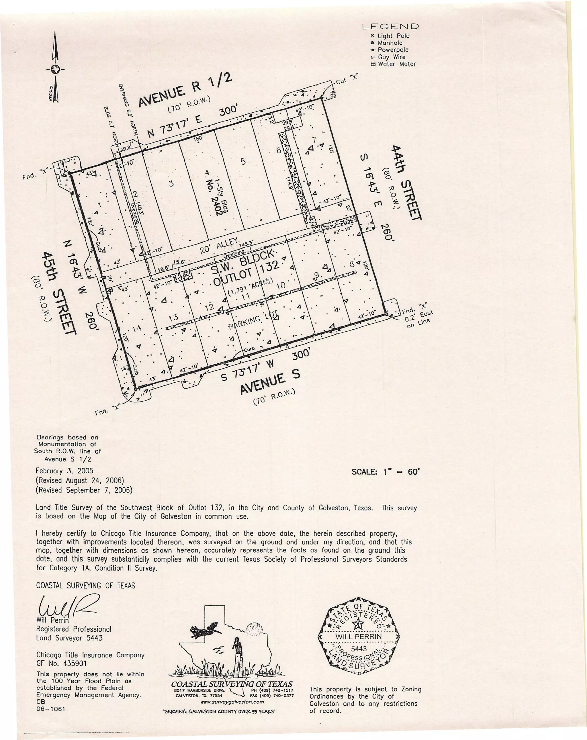
This survey map summarizes the findings of a land title survey of a property in Galveston, Texas. The map depicts the location of light poles, manholes, power poles, and guy wires on the property. It also shows bearings and distances used to establish boundaries based on prior monumentation. The surveyor certifies that the map accurately represents the facts found on the ground and complies with Texas surveying standards. The property is subject to city zoning and any restrictions of record.