SlideShare a Scribd company logo
1 of 50
Download to read offline
T H E C I T Y O F
Fridley
Right of Ways Welcome You to Fridley
ESPM 4041W— Problem Solving
for Environmental Change
University of Minnesota
College of Food, Agricultural
and Natural Resource Sciences
Report 5/5 prepared by:
Sunny Leung, Project lead
Kyle Welna, Group Liaison
Grayson Roper
Henry Carlson
December 14, 2015
Table of Contents
List of Figures ........................................................................................... ii
Acknowledgments .................................................................................... iii
Executive Summary ................................................................................. iv
Introduction ................................................................................................ 1
Overview .............................................................................................. 1
ROWs Welcome You to Fridley .......................................................... 2
Fridley Master Plan .............................................................................. 2
Site Description .................................................................................... 3
Goals and Vision .................................................................................. 4
Methods ..................................................................................................... 5
Site Visits ............................................................................................. 5
Secondary Resources ........................................................................... 5
Societal Benefits of ROW Improvements ............................................ 6
ROW Landscape Improvements and Safety ........................................ 7
Case Studies ......................................................................................... 8
Proefssional Collaboration ................................................................... 9
Findings ................................................................................................... 10
Common Roadside Vegetation .......................................................... 10
Societal Benefits to ROW Improvements .......................................... 11
ROW Landscape Improvements and Safety ...................................... 12
ROW Rules and Regulations ............................................................. 14
Case Studies ....................................................................................... 14
Recommendations .................................................................................... 19
MN-DOT Community Roadside Landscape Partnership
Program ........................................................................................ 19
University Avenue-Fridley Welcomes You (57th
to 67st) ................. 19
East River Road ................................................................................. 20
Additional Recommendations ............................................................ 21
Conclusion ............................................................................................... 22
References ................................................................................................ 22
Appendices ............................................................................................... 25
Appendix A: List of Figures
Appendix B: Vegetation Information
i
List of Figures
Figure 1. Map of Fridley ........................................................................... 1
Figure 2. Comparison of Different ROW Designs .................................. 11
Figure 3. TH 36 Visualization Typical Section ....................................... 15
Figure 4. Results of Golden Valley Lilac Way Project ........................... 17
Figure 5. Results of Triangle Park Project ............................................... 18
Figure 6. East side shoulder on University Avenue between 57th and
61st in Fridley .................................................................................... 20
Figure 7. Example of right-of-way plan ................................................. 20
Figure 8. Illustrative view of TOD site. Island of Peace Parkway
(57th Avenue) ................................................................................... 21
ii
Acknowledgments
We would sincerely like to thank the City of Fridley, notably Kay Qualley, for the
continuous support and assistance in the development of this Right of Way
development plan. Other members of the City of Fridley we owe thanks to include,
but are not limited to; Erika Van Krevelen and Julia Jones.
Additionally we would like to extend thanks to Todd Carroll and Anthony Wotzka of
the Community Roadside Landscape Partnership Program (CRLPR) for all the
recommendations and help in interpreting Minnesota Department of Transportation
(MN-DOT) regulations and vegetation suggestions. We would also like to thank
Craig Krueger, the University of Minnesota turfgrass field manager for his assistance
in identification and selection of turf grass. Finally we extend a huge thank you to
Tim Teynor of the City of Golden Valley and Andrew Carlson of the City of
Minneapolis for answering questions related to similar Right of Way improvement
projects.
iii
Executive Summary
Right of Way (ROW) refers to the area designated as a transportation corridor.
Improvement of Fridley’s ROWs is consistent with the City’s 2030 Comprehensive
Plan which focused on aesthetics, safety features and functionality of ROWs without
modifying existing structures. This report was compiled in order to provide
recommendations for the improvement of ROWs that create a more inviting, safe,
and functional entrance to the City of Fridley. This was done in conjunction with four
other reports addressing multiple aspects of the comprehensive plan. These reports
were all developed by students attending the University of Minnesota-Twin Cities in
the Problem Solving for Environmental Change capstone class.
ROWs can help to improve a person’s impressions of the city, and provide safety for
the citizens of Fridley. The main goal was to provide an inviting, visually appealing,
safe, and environmentally sustainable ROW for University Avenue that can be used
in other ROWs in Fridley as opportunities arise. This area is heavily traveled in
Fridley and needs improvements to regulate traffic flow and ensure a maintainable
and safe speed limit.
Analysis of findings on ROW improvements in other cities similar to Fridley
contributed to the recommendations on the ROW improvements for the City of
Fridley. Findings included ROW improvement regulations, ROW vegetation types
based on site characteristics, and societal benefits from ROW improvements.
Recommendations center around the Community Roadside Landscape Partnership
(CRLP) Program through the Minnesota Department of Transportation (MN-DOT).
The CRLP Program would provide funding and resources necessary for the
implementation of ROW improvements in the City of Fridley. Landscape experts
additionally extend design support throughout the planning phase to help city
planners achieve their goals for the community. Vegetation suggestions as well as
design recommendations should include plans for vegetative bloom, color
seasonality, survivability, and safety in order to assist the City of Fridley in
improvements of their ROWs that are in line with the 2030 Comprehensive Plan.
iv
Introduction
Overview
Fridley is a suburb of the Minneapolis-St. Paul metropolitan area located in Anoka
County, Minnesota (Figure 1). It was founded as a village in 1880; however, the area
was in heavy industrial use since the 1850s (City of Fridley, 2008). For the most part
factories and processing mills existed from the creation of Anoka County in 1857
until the 1940s. At this point in time, two major roadways ran directly from the Twin
Cities of Minneapolis and St. Paul through Fridley and from then on it became a
convenient and desirable place for urban workers to settle and raise families (City of
Fridley, 2008). Housing demands spiked in the 1960s and 1970s and Fridley soon
became a bustling community that provided opportunities for commercial and
industrial enterprises as well as a home for people working in the metropolitan area.
Figure 1. Map of Fridley.
1
Currently, Fridley’s population is 27,677 people (U.S. Census Bureau, 2013) and the
two major roadways that contributed to its rapid growth in the past (Highway 65 and
Interstate 694) became the transport route by which countless people used to get to
and from their places of employment.
Fridley is recognized as a top-ranking industrialized city in Minnesota but it is also
home to a vibrant community that has created successful businesses and naturalized
recreation areas for itself. Unfortunately most people’s perception of Fridley is
restricted to the corridors that run straight through the city.
Students from the University of Minnesota in the College of Food and Agricultural
Sciences have joined the planners from the City of Fridley to devise ways in which
Fridley’s most crowded roadways can still reflect the beauty that is evident
throughout the rest of the community. Research and planning will be dedicated
toward ROW improvements along these corridors that will aid in their development
of an inviting, safe and ecologically sound transportation system.
ROWs Welcome You to Fridley
A ROW refers to land that is reserved for a transportation corridor. It is usually
acquired by the government through a land easement that serves as both the surface
for the road as well as any traffic buffer strip on the shoulders or in medians. The
strips of land that surround the road as well as the medians were originally designed
with only the safety of the driver in mind and consisted of mown turf and weeds.
More recently however, a greater emphasis has been placed on enhancing the visual
and environmental aspects of ROWs. Ideal ROWs feature design elements that allow
for stormwater filtration and redirection as well as pollinator corridors that strengthen
the surrounding ecosystem and bring life to a concrete jungle.
There is a considerable amount of land devoted to ROWs in Fridley especially along
most of the major north to south minor arterials such as University Avenue and East
River Road. In a city that experiences a high volume of traffic with no starts or
endpoints anywhere in Fridley itself (City of Fridley, 2008), these ROWs can embody
the overall appearance of the entire community. This is why it is important for these
corridors to not only provide safe, efficient driving conditions but also generate
visually appealing surroundings. In Minnesota, the Department of Transportation
(MN-DOT) is the primary agency that creates, maintains and improves the status of
ROWs. With this in mind, it is important that the development and implementation of
this project be in accordance with ROW regulations.
Fridley Master Plan
The 2030 comprehensive plan of Fridley is designed to assist the Metropolitan
Council’s responsibility of preserving and managing natural resources, the
2
transportation system and community improvement. The 2030 comprehensive plan
was completed in 2008, and a new version is updated every ten years. The
comprehensive plan of Fridley aims to improve the ROW system and to provide a
safe, beautiful, and convenient transportation system throughout the community. The
primary focus of Fridley's transportation plan is to improve mobility of community
roadways while protecting the existing infrastructure (City of Fridley, 2008). This
project addresses several of the noted goals either directly or indirectly through
design features that enable a positive interaction between the residents and their
transportation network.
Fridley has also recently been accepted into a voluntary challenge, assistance, and
recognition program known as GreenStep Cities. Greenstep Cities is a program that
lays a framework for communities to reach their environmental and livability goals.
One of best practices suggested by the GreenStep Cities program under transportation
is the “Living Streets” protocol that lists several actions to “Create a network of green
complete streets that improve city quality of life and adds value to surrounding
property” (Minnesota GreenStep Cities, 2009). There are several action steps shown
to reach this best practice and several address the need for stormwater management
and street trees. The recommendations provided in this project will certainly line up
with several of the Living Streets goals found in Greenstep Cities.
Site Description
University Avenue
University Avenue is a major commuter route that runs north to south through
Fridley, connecting I-694 to Highway 10 North of Fridley (see Figure 2 in Appendix
A). An estimated 46,100 people will commute along this four-lane corridor daily in
2030 (City of Fridley, 2008) making it an area of Fridley that is widely seen by
Minnesota citizens, whether they live in Fridley or not. University Avenue is a state
roadway that contains a considerable amount of ROWs in the form of both
surrounding strips and a continuous median.
The composition of these expansive plots of land is generally grass and weeds. In
addition, there is a substantial amount of impervious surface along the shoulders and
on sidewalks and crosswalk areas that drain stormwater directly into the city’s
drainage system. This roadway experiences a very high traffic volume on a daily
basis but it also separates the eastern and western portions of Fridley. Many residents
that live in the community cross University either by automobile or by walking and
biking. The ROWs on this corridor are mowed by city employees once a month.
East River Road
A north/south road that runs along the Mississippi River, East River Road is a more
scenic route with a slower speed limit and large areas of turf on either side of the road
3
and in the median. A predicted 23,000 vehicles in 2030 will commute along East
River Road daily (City of Fridley, 2008) meaning that this is a well-travelled route
that has the potential to make a greater impression on motorists. The maintenance of
this corridor appears to be inconsistent (East River Road Corridor Study in Fridley
and Coon Rapids, 2012), leading to conflicting visual quality along the road. On the
southern end of East River Road where it meets I-694, there is a major plan underway
called the Northstar TOD (Transit Oriented Development) Master Plan. This plan
includes connecting a train from downtown Minneapolis to the area, making it much
easier for people to commute (City of Fridley, 2014). Also light industrial and
residential areas will be constructed along East River Road near this connection (City
of Fridley, 2014), making visual quality along East River Road very important for
future residents/employees of the City of Fridley.
Goals and Vision
With new housing development underway, making the ROWs not only aesthetic and
inviting, but ecologically sound will benefit the city of Fridley in many ways. First,
improving people’s initial impressions as they enter the city means they are much
more likely to stop at a local businesses, parks etc. Second, improving the livability
of a main corridor in the city will draw people toward the idea of moving there and
making Fridley their family’s home. The improvement to visual aesthetics along
these corridors will not only provide the community with a sense of pride but also
hopefully create safer driving conditions. University Avenue has several intersection
crossings that are used heavily by pedestrians and cyclists and the current speed of
traffic on this road poses dangers for these residents. By placing visual barriers along
medians that are additionally safe to drivers will help regulate the flow of traffic and
ensure a safe and comfortable speed limit. Additionally the completion of this project
aids objectives set forth by the Urban Forestry group. The inclusion of certain ROW
features such as trees contributes to increased canopy cover and diversity of tree
species. Our deliverables for this project will include:
1. Recommendations for vegetation mixes on University Avenue. These mixes:
• Provide a visual barrier separating opposing traffic lanes and zones east
and west of roadway.
• Offer societal benefits in the form of pollution abatement and increased
property value
• Offer aesthetic benefits to the landscape of this roadway
• Are in accordance with MN-DOT rules and regulations for ROW design
2. Recommendations for an additional ROW improvement project in Fridley on
East River Road
3. Additional recommendations to improve success rate of projects
4
Methods
Site Visits
To assess and categorize the sites for this project, visits were carried out on
September 15 and September 21, 2015. Several photos were taken along the corridors
and intersections were navigated by foot at Mississippi Street and University Avenue,
61st Street and University Avenue and Mississippi Street and East River Road.
During these visits several existing ROW features were noted and targeted.
Assessment of these features was based on a visual and ecological spectrum. Areas
targeted for improvement were found to be wide-open spaces with turf as the primary
vegetation. The navigation of crosswalks helped in identifying areas along University
Avenue where traffic seems dense, fast, and hazardous to nonmotorists.
Secondary Resources
ROW Vegetation
Identifying the correct vegetation needed to achieve all of the goals stated earlier
required categorization of plants based on a series of criteria. Using a variety of
public literature, vegetation was chosen based on a list of technical criteria that would
lead to successful growing conditions and a pleasing design.
Recommended vegetation had to be sustainable on roadway conditions in the Anoka
Sand Plain Area. Initial focuses were vegetation (grasses, forbs, bushes and trees) that
withstand growing conditions of ROWs in Minnesota. Several Minnesota agencies
and institutions, such as the Minnesota Pollution Control Agency (MPCA),
MN-DOT, Minnesota Department of Natural Resources (MNDNR), and the
University of Minnesota Extension offers base line lists of plants that survive in these
conditions. Next, this preliminary list of vegetation was cross referenced with a list of
plants from a MN-DOT plant selection manual of native plants able to grow in the
soil characteristics of Fridley (Anoka Sand Plain). Finally, all requirements set forth
by MN-DOT that relate to the limitations of vegetation planting on ROWs were
reviewed using MN-DOT’s handbook for roadside engineers. A tool that was used
throughout this entire process was the MN-DOT plant selector which was available
through http://dotapp7.dot.state.mn.us/plant/apps/link/glossary.html. This tool
enabled the researchers to browse a vast series of plants based on the variety of
criteria that fit the project corridors.
This stepwise process to single out vegetation made certain that the recommendations
put forth fulfilled the important goals of this project but also remained realistic. The
following sources were used to gather information about vegetation
recommendations:
5
Vegetation with roadway tolerance:
• The Best Plants for 30 Tough Sites, UMN Master Gardeners
http://www.extension.umn.edu/garden/yard-garden/landscaping/best-plants-fo
r-tough-sites/docs/08464-complete.pdf
• MN-DOT Plant Selector
http://dotapp7.dot.state.mn.us/plant/apps/link/glossary.html
• Plant Selection, SULIS: Sustainable Urban Landscape Information Series
http://www.extension.umn.edu/garden/landscaping/plant/
• Salt-Tolerant Roadside Grasses: Does Anything Actually Survive?, UMN
Turf Sciences
http://turf.umn.edu/2015/01/salt-tolerant-roadside-grasses-anything-actually-s
urvive/
• Seeding Manual 2014, Edition Office of Environmental Stewardship Erosion
Control Engineering Unit (MN-DOT)
http://www.dot.state.mn.us/environment/erosion/pdf/seedingmanual.pdf
• Tough Trees and Shrubs for Tough Sites, UMN Extension.
http://www.extension.umn.edu/garden/yard-garden/trees-shrubs/tough-trees-a
nd-shrubs-for-tough-sites/
Vegetation native to Anoka sandplain:
• Minnesota Plant List, MPCA Minnesota Stormwater Manual
http://www.pca.state.mn.us/index.php/water/water-types-and-programs/storm
water/stormwater-management/plants-for-stormwater-design.html
• MN-DOT Plant Selector
• Plant List for Anoka Sand Plain, Minnesota's St. Croix Valley and Anoka
Sandplain: A Guide to Native Habitats (MN-DNR)
ROW rules and regulations:
• MN-DOT Design-Build Program, Book 2, Section 11.3.3.3, Snow Storage
• MN-DOT Road Design Manual 4-6(6), Clear Zones
http://roaddesign.dot.state.mn.us/
• Minnesota Statutes on Speed Limits, Section 169.132
Societal Benefits of ROW Improvements
An important aspect of this project was the influence these ROW improvements have
on the community of Fridley. To fulfill the societal benefits that are important in this
project, an understanding of the connection between ROW improvements and
motorist perception was needed. This was carried out through the research of three
central themes in roadside landscaping: the perception of ROWs from the standpoint
of a driver, the influence these ROWs have on surrounding commercial and
residential properties, and the benefits to air and water quality in the community. A
great deal of literature has been published (some of which in Minnesota) to identify
ROW themes that seem to be preferred by motorists in certain sociodemographic
6
situations. In addition to this, scientific literature was analyzed that looked into direct
increase in property value with inclusion of urban forestry. This research was
compiled from a series of scientific journals and state-funded studies and
demonstrated some of the qualitative benefits of ROW improvements. The following
sources were used to gather this information:
• Evaluation of Methodologies for Visual Impact Assessment. Churchward, C.
Palmer, J.F. Nassauer, J.I. and Swanwick, C.A.
http://onlinepubs.trb.org/onlinepubs/nchrp/nchrp_rpt_741.pdf
• Northstar TOD Plan, City of Fridley
• The Restorative Effects of Roadside Vegetation Implications for Automobile
Driver Anger and Frustration. Cackowski, J. M. Nasar, J. L. 2003.
http://eab.sagepub.com/content/35/6/736.short
• Identified Benefits of Community Trees and Forests. Coder, R.D.
http://www.nfs.unl.edu/documents/communityforestry/coderbenefitsofcommtrees
.pdf
• Air pollution removal by urban trees and shrubs in the United States. Nowak,
D.J., Crane, D.E. Stevens, J.C.
http://www.fs.fed.us/ne/newtown_square/publications/other_publishers/OCR/ne_
2006_nowak001.pdf
• The value of urban tree cover: A hedonic property price model in Ramsey and
Dakota Counties, Minnesota, USA. Sandera, H. Polaskyb, S. Haightc, R.G.
http://www.researchgate.net/publication/46490655_The_value_of_urban_tree_co
ver_A_hedonic_property_price_model_in_Ramsey_and_Dakota_Counties_Minn
esota_USA
ROW Landscape Improvements and Safety
One of the underlying goals of this report was to create safer conditions for motorists
and nonmotorists alike. To better understand how and when ROW improvements aid
in traffic calming, research into a variety of different published works was completed.
Statistics that describe common collision accidents off highways and other injuries
related to roadway accidents were used to show patterns in ROW design. This report
also utilized a body of research that explains some of the behavioral changes
motorists undergo when using roadways that contain ROW improvements. The data
used for this section came from the following sources:
• The Restorative Effect of Roadside Vegetation; Implications for Automobile
Driver Anger and Frustration. Cackowski, Jean.
http://eab.sagepub.com/content/35/6/736.short
• Landscape improvement impacts on roadside safety in Texas. Moka, J.H.
Landphairb, H.C. Naderic, J.R.
http://www.treelafayette.net/downloads/roadside_safety_TX.pdf
7
• The Built Environment and Traffic Safety A Review of Empirical Evidence.
Ewing, R. Dumbaugh, E. http://jpl.sagepub.com/content/23/4/347.abstract
• Urban Trees and Traffic Safety: Considering U.S. Roadside Policy and Crash
Data.Wolf, K.L Bratton, N.
http://www.fs.fed.us/pnw/pubs/journals/pnw_2006_wolf001.pdf
• Urban Trees and Roadside Safety. Turner, D.S. ASCE. Mansfield, E.R.
http://rns.trb.org/dproject.asp?n=34923
Case Studies
Case studies were used in this report to help understand the background of ROW
improvement projects and to provide an illustrative layer of what has been done in
the past. These case studies were carefully chosen among a range of ROW
improvement projects and chosen based on their relatability to University Avenue
and East River Road. The specific climate in Minnesota along with the rules and
regulations of MN-DOT disallow comparison of many ROW improvement projects
that have been completed elsewhere in the nation. These case studies were analyzed
using three principles:
Relatability:
The case studies chosen had to be comparable to the various economic, technical and
political factors that this project faces. The projects in these case studies had to have
similar roadway features such as the speed limit, amount of lanes and presence of
pre-existing ROW features.
Practicality:
The cost and overall effectiveness relative to the incurred costs of these projects was
also measured. An analysis of the labor required for the implementation and ongoing
management of these projects was done. Limitations to the completion of these
projects were also discussed. The monetary costs associated with these projects were
not included as this information was not available publicly.
Results:
These case studies were finally investigated to see whether the ROW improvements
implemented performed any of the goals envisioned in this project. Did they perform
any stormwater mitigation effects? Were the features both aesthetically pleasing and
also beneficial to the safety of motorists and pedestrians? This section also looked at
any technical support received from government and nongovernment agencies alike.
Very little information was available for some of the case studies analyzed.
Knowledge about maintenance, road characteristics, responsibilities and specific
plantings was typically not found in project overviews. To obtain this knowledge,
scheduled phone interviews were carried out. On Thursday, November 19, 2015 Tim
Teynor was contacted regarding the Lilac Way project in Golden Valley. On
8
Tuesday, November 24, 2015 Andrew Carlson was contacted regarding the Triangle
Park project in Minneapolis. The questions below served as the guiding format for
conducting the phone interviews.
Case Study Questions:
Project site and characteristics
• Original plantings, speed limit, intersections etc.
How did the project come to be?
• Original goals, starting entities
What criteria were used when deciding on vegetation design?
• Seasonality, tolerance, visual preference
What initial investments were made? What help was given?
• Grants, programs, volunteers
What are some of the ongoing maintenance requirements and who is responsible?
What was the response from the community? Was it considered a success?
What were the limitations of the project or problems encountered?
• Regulatory restrictions, technical issues, project approval etc.
ROW Improvement Projects Used for Analysis
• Little Bohemia (W 7th St)
• St. Croix River Crossing Project; MN TH 36, MN-DOT
• Lilac Corridor Golden Valley
• Triangle Park Minneapolis
Professional Collaboration
With the extensive secondary information used and cited in this report, additional
resources were accessed in the form of experts. There is a considerable amount of
research online related to appropriate vegetation and design features but it was
essential that we worked closely with MN-DOT, the City of Fridley and the
University of Minnesota in order to ensure the best choices were used. From the City
of Fridley, Environmental Planner Kay Qualley was consulted various times from
September to December by personal meetings and email. Ms. Qualley and her
colleagues as representatives of the City of Fridley were the primary clients of this
proposal and all input from them was taken into consideration. A Landscape Design
Specialist from MN-DOT, Tony Wotzka, was also consulted as the primary resource
for regulatory and technical aid regarding ROW improvement projects. An interview
between the research group, City of Fridley representatives and Wotzka took place on
October 29, 2015, for roughly two hours regarding the Community Roadside
Landscape Partnership, a program offered by MN-DOT. A dialogue was carried out
regarding MN-DOT’s potential help in carrying out this project. Mr. Wotzka, as a
manager of past ROW projects, agreed to provide technical support for this research
project.
9
Findings
Common Roadside Vegetation
Roadside vegetation was analyzed for factors that allowed certain species to grow on
the specified sites. Factors included salt-tolerance, growing size, seasonal activity,
and soil growing conditions. Salt-tolerance of selected plants were categorized into
either moderate or tolerant salt-tolerance in which plants exhibit little to no evidence
of disfigurement, growth reduction, and dieback (MN-DOT Glossary). Other factors
taken into consideration include visually appealing aesthetics, roadside planting
regulations and availability (Bailey, 2011). The following plants were found to be
appropriate for the site conditions and are available at local wholesale nurseries (e.g.,
Bachman's, 2015; Bailey Nurseries, Inc.). These specific plants were also chosen due
to their aesthetic values of flowering seasonality and color; assembling a variety of
possibilities, and they all have moderate to high attractiveness to wildlife for
pollinator corridors according to the MN-DOT PlantSelector. A pollinator corridor
both attracts and provides nourishment for a variety of pollinators and increases
connectivity for terrestrial habitat. Some examples include but are not limited to:
• Grasses:
- Sheep (Blue) Fescue
• Forbes:
- Black Eyed Susan, Butterfly Milkweed, Prairie Smoke, Stella d Oro Daylily,
Silky Aster
• Shrubs:
- Dwarf Bush-Honeysuckle, Grow-Low Sumac, Staghorn Sumac
• Trees:
- Crabapple, Japanese Tree Lilac, Staghorn Sumac
A full list of vegetation can be found in (see Table 1 in Appendix B).
Grass seed mixtures were found locally through JRK Seed Turf Supply.
Recommended seed mixtures are either the JRK Highway 500 Mesic (Wet) Mix or
the JRK Highway 500 Dry Mix. Use of these seed mixtures are dependent on whether
a site has drier or wetter conditions; both are low maintenance and salt-tolerant.
Mixes can be found in (see Table 2 in Appendix B) and are available through the
vendor JRK Seed Turf Supply. For photos of these examples, see Figures 14-24 in
Appendix B.
10
Societal Benefits to ROW Improvements
There has been a recent shift in the landscaping of ROWs in the U.S. Originally the
use of high input turf (Kentucky Bluegrass) with straight mowing patterns was
common on ROWs as it was thought to be well kept and manicured. This view has
changed in the past few decades as bodies of research continue to point out that there
is a very strong link between a motorist’s visual experience and their aesthetic
preferences (Churchward, Palmer, Nassauer, Swanwick, 2013). This connection not
only has serious impacts on the driver's personal experience but also creates context
for the broader landscape and paints a picture of the surrounding community.
Figure 2. Comparison of different ROW designs (Nassauer, Dayrell, Wang, 2006).
A survey study completed in Minnesota sought to explore this connection in detail to
determine what sort of roadway features inhibit a positive experience for motorists in
both urban and rural settings. An analysis of the findings proved that vegetation
design affected driver perception more than any other variable tested (road
characteristics, surrounding structures etc.) (Nassauer, Dayrell, Wang, 2006). The
vegetation design that was viewed as the most attractive, safe, well-maintained and
natural in urban settings was a flowery prairie ROW landscape. In addition to this a
“single straight swath of mowed turf” was the most attractive mowing pattern
11
suggesting that limited use of turf is preferred (Nassauer, Dayrell, Wang, 2006).
These results attempt to deconstruct the seemingly subconscious experience of
drivers in urban settings and prove that certain landscape features do indeed affect the
outcome of aesthetic preference.
The positive benefits related to improved ROW features are not confined to
motorists. There are various societal advantages to well-designed ROW
improvements that improve economic value of attractive landscapes and public
health. Many of these advantages are connected with the placement of small trees and
shrubs along roadways. Several studies have highlighted the outstanding increase in
property values with the introduction of trees to residential areas and along streets
(Coder, 1996; Sandera et al., 2010). The presence and proximity of trees is strongly
correlated to the value of property in suburban areas as shown by the overall real
estate value and the value of building lots that have had the trees removed versus
those where trees were retained (Coder, 1996).
A study in Ramsey County Minnesota showed that residents preferred tree cover in
their immediate neighborhood along streets and that this generally increased real
estate values (Sandera et al., 2010). On average, parcels up to 100 m (around 300 ft)
from tree canopy in these counties had a 44% increase in property value. The increase
in value could also be linked to noise abatement of surrounding traffic. By placing
living fences along busy corridors, noise from traffic is absorbed and reflected by
trees. Trees also create “white noise” from wind which additionally masks highway
sounds (Coder, 1996).
Using living vegetation along these corridors has the potential to improve air and
water quality through a series of ecosystem services. Trees and shrubs in urban
settings especially have a lot of influence on surrounding air quality. Through
removal of volatile compounds and particulates (Nowak et al., 2006), trees and
shrubs on roadways will certainly reduce any negative air quality effects from traffic
emissions. They are also actively storing carbon dioxide, a mechanism that helps
reduce an area’s contribution of greenhouse gases. Using vegetation with extensive
rooting systems instead of simply turf-grass is also a great way to improve water
quality in areas surrounded by impervious surface. Water is allowed to filter through
these networks and harmful effects of chemicals or nutrients are better phased out
(Coder, 1996).
ROW Landscape Improvements and Safety
The context of ROW landscaping has very important implications in the speed and
control of traffic. Not only do certain ROW vegetation designs influence a positive
relationship between motorists and aesthetic experience but there also seems to be a
correlation with crash rates. In a research experiment conducted in Texas, 10 sites
were tested for crash frequency before and after landscape improvements on ROWs.
12
The results showed that significant decreases in crash frequency occurred along all
improved sites in the experiment (Moka, Landphairb, & Naderic, 2006). A similar
experiment taking place in Toronto, Canada displayed similar results. This
quasi-experimental approach looked at five different roadways and found that the
presence of roadway features such as trees, sidewalks and other immediate features
reduced mid-block accidents by 5-20% (Ewing & Dumbaugh, 2009).
When looking at larger areas instead of specific roadways, there was again
corresponding results with lower crash rates in village areas containing multiple land
use features and more pedestrians (Ewing & Dumbaugh, 2009). All of the ROW
features in these studies followed their site specific roadway regulations such as clear
zone and plant height requirements. While these studies indicate that safety is
improved with ROW features some still believe that trees introduce immense hazard
on their own.
The presence of trees along roadways has always been a concern to roadway
engineers and city planners. Logic states that the placement of a fixed object close to
the road increases the chance for severe or fatal injuries along roadways. Through
analysis of tree collision data, however, studies have identified threads that suggest
trees pose little danger to motorists in urban settings (Wolf & Bratton, 2006; Turner,
ASCE, & Mansfield, 1990). When comparing rural and urban tree collision data, the
majority of fatal accidents occur in rural settings (Wolf & Bratton, 2006; Turner,
ASCE, & Mansfield, 1990). Of the minority tree collision accidents in urban settings,
one study showed that more than 70% of these involved intoxicated motorists (Wolf
& Bratton, 2006).
Some theories have sought to explain this phenomenon. One proposes that a driver’s
sense of security and safety are often misunderstood and confused with one another
(Ewing & Dumbaugh, 2009). While moving through landscapes with little to no
ROW features there is a false sense of driver security (or perception of safety). The
absence of collidable objects encourages the driver to inherently engage in riskier and
less safe behavior. In scenarios where drivers are subjected to narrow corridors and
constantly observing nearby features, security is effectively decreased and prudent
driving practices are a result. There was also an observed reduction in driver
frustration with the incorporation of parkway and vegetative design on roadways in a
study (Cackowski & Nasar, 2015). This might further explain some of the
preventative and cautious driving behaviors of drivers in restricted urban corridors.
While further research into the subject is needed it is clear that in urban settings,
using trees in ROWs has the potential to increase safety for both motorists and
pedestrians.
13
ROW Rules and Regulation
Determining the rules and regulations governing the ROWs in the state of Minnesota
was essential for further understanding Fridley’s ROW improvement limitations.
Perhaps the most important of these regulations has to do with “sight lines.” Sight
line describes the open area that citizens or drivers are able to see while traveling on
the road. Blocking these sight lines with vegetation or other barriers can be
detrimental to the overall safety of the roadway, especially near intersections
(MN-DOT, Section 11, Roadways). It is because of the importance of these sight
lines that we will not be recommending the addition of vegetation that breaks the
sight line to the median on University Avenue. Sight lines also come into play on the
shoulders of roads, and MN-DOT requires at least 10 feet of turf on the shoulder of
roads before any sight blocking vegetation or objects can be placed there. This is to
ensure that 80-85% of “run-off-the-road” vehicles to either recover or come to a safe
stop (MN-DOT, Section 11, Roadways). The necessity of storage space for snow that
is pushed off roads during the winter months calls for at least 10 feet on either side of
the roadway.
Speed limit is a big determinant when it comes to what is acceptable within ROWs.
University Avenue was classified as a 55 mph zone (Minnesota Statutes on Speed
Limits, 2015). The City of Fridley felt that this was too fast for University and was
able to get MN-DOT to decrease the speed limit to 50 mph. Decreasing the speed
limit another 5 mph to make it 45 mph could potentially have great benefits to the
safety of the corridor, and to accomplish this MN-DOT would have to carry out an
official engineering and traffic investigation (Minnesota Statutes on Speed Limits,
2015). With each increase of 5 mph, MN-DOT calls for an extra amount of space in
the ROW to accommodate the increased imposing danger of a crash. For example, an
increase of the speed limit from 50 mph to 55 mph requires the clear zone to go from
11 feet up to 13 feet (MN-DOT, Section 11, Roadways). Ditch traversability is the
ability of a car to run off the road and maintain control, which means the grade or
steepness of the ROW ditch is also determinant on speed limit, and curvature of the
road.
Case Studies
St. Croix River-Crossing Project
The St. Croix River-Crossing Project is a plan to connect Oak Park Heights, MN,
over the St. Croix River and state boundary to St. Joseph, WI. The section of the
project in consideration is chapter 2, TH 36. Minnesota Trunk Highway 36 (TH 36) is
a highway that starts in Minneapolis and runs east to west to Stillwater, MN, which is
just before the Minnesota/Wisconsin border at the St. Croix River. It is the western
boundary of the St. Croix River-Crossing project. TH 36 is a four-lane divided
roadway that sees about 30,000 vehicles per day and is projected to serve
approximately 55,000 people by 2030. The Visual Quality Review Committee
14
(VQRC) for this project particularly noted the unpleasant aesthetics and they saw this
as an opportunity to improve upon the safety and visual harshness of this part of the
highway.
Relatability:
Both TH 36 and University Avenue display retail/strip development, vast parking
areas, frontage roads, are both seen as being unfriendly for pedestrian use, and both
carry about the same amount of daily traffic. Aesthetic improvements could be made
to both to diminish the harshness and openness of the roadsides with native shrubs
and grasses.
Practicality:
One way that this project could be completed is through extensive use of volunteers
in cooperation with MN-DOT. Using the MN-DOT Community Roadside Landscape
Partnership program would mean that the state agency would provide the necessary
materials, tools and knowledge to effectively improve the corridor at a small cost.
Raising awareness in the area would inform citizens about what is going on and in
many other projects this has sparked their desire to get out and better their
community.
Figure 3. TH 36 Visualization Typical Section (Minnesota Department of Transportation, 2007).
Results:
Once this project is completed it will have successfully eliminated the view of
opposing traffic. In doing so, the vast openness will be diminished leading to a
corridor that feels safer and is much more enjoyable to commute on. Having a more
naturalized look will improve upon the aesthetics of the corridor while at the same
time providing more of a connection with surrounding forest canopy and extending
habitat across multiple species.
15
Lilac Way Project
The Lilac Way project in Golden Valley, MN was initiated in the fall of 2008 after
the city council approached MN-DOT for a proposal on US highway 55. The project
currently extends roughly 2 miles from Highway 169 to Douglas Drive (see Figure 4.
in Appendix A) and features extend along left and right shoulders for a majority of
this stretch. These features include a wide variety of lilac trees and shrubs as well as
black chokeberry to fill in flooded spots. This project was made possible with the
Community Roadside Landscape Partnership (CRLP) program offered by MN-DOT
and phase one was completed in 2013. Proposals have been filed to initiate phase two
starting 2016.
Relatability:
Highway 55 in Golden Valley has many similarities to University Avenue in terms of
roadway characteristics. It has a speed limit of 55, however, this fluctuates near
Highway 169 and the stoplight at Douglas Drive, much like University Avenue. It is a
four-lane highway divided by a turf median with several intersections many of which
containing stoplights. Before the project took place the ROWs consisted of only turf
with noticed rubble and unsound foundry underneath that took time to fix. The
developments just outside of the ROWs are also similar to University Avenue in
Fridley. Although there is no steel fence separating properties from the highway, both
residential areas and intermittent businesses are visible from the road.
Practicality:
Working with MN-DOT, Golden Valley was able to avoid a considerable amount of
time and money with this improvement project. The CRLP of MN-DOT provided all
necessary money for the planting materials such as the mulch, fertilizer and plantings
themselves. Landscape designers in the program also took care of a lot of the planting
designs and budgeting information. The planting and ongoing maintenance of the
project was carried out mainly by city staff. It was noticed that volunteer recruitment
was difficult during planting sessions in late spring and early fall near holidays and
little ongoing maintenance was done by city residents. All watering was done initially
by tank truck which proved to be inefficient and weeding was done by a few diehard
residents, businesses and some committees (in addition to city staff). Over the five-
year period of phase one, maintenance was somewhat ineffective and phase two was
postponed for this reason. Golden Valley gained more support after results of the
project were visible to residents and volunteers became more involved.
Results:
After the coordination of ongoing maintenance through the help from businesses,
some residents and city staff, the Lilac Way project has reached its highest potential.
There has been positive feedback from the community (depending on the season) and
businesses are optimistic about the visual improvement of their surroundings. Data is
lacking on the speed of motorists in this corridor as well as the magnitude of runoff
water collected. However, the movement into phase two of this program after five
16
years is proof that no negative effects were noticed in motorist safety or
environmental impact. In 2015, Golden Valley was presented the Minnesota
Community Forestry Treescape Award given by the Minnesota Shade Tree Advisory
Committee for their outstanding community involvement and dedication to urban
forestry.
Figure 4. Results of Golden Valley Lilac way project. (City of Golden Valley, 2013)
Triangle Park Minneapolis
Triangle Park was created by the City of Minneapolis in 1975. It is uniquely located
between the on and off ramps of Highway 35W in South Minneapolis and bound by
South 10th Street to the north (see Figure 7-11 in Appendix A). Up until the
mid-2000s the park consisted of scattered honey locust trees and was recognized for
its panhandlers and criminal activity. The Triangle Park improvement project was
started in the fall of 2013 and continued throughout 2014. The parcel now consists of
a variety of trees (Japanese Yew, Eastern Hemlock) shrubs (ninebark, meadowlark
Forsythia and Annabelle among others), and forbs. The recent Triangle Park project
was proposed by a nonprofit volunteer group, The Friends of Triangle Park, and
completed in conjunction with the City of Minneapolis and MN-DOT.
Relatability:
Although Triangle Park is unique in its ROW dimensions, there are many
characteristics similar to University Avenue in Fridley. It exists in an area with
radically shifting speed limits coming on and off the highway. This is consistent with
both the connecting ramps of Highway 694 to University Avenue and the various
stoplight intersections. In addition, very few landscaping features existed before the
project besides scattered trees and turf. The area is a bit more urbanized than Fridley
and is surrounded by more development in the form of commercial businesses and
large scale residential areas.
17
Practicality:
The Friends of Triangle Park were ongoing patrons of this parcel of land before the
CRLP program was initiated in 2013. The group consists of voluntary members both
local residents and business owners that sought to improve the livability and scenic
beauty of their local park. They had been successful in smaller scale planting in the
park with fundraising and reliable, continuous labor. This particular CRLP project
required additional funds for materials which MN-DOT supplied. Planning for
vegetation and design was done mostly through a MN-DOT landscape designer. Most
of the primary planting and maintenance thereafter was left to the Friends of Triangle
Park (see Figure 8 & 9 in Appendix A). Additionally the City of Minneapolis had
organized Sentence to Service (STS) groups to do weeding, planting, and mulching
throughout the summer of 2014. There has been no shortage of help for this project
and the site is maintained with pride through the help of an organized local nonprofit.
Results:
One of the biggest successes for this project was the level of connectivity it offered to
the surrounding community. Pedestrians and other nonmotorists now have a
beautified area that offers easier access to surrounding neighborhoods. Additionally
this project ran into almost no limitations or setbacks throughout the planning and
implementation phases. This was associated with clear communication between all
entities involved as well as a concrete and reliable volunteer group. Additionally, The
Friends of Triangle Park were awarded the Downtown Improvement District
Greening and Public Realm award in the summer of 2014 for their contribution to this
project.
Figure 5. Results of Triangle Park project. (Friends of Triangle Park, 2015).
18
Recommendations
MN-DOT Community Roadside Landscape Partnership Program
MN-DOT actively works with communities and volunteers on roadside landscaping
partnerships in order to add aesthetic value to ROWs. Many projects of similar
magnitude have been designed and completed by the MN-DOT community roadside
landscape partnership program. A majority of the case studies analyzed were projects
completed through the CRLP program and are considered success stories. Working in
close conjunction with MN-DOT would provide additional funding and resources to
improve the City of Fridley ROWs. Working through this program would either
require a community-designed project and an approved application or a MN-DOT
assisted design. In the assisted design, a member of MN-DOT would aid the
community in designing a ROW design that aligns with the various goals of Fridley.
University Avenue-Fridley Welcomes You (57th to 61st)
This site is targeted mainly for its high volume of traffic and therefore visual impact
with drivers that use University Avenue for transportation only. This corridor is
located just north of US highway 694 and motorists routinely entering and exiting
this highway are constantly viewing this section. With sizeable new development
underway in the form of a large upscale apartment complex (Cielo), this site will
become the home of many Fridley residents. In addition to the project goals stated
earlier, the following design concepts were taken into consideration:
MN-DOT Approval:
• ROW plantings must be tolerant/avoid close proximity to snowplowing
operations.
• Trees in plantings must pose little to no danger with traffic.
• Plant height must not inhibit sight lines.
- Create a pattern of forbs and trees that are positioned to bloom in
different seasons
- Plant materials should be available at local vendors
The following vegetation were chosen based on the variety of criteria needed for this
site:
• Grass: Sheep (Blue) Fescue
• Forbs: Black-Eyed Susan, Butterfly Milkweed, Prairie Smoke, Stella d Oro
Daylily, Silky Aster
• Shrubs: Dwarf Bush-Honeysuckle, Grow-Low Sumac, Staghorn Sumac
• Trees: Crabapple, Japanese Tree Lilac, Staghorn Sumac (all less than 4"
diameter stems)
19
Example ROW improvement diagram, simplified to plantings of trees, shrubs and
forbs with a two- to three-foot buffer of grass on either side of the roadside. (Trees in
dark green, shrubs in light green, forbs in red with grasses present elsewhere.)
• Vegetation Quality Assessment Manual by the Government of Victoria
(http://www.depi.vic.gov.au/__data/assets/pdf_file/0009/228771/VQAM-V1_
3-Chapters-1-11.pdf)
Figure 6. East side shoulder on University Avenue between 57th and 61st in Fridley (Google Map,
2013).
Figure 7. Example of right-of-way plan.
East River Road
Depending on the success of University Avenue, the City of Fridley should certainly
consider a ROW improvement project just north of the Highway 694 exit on East
River Road. The various developments underway in this area will bring in new
residents and serve as a transportation hub between Fridley and the Twin Cities (City
of Fridley, 2014). The design for these ROW improvements would include a series of
20
pollinator corridors along the sides of the road. These pollinator corridors will
include various flowers found in Appendix B. Examples of possible flowers for
pollinator ROWs include but are not limited to: Bertie Ferris Daylily, Black-Eyed
Susan, Butterfly Milkweed, Carefree Peach Daylily, Dotted Blazingstar, Golden Prize
Daylily, Hairy Vetch, Hyperion Daylily, Prairie Smoke, Purple Prairie Clover, Red
Clover, Silky Aster, Stella d Oro Daylily, Tawny Daylily, and White Clover.
Figure 8. Illustrative view of TOD site. Island of Peace Parkway (57th Avenue) (City of Fridley, 2014)
Additional Recommendations
• Begin proposal of CRLP program by coordinating city officials with MN-DOT
landscape professionals.
• Contact businesses that are close to ROW or visible on this corridor. They have
been willing to aid in maintenance of areas close to property in past projects.
• Coordinate with the County of Anoka to request STS groups for maintenance of
project area in spring and summer.
• Design planting and maintenance standards for the project.
- Coordinate in-house training with city staff.
- Utilize University of Minnesota’s Master Gardener program. Contact Anoka
County's Master Gardener program coordinator through the UMN Extension
Program.
(http://www.extension.umn.edu/garden/master-gardener/contact/county/)
21
• Before planting, have professional landscaper or engineer walk the site physically
looking for presence of large rocks, rubble or any other immovable objects that
would restrict plantings.
• Conduct plant performance assessments every spring to document the success and
failure of certain species. Make the adjustments necessary for future plantings.
Conclusions
ROW improvements are a valuable way for the City of Fridley to gain aesthetic value
as well as improving the safety of their roadways. This report contained
recommendations for the improvement of ROWs in the City of Fridley based on
finding gathered through case studies and qualitative data. Engagement in this project
would provide residents the opportunity to volunteer during initialization, preparation
and implementation. ROW modifications will allow the City of Fridley to improve its
visual image for highway commuters and provide better safety measures for both
commuters and pedestrians.
References
Bachman’s. 2015. Bachman’s Wholesale Nursery & Hardscapes 2015 Wholesale
Catalog.
Bailey Nurseries. 2011. Bailey: 2011 Catalog.
Cackowski, J.M., and J.L. Nasar. 2003. The restorative effects of roadside vegetation
implications for automobile driver anger and frustration. Environment and
Behavior 35-736-51. Retrieved from
http://eab.sagepub.com/content/35/6/736.short
Carlson, A , e-mail message to author, November 24, 2015
Churchward, C., J.F. Palmer, J.L. Nassauer, and C.A. Swanwick. 2013. Evaluation of
Methodologies for Visual Impact Assessment. National Cooperative Highway
Research Program. Retrieved from
https://static1.squarespace.com/static/52a213fce4b0a5794c59856f/t/553a8a12e4b
0bada3c80df07/1429899794875/13ChurchwardPalmerNassauerSwanwicknchrp_r
pt_741.pdf
City of Fridley. 2009. City Comprehensive Plan of 2030. Retrieved from
http://www.ci.fridley.mn.us/567/Comprehensive-Plan.
City of Fridley. 2009. Comprehensive plan of Transportation in 2030. Retrieved from
http://www.ci.fridley.mn.us/DocumentCenter/Home/View/663
City of Fridley. 2014. Northstar TOD District Master Plan. Retrieved from
http://www.ci.fridley.mn.us/DocumentCenter/View/926
22
City of Golden Valley. 2013. Lilac Project. Retrieved from
http://www.goldenvalleymn.gov/events/lilacplanting/
Coder, R.D. 1996. Identified Benefits of Community Trees and Forests. University of
Georgia. Retrieved from
http://www.nysenvirothon.net/Referencesandother/values_of_community_forests.
pdf
Dumbaugh, E., and J.L. Gattis. 2005. Safe streets, livable streets. Journal of the
American Planning Association 71-283-300. Retrieved from
http://www.tandfonline.com/doi/abs/10.1080/01944360508976699
East River Road Corridor Study in Fridley and Coon Rapids. 2012.
https://www.anokacounty.us/DocumentCenter/View/4620. (accessed October 15,
2015)
Ewing, R., and E. Dumbaugh. 2009. The built environment and traffic safety a review
of empirical evidence. Journal of Planning Literature 23-347-367. Retrieved
from http://jpl.sagepub.com/content/23/4/347.full.pdf+html
Friends of Triangle Park. 2015. Photo of Minneapolis Triangle Park. Retrieved from
http://photos.minneapolistrianglepark.org/
Google Map. 2013. East side shoulder on University Avenue between 57th and 61st
.
Retrieved from
https://www.google.com/maps/@45.0741862,-93.2633849,3a,75y,52.07h,73.1t/d
ata=!3m6!1e1!3m4!1s8rbRIxOctao_KG12qlEVuA!2e0!7i13312!8i6656!6m1!1e1
Minnesota GreenStep Cities. 2009. Living Streets. Retrieved from
http://greenstep.pca.state.mn.us/bestPracticesDetail_actions.cfm?bpid=11&aid=7
75
Moka, J.H., H.C. Landphairb, and J.R. Naderic. 2006. Landscape improvement
impacts on roadside safety in Texas. Landscape and Urban Planning 78-263-74.
Retrieved from
http://www.sciencedirect.com/science/article/pii/S0169204605001386
Minnesota Department of Transportation. 2015. Plant Selector, Making choices for
roadside planting. Retrieved from
http://dotapp7.dot.state.mn.us/plant/apps/link/glossary.html
Minnesota Department of Transportation. 2007. St. Croix River Crossing Project -
Visual Quality Manual. Retrieved from
http://www.dot.state.mn.us/metro/projects/stcroix/pdfs/visqman/vqmanual.pdf
Minnesota Statutes. 2015. Speed Limit, Zones; Radar. 2015. Retrieved from
https://www.revisor.mn.gov/statutes/?id=169.14
Nassauer, J.I., E.S. Dayrell, and Z. Wang. 2006. Perceptions of the View from the
Road. Aesthetic Initiative Measurement System II (AIMS II): A statewide survey.
University of Michigan. Retrieved from
http://static1.squarespace.com/static/52a213fce4b0a5794c59856f/t/54136744e4b0
37d2d580035a/1410557764116/AIMSII_Low_res.pdf
Nowak, D.J. , D.E. Crane, and J.C. Stevens. 2006. Air pollution removal by urban
trees and shrubs in the United States. Urban Forestry & Urban Greening
4-115-23. Retrieved from
http://www.sciencedirect.com/science/article/pii/S1618866706000173
23
Sandera, H., S. Polaskyb, and R.G. Haightc. 2010. The value of urban tree cover: A
hedonic property price model in Ramsey and Dakota Counties, Minnesota, USA,
Ecological Economics 69-1646-56. Retrieved from
http://www.sciencedirect.com/science/article/pii/S0921800910001072
Turner, D.S., ASCE, and E.R. Mansfield. 1990. Urban Trees and Roadside Safety.
Retrieved from
http://ascelibrary.org.ezp2.lib.umn.edu/doi/pdf/10.1061/%28ASCE%290733-947
X%281990%29116%3A1%2890%29
Teynor, Tim, e-mail message to author, November 16, 2015.
Wolf, K.L., and N. Bratton. 2006. Urban Trees and traffic safety: considering U.S.
roadside policy and crash data. Arboriculture & Urban Forestry 32-170-79.
Retrieved from http://treelafayette.com/downloads/urban_trees_and_safety.pdf
24
Appendix
Appendix A: List of Figures
Appendix B: Vegetation Information
25
A - 1
APPENDIX A- List of Figures
Figure 1. Map of Fridley.
A - 2
Figure 2. Existing 2007 Roadway Jurisdiction of city of Fridley. (City of Fridley, 2008)
A - 3
Figure 3a. Comparison of different ROW designs (Nassauer, Dayrell, Wang, 2006)
Figure 3b. TH 36 Visualization Typical Section (Minnesota Department of
Transportation, 2007)
A - 4
Figure 4. Map overview of Lilac Way project Golden Valley (Teynor, 2015)
A - 5
Figure 5 & 6. Results of Golden Valley Lilac way project. (City of Golden Valley, 2013)
Figure 7. Satellite image of Triangle Park in Minneapolis (Andrew Carlson)
A - 6
Figure 8 & 9. Minneapolis Triangle Park Landscape Maintenance Timeline. (Carlson,
2015)
A - 7
Figure 10 & 11. Results of Triangle Park project. (Friends of Triangle Park, 2015)
Figure 12. East side shoulder on University Ave. between 57th and 61st in Fridley
(Google Map, 2013)
A - 8
Figure 13. Example right-of-way plan.
Figure 14. Illustrative view of TOD site. Island of Peace Parkway (57th Avenue) (City of
Fridley, 2014)
B - 1
APPENDIX B- Vegetation Information
Species for Consideration
Common Name Taxonomy
Plant
Class
Approx.
Growing
Height
Flower
Color
Flower
Season Nativity
Bach
man's
Avail
abilit
y
Bailey'
s
Availa
bility
American
Hazelnut
Corylus
americana Shrub 6 - 12 ft. Brown Spring
MN
Native
Yes,
Page
198
Yes,
Page
141
Bertie Ferris
Daylily
Hemerocallis
(Bertie
Ferris) Forb 16 - 20 in.
White,
Yellow,
Orange, etc.
Late
Summer
Non-
NA No No
Black Cherry -
Not for
roadside
Prunus
serotina Tree 70 - 100 ft. White Spring
MN
Native No No
Black Eyed
Susan
Rudbeckia
hirta Forb 12 - 36 in. Yellow
Late
Summer
MN
Native
Yes,
Page
128
Yes,
Page
295
Bur Oak - Not
for roadside
Quercus
macrocarpa Tree 60 - 100 ft. Yellow Spring
MN
Native
Yes,
Page
273
Yes,
Page
110
Butterfly
Milkweed
Asclepias
tuberosa Forb 24 - 36 in. Orange
Late
Summer
MN
Native
Yes,
Page
28
Yes,
Page
281
Carefree Peach
Daylily
Hemerocallis
(Carefree
Peach) Forb 25 - 27 in.
White,
Yellow,
Orange, etc.
Late
Summer
Non-
NA No No
Common
Chokecherry
Prunus
virginia Shrub 10 - 20 ft. White Spring
MN
Native No
Yes,
Page
B - 2
107
Crabapple Malus Tree 20 - 25 ft. Red Spring
Yes,
Page
242
Yes,
Page
91-99
Dotted
Blazingstar
Liatris
punctata Forb 12 - 24 in. Pink, Purple
Late
Summer
MN
Native No No
Dwarf Bush-
Honeysuckle
Diervilla
lonicera Shrub 3 - 4 ft. Yellow Summer
MN
Native
Yes,
Page
189
Yes,
Page
143
Eastern Red
Cedar - Not for
roadside
Juniperus
virginiana Tree 40 - 50 ft. Purple Spring
MN
Native No
Yes,
Page
219
Fragrant Sumac
Rhus
aromatica Shrub 3 - 8 ft. Yellow Spring
MN
Native
Yes,
Page
219
Yes,
Page
179
Golden Prize
Daylily
Hemerocallis
(Golden
Prize) Forb 24 - 36 in.
Yellow,
Orange, Red,
etc.
Late
Summer
Non-
NA No No
Gray Dogwood
Cornus
racemosa Shrub 6 - 12 ft. White Spring
MN
Native
Yes,
Page
193
Yes,
Page
138
Grow-Low
Sumac
Rhus
aromatica
(Grow-Low) Shrub ~2 ft. Yellow Spring
NA
Native
Yes,
Page
219
Yes,
Page
179
Hairy Vetch Vicia villosa Forb 6 - 24 in. Purple
Early
Summer
Non-
NA No No
Hard Fescue
Festuca
trachyphylla Grass 4 - 16 in.
White,
Yellow Summer No No
Hyperion
Daylily
Hemerocallis
(Hyperion) Forb 18 - 40 in. Yellow
Mid-
Summer
Non-
NA No
Yes,
Page
B - 3
297
Japanese Tree
Lilac
Syringa
reticulata Tree 15 - 25 ft. White Summer
Non-
NA
Yes,
Page
257-
258
Yes,
Page
117
Northern Pin
Oak - Not for
roadside
Quercus
ellipsoidalis Tree 50 - 75 ft. Yellow Spring
MN
Native
Yes,
Page
274
Yes,
Page
109
Prairie Smoke
Geum
triflorum Forb 6 - 18 in.
Red, Pink,
Purple
Early
Summer
MN
Native
Yes,
Page
125 No
Purple Prairie
Clover
Dalea
purpurea Forb 12 - 30 in. Purple
Mid-
Summer
MN
Native No No
Quaking Aspen
- Not for
roadside
Populus
tremuloides Tree 35 - 60 ft. Gray Spring
MN
Native
Yes,
Page
234
Yes,
Page
102
Red Clover
Trifolium
pratense Forb 6 - 18 in. Red Summer
Non-
NA No No
Red Oak - Not
for roadside
Quercus
rubra Tree 60 - 80 ft. Brown Spring
MN
Native
Yes,
Page
274
Yes,
Page
111
Red Raspberry
Rubus
(Caroline) Shrub ~6 ft. White Spring
MN
Native
Yes,
Page
230 No
Redtop
Agrostis
gigantea Grass 10 - 60 in.
Brown,
Green
Mid-
Summer
Non-
NA No No
Sheep (Blue)
Fescue Festuca ovina Grass 6 - 18 in.
Brown,
Green
Mid-
Summer
Non-
NA
Yes,
Page
53 No
Silky Aster Aster sericeus Forb 12 - 30 in. Purple Fall MN Yes, No
B - 4
Native Page
28
Smooth Brome
Bromus
inermis Grass 30 - 42 in. Green Summer
Non-
NA No No
Smooth Sumac Rhus glabra
Shrub/
Tree 10 - 15 ft.
Yellow,
Green Summer
MN
Native No
Yes,
Page
179
Staghorn
Sumac Rhus typhina
Shrub/
Tree 12 - 25 ft. Yellow Summer
MN
Native
Yes,
Page
219
Yes,
Page
180
Stella d Oro
Daylily
Hemerocallis
(Stella d Oro) Forb 6 - 24 in.
Yellow,
Orange Summer
Non-
NA
Yes,
Page
62
Yes,
Page
299
Tawny Daylily
Hemerocallis
fulva Forb 12 - 48 in. Orange Summer
Non-
NA No No
White Clover
Trifolium
repens Forb 6 - 8 in. White, Pink Fall
Non-
NA No No
Table 1. List of suitable, recommended plants with appropriate site growing
characteristics; those plants listed as ‘not for roadside’ could be considered beyond
ROWs for urban forestry improvements (Minnesota Department of Transportation, 2015)
B - 5
JRK Seed Turf Supply Dry/Wet Seed Mixes
JRK Highway 500 Dry Mix JRK Highway 400 Wet Mix
Park Kentucky Bluegrass 35% 35%
VNS* Perennial Ryegrass 15% 20%
Sheeps Fescue 15% 10%
Persister Mountain
Bromegrass (Meadow)
10% 10%
Climax Timothy - 10%
Reliant IV Hard Fescue 10% -
Dakota Switchgrass 5% 5%
Dutch White Clover - 5%
Red Top Bentgrass - 2.5%
Vernal Alfalfa - 2.5%
Boreal Creeping Red Fescue 5% -
Red Clover VNS* 5% -
Table 2. List of grass seed mixes recommended from JRK Seed Turf Supply, each
species percent of total seed mixture is given; VNS* stands for Variety Not Specified
(Minnesota Department of Transportation, 2015)
B - 6
Figure 14. Sheep Fescue (Minnesota Department of Transportation, 2015)
Figure 15. Black Eyed Susan (Minnesota Department of Transportation, 2015)
B -7
Figure 16. Butterfly Milkweed (Minnesota Department of Transportation, 2015)
Figure 17. Prairie Smoke (Minnesota Department of Transportation, 2015)
B - 8
Figure 18. Stella d Oro Daylily (Minnesota Department of Transportation, 2015)
Figure 19. Silky Aster (Minnesota Department of Transportation, 2015)
B - 9
Figure 20. Dwarf Bush-Honeysuckle (Minnesota Department of Transportation, 2015)
Figure 21. Grow-Low Sumac (Minnesota Department of Transportation, 2015)
B - 10
Figure 22. Staghorn Sumac (Minnesota Department of Transportation, 2015)
Figure 23. Crabapple, Snowdrift variety (Minnesota Department of Transportation, 2015)
B - 11
Figure 24. Japanese Tree Lilac (Minnesota Department of Transportation, 2015)

More Related Content

Viewers also liked

Computador Intermediário
Computador IntermediárioComputador Intermediário
Computador IntermediárioRayner Barbosa
 
Evidencia de slideshara
Evidencia de slidesharaEvidencia de slideshara
Evidencia de slidesharaMily Pimentel
 
Human orosomucoid-2-elisa-kit
Human orosomucoid-2-elisa-kitHuman orosomucoid-2-elisa-kit
Human orosomucoid-2-elisa-kitDavid tong
 
Soal ukk semester 2 kelas x
Soal ukk semester 2 kelas xSoal ukk semester 2 kelas x
Soal ukk semester 2 kelas xdedy wingky
 
BJackson, CRC Presentation
BJackson, CRC PresentationBJackson, CRC Presentation
BJackson, CRC PresentationBrent Jackson
 

Viewers also liked (7)

Computador Intermediário
Computador IntermediárioComputador Intermediário
Computador Intermediário
 
Evidencia de slideshara
Evidencia de slidesharaEvidencia de slideshara
Evidencia de slideshara
 
Bekele_EssayAssignment_378
Bekele_EssayAssignment_378Bekele_EssayAssignment_378
Bekele_EssayAssignment_378
 
Human orosomucoid-2-elisa-kit
Human orosomucoid-2-elisa-kitHuman orosomucoid-2-elisa-kit
Human orosomucoid-2-elisa-kit
 
Soal ukk semester 2 kelas x
Soal ukk semester 2 kelas xSoal ukk semester 2 kelas x
Soal ukk semester 2 kelas x
 
CNHDRC Introduction
CNHDRC IntroductionCNHDRC Introduction
CNHDRC Introduction
 
BJackson, CRC Presentation
BJackson, CRC PresentationBJackson, CRC Presentation
BJackson, CRC Presentation
 

Similar to Right-of-Way Study

Atlas on prev 2013_african_ag_ihp
Atlas on prev 2013_african_ag_ihpAtlas on prev 2013_african_ag_ihp
Atlas on prev 2013_african_ag_ihpissacbar
 
Ward 5 Industrial Land Transformation Study
Ward 5 Industrial Land Transformation StudyWard 5 Industrial Land Transformation Study
Ward 5 Industrial Land Transformation StudyTessa Edison
 
LivingStreets_TransportationPlan_HighRes
LivingStreets_TransportationPlan_HighResLivingStreets_TransportationPlan_HighRes
LivingStreets_TransportationPlan_HighResMark Nolan, AICP
 
Imagine austin speakers bureau june 18
Imagine austin speakers bureau june 18Imagine austin speakers bureau june 18
Imagine austin speakers bureau june 18gclaxton
 
USDA - Beneficial Landscaping Prime Design
USDA - Beneficial Landscaping Prime DesignUSDA - Beneficial Landscaping Prime Design
USDA - Beneficial Landscaping Prime DesignMatt Pilger - CPRP - MBA
 
The 3rd International Seminar on Tropical Settlements. Urban Deprivation: A C...
The 3rd International Seminar on Tropical Settlements. Urban Deprivation: A C...The 3rd International Seminar on Tropical Settlements. Urban Deprivation: A C...
The 3rd International Seminar on Tropical Settlements. Urban Deprivation: A C...Oswar Mungkasa
 
Combined dunedin greenhouse gas audit
Combined  dunedin greenhouse gas auditCombined  dunedin greenhouse gas audit
Combined dunedin greenhouse gas auditPatrick Murphy
 
Disintegrated development in the rural urban fringe
Disintegrated development in the rural urban fringe Disintegrated development in the rural urban fringe
Disintegrated development in the rural urban fringe ruralfringe
 
PhD Economics Ch 1 2 first half
PhD Economics Ch 1 2 first halfPhD Economics Ch 1 2 first half
PhD Economics Ch 1 2 first halfDr Bryan Mills
 
China's international behavior
China's international behaviorChina's international behavior
China's international behaviorPaulo Patrício
 
1207 Chicopee Final Report (TRANSPORTATION)
1207 Chicopee Final Report (TRANSPORTATION)1207 Chicopee Final Report (TRANSPORTATION)
1207 Chicopee Final Report (TRANSPORTATION)Noam Goldstein
 
Sustainable Community Design Project
Sustainable Community Design ProjectSustainable Community Design Project
Sustainable Community Design ProjectCleantechPoland
 
RedmondBookletExcerpt
RedmondBookletExcerptRedmondBookletExcerpt
RedmondBookletExcerptDaniel Lokic
 
Mining and indigenous peoples
Mining and indigenous peoplesMining and indigenous peoples
Mining and indigenous peoplesDr Lendy Spires
 
Hargeisa, Somaliland – Invisible City
Hargeisa, Somaliland – Invisible CityHargeisa, Somaliland – Invisible City
Hargeisa, Somaliland – Invisible CityShaqodoon
 

Similar to Right-of-Way Study (20)

Greening our City: Improved Health and Sustainability, Economic Stability in ...
Greening our City: Improved Health and Sustainability, Economic Stability in ...Greening our City: Improved Health and Sustainability, Economic Stability in ...
Greening our City: Improved Health and Sustainability, Economic Stability in ...
 
Atlas on prev 2013_african_ag_ihp
Atlas on prev 2013_african_ag_ihpAtlas on prev 2013_african_ag_ihp
Atlas on prev 2013_african_ag_ihp
 
Ward 5 Industrial Land Transformation Study
Ward 5 Industrial Land Transformation StudyWard 5 Industrial Land Transformation Study
Ward 5 Industrial Land Transformation Study
 
LivingStreets_TransportationPlan_HighRes
LivingStreets_TransportationPlan_HighResLivingStreets_TransportationPlan_HighRes
LivingStreets_TransportationPlan_HighRes
 
Imagine austin speakers bureau june 18
Imagine austin speakers bureau june 18Imagine austin speakers bureau june 18
Imagine austin speakers bureau june 18
 
USDA - Beneficial Landscaping Prime Design
USDA - Beneficial Landscaping Prime DesignUSDA - Beneficial Landscaping Prime Design
USDA - Beneficial Landscaping Prime Design
 
The 3rd International Seminar on Tropical Settlements. Urban Deprivation: A C...
The 3rd International Seminar on Tropical Settlements. Urban Deprivation: A C...The 3rd International Seminar on Tropical Settlements. Urban Deprivation: A C...
The 3rd International Seminar on Tropical Settlements. Urban Deprivation: A C...
 
Combined dunedin greenhouse gas audit
Combined  dunedin greenhouse gas auditCombined  dunedin greenhouse gas audit
Combined dunedin greenhouse gas audit
 
Disintegrated development in the rural urban fringe
Disintegrated development in the rural urban fringe Disintegrated development in the rural urban fringe
Disintegrated development in the rural urban fringe
 
PhD Economics Ch 1 2 first half
PhD Economics Ch 1 2 first halfPhD Economics Ch 1 2 first half
PhD Economics Ch 1 2 first half
 
China's international behavior
China's international behaviorChina's international behavior
China's international behavior
 
Mount Zion Community Assessment 8-19-2008
Mount Zion Community Assessment 8-19-2008Mount Zion Community Assessment 8-19-2008
Mount Zion Community Assessment 8-19-2008
 
1207 Chicopee Final Report (TRANSPORTATION)
1207 Chicopee Final Report (TRANSPORTATION)1207 Chicopee Final Report (TRANSPORTATION)
1207 Chicopee Final Report (TRANSPORTATION)
 
Work 5 Works
Work 5 WorksWork 5 Works
Work 5 Works
 
Sustainable Community Design Project
Sustainable Community Design ProjectSustainable Community Design Project
Sustainable Community Design Project
 
HUD FINAL_1e_print
HUD FINAL_1e_printHUD FINAL_1e_print
HUD FINAL_1e_print
 
RedmondBookletExcerpt
RedmondBookletExcerptRedmondBookletExcerpt
RedmondBookletExcerpt
 
Mining and indigenous peoples
Mining and indigenous peoplesMining and indigenous peoples
Mining and indigenous peoples
 
Hargeisa, Somaliland – Invisible City
Hargeisa, Somaliland – Invisible CityHargeisa, Somaliland – Invisible City
Hargeisa, Somaliland – Invisible City
 
Growing Food In Cities: Benefits of Urban Agriculture in the United Kingdom
Growing Food In Cities: Benefits of Urban Agriculture in the United KingdomGrowing Food In Cities: Benefits of Urban Agriculture in the United Kingdom
Growing Food In Cities: Benefits of Urban Agriculture in the United Kingdom
 

Right-of-Way Study

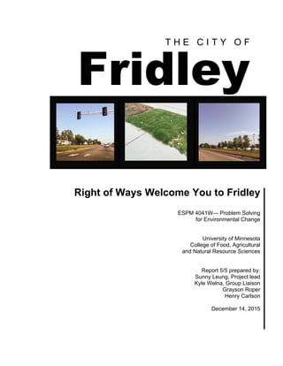
  • 1. T H E C I T Y O F Fridley Right of Ways Welcome You to Fridley ESPM 4041W— Problem Solving for Environmental Change University of Minnesota College of Food, Agricultural and Natural Resource Sciences Report 5/5 prepared by: Sunny Leung, Project lead Kyle Welna, Group Liaison Grayson Roper Henry Carlson December 14, 2015
  • 2.
  • 3. Table of Contents List of Figures ........................................................................................... ii Acknowledgments .................................................................................... iii Executive Summary ................................................................................. iv Introduction ................................................................................................ 1 Overview .............................................................................................. 1 ROWs Welcome You to Fridley .......................................................... 2 Fridley Master Plan .............................................................................. 2 Site Description .................................................................................... 3 Goals and Vision .................................................................................. 4 Methods ..................................................................................................... 5 Site Visits ............................................................................................. 5 Secondary Resources ........................................................................... 5 Societal Benefits of ROW Improvements ............................................ 6 ROW Landscape Improvements and Safety ........................................ 7 Case Studies ......................................................................................... 8 Proefssional Collaboration ................................................................... 9 Findings ................................................................................................... 10 Common Roadside Vegetation .......................................................... 10 Societal Benefits to ROW Improvements .......................................... 11 ROW Landscape Improvements and Safety ...................................... 12 ROW Rules and Regulations ............................................................. 14 Case Studies ....................................................................................... 14 Recommendations .................................................................................... 19 MN-DOT Community Roadside Landscape Partnership Program ........................................................................................ 19 University Avenue-Fridley Welcomes You (57th to 67st) ................. 19 East River Road ................................................................................. 20 Additional Recommendations ............................................................ 21 Conclusion ............................................................................................... 22 References ................................................................................................ 22 Appendices ............................................................................................... 25 Appendix A: List of Figures Appendix B: Vegetation Information i
  • 4. List of Figures Figure 1. Map of Fridley ........................................................................... 1 Figure 2. Comparison of Different ROW Designs .................................. 11 Figure 3. TH 36 Visualization Typical Section ....................................... 15 Figure 4. Results of Golden Valley Lilac Way Project ........................... 17 Figure 5. Results of Triangle Park Project ............................................... 18 Figure 6. East side shoulder on University Avenue between 57th and 61st in Fridley .................................................................................... 20 Figure 7. Example of right-of-way plan ................................................. 20 Figure 8. Illustrative view of TOD site. Island of Peace Parkway (57th Avenue) ................................................................................... 21 ii
  • 5. Acknowledgments We would sincerely like to thank the City of Fridley, notably Kay Qualley, for the continuous support and assistance in the development of this Right of Way development plan. Other members of the City of Fridley we owe thanks to include, but are not limited to; Erika Van Krevelen and Julia Jones. Additionally we would like to extend thanks to Todd Carroll and Anthony Wotzka of the Community Roadside Landscape Partnership Program (CRLPR) for all the recommendations and help in interpreting Minnesota Department of Transportation (MN-DOT) regulations and vegetation suggestions. We would also like to thank Craig Krueger, the University of Minnesota turfgrass field manager for his assistance in identification and selection of turf grass. Finally we extend a huge thank you to Tim Teynor of the City of Golden Valley and Andrew Carlson of the City of Minneapolis for answering questions related to similar Right of Way improvement projects. iii
  • 6. Executive Summary Right of Way (ROW) refers to the area designated as a transportation corridor. Improvement of Fridley’s ROWs is consistent with the City’s 2030 Comprehensive Plan which focused on aesthetics, safety features and functionality of ROWs without modifying existing structures. This report was compiled in order to provide recommendations for the improvement of ROWs that create a more inviting, safe, and functional entrance to the City of Fridley. This was done in conjunction with four other reports addressing multiple aspects of the comprehensive plan. These reports were all developed by students attending the University of Minnesota-Twin Cities in the Problem Solving for Environmental Change capstone class. ROWs can help to improve a person’s impressions of the city, and provide safety for the citizens of Fridley. The main goal was to provide an inviting, visually appealing, safe, and environmentally sustainable ROW for University Avenue that can be used in other ROWs in Fridley as opportunities arise. This area is heavily traveled in Fridley and needs improvements to regulate traffic flow and ensure a maintainable and safe speed limit. Analysis of findings on ROW improvements in other cities similar to Fridley contributed to the recommendations on the ROW improvements for the City of Fridley. Findings included ROW improvement regulations, ROW vegetation types based on site characteristics, and societal benefits from ROW improvements. Recommendations center around the Community Roadside Landscape Partnership (CRLP) Program through the Minnesota Department of Transportation (MN-DOT). The CRLP Program would provide funding and resources necessary for the implementation of ROW improvements in the City of Fridley. Landscape experts additionally extend design support throughout the planning phase to help city planners achieve their goals for the community. Vegetation suggestions as well as design recommendations should include plans for vegetative bloom, color seasonality, survivability, and safety in order to assist the City of Fridley in improvements of their ROWs that are in line with the 2030 Comprehensive Plan. iv
  • 7. Introduction Overview Fridley is a suburb of the Minneapolis-St. Paul metropolitan area located in Anoka County, Minnesota (Figure 1). It was founded as a village in 1880; however, the area was in heavy industrial use since the 1850s (City of Fridley, 2008). For the most part factories and processing mills existed from the creation of Anoka County in 1857 until the 1940s. At this point in time, two major roadways ran directly from the Twin Cities of Minneapolis and St. Paul through Fridley and from then on it became a convenient and desirable place for urban workers to settle and raise families (City of Fridley, 2008). Housing demands spiked in the 1960s and 1970s and Fridley soon became a bustling community that provided opportunities for commercial and industrial enterprises as well as a home for people working in the metropolitan area. Figure 1. Map of Fridley. 1
  • 8. Currently, Fridley’s population is 27,677 people (U.S. Census Bureau, 2013) and the two major roadways that contributed to its rapid growth in the past (Highway 65 and Interstate 694) became the transport route by which countless people used to get to and from their places of employment. Fridley is recognized as a top-ranking industrialized city in Minnesota but it is also home to a vibrant community that has created successful businesses and naturalized recreation areas for itself. Unfortunately most people’s perception of Fridley is restricted to the corridors that run straight through the city. Students from the University of Minnesota in the College of Food and Agricultural Sciences have joined the planners from the City of Fridley to devise ways in which Fridley’s most crowded roadways can still reflect the beauty that is evident throughout the rest of the community. Research and planning will be dedicated toward ROW improvements along these corridors that will aid in their development of an inviting, safe and ecologically sound transportation system. ROWs Welcome You to Fridley A ROW refers to land that is reserved for a transportation corridor. It is usually acquired by the government through a land easement that serves as both the surface for the road as well as any traffic buffer strip on the shoulders or in medians. The strips of land that surround the road as well as the medians were originally designed with only the safety of the driver in mind and consisted of mown turf and weeds. More recently however, a greater emphasis has been placed on enhancing the visual and environmental aspects of ROWs. Ideal ROWs feature design elements that allow for stormwater filtration and redirection as well as pollinator corridors that strengthen the surrounding ecosystem and bring life to a concrete jungle. There is a considerable amount of land devoted to ROWs in Fridley especially along most of the major north to south minor arterials such as University Avenue and East River Road. In a city that experiences a high volume of traffic with no starts or endpoints anywhere in Fridley itself (City of Fridley, 2008), these ROWs can embody the overall appearance of the entire community. This is why it is important for these corridors to not only provide safe, efficient driving conditions but also generate visually appealing surroundings. In Minnesota, the Department of Transportation (MN-DOT) is the primary agency that creates, maintains and improves the status of ROWs. With this in mind, it is important that the development and implementation of this project be in accordance with ROW regulations. Fridley Master Plan The 2030 comprehensive plan of Fridley is designed to assist the Metropolitan Council’s responsibility of preserving and managing natural resources, the 2
  • 9. transportation system and community improvement. The 2030 comprehensive plan was completed in 2008, and a new version is updated every ten years. The comprehensive plan of Fridley aims to improve the ROW system and to provide a safe, beautiful, and convenient transportation system throughout the community. The primary focus of Fridley's transportation plan is to improve mobility of community roadways while protecting the existing infrastructure (City of Fridley, 2008). This project addresses several of the noted goals either directly or indirectly through design features that enable a positive interaction between the residents and their transportation network. Fridley has also recently been accepted into a voluntary challenge, assistance, and recognition program known as GreenStep Cities. Greenstep Cities is a program that lays a framework for communities to reach their environmental and livability goals. One of best practices suggested by the GreenStep Cities program under transportation is the “Living Streets” protocol that lists several actions to “Create a network of green complete streets that improve city quality of life and adds value to surrounding property” (Minnesota GreenStep Cities, 2009). There are several action steps shown to reach this best practice and several address the need for stormwater management and street trees. The recommendations provided in this project will certainly line up with several of the Living Streets goals found in Greenstep Cities. Site Description University Avenue University Avenue is a major commuter route that runs north to south through Fridley, connecting I-694 to Highway 10 North of Fridley (see Figure 2 in Appendix A). An estimated 46,100 people will commute along this four-lane corridor daily in 2030 (City of Fridley, 2008) making it an area of Fridley that is widely seen by Minnesota citizens, whether they live in Fridley or not. University Avenue is a state roadway that contains a considerable amount of ROWs in the form of both surrounding strips and a continuous median. The composition of these expansive plots of land is generally grass and weeds. In addition, there is a substantial amount of impervious surface along the shoulders and on sidewalks and crosswalk areas that drain stormwater directly into the city’s drainage system. This roadway experiences a very high traffic volume on a daily basis but it also separates the eastern and western portions of Fridley. Many residents that live in the community cross University either by automobile or by walking and biking. The ROWs on this corridor are mowed by city employees once a month. East River Road A north/south road that runs along the Mississippi River, East River Road is a more scenic route with a slower speed limit and large areas of turf on either side of the road 3
  • 10. and in the median. A predicted 23,000 vehicles in 2030 will commute along East River Road daily (City of Fridley, 2008) meaning that this is a well-travelled route that has the potential to make a greater impression on motorists. The maintenance of this corridor appears to be inconsistent (East River Road Corridor Study in Fridley and Coon Rapids, 2012), leading to conflicting visual quality along the road. On the southern end of East River Road where it meets I-694, there is a major plan underway called the Northstar TOD (Transit Oriented Development) Master Plan. This plan includes connecting a train from downtown Minneapolis to the area, making it much easier for people to commute (City of Fridley, 2014). Also light industrial and residential areas will be constructed along East River Road near this connection (City of Fridley, 2014), making visual quality along East River Road very important for future residents/employees of the City of Fridley. Goals and Vision With new housing development underway, making the ROWs not only aesthetic and inviting, but ecologically sound will benefit the city of Fridley in many ways. First, improving people’s initial impressions as they enter the city means they are much more likely to stop at a local businesses, parks etc. Second, improving the livability of a main corridor in the city will draw people toward the idea of moving there and making Fridley their family’s home. The improvement to visual aesthetics along these corridors will not only provide the community with a sense of pride but also hopefully create safer driving conditions. University Avenue has several intersection crossings that are used heavily by pedestrians and cyclists and the current speed of traffic on this road poses dangers for these residents. By placing visual barriers along medians that are additionally safe to drivers will help regulate the flow of traffic and ensure a safe and comfortable speed limit. Additionally the completion of this project aids objectives set forth by the Urban Forestry group. The inclusion of certain ROW features such as trees contributes to increased canopy cover and diversity of tree species. Our deliverables for this project will include: 1. Recommendations for vegetation mixes on University Avenue. These mixes: • Provide a visual barrier separating opposing traffic lanes and zones east and west of roadway. • Offer societal benefits in the form of pollution abatement and increased property value • Offer aesthetic benefits to the landscape of this roadway • Are in accordance with MN-DOT rules and regulations for ROW design 2. Recommendations for an additional ROW improvement project in Fridley on East River Road 3. Additional recommendations to improve success rate of projects 4
  • 11. Methods Site Visits To assess and categorize the sites for this project, visits were carried out on September 15 and September 21, 2015. Several photos were taken along the corridors and intersections were navigated by foot at Mississippi Street and University Avenue, 61st Street and University Avenue and Mississippi Street and East River Road. During these visits several existing ROW features were noted and targeted. Assessment of these features was based on a visual and ecological spectrum. Areas targeted for improvement were found to be wide-open spaces with turf as the primary vegetation. The navigation of crosswalks helped in identifying areas along University Avenue where traffic seems dense, fast, and hazardous to nonmotorists. Secondary Resources ROW Vegetation Identifying the correct vegetation needed to achieve all of the goals stated earlier required categorization of plants based on a series of criteria. Using a variety of public literature, vegetation was chosen based on a list of technical criteria that would lead to successful growing conditions and a pleasing design. Recommended vegetation had to be sustainable on roadway conditions in the Anoka Sand Plain Area. Initial focuses were vegetation (grasses, forbs, bushes and trees) that withstand growing conditions of ROWs in Minnesota. Several Minnesota agencies and institutions, such as the Minnesota Pollution Control Agency (MPCA), MN-DOT, Minnesota Department of Natural Resources (MNDNR), and the University of Minnesota Extension offers base line lists of plants that survive in these conditions. Next, this preliminary list of vegetation was cross referenced with a list of plants from a MN-DOT plant selection manual of native plants able to grow in the soil characteristics of Fridley (Anoka Sand Plain). Finally, all requirements set forth by MN-DOT that relate to the limitations of vegetation planting on ROWs were reviewed using MN-DOT’s handbook for roadside engineers. A tool that was used throughout this entire process was the MN-DOT plant selector which was available through http://dotapp7.dot.state.mn.us/plant/apps/link/glossary.html. This tool enabled the researchers to browse a vast series of plants based on the variety of criteria that fit the project corridors. This stepwise process to single out vegetation made certain that the recommendations put forth fulfilled the important goals of this project but also remained realistic. The following sources were used to gather information about vegetation recommendations: 5
  • 12. Vegetation with roadway tolerance: • The Best Plants for 30 Tough Sites, UMN Master Gardeners http://www.extension.umn.edu/garden/yard-garden/landscaping/best-plants-fo r-tough-sites/docs/08464-complete.pdf • MN-DOT Plant Selector http://dotapp7.dot.state.mn.us/plant/apps/link/glossary.html • Plant Selection, SULIS: Sustainable Urban Landscape Information Series http://www.extension.umn.edu/garden/landscaping/plant/ • Salt-Tolerant Roadside Grasses: Does Anything Actually Survive?, UMN Turf Sciences http://turf.umn.edu/2015/01/salt-tolerant-roadside-grasses-anything-actually-s urvive/ • Seeding Manual 2014, Edition Office of Environmental Stewardship Erosion Control Engineering Unit (MN-DOT) http://www.dot.state.mn.us/environment/erosion/pdf/seedingmanual.pdf • Tough Trees and Shrubs for Tough Sites, UMN Extension. http://www.extension.umn.edu/garden/yard-garden/trees-shrubs/tough-trees-a nd-shrubs-for-tough-sites/ Vegetation native to Anoka sandplain: • Minnesota Plant List, MPCA Minnesota Stormwater Manual http://www.pca.state.mn.us/index.php/water/water-types-and-programs/storm water/stormwater-management/plants-for-stormwater-design.html • MN-DOT Plant Selector • Plant List for Anoka Sand Plain, Minnesota's St. Croix Valley and Anoka Sandplain: A Guide to Native Habitats (MN-DNR) ROW rules and regulations: • MN-DOT Design-Build Program, Book 2, Section 11.3.3.3, Snow Storage • MN-DOT Road Design Manual 4-6(6), Clear Zones http://roaddesign.dot.state.mn.us/ • Minnesota Statutes on Speed Limits, Section 169.132 Societal Benefits of ROW Improvements An important aspect of this project was the influence these ROW improvements have on the community of Fridley. To fulfill the societal benefits that are important in this project, an understanding of the connection between ROW improvements and motorist perception was needed. This was carried out through the research of three central themes in roadside landscaping: the perception of ROWs from the standpoint of a driver, the influence these ROWs have on surrounding commercial and residential properties, and the benefits to air and water quality in the community. A great deal of literature has been published (some of which in Minnesota) to identify ROW themes that seem to be preferred by motorists in certain sociodemographic 6
  • 13. situations. In addition to this, scientific literature was analyzed that looked into direct increase in property value with inclusion of urban forestry. This research was compiled from a series of scientific journals and state-funded studies and demonstrated some of the qualitative benefits of ROW improvements. The following sources were used to gather this information: • Evaluation of Methodologies for Visual Impact Assessment. Churchward, C. Palmer, J.F. Nassauer, J.I. and Swanwick, C.A. http://onlinepubs.trb.org/onlinepubs/nchrp/nchrp_rpt_741.pdf • Northstar TOD Plan, City of Fridley • The Restorative Effects of Roadside Vegetation Implications for Automobile Driver Anger and Frustration. Cackowski, J. M. Nasar, J. L. 2003. http://eab.sagepub.com/content/35/6/736.short • Identified Benefits of Community Trees and Forests. Coder, R.D. http://www.nfs.unl.edu/documents/communityforestry/coderbenefitsofcommtrees .pdf • Air pollution removal by urban trees and shrubs in the United States. Nowak, D.J., Crane, D.E. Stevens, J.C. http://www.fs.fed.us/ne/newtown_square/publications/other_publishers/OCR/ne_ 2006_nowak001.pdf • The value of urban tree cover: A hedonic property price model in Ramsey and Dakota Counties, Minnesota, USA. Sandera, H. Polaskyb, S. Haightc, R.G. http://www.researchgate.net/publication/46490655_The_value_of_urban_tree_co ver_A_hedonic_property_price_model_in_Ramsey_and_Dakota_Counties_Minn esota_USA ROW Landscape Improvements and Safety One of the underlying goals of this report was to create safer conditions for motorists and nonmotorists alike. To better understand how and when ROW improvements aid in traffic calming, research into a variety of different published works was completed. Statistics that describe common collision accidents off highways and other injuries related to roadway accidents were used to show patterns in ROW design. This report also utilized a body of research that explains some of the behavioral changes motorists undergo when using roadways that contain ROW improvements. The data used for this section came from the following sources: • The Restorative Effect of Roadside Vegetation; Implications for Automobile Driver Anger and Frustration. Cackowski, Jean. http://eab.sagepub.com/content/35/6/736.short • Landscape improvement impacts on roadside safety in Texas. Moka, J.H. Landphairb, H.C. Naderic, J.R. http://www.treelafayette.net/downloads/roadside_safety_TX.pdf 7
  • 14. • The Built Environment and Traffic Safety A Review of Empirical Evidence. Ewing, R. Dumbaugh, E. http://jpl.sagepub.com/content/23/4/347.abstract • Urban Trees and Traffic Safety: Considering U.S. Roadside Policy and Crash Data.Wolf, K.L Bratton, N. http://www.fs.fed.us/pnw/pubs/journals/pnw_2006_wolf001.pdf • Urban Trees and Roadside Safety. Turner, D.S. ASCE. Mansfield, E.R. http://rns.trb.org/dproject.asp?n=34923 Case Studies Case studies were used in this report to help understand the background of ROW improvement projects and to provide an illustrative layer of what has been done in the past. These case studies were carefully chosen among a range of ROW improvement projects and chosen based on their relatability to University Avenue and East River Road. The specific climate in Minnesota along with the rules and regulations of MN-DOT disallow comparison of many ROW improvement projects that have been completed elsewhere in the nation. These case studies were analyzed using three principles: Relatability: The case studies chosen had to be comparable to the various economic, technical and political factors that this project faces. The projects in these case studies had to have similar roadway features such as the speed limit, amount of lanes and presence of pre-existing ROW features. Practicality: The cost and overall effectiveness relative to the incurred costs of these projects was also measured. An analysis of the labor required for the implementation and ongoing management of these projects was done. Limitations to the completion of these projects were also discussed. The monetary costs associated with these projects were not included as this information was not available publicly. Results: These case studies were finally investigated to see whether the ROW improvements implemented performed any of the goals envisioned in this project. Did they perform any stormwater mitigation effects? Were the features both aesthetically pleasing and also beneficial to the safety of motorists and pedestrians? This section also looked at any technical support received from government and nongovernment agencies alike. Very little information was available for some of the case studies analyzed. Knowledge about maintenance, road characteristics, responsibilities and specific plantings was typically not found in project overviews. To obtain this knowledge, scheduled phone interviews were carried out. On Thursday, November 19, 2015 Tim Teynor was contacted regarding the Lilac Way project in Golden Valley. On 8
  • 15. Tuesday, November 24, 2015 Andrew Carlson was contacted regarding the Triangle Park project in Minneapolis. The questions below served as the guiding format for conducting the phone interviews. Case Study Questions: Project site and characteristics • Original plantings, speed limit, intersections etc. How did the project come to be? • Original goals, starting entities What criteria were used when deciding on vegetation design? • Seasonality, tolerance, visual preference What initial investments were made? What help was given? • Grants, programs, volunteers What are some of the ongoing maintenance requirements and who is responsible? What was the response from the community? Was it considered a success? What were the limitations of the project or problems encountered? • Regulatory restrictions, technical issues, project approval etc. ROW Improvement Projects Used for Analysis • Little Bohemia (W 7th St) • St. Croix River Crossing Project; MN TH 36, MN-DOT • Lilac Corridor Golden Valley • Triangle Park Minneapolis Professional Collaboration With the extensive secondary information used and cited in this report, additional resources were accessed in the form of experts. There is a considerable amount of research online related to appropriate vegetation and design features but it was essential that we worked closely with MN-DOT, the City of Fridley and the University of Minnesota in order to ensure the best choices were used. From the City of Fridley, Environmental Planner Kay Qualley was consulted various times from September to December by personal meetings and email. Ms. Qualley and her colleagues as representatives of the City of Fridley were the primary clients of this proposal and all input from them was taken into consideration. A Landscape Design Specialist from MN-DOT, Tony Wotzka, was also consulted as the primary resource for regulatory and technical aid regarding ROW improvement projects. An interview between the research group, City of Fridley representatives and Wotzka took place on October 29, 2015, for roughly two hours regarding the Community Roadside Landscape Partnership, a program offered by MN-DOT. A dialogue was carried out regarding MN-DOT’s potential help in carrying out this project. Mr. Wotzka, as a manager of past ROW projects, agreed to provide technical support for this research project. 9
  • 16. Findings Common Roadside Vegetation Roadside vegetation was analyzed for factors that allowed certain species to grow on the specified sites. Factors included salt-tolerance, growing size, seasonal activity, and soil growing conditions. Salt-tolerance of selected plants were categorized into either moderate or tolerant salt-tolerance in which plants exhibit little to no evidence of disfigurement, growth reduction, and dieback (MN-DOT Glossary). Other factors taken into consideration include visually appealing aesthetics, roadside planting regulations and availability (Bailey, 2011). The following plants were found to be appropriate for the site conditions and are available at local wholesale nurseries (e.g., Bachman's, 2015; Bailey Nurseries, Inc.). These specific plants were also chosen due to their aesthetic values of flowering seasonality and color; assembling a variety of possibilities, and they all have moderate to high attractiveness to wildlife for pollinator corridors according to the MN-DOT PlantSelector. A pollinator corridor both attracts and provides nourishment for a variety of pollinators and increases connectivity for terrestrial habitat. Some examples include but are not limited to: • Grasses: - Sheep (Blue) Fescue • Forbes: - Black Eyed Susan, Butterfly Milkweed, Prairie Smoke, Stella d Oro Daylily, Silky Aster • Shrubs: - Dwarf Bush-Honeysuckle, Grow-Low Sumac, Staghorn Sumac • Trees: - Crabapple, Japanese Tree Lilac, Staghorn Sumac A full list of vegetation can be found in (see Table 1 in Appendix B). Grass seed mixtures were found locally through JRK Seed Turf Supply. Recommended seed mixtures are either the JRK Highway 500 Mesic (Wet) Mix or the JRK Highway 500 Dry Mix. Use of these seed mixtures are dependent on whether a site has drier or wetter conditions; both are low maintenance and salt-tolerant. Mixes can be found in (see Table 2 in Appendix B) and are available through the vendor JRK Seed Turf Supply. For photos of these examples, see Figures 14-24 in Appendix B. 10
  • 17. Societal Benefits to ROW Improvements There has been a recent shift in the landscaping of ROWs in the U.S. Originally the use of high input turf (Kentucky Bluegrass) with straight mowing patterns was common on ROWs as it was thought to be well kept and manicured. This view has changed in the past few decades as bodies of research continue to point out that there is a very strong link between a motorist’s visual experience and their aesthetic preferences (Churchward, Palmer, Nassauer, Swanwick, 2013). This connection not only has serious impacts on the driver's personal experience but also creates context for the broader landscape and paints a picture of the surrounding community. Figure 2. Comparison of different ROW designs (Nassauer, Dayrell, Wang, 2006). A survey study completed in Minnesota sought to explore this connection in detail to determine what sort of roadway features inhibit a positive experience for motorists in both urban and rural settings. An analysis of the findings proved that vegetation design affected driver perception more than any other variable tested (road characteristics, surrounding structures etc.) (Nassauer, Dayrell, Wang, 2006). The vegetation design that was viewed as the most attractive, safe, well-maintained and natural in urban settings was a flowery prairie ROW landscape. In addition to this a “single straight swath of mowed turf” was the most attractive mowing pattern 11
  • 18. suggesting that limited use of turf is preferred (Nassauer, Dayrell, Wang, 2006). These results attempt to deconstruct the seemingly subconscious experience of drivers in urban settings and prove that certain landscape features do indeed affect the outcome of aesthetic preference. The positive benefits related to improved ROW features are not confined to motorists. There are various societal advantages to well-designed ROW improvements that improve economic value of attractive landscapes and public health. Many of these advantages are connected with the placement of small trees and shrubs along roadways. Several studies have highlighted the outstanding increase in property values with the introduction of trees to residential areas and along streets (Coder, 1996; Sandera et al., 2010). The presence and proximity of trees is strongly correlated to the value of property in suburban areas as shown by the overall real estate value and the value of building lots that have had the trees removed versus those where trees were retained (Coder, 1996). A study in Ramsey County Minnesota showed that residents preferred tree cover in their immediate neighborhood along streets and that this generally increased real estate values (Sandera et al., 2010). On average, parcels up to 100 m (around 300 ft) from tree canopy in these counties had a 44% increase in property value. The increase in value could also be linked to noise abatement of surrounding traffic. By placing living fences along busy corridors, noise from traffic is absorbed and reflected by trees. Trees also create “white noise” from wind which additionally masks highway sounds (Coder, 1996). Using living vegetation along these corridors has the potential to improve air and water quality through a series of ecosystem services. Trees and shrubs in urban settings especially have a lot of influence on surrounding air quality. Through removal of volatile compounds and particulates (Nowak et al., 2006), trees and shrubs on roadways will certainly reduce any negative air quality effects from traffic emissions. They are also actively storing carbon dioxide, a mechanism that helps reduce an area’s contribution of greenhouse gases. Using vegetation with extensive rooting systems instead of simply turf-grass is also a great way to improve water quality in areas surrounded by impervious surface. Water is allowed to filter through these networks and harmful effects of chemicals or nutrients are better phased out (Coder, 1996). ROW Landscape Improvements and Safety The context of ROW landscaping has very important implications in the speed and control of traffic. Not only do certain ROW vegetation designs influence a positive relationship between motorists and aesthetic experience but there also seems to be a correlation with crash rates. In a research experiment conducted in Texas, 10 sites were tested for crash frequency before and after landscape improvements on ROWs. 12
  • 19. The results showed that significant decreases in crash frequency occurred along all improved sites in the experiment (Moka, Landphairb, & Naderic, 2006). A similar experiment taking place in Toronto, Canada displayed similar results. This quasi-experimental approach looked at five different roadways and found that the presence of roadway features such as trees, sidewalks and other immediate features reduced mid-block accidents by 5-20% (Ewing & Dumbaugh, 2009). When looking at larger areas instead of specific roadways, there was again corresponding results with lower crash rates in village areas containing multiple land use features and more pedestrians (Ewing & Dumbaugh, 2009). All of the ROW features in these studies followed their site specific roadway regulations such as clear zone and plant height requirements. While these studies indicate that safety is improved with ROW features some still believe that trees introduce immense hazard on their own. The presence of trees along roadways has always been a concern to roadway engineers and city planners. Logic states that the placement of a fixed object close to the road increases the chance for severe or fatal injuries along roadways. Through analysis of tree collision data, however, studies have identified threads that suggest trees pose little danger to motorists in urban settings (Wolf & Bratton, 2006; Turner, ASCE, & Mansfield, 1990). When comparing rural and urban tree collision data, the majority of fatal accidents occur in rural settings (Wolf & Bratton, 2006; Turner, ASCE, & Mansfield, 1990). Of the minority tree collision accidents in urban settings, one study showed that more than 70% of these involved intoxicated motorists (Wolf & Bratton, 2006). Some theories have sought to explain this phenomenon. One proposes that a driver’s sense of security and safety are often misunderstood and confused with one another (Ewing & Dumbaugh, 2009). While moving through landscapes with little to no ROW features there is a false sense of driver security (or perception of safety). The absence of collidable objects encourages the driver to inherently engage in riskier and less safe behavior. In scenarios where drivers are subjected to narrow corridors and constantly observing nearby features, security is effectively decreased and prudent driving practices are a result. There was also an observed reduction in driver frustration with the incorporation of parkway and vegetative design on roadways in a study (Cackowski & Nasar, 2015). This might further explain some of the preventative and cautious driving behaviors of drivers in restricted urban corridors. While further research into the subject is needed it is clear that in urban settings, using trees in ROWs has the potential to increase safety for both motorists and pedestrians. 13
  • 20. ROW Rules and Regulation Determining the rules and regulations governing the ROWs in the state of Minnesota was essential for further understanding Fridley’s ROW improvement limitations. Perhaps the most important of these regulations has to do with “sight lines.” Sight line describes the open area that citizens or drivers are able to see while traveling on the road. Blocking these sight lines with vegetation or other barriers can be detrimental to the overall safety of the roadway, especially near intersections (MN-DOT, Section 11, Roadways). It is because of the importance of these sight lines that we will not be recommending the addition of vegetation that breaks the sight line to the median on University Avenue. Sight lines also come into play on the shoulders of roads, and MN-DOT requires at least 10 feet of turf on the shoulder of roads before any sight blocking vegetation or objects can be placed there. This is to ensure that 80-85% of “run-off-the-road” vehicles to either recover or come to a safe stop (MN-DOT, Section 11, Roadways). The necessity of storage space for snow that is pushed off roads during the winter months calls for at least 10 feet on either side of the roadway. Speed limit is a big determinant when it comes to what is acceptable within ROWs. University Avenue was classified as a 55 mph zone (Minnesota Statutes on Speed Limits, 2015). The City of Fridley felt that this was too fast for University and was able to get MN-DOT to decrease the speed limit to 50 mph. Decreasing the speed limit another 5 mph to make it 45 mph could potentially have great benefits to the safety of the corridor, and to accomplish this MN-DOT would have to carry out an official engineering and traffic investigation (Minnesota Statutes on Speed Limits, 2015). With each increase of 5 mph, MN-DOT calls for an extra amount of space in the ROW to accommodate the increased imposing danger of a crash. For example, an increase of the speed limit from 50 mph to 55 mph requires the clear zone to go from 11 feet up to 13 feet (MN-DOT, Section 11, Roadways). Ditch traversability is the ability of a car to run off the road and maintain control, which means the grade or steepness of the ROW ditch is also determinant on speed limit, and curvature of the road. Case Studies St. Croix River-Crossing Project The St. Croix River-Crossing Project is a plan to connect Oak Park Heights, MN, over the St. Croix River and state boundary to St. Joseph, WI. The section of the project in consideration is chapter 2, TH 36. Minnesota Trunk Highway 36 (TH 36) is a highway that starts in Minneapolis and runs east to west to Stillwater, MN, which is just before the Minnesota/Wisconsin border at the St. Croix River. It is the western boundary of the St. Croix River-Crossing project. TH 36 is a four-lane divided roadway that sees about 30,000 vehicles per day and is projected to serve approximately 55,000 people by 2030. The Visual Quality Review Committee 14
  • 21. (VQRC) for this project particularly noted the unpleasant aesthetics and they saw this as an opportunity to improve upon the safety and visual harshness of this part of the highway. Relatability: Both TH 36 and University Avenue display retail/strip development, vast parking areas, frontage roads, are both seen as being unfriendly for pedestrian use, and both carry about the same amount of daily traffic. Aesthetic improvements could be made to both to diminish the harshness and openness of the roadsides with native shrubs and grasses. Practicality: One way that this project could be completed is through extensive use of volunteers in cooperation with MN-DOT. Using the MN-DOT Community Roadside Landscape Partnership program would mean that the state agency would provide the necessary materials, tools and knowledge to effectively improve the corridor at a small cost. Raising awareness in the area would inform citizens about what is going on and in many other projects this has sparked their desire to get out and better their community. Figure 3. TH 36 Visualization Typical Section (Minnesota Department of Transportation, 2007). Results: Once this project is completed it will have successfully eliminated the view of opposing traffic. In doing so, the vast openness will be diminished leading to a corridor that feels safer and is much more enjoyable to commute on. Having a more naturalized look will improve upon the aesthetics of the corridor while at the same time providing more of a connection with surrounding forest canopy and extending habitat across multiple species. 15
  • 22. Lilac Way Project The Lilac Way project in Golden Valley, MN was initiated in the fall of 2008 after the city council approached MN-DOT for a proposal on US highway 55. The project currently extends roughly 2 miles from Highway 169 to Douglas Drive (see Figure 4. in Appendix A) and features extend along left and right shoulders for a majority of this stretch. These features include a wide variety of lilac trees and shrubs as well as black chokeberry to fill in flooded spots. This project was made possible with the Community Roadside Landscape Partnership (CRLP) program offered by MN-DOT and phase one was completed in 2013. Proposals have been filed to initiate phase two starting 2016. Relatability: Highway 55 in Golden Valley has many similarities to University Avenue in terms of roadway characteristics. It has a speed limit of 55, however, this fluctuates near Highway 169 and the stoplight at Douglas Drive, much like University Avenue. It is a four-lane highway divided by a turf median with several intersections many of which containing stoplights. Before the project took place the ROWs consisted of only turf with noticed rubble and unsound foundry underneath that took time to fix. The developments just outside of the ROWs are also similar to University Avenue in Fridley. Although there is no steel fence separating properties from the highway, both residential areas and intermittent businesses are visible from the road. Practicality: Working with MN-DOT, Golden Valley was able to avoid a considerable amount of time and money with this improvement project. The CRLP of MN-DOT provided all necessary money for the planting materials such as the mulch, fertilizer and plantings themselves. Landscape designers in the program also took care of a lot of the planting designs and budgeting information. The planting and ongoing maintenance of the project was carried out mainly by city staff. It was noticed that volunteer recruitment was difficult during planting sessions in late spring and early fall near holidays and little ongoing maintenance was done by city residents. All watering was done initially by tank truck which proved to be inefficient and weeding was done by a few diehard residents, businesses and some committees (in addition to city staff). Over the five- year period of phase one, maintenance was somewhat ineffective and phase two was postponed for this reason. Golden Valley gained more support after results of the project were visible to residents and volunteers became more involved. Results: After the coordination of ongoing maintenance through the help from businesses, some residents and city staff, the Lilac Way project has reached its highest potential. There has been positive feedback from the community (depending on the season) and businesses are optimistic about the visual improvement of their surroundings. Data is lacking on the speed of motorists in this corridor as well as the magnitude of runoff water collected. However, the movement into phase two of this program after five 16
  • 23. years is proof that no negative effects were noticed in motorist safety or environmental impact. In 2015, Golden Valley was presented the Minnesota Community Forestry Treescape Award given by the Minnesota Shade Tree Advisory Committee for their outstanding community involvement and dedication to urban forestry. Figure 4. Results of Golden Valley Lilac way project. (City of Golden Valley, 2013) Triangle Park Minneapolis Triangle Park was created by the City of Minneapolis in 1975. It is uniquely located between the on and off ramps of Highway 35W in South Minneapolis and bound by South 10th Street to the north (see Figure 7-11 in Appendix A). Up until the mid-2000s the park consisted of scattered honey locust trees and was recognized for its panhandlers and criminal activity. The Triangle Park improvement project was started in the fall of 2013 and continued throughout 2014. The parcel now consists of a variety of trees (Japanese Yew, Eastern Hemlock) shrubs (ninebark, meadowlark Forsythia and Annabelle among others), and forbs. The recent Triangle Park project was proposed by a nonprofit volunteer group, The Friends of Triangle Park, and completed in conjunction with the City of Minneapolis and MN-DOT. Relatability: Although Triangle Park is unique in its ROW dimensions, there are many characteristics similar to University Avenue in Fridley. It exists in an area with radically shifting speed limits coming on and off the highway. This is consistent with both the connecting ramps of Highway 694 to University Avenue and the various stoplight intersections. In addition, very few landscaping features existed before the project besides scattered trees and turf. The area is a bit more urbanized than Fridley and is surrounded by more development in the form of commercial businesses and large scale residential areas. 17
  • 24. Practicality: The Friends of Triangle Park were ongoing patrons of this parcel of land before the CRLP program was initiated in 2013. The group consists of voluntary members both local residents and business owners that sought to improve the livability and scenic beauty of their local park. They had been successful in smaller scale planting in the park with fundraising and reliable, continuous labor. This particular CRLP project required additional funds for materials which MN-DOT supplied. Planning for vegetation and design was done mostly through a MN-DOT landscape designer. Most of the primary planting and maintenance thereafter was left to the Friends of Triangle Park (see Figure 8 & 9 in Appendix A). Additionally the City of Minneapolis had organized Sentence to Service (STS) groups to do weeding, planting, and mulching throughout the summer of 2014. There has been no shortage of help for this project and the site is maintained with pride through the help of an organized local nonprofit. Results: One of the biggest successes for this project was the level of connectivity it offered to the surrounding community. Pedestrians and other nonmotorists now have a beautified area that offers easier access to surrounding neighborhoods. Additionally this project ran into almost no limitations or setbacks throughout the planning and implementation phases. This was associated with clear communication between all entities involved as well as a concrete and reliable volunteer group. Additionally, The Friends of Triangle Park were awarded the Downtown Improvement District Greening and Public Realm award in the summer of 2014 for their contribution to this project. Figure 5. Results of Triangle Park project. (Friends of Triangle Park, 2015). 18
  • 25. Recommendations MN-DOT Community Roadside Landscape Partnership Program MN-DOT actively works with communities and volunteers on roadside landscaping partnerships in order to add aesthetic value to ROWs. Many projects of similar magnitude have been designed and completed by the MN-DOT community roadside landscape partnership program. A majority of the case studies analyzed were projects completed through the CRLP program and are considered success stories. Working in close conjunction with MN-DOT would provide additional funding and resources to improve the City of Fridley ROWs. Working through this program would either require a community-designed project and an approved application or a MN-DOT assisted design. In the assisted design, a member of MN-DOT would aid the community in designing a ROW design that aligns with the various goals of Fridley. University Avenue-Fridley Welcomes You (57th to 61st) This site is targeted mainly for its high volume of traffic and therefore visual impact with drivers that use University Avenue for transportation only. This corridor is located just north of US highway 694 and motorists routinely entering and exiting this highway are constantly viewing this section. With sizeable new development underway in the form of a large upscale apartment complex (Cielo), this site will become the home of many Fridley residents. In addition to the project goals stated earlier, the following design concepts were taken into consideration: MN-DOT Approval: • ROW plantings must be tolerant/avoid close proximity to snowplowing operations. • Trees in plantings must pose little to no danger with traffic. • Plant height must not inhibit sight lines. - Create a pattern of forbs and trees that are positioned to bloom in different seasons - Plant materials should be available at local vendors The following vegetation were chosen based on the variety of criteria needed for this site: • Grass: Sheep (Blue) Fescue • Forbs: Black-Eyed Susan, Butterfly Milkweed, Prairie Smoke, Stella d Oro Daylily, Silky Aster • Shrubs: Dwarf Bush-Honeysuckle, Grow-Low Sumac, Staghorn Sumac • Trees: Crabapple, Japanese Tree Lilac, Staghorn Sumac (all less than 4" diameter stems) 19
  • 26. Example ROW improvement diagram, simplified to plantings of trees, shrubs and forbs with a two- to three-foot buffer of grass on either side of the roadside. (Trees in dark green, shrubs in light green, forbs in red with grasses present elsewhere.) • Vegetation Quality Assessment Manual by the Government of Victoria (http://www.depi.vic.gov.au/__data/assets/pdf_file/0009/228771/VQAM-V1_ 3-Chapters-1-11.pdf) Figure 6. East side shoulder on University Avenue between 57th and 61st in Fridley (Google Map, 2013). Figure 7. Example of right-of-way plan. East River Road Depending on the success of University Avenue, the City of Fridley should certainly consider a ROW improvement project just north of the Highway 694 exit on East River Road. The various developments underway in this area will bring in new residents and serve as a transportation hub between Fridley and the Twin Cities (City of Fridley, 2014). The design for these ROW improvements would include a series of 20
  • 27. pollinator corridors along the sides of the road. These pollinator corridors will include various flowers found in Appendix B. Examples of possible flowers for pollinator ROWs include but are not limited to: Bertie Ferris Daylily, Black-Eyed Susan, Butterfly Milkweed, Carefree Peach Daylily, Dotted Blazingstar, Golden Prize Daylily, Hairy Vetch, Hyperion Daylily, Prairie Smoke, Purple Prairie Clover, Red Clover, Silky Aster, Stella d Oro Daylily, Tawny Daylily, and White Clover. Figure 8. Illustrative view of TOD site. Island of Peace Parkway (57th Avenue) (City of Fridley, 2014) Additional Recommendations • Begin proposal of CRLP program by coordinating city officials with MN-DOT landscape professionals. • Contact businesses that are close to ROW or visible on this corridor. They have been willing to aid in maintenance of areas close to property in past projects. • Coordinate with the County of Anoka to request STS groups for maintenance of project area in spring and summer. • Design planting and maintenance standards for the project. - Coordinate in-house training with city staff. - Utilize University of Minnesota’s Master Gardener program. Contact Anoka County's Master Gardener program coordinator through the UMN Extension Program. (http://www.extension.umn.edu/garden/master-gardener/contact/county/) 21
  • 28. • Before planting, have professional landscaper or engineer walk the site physically looking for presence of large rocks, rubble or any other immovable objects that would restrict plantings. • Conduct plant performance assessments every spring to document the success and failure of certain species. Make the adjustments necessary for future plantings. Conclusions ROW improvements are a valuable way for the City of Fridley to gain aesthetic value as well as improving the safety of their roadways. This report contained recommendations for the improvement of ROWs in the City of Fridley based on finding gathered through case studies and qualitative data. Engagement in this project would provide residents the opportunity to volunteer during initialization, preparation and implementation. ROW modifications will allow the City of Fridley to improve its visual image for highway commuters and provide better safety measures for both commuters and pedestrians. References Bachman’s. 2015. Bachman’s Wholesale Nursery & Hardscapes 2015 Wholesale Catalog. Bailey Nurseries. 2011. Bailey: 2011 Catalog. Cackowski, J.M., and J.L. Nasar. 2003. The restorative effects of roadside vegetation implications for automobile driver anger and frustration. Environment and Behavior 35-736-51. Retrieved from http://eab.sagepub.com/content/35/6/736.short Carlson, A , e-mail message to author, November 24, 2015 Churchward, C., J.F. Palmer, J.L. Nassauer, and C.A. Swanwick. 2013. Evaluation of Methodologies for Visual Impact Assessment. National Cooperative Highway Research Program. Retrieved from https://static1.squarespace.com/static/52a213fce4b0a5794c59856f/t/553a8a12e4b 0bada3c80df07/1429899794875/13ChurchwardPalmerNassauerSwanwicknchrp_r pt_741.pdf City of Fridley. 2009. City Comprehensive Plan of 2030. Retrieved from http://www.ci.fridley.mn.us/567/Comprehensive-Plan. City of Fridley. 2009. Comprehensive plan of Transportation in 2030. Retrieved from http://www.ci.fridley.mn.us/DocumentCenter/Home/View/663 City of Fridley. 2014. Northstar TOD District Master Plan. Retrieved from http://www.ci.fridley.mn.us/DocumentCenter/View/926 22
  • 29. City of Golden Valley. 2013. Lilac Project. Retrieved from http://www.goldenvalleymn.gov/events/lilacplanting/ Coder, R.D. 1996. Identified Benefits of Community Trees and Forests. University of Georgia. Retrieved from http://www.nysenvirothon.net/Referencesandother/values_of_community_forests. pdf Dumbaugh, E., and J.L. Gattis. 2005. Safe streets, livable streets. Journal of the American Planning Association 71-283-300. Retrieved from http://www.tandfonline.com/doi/abs/10.1080/01944360508976699 East River Road Corridor Study in Fridley and Coon Rapids. 2012. https://www.anokacounty.us/DocumentCenter/View/4620. (accessed October 15, 2015) Ewing, R., and E. Dumbaugh. 2009. The built environment and traffic safety a review of empirical evidence. Journal of Planning Literature 23-347-367. Retrieved from http://jpl.sagepub.com/content/23/4/347.full.pdf+html Friends of Triangle Park. 2015. Photo of Minneapolis Triangle Park. Retrieved from http://photos.minneapolistrianglepark.org/ Google Map. 2013. East side shoulder on University Avenue between 57th and 61st . Retrieved from https://www.google.com/maps/@45.0741862,-93.2633849,3a,75y,52.07h,73.1t/d ata=!3m6!1e1!3m4!1s8rbRIxOctao_KG12qlEVuA!2e0!7i13312!8i6656!6m1!1e1 Minnesota GreenStep Cities. 2009. Living Streets. Retrieved from http://greenstep.pca.state.mn.us/bestPracticesDetail_actions.cfm?bpid=11&aid=7 75 Moka, J.H., H.C. Landphairb, and J.R. Naderic. 2006. Landscape improvement impacts on roadside safety in Texas. Landscape and Urban Planning 78-263-74. Retrieved from http://www.sciencedirect.com/science/article/pii/S0169204605001386 Minnesota Department of Transportation. 2015. Plant Selector, Making choices for roadside planting. Retrieved from http://dotapp7.dot.state.mn.us/plant/apps/link/glossary.html Minnesota Department of Transportation. 2007. St. Croix River Crossing Project - Visual Quality Manual. Retrieved from http://www.dot.state.mn.us/metro/projects/stcroix/pdfs/visqman/vqmanual.pdf Minnesota Statutes. 2015. Speed Limit, Zones; Radar. 2015. Retrieved from https://www.revisor.mn.gov/statutes/?id=169.14 Nassauer, J.I., E.S. Dayrell, and Z. Wang. 2006. Perceptions of the View from the Road. Aesthetic Initiative Measurement System II (AIMS II): A statewide survey. University of Michigan. Retrieved from http://static1.squarespace.com/static/52a213fce4b0a5794c59856f/t/54136744e4b0 37d2d580035a/1410557764116/AIMSII_Low_res.pdf Nowak, D.J. , D.E. Crane, and J.C. Stevens. 2006. Air pollution removal by urban trees and shrubs in the United States. Urban Forestry & Urban Greening 4-115-23. Retrieved from http://www.sciencedirect.com/science/article/pii/S1618866706000173 23
  • 30. Sandera, H., S. Polaskyb, and R.G. Haightc. 2010. The value of urban tree cover: A hedonic property price model in Ramsey and Dakota Counties, Minnesota, USA, Ecological Economics 69-1646-56. Retrieved from http://www.sciencedirect.com/science/article/pii/S0921800910001072 Turner, D.S., ASCE, and E.R. Mansfield. 1990. Urban Trees and Roadside Safety. Retrieved from http://ascelibrary.org.ezp2.lib.umn.edu/doi/pdf/10.1061/%28ASCE%290733-947 X%281990%29116%3A1%2890%29 Teynor, Tim, e-mail message to author, November 16, 2015. Wolf, K.L., and N. Bratton. 2006. Urban Trees and traffic safety: considering U.S. roadside policy and crash data. Arboriculture & Urban Forestry 32-170-79. Retrieved from http://treelafayette.com/downloads/urban_trees_and_safety.pdf 24
  • 31. Appendix Appendix A: List of Figures Appendix B: Vegetation Information 25
  • 32. A - 1 APPENDIX A- List of Figures Figure 1. Map of Fridley.
  • 33. A - 2 Figure 2. Existing 2007 Roadway Jurisdiction of city of Fridley. (City of Fridley, 2008)
  • 34. A - 3 Figure 3a. Comparison of different ROW designs (Nassauer, Dayrell, Wang, 2006) Figure 3b. TH 36 Visualization Typical Section (Minnesota Department of Transportation, 2007)
  • 35. A - 4 Figure 4. Map overview of Lilac Way project Golden Valley (Teynor, 2015)
  • 36. A - 5 Figure 5 & 6. Results of Golden Valley Lilac way project. (City of Golden Valley, 2013) Figure 7. Satellite image of Triangle Park in Minneapolis (Andrew Carlson)
  • 37. A - 6 Figure 8 & 9. Minneapolis Triangle Park Landscape Maintenance Timeline. (Carlson, 2015)
  • 38. A - 7 Figure 10 & 11. Results of Triangle Park project. (Friends of Triangle Park, 2015) Figure 12. East side shoulder on University Ave. between 57th and 61st in Fridley (Google Map, 2013)
  • 39. A - 8 Figure 13. Example right-of-way plan. Figure 14. Illustrative view of TOD site. Island of Peace Parkway (57th Avenue) (City of Fridley, 2014)
  • 40. B - 1 APPENDIX B- Vegetation Information Species for Consideration Common Name Taxonomy Plant Class Approx. Growing Height Flower Color Flower Season Nativity Bach man's Avail abilit y Bailey' s Availa bility American Hazelnut Corylus americana Shrub 6 - 12 ft. Brown Spring MN Native Yes, Page 198 Yes, Page 141 Bertie Ferris Daylily Hemerocallis (Bertie Ferris) Forb 16 - 20 in. White, Yellow, Orange, etc. Late Summer Non- NA No No Black Cherry - Not for roadside Prunus serotina Tree 70 - 100 ft. White Spring MN Native No No Black Eyed Susan Rudbeckia hirta Forb 12 - 36 in. Yellow Late Summer MN Native Yes, Page 128 Yes, Page 295 Bur Oak - Not for roadside Quercus macrocarpa Tree 60 - 100 ft. Yellow Spring MN Native Yes, Page 273 Yes, Page 110 Butterfly Milkweed Asclepias tuberosa Forb 24 - 36 in. Orange Late Summer MN Native Yes, Page 28 Yes, Page 281 Carefree Peach Daylily Hemerocallis (Carefree Peach) Forb 25 - 27 in. White, Yellow, Orange, etc. Late Summer Non- NA No No Common Chokecherry Prunus virginia Shrub 10 - 20 ft. White Spring MN Native No Yes, Page
  • 41. B - 2 107 Crabapple Malus Tree 20 - 25 ft. Red Spring Yes, Page 242 Yes, Page 91-99 Dotted Blazingstar Liatris punctata Forb 12 - 24 in. Pink, Purple Late Summer MN Native No No Dwarf Bush- Honeysuckle Diervilla lonicera Shrub 3 - 4 ft. Yellow Summer MN Native Yes, Page 189 Yes, Page 143 Eastern Red Cedar - Not for roadside Juniperus virginiana Tree 40 - 50 ft. Purple Spring MN Native No Yes, Page 219 Fragrant Sumac Rhus aromatica Shrub 3 - 8 ft. Yellow Spring MN Native Yes, Page 219 Yes, Page 179 Golden Prize Daylily Hemerocallis (Golden Prize) Forb 24 - 36 in. Yellow, Orange, Red, etc. Late Summer Non- NA No No Gray Dogwood Cornus racemosa Shrub 6 - 12 ft. White Spring MN Native Yes, Page 193 Yes, Page 138 Grow-Low Sumac Rhus aromatica (Grow-Low) Shrub ~2 ft. Yellow Spring NA Native Yes, Page 219 Yes, Page 179 Hairy Vetch Vicia villosa Forb 6 - 24 in. Purple Early Summer Non- NA No No Hard Fescue Festuca trachyphylla Grass 4 - 16 in. White, Yellow Summer No No Hyperion Daylily Hemerocallis (Hyperion) Forb 18 - 40 in. Yellow Mid- Summer Non- NA No Yes, Page
  • 42. B - 3 297 Japanese Tree Lilac Syringa reticulata Tree 15 - 25 ft. White Summer Non- NA Yes, Page 257- 258 Yes, Page 117 Northern Pin Oak - Not for roadside Quercus ellipsoidalis Tree 50 - 75 ft. Yellow Spring MN Native Yes, Page 274 Yes, Page 109 Prairie Smoke Geum triflorum Forb 6 - 18 in. Red, Pink, Purple Early Summer MN Native Yes, Page 125 No Purple Prairie Clover Dalea purpurea Forb 12 - 30 in. Purple Mid- Summer MN Native No No Quaking Aspen - Not for roadside Populus tremuloides Tree 35 - 60 ft. Gray Spring MN Native Yes, Page 234 Yes, Page 102 Red Clover Trifolium pratense Forb 6 - 18 in. Red Summer Non- NA No No Red Oak - Not for roadside Quercus rubra Tree 60 - 80 ft. Brown Spring MN Native Yes, Page 274 Yes, Page 111 Red Raspberry Rubus (Caroline) Shrub ~6 ft. White Spring MN Native Yes, Page 230 No Redtop Agrostis gigantea Grass 10 - 60 in. Brown, Green Mid- Summer Non- NA No No Sheep (Blue) Fescue Festuca ovina Grass 6 - 18 in. Brown, Green Mid- Summer Non- NA Yes, Page 53 No Silky Aster Aster sericeus Forb 12 - 30 in. Purple Fall MN Yes, No
  • 43. B - 4 Native Page 28 Smooth Brome Bromus inermis Grass 30 - 42 in. Green Summer Non- NA No No Smooth Sumac Rhus glabra Shrub/ Tree 10 - 15 ft. Yellow, Green Summer MN Native No Yes, Page 179 Staghorn Sumac Rhus typhina Shrub/ Tree 12 - 25 ft. Yellow Summer MN Native Yes, Page 219 Yes, Page 180 Stella d Oro Daylily Hemerocallis (Stella d Oro) Forb 6 - 24 in. Yellow, Orange Summer Non- NA Yes, Page 62 Yes, Page 299 Tawny Daylily Hemerocallis fulva Forb 12 - 48 in. Orange Summer Non- NA No No White Clover Trifolium repens Forb 6 - 8 in. White, Pink Fall Non- NA No No Table 1. List of suitable, recommended plants with appropriate site growing characteristics; those plants listed as ‘not for roadside’ could be considered beyond ROWs for urban forestry improvements (Minnesota Department of Transportation, 2015)
  • 44. B - 5 JRK Seed Turf Supply Dry/Wet Seed Mixes JRK Highway 500 Dry Mix JRK Highway 400 Wet Mix Park Kentucky Bluegrass 35% 35% VNS* Perennial Ryegrass 15% 20% Sheeps Fescue 15% 10% Persister Mountain Bromegrass (Meadow) 10% 10% Climax Timothy - 10% Reliant IV Hard Fescue 10% - Dakota Switchgrass 5% 5% Dutch White Clover - 5% Red Top Bentgrass - 2.5% Vernal Alfalfa - 2.5% Boreal Creeping Red Fescue 5% - Red Clover VNS* 5% - Table 2. List of grass seed mixes recommended from JRK Seed Turf Supply, each species percent of total seed mixture is given; VNS* stands for Variety Not Specified (Minnesota Department of Transportation, 2015)
  • 45. B - 6 Figure 14. Sheep Fescue (Minnesota Department of Transportation, 2015) Figure 15. Black Eyed Susan (Minnesota Department of Transportation, 2015)
  • 46. B -7 Figure 16. Butterfly Milkweed (Minnesota Department of Transportation, 2015) Figure 17. Prairie Smoke (Minnesota Department of Transportation, 2015)
  • 47. B - 8 Figure 18. Stella d Oro Daylily (Minnesota Department of Transportation, 2015) Figure 19. Silky Aster (Minnesota Department of Transportation, 2015)
  • 48. B - 9 Figure 20. Dwarf Bush-Honeysuckle (Minnesota Department of Transportation, 2015) Figure 21. Grow-Low Sumac (Minnesota Department of Transportation, 2015)
  • 49. B - 10 Figure 22. Staghorn Sumac (Minnesota Department of Transportation, 2015) Figure 23. Crabapple, Snowdrift variety (Minnesota Department of Transportation, 2015)
  • 50. B - 11 Figure 24. Japanese Tree Lilac (Minnesota Department of Transportation, 2015)