Download as PDF, PPTX
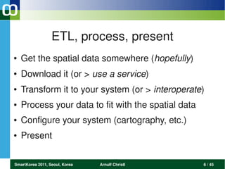
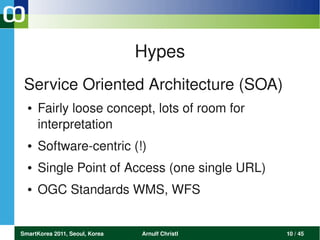
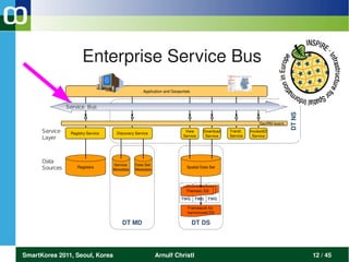
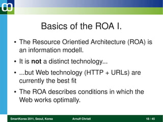

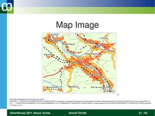
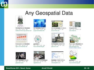
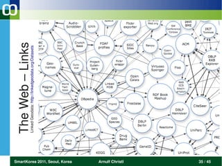
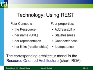
![Raw Geospatial Data (yummy)
<?xml version='1.0' encoding="ISO88591" ?>
<wfs:~FeatureCollection
xmlns:wfs="!http://www.opengis.net/wfs"
<gml:featureMember>
<Postleitzahlbereiche>
<gml:polygonProperty>
<gml:Polygon srsName="epsg:31467">
<gml:outerBoundaryIs>
<gml:LinearRing>
<gml:coordinates>
3365496.566430,5624978.448441
3365521.124423,5625013.908323
3365458.518013,5624832.944095
[...]
3365502.496403,5624908.664231
3365531.735324,5624963.958282
3365496.566430,5624978.448441
</gml:coordinates>
</gml:~LinearRing>
</gml:outerBoundaryIs>
</gml:Polygon>
</gml:polygonProperty>
<gid>3695</gid>
<oid>15223704</oid>
<plz99>53111</plz99>
<item_plz>53111</item_plz>
</Postleitzahlbereiche>
</gml:featureMember>
</wfs:FeatureCollection>
</pre>
http://arnulf.us/PLZ#Download
SmartKorea 2011, Seoul, Korea Arnulf Christl 25 / 45](https://image.slidesharecdn.com/resource-oriented-futurearnulf-christl-111107030833-phpapp01/85/Resource-Oriented-Future-for-Geospatial-Data-25-320.jpg)
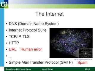
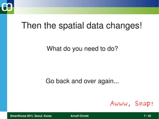
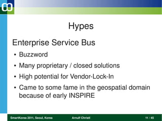
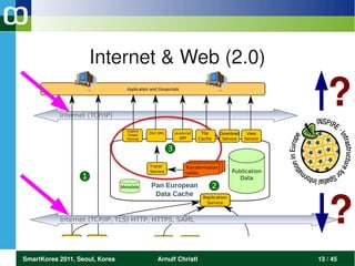
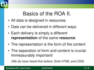
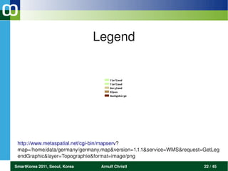
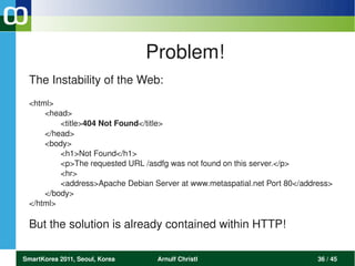
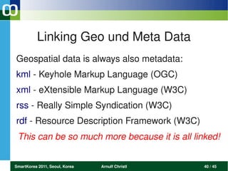
![The Web is: Documents
<html xmlns="http://www.w3.org/1999/xhtml" xml:lang="dede" lang="dede">
<head>
<meta httpequiv="contenttype" content="text/html; charset=utf8" />
<meta name="robots" content="index, follow" />
<meta name="description" content="Die Seite informiert über die
Studienangebote, die Forschungseinrichtungen und Organisation
der Fakultät für Bauingenieur und Vermessungswesen der
Technischen Universität München" />
<style type="text/css" style="display:none"> […] </style>
</head>
<body>
<a href="http://www.tum.de"><img src="http://.../tum_logo.gif"
alt="TUM" width="227" height="117" /></a>
[...]
Willkommen an der Fakultät für Bauingenieur und Vermessungswesen
[...]
</body>
http://www.bv.tum.de/
</html>
SmartKorea 2011, Seoul, Korea Arnulf Christl 32 / 45](https://image.slidesharecdn.com/resource-oriented-futurearnulf-christl-111107030833-phpapp01/85/Resource-Oriented-Future-for-Geospatial-Data-32-320.jpg)

The document presents an introduction to resource-oriented architecture (ROA) and its relevance to geospatial data, discussing the transition from traditional data handling to a more dynamic, linked approach. It highlights various technologies and paradigms such as REST, SOA, and linked open data, emphasizing the importance of URLs and metadata in modern web-based systems. The presentation concludes with a summary of the web's structure, asserting that geospatial data plays a critical role in this architecture.


