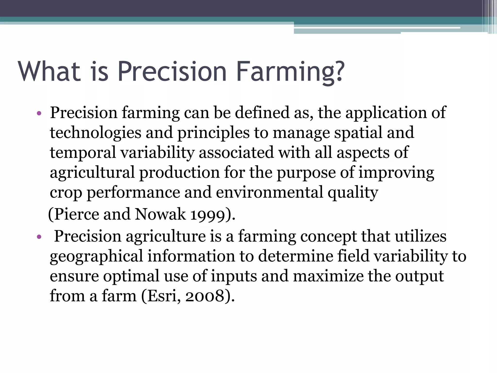
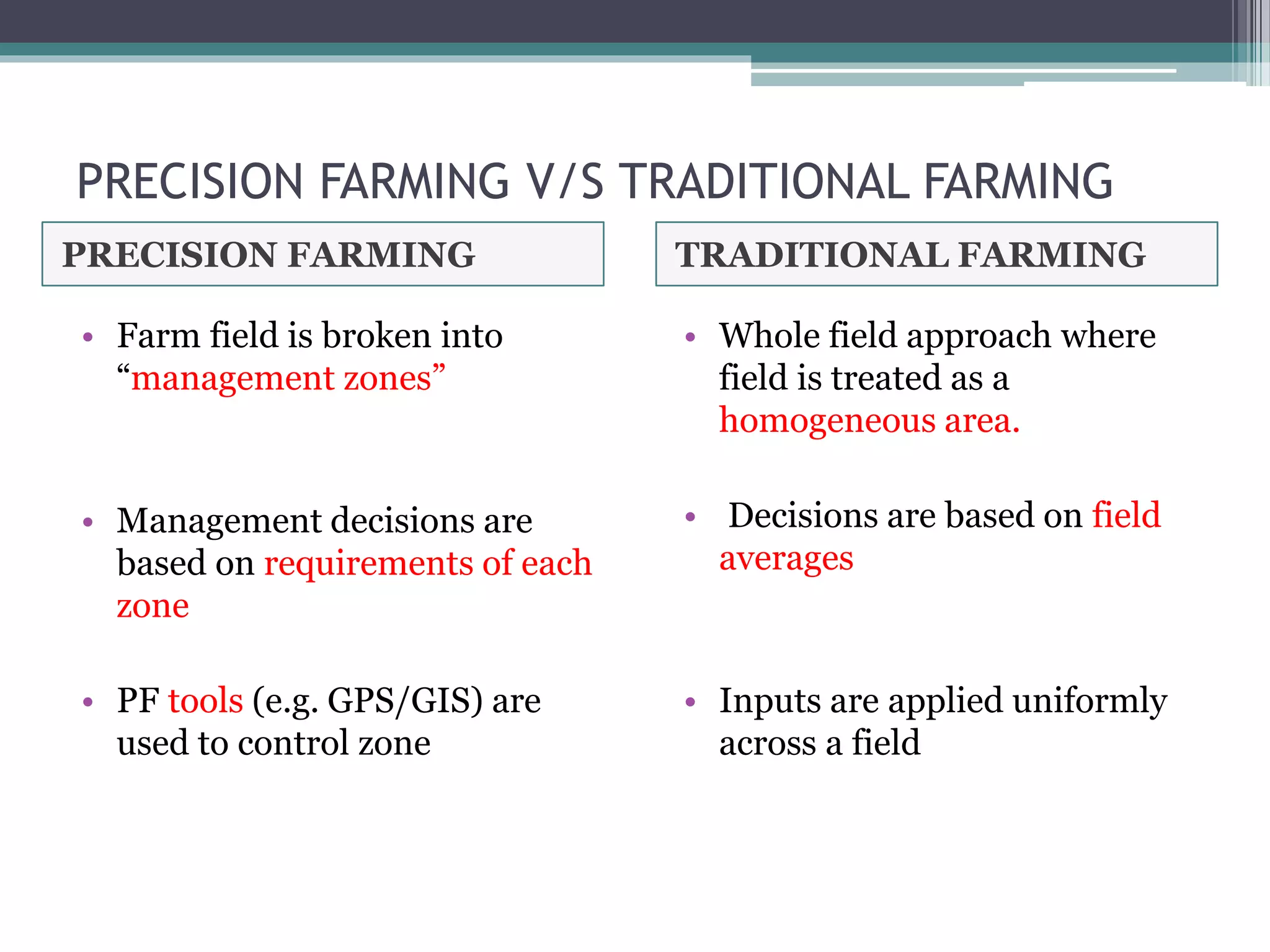
Precision Farming
Need for Precision Farming
• Conventional farming practices are area-centric.
• There is a general set of crops cultivated throughout an
area.
• All the farmers in that area follow the same procedures
with respect to sowing, nourishing, irrigation and
harvesting period.
• What these practices result in is: unpredictability,
overuse of resources and uncontrolled waste production.
• Since farmers had no information on their farms, there
was no way of learning the causes for crop loss. This
practice pushed the farmers towards losses and debt.
Precision Farming technology provides the
possibility to do the right thing, in the right
place, at the right time and in the right manner
along the food production chain and manage
both the quantity and quality of agricultural
produce.
What is Precision Farming?
• Precision farming can be defined as, the application of
technologies and principles to manage spatial and
temporal variability associated with all aspects of
agricultural production for the purpose of improving
crop performance and environmental quality
(Pierce and Nowak 1999).
• Precision agriculture is a farming concept that utilizes
geographical information to determine field variability to
ensure optimal use of inputs and maximize the output
from a farm (Esri, 2008).
Precision agriculture is described in the literature
by various terms such as
Precision farming (PF) , Site-Specific input
Application (SSA), Site-Specific Agricultural
Technology, Smart agriculture and Variable-Rate
Treatment (VRT).
Precision agriculture is based on the use of
information and science-based decision tools to
improve productivity and profitability.
PRECISION FARMING V/S TRADITIONAL FARMING
PRECISION FARMING TRADITIONAL FARMING
• Farm field is broken into
“management zones”
• Management decisions are
based on requirements of each
zone
• PF tools (e.g. GPS/GIS) are
used to control zone
• Whole field approach where
field is treated as a
homogeneous area.
• Decisions are based on field
averages
• Inputs are applied uniformly
across a field
Basic concept of Precision Farming
1. Accessing variability
• Spatial and temporal variability enables us to
know the determinants of crop yield.
• On the basis of variability we can construct
condition maps through surveys, point
sampling, remote sensing and modeling.
2. Management of variability
• Variation in field are noted and mapped. They
can be managed by various tools such as,
 VRT
 Site specific planting
 Site specific weed management
 Site specific nutrient management
Tools of Precision agriculture
• Geographical positioning (GPS)
• Geographical Information System
• Variable-rate treatment
• Grid sampling
• Yield mapping
• Remote sensors , etc.
1. Global positioning system
GPS is a set of satellites that identify the location of farm
equipment within a meter of an actual site in the field.
The value of knowing a precision location within inches is
that:
• Location of soil samples and the laboratory results can be
compared to a soil map.
• Fertilizer and pesticides can be prescribed to fit soil
properties (clay and organic matter content) and soil
conditions (relief and
drainage)
• Tillage adjustments can be made as one finds
various conditions across the field and
One can monitor and record yield data as one
goes across the field.
• The GPS technology provides accurate
positioning system necessary for field
implementation of variable rate technology.
• The present internet makes possible the
development of a mechanism for effective farm
management using remote sensing.
2. Geographical information system
(GIS)
• A Geographic Information System (GIS) is a tool
that creates visual representations of data and
performs spatial analyses in order to make informed
decisions.
• It is a technology that combines hardware, software,
and data.
• The data can represent almost anything imaginable
so long as it has a geographic component.
• The hardware can be anything from a desktop
computer or laptop to satellites, drones, and
handheld GPS units.
The images above were acquired by the Daedalus sensor
aboard a NASA aircraft flying over the Maricopa
Agricultural Center in Arizona on January 30, 2001.
3. Grid sampling
• Grid sampling is a method of breaking a field
into blocks of about 0.5-5 ha.
• The sampling soils within those grids to
determine appropriate application rates.
• Several samples are taken from each grid, mixed
and sent into the laboratory for analysis.
• Grid sampling reveals how the nutrients are
distributed across a field.
• By collecting more soil samples on a field we
gain a better understanding of the nutrients
available.
• By understanding the nutrients available, we can
be confident the fertilizer dollars are being used
efficiently.
• Grid sampling prevents over-application of
fertilizer in areas where nutrient levels are high.
• Grid sampling allows for soil enrichment with
fertilizer in areas where nutrient levels are low.
4. Variable rate technology
• Variable rate technology (VRT) consists of farm
field equipment with the ability to precisely
control the rate of application of crop inputs that
can be varied in their application commonly
include tillage, fertilizer, weed control, insect
control, plant population and irrigation.
• The application of these inputs is based on data
that is collected by technologies like sensors,
GPS and maps.
• Variable rate application focuses on different
areas in farming activities like fertilization, lime
application, weed control, irrigation and
seeding.
• Some variable application can be used by the
help of geographical positioning system (GPS) or
even without GPS system.
Two basic technologies of variable rate application
are:
• Map based and
• Sensor based.
• Map-based variable rate
application adjusts the
relevant application rate
based on a generated
electronic map, also
known as prescription
map.
• The GPS receiver gives
the field position and a
prescription map at a
desired rate.
• The applicator then
applies the field position
and prescription from a
GPS as it moves in the
field.
Map-based variable rate
application
• Sensor-based variable
rate application requires
no positioning system or
map.
• Sensors that are mounted
on the applicator
measures the soil
properties or crop
characteristics at the
same time.
• The information is then
streamed on real-time
basis the control system
calculates the quantity of
inputs that are required
based on the crop or soil
needs.
Sensor-based variable rate
application
5. Yield monitors
• Yield monitors are crop yield measuring devices
installed on harvesting equipment.
• The yield data from the monitor is recorded and
stored at regular intervals along with positional
data received from GPS unit.
• GIS software takes the yield data and produce
yield maps
6. Remote sensors
• Remote sensors indicate variations in field color
that corresponds to changes in soil type, crop
development, field boundaries, roads, water etc.
• Remote science in agricultural terms means
viewing crop from overhead (from a satellite or
low flying aircraft) without coming into contact,
recording what is viewed and displaying the
image and provide the map to pinpoint the field
problems more earlier and more effectively.
Some of the broad agricultural application areas are:
• Crop production forecasting: It includes the
identification of crops, acreage estimation and
yield forecasting.
• Soil mapping: Soil maps afford the information
on the suitability and limitation of the soil for
agricultural production, which are helpful in
selection of proper cropping system and optimal
land use planning.
• Wasteland mapping: Information on degraded
and wasteland e.g. salt affected areas, acidic
soils, eroded soils, water logged area, dryland
etc.
• Nutrient stress: Plant nitrogen stress areas can
be located in the field using high-resolution
color infrared aerial images. The reflectance of
near infrared, visible red and visible green
wavelengths have a high correlation to the
amount of applied nitrogen in the field.
Precision Farming Cycle
Conclusion
• In the present time of increasing input costs,
decreasing commodity prices and environmental
concerns, farmers’ and Government authorities
are looking for new ways to increase efficiency,
cut costs and subscribe to sustainable
agriculture.
• While PF technology looks promising as a future
farming tool.
• The scope is there for commercial crops grown
in large farms.
• The adoption of PF in large areas would require
some Govt./public sector interventions in the
initial stage before the full benefit of PF could be
realized.
• This is because:
1. Investment on equipment is high
2. Identification of crop and minimum farm size
for PF to be economically viable.
Project CHAMAN
• The project Coordinated programme on
Horticulture Assessment Management using
geoiNformatics (CHAMAN)
• Launched by Department of Agriculture,
Cooperation &Farmers welfare under the
Mission for Integrated Development of
Horticulture,
• Launched in 2014.
• This project aims in development of methods for
estimation of horticultural crops and implementing
the same with the help of sample survey methodology
and remote sensing.
• The project has 2 components: survey component and
remote sensing component.
• Salient achievements of CHAMAN:
Area assessment and production of forecasting of 7
major horticultural crops(namely mango, banana,
citrus,potato, onion, tomato and chilli) spanning wide
15 states.
Thank You

Precision farming

  • 1.
  • 2.
    Need for PrecisionFarming • Conventional farming practices are area-centric. • There is a general set of crops cultivated throughout an area. • All the farmers in that area follow the same procedures with respect to sowing, nourishing, irrigation and harvesting period. • What these practices result in is: unpredictability, overuse of resources and uncontrolled waste production. • Since farmers had no information on their farms, there was no way of learning the causes for crop loss. This practice pushed the farmers towards losses and debt.
  • 3.
    Precision Farming technologyprovides the possibility to do the right thing, in the right place, at the right time and in the right manner along the food production chain and manage both the quantity and quality of agricultural produce.
  • 4.
    What is PrecisionFarming? • Precision farming can be defined as, the application of technologies and principles to manage spatial and temporal variability associated with all aspects of agricultural production for the purpose of improving crop performance and environmental quality (Pierce and Nowak 1999). • Precision agriculture is a farming concept that utilizes geographical information to determine field variability to ensure optimal use of inputs and maximize the output from a farm (Esri, 2008).
  • 5.
    Precision agriculture isdescribed in the literature by various terms such as Precision farming (PF) , Site-Specific input Application (SSA), Site-Specific Agricultural Technology, Smart agriculture and Variable-Rate Treatment (VRT). Precision agriculture is based on the use of information and science-based decision tools to improve productivity and profitability.
  • 6.
    PRECISION FARMING V/STRADITIONAL FARMING PRECISION FARMING TRADITIONAL FARMING • Farm field is broken into “management zones” • Management decisions are based on requirements of each zone • PF tools (e.g. GPS/GIS) are used to control zone • Whole field approach where field is treated as a homogeneous area. • Decisions are based on field averages • Inputs are applied uniformly across a field
  • 7.
    Basic concept ofPrecision Farming 1. Accessing variability • Spatial and temporal variability enables us to know the determinants of crop yield. • On the basis of variability we can construct condition maps through surveys, point sampling, remote sensing and modeling.
  • 8.
    2. Management ofvariability • Variation in field are noted and mapped. They can be managed by various tools such as,  VRT  Site specific planting  Site specific weed management  Site specific nutrient management
  • 9.
    Tools of Precisionagriculture • Geographical positioning (GPS) • Geographical Information System • Variable-rate treatment • Grid sampling • Yield mapping • Remote sensors , etc.
  • 10.
    1. Global positioningsystem GPS is a set of satellites that identify the location of farm equipment within a meter of an actual site in the field. The value of knowing a precision location within inches is that: • Location of soil samples and the laboratory results can be compared to a soil map. • Fertilizer and pesticides can be prescribed to fit soil properties (clay and organic matter content) and soil conditions (relief and drainage)
  • 11.
    • Tillage adjustmentscan be made as one finds various conditions across the field and One can monitor and record yield data as one goes across the field. • The GPS technology provides accurate positioning system necessary for field implementation of variable rate technology. • The present internet makes possible the development of a mechanism for effective farm management using remote sensing.
  • 12.
    2. Geographical informationsystem (GIS) • A Geographic Information System (GIS) is a tool that creates visual representations of data and performs spatial analyses in order to make informed decisions. • It is a technology that combines hardware, software, and data. • The data can represent almost anything imaginable so long as it has a geographic component. • The hardware can be anything from a desktop computer or laptop to satellites, drones, and handheld GPS units.
  • 13.
    The images abovewere acquired by the Daedalus sensor aboard a NASA aircraft flying over the Maricopa Agricultural Center in Arizona on January 30, 2001.
  • 14.
    3. Grid sampling •Grid sampling is a method of breaking a field into blocks of about 0.5-5 ha. • The sampling soils within those grids to determine appropriate application rates. • Several samples are taken from each grid, mixed and sent into the laboratory for analysis.
  • 15.
    • Grid samplingreveals how the nutrients are distributed across a field. • By collecting more soil samples on a field we gain a better understanding of the nutrients available. • By understanding the nutrients available, we can be confident the fertilizer dollars are being used efficiently. • Grid sampling prevents over-application of fertilizer in areas where nutrient levels are high. • Grid sampling allows for soil enrichment with fertilizer in areas where nutrient levels are low.
  • 18.
    4. Variable ratetechnology • Variable rate technology (VRT) consists of farm field equipment with the ability to precisely control the rate of application of crop inputs that can be varied in their application commonly include tillage, fertilizer, weed control, insect control, plant population and irrigation. • The application of these inputs is based on data that is collected by technologies like sensors, GPS and maps.
  • 19.
    • Variable rateapplication focuses on different areas in farming activities like fertilization, lime application, weed control, irrigation and seeding. • Some variable application can be used by the help of geographical positioning system (GPS) or even without GPS system. Two basic technologies of variable rate application are: • Map based and • Sensor based.
  • 20.
    • Map-based variablerate application adjusts the relevant application rate based on a generated electronic map, also known as prescription map. • The GPS receiver gives the field position and a prescription map at a desired rate. • The applicator then applies the field position and prescription from a GPS as it moves in the field. Map-based variable rate application
  • 21.
    • Sensor-based variable rateapplication requires no positioning system or map. • Sensors that are mounted on the applicator measures the soil properties or crop characteristics at the same time. • The information is then streamed on real-time basis the control system calculates the quantity of inputs that are required based on the crop or soil needs. Sensor-based variable rate application
  • 22.
    5. Yield monitors •Yield monitors are crop yield measuring devices installed on harvesting equipment. • The yield data from the monitor is recorded and stored at regular intervals along with positional data received from GPS unit. • GIS software takes the yield data and produce yield maps
  • 23.
    6. Remote sensors •Remote sensors indicate variations in field color that corresponds to changes in soil type, crop development, field boundaries, roads, water etc. • Remote science in agricultural terms means viewing crop from overhead (from a satellite or low flying aircraft) without coming into contact, recording what is viewed and displaying the image and provide the map to pinpoint the field problems more earlier and more effectively.
  • 24.
    Some of thebroad agricultural application areas are: • Crop production forecasting: It includes the identification of crops, acreage estimation and yield forecasting. • Soil mapping: Soil maps afford the information on the suitability and limitation of the soil for agricultural production, which are helpful in selection of proper cropping system and optimal land use planning. • Wasteland mapping: Information on degraded and wasteland e.g. salt affected areas, acidic soils, eroded soils, water logged area, dryland etc.
  • 25.
    • Nutrient stress:Plant nitrogen stress areas can be located in the field using high-resolution color infrared aerial images. The reflectance of near infrared, visible red and visible green wavelengths have a high correlation to the amount of applied nitrogen in the field.
  • 26.
  • 27.
    Conclusion • In thepresent time of increasing input costs, decreasing commodity prices and environmental concerns, farmers’ and Government authorities are looking for new ways to increase efficiency, cut costs and subscribe to sustainable agriculture. • While PF technology looks promising as a future farming tool.
  • 28.
    • The scopeis there for commercial crops grown in large farms. • The adoption of PF in large areas would require some Govt./public sector interventions in the initial stage before the full benefit of PF could be realized. • This is because: 1. Investment on equipment is high 2. Identification of crop and minimum farm size for PF to be economically viable.
  • 29.
    Project CHAMAN • Theproject Coordinated programme on Horticulture Assessment Management using geoiNformatics (CHAMAN) • Launched by Department of Agriculture, Cooperation &Farmers welfare under the Mission for Integrated Development of Horticulture, • Launched in 2014.
  • 30.
    • This projectaims in development of methods for estimation of horticultural crops and implementing the same with the help of sample survey methodology and remote sensing. • The project has 2 components: survey component and remote sensing component. • Salient achievements of CHAMAN: Area assessment and production of forecasting of 7 major horticultural crops(namely mango, banana, citrus,potato, onion, tomato and chilli) spanning wide 15 states.
  • 31.