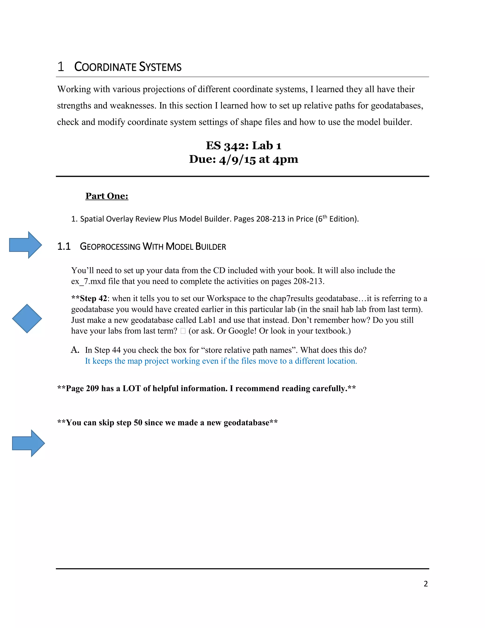
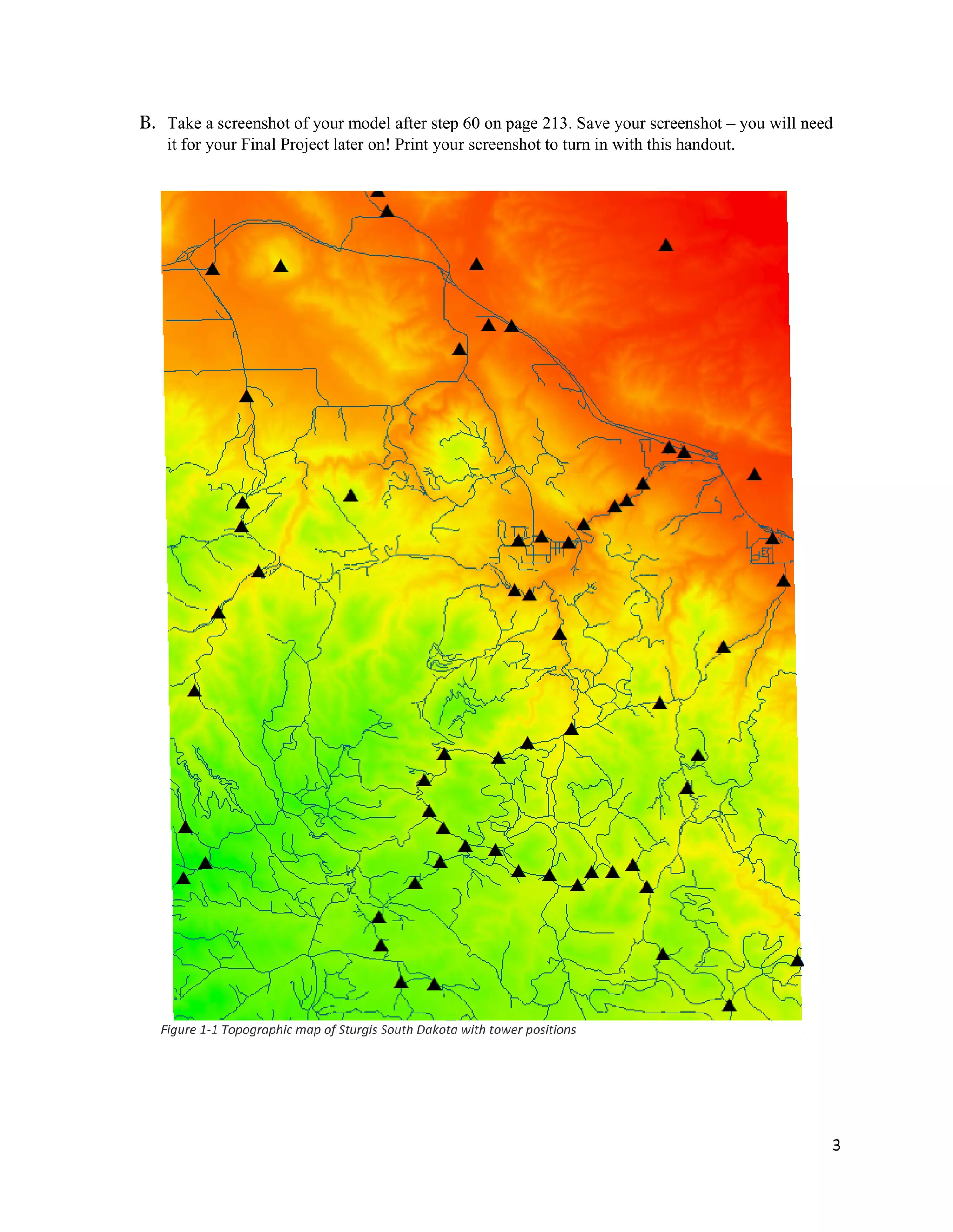
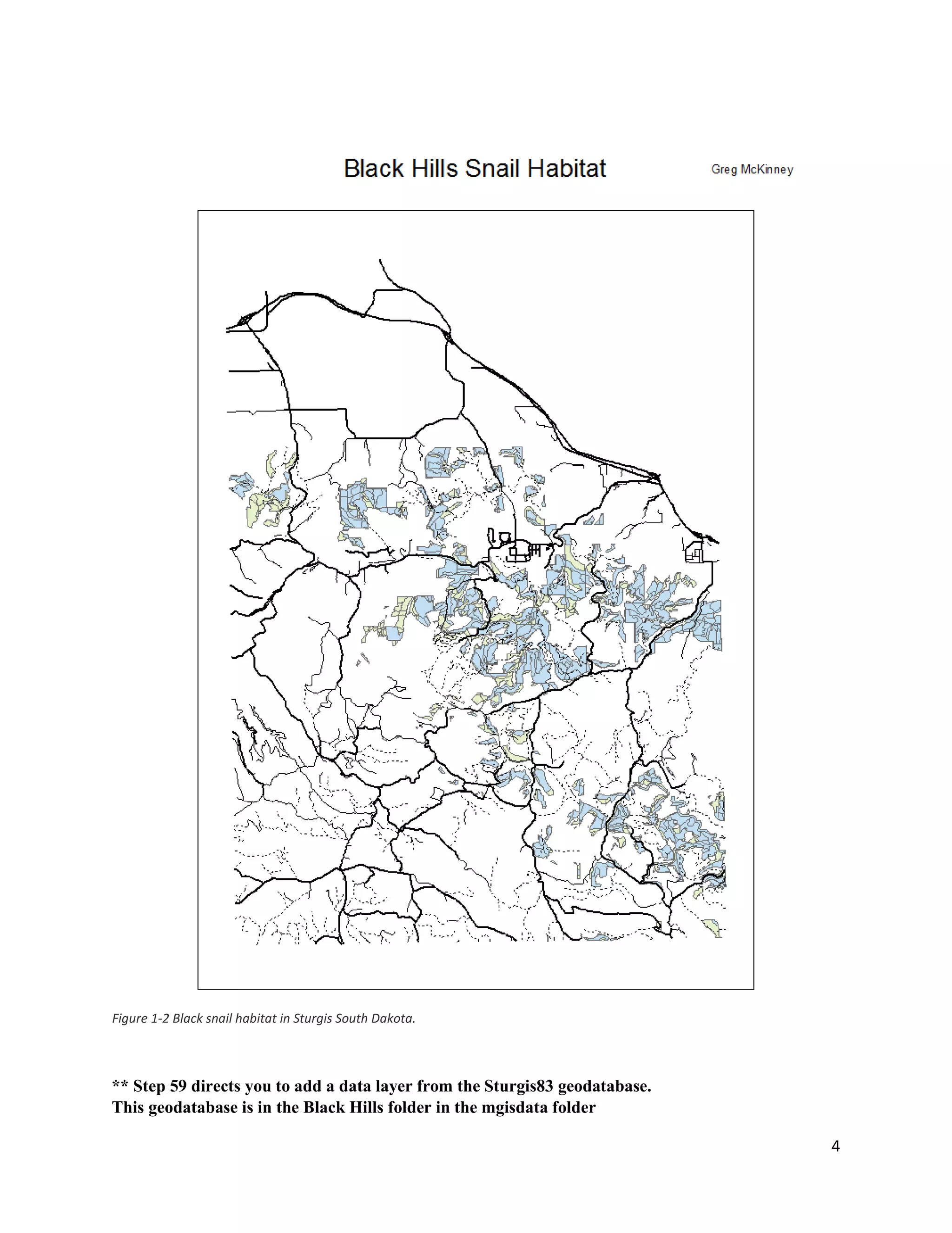
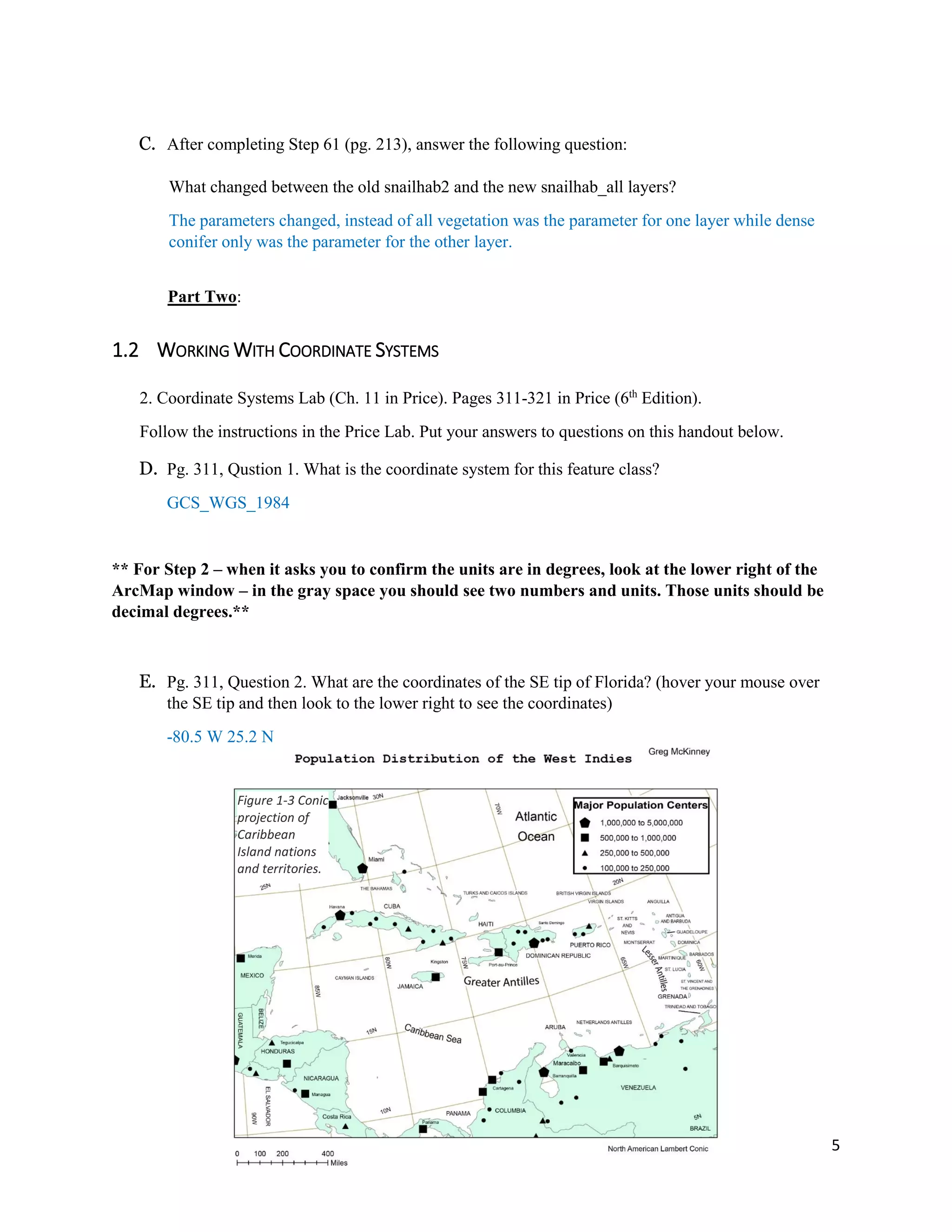
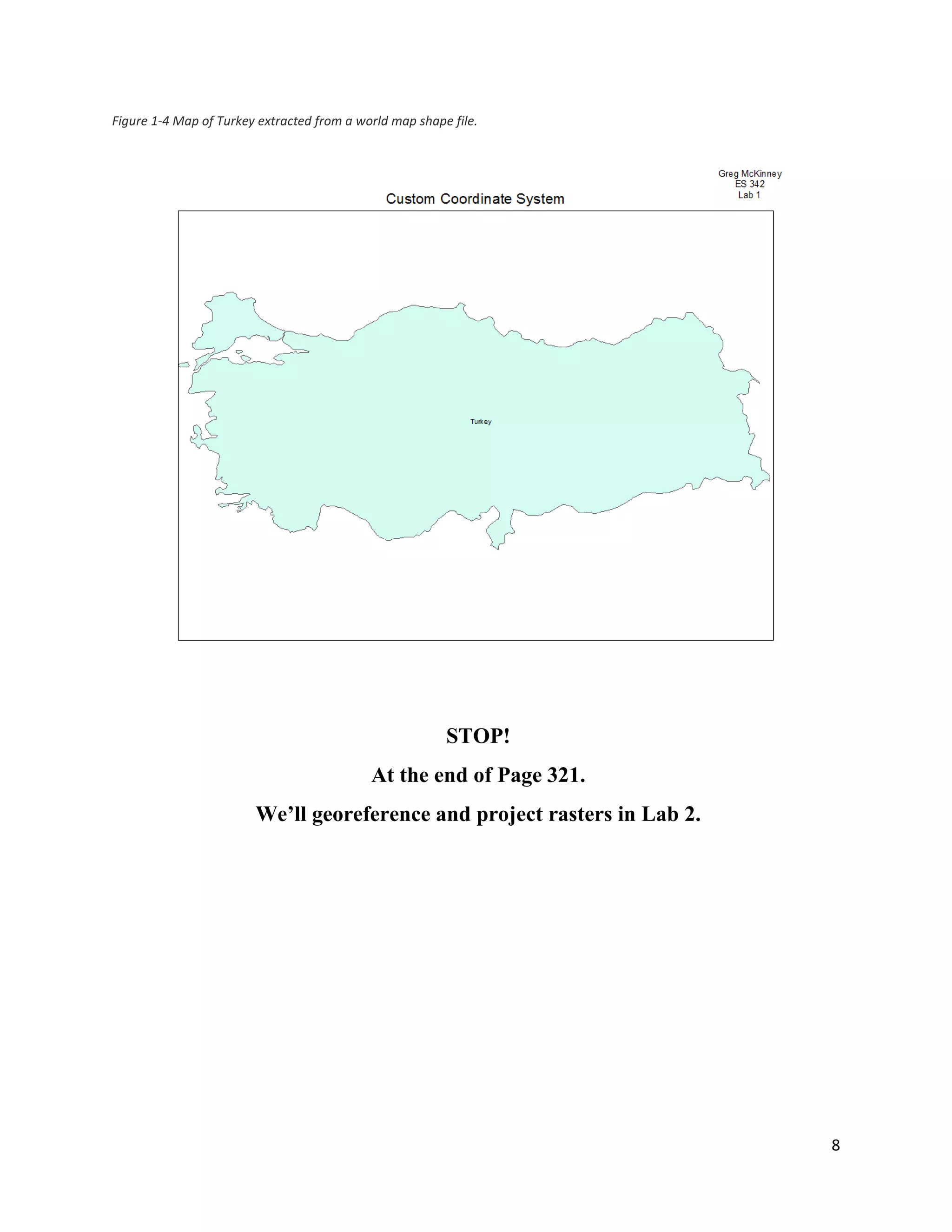
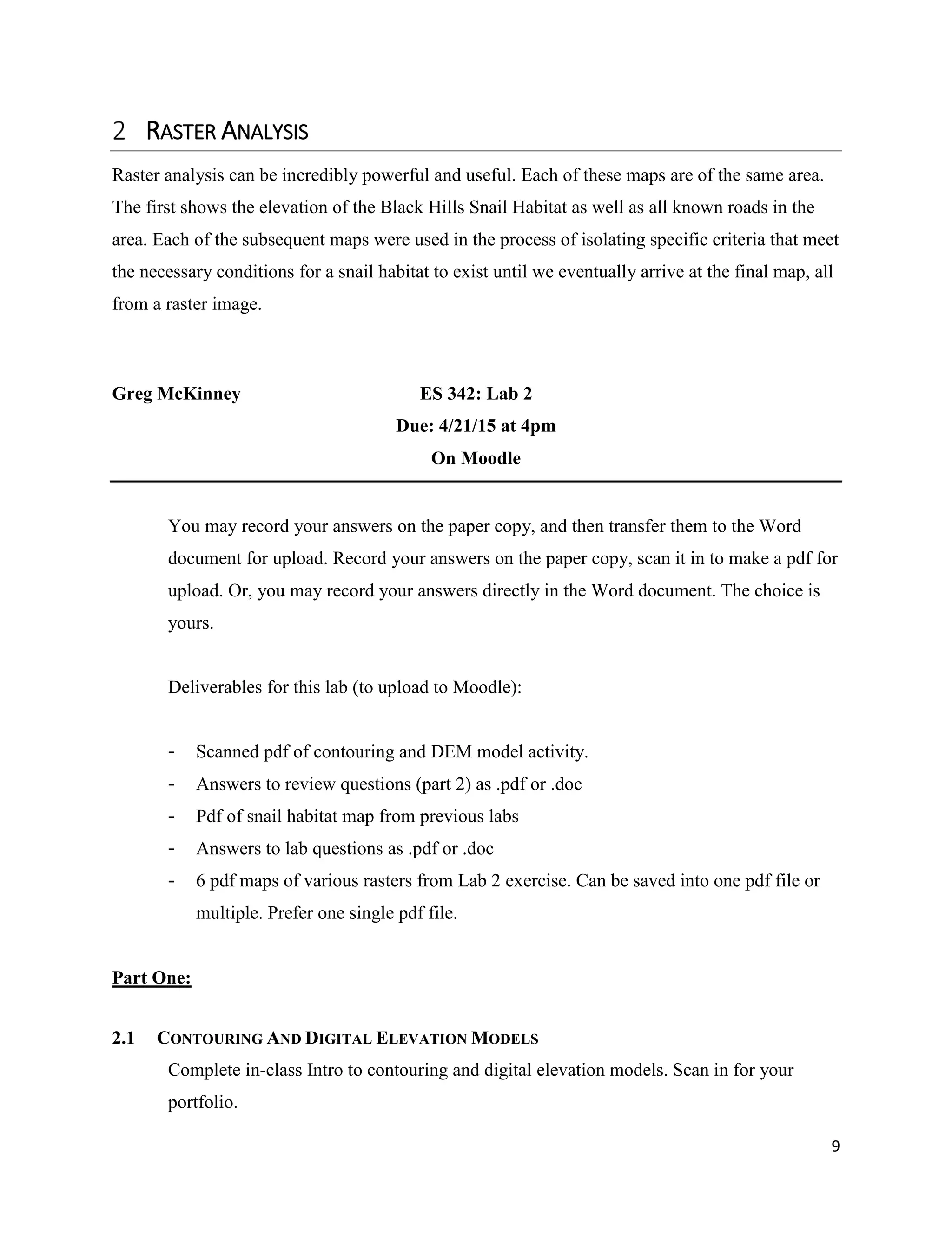
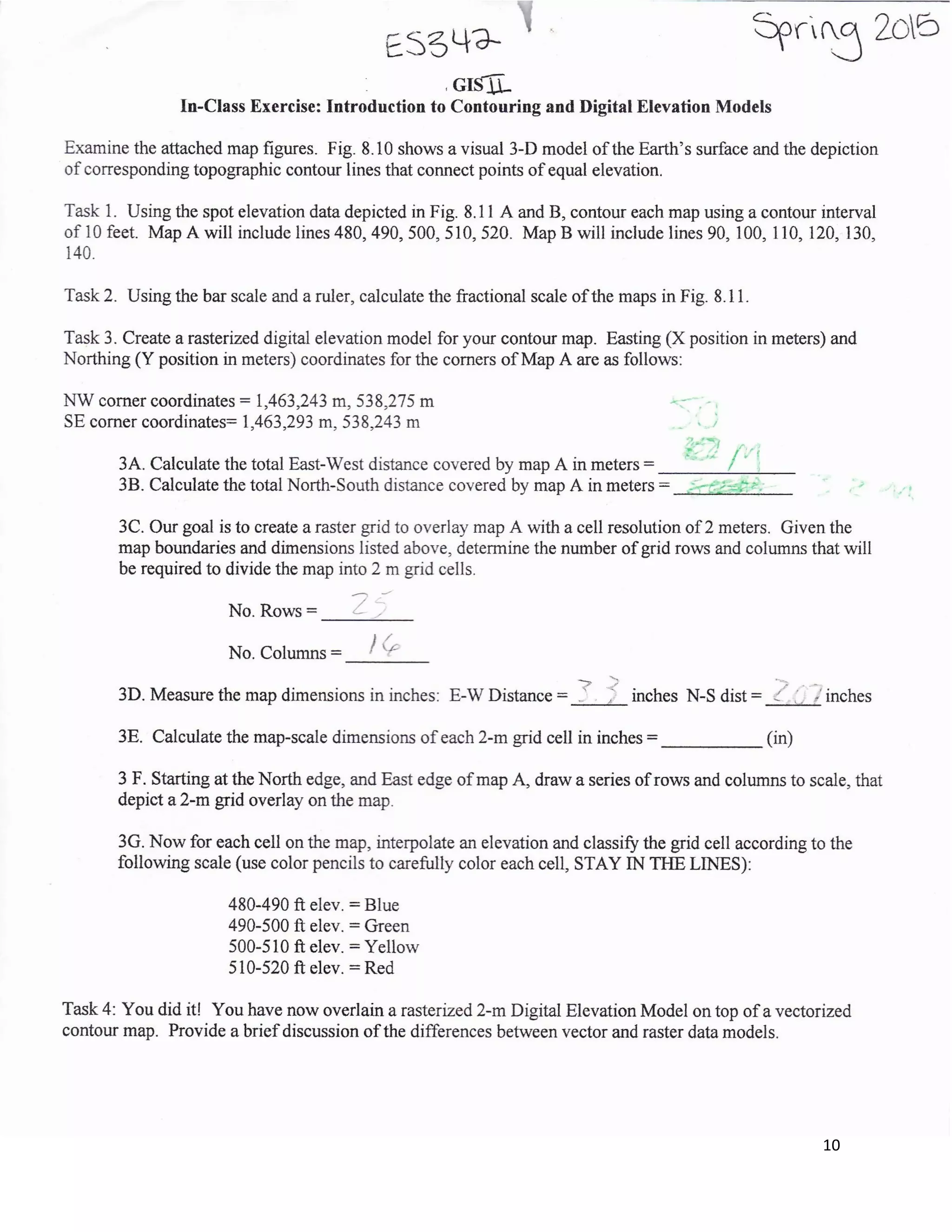
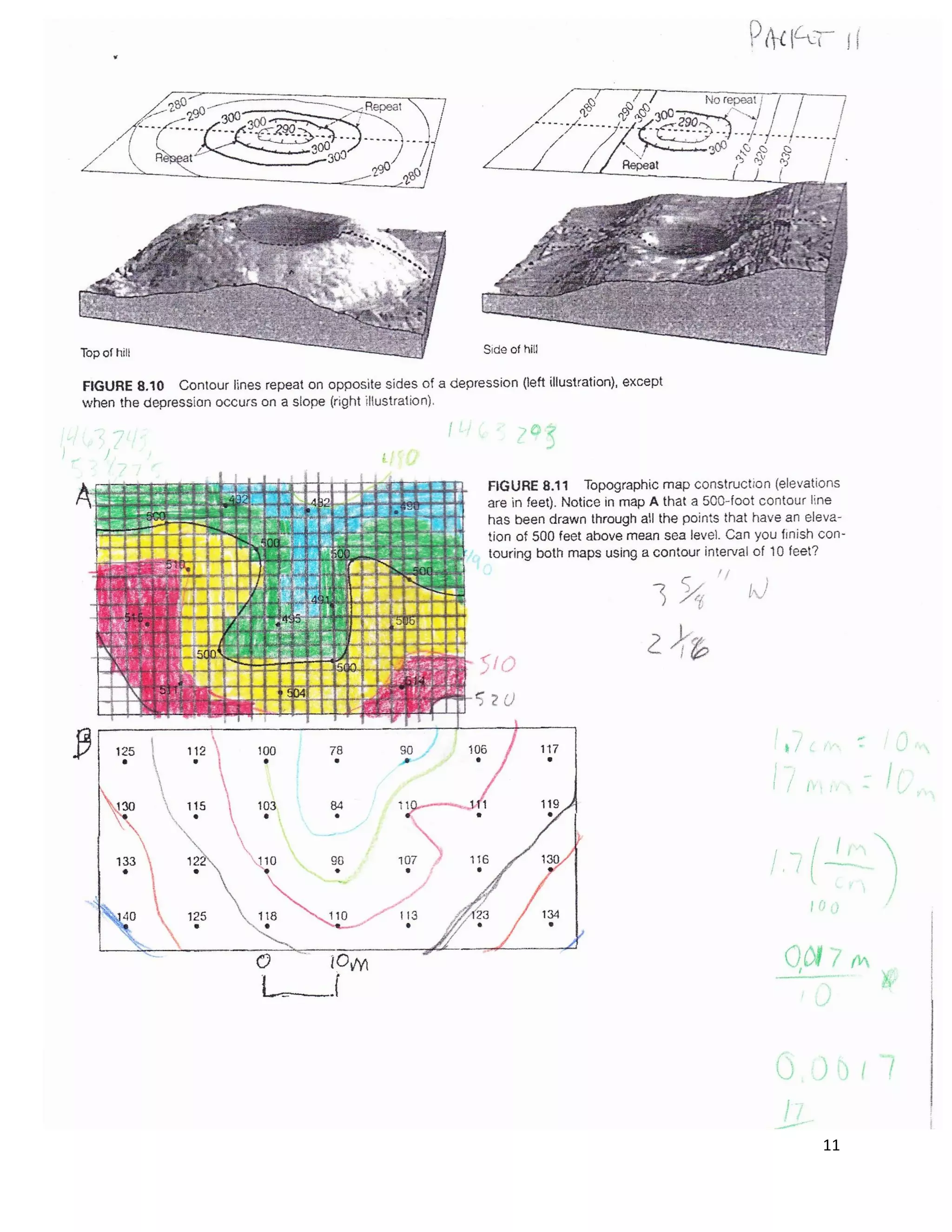
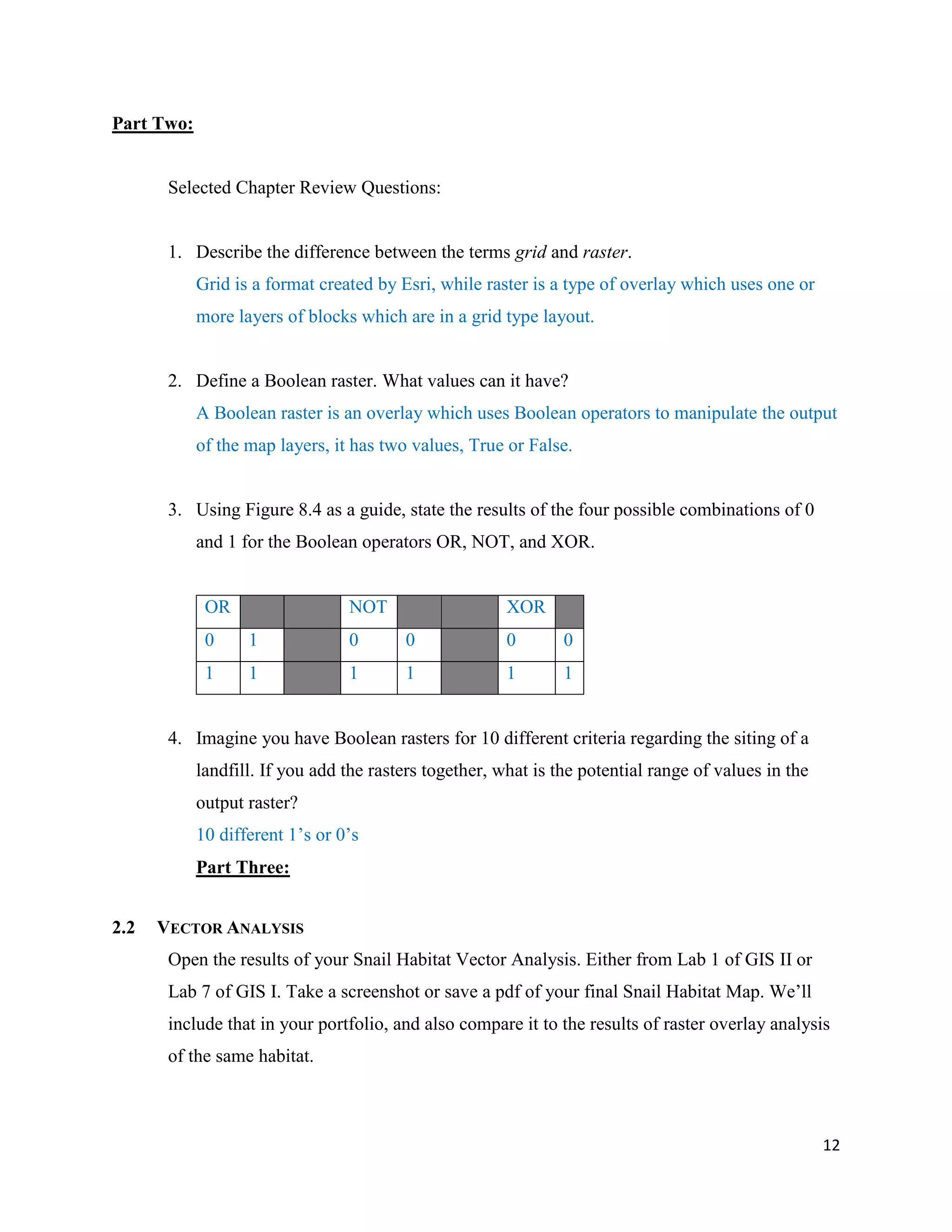
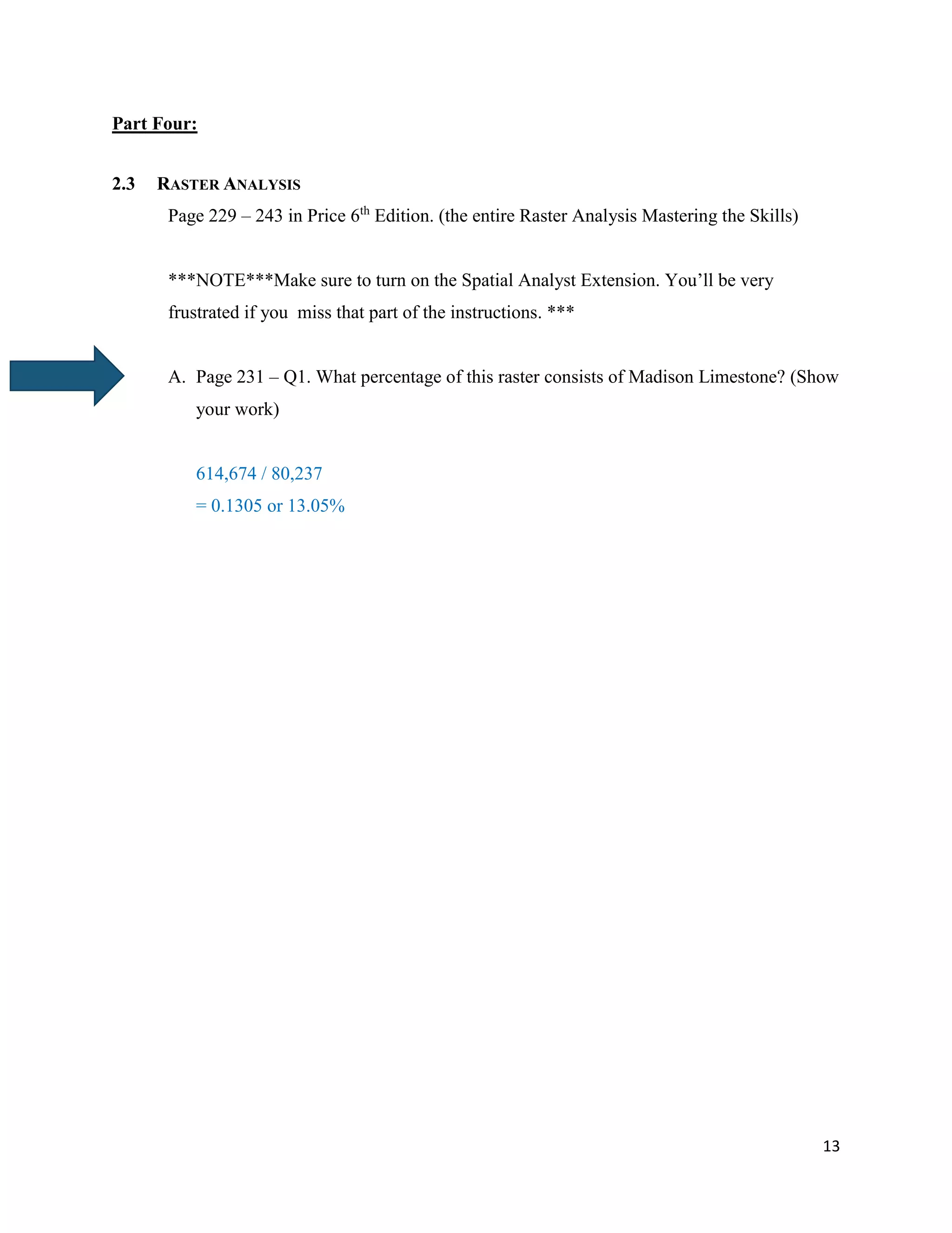
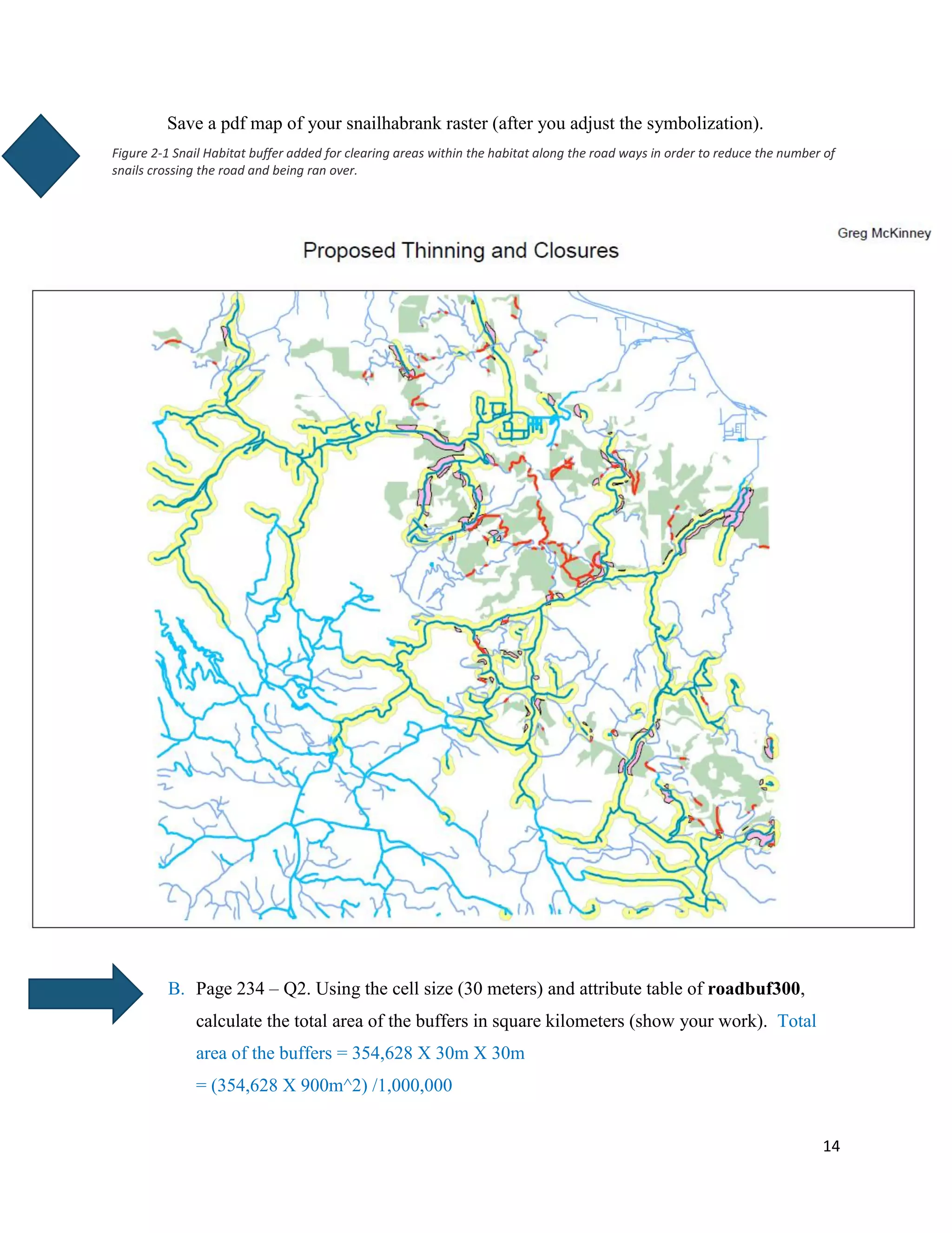
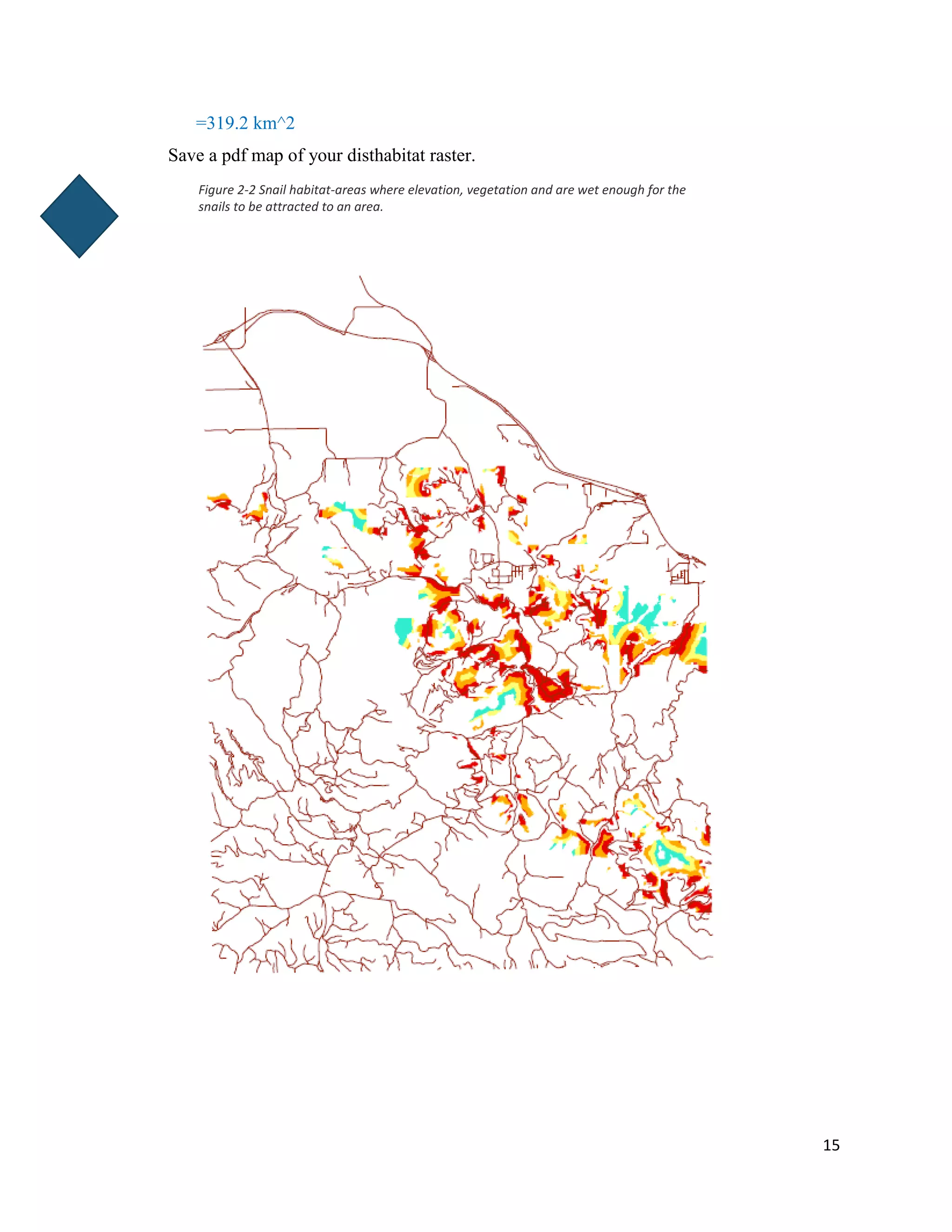
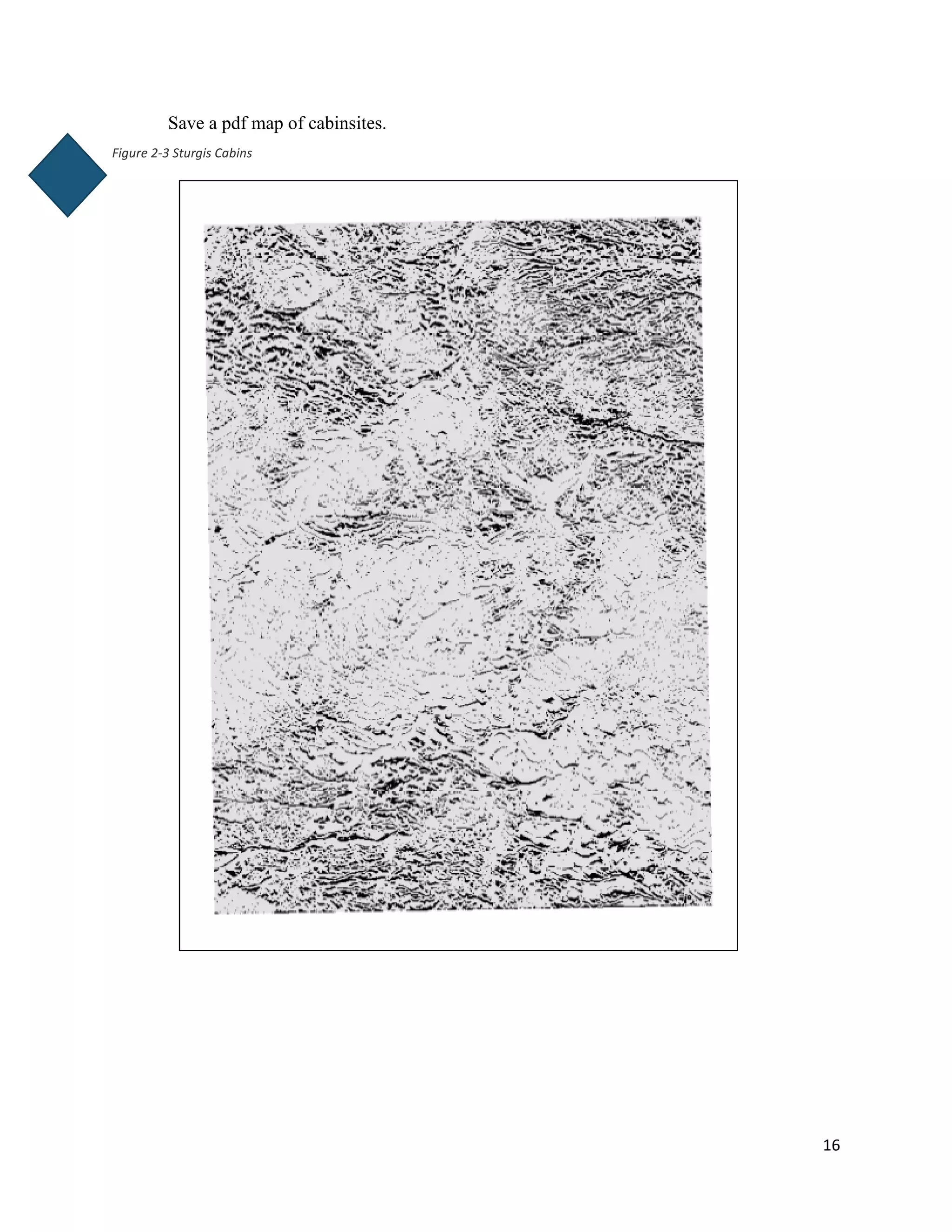
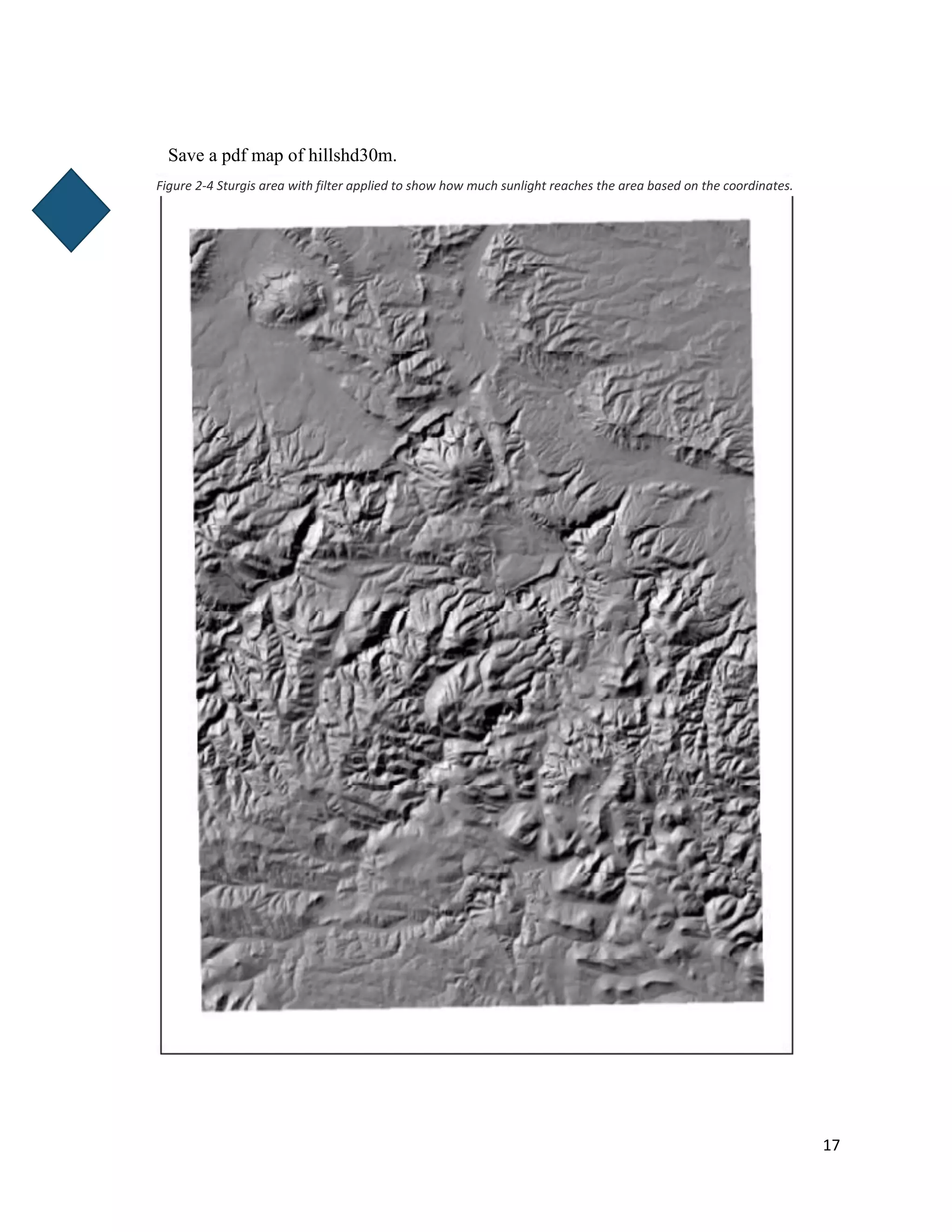
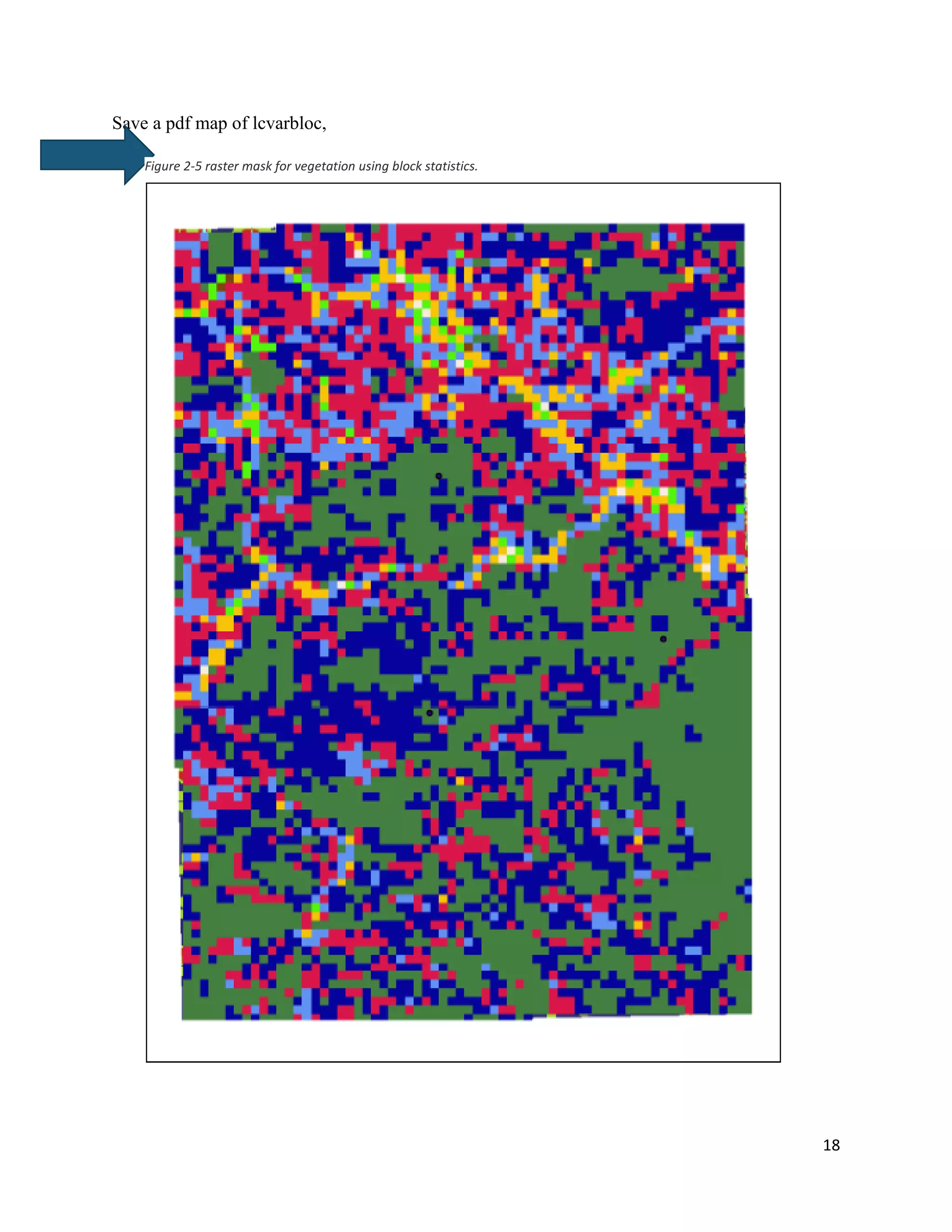
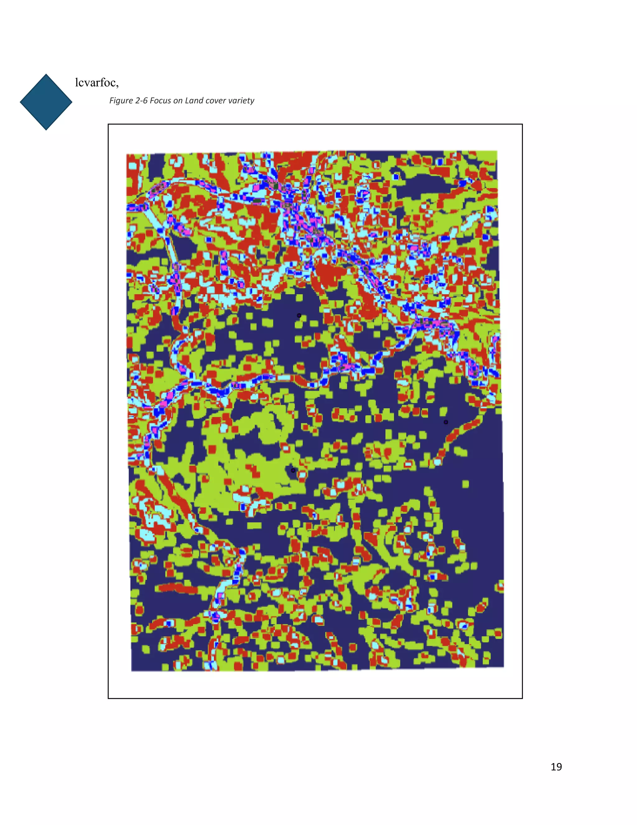
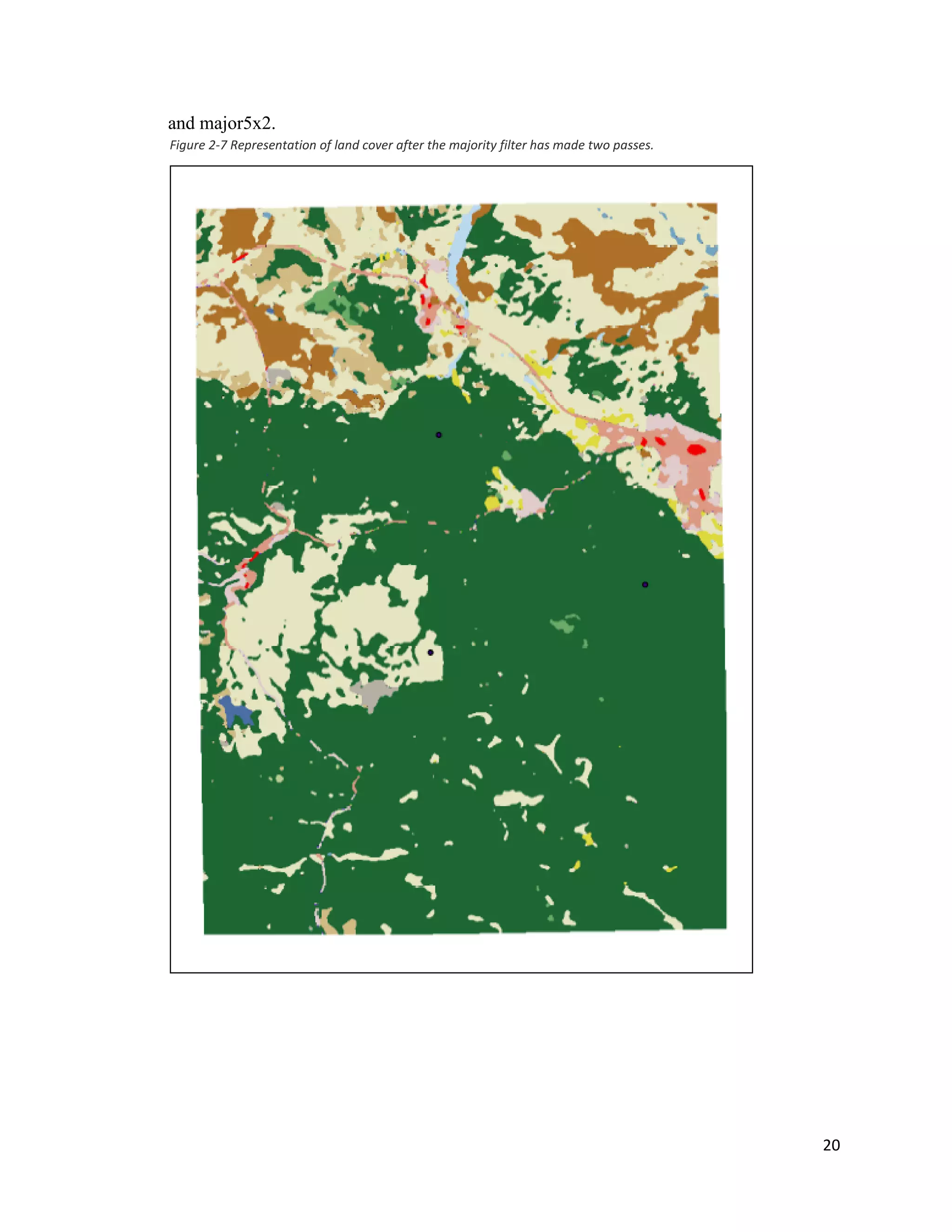
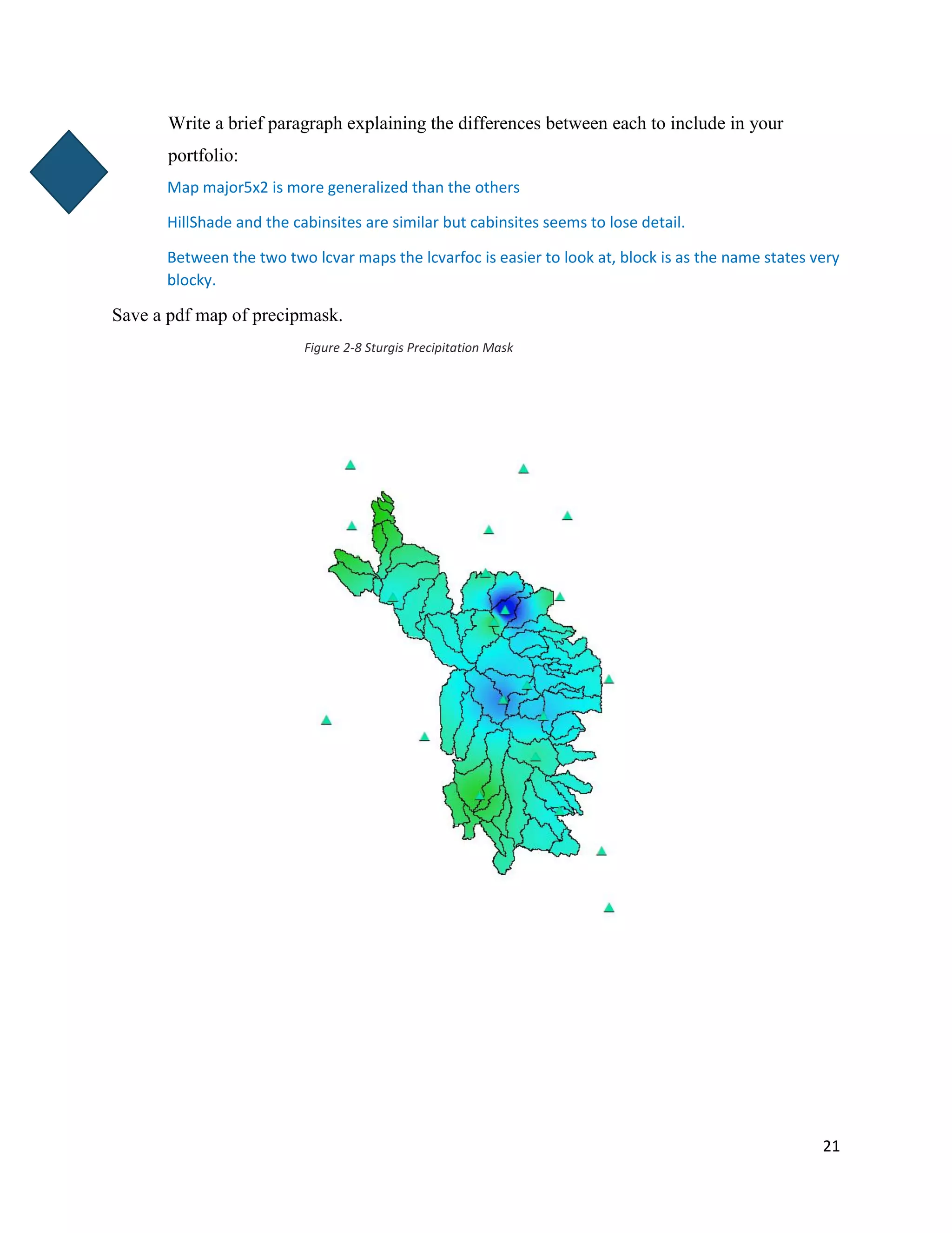
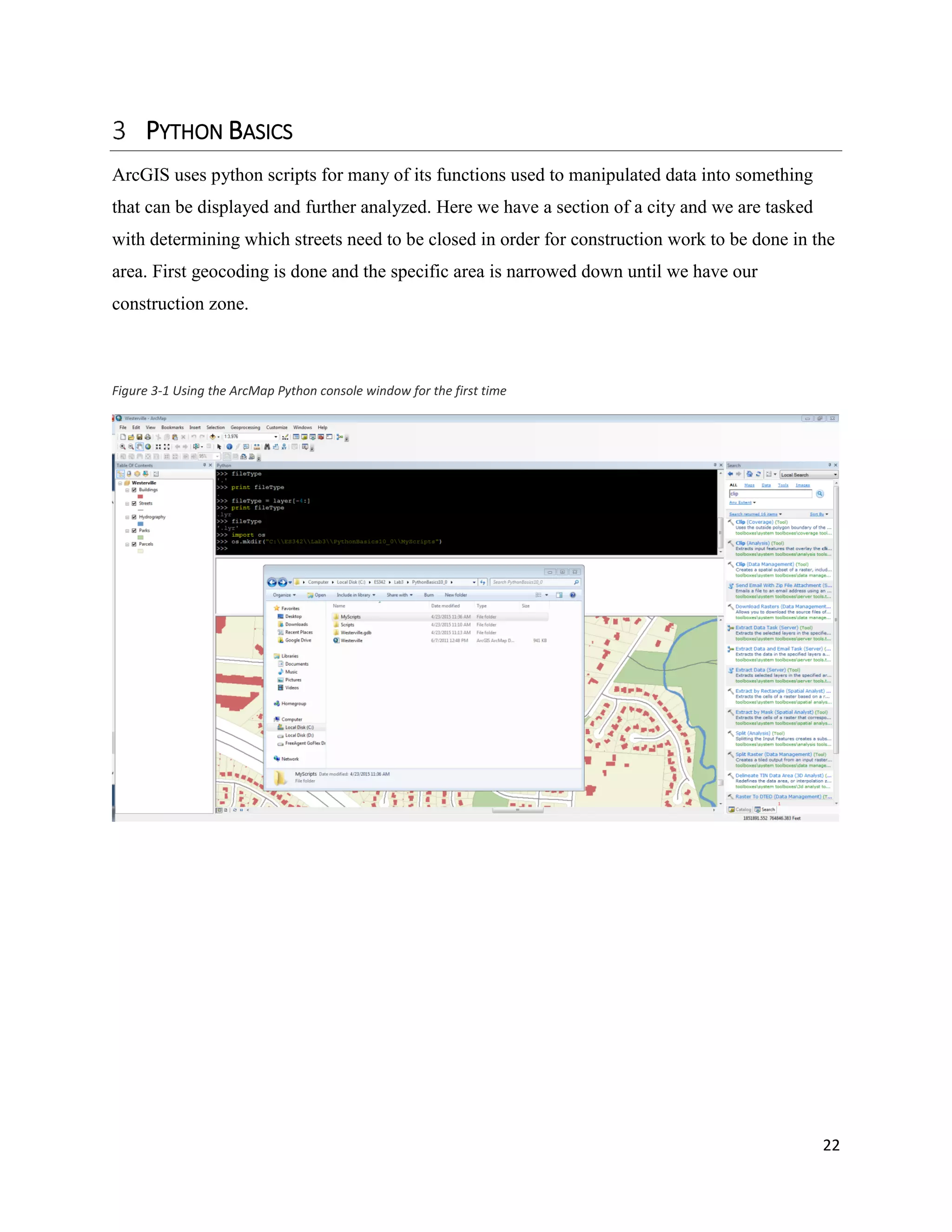
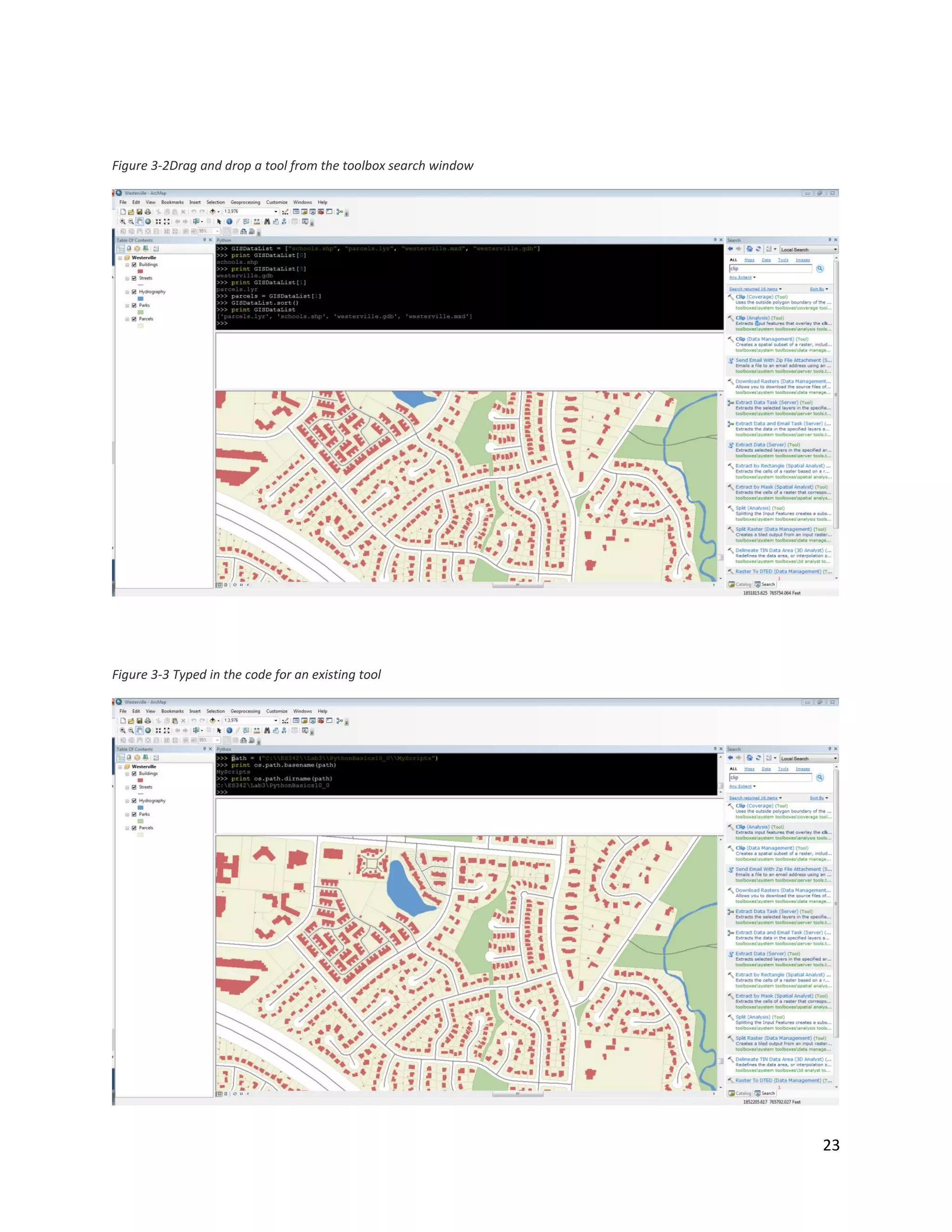
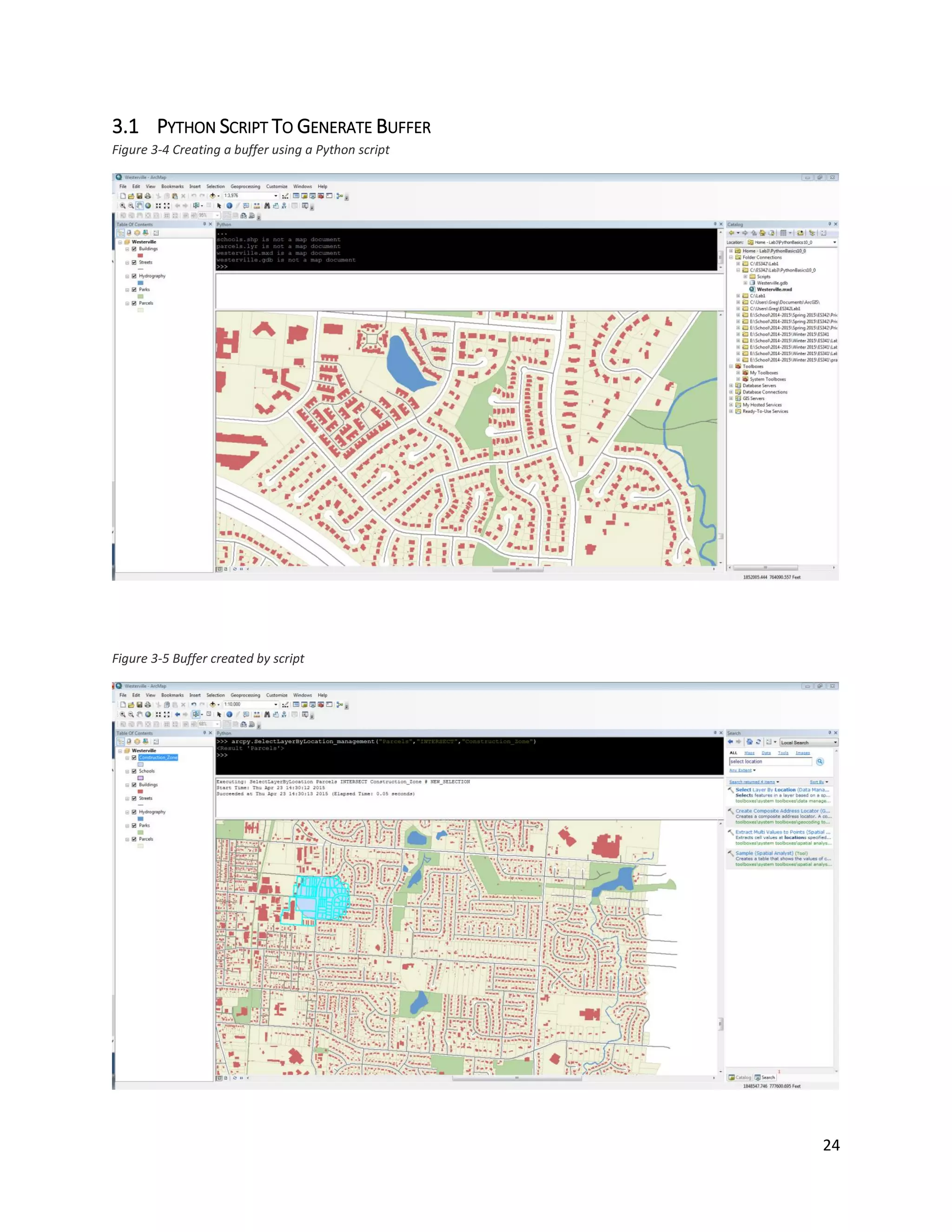
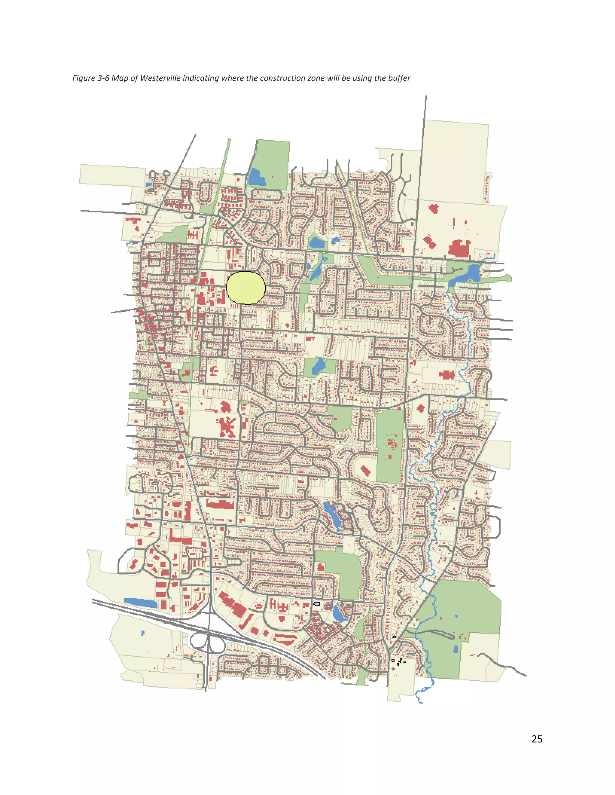
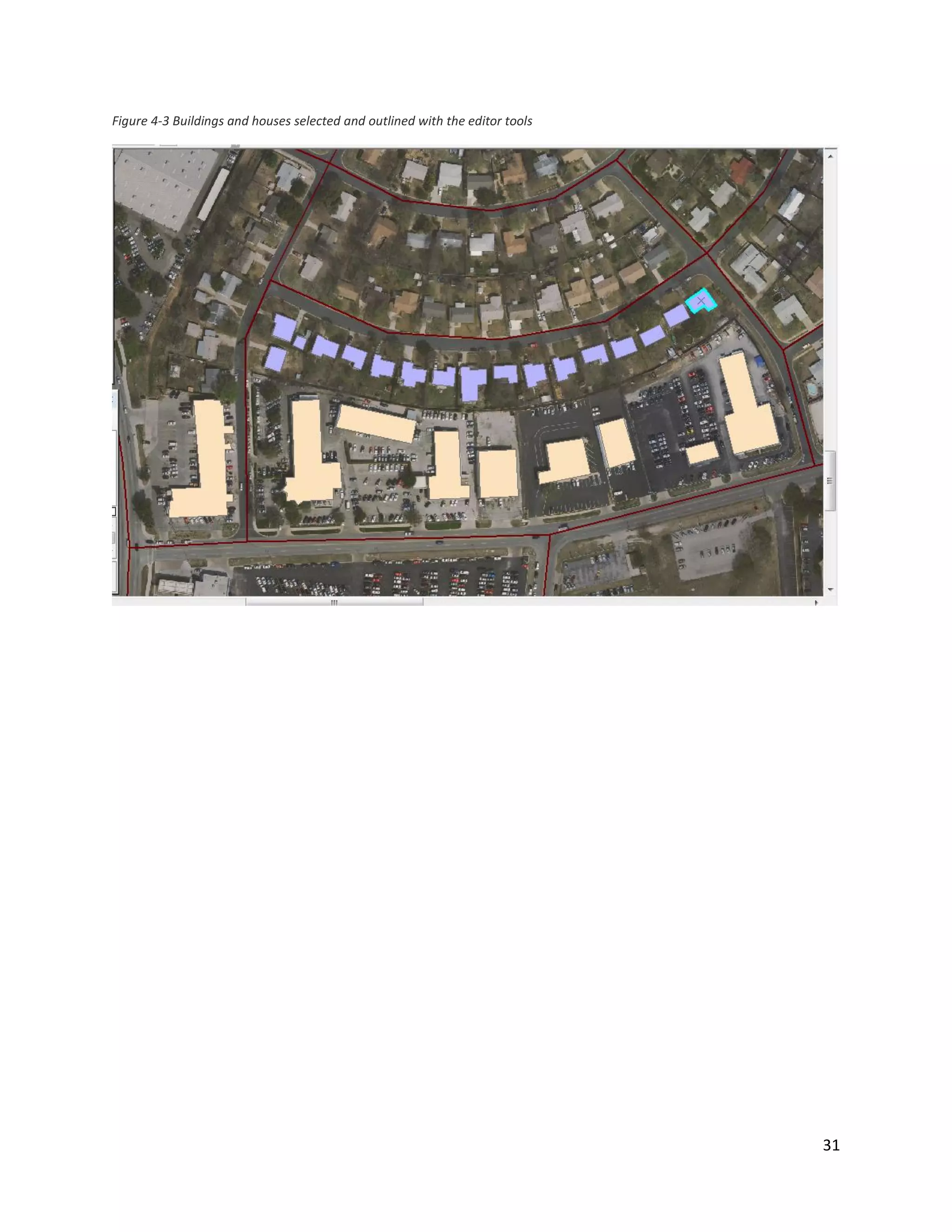
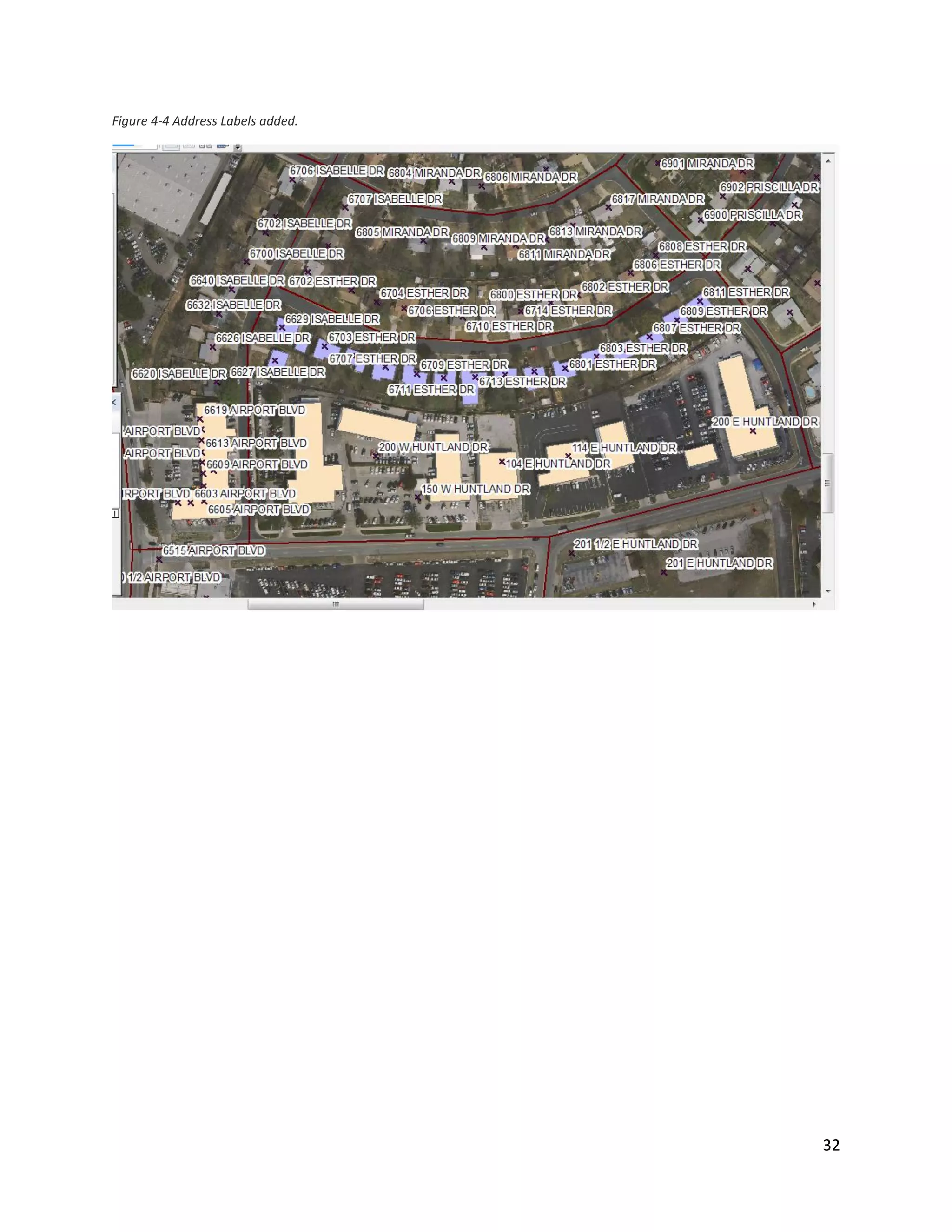
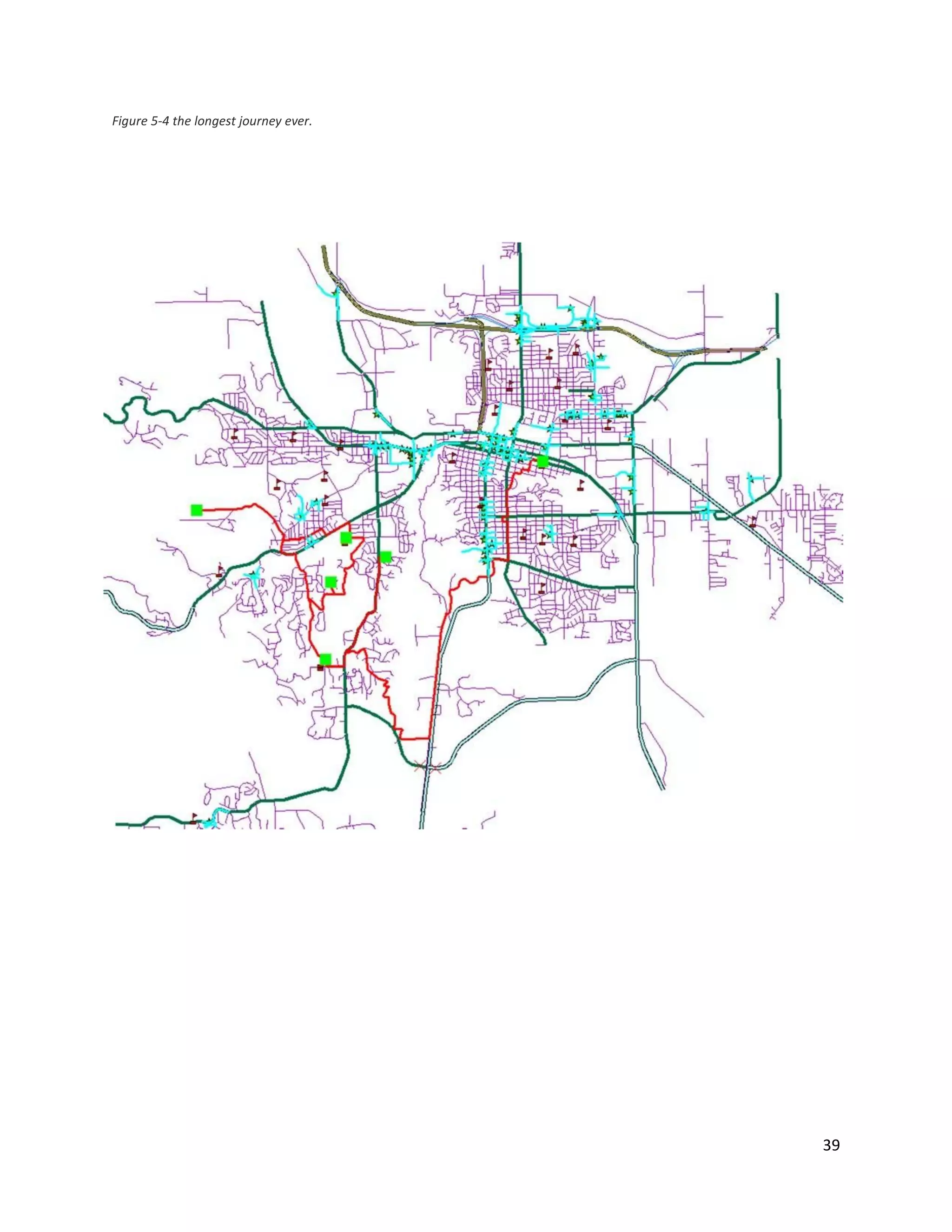
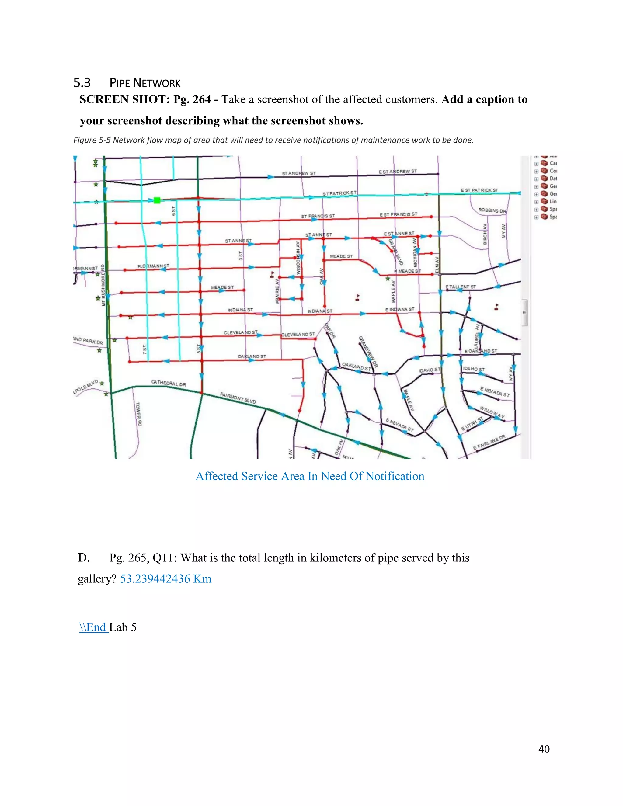
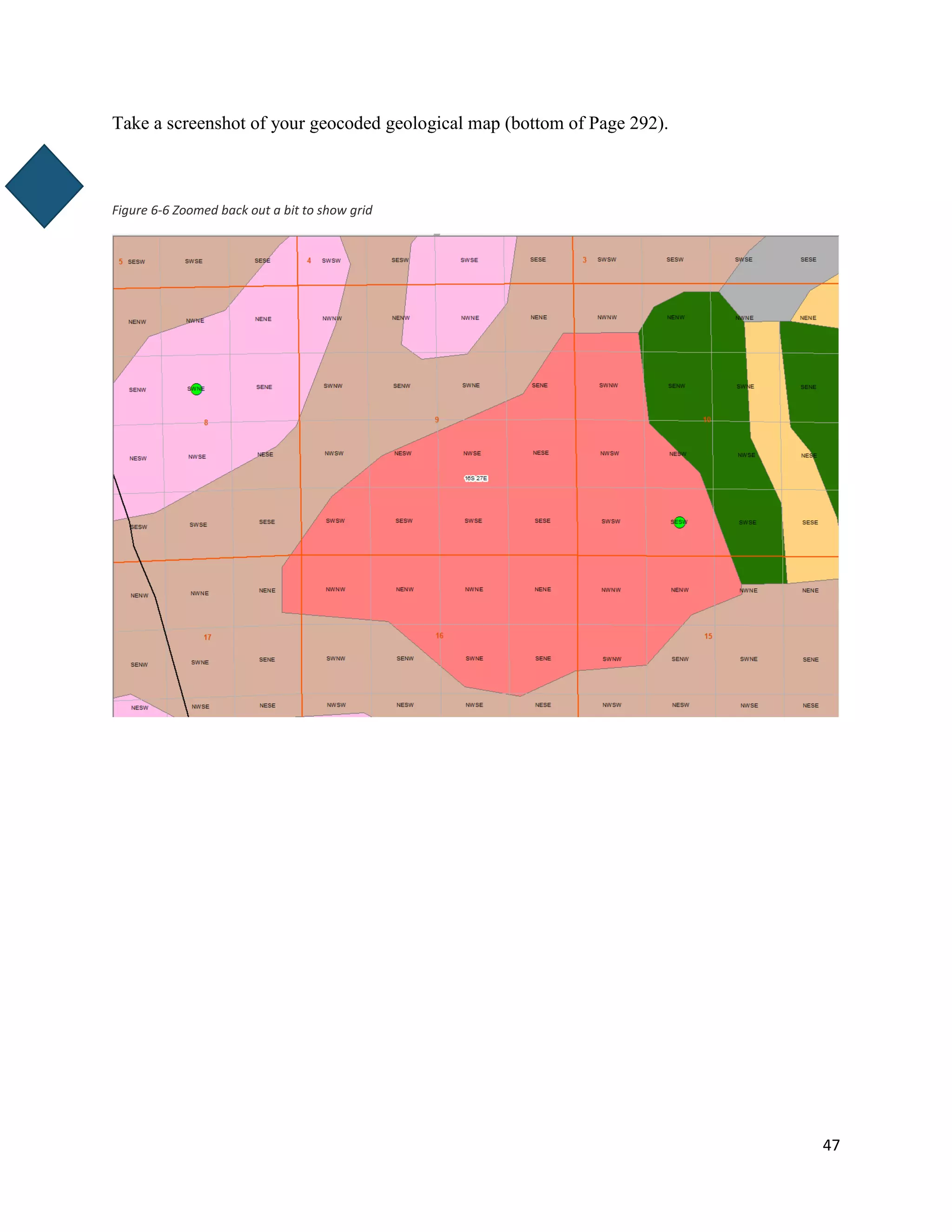
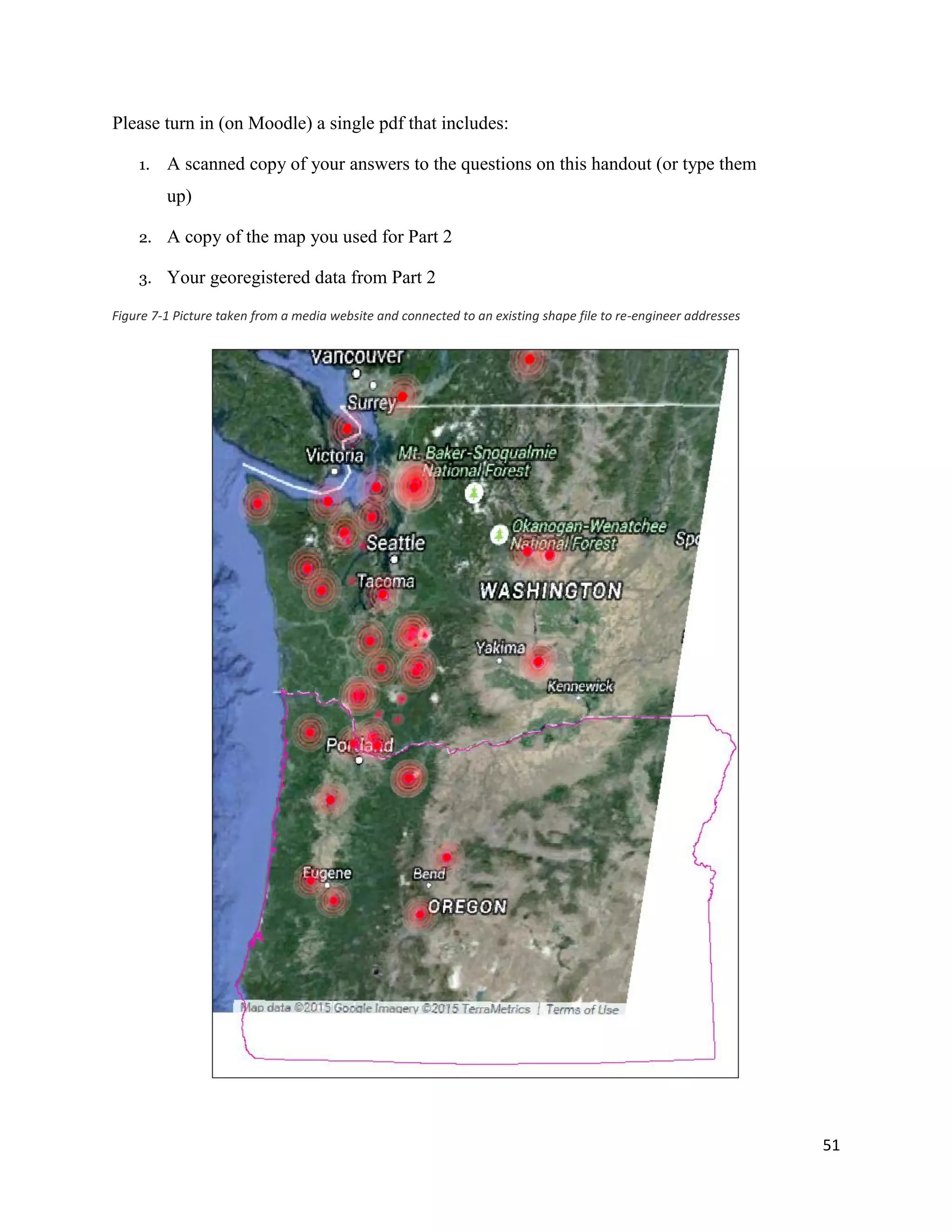
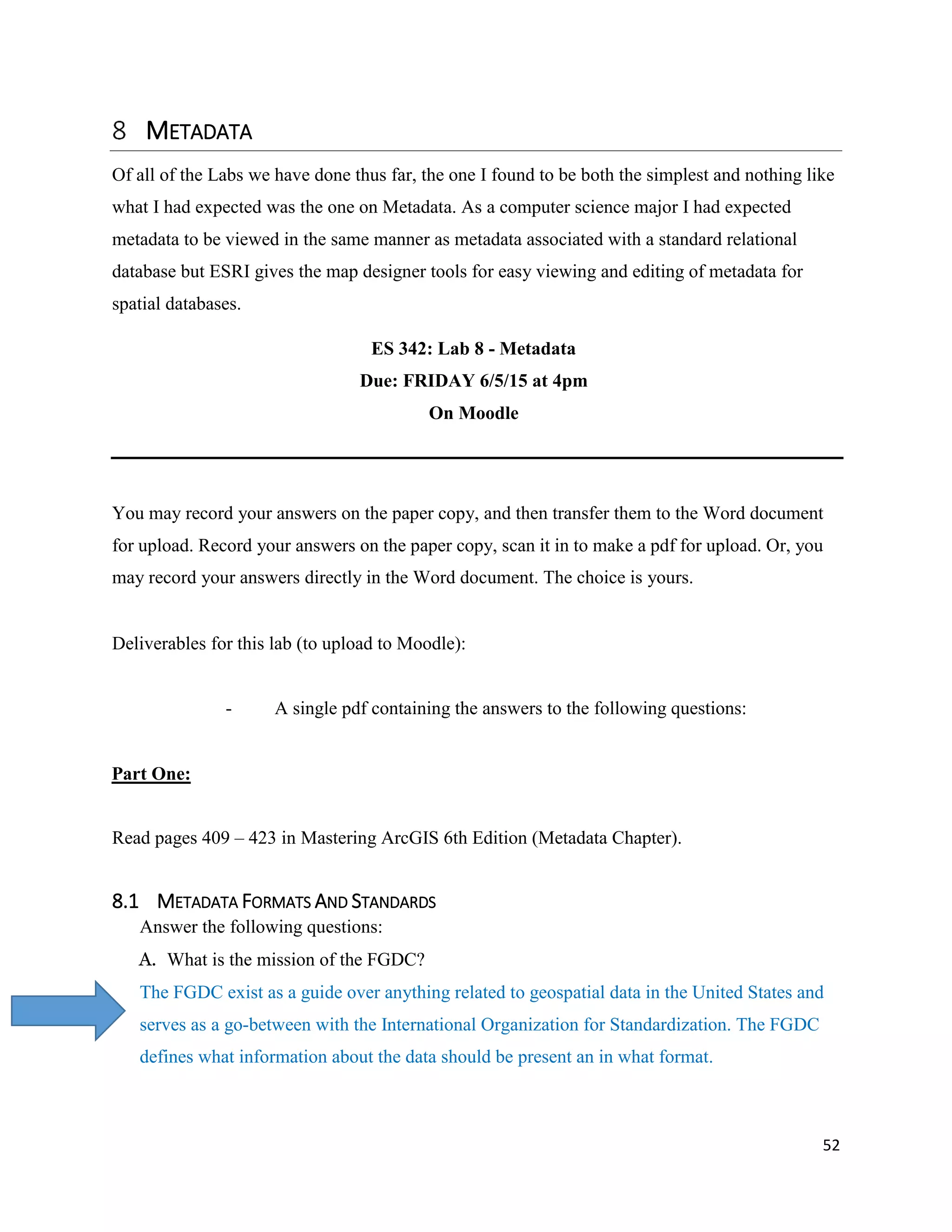
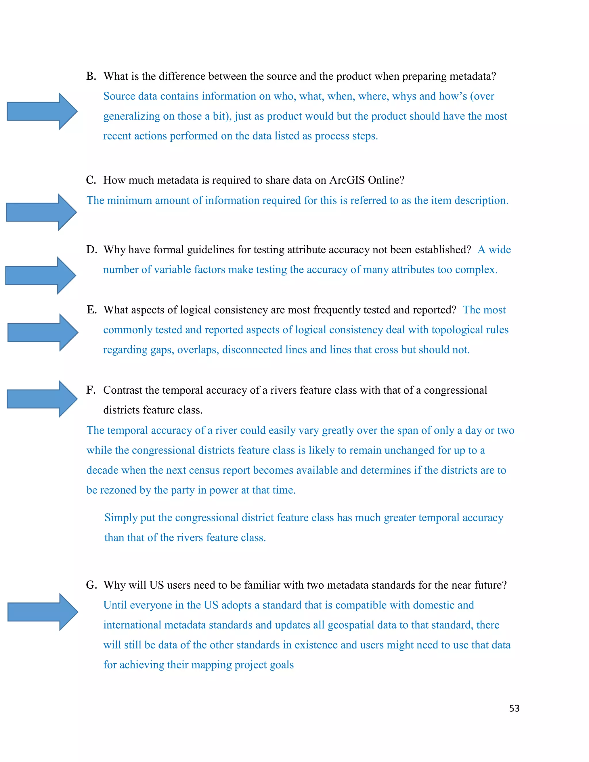
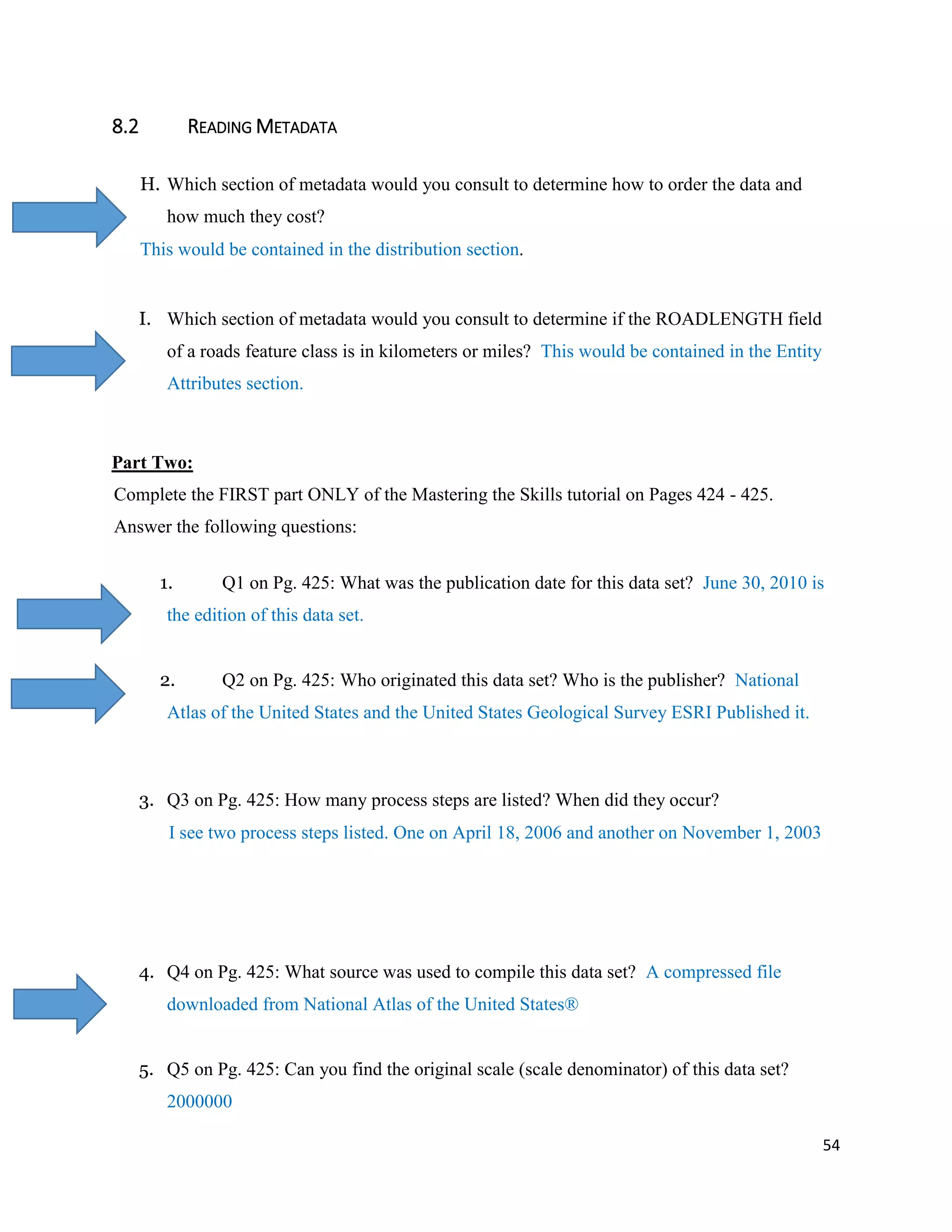
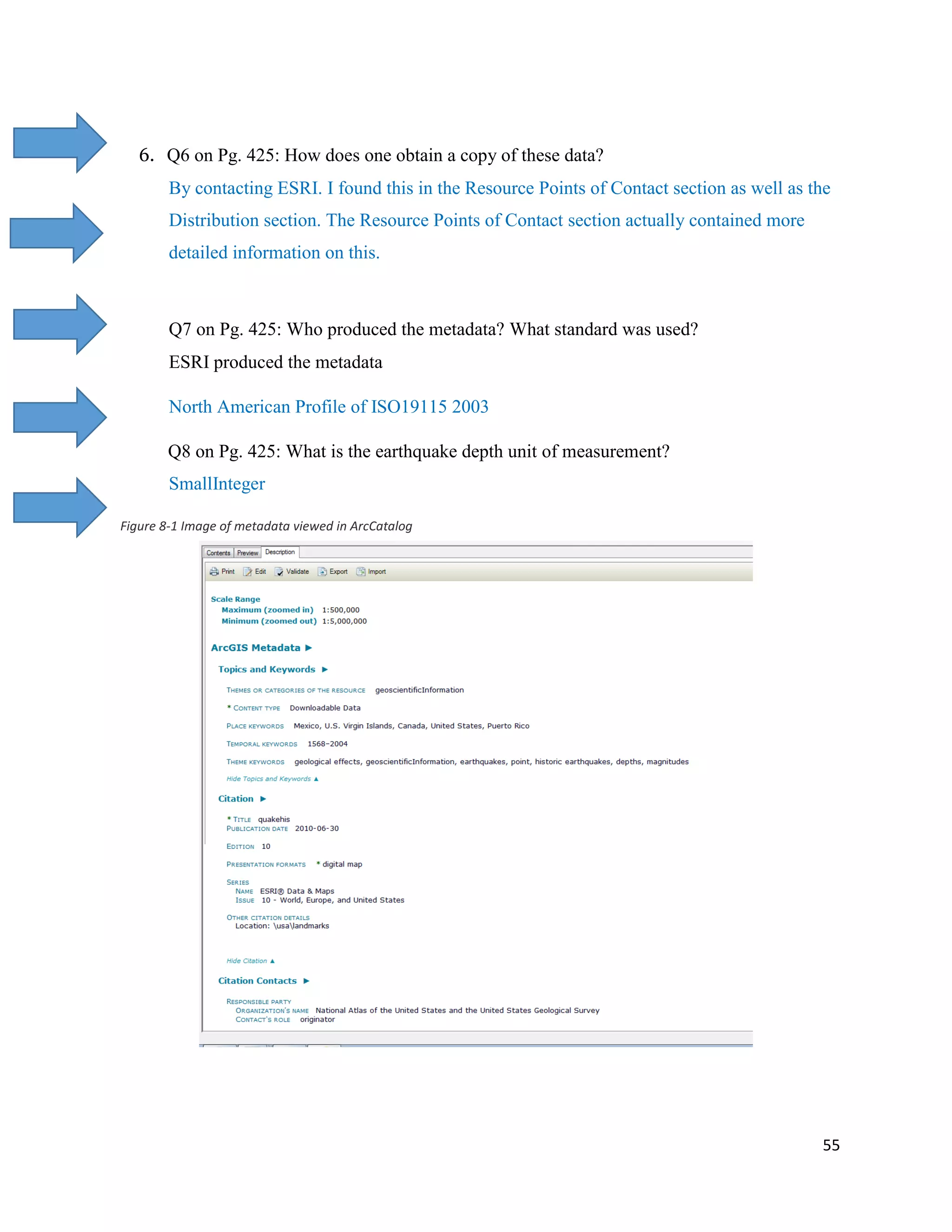
This document contains a portfolio for an ES 342 GIS course. It includes sections on coordinate systems, raster analysis, Python basics, editing skills, networks, geocoding, ethics, and metadata. For the coordinate systems section, the document discusses working with different projections and resolving coordinate system issues. The raster analysis section covers contouring, digital elevation models, and performing analysis in raster format. Python scripting is demonstrated for generating a buffer. The basics of editing terminology and skills are reviewed. Other sections discuss network analysis, geocoding addresses, spatial confidentiality and ethics, and metadata standards. Screenshots and maps from exercises are included throughout.


![Rs unit iii-gis--- [repaired]](https://cdn.slidesharecdn.com/ss_thumbnails/rsunit-iiigis-repaired-180305142425-thumbnail.jpg?width=640&height=640&fit=bounds)


![Rs unit iii-gis--- [repaired]](https://cdn.slidesharecdn.com/ss_thumbnails/rsunit-iiigis-repaired-180305142705-thumbnail.jpg?width=640&height=640&fit=bounds)