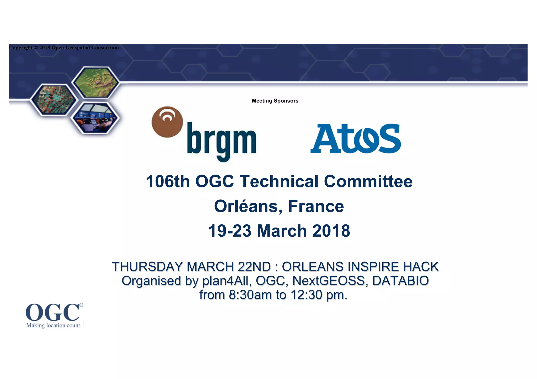
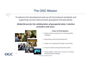
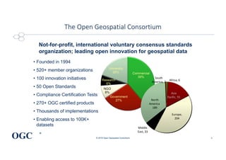
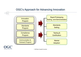
®
THURSDAY MARCH 22ND : ORLEANS INSPIRE HACK
Organised by plan4All, OGC, NextGEOSS, DATABIO
from 8:30am to 12:30 pm.
106th OGC Technical Committee
Orléans, France
19-23 March 2018
Copyright © 2018 Open Geospatial Consortium
Meeting Sponsors
OGC
®
The OGC Mission
To advance the development and use of international standards and
supporting services that promote geospatial interoperability.
Global forum for the collaboration of geospatial data / solution
providers and users.
© 2018 Open Geospatial Consortium
2
Value of Participation
• Achieve technical agreement on interoperability
challenges
• Networking, partnership development
• Insight into emerging technologies and markets
• Discover solutions being advanced by others
• Unique ability to share cost / resources in solving
interoperability challenges
OGC
®
The Open Geospatial Consortium
© 2018 Open Geospatial Consortium
Not-for-profit, international voluntary consensus standards
organization; leading open innovation for geospatial data
• Founded in 1994
• 520+ member organizations
• 100 innovation initiatives
• 50 Open Standards
• Compliance Certification Tests
• 270+ OGC certified products
• Thousands of implementations
• Enabling access to 100K+
datasets
Africa, 6
Asia
Pacific, 91
Europe,
204
Middle
East, 33
North
America,
189
South
America, 2
3
OGC’s Approach for Advancing Innovation
© 2018 Open Geospatial Consortium
Rapid Prototyping
Testing, and Demonstration
Standards
Setting
Market
Adoption
Innovation
Program
Standards
Program
Compliance
Program
Communication &
Outreach Program
Testing &
Certification
DWGs as of June 2017
Copyright © 2017 Open Geospatial Consortium
Metadata DWG Current works
© 2018 Open Geospatial Consortium
Several standards are used in different ecosystems
Geo World
ISO 19115
ISO 19139
INSPIRE
Geo-DCAT (JRC)
…
• Open-data and e-Gov World
DCAT (W3C)
ISO 18536 - Dublin core
…
• Archive World
ISO 15836 - Dublin core
…
OGC Position documents
• OGC Standard
– Implementation standard
– Abstract Specification
– Community standard
• OGC Best Practice
– A document containing discussion of best practices related to the use and/or implementation of an adopted
OGC standard or related technology and for release to the public. Best Practices Papers are the official
position of the OGC and thus represent an endorsement of the content of the paper.
• Engineering Report (ER)
• Discussion Paper
• White Paper
Copyright © 2017 Open Geospatial Consortium
OGC’s Approach for Advancing Innovation
© 2018 Open Geospatial Consortium
Rapid Prototyping
Testing, and Demonstration
Standards
Setting
Market
Adoption
Innovation
Program
Standards
Program
Compliance
Program
Communication &
Outreach Program
Testing &
Certification
Types of Initiatives – Agile Prototyping
Testbed
Technology
Maturation
Scope/
Variety
Hackathon Plugfest
Interoperability Experiment
Pilot
100-200
Number of Participants
TRL = 4 TRL = 8
0-3

Introduction

  • 1.
    ® THURSDAY MARCH 22ND: ORLEANS INSPIRE HACK Organised by plan4All, OGC, NextGEOSS, DATABIO from 8:30am to 12:30 pm. 106th OGC Technical Committee Orléans, France 19-23 March 2018 Copyright © 2018 Open Geospatial Consortium Meeting Sponsors
  • 2.
    OGC ® The OGC Mission Toadvance the development and use of international standards and supporting services that promote geospatial interoperability. Global forum for the collaboration of geospatial data / solution providers and users. © 2018 Open Geospatial Consortium 2 Value of Participation • Achieve technical agreement on interoperability challenges • Networking, partnership development • Insight into emerging technologies and markets • Discover solutions being advanced by others • Unique ability to share cost / resources in solving interoperability challenges
  • 3.
    OGC ® The Open GeospatialConsortium © 2018 Open Geospatial Consortium Not-for-profit, international voluntary consensus standards organization; leading open innovation for geospatial data • Founded in 1994 • 520+ member organizations • 100 innovation initiatives • 50 Open Standards • Compliance Certification Tests • 270+ OGC certified products • Thousands of implementations • Enabling access to 100K+ datasets Africa, 6 Asia Pacific, 91 Europe, 204 Middle East, 33 North America, 189 South America, 2 3
  • 4.
    OGC’s Approach forAdvancing Innovation © 2018 Open Geospatial Consortium Rapid Prototyping Testing, and Demonstration Standards Setting Market Adoption Innovation Program Standards Program Compliance Program Communication & Outreach Program Testing & Certification
  • 5.
    DWGs as ofJune 2017 Copyright © 2017 Open Geospatial Consortium
  • 6.
    Metadata DWG Currentworks © 2018 Open Geospatial Consortium Several standards are used in different ecosystems Geo World ISO 19115 ISO 19139 INSPIRE Geo-DCAT (JRC) … • Open-data and e-Gov World DCAT (W3C) ISO 18536 - Dublin core … • Archive World ISO 15836 - Dublin core …
  • 7.
    OGC Position documents •OGC Standard – Implementation standard – Abstract Specification – Community standard • OGC Best Practice – A document containing discussion of best practices related to the use and/or implementation of an adopted OGC standard or related technology and for release to the public. Best Practices Papers are the official position of the OGC and thus represent an endorsement of the content of the paper. • Engineering Report (ER) • Discussion Paper • White Paper Copyright © 2017 Open Geospatial Consortium
  • 8.
    OGC’s Approach forAdvancing Innovation © 2018 Open Geospatial Consortium Rapid Prototyping Testing, and Demonstration Standards Setting Market Adoption Innovation Program Standards Program Compliance Program Communication & Outreach Program Testing & Certification
  • 9.
    Types of Initiatives– Agile Prototyping Testbed Technology Maturation Scope/ Variety Hackathon Plugfest Interoperability Experiment Pilot 100-200 Number of Participants TRL = 4 TRL = 8 0-3