The S82(S82T) GNSS receiver has high accuracy for real-time kinematic surveying and static surveying. It supports 220 channels for multi-GNSS constellations including GPS, GLONASS, SBAS, and more. It has dual Bluetooth technology and internal memory to store up to 45.7 days of raw data. The receiver is waterproof, dustproof, and resistant to shock and vibration.
The SENSIT GAS•TRAC® LZ-30 is a small methane-specific leak detector that produces fast and accurate responses to methane gas from 100 feet away. Due to its extended detection range, the LZ-30 is perfect for hard to reach areas, eliminating the need to directly access the gas plume, climb to elevated areas, access fenced-in property, or other potentially dangerous situations.
The SENSIT® Portable Methane Detector is one of the best performing and most cost efficient methane gas analyzers on the market. Using the most advanced filtered infrared spectroscopy technology, the Portable Methane Detector allows users to survey, pinpoint, and grade methane gas leaks quickly and accurately for both walking and vehicle applications.
HUBUNGI KAMI : PT.MINDS INDO SURVEY, DISTRIBUTOR ALAT UKUR SURVEY DAN PEMETAAN, KOMP/RUKO. MEGA KALIMALANG KAV. 8 JLN KH NOER ALI NO. 11,PEKAYON JAYA BEKASI, Tlp : 02195099644/ HP : 082119953499/ 087886144398 Pin BB : 237FC845 .
PENGIRIMAN GRATIS UNTUK WILAYAH DKI
Menjual Alat-Alat Untuk Survey Pemetaan, Infrastruktur, Kontraktor, Telekomunikasi, Pertambangan, Geologist, Exploration, Mining, Dirling, Kelautan, Militer, Migas, Pembangunan Pembangunan, Pengelolaan Lahan Lahan Perhutanan Dan Perkebunan Kelapa Sawit.
RUANG LINGKUP KEGIATAN
PENJUALAN, SERVICE / PERBAIKAN DAN PENYEWAAN ALAT-ALAT UKUR
PENJUALAN :
Alat Ukur
- Total Station
- Altimeter
- Theodolite
- Digital Planimeter
- Levels
- Walking Measure
- GPS Geodetic
- Digital Level / Smart Tool
- Compass
- Phantograph
- Clinometer
- Tandem / Clino - Compass
Accessories :
- Tripod
- Prisma
- Rambu Ukur
- Meteran
- Jalon
- Binocular
PENYEWAAN :
- Total Station
- Automatic Level
- Theodolite
MEREK ALAT UKUR YANG TERSEDIA :
- MINDS
- SPECTRA
- NIKON
- SUUNTO
- GARMIN
- LEICA
- HORIZON
SERVICE / PERBAIKAN DAN KALIBRASI MACAM-MACAM ALAT UKUR
HARGA MENARIK / COMPETITIVE
Catatan : Price List akan dikirim sesuai permintaan
Thermal Camera VTMS Vessel Traffic Management System & Coastal surveillance & security solution for complete MDA Maritime domain awareness. www.infinitioptics.com
Coastal security surveillance and maritime domain awareness systems is a solution that integrates , sythenzies and displays of information from all the sensor including but not limited to primary radar, AIS and CCTV, VHS, Nautical maps, EO/IR cameras.. Infiniti solution provides state of the art high-performance software solutions to provide our customers and integrators with a complete VTMS solution on a modular platform to suite the size and budget of the customer from 1 standalone station to complete country solution the require interagency cooperation and tasking all in one unified turnkey solution solution.
A true turnkey solution for maritime surveillance, our coastal monitoring system pairs a UHD digital radar and advanced multi-sensor PTZ camera system using a sophisticated software suite and automatic slew-to-cue performance.
The radar is an advanced X-Class radar system with impressive long-range detection up to 96 nautical miles. The Vega camera is a revolutionary multisensor PTZ camera boasting a long-range 135X visible day/night camera, long-range thermal infrared zoom, and optional ZLID NIR illumination with LRF. This complete system is an all-in-one solution for oil platforms, ports, harbours, fish farms, marine protected areas, wind farms, nuclear power plants, bridges or
dam constructions, military sites, submarine cable areas and more.
Applications:
›› Detection of illegal marine activities (illegal fishing, piracy, terrorism, etc.)
›› Anti-collision system between vessels and/or platforms
›› Search and rescue operations
›› Optimization of port infrastructure
›› Protection of sensitive coastal sites
X-Band Marine Radar
We offer native and advanced compatibility with
most of the newer marine radars on the market. Up
to 6 radars can be remotely merged, displayed and
controlled from our coastal monitoring.
EO/IR Cameras
Slew-to-cue and tracking integration with Infiniti
Electro-Optics cameras can track targets picked up
via radar either manually or automatically based on
user defined parameters. Up to 12 cameras can be
displayed and controlled.
Optional AIS
VHF Recording
The system can be connected to 4 VHF radios
which allow the monitoring of up to 4 channels
at the same time.
www.infinitioptics.com
The LV-1800 non-contact type Laser Doppler Vibrometer uses newly designed interference optical system and has achieved improvement of detection sensitivity by 20 dB compared to the conventional models. The built-in positioning camera makes it easy to check the target by laser beam irradiation.
The LV-1800 can perform amplitude velocity measurements in a wide range of fields that are difficult with a contact type vibration sensor; small actuator using piezoelectric element, cell phones and digital camera with MEMS (Micro Electro Mechanical Systems), inverter an other devices in an EV/HEV. By using the LV-1800 with FFT Analyzer, it is possible to visualize not just vibration but the state of the vibration.
https://www.n-denkei.com/singapore/inquiry/
In IBJ Technology mud flowmeters the two
ultrasonic transducers are placed at an angle
in relation to the pipe axis. The transducers
function as transmitters and receivers of the
ultrasonic signals. Measurement is
performed by determining the time the
ultrasonic signal takes to travel with and
against the flow.
Properties: -For all drilling muds suited
-No limitation by cuttings and weight
-For all flange sizes and standards
-High Pressure class 2500 possible
Enhancements: -Acoustic Attenuation Spectroscope
-Solids & Cutting Separator control
Experimentalstudy measurement of sonic speed of drilling muds under shear stressFrank-Michael Jäger
The measurement of sound velocity and damping took place at IBJ technology with other acoustic and electric parameters and under realistic conditions with shear stress of the drilling muds. The measurement of the speed of sound is practical with the concept of the Ultrasonic sensors.
Interference by rotating drill strands are not to be expected. The depth and range of the sensors safely exceeds the damping of the mud. Even in the most absorbing mud (20.2 lb/gal), the penetration depth is 10 x the distance of the s
The measurement of the flow of drilling mud is possible also with all commonly used drilling sludge and diameters of pipelines
HFC actives towards 1.8 GHz? - #TelesteLive webinar presentation May 19, 2020Teleste Corporation
Rami Kimari presented about 1.8 GHz HFC actives on the #TelesteLive webinar Network Transformation in 2020's, organized May 19, 2020. You can now watch the webinar on video as well as read answers to audience questions by clicking to: https://www.telestehub.com/broadbandvideo/telestelive-network-transformation-in-2020s/
es una presentación donde presento lo que es impunidad por que se da, algunos casos, lo que es para nosotros los mexicanos y como nos afecta socialmente
How to do certificate attestation for fresh passportServices 2 NRI
Certificate attestation signifies verified documents of the passport applicant. The applicants can check list of various documents for getting rid of inconvenience. The proofs of address, identity with photograph and others include birth certificate, marriage/divorce and death certificate, PAN card, Aadhaar card, educational certificate, voter id and so on. Photocopies of these must be attested by self as well as gazetted officer.
KAMI MELAYANI PEMESANAN KESELURUH KOTA-KOTA DI INDONESIA,
Surabaya, Bali, Sidoarjo, Malang, Semarang, Yogyakarta, Pekalongan, Cirebon, Tangerang, Jakarta, Bandung, Sumatra, Aceh, Lampung, Medan, Riau, Batam, Jambi, Padang, Kalimantan, Samarinda, Pekanbaru, Bengkulu, Makasar, Sulawesi, Irian jaya,Papua, Bangka Belitung, Banten, Jabar, Jateng, Jatim, Ntt, Ntb, Gorontalo, maluku DLL
Pengiriman Untuk Kota Jakarta Gratis. Luar Jakarta dgn layanan JNE YES .TIKI
HUBUNGI KAMI : PT.MINDS INDO SURVEY, DISTRIBUTOR ALAT UKUR SURVEY DAN PEMETAAN, KOMP/RUKO. MEGA KALIMALANG KAV. 8 JLN KH NOER ALI NO. 11,PEKAYON JAYA BEKASI, Tlp : 02195099644/ HP : 082119953499/ 087886144398 Pin BB : 237FC845 .
PENGIRIMAN GRATIS UNTUK WILAYAH DKI
Menjual Alat-Alat Untuk Survey Pemetaan, Infrastruktur, Kontraktor, Telekomunikasi, Pertambangan, Geologist, Exploration, Mining, Dirling, Kelautan, Militer, Migas, Pembangunan Pembangunan, Pengelolaan Lahan Lahan Perhutanan Dan Perkebunan Kelapa Sawit.
RUANG LINGKUP KEGIATAN
PENJUALAN, SERVICE / PERBAIKAN DAN PENYEWAAN ALAT-ALAT UKUR
PENJUALAN :
Alat Ukur
- Total Station
- Altimeter
- Theodolite
- Digital Planimeter
- Levels
- Walking Measure
- GPS Geodetic
- Digital Level / Smart Tool
- Compass
- Phantograph
- Clinometer
- Tandem / Clino - Compass
Accessories :
- Tripod
- Prisma
- Rambu Ukur
- Meteran
- Jalon
- Binocular
PENYEWAAN :
- Total Station
- Automatic Level
- Theodolite
MEREK ALAT UKUR YANG TERSEDIA :
- MINDS
- SPECTRA
- NIKON
- SUUNTO
- GARMIN
- LEICA
- HORIZON
SERVICE / PERBAIKAN DAN KALIBRASI MACAM-MACAM ALAT UKUR
HARGA MENARIK / COMPETITIVE
Catatan : Price List akan dikirim sesuai permintaan
Digilogic Systems' Telemetry Receiver design is so remarkable due to its incredible flexibility and unparalleled capability of antenna and flight experiment's ground station use. It consists of a combination of the latest technologies, such as field-programmable-gate-array (FPGA)-type and software-defined-radio (SDR). As a result, the overall performance of the digital telemetry is greatly improved in the context of reception, waveform processing, and signal analysis.
Sagittar LD (Long Distance) Series IP Radio BrochureSagittar
Sagittar LD (Long Distance) Series IP Radio are quick installation links that are designed to achieve the following data throughput speeds:
Sagittar LD Series 20Mbps@40km
Sagittar LD Series 8Mbps@100km
Sagittar LD (Long Distance) Series IP Radio Brochure
Gps geodetik s82 t
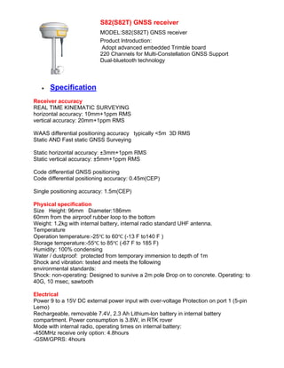
1. S82(S82T) GNSS receiver
MODEL:S82(S82T) GNSS receiver
Product Introduction:
Adopt advanced embedded Trimble board
220 Channels for Multi-Constellation GNSS Support
Dual-bluetooth technology
Specification
Receiver accuracy
REAL TIME KINEMATIC SURVEYING
horizontal accuracy: 10mm+1ppm RMS
vertical accuracy: 20mm+1ppm RMS
WAAS differential positioning accuracy typically <5m 3D RMS
Static AND Fast static GNSS Surveying
Static horizontal accuracy: ±3mm+1ppm RMS
Static vertical accuracy: ±5mm+1ppm RMS
Code differential GNSS positioning
Code differential positioning accuracy: 0.45m(CEP)
Single positioning accuracy: 1.5m(CEP)
Physical specification
Size Height: 96mm Diameter:186mm
60mm from the airproof rubber loop to the bottom
Weight: 1.2kg with internal battery, internal radio standard UHF antenna.
Temperature
Operation temperature:-25 to 60 (-13 F to140 F )
Storage temperature:-55 to 85 (-67 F to 185 F)
Humidity: 100% condensing
Water / dustproof: protected from temporary immersion to depth of 1m
Shock and vibration: tested and meets the following
environmental standards:
Shock: non-operating: Designed to survive a 2m pole Drop on to concrete. Operating: to
40G, 10 msec, sawtooth
Electrical
Power 9 to a 15V DC external power input with over-voltage Protection on port 1 (5-pin
Lemo)
Rechargeable, removable 7.4V, 2.3 Ah Lithium-lon battery in internal battery
compartment. Power consumption is 3.8W, in RTK rover
Mode with internal radio, operating times on internal battery:
-450MHz receive only option: 4.8hours
-GSM/GPRS: 4hours
2. Communication and data storage
3-wire serial (5-pin Lemo) on port 1, 3-wire serial+1.1 USB on port 2(DB9)
Full integrated, fully sealed internal 450MHz receiver
Fully integrated, fully sealed internal GSM/GPRS option
Fully integrated, fully sealed 2.4Ghz communications
port(Bluetooth)
External cellphone support for GSM/GPRS modems for RTK and VRS operations
Data storage on 64MB internal memory: 45.7 days of raw
observables (approx. 1.4MB per Day), based on recording
every 15 seconds from an average of 14 satellites
1Hz,2Hz, 5Hz, 10Hz and 20Hz positioning
CMR, RTCM2.3, RTCM3.0 input and output
0183 NMEA outputs
Radio Frequency
430-450MHz , 450-470MHz optional
Product Feature
Receiver part
Advanced Trimble Maxwell 6 Custom Survey GNSS chip with 220 channels
High precision multiple correlator for GNSS pseudorange measurements
Unfiltered, unsmoothed pseudorange measurements data for low noise, low
multipath error, low time domain correlation and high dynamic response
Very low noise GNSS carrier phase measurements with <1mm
Precision in a 1Hz bandwidth
Signal-to-Noise ratios reported in db-Hz
Proven low elevation tracking technology
Initialization time <15s
initialization reliability>99.9%
Satellite signals tracked simultaneously
GPS:
L1 C/A, L2E, L2C, L5(reserved)
GLONASS:
L1 C/A, L1P,
L2 C/A (GLONASS M only), L2P
SBAS:
L1 C/A, L5(reserved)
Gallileo: (reserved)
GIOVE-A: L1 BOC, E5A, E5B, E5AltBOC
GIOVE-B: L1 CBOC, E5A. E5B, E5AltBOC
Compass: (reserved)
B1(QPSK), B1-MBOC(6,1,1/11) , B1-2 (QPSK),
B2(QPSK), B2-BOC(10,5 ) ,
B3(QPSK), B3BOC(15,2.5),
L5 (QPSK).