Downloaded 14 times
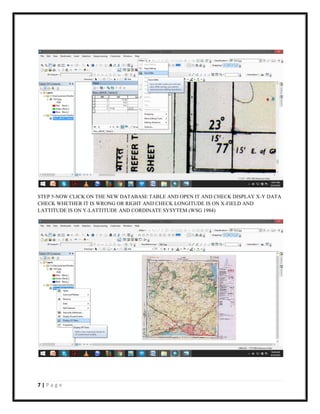
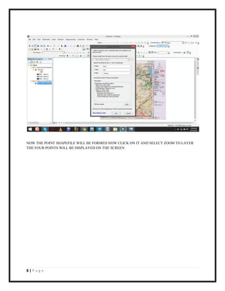
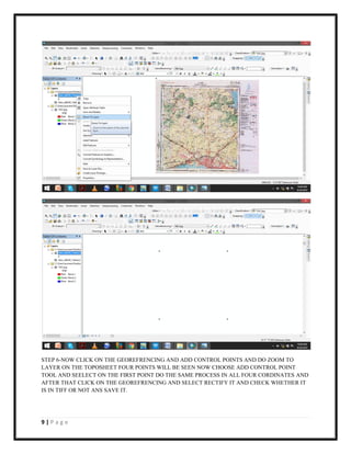
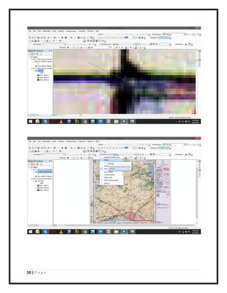
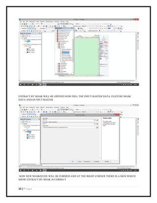
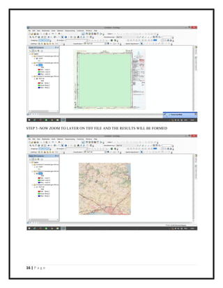
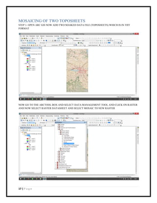
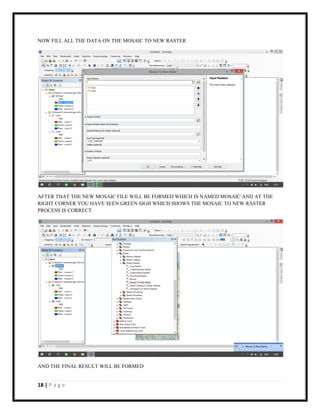
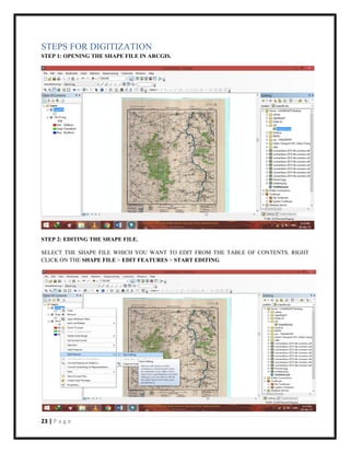
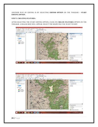
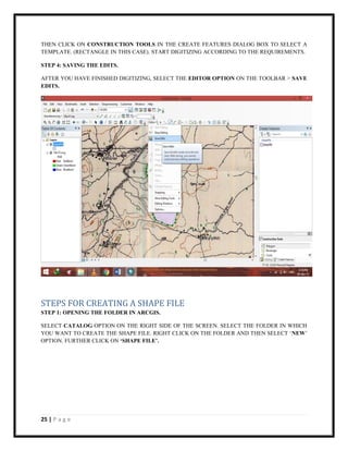
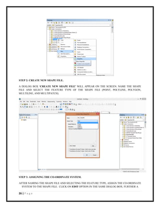

The document is a guide for georeferencing, masking, mosaicing topographical sheets, and image classification using ArcGIS software. It details step-by-step processes for tasks such as creating database tables, adding control points, extracting by mask, and performing image classification. Each section provides clear instructions along with tips for saving edits and checking outputs.