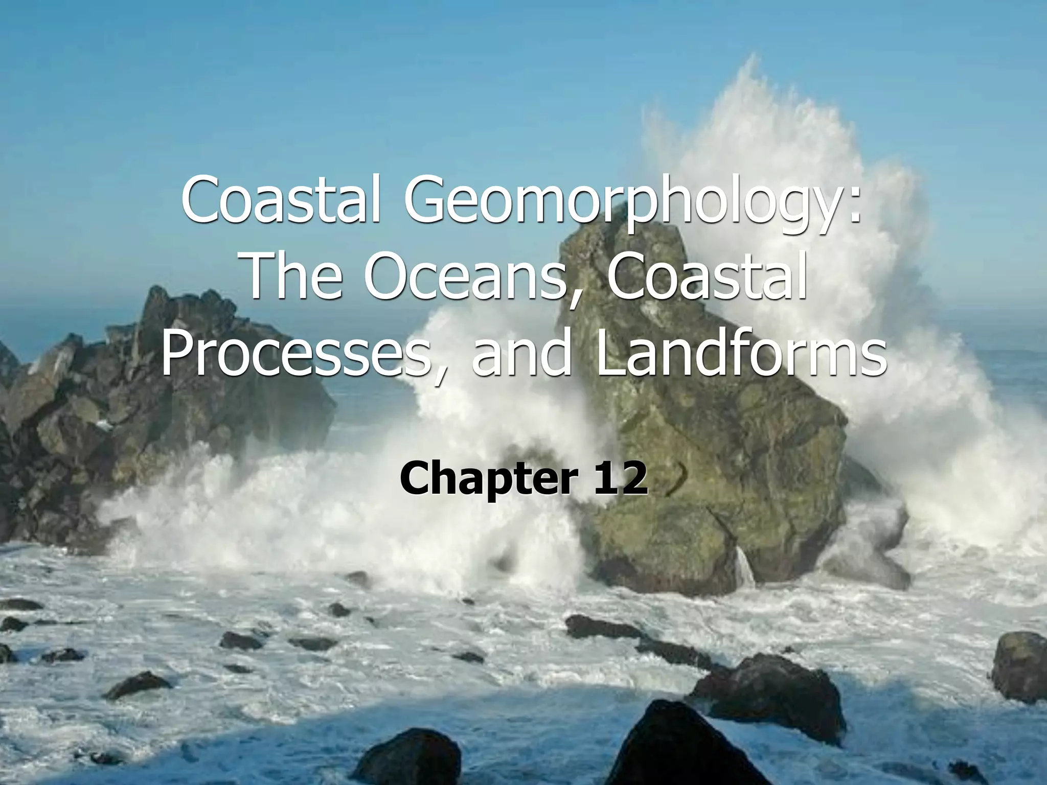
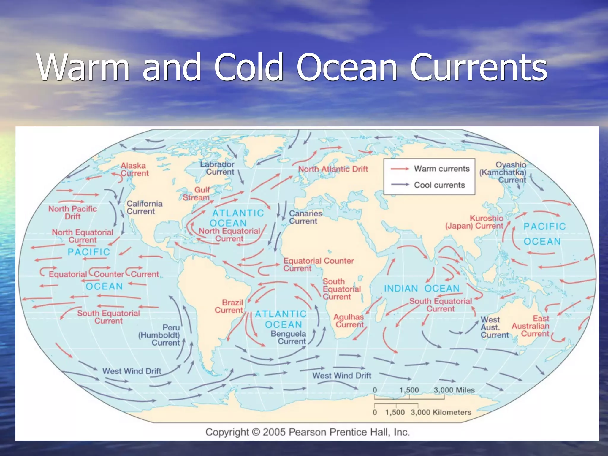
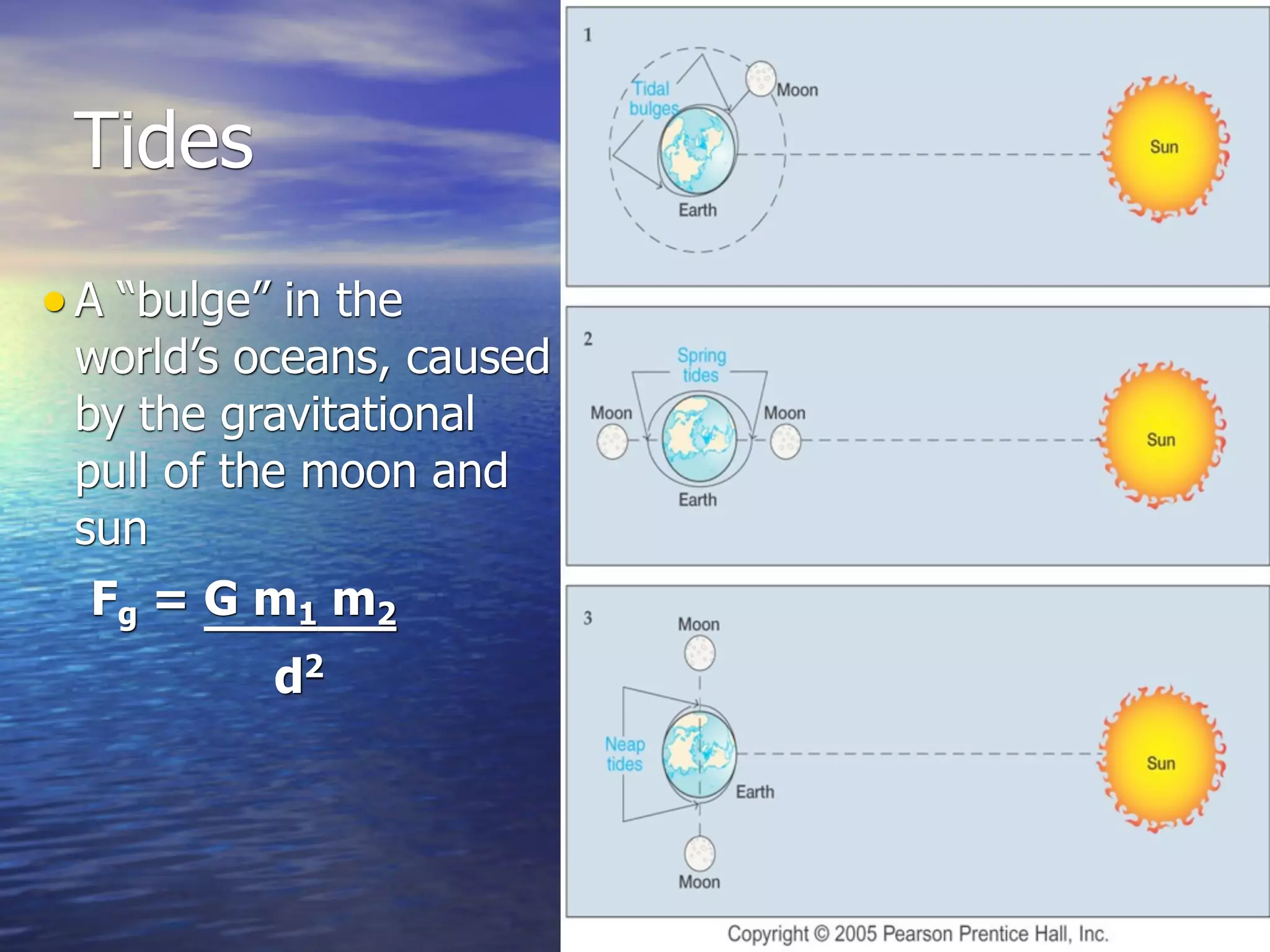
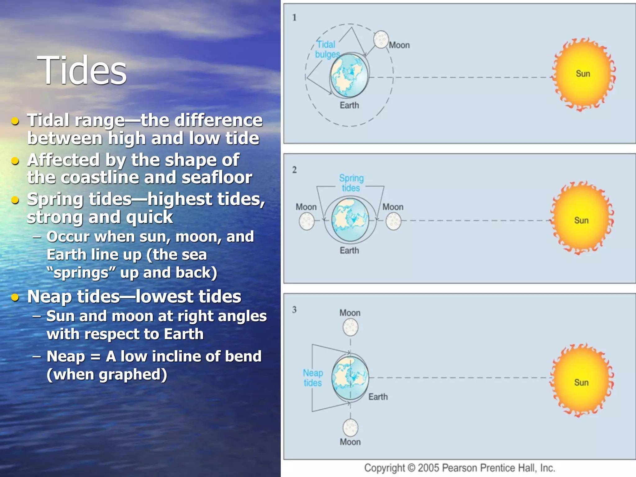
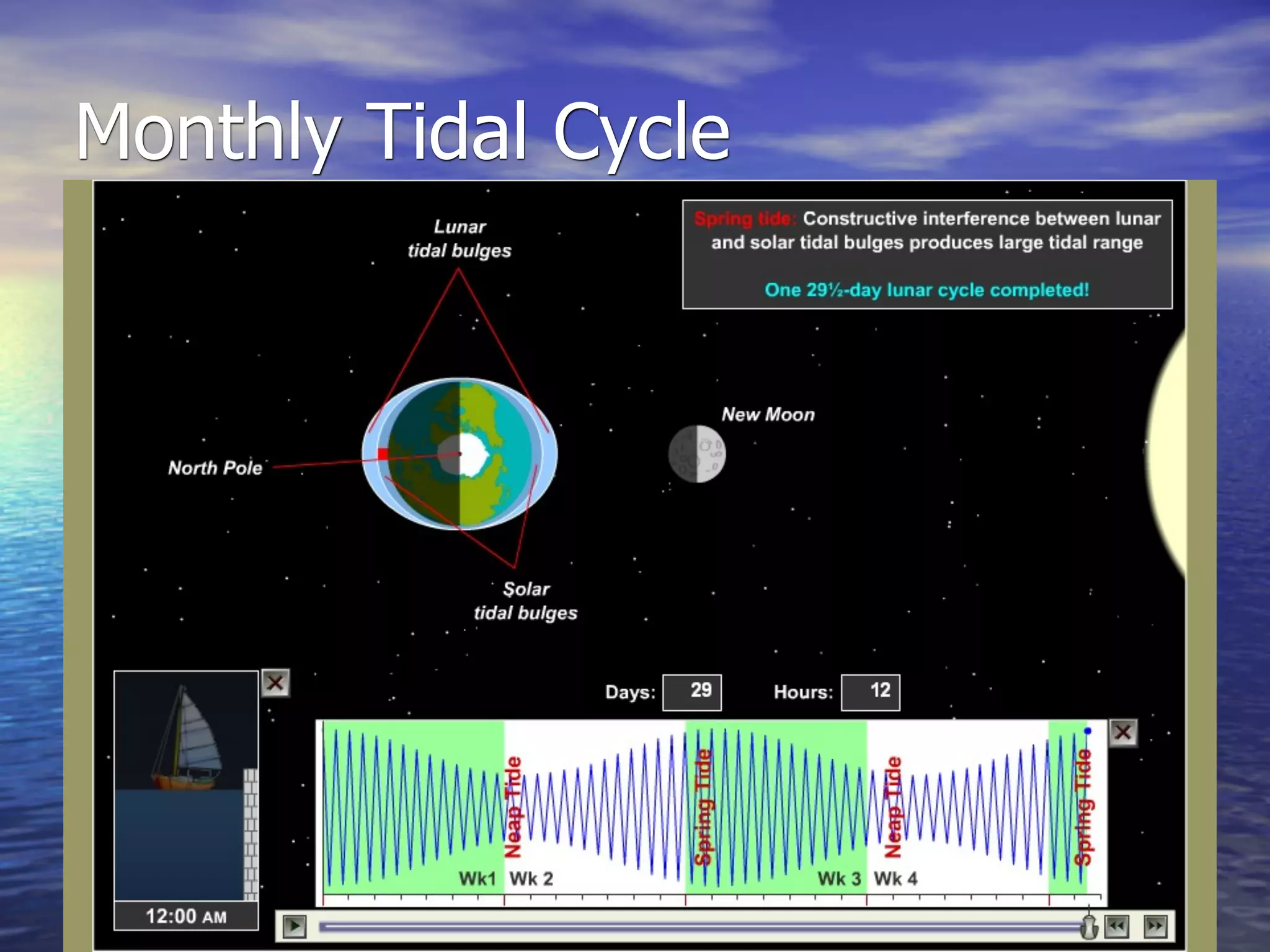
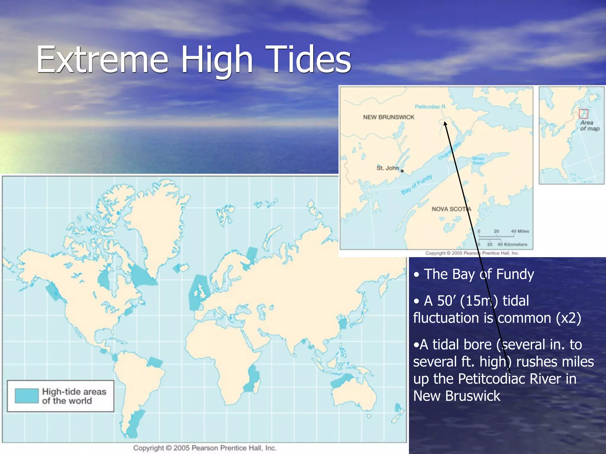
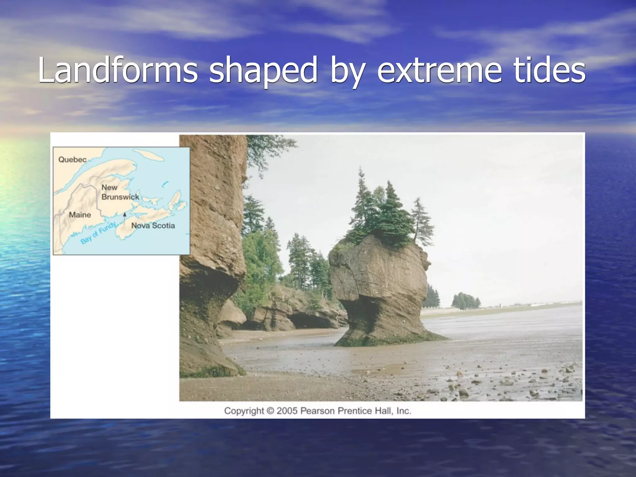
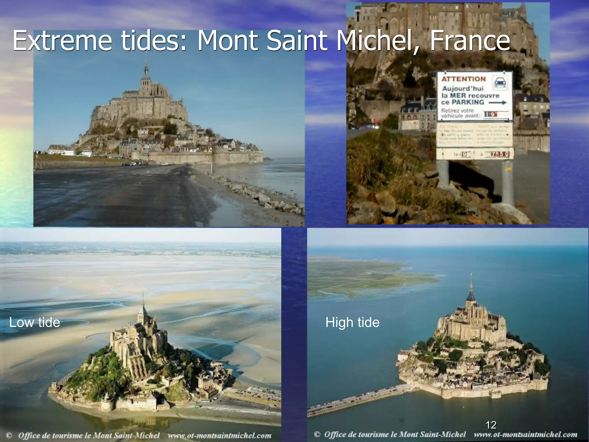
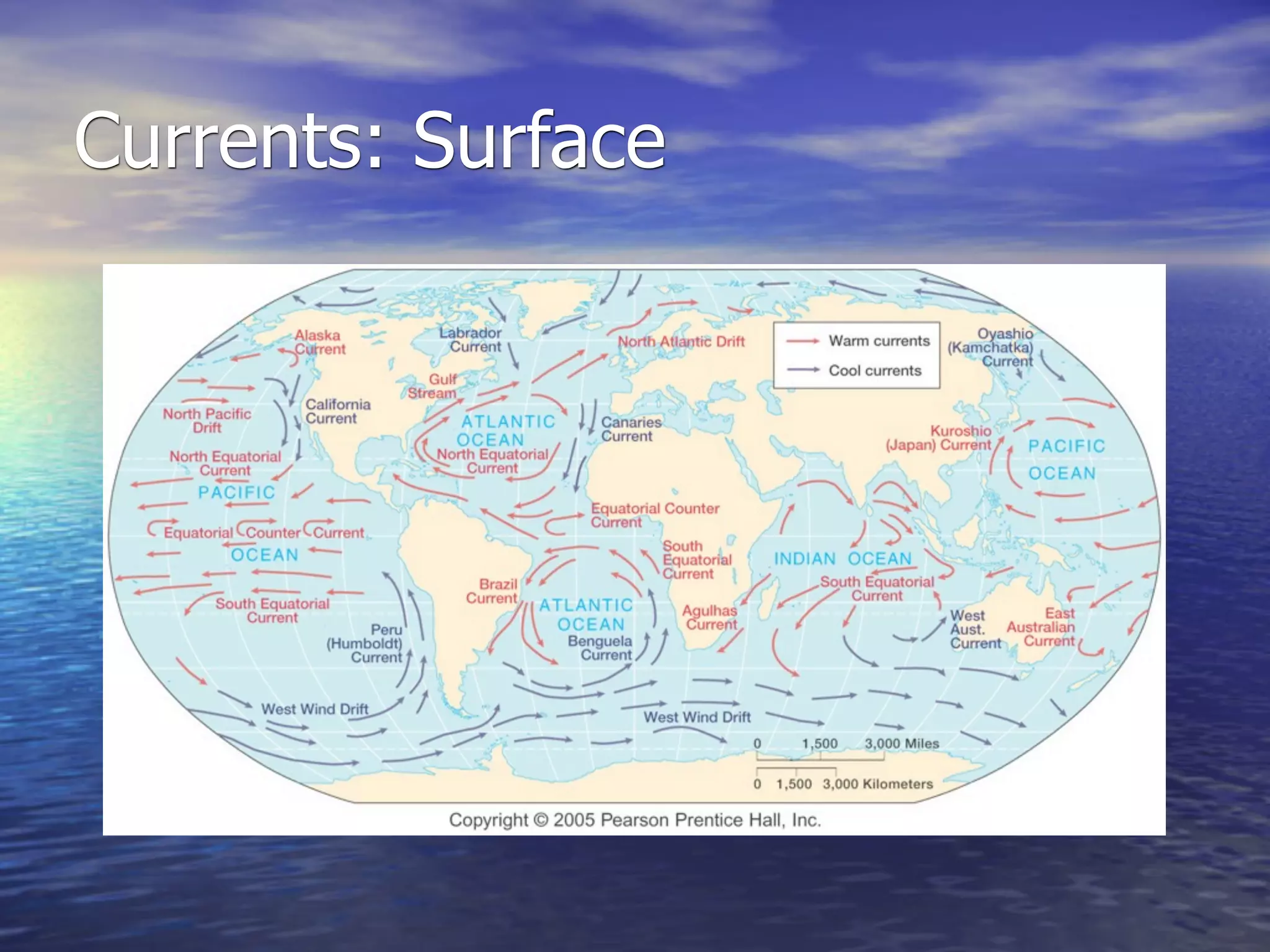
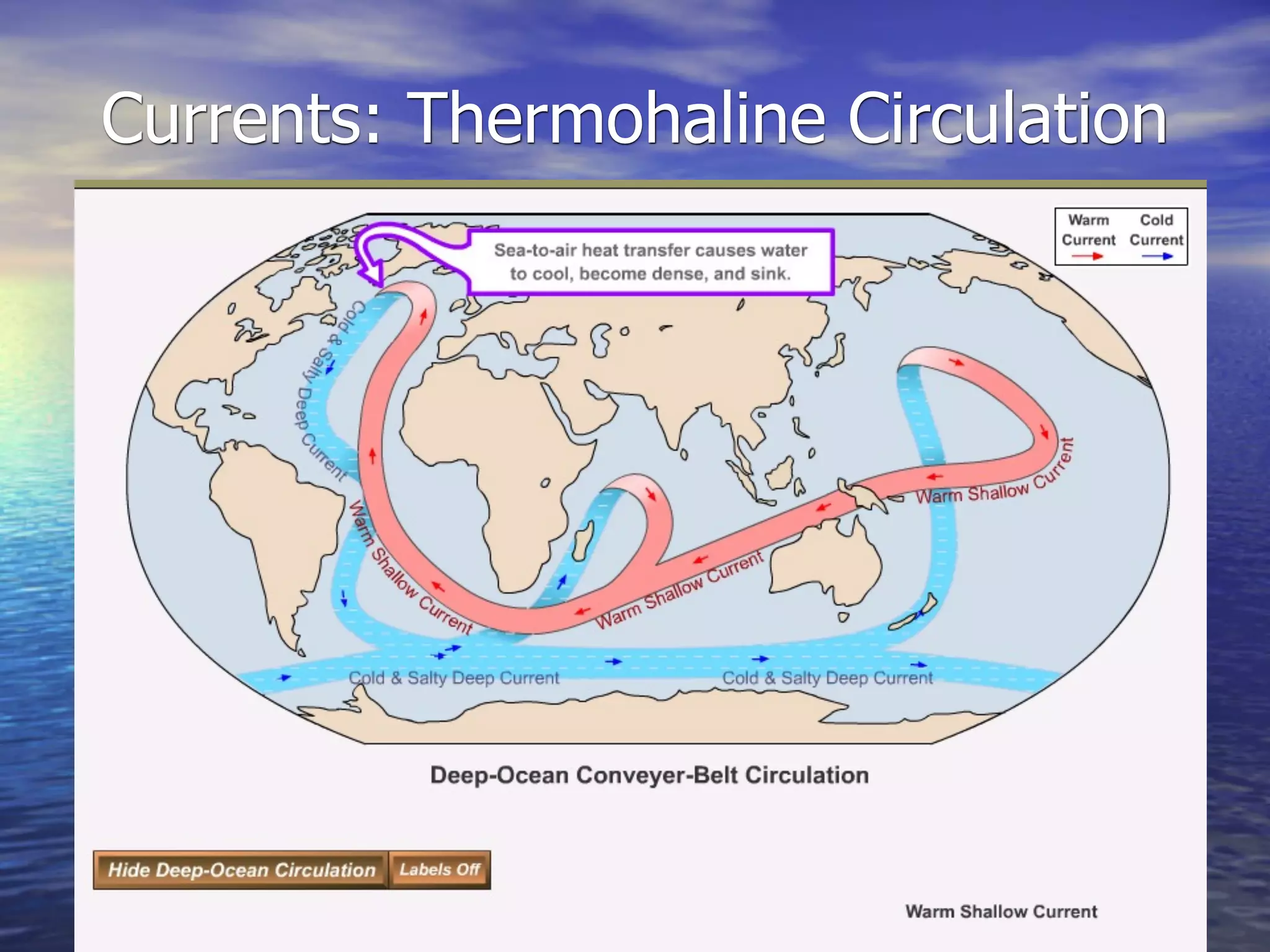
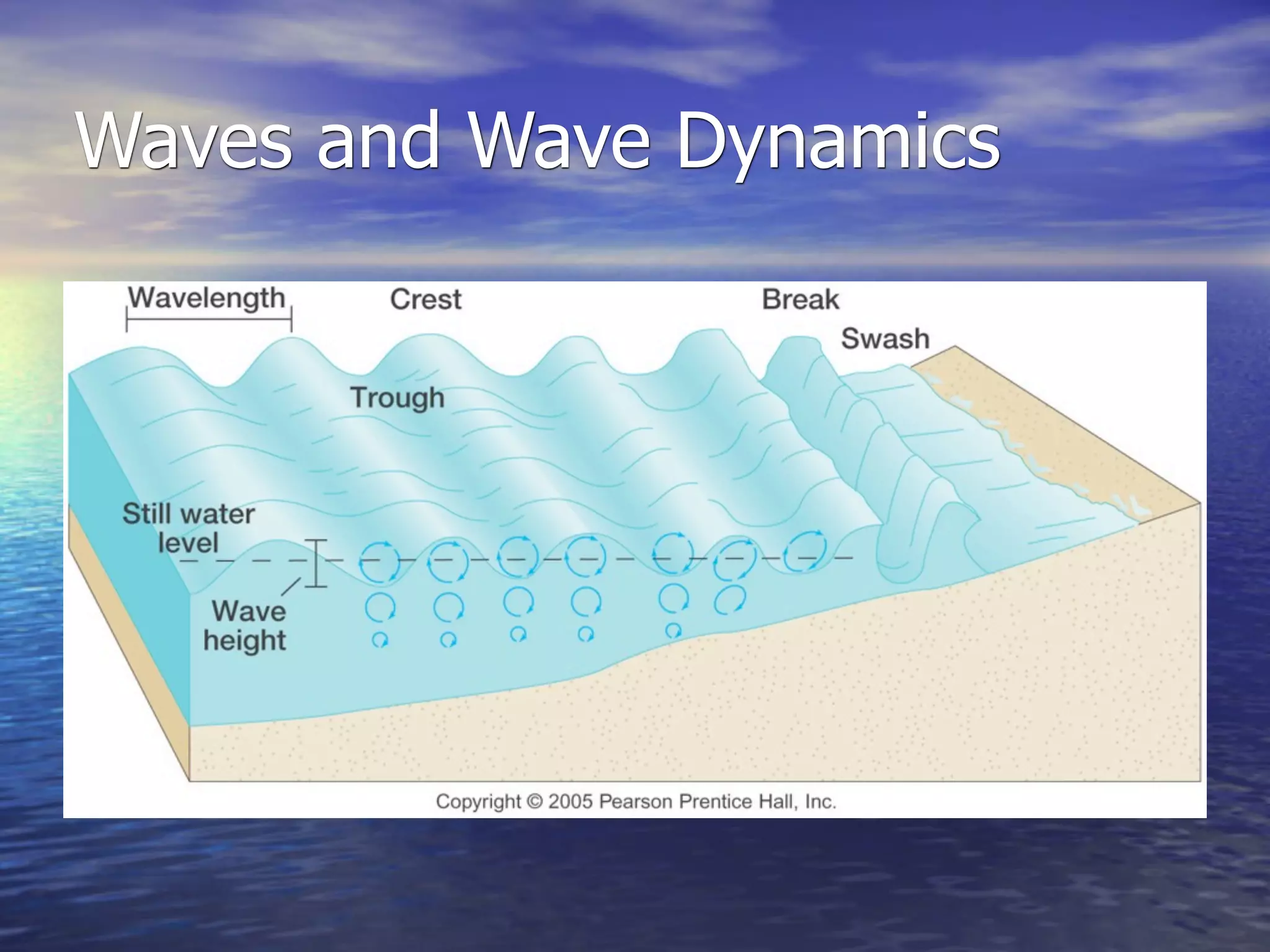
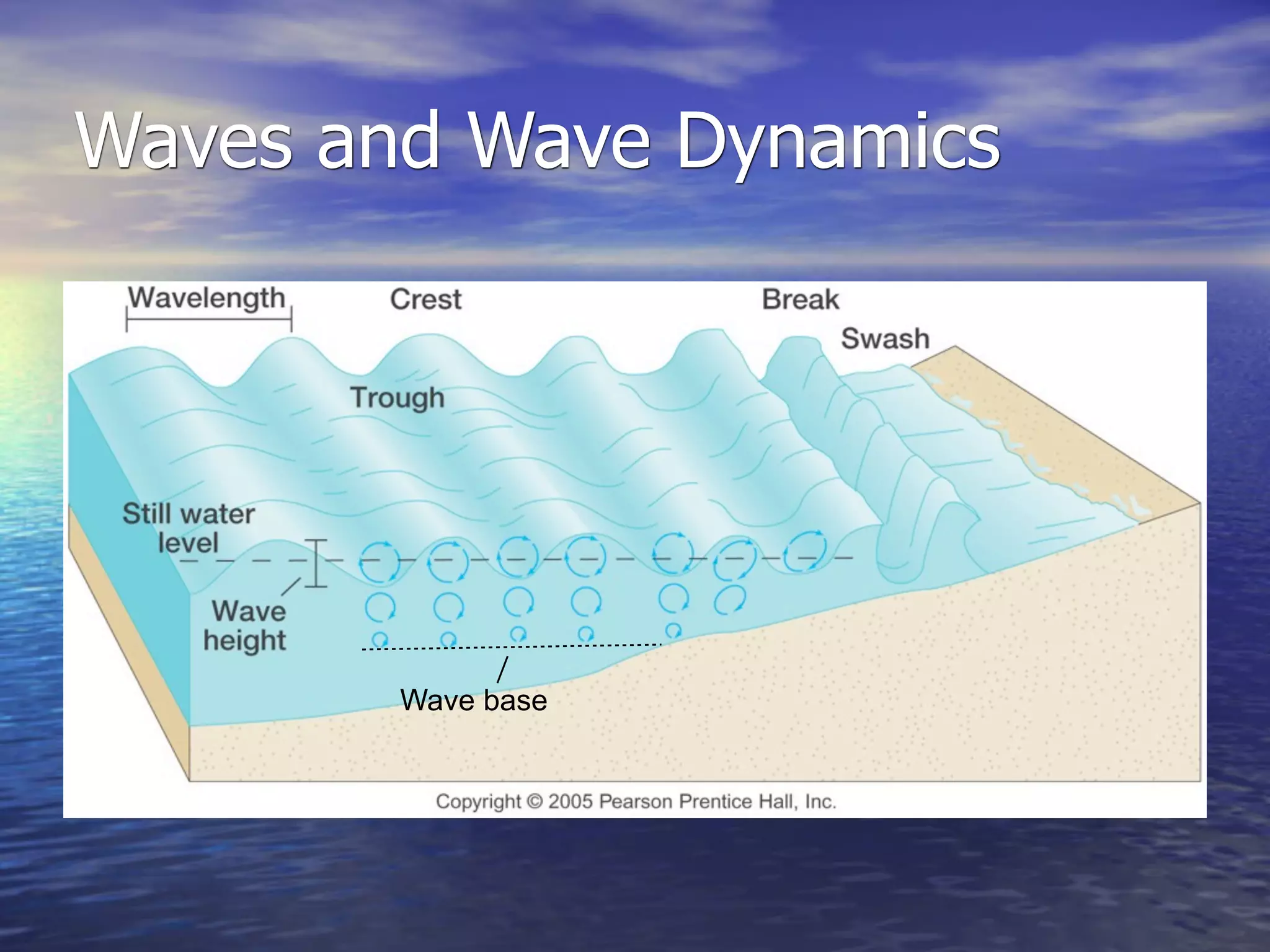
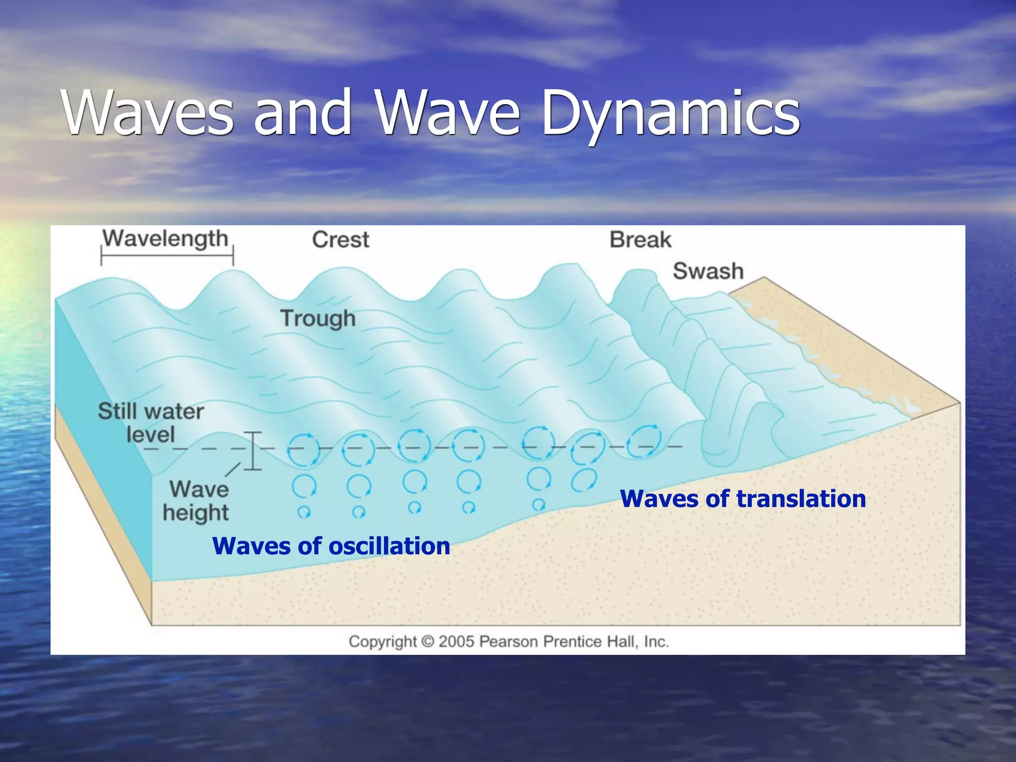
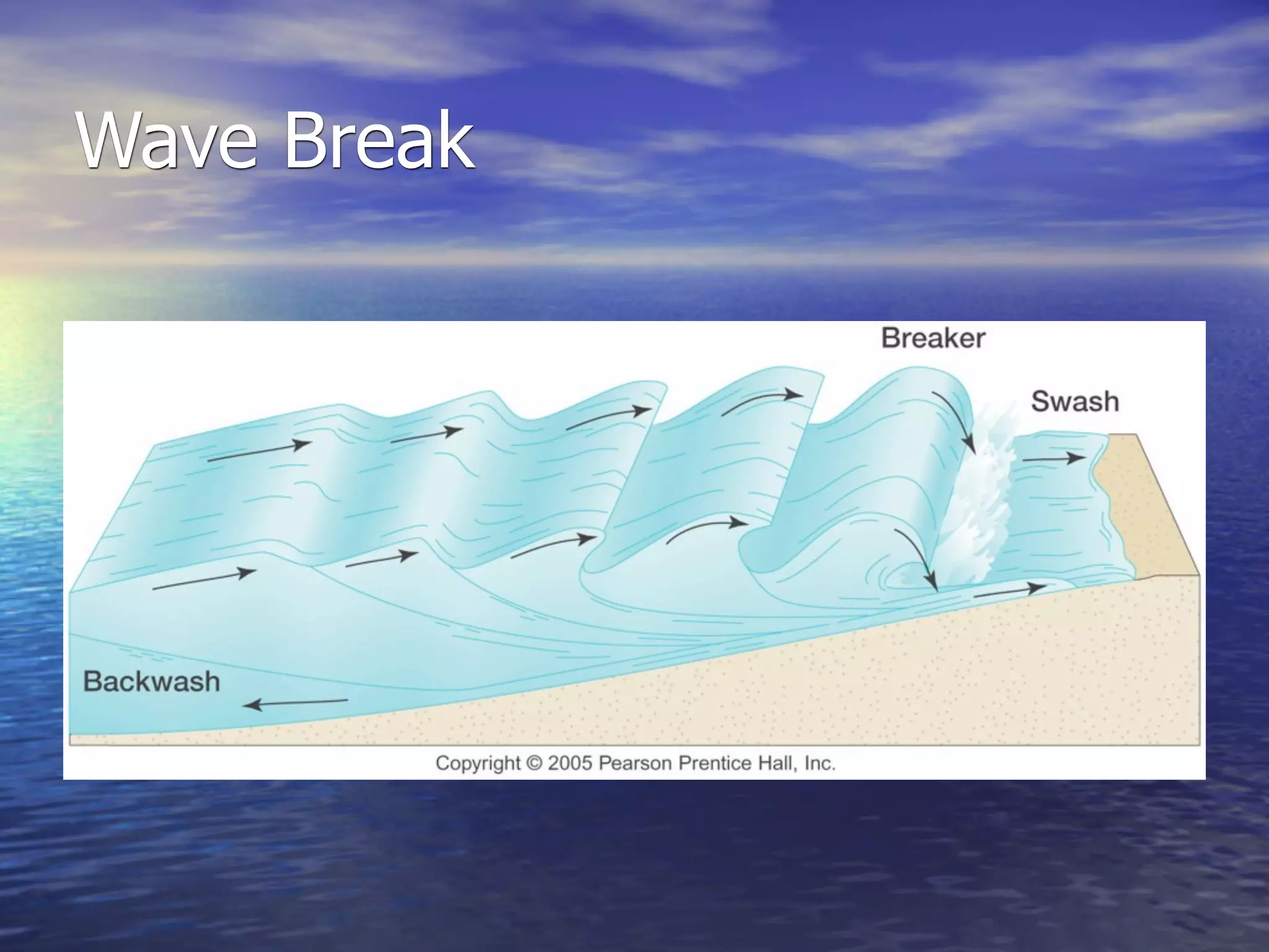
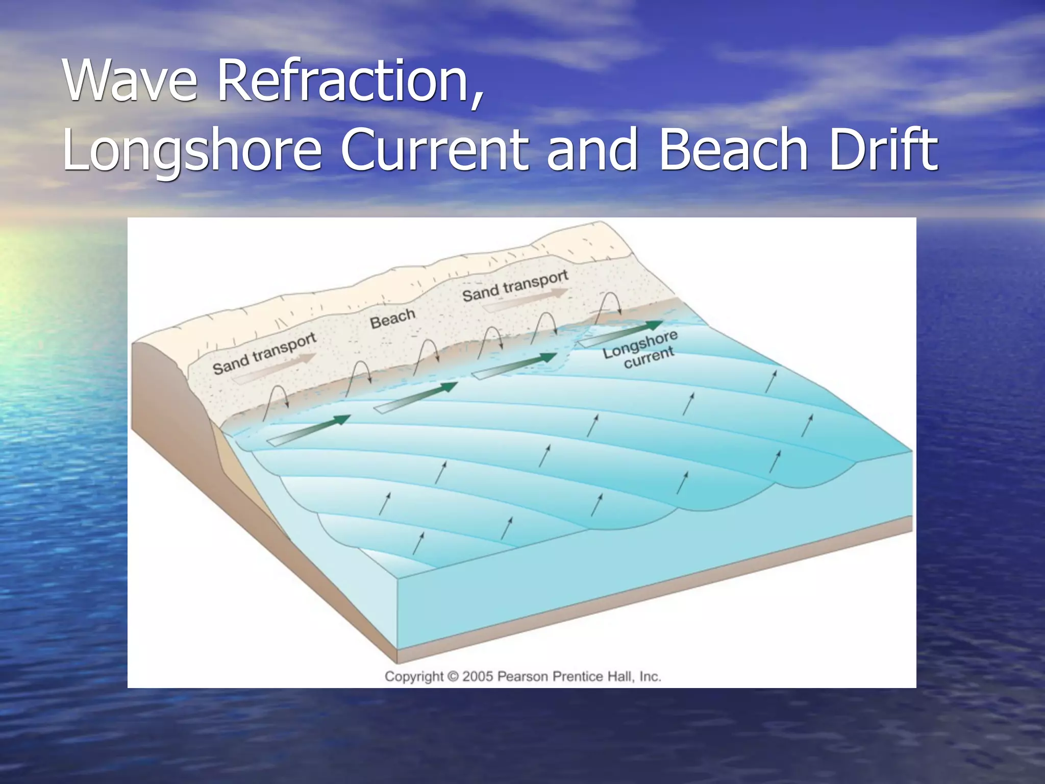
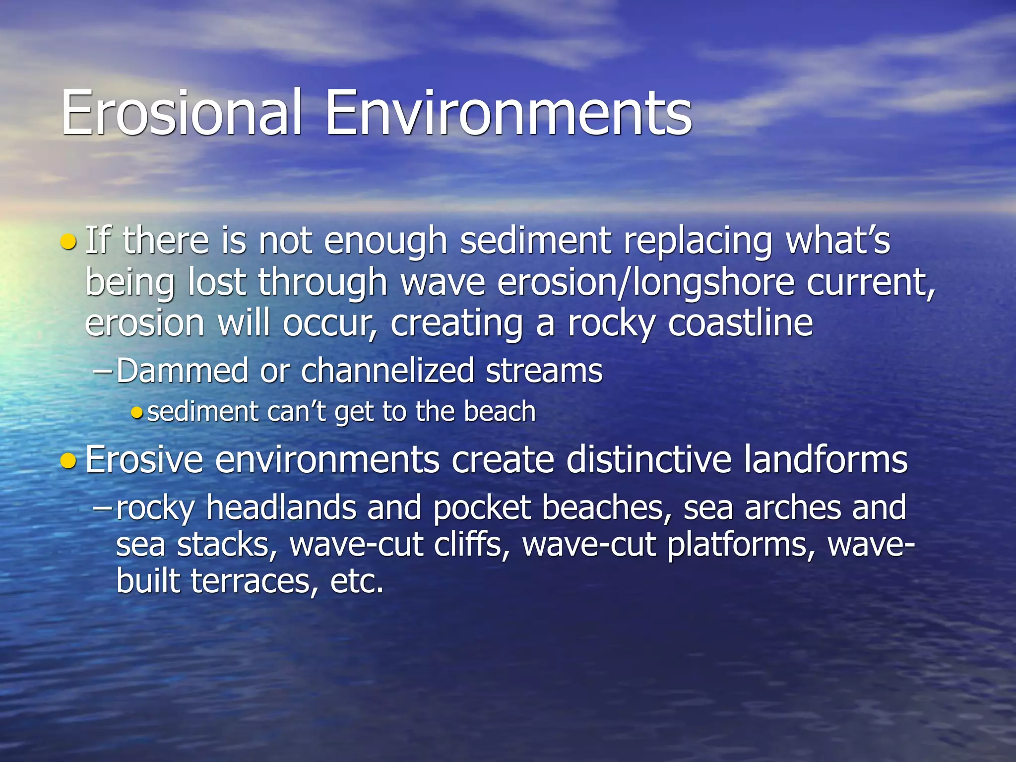
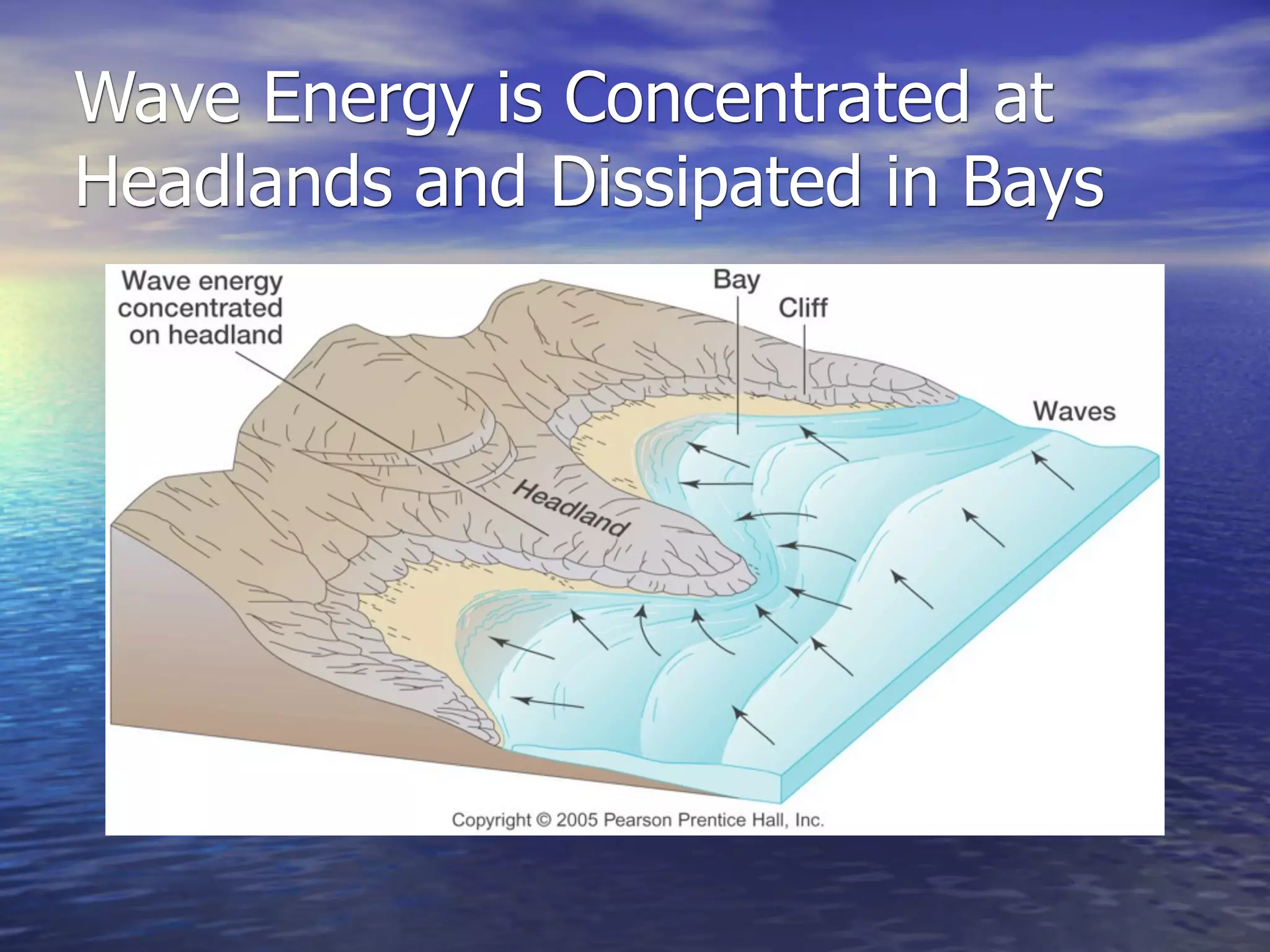
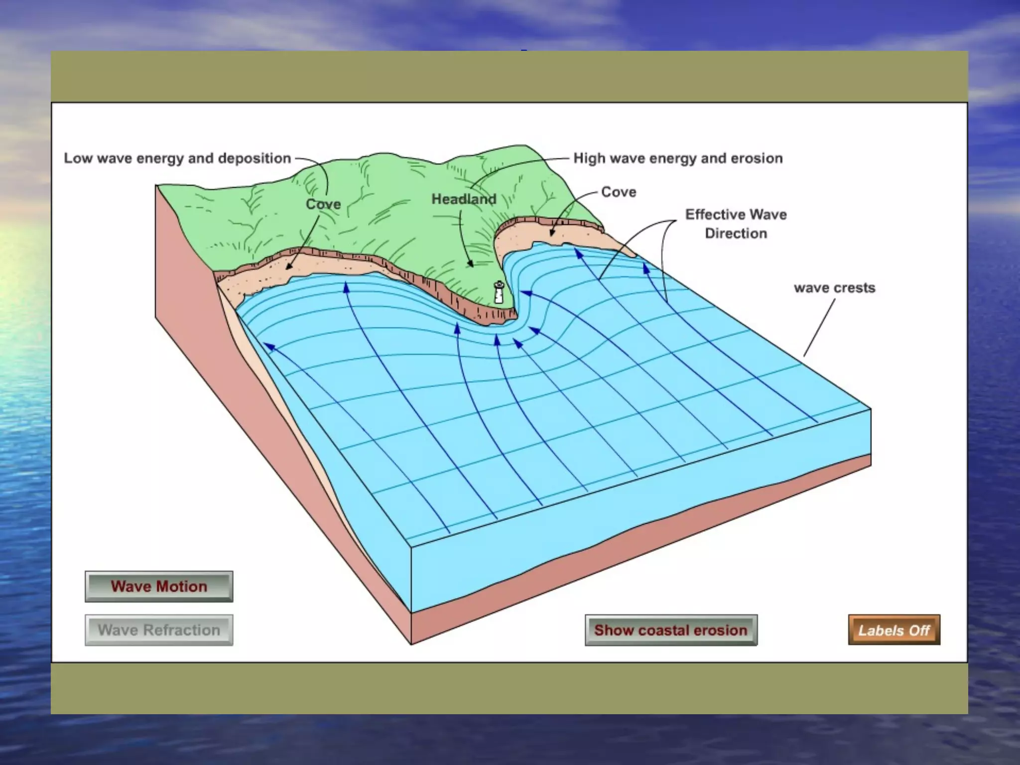
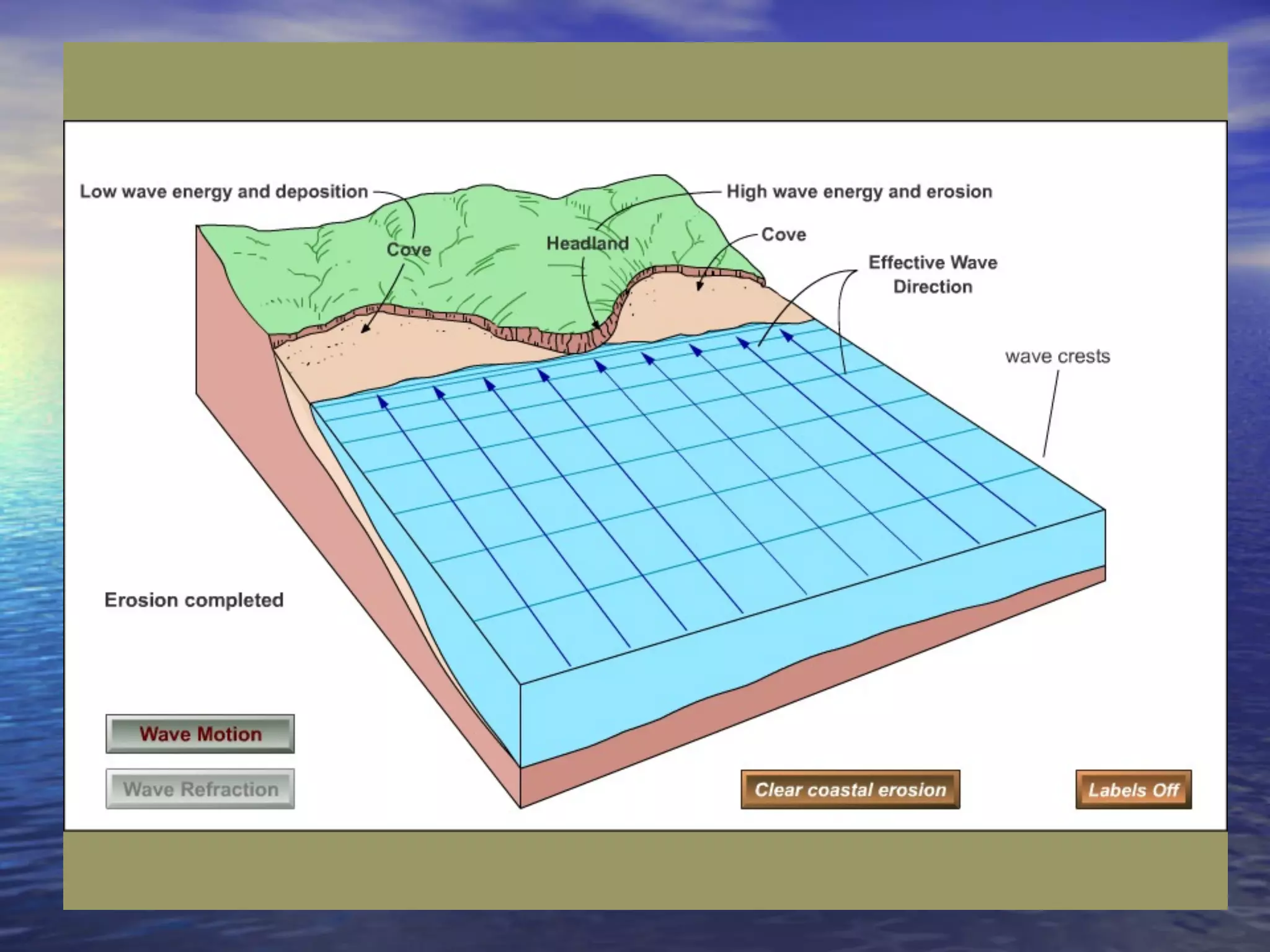
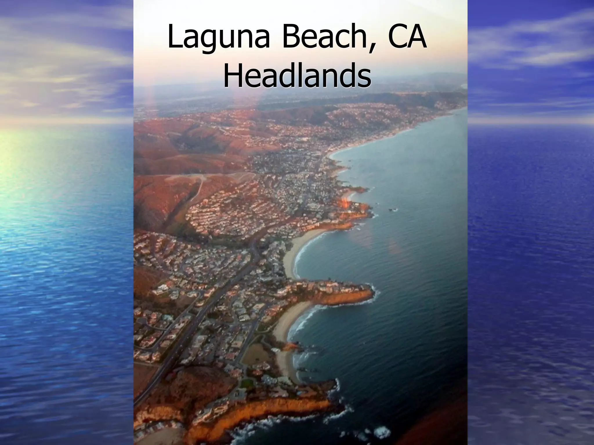
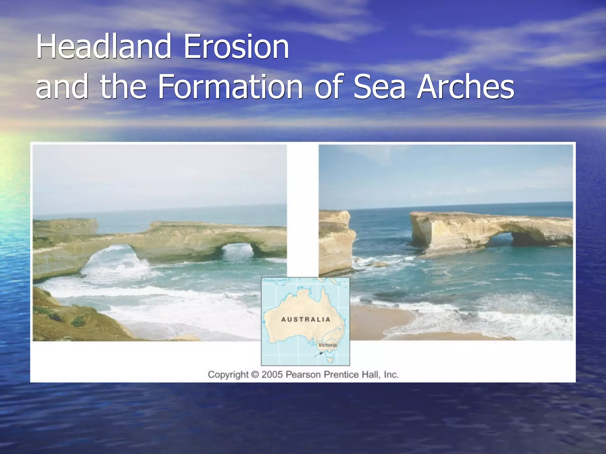
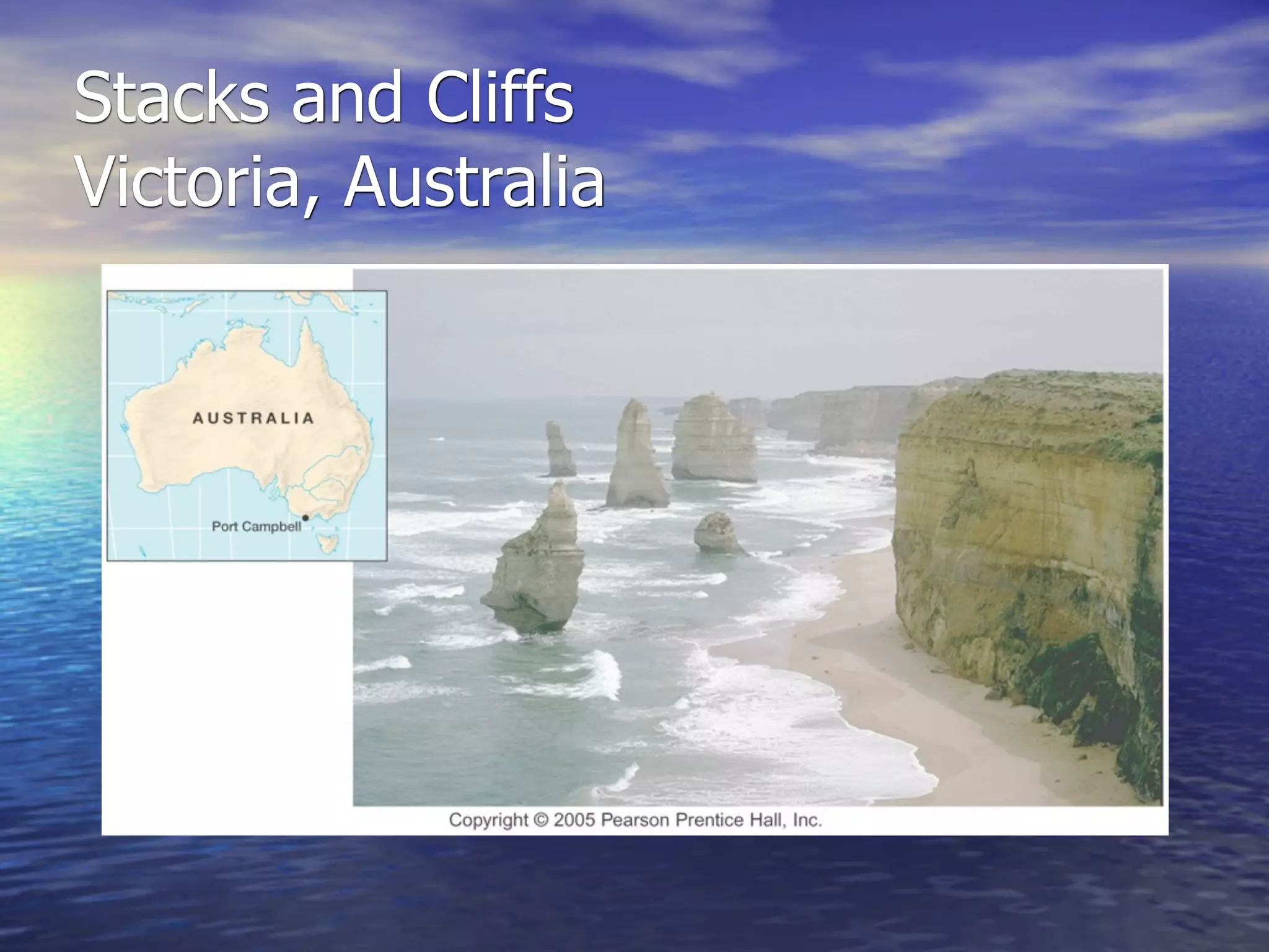
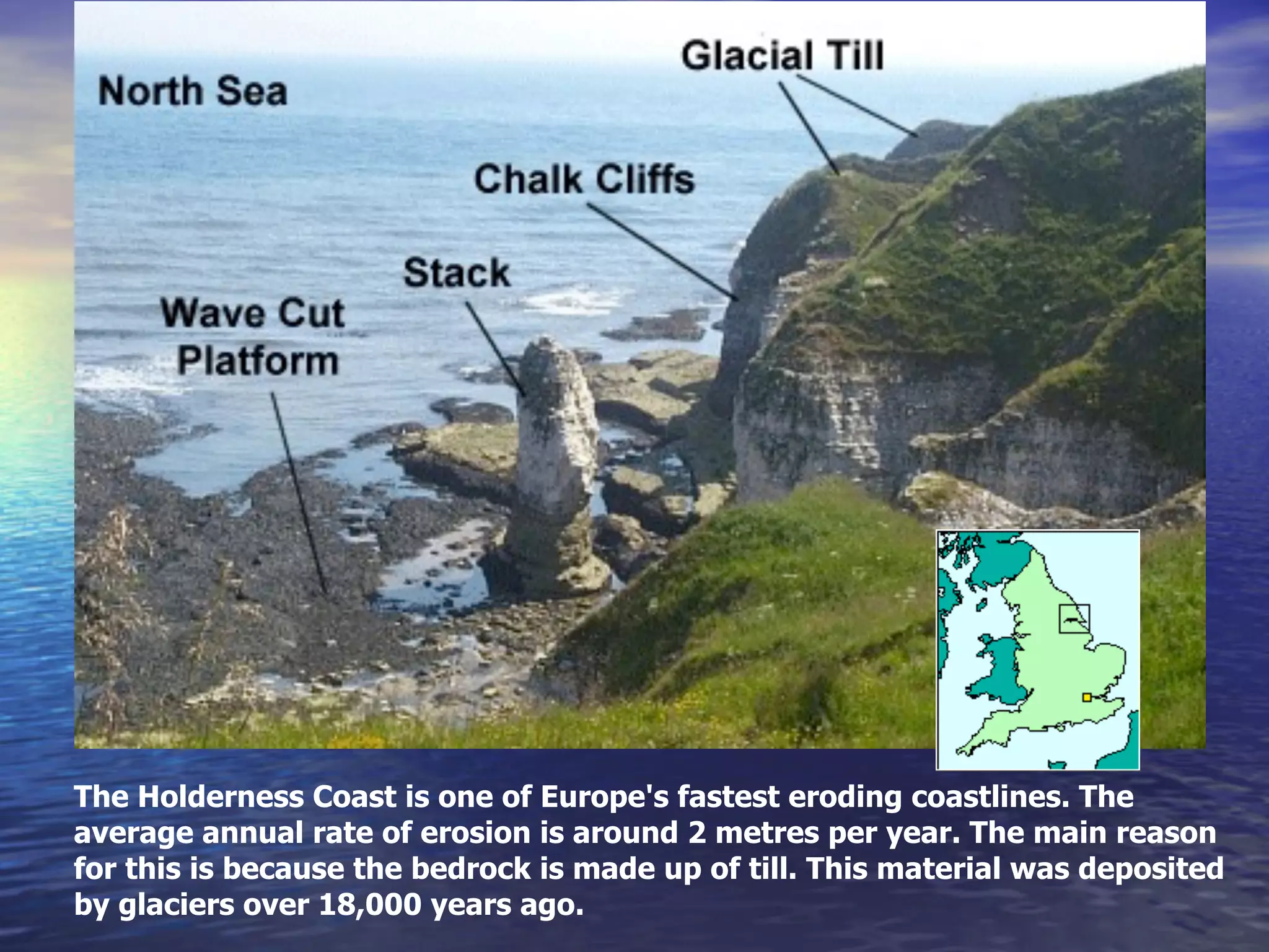
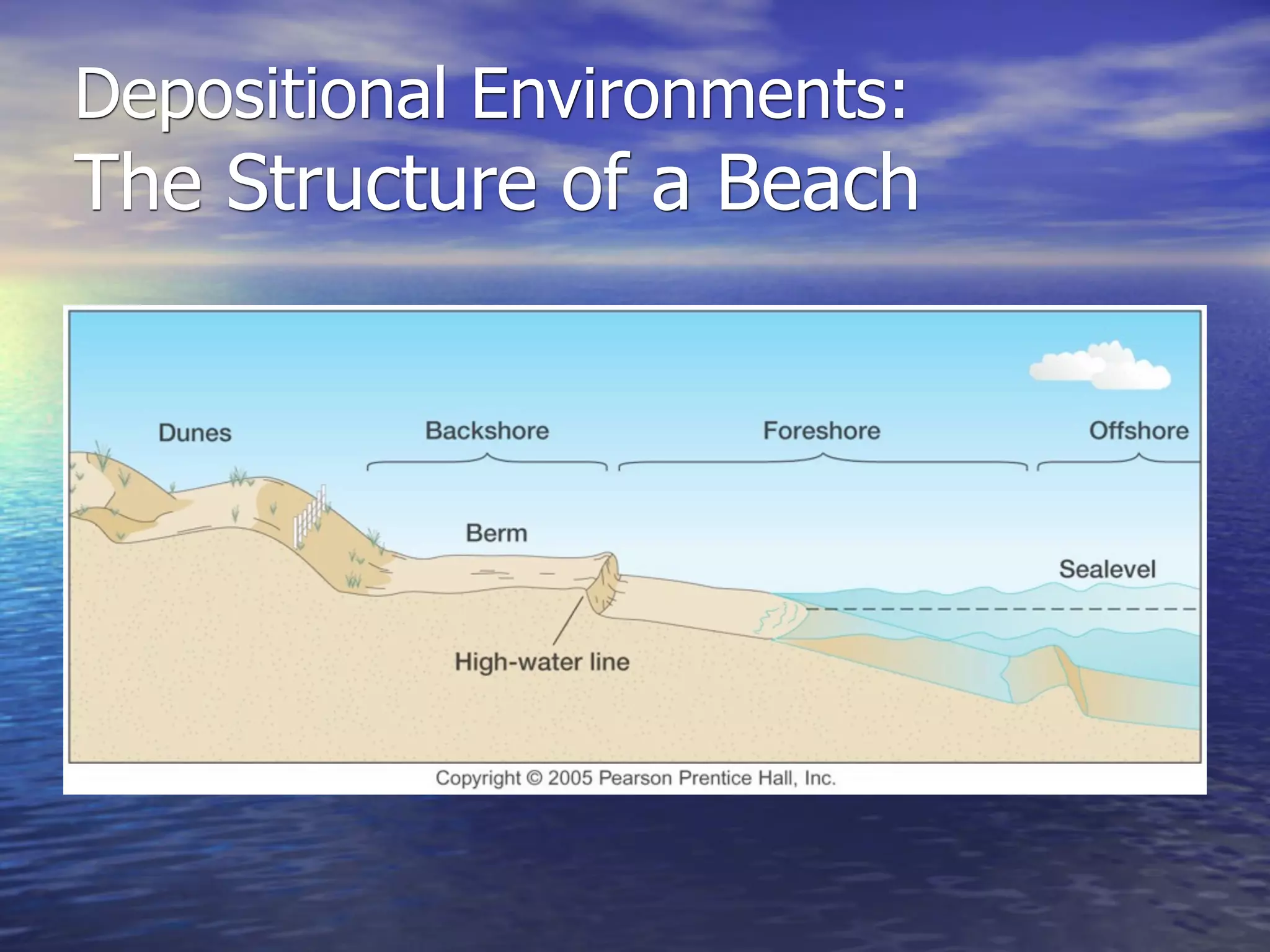
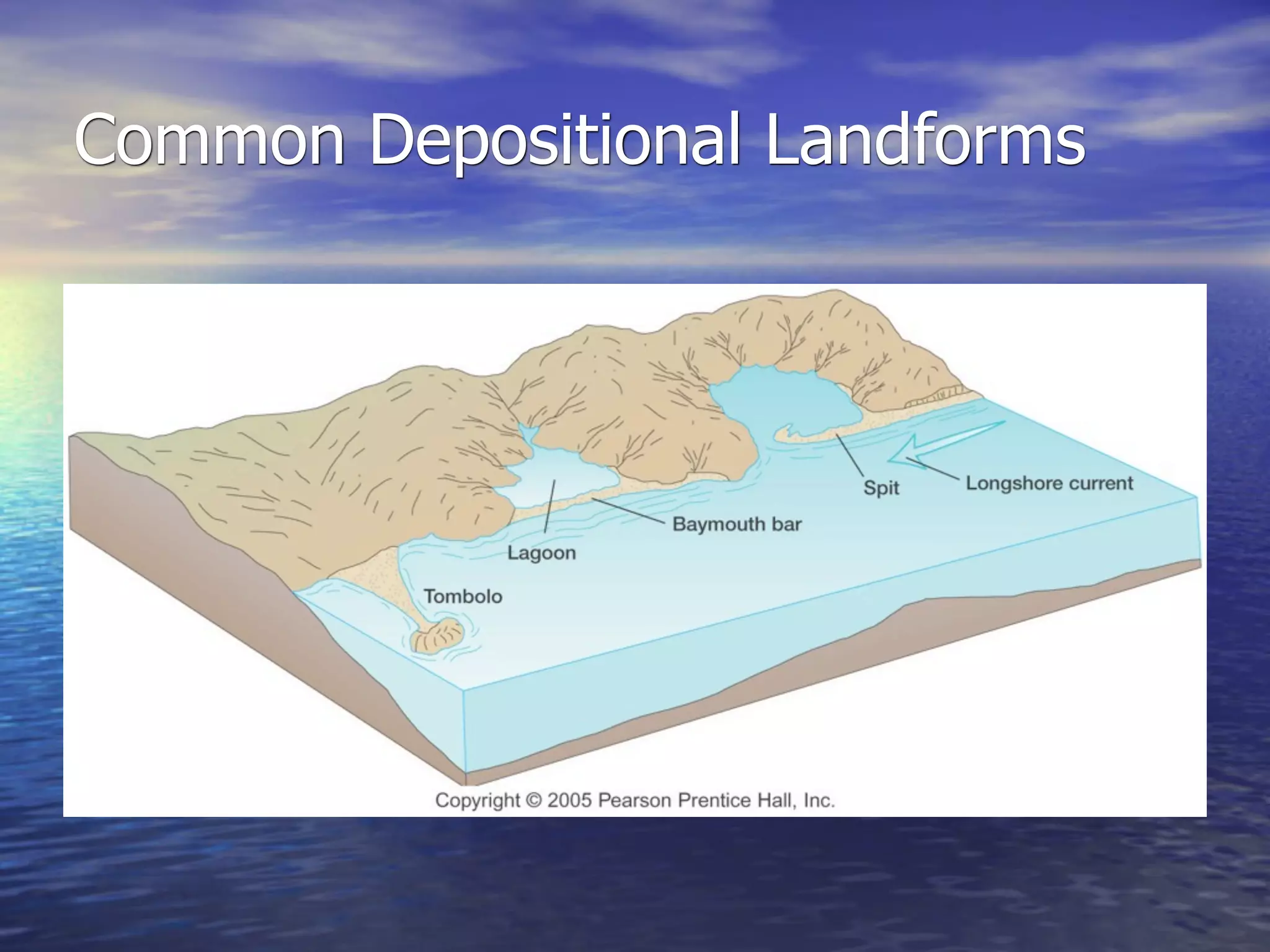
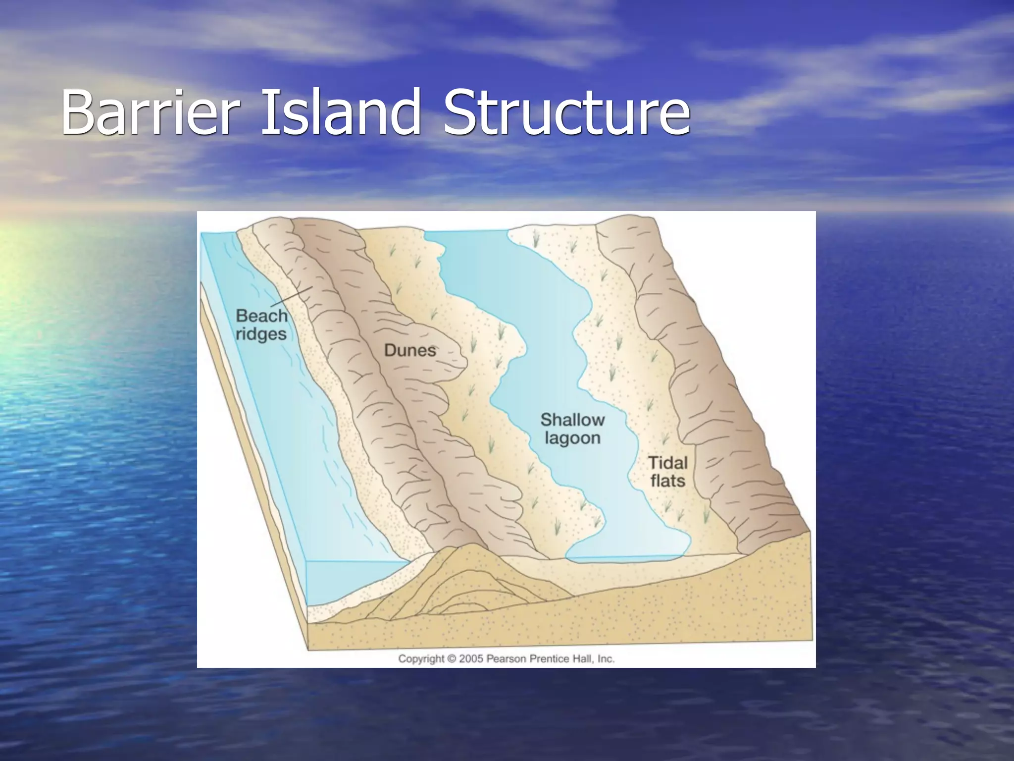
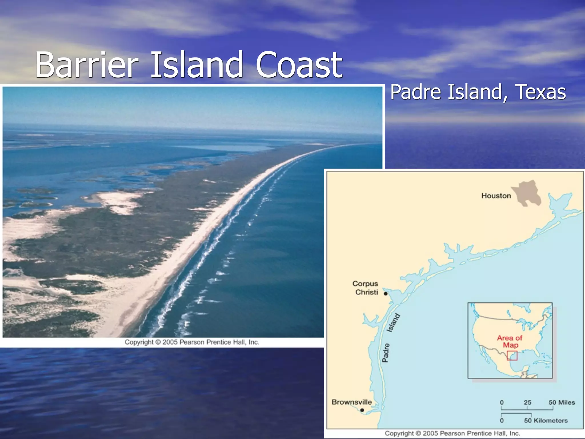
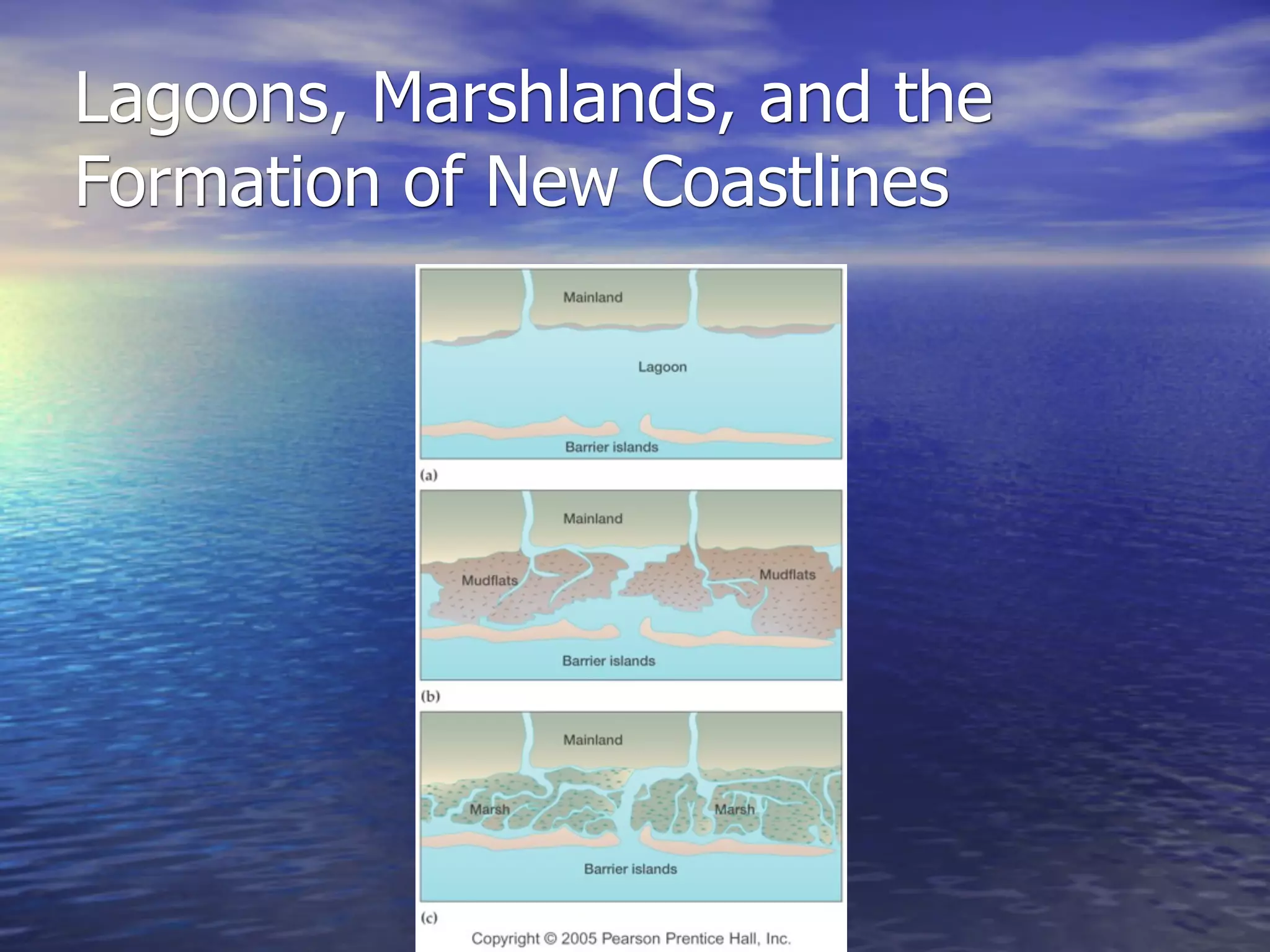
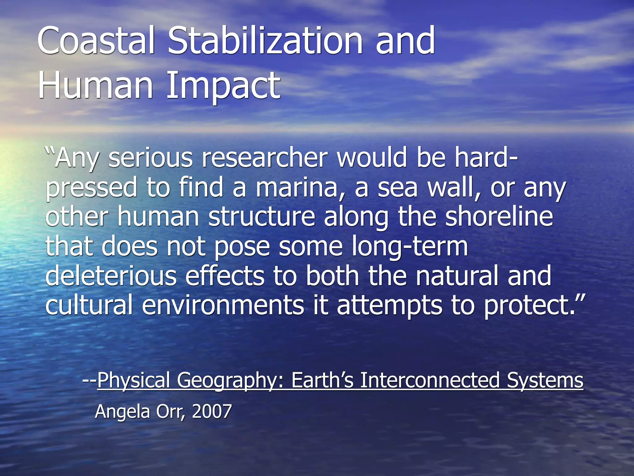
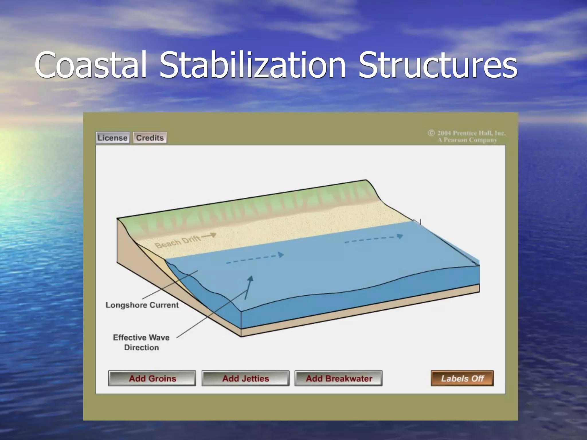
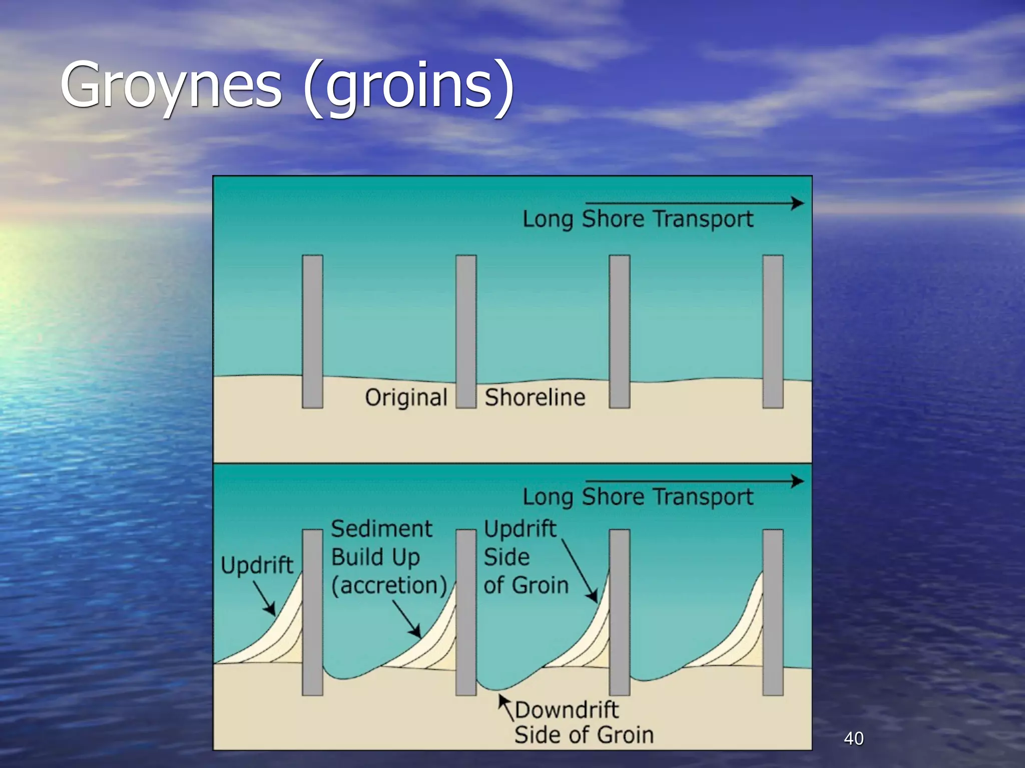
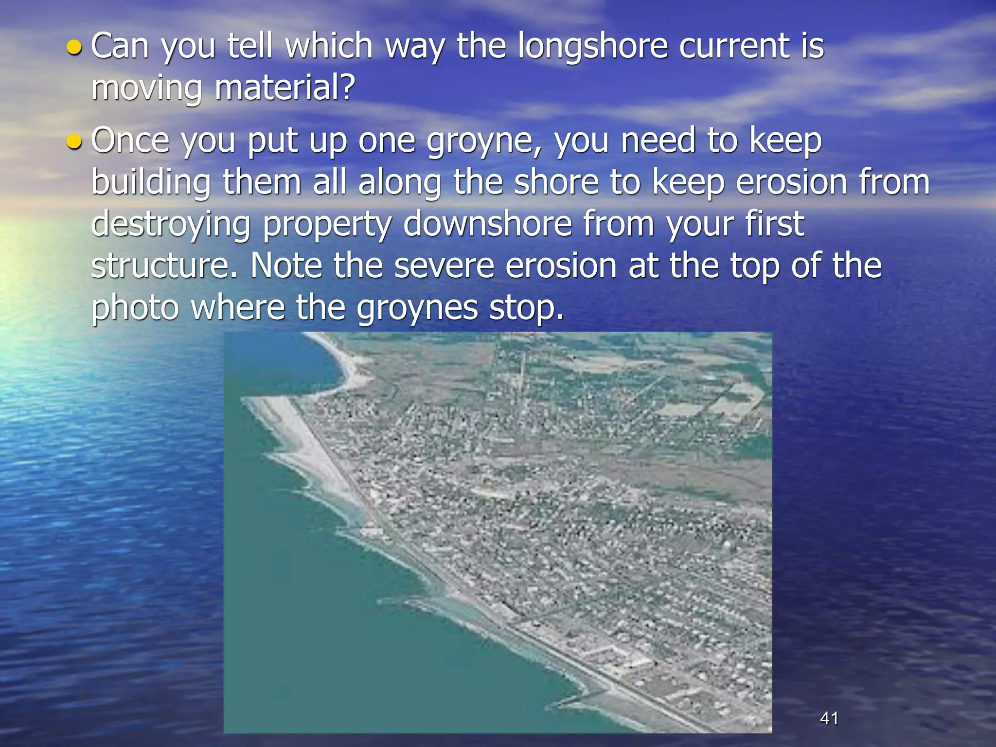
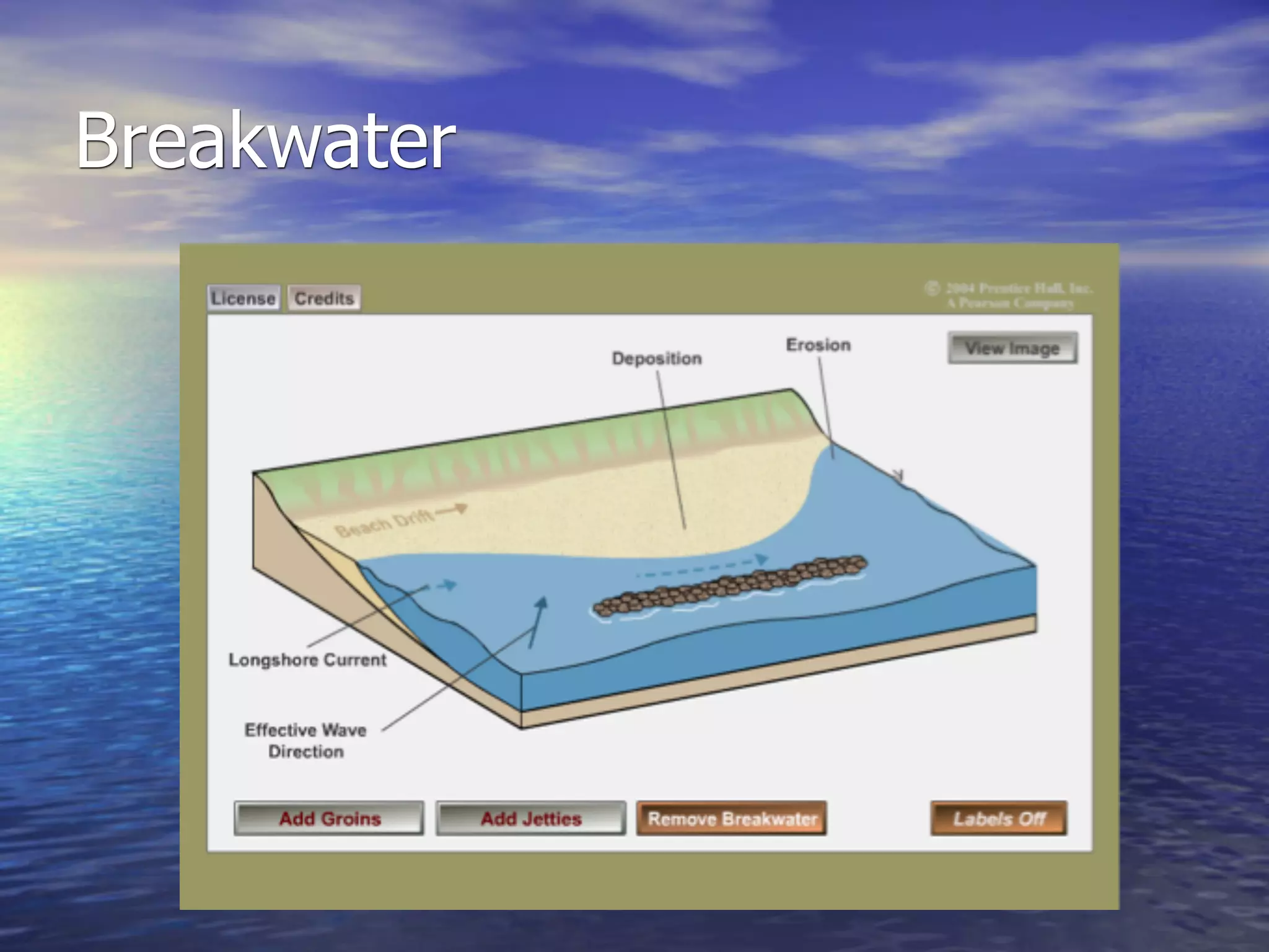
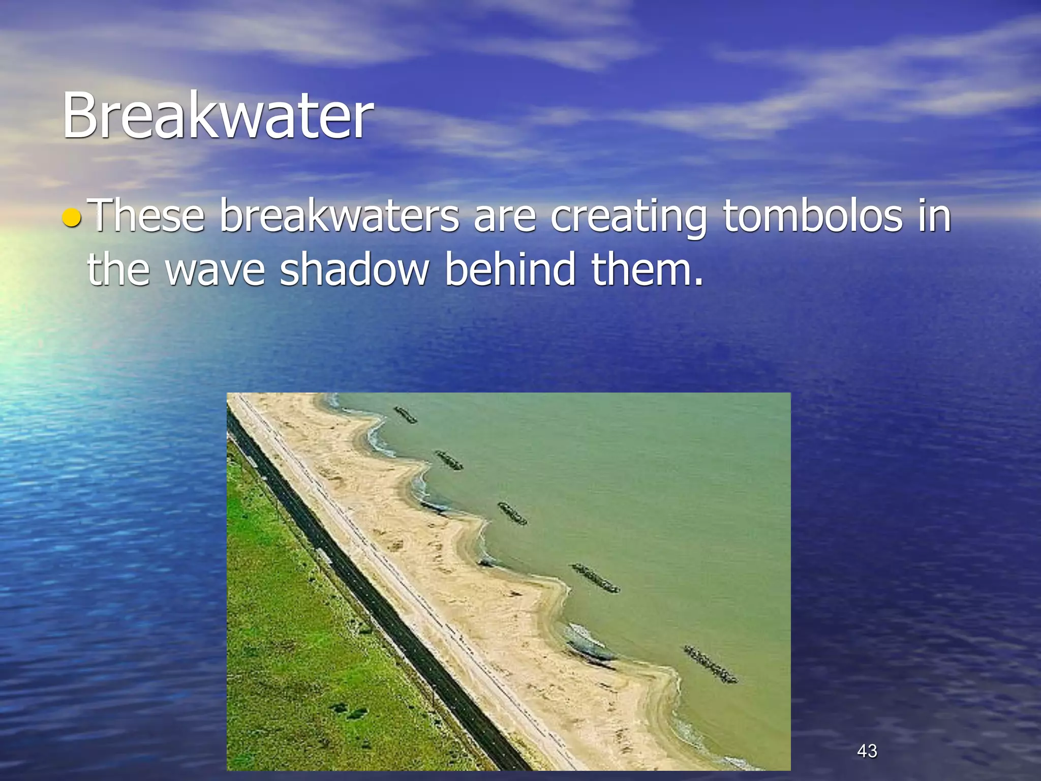
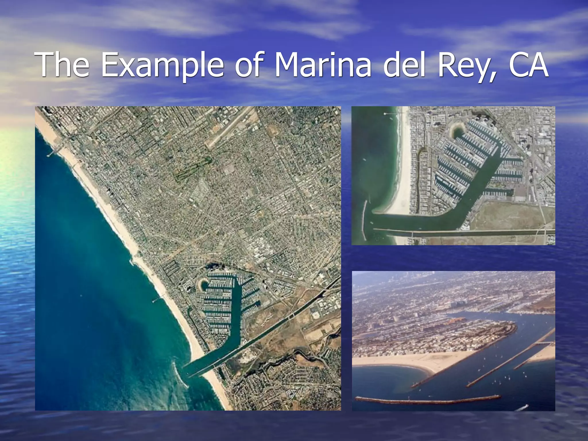
Coastal Geomorphology:
   The Oceans, Coastal
Processes, and Landforms
       Chapter 12
Ocean Water:
Salinity, Temperature, and Density
• Salinity
  – Dissolved mineral salts (sodium chloride, magnesium,
    sulfur, calcium, potassium, etc.)
  – Differences in salinity are related to evaporation rates
    and fresh water inflow
     • Avg. max. salinity found in subtropics (high evap., low precip.)
     • Avg. min. salinity found in tropical regions (fresh water from high
      precipitation, low evaporation due to high atmospheric saturation)
Ocean Water

• Temperature
 –Decreasing temperatures with increasing latitude
   •Polar water = cold, equatorial water = warm
 –Decreasing temperatures with increasing depth
   •Deeper waters are colder (sunlight can’t reach, there
    is little or no mixing)
 –Western sides of oceans are warmer due to ocean
  circulation patterns (see next slide)
Warm and Cold Ocean Currents
Ocean Water
• Density
  – Related to temperature
     • low temp. = high density
        – Molecules are less active, so cold water contracts

  – Related to salinity
     • high salinity = high density
        – More solids in the water (salts) increases overall density

  – Related to depth
     • deep water = high density
        – Pressure of water above compresses deep water, increasing density
The Movements of The Oceans

• Tides
• Currents
• Wave motion
Tides
• A “bulge” in the
 world’s oceans, caused
 by the gravitational
 pull of the moon and
 sun
  Fg = G m1 m2
           d2
Tides
• Tidal range—the difference
    between high and low tide
•   Affected by the shape of
    the coastline and seafloor
•   Spring tides—highest tides,
    strong and quick
    – Occur when sun, moon, and
      Earth line up (the sea
      “springs” up and back)
• Neap tides—lowest tides
    – Sun and moon at right angles
      with respect to Earth
    – Neap = A low incline of bend
      (when graphed)
Monthly Tidal Cycle
Extreme High Tides


                     • The Bay of Fundy
                     • A 50’ (15m) tidal
                     fluctuation is common (x2)
                     •A tidal bore (several in. to
                     several ft. high) rushes miles
                     up the Petitcodiac River in
                     New Bruswick
Landforms shaped by extreme tides
Extreme tides: Mont Saint Michel, France


Low tide                 High tide


                                     12
Currents: Surface
Currents: Thermohaline Circulation
Waves and Wave Dynamics

• Period—The time it takes two successive
  waves (from crest to crest, or from trough to
  trough) to pass a given point
• Fetch—The distance over which the wind
  blows, creating waves
Waves and Wave Dynamics

• Factors affecting open ocean waves:
 –Fetch
   •The greater the distance over which the wind blows,
    the larger the waves
 –Wind strength
   •The stronger the wind, the larger the waves
 –Wind duration
   •The longer the wind blows, the more waves will be
    created
Waves and Wave Dynamics


        Wave base
Waves of Oscillation (Transition) and
Waves of Translation
• Water molecules on the open ocean move in a
 circular motion
  – The motion passes through the water, but the water
    doesn’t move forward (to oscillate is to move up and
    down)
  – What moves the water forward is wind blowing over the
    surface and the movement of currents
• Water molecules that reach the shore have their
 circular motion interrupted
  – Their energy is translated into the shore face (it passes
    from the water to the land, where it does work to move
    material—like sand—around)
Waves and Wave Dynamics


                           Waves of translation
    Waves of oscillation
Wave Break
Wave Refraction and
Longshore Current
• As waves reach the shore and “feel” the bottom,
  they slow and break
• The direction of wave break follows the underwater
  topography
• This causes the wave to “bend” and become more
  parallel to the shoreline
  – This bending is called wave refraction
• As it breaks from one side to the other, it creates a
 current
  – This current, called the longshore current picks up
    and moves sediment (sand) down the shore
Wave Refraction,
Longshore Current and Beach Drift
Erosional Environments
• If there is not enough sediment replacing what’s
 being lost through wave erosion/longshore current,
 erosion will occur, creating a rocky coastline
  – Dammed or channelized streams
     • sediment can’t get to the beach
• Erosive environments create distinctive landforms
  – rocky headlands and pocket beaches, sea arches and
    sea stacks, wave-cut cliffs, wave-cut platforms, wave-
    built terraces, etc.
Wave Energy is Concentrated at
Headlands and Dissipated in Bays
Wave Motion and Wave
Refraction
Wave Motion and Wave
Refraction
Laguna Beach, CA
   Headlands
Headland Erosion
and the Formation of Sea Arches
Stacks and Cliffs
Victoria, Australia
The Holderness Coast is one of Europe's fastest eroding coastlines. The
average annual rate of erosion is around 2 metres per year. The main reason
for this is because the bedrock is made up of till. This material was deposited
by glaciers over 18,000 years ago.
Depositional Environments:
The Structure of a Beach
Common Depositional Landforms
Barrier Island Structure
Barrier Island Coast
                       Padre Island, Texas


                                35
Lagoons, Marshlands, and the
Formation of New Coastlines
Coastal Stabilization and
Human Impact
“Any serious researcher would be hard-
pressed to find a marina, a sea wall, or any
other human structure along the shoreline
that does not pose some long-term
deleterious effects to both the natural and
cultural environments it attempts to protect.”

   --Physical Geography: Earth’s Interconnected Systems
    Angela Orr, 2007
Coastal Stabilization and Human
Impact
• Damming and channelizing streams
 –Causes a loss of sediment where streams empty
  into the sea. Without sediment, the beach will
  erode away.
• Groynes (groins)
• Seawalls
• Breakwaters and jetties

                                           38
Coastal Stabilization Structures
Groynes (groins)


                   40
• Can you tell which way the longshore current is
  moving material?
• Once you put up one groyne, you need to keep
  building them all along the shore to keep erosion from
  destroying property downshore from your first
  structure. Note the severe erosion at the top of the
  photo where the groynes stop.


                                                41
Breakwater
Breakwater
• These breakwaters are creating tombolos in
 the wave shadow behind them.


                                       43
The Example of Marina del Rey, CA

GEOG 100--Lecture 17--Coastal Geomorphology

  • 1.
    Coastal Geomorphology: The Oceans, Coastal Processes, and Landforms Chapter 12
  • 2.
    Ocean Water: Salinity, Temperature,and Density • Salinity – Dissolved mineral salts (sodium chloride, magnesium, sulfur, calcium, potassium, etc.) – Differences in salinity are related to evaporation rates and fresh water inflow • Avg. max. salinity found in subtropics (high evap., low precip.) • Avg. min. salinity found in tropical regions (fresh water from high precipitation, low evaporation due to high atmospheric saturation)
  • 3.
    Ocean Water • Temperature –Decreasing temperatures with increasing latitude •Polar water = cold, equatorial water = warm –Decreasing temperatures with increasing depth •Deeper waters are colder (sunlight can’t reach, there is little or no mixing) –Western sides of oceans are warmer due to ocean circulation patterns (see next slide)
  • 4.
    Warm and ColdOcean Currents
  • 5.
    Ocean Water • Density – Related to temperature • low temp. = high density – Molecules are less active, so cold water contracts – Related to salinity • high salinity = high density – More solids in the water (salts) increases overall density – Related to depth • deep water = high density – Pressure of water above compresses deep water, increasing density
  • 6.
    The Movements ofThe Oceans • Tides • Currents • Wave motion
  • 7.
    Tides • A “bulge”in the world’s oceans, caused by the gravitational pull of the moon and sun Fg = G m1 m2 d2
  • 8.
    Tides • Tidal range—thedifference between high and low tide • Affected by the shape of the coastline and seafloor • Spring tides—highest tides, strong and quick – Occur when sun, moon, and Earth line up (the sea “springs” up and back) • Neap tides—lowest tides – Sun and moon at right angles with respect to Earth – Neap = A low incline of bend (when graphed)
  • 9.
  • 10.
    Extreme High Tides • The Bay of Fundy • A 50’ (15m) tidal fluctuation is common (x2) •A tidal bore (several in. to several ft. high) rushes miles up the Petitcodiac River in New Bruswick
  • 11.
    Landforms shaped byextreme tides
  • 12.
    Extreme tides: MontSaint Michel, France Low tide High tide 12
  • 13.
  • 14.
  • 15.
  • 16.
    Waves and WaveDynamics • Period—The time it takes two successive waves (from crest to crest, or from trough to trough) to pass a given point • Fetch—The distance over which the wind blows, creating waves
  • 17.
    Waves and WaveDynamics • Factors affecting open ocean waves: –Fetch •The greater the distance over which the wind blows, the larger the waves –Wind strength •The stronger the wind, the larger the waves –Wind duration •The longer the wind blows, the more waves will be created
  • 18.
    Waves and WaveDynamics Wave base
  • 19.
    Waves of Oscillation(Transition) and Waves of Translation • Water molecules on the open ocean move in a circular motion – The motion passes through the water, but the water doesn’t move forward (to oscillate is to move up and down) – What moves the water forward is wind blowing over the surface and the movement of currents • Water molecules that reach the shore have their circular motion interrupted – Their energy is translated into the shore face (it passes from the water to the land, where it does work to move material—like sand—around)
  • 20.
    Waves and WaveDynamics Waves of translation Waves of oscillation
  • 21.
  • 22.
    Wave Refraction and LongshoreCurrent • As waves reach the shore and “feel” the bottom, they slow and break • The direction of wave break follows the underwater topography • This causes the wave to “bend” and become more parallel to the shoreline – This bending is called wave refraction • As it breaks from one side to the other, it creates a current – This current, called the longshore current picks up and moves sediment (sand) down the shore
  • 23.
  • 24.
    Erosional Environments • Ifthere is not enough sediment replacing what’s being lost through wave erosion/longshore current, erosion will occur, creating a rocky coastline – Dammed or channelized streams • sediment can’t get to the beach • Erosive environments create distinctive landforms – rocky headlands and pocket beaches, sea arches and sea stacks, wave-cut cliffs, wave-cut platforms, wave- built terraces, etc.
  • 25.
    Wave Energy isConcentrated at Headlands and Dissipated in Bays
  • 26.
    Wave Motion andWave Refraction
  • 27.
    Wave Motion andWave Refraction
  • 28.
  • 29.
    Headland Erosion and theFormation of Sea Arches
  • 30.
  • 31.
    The Holderness Coastis one of Europe's fastest eroding coastlines. The average annual rate of erosion is around 2 metres per year. The main reason for this is because the bedrock is made up of till. This material was deposited by glaciers over 18,000 years ago.
  • 32.
  • 33.
  • 34.
  • 35.
    Barrier Island Coast Padre Island, Texas 35
  • 36.
    Lagoons, Marshlands, andthe Formation of New Coastlines
  • 37.
    Coastal Stabilization and HumanImpact “Any serious researcher would be hard- pressed to find a marina, a sea wall, or any other human structure along the shoreline that does not pose some long-term deleterious effects to both the natural and cultural environments it attempts to protect.” --Physical Geography: Earth’s Interconnected Systems Angela Orr, 2007
  • 38.
    Coastal Stabilization andHuman Impact • Damming and channelizing streams –Causes a loss of sediment where streams empty into the sea. Without sediment, the beach will erode away. • Groynes (groins) • Seawalls • Breakwaters and jetties 38
  • 39.
  • 40.
  • 41.
    • Can youtell which way the longshore current is moving material? • Once you put up one groyne, you need to keep building them all along the shore to keep erosion from destroying property downshore from your first structure. Note the severe erosion at the top of the photo where the groynes stop. 41
  • 42.
  • 43.
    Breakwater • These breakwatersare creating tombolos in the wave shadow behind them. 43
  • 44.
    The Example ofMarina del Rey, CA