Downloaded 506 times
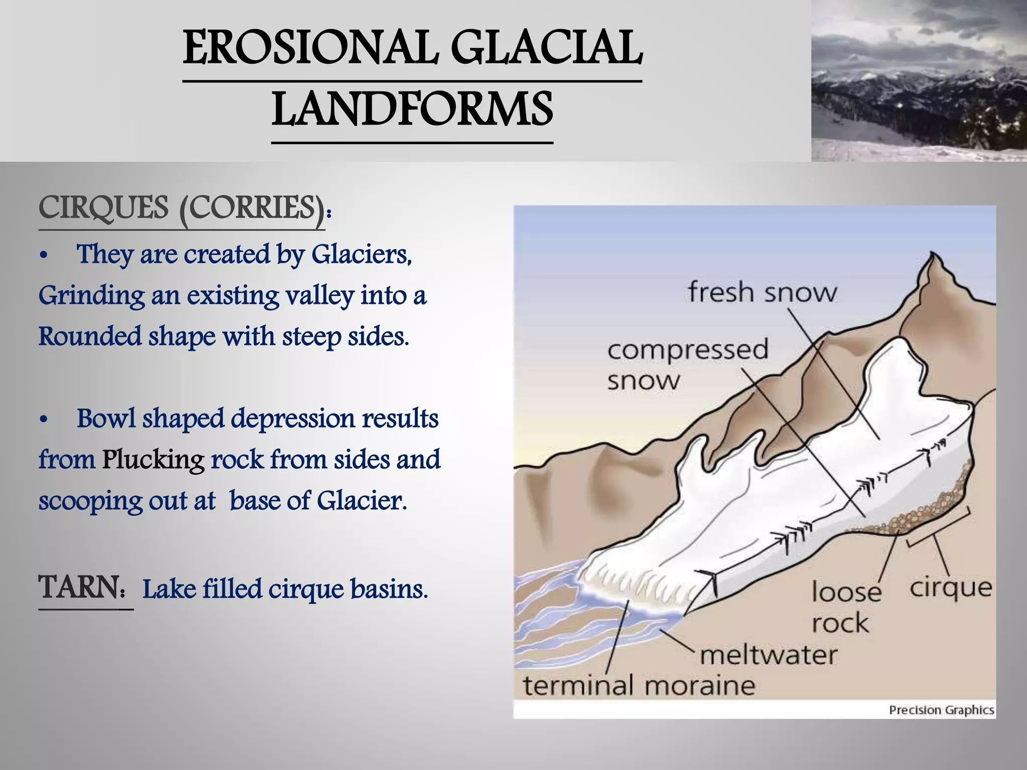
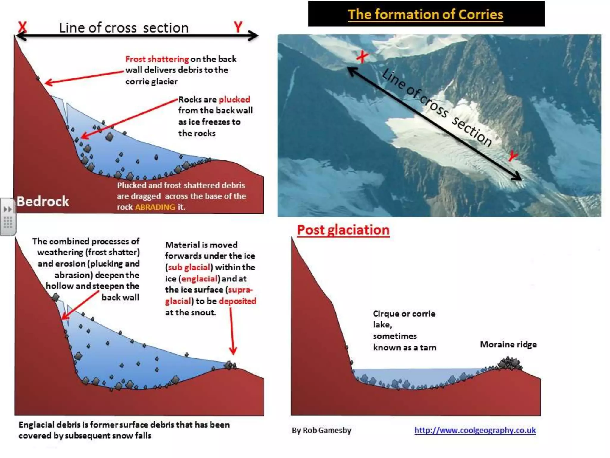
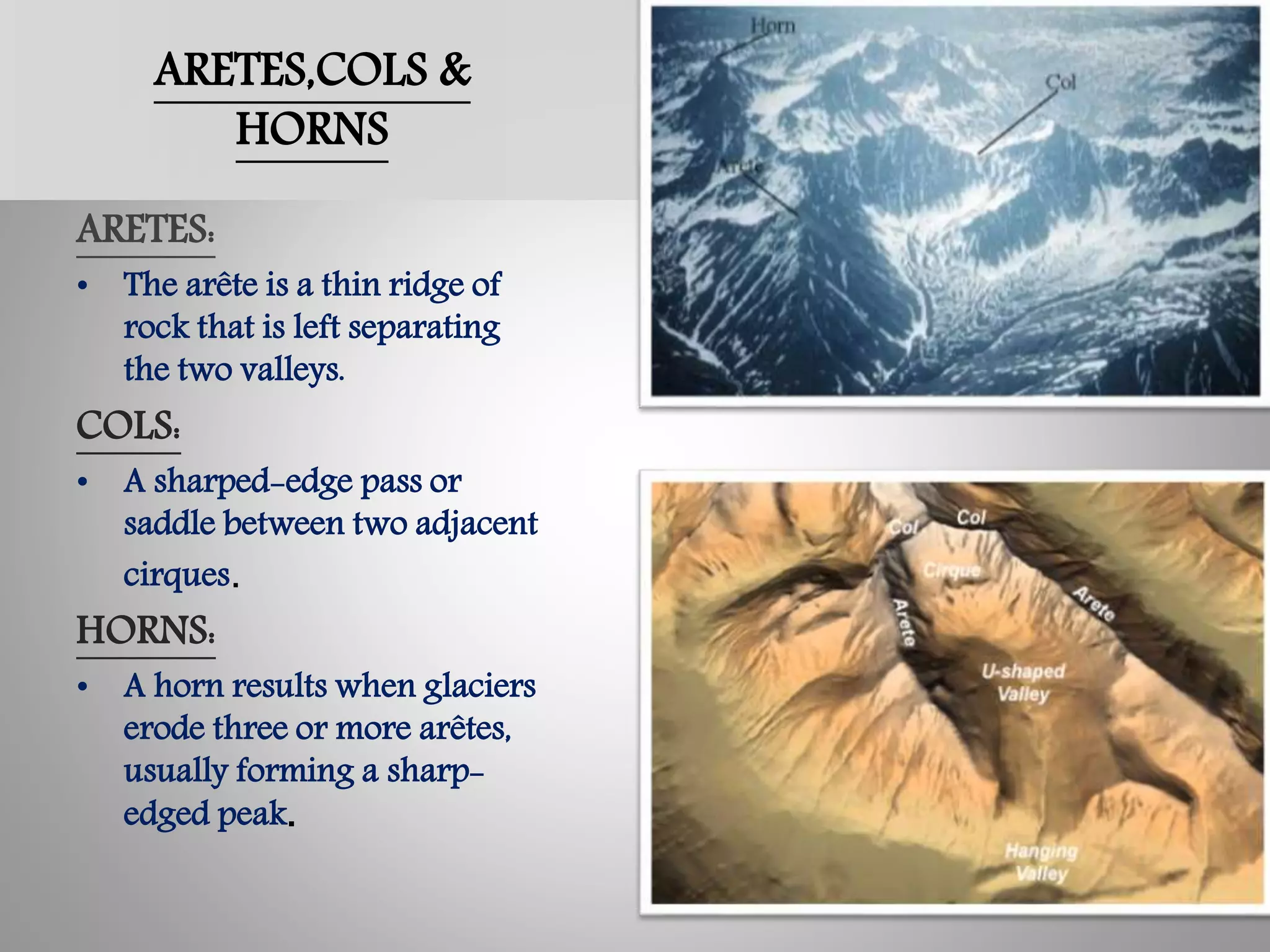
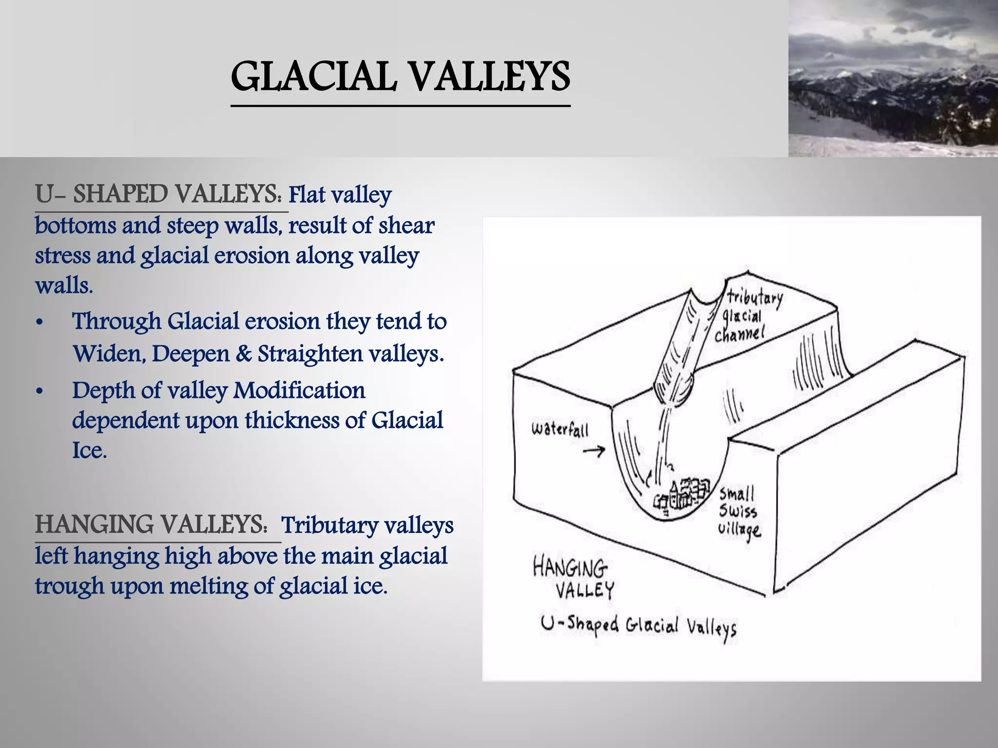
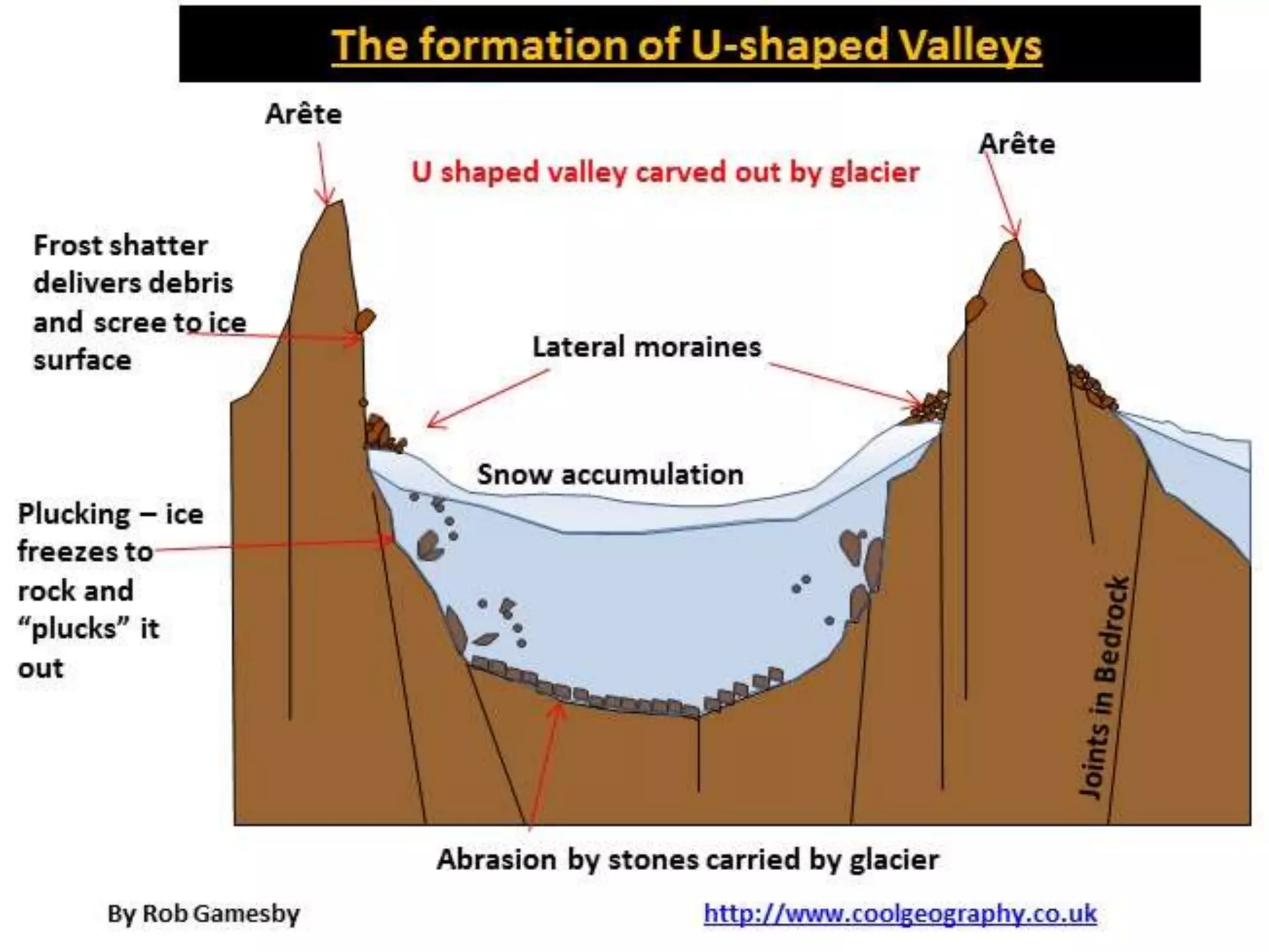
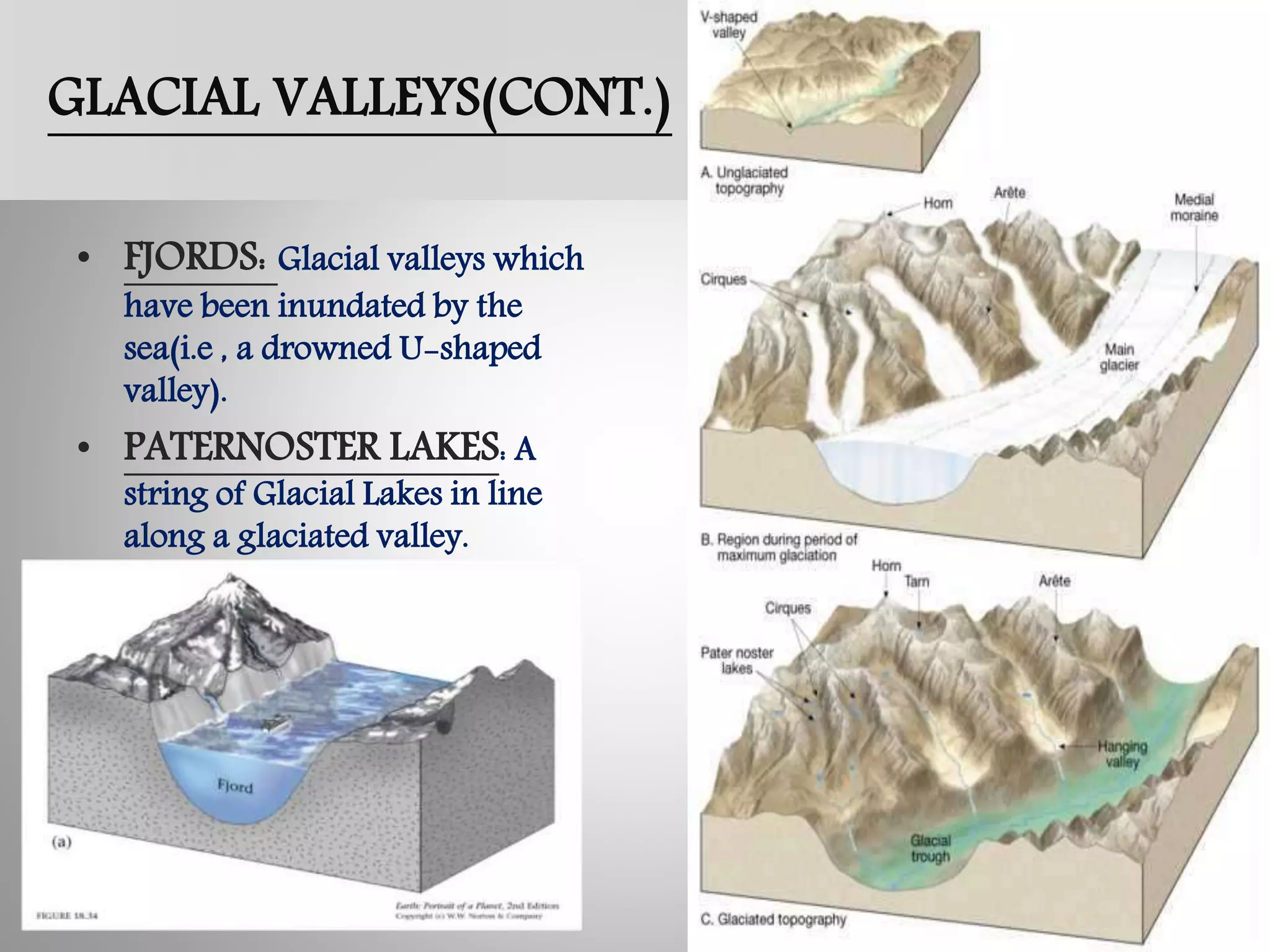
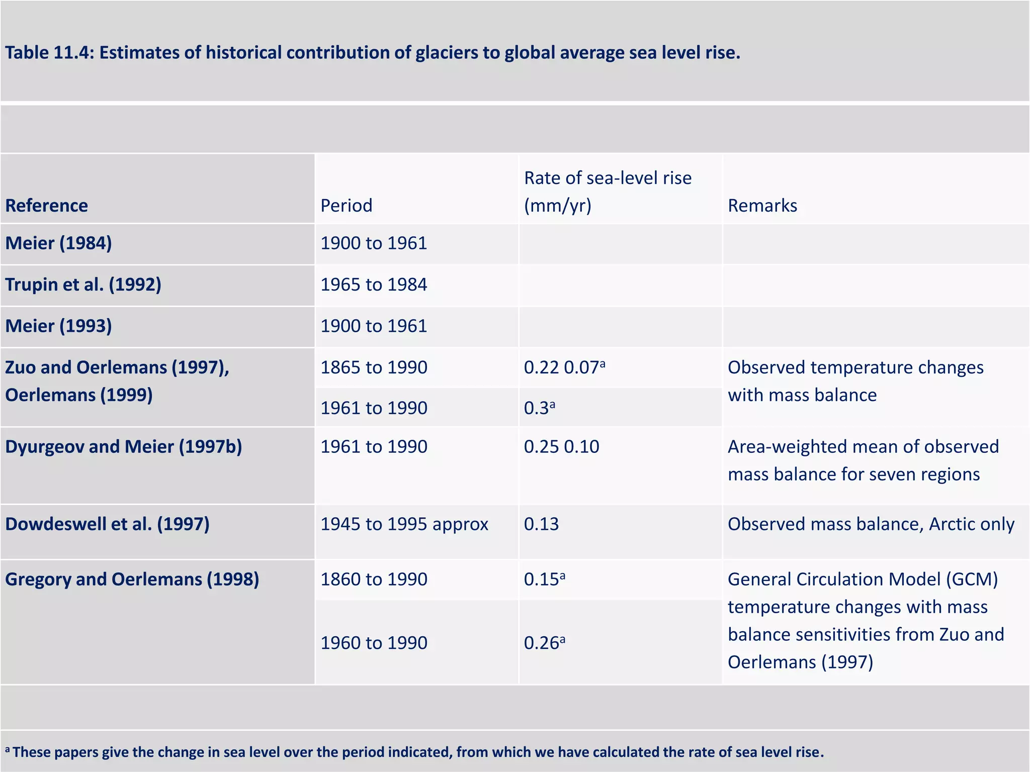
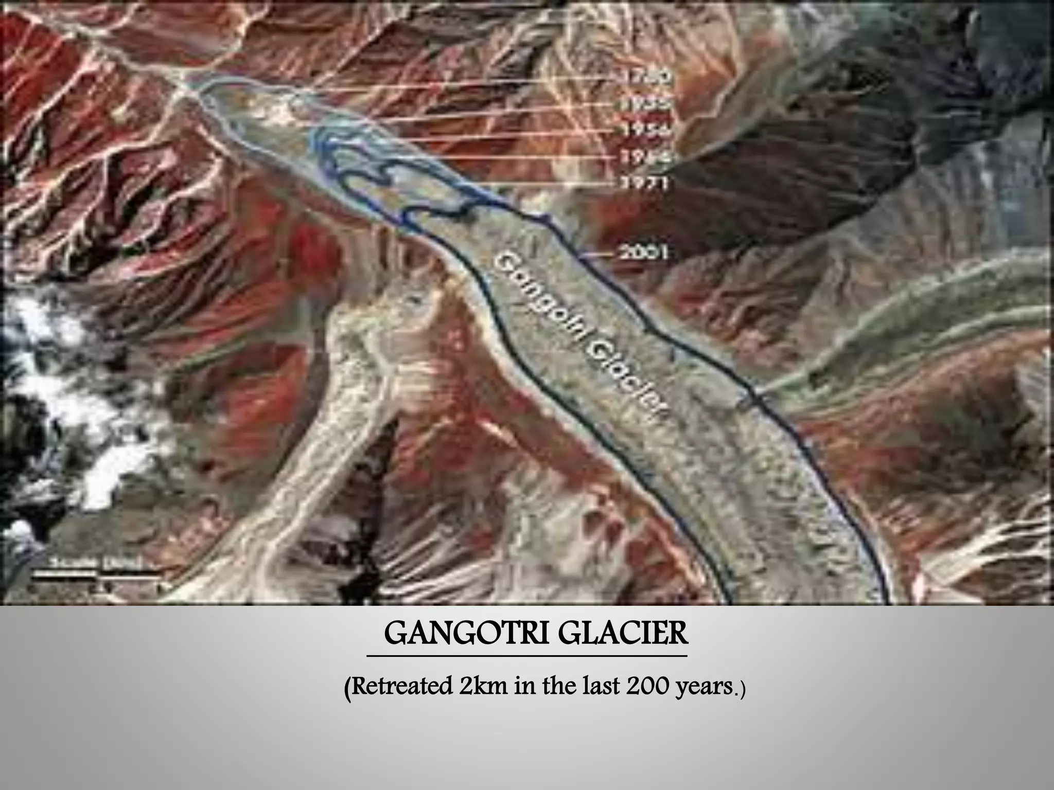
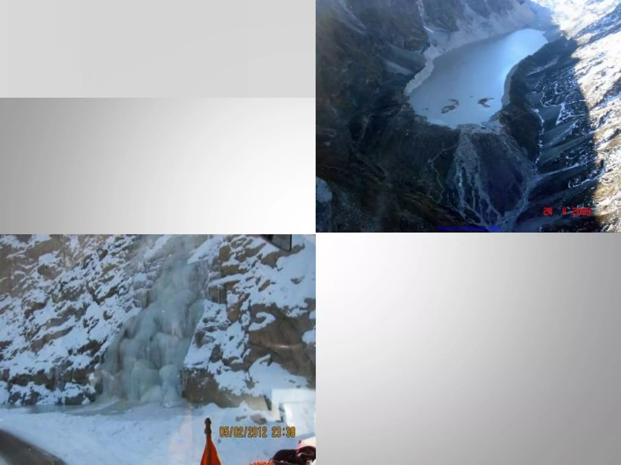
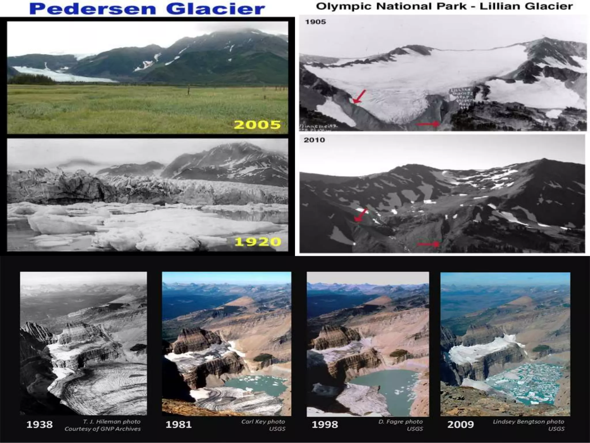

The document discusses various erosional and depositional glacial landforms, detailing their formation and classification, such as cirques, arêtes, moraines, and drumlins. It highlights the impact of climate change on glaciers, noting their general retreat and implications for sea level rise, particularly in regions like Greenland and the Himalayas. The summary also addresses glacier mass balance studies, illustrating the sensitivity of glaciers to temperature and precipitation changes, which are critical for understanding future projections.


![Chapter 12 graphics- glaciers (1) [Autosaved].ppt](https://cdn.slidesharecdn.com/ss_thumbnails/chapter12graphics-glaciers1autosaved-230303182549-de7c9ed7-thumbnail.jpg?width=640&height=640&fit=bounds)


