Download to read offline
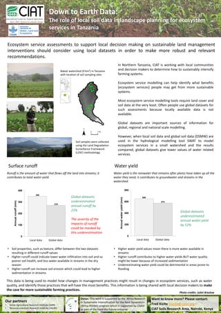

1) CIAT is working with local communities in Northern Tanzania to determine how to sustainably intensify farming systems through ecosystem service modeling. 2) When local soil data was used in a hydrological model compared to global soil data, the local data gave higher values for water-related ecosystem services. 3) Specifically, the local soil data estimated annual water yield to be 12% higher and annual runoff to be 23% higher than estimates using global soil data, suggesting global data may underestimate these services.


