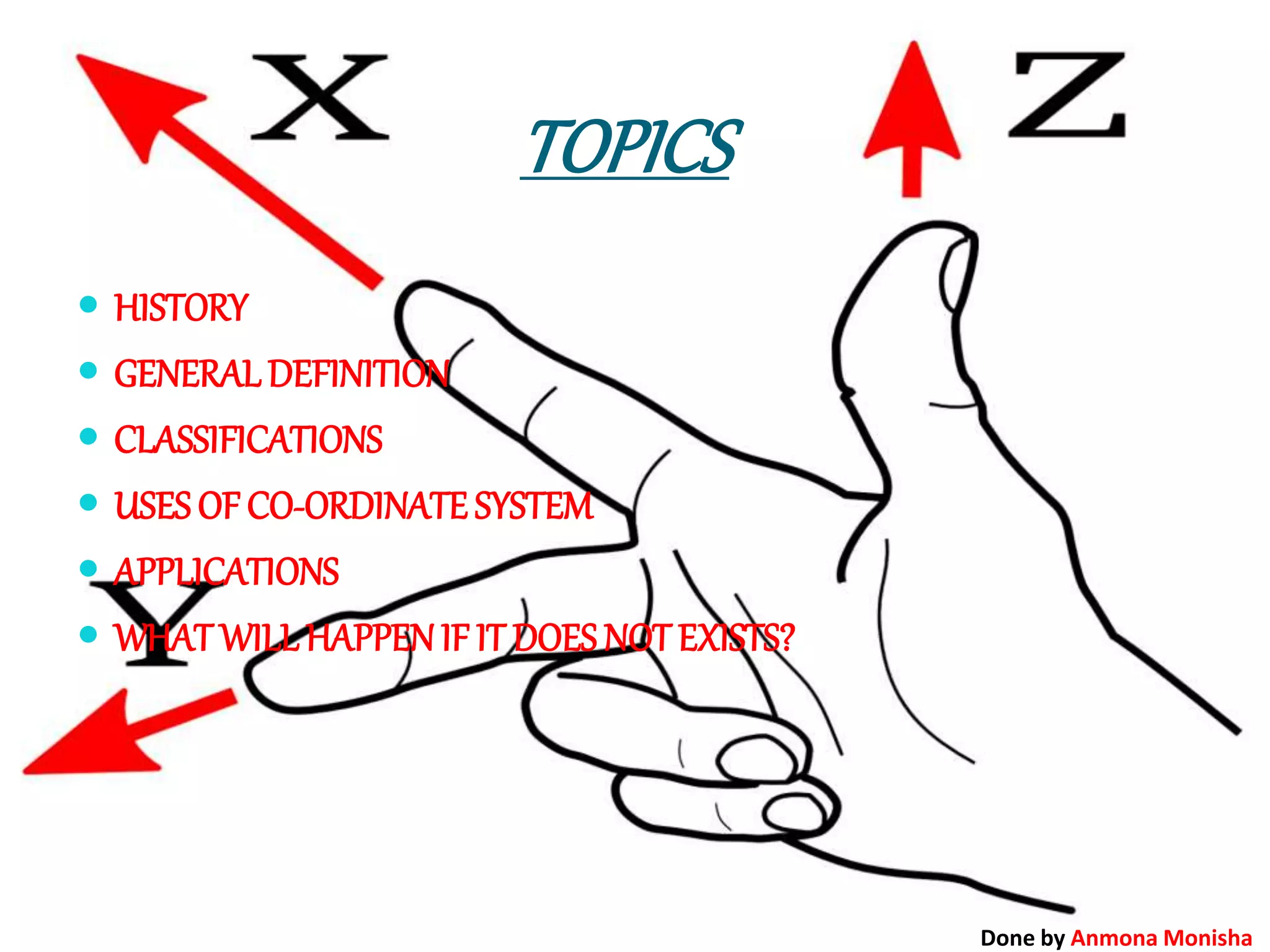
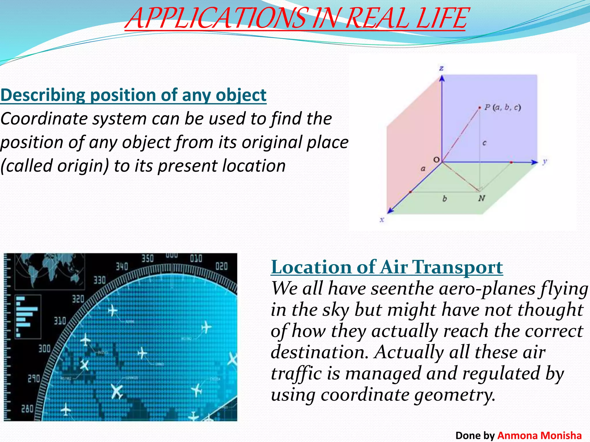
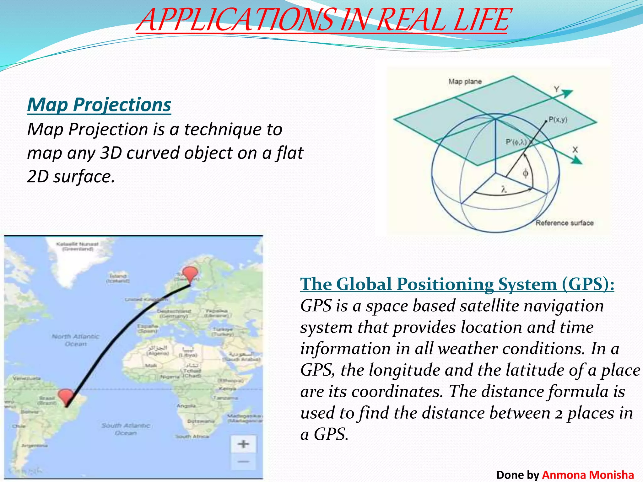
PRESENTATION
ON
co-ordinate system
Done by Anmona Monisha
TOPICS
 HISTORY
 GENERALDEFINITION
 CLASSIFICATIONS
 USES OF CO-ORDINATE SYSTEM
 APPLICATIONS
 WHAT WILLHAPPENIF IT DOES NOT EXISTS?
Done by Anmona Monisha
HISTORY
Cartesian means relating to the French mathematician and
philosopher Rene Descartes (Latin: Cartesius), who,
among other things, worked to merge algebra and
Euclidean geometry.
Rene Descartes who lived in 1600s. When he was a child, he
was often sick, so the teachers at his boarding school let
him stay in bed until noon. He went on staying in bed
until noon for almost all his life. While in bed, Descartes
thought about math and philosophy.
One day, Descartes noticed a fly crawling around on the
ceiling. He watched the fly for a long time. He wanted to
know how to tell someone else where the fly was. Finally
he realized that he could describe the position of the fly
by its distance from the walls of the room. When he got
out of bed Descartes wrote down what he had
discovered the position of the fly. Descartes had
invented the co-ordinate plane! In fact ,the co-ordinate
plane is sometimes called the Cartesiun plane in his
honor.
Done by Anmona Monisha
A co-ordinate system is a system designed to establish
positions with respect to given reference points. The co-
ordinate system consists of one or more reference points, the
style of measurement (linear or angular) from those reference
points, and the directions (or axes) in which those
measurements will be taken.
Done by Anmona Monisha
CLASSIFICATIONS
1. POLAR CO-ORDINATE SYSTEM: It is a
two-dimensional coordinate system in
which each point on a plane in determined
by a distance from a fixed point and an
angle from a fixed direction. (r,θ)
2. CYLINDRICAL CO-ORDINATE SYSTEM: It is
a three-dimensional coordinate system,
where each point is specified by the two
polar coordinates of its perpendicular
projection onto some fixed plane, and by
its distance from the plane. (ρ,Ф,z)
Done by Anmona Monisha
CLASSIFICATIONS
4. CARTESIAN CO-ORDINATE
SYSTEM: It specifies each point
uniquely in a plan by a pair of
numerical coordinates, which are
the signed distances from the point
to two fixed perpendicular directed
lines, measured in the same unit of
length.
3. SPHERICAL CO-ORDINATE SYSTEM: It is a
three-dimensional coordinate system, where
the position of a point is specified by three
numbers: the radial distance of that point
from a fixed origin, its elevation angle
measured from a fixed plane, and the
azimuth angle of its orthogonal projection on
that plane. (r,θ,Ф)
Done by Anmona Monisha
Learning Co-ordinate geometry is not just to clear your present class but
also helps your understanding in various ways. Like –
1. Geometry is applicable in computers or cell phones.
2. The text file or PDF file which we open is itself an example of
coordinate plane.
3. In these, the words or images are written or modified with the use of
coordinate geometry.
4. Any PDF file, which contains text, images and different shapes, are
placed according to the 2-dimentional coordinate (x, y) system.
5. All the concepts like distances, slopes and simple trigonometry are also
applicable here.
USES OF CO-ORDINATE SYSTEM
Done by Anmona Monisha
Some important fields that we need math-
APPLICATIONS
Done by Anmona Monisha
Describing position of any object
Coordinate system can be used to find the
position of any object from its original place
(called origin) to its present location
APPLICATIONS IN REAL LIFE
Location of Air Transport
We all have seenthe aero-planes flying
in the sky but might have not thought
of how they actually reach the correct
destination. Actually all these air
traffic is managed and regulated by
using coordinate geometry.
Done by Anmona Monisha
Map Projections
Map Projection is a technique to
map any 3D curved object on a flat
2D surface.
APPLICATIONS IN REAL LIFE
The Global Positioning System (GPS):
GPS is a space based satellite navigation
system that provides location and time
information in all weather conditions. In a
GPS, the longitude and the latitude of a place
are its coordinates. The distance formula is
used to find the distance between 2 places in
a GPS.
Done by Anmona Monisha
In real life, when weather forecasters
are tracking hurricanes, they note the
absolute location on a periodic basis to
see the path of the storm and try to
predict the future path based partially
on these findings.
APPLICATIONS IN REAL LIFE
A latitude measurement indicates locations
at a given angle north or south of Earth’s
equator. So, latitude measurements range
from 90° North at the North Pole to 0° at the
equator to 90° South at the South Pole.
A longitude measurement indicates
locations at a given angle east or west of an
imaginary north-south line called the prime
meridian, which runs through Greenwich,
England. Longitude measurements begin at
0° at the prime meridian and extend 180°
both to the west and to the east.Done by Anmona Monisha
Now imagine what if coordinate system doesn’t exist. Pilots, aircraft
controller, passengers in the flight, persons waiting for the flight all will
not be able to get the location or position of aircraft. These will also
definitely increase the chances of aircraft crushes. So from here we can
easily say that coordinate system is one of the most important parts of air
transport.
WHAT WILL HAPPEN IF IT DOES NOT
EXISTS?
Done by Anmona Monisha
THE HORROR ………….. (END )
Done by Anmona Monisha

Co ordinate system

  • 1.
  • 2.
    TOPICS  HISTORY  GENERALDEFINITION CLASSIFICATIONS  USES OF CO-ORDINATE SYSTEM  APPLICATIONS  WHAT WILLHAPPENIF IT DOES NOT EXISTS? Done by Anmona Monisha
  • 3.
    HISTORY Cartesian means relatingto the French mathematician and philosopher Rene Descartes (Latin: Cartesius), who, among other things, worked to merge algebra and Euclidean geometry. Rene Descartes who lived in 1600s. When he was a child, he was often sick, so the teachers at his boarding school let him stay in bed until noon. He went on staying in bed until noon for almost all his life. While in bed, Descartes thought about math and philosophy. One day, Descartes noticed a fly crawling around on the ceiling. He watched the fly for a long time. He wanted to know how to tell someone else where the fly was. Finally he realized that he could describe the position of the fly by its distance from the walls of the room. When he got out of bed Descartes wrote down what he had discovered the position of the fly. Descartes had invented the co-ordinate plane! In fact ,the co-ordinate plane is sometimes called the Cartesiun plane in his honor. Done by Anmona Monisha
  • 4.
    A co-ordinate systemis a system designed to establish positions with respect to given reference points. The co- ordinate system consists of one or more reference points, the style of measurement (linear or angular) from those reference points, and the directions (or axes) in which those measurements will be taken. Done by Anmona Monisha
  • 5.
    CLASSIFICATIONS 1. POLAR CO-ORDINATESYSTEM: It is a two-dimensional coordinate system in which each point on a plane in determined by a distance from a fixed point and an angle from a fixed direction. (r,θ) 2. CYLINDRICAL CO-ORDINATE SYSTEM: It is a three-dimensional coordinate system, where each point is specified by the two polar coordinates of its perpendicular projection onto some fixed plane, and by its distance from the plane. (ρ,Ф,z) Done by Anmona Monisha
  • 6.
    CLASSIFICATIONS 4. CARTESIAN CO-ORDINATE SYSTEM:It specifies each point uniquely in a plan by a pair of numerical coordinates, which are the signed distances from the point to two fixed perpendicular directed lines, measured in the same unit of length. 3. SPHERICAL CO-ORDINATE SYSTEM: It is a three-dimensional coordinate system, where the position of a point is specified by three numbers: the radial distance of that point from a fixed origin, its elevation angle measured from a fixed plane, and the azimuth angle of its orthogonal projection on that plane. (r,θ,Ф) Done by Anmona Monisha
  • 7.
    Learning Co-ordinate geometryis not just to clear your present class but also helps your understanding in various ways. Like – 1. Geometry is applicable in computers or cell phones. 2. The text file or PDF file which we open is itself an example of coordinate plane. 3. In these, the words or images are written or modified with the use of coordinate geometry. 4. Any PDF file, which contains text, images and different shapes, are placed according to the 2-dimentional coordinate (x, y) system. 5. All the concepts like distances, slopes and simple trigonometry are also applicable here. USES OF CO-ORDINATE SYSTEM Done by Anmona Monisha
  • 8.
    Some important fieldsthat we need math- APPLICATIONS Done by Anmona Monisha
  • 9.
    Describing position ofany object Coordinate system can be used to find the position of any object from its original place (called origin) to its present location APPLICATIONS IN REAL LIFE Location of Air Transport We all have seenthe aero-planes flying in the sky but might have not thought of how they actually reach the correct destination. Actually all these air traffic is managed and regulated by using coordinate geometry. Done by Anmona Monisha
  • 10.
    Map Projections Map Projectionis a technique to map any 3D curved object on a flat 2D surface. APPLICATIONS IN REAL LIFE The Global Positioning System (GPS): GPS is a space based satellite navigation system that provides location and time information in all weather conditions. In a GPS, the longitude and the latitude of a place are its coordinates. The distance formula is used to find the distance between 2 places in a GPS. Done by Anmona Monisha
  • 11.
    In real life,when weather forecasters are tracking hurricanes, they note the absolute location on a periodic basis to see the path of the storm and try to predict the future path based partially on these findings. APPLICATIONS IN REAL LIFE A latitude measurement indicates locations at a given angle north or south of Earth’s equator. So, latitude measurements range from 90° North at the North Pole to 0° at the equator to 90° South at the South Pole. A longitude measurement indicates locations at a given angle east or west of an imaginary north-south line called the prime meridian, which runs through Greenwich, England. Longitude measurements begin at 0° at the prime meridian and extend 180° both to the west and to the east.Done by Anmona Monisha
  • 12.
    Now imagine whatif coordinate system doesn’t exist. Pilots, aircraft controller, passengers in the flight, persons waiting for the flight all will not be able to get the location or position of aircraft. These will also definitely increase the chances of aircraft crushes. So from here we can easily say that coordinate system is one of the most important parts of air transport. WHAT WILL HAPPEN IF IT DOES NOT EXISTS? Done by Anmona Monisha
  • 13.
    THE HORROR …………..(END ) Done by Anmona Monisha