Download to read offline
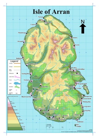

This map shows the landscape features and settlements of the Isle of Arran, Scotland. It depicts rivers, lochs, woodlands, roads, elevation lines, and place names. The highest point on the island is Goat Fell, which rises to 874 meters above sea level. The map provides an overview of the physical geography and infrastructure of Arran.