
More Related Content
What's hot
Similar to accident map improved
Similar to accident map improved (19)
accident map improved
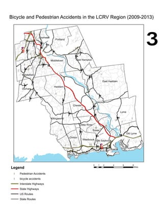
- 1. !( !(!( !( !( !( !(!( !( !( !( !( !( !( !(!( !( !( !( !( !( !( !( !(!(!( !( !( !( !(!(!( !( !( !( !( !( !(!( !( !( !( !( !( !( !( !( !(!( !( !( !( !( !( !( !( !( !( !( !( !( !( !( !( !( !(!( !( !( !( !( !( !( !( !( !( !( !( !( !( !( !(!( !( !( !( !( !( !(!( !( !( !( !( !( !( !( !(!( !( !(!( !( !( !( !( !( !( !( !( !( !( !( !( !( !( !( !( !( !( !( !( !( !( !( !( !(!( !( !( !( !( !( !( !(!(!( !( !( !( !( !(!( !(!( !( !( !( !( !( !( !( !( !(!( !( !( !( !( !( !( !( !( !( !( !( !( !( !( !( !( !( !( !( !( !(!(!( !( !( !( !( !( !(!( !(!( !( !( !( !( !( !( !( !( !( !( !( !( !(!( !( !( !( !( !( !( !( !( !( !( !( !( !( !( !(!( !( !( !( !( !( !( !( !( !( !( !( !( !( !( Old Lyme Lyme East Haddam Old SaybrookWestbrook Clinton Killingworth Essex Deep River Chester Haddam Durham Middlefield Middletown Cromwell Portland East Hampton §¨¦95 §¨¦91 ¬«9 £¤1 ")154 ")148 ")66 ")82 ")17 ")151 ")145 ")81 ")156 ")80 ")157 ")149 ")16 ")3 ")196 ")153 ")372 ")217 ")99 ")68 ")17A ")79 ")77 ")155 ")166 Bicycle and Pedestrian Accidents in the LCRV Region (2009-2013) ³ Legend !( Pedestrian Accidents !( bicycle accidents Interstate Highways State Highways US Routes State Routes 0 2 4 6 81 Miles