Traditional water harvesting in Thar region of India.The presentation shows various methods employed for water conservation and recharging in Rajasthan and Gujarat in Western India.
Traditional water harvesting systems of indiaAmit Dwivedi
This document discusses traditional water harvesting systems in India. It explains that India receives most of its water from rainfall and different regions developed unique water harvesting methods suited to local conditions like kuls in Himachal Pradesh and zabo in Nagaland. However, many traditional systems have been abandoned due to factors like urbanization, groundwater exploitation, and a shift to modern water sources. The document argues that reviving traditional water harvesting could help address water scarcity issues, as evidenced by the success of communities like Sukhomajari that adopted watershed management approaches.
Greens’ Alliance for Conservation of Eastern Ghats (GrACE) was founded in 2011 by Council for Green Revolution to protect the fragile Eastern Ghats hill ranges from degradation. GrACE aims to provide a platform for conservation of the Eastern Ghats ecosystems and natural heritage. So far, GrACE has organized two national conferences, three regional conventions, a conservation expedition, and published this Eastern Ghats Environment Outlook report. The report provides an overview of the Eastern Ghats geography, vegetation, and biodiversity across five Indian states.
The Great Indian Desert, also known as the Thar Desert, spans parts of northwest India and eastern Pakistan. It is characterized by large sand dunes and receives little rainfall. Wildlife such as blackbucks have adapted to the harsh desert conditions. Agriculture is the main occupation where water is available, though many nomadic herders also live in the desert, moving their flocks in search of grass and water. The Indian government has implemented irrigation projects like the Indira Gandhi Canal to bring water from other regions and increase agriculture in parts of the desert.
This document discusses traditional rainwater harvesting methods used in parts of India. It introduces the concept of rainwater harvesting as a technology to collect and store rainwater for human use using simple engineered techniques. It then describes 10 common traditional rainwater harvesting methods used in various parts of India, including paar systems in western Rajasthan, talab/bandhis ponds in Bundelkhand and Udaipur, saza kuwas wells with multiple owners, johads earthen check dams, and kunds/kundis and kuis/beris dug wells.
The climates of Jammu and Kashmir vary by region and altitude. In the Kashmir Valley, summers are mild and nights are cool, while only Kashmir experiences monsoons and Ladakh does not. The best time to visit is between September and April. The region consists of three main areas - Jammu, the Kashmir Valley, and Ladakh. Vegetation is sparse but the flora and fauna diversity is high due to the varied climate and terrain. Agriculture is important to the economy and economy, with saffron and cashmere wool as notable products.
The document discusses India's natural vegetation and wildlife. It describes various types of natural vegetation found in India, including tropical evergreen forests, tropical deciduous forests, thorn forests and scrubs, montane forests, and mangrove forests. It also discusses factors like relief, climate, and ecosystems that affect India's diversity of flora and fauna. Additionally, it provides examples of important plant and animal species found in different forest types and biome across India and conservation efforts undertaken by the government to protect natural heritage.
This is the first of 4 parts of presentation showing Traditional water harvesting system prevailing in North and North-Eastern parts of India.Over a period of time these have become defunct in general.However the same needs to be revived to create local sources.
This document provides an overview of the culture of Jammu, India. It discusses the founding of Jammu by Raja Jambu Lochan in the 14th century BC. It describes several important temples in Jammu including the Raghunath Temple, Mubarak Mandi Palace, Shiv Khori Cave, Mata Vaishno Devi, and Peer Khoh Temple. It also discusses the predominant religions of Hinduism, Islam, and Sikhism. The document outlines key aspects of Jammu's culture such as languages, cuisines including rajma chawal and sweets, and folk dances including jagarna and surma. It concludes that Jammu is known for its rich heritage and diversity.
The Mahanadi River originates in Chhattisgarh and flows east through Orissa before entering the Bay of Bengal. It is one of the longest rivers in India, covering 860 km. The Hirakud Dam on the Mahanadi is a major landmark and the world's longest dam when constructed. The river irrigates fertile lands used to cultivate crops like rice, oilseeds, and sugarcane.
Dams And Hydroelectricity In Maharashtra | Art Integrated Project | Science P...PritamPriyambadSahoo
Dams And Hydroelectricity In Maharashtra a Science Art Integrated Project of CBSE Class 10.
A PowerPoint presentation Made By Pritam Priyambad Sahoo
For any queries, mail at pritamsahoo.edu@gmail.com
Thank You! :)
The document provides information about the Indian state of Assam. It summarizes that Assam was established in 1947, has a population of over 31 million according to the 2011 census, and its capital and largest city is Dispur and Guwahati respectively. The key industries in Assam include tea production, for which it is well known, as well as oil, gas, and cement. The state has significant infrastructure for transportation including airports, roads, and inland waterways on major rivers.
Orissa has abundant natural resources including water, land, forests, and minerals. Its water resources include several major rivers like the Mahanadi that flow across the state and empty into the Bay of Bengal. The state has forests covering 32% of its area that contain valuable trees. Orissa also has significant mineral resources such as iron ore, manganese, chromite, bauxite, limestone, and coal deposits that make it a major producer for industries. The state utilizes its water and land resources for irrigation, hydroelectricity, and agriculture.
The water resources of Karnataka primarily constitutes surface and groundwater. Rainfall is the basic source of water in the state. Karnataka is blessed with seven river basins. There are 36,753 tanks in the state and they have a capacity of about 684518 hectares. The rivers, along with their tributaries, account for much of Karnataka’s surface water resources. Surface water is available in Karnataka in the form of rivers, lakes, waterfalls, reservoirs, etc. Being the seventh largest state in India (area-wise), Karnataka possesses about six percent of the country’s total surface water resources of about 17 lakh million cubic metres (Mcum).
It is a nice presentation work on culture of jammu and kashmir in 10 slides that includes the folk dance, about pashmina shawl, houseboat, and many places of tourists attraction.
Jammu and Kashmir consists of three regions - Jammu, the Kashmir Valley, and Ladakh. Srinagar is the summer capital while Jammu is the winter capital. Jammu is known for its Hindu pilgrimage sites. The Kashmir Valley is a popular tourist destination, known for its mountainous landscape and sites like Gulmarg and Sonamarg. Ladakh, also known as "Little Tibet", is renowned for its remote mountain beauty and Buddhist culture, and features sites like Pangong Lake, Leh, and Nubra Valley.
The Kaveri River is about 475 miles long and flows through southern India, originating in the hills of Karnataka and passing through Karnataka and Tamil Nadu before emptying into the Bay of Bengal. According to Hindu legend, the river was born as a daughter of the god Brahma to purify sins. The Kaveri is considered sacred and taking a bath in its waters on certain astrologically significant days is believed to provide benefits like attaining heaven. Holy sites along the river like the Kaveri Kund are believed to grant godliness or benefits simply through worship or bathing in the river's waters.
The Sahara Desert ecoregion covers an area of 4.6 million square kilometers in the hyper-arid center of the Sahara Desert. It is surrounded by desert ecoregions that receive slightly higher rainfall and have more vegetation. The Sahara Desert is the world's largest subtropical hot desert, located in Northern Africa between the Red Sea and the Atlantic Ocean. It features extremely high temperatures year-round and very low and irregular rainfall, making it one of the hottest and driest places on Earth. The Sahara is home to various wildlife adaptations as well as human populations that have historically relied on nomadic herding and trade routes.
Water resources are sources of water that are useful for human uses like agriculture, industry, households, recreation and the environment. Only 3% of water on Earth is fresh water, with the majority found as groundwater or frozen in glaciers and ice caps. Water is a renewable resource, but groundwater depletion is occurring in many places around the world. Water is essential for agriculture, which accounts for about 70% of water usage globally. Managing water resources sustainably is important for reducing poverty, maintaining environmental health, and supporting economic development.
The development of major water resource projects like the Narmada Valley Scheme can lead to both positive and negative physical, economic, and social changes in the local environment, depending on the context. While the scheme aims to increase food production and provide irrigation and drinking water, it has also displaced many people, especially tribal communities, and risks becoming unsustainable due to issues like heavy silting reducing reservoir capacity over time. There are arguments on both sides as to whether the benefits outweigh the social and environmental costs.
Top destination places in Jammu and kashmir. You come to know about some of the most popular desination in Jammu and Kashmir like Nilagrad, srinagar etc.
The document summarizes micro irrigation initiatives in the state of Gujarat, India. It discusses how Gujarat has formed a single nodal agency called the Gujarat Green Revolution Company to promote micro irrigation systems like drip and sprinkler irrigation. The agency has been successful in expanding micro irrigation coverage through a streamlined application process, subsidies up to 50% of costs, strong monitoring systems, and extensive farmer outreach and training programs. Micro irrigation has now been implemented on over 1.88 lakh hectares in Gujarat, bringing water and energy savings as well as yield increases for various crops.
This document discusses the geology, hydrogeology, and groundwater resources of Solapur City and surrounding areas in Maharashtra, India. It describes the regional geology consisting of Deccan basalt lava flows between 55-65 million years old. The city area contains heterogeneity in the basalt units including variations in thickness, fractures, and weathering which affects groundwater availability. Groundwater recharge primarily occurs in the shallow aquifer during monsoon season. Overextraction and urbanization are depleting groundwater levels, with many borewells now low-yielding or dry. The document provides details on the municipal water supply network and estimates of private borewell usage. Water quality is deteriorating in some parts of the city due to
Kashmir, known as the "Venice of the East", is a region in the northern Indian subcontinent located in the Himalayan mountains. Some of its key attractions include Dal Lake, Gulmarg, Pahalgam, and Sonmarg. Activities available in Kashmir include skiing, hiking, boating, and visiting famous Mughal gardens like Shalimar Bagh and Nishat Bagh. The annual Amarnath Yatra pilgrimage to a holy cave located in Kashmir draws many visitors every year. Kashmir is known for its beautiful scenery, houseboats, and traditional Kashmiri cuisine like the multi-course Wazwan feast.
Pakistan has one of the largest contiguous irrigation systems in the world called the Indus Basin Irrigation System (IBIS). The IBIS includes 3 major reservoirs, 19 barrages, 2 head works, 12 link canals, 45 irrigation canals, over 100,000 water courses, and millions of farm channels with a total length of over 500,000 km. It provides irrigation to over 22 million hectares of cultivated land, sourcing water from the Indus River and its tributaries as well as groundwater and rainfall. Surface water makes up the largest portion at around 104 MAF annually. Groundwater contributes another 41 MAF and rainfall provides around 9 MAF. Together this irrigation system provides around 69 MAF
Assam ppt in eng. असम BEST ppt description ki last line ...KALPESH-JNV
Assam (/æsˈsæm, əˈsæm/,[10][11] Assamese: [ˈɔxɔm] (About this soundlisten)) is a state in northeastern India, situated south of the eastern Himalayas along the Brahmaputra and Barak River valleys. Assam covers an area of 78,438 km2 (30,285 sq mi). The state is bordered by Bhutan and Arunachal Pradesh to the north; Nagaland and Manipur to the east; Meghalaya, Tripura, Mizoram and Bangladesh to the south; and West Bengal to the west via the Siliguri Corridor, a 22 kilometres (14 mi) wide strip of land that connects the state to the rest of India. It is also one of the world's most populous subdivisions. Assamese is the official and most commonly spoken language of the state, followed by Bengali, which is official in the Barak Valley and Bodo which is official in Bodoland Territorial Region.
Assam is known for Assam tea and Assam silk. The state was the first site for oil drilling in Asia.[12] Assam is home to the one-horned Indian rhinoceros, along with the wild water buffalo, pygmy hog, tiger and various species of Asiatic birds, and provides one of the last wild habitats for the Asian elephant. The Assamese economy is aided by wildlife tourism to Kaziranga National Park and Manas National Park, which are World Heritage Sites. Dibru-Saikhowa National Park is famed for its feral horses. Sal tree forests are found in the state which, as a result of abundant rainfall, look green all year round. Assam receives more rainfall than most parts of India; this rain feeds the Brahmaputra River, whose tributaries and oxbow lakes provide the region with a hydro-geomorphic environment.
Jane se phele niche vali video dekh lo (VERY IMP)
https://www.youtube.com/watch?v=V5qMCRAZTN8
Assam ppt in eng. असम BEST ppt description ki last line ...
3 hindi project.pptx
1.
2. आभार
हम अपने अध्यापक सुरजीत मीना जी का सहृदय धन्यवाद
करना चाहते हैं कक उन्होंने हमे इतनी किक्षाप्रद पररयहजना
बनाने का यह अवसर प्रदान ककया। इस पररयहजना से हमे
जम्मू और कश्मीर क
े बारे में बहुत क
ु छ सीखने कह कमला।
हम अपने माता -कपता का भी हाकदिक धन्यवाद करना चाहेंगे
क्होंकक उनकी सहायता क
े कबना यह पररयहजना बनाना
सफल नही हह पाता। हम भकवष्य में भी ऐसी किक्षाप्रद
पररयहजना बनाने की आिा करते हैं ।
धन्यवाद,
ग्रुप 3
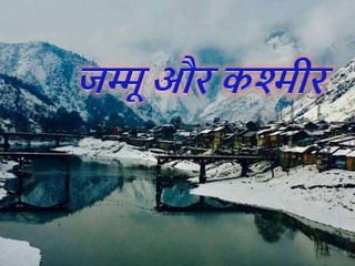
3. पररचय
यह परियोजना जम्मू औि कश्मीि क
े बािे में बनाया गया है | जम्मू
और कश्मीर ५ अगस्त २०१९ तक भाित का एक िाज्य था जजसे
अगस्त २०१९ में जिभाजजत कि जम्मू औि
कश्मीि एवं लद्दाख नमक दो क
ें द्र शाजसत प्रदेश क
े रूप में
स्थाजपत कि जदया गया। इस िाज्य का क्षत्र भाित क
े जवभाजन क
े
बाद से ही भाित, पाजकस्तान औि चीन क
े बीच जववाजदत िहा है,
जजनमे से तीनों ही पूवव रियासत क
े जवजभन्न जहस्ों पि आज भी
जनयंत्रण िखते हैं। जम्मू औि कश्मीि जहमालय पववत शंखला क
े
सबसे ऊ
ँ चे जहस्ों में स्स्थत है, औि इसे अपनी प्राक
ृ जतक स ंदयव
एवं संसाधनों क
े जलए जाना जाता है। साथ ही कश्मीि घाटी
औि लद्दाख का इलाका अपनी जवजशष्ट संस्क
ृ जत क
े जलए जाना
जाता है। यहाँ स्स्थत वैष्णो देवी तथा अमिनाथ की गुफाएँ जहंदुओं
क
े अत्यंत महत्वपूणव तीथव का क
ें द्र िहा है।
4. पिु पकक्षयााँ
जम्मू औि कश्मीि क
े जीव अपने अजितीय स्थान औि जलवायु
स्स्थजत क
े कािण जवजवध हैं। िाज्य में लगभग 16% भाितीय
स्तनधािी, पक्षी, सिीसृप, उभयचि औि जततजलयों को प्रस्तुत
जकया जाता है।
हंगुल (कश्मीिी हरिण; लाल जहिणों की एक लुप्तप्राय प्रजाजत),
तेंदुआ, जंगली जबस्ियाँ, जहमालयी काले भालू, कस्तूिी मृग,
जहमालयन ममोट औि जंगली बकिों की प्रजाजतयाँ देखी जा
सकती हैं।
जवजभन्न जहमालयी पक्षी, िंगीन तीति जैसे जक जिमसन टरोपोपन,
मोनाल तीति, िक्त तीति औि कोकलस तीति, गोल्डन ईगल
औि दाढी वाले जगद्ध भी िाजसी पहाडों को घेिते हुए जदखाई देते
हैं।
6. नकदयााँ
प्रक
ृ जत ने जम्मू औि कश्मीि िाज्य को झीलों औि नजदयों क
े
समृद्ध संसाधनों क
े साथ संपन्न जकया है।
सबसे महत्वपूणव नजदयों में जसंधु, झेलम, तवी, जचनाब, िावी
औि जकशनगंगा शाजमल हैं ।
7. झीलें
जम्मू औि कश्मीि में प्रजसद्ध झीलें -
डल झील, नाजगन झील, वुलि झील, सुरिनसि झील, मानसि झील, पैंगोंग
झील, त्सो मोिीिी झील, गंगासागि झील।
त्सोकाि झील िाज्य क
े जनवाजसयों क
े जलए जीवन का क
ें द्र, इन झीलों को
जम्मू औि कश्मीि िाज्य की एक अनूठी संस्क
ृ जत क
े उद्भव क
े जलए श्रेय
जदया जाता है।
8. भाषा और िैली
कश्मीिी या कोशुि इंडो-आयवन भाषाओं क
े डाजडवक उपसमूह
की एक भाषा है, जो लगभग 7 जमजलयन कश्मीरियों िािा बोली
जाती है, मुख्य रूप से जम्मू औि कश्मीि क
े भाितीय क्षेत्र में।
आजाद कश्मीि क
े पडोसी पाजकस्तानी क्षेत्र क
े क
ु छ जहस्ों में
भी वक्ता हैं।
9. जम्मू औि कश्मीि की आजधकारिक भाषा
कोशुि, डोगिी, जहंदी-उदूव औि अंग्रेजी हैं।
कश्मीिी िाज्य में एक क्षेत्रीय भाषा क
े रूप में
मान्यता प्राप्त है औि भाित की 22 अनुसूजचत
भाषाओं में से एक है।
फािस-अिबी जलजप को जम्मू-कश्मीि सिकाि
औि कश्मीिी अकादमी ऑफ आटव, कल्चि एं ड
लैंग्वेजेज िािा कश्मीिी भाषा की आजधकारिक
जलजप क
े रूप में मान्यता प्राप्त है।
10. पयिटन स्थल:-
श्रीनगर
•श्रीनगि भाित क
े जम्मू औि कश्मीि प्रान्त की
िाजधानी है
•कश्मीि घाटी क
े मध्य में बसा यह भाित क
े प्रमुख
पयवटन स्थलो में से है।
•श्रीनगि एक ओि जहां डल झील क
े जलए प्रजसद्ध है
वही दू सिी ओि जवजभन्न मंजदिों क
े जलए जवशेषरूप से
है।
•1700 मीटि ऊ
ं चाई पि बसा श्रीनगि जवशेष रूप से
•से झीलों औि हाऊसवोट जाना जाता है।
11. श्रीनगि जम्मू औि कश्मीि िाज्य की ग्रीष्मकालकालीन
िाजधान है।
ये शहि औि उसक
े आस-पास क
े क्षेत्र एक
जमाने में दुजनया क
े सबसे खूबसूित पयवटन स्थल
माने जाते थे। जैसे डि झील,शजलमाि औि
जनशात बाग, गुलमगव, पहलगाम आजद।
श्रीनगि में ही शंकिाचायव पववत है जहां जवख्यात
जहन्दू धमसुधािक औि अव्दैत वेदान्त क
े
प्रजतपादक आजद शंकिाचायव सवर्ज्ावनपीठ क
ै
आसन पि जविाजमान हुए थे।फ
ु लों से सजी िहने
वाली डल झील पि कई खूबसूित नावों पि तैिते
घि भी है जजनको हाउसबोट कहा जाता है।
12. वैष्णह देवी
वैष्णह देवी मोंकदर एक महत्वपूणि कहोंदू मोंकदर है जह जम्मू
और कश्मीर क
े भारतीय क
ें द्र िाकसत प्रदेि क
े किक
ु ट
पवित पर स्स्थत कटरा में स्स्थत वैष्णह देवी कह समकपित
है।
मोंकदर दुगाि कह समकपित 108 िस्िपीठहों में से एक है,
कजसे वैष्णह देवी क
े रूप में पूजा जाता है
यह भारत क
े सबसे अकधक देखे जाने वाले तीथिस्थलहों
में से एक है।
हर साल लाखहों आगोंतुक मोंकदर जाते हैं।
मोंकदर सभी कहोंदुओों और कसखहों क
े कलए पकवि है। गुरु
गहकवोंद कसोंह और कववेकानोंद जैसे कई प्रमुख सोंतहों ने
मोंकदर का दौरा ककया है।
13. लामायुरु गोम्पा
लहाख क
े उबह-खाबह
इलाक
े मे अनजमनब मठ
आपको देखने को जमला
जाएगे क्ोंजक यहा
अजधकति लोग ब ध्द दम को
मानते हैं।
14. भाित में लेह जजले में स्स्थत एक जतब्बती ब द्ध
मठ है।अगि आप श्रीनगि लेह हाइवे से लाख जा
िहे हैं तो आपको यहां जरूि रुकना चाजहए ।
लामायुरु मठ ,दिीक
ु ग कागयू स्क
ू ल आफ
ॅ
बुस्ध्दज़्म से जुडा है। ये लाख
क
े सबसे पुिाने औि सबसे
बडे मठ में से एक
है । इसक
े बाद पास की
गुफा से मजहध्द निोपा
यहां साधना किने आए
औि झील सूख गई है।
15. नुब्रा घाटी
नुब्रा घाटी एक तीन भुजाओं वाली घाटी है
जो लद्दाख घाटी क
े उत्ति-पूवव में स्स्थत है।
यह श्योक औि नुब्रा
नजदयों क
े संगम से
बनी है।श्योक नदी
उत्ति पजिम की ओि
बहती है औि
नुब्रा नदी एक न्यूनकोण
बनाते हुए इसमें उत्ति-
उत्ति पजिम से आ कि
जमलती है।
16. जम्मू और कश्मीर क
े प्राक
ृ कतक सौोंदयि
गुलमगव
फ
ू लों की वाजदयों क
े जलए
मशहूि गुलमगव को कश्मीि क
े
शान कहा जाता है गुरु मांगी
जम्मू कश्मीि क
े बािामुला
जजले में है। स्थान की खूबसूित
औि शांत वाताविण में होकि
इसका नाम ग िीमग से
गुलमगव िखा गया था।
17. लद्दाख 🌺
जम्मू कश्मीि को
भाित का स्वग बनाने
में लद्दाख का भी
काफी बडा योगदान है
क्ोंजक
लद्दाख जम्मू कश्मीि
का सबसे प्रत्यय से
प्रक
ृ जतक स्थल है मून
लैंड या ब्रोकन मून
आजद क
े नाम से भी
जाना जाता है।
18. जम्मू और कश्मीर की
कला
जम्मू और कश्मीर अपनी िानदार
प्राक
ृ कतक सुोंदरता में आधाररत हैं।.
इसक
े साथ ही, इसमें साोंस्क
ृ कतक
कवरासत का एक अनूठा कमश्रण है जह
इसे अपने अतीत से कवरासत में कमला
है।.
सूफी और सोंतहों की भूकम क
े रूप में,
इसक
े सामाकजक ताने-बाने में
साोंप्रदाकयक सद्भाव का मजबूत प्रभाव
है।. राज्य में कवकभन्न स्थलाक
ृ कत और
भौगहकलक स्स्थकतयाों हैं।.
इन कवकवधताओों क
े साथ, जम्मू और
कश्मीर की सोंस्क
ृ कत भी कवकभन्न क्षेिहों में
नाटकीय रूप से बदलती है।. इसकी
बहुआयामी सोंस्क
ृ कत प्राचीन काल से यहाों
पनप रहे कवकभन्न नैकतक समाजहों कह
19. जम्मू और कश्मीर की सोंस्क
ृ कत
यहाों तक कक ऐकतहाकसक रूप से, जम्मू और कश्मीर
मध्य और दकक्षण एकिया क
े आसपास कवकभन्न
साोंस्क
ृ कतक सोंस्थाओों क
े कलए सीखने क
े कलए एक
सीट रही है।. इसकी अनुकरणीय परोंपराएों रोंगीन
और जीवोंत हैं।.
जम्मू कश्मीर की जीवन िैली, भाषा, नृत्य, सोंगीत
और कलाओों कह उनक
े रूप में उत्क
ृ ष्ट बनाने क
े
कलए प्रत्येक आयु क
े साथ कफर से बनाया गया है।.
आज, यह राज्य न क
े वल अपनी प्राक
ृ कतक सुोंदरता
या धाकमिक महत्व क
े कलए बस्ि अपनी कवकिष्ट
सोंस्क
ृ कत क
े कलए भी दौरा ककया जाता है जह अपने
तीन क्षेिहों यानी जम्मू, कश्मीर घाटी और लद्दाख क
े
साथ बदल गया।.
20. • जम्मू क्षेि में, डहगरा सोंस्क
ृ कत की अपनी मजबूत
तलहटी है।.
• इसमें एक ओर पोंजाब की सोंस्क
ृ कत और दू सरी
ओर कहमाचल प्रदेि जैसा है।.
• इस क्षेि में गुजरात दू सरे आम नैकतक समुदाय हैं।.
21. जम्मू कश्मीर क
े रीकत-ररवाज
आधुकनकता क
े इस युग में भी जम्मू क
े लहग पारोंपररक
मदर द नेचर क
े डायरेक्टर और पूवि आईजीपी एसएस
कबजराल का कहना है कक अोंकतम सोंस्कार क
े कलए
कक्रमैटहररयम का इस्तेमाल हहना चाकहए ताकक
पयािवरण और कम हह रहे वनहों कह बचाया जा से ही
अोंकतम सोंस्कार करने कह प्राथकमकता देते हैं। लाखहों
रुपयहों की लागत से बने कक्रमैटहररयम में अभी तक 42
लहगहों का ही सोंस्कार हह पाया है। इसका सीधा
नुकसान पयािवरण कह हह रहा है।
22. वन कवभाग से कमली जानकारी क
े अनुसार कक्रमैटहररयम िुरू हहने
से वषि 2012 तक िाोंकत घाट और जहगी गेट में क
ु ल 40, 494 स्व
ों टल
लकड़ी जलाई गई।
इस पर 52,97,094 रुपये खचि हुए। इससे यह भी अनुमान लगाया
जा सकता है कक इसक
े कलए ककतने वृक्षहों कह काटा गया हहगा।
हालाोंकक वन कवभाग का यह तक
ि है कक लकड़ी पहले से कगरे वृक्षहों
की इस्तेमाल की जाती है, लेककन यह भी सही है कक इस लकड़ी कह
उन पररवारहों कह कदया जा सकता है जह गरीबी रेखा से नीचे रह रहे
हैं।
मदर द नेचर क
े डायरेक्टर और पूवि आईजीपी एसएस कबजराल
का कहना है कक अोंकतम सोंस्कार क
े कलए कक्रमैटहररयम का इस्तेमाल
हहना चाकहए ताकक पयािवरण और कम हह रहे वनहों कह बचाया जा
सक
े ।
उन्होंने इस प्रकार क
े कक्रमैटहररयम ऊधमपुर और कठुआ में भी
बनाने कह कहा।
23. जम्मू और कश्मीर की
जनजाकतयााँ
बकरवात
बकरवाल (बखरवाल,
बक्रावल्लाह और बेकरवाल) भी
ज्यादातर मुस्िम हैं। दकक्षण
एकिया क
े पीर पोंजल और
कहमालयी पहाड़हों में स्स्थत
खानाबदहि जनजाकत।. वे
पारोंपररक रूप से हैं, और अभी
भी मुख्य रूप से, बकरी और
चरवाहे हैं।. वे भारत और
पाककस्तान क
े बीच और
अफगाकनस्तान क
े नूररस्तान प्राोंत
में पूरे कश्मीर क्षेि में रहते हैं।
24. बेदा
बेदा लहग भारतीय राज्य
जम्मू और कश्मीर क
े एक
समुदाय हैं।. वे ज्यादातर
लद्दाख क्षेि में रहते हैं,
जहाों वे सोंगीतकारहों क
े
अपने पारोंपररक व्यवसाय
का अभ्यास करते हैं।. वे
मुख्य रूप से मुस्िम धमि
क
े अनुयायी हैं, हालाोंकक
क
ु छ बौद्ध हैं।. क
ु छ
कवद्वानहों क
े अनुसार, वे एक
अछ
ू त समूह हैं, हालाोंकक
अन्य लहग सहचते हैं कक
स्स्थकत अकधक बारीक है।.
25. कश्मीर की प्राचीन महाकाव्य, अथाित् कनल्माता पुराण हमें बताता है कक
कश्मीररयहों माोंस भक्षण करते थे। यह आदत आज कश्मीर में बनी रहती है।
आज कश्मीर व्योंजन में सबसे उल्लेखनीय घटक मटन है, कजनमें से ३० ककस्हों
से अकधक हैं। इसक
े अलावा करने क
े कलए ध्यान कदया जाना चाकहए बाल्टी
करी, अपने कवदेिी स्वाद क
े कलए यूनाइटेड कक
ों गडम में लहककप्रय है, कक
बास्ल्टस्तान से फ
ै ला है।
26. कश्मीरी पुलाव
खुिबूदार बासमती चावल कह दू ध,
चीनी, सीज़नल और डर ाय फ्र
ू ट्स क
े
साथ कमक्स कर कमक्स कर बनाया
जाता है। जह बहुत ही लजीज हहता
है। ज्यादातर लहग इसमें मटन क
े
साथ बनाते ह।
रहगन जहि
ये कश्मीर की खास कडिेज में से
एक है। कजसमें मीट कह भुने हुए
प्याज, मसाले और दही क
े साथ
पकाया जाता है। रहगन जहि कडि
कदखने में लाल हहती है क्होंकक
इसमें लाल कमचि का इस्तेमाल
ककया जाता है।
27. कश्मीर क
े लहक-नृत्य
िऊफ जनजाजत िािा जकया जाता है, कश्मीिी
लोगों क
े इस प्रजसद्ध लोक नृत्य को डमहल
कहा जाता है, जवजशष्ट अवसिों पि औि
जनधावरित स्थानों पि जकया जाता है। आम त ि
पि, यह नृत्य क
े वल वाटल क
े पुरुषों िािा
जकया जाता है, जो लंबे िंगीन वस्त्र औि लम्बी
शंक्वाकाि टोपी पहनते हैं, जो आमत ि पि
मोजतयों औि शंखों से जडी होती हैं।
29. कश्मीर की
पहनावा
फ
े िन: कश्मीर में पुरुष औि
मजहला दोनों क
े जलए पािंपरिक
पोशाक है। फ
े िन मूल रूप से
एक ढीले ऊपिी वस्त्र है जो
आस्तीन में जशजथल रूप से
इकट्ठा होता है जो च डा होता है। ... पश्मीना शॉल: पश्मीना
शॉल पािंपरिक ऊनी वस्त्रों से बनाए जाते हैं, जो पहाड क
े
बकिे से प्राप्त जकए जाते हैं। इन शॉल क
े दोनों जकनािों पि
जजटल काम जकया जाता है।