This document is the 2011 Landbase Atlas published by the GIS department of the City of Grand Haven, Michigan. It provides maps and information about the city's boundaries, streets, parks, neighborhoods, zoning, and other geographical features. Contact information is included for the GIS department and other relevant city departments. An index and legend are also provided.
PG15110 -TP01-TP10 PROPOSED TOWNHOUSE AT 214 CANTERBURY RD - BLACKBURN SOUTH
Grand_Haven_City_Atlas.mxd
1. City of Grand HavenCity of Grand Haven
Landbase Atlas 2011Landbase Atlas 2011
2. City of Grand Haven
Information
This Landbase Atlas was published
by the City of Grand Haven's GIS
department.
Matt VanPortfliet, GIS Technician
Zach Christian-Rotramel, GIS Intern
Grand Haven City Hall
519 Washington Avenue
Grand Haven, MI 49417-1486
(616) 935-3282
City of Grand Haven
519 Washington Avenue
Grand Haven, MI 49417-1486
(616) 842-3210
www.grandhaven.org
Public Safety
525 Washington Avenue
Grand Haven, MI 49417
(616) 842-3460
Public Works
1120 Jackson Street
Grand Haven, MI 49417
(616) 847-3493
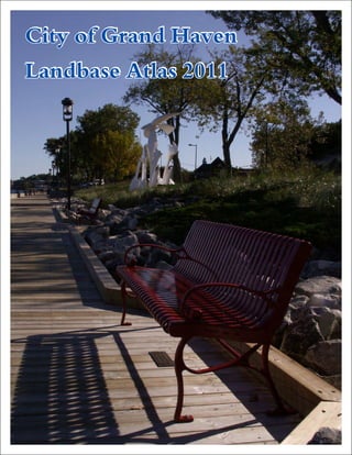
Photos Courtesy: Jim Bonamy
Atlas Legend
City Limit
Pavement
Building Footprints
Parcels
Wetlands
Water
Parks and Public Land
City Owned Parcels
Boat Launches
City Hydrants
Private Hydrants
3. Table of Contents
Index ……………………………………………………………………..……………..……… 2
Landbase Atlas ………………………………………………………………………….… 3-29
Street Types………………………………………………………………………….……..… 30
Plat Ownership (2009)……………………………………….………………………..…….. 31
Neighborhoods …………………………………………………………………………….… 32
Parks and Public Land………………..………………………………………………...…… 33
MSDDA Districts …………………………………………………………………………..…. 34
Voting Precincts ………………………………………………………………………….….. 35
School Districts ………………………………………………………………………….…… 36
Zoning ....……………………………………………………………………………………… 37
Land Use ...…………....……………………………………………………………………… 38
Digital Elevation Model (DEM) .…………………………………………………..………... 39
Land Cover circa 1800 ..…………………………………………………………………..… 40
4. Grand Haven Township
City of Ferrysburg
Village of Spring Lake
Page 3
Page 7
Page 6Page 4
Page 8
Page 5
Page 9 Page 11Page 10
Page 18Page 17
Page 29
Page 13 Page 14
Page 21
Page 12 Page 15 Page 16
Page 28Page 27
Page 22 Page 26Page 24 Page 25Page 23
Page 19 Page 20
City of Grand Haven
2
Section Index
6. City of Ferrysburg
Dewey Hill
Harbor Island
Harbor Island Linear Park
Power Plant Rd
Grand River
53
7
64
8 9 11
28
1817
29
13 14
21
12 15 16
10
27
22 2624 2523
19 20
0 250 500 750 1,000125
Feet
City of Grand Haven
4
SeePage3
See Page 8
SeePage5
Landbase Atlas
1 inch = 400 feet
7. City of Ferrysburg
7
4
740
747
501 501
Harbor Island
Rix Robinson Park
3rdSt
Coho Dr
BeaconBlvd
HarborIslandDr
D Ave
Grand
IsleDrPower Plant Rd
BeaconBlvd
HarborIslandDr
Grand River
Grand River
Grand River
53
7
64
8 9 11
28
1817
29
13 14
21
12 15 16
10
27
22 2624 2523
19 20
0 250 500 750 1,000125
Feet
City of Grand Haven
5
SeePage4
See Page 9
SeePage6
Landbase Atlas
1 inch = 400 feet
8. City of Ferrysburg
Village of Spring Lake
1
7
G
rand
Isle
D
r
Grand River
Spring Lake
Grand River
53
7
64
8 9 11
28
1817
29
13 14
21
12 15 16
10
27
22 2624 2523
19 20
0 250 500 750 1,000125
Feet
City of Grand Haven
6
SeePage5
See Page 10
Landbase Atlas
1 inch = 400 feet
13. Grand Haven Township
Village of Spring Lake
200
1525
1644
East Grand River Park
Grand River
53
7
64
8 9 11
28
1817
29
13 14
21
12 15 16
10
27
22 2624 2523
19 20
0 250 500 750 1,000125
Feet
City of Grand Haven
11
SeePage10
See Page 16
Landbase Atlas
1 inch = 400 feet
31. Grand Haven Township
16446
1900
1855
1865
16344
1901
1835
Hayes St
160thAve
IndustrialParkDr
Pottawattomie Bayou
53
7
64
8 9 11
28
1817
29
13 14
21
12 15 16
10
27
22 2624 2523
19 20
0 250 500 750 1,000125
Feet
City of Grand Haven
29
SeePage28
Landbase Atlas
1 inch = 400 feet
See Page 26
32. Grand River
Lake Michigan
Spring Lake
Pottawattomie
Bayou
Lloyd
Bayou
Robbins Rd
FerrySt
Hayes St
3rdSt
Grant St
GriffinSt
BeaconBlvd
Comstock St
160thAve
Fulton St
168thAve
Savidge St
172ndAve
Taylor Ave
7thSt
5thSt
BeechtreeSt
Waverly Ave
178thAve
SheldonRd
SUS31HWY
NUS31HWY
LakeshoreDr
M
ercury
Dr
Washington Ave
PineSt
NorthShoreDr
Franklin St
6thSt
Pennoyer Ave
AlbeeSt
Jackson St
Colfax St
Exchange St
1stSt
E River St
DeSpelderSt
Clinton St
HopkinsSt
LeonardRd
2nd St
164thAve
Brucker St
161stAve
177thAve
HillcrestSt
Liberty St
S
LakeAve
Eaton Dr
FriantSt
Howard St
Park Ave
Terrill Ave
Fall St
Coho Dr
Sherman St
Ohio Ave
HarborDr
Oakes Ave
Lake Ave
ClovernookDr
South St
DorisAve
WisconsinAve
Marion St
AWay
Slayton St
CutlerSt
KitchelLn
D Ave
Gary Ave
Shore Acres Rd
8thSt
Cedar Ave
Mason St
NLakeAve
ProspectSt
Grand Ave
Ann St
Summer St
WestraySt
4thSt
Madison St
Shady Ln
FairmountCt
Industrial Park Dr
BretonSt
AirparkDr
PineCt
Mulligan Dr
WhittakerWy
Williams St
BarbaraCt
DaleCt
Ridgefield StDairyLn
Adams St
Edward
Ave
Timberview Dr
AngelusCir
KooimanAve
GillinSt
Fleser Ct
Bluebird Rd
Elliott St
GladysAve
CrescentSt
TilesCt
RexAve
Oak Ln
Doris Ct
MapleTer
Forest Dr
M 104
Madison St
PineSt
2ndSt
Park Ave
BeaconBlvd
Terrill Ave
Slayton St
30
City of Grand Haven
Street Types
0 1,500 3,000 4,500 6,000750
Feet
Legend
Unclassified Road
A21 - Primary Highway
A34 - Secondary Highway
A35 - Secondary Highway
A36 - Secondary Highway
A42 - Local Road
A44 - Local Road
Active Alleyway
Vacated Alleyway
STREET TYPE KEY
A34 - unseparated rail line in center
A35 - separated
A36 - separated in tunnel
A42 - unseparated
A44 - unseparated rail line in center
33. RycengasAssessors
Plat No 3
27.7
East Highland
Park Sub No 4
17.7
Stickney
Woods Sub
5.9
Far Hills
Sub No 2
5.1
Ottos
Sub
10.2
Christian
School
Add
10.1
Jown W
Verhoeks
Add
10.7
Staps
Assessors
Plat No 4
9.5
Kooimans
Add
10.1
Reenders Add No 4
10.1
Gasemier Plat
5
Fairfield
Add
10
Pinehurst
Add
10.1
Tiles Sub
5
Dewitt Sub
5
Reenders
Add
5
Achterhof Sub
4
Nordhouse Add
4.9
Slootmakers
Add
4.9
Gardners Sub
3.8
Woodlawn
Sub
4.1
Oaks
Peter
Sub
4.2
Akeleys
Add
3.2
Reenders Add No 2
4.9
Reenders Add No 6
4.9
Akeleys Add
3
Plat Of
Munroe
Park
5
Henry
Fg
Schmidt
Plat
5
Comstock Sub
3.2
The Wharfside
3.1
Verduin &
Zaagman
Add
5
Stars
Assessors
Plat
No 3
5
Reenders
Sub No 7
3.7
Staps Assessors
Plat No 1
4.9
Reender'S Sub No 8
3.7
Beechtree
Commons
Condos
4.7
Cutler And
Sheldons
Add
7
East
Highland
Park Sub
No 3
4.1
Beechtree
Professional
Suites
4
Grand
View
Condominium
3.3
Woodlawn
Commons
Condos
3.7
Captains
Cove
Condominium
3.4 Clubbs
Add
13.4
Barnes
Add
10
Akeleys
Add
9.6
Campaus Add
6.4
Shupes
Add
9
Davis Add
7.5
Hillcrest
Sub
9.3
C B Albee
Add
13.3
Lake View
7
Kluempels Sub
9.7
Sheldon
Homes
10
Harbor
View Add
9.8
High
School
Add
9.6
Duncan
Park Add
9.9
Peter Plat
5
Edward
Smiths
Add
10
Legion Sub
5.5
Beukemas
Sub
6.9
Hansels Plat
5.2
Far Hills
Sub No 1
7.5
George
Bethke Add
8
Warbers Sub
5.2
Gluecks Sub
5
South
Shelden
Heights
8.5
Scheifele
Ridge Sub
7.5
Despelder Add
5.4
Wm Rosin Add
5.1
Harbor
View Add
No 2
7.2
East Highland
Park Sub No 2
9.5
Beechwood
Bluff
Condos
8
Reenders Add No 5
5.6
Gluecks Sub No 3
5.1
Grand Isle
Marina
Condominium
8
North
Shore
Sub
No 1
5.3
George Swarts
Assessors Plat
6.8
Van Anrooys
Assessors
Plat No 1
6
Airpark Industrial Plat
277.8
Burgess And Gillens Sub
80
Southern Hills
28.6
Lemke Sub
20.3
Original Plat Of
Grand Haven
106.9
Monroe & Harris
Add
76.7
Highland
Park Add
62.3
Leggats Add
40.5
Corls
Add
20.2
Industrial Re-Plat
34.1
Amended
North Shore
Grand Haven
Plat
77.2
Sheldon
Heights
30
Mieras Add
20
Munroe Howlett
And Cutlers Add
59.1
Hofma Hills
19.3
Hopkins
Add
23.3
North Shore
Grand Haven Plat
47.8
Airpark Industrial
Plat No 2
39.4
Rycengas
Assessors Plat
No 3
39.5
River
View
Sub
20.1
Rycengas
Assrs Plat
No 2
31.1
Sunrise
Sub
14.4
Boltwood's Add
10
Bolts Add
10
Grand
View
Add
17.1
Dykhouse
Add
14.5
Stickney Woods
Sub No 2
25
Rycengas
Assessors
Plat No 4
28.7
Woodland
Heights Sub
18.6
Kuhlman
Add
10.5
Tysmans
Sub
10.6
East
Gate Add
10
River
Heights
Add
11.9
East Highland
Park Sub No 1
19.1
Maplewood
Add
10
Munroe
Howlett
Cutlers
Add
30
Gluecks
Sub No 2
10.1
Klemple
Farm
Condos
10.3
Grand Landing
Site Condominiums
12.5
Grand
Haven
Storage
11.1
Grand River
Lake Michigan
Lloyd
Bayou
Pottawattomie
Bayou
31
City of Grand Haven
Plat Ownership (2009)
0 1,500 3,000 4,500 6,000750
Feet
34. Grand River
Lake Michigan
Lloyd
Bayou
Pottawattomie
Bayou
Griffin
East End
Hospital
Airport Industrial Park
Rycenga
Washington
Square
North Shore
Riverfront
Industrial Park
Lakeshore
Olde Towne
Highland Park
Hilltop
Lakeshore
Southwest
Business
District
Downtown
Centertown
Beechtree
Robbins Road Corridor
Grand Landing
Washington
Square BD
32
City of Grand Haven
Neighborhoods
0 1,500 3,000 4,500 6,000750
Feet
35. Grand River
Lake Michigan
Lloyd
Bayou
Pottawattomie
Bayou
Lake Forest
Cemetery
Harbor Island
Mulligan's
Hollow
Duncan Woods
Grand Haven
State Park
Grand Haven
City Beach
Sluka
Field
Bicentennial Park
Rix Robinson
Park
Chinook Pier Park
East Grand
River Park
Central
Park
Escanaba Park
Harbor Island
Linear Park
Hatton
Park
3rd
Robbins
Ferry
Beacon
160th
Grant
Hayes
Griffin
168th
7th
172nd
Fulton
Taylor
Shore
Comstock
178th
Lake
Waverly
1st
2nd
Lakeshore
PennoyerSheldon
Jackson
Eaton
Coho
Harbor
Timberview
Meadow
33
City of Grand Haven
Parks and Public Land
0 1,500 3,000 4,500 6,000750
Feet
Legend
City Owned Parcels
Parks and Public Property
36. Hilltop
Waterfront
Olde Towne
Center Town
Downtown
3rdSt
5thSt
6thSt
1stSt
2ndSt
Fulton St
Clinton St
7thSt
Franklin St
Elliott St
HarborDr
Columbus St
Lafayette St
4thSt
Washington Ave
Jackson St
Howard St
Coho Dr
Sherman St
AWay
Pennoyer Ave
D Ave
8thSt
LeggattSt
Madison St
Adams St
Power Plant Rd
LakeAve
Monroe St
ESt
SandDr
Wharfside
MillerDr
NathansWay
ButlerSt
N4thSt
MulliganDr
CottageLn
SandpiperDr
Sheldon Ter
Franklin St
ButlerSt
4thSt
BeaconBlvd
MillerDr
Grand
River
34
City of Grand Haven
Main Street Downtown
Development Authority Districts
0 500 1,000 1,500250
Feet
37. Grand River
Lake Michigan
Lloyd
Bayou
Pottawattomie
Bayou
Community Center
421 Columbus
St. Patrick's Church
901 Columbus
Second Christian Reformed Church
2021 Sheldon
St. Paul's United Church of Christ
1401 S Griffin
Precinct 3
Precinct 1
Precinct 2
Precinct 4
35
City of Grand Haven
Voting Precincts and Polling Stations
0 1,500 3,000 4,500 6,000750
Feet
38. Lake Michigan
Spring Lake
Grand River
GRAND HAVEN PUBLIC SCHOOLS
SPRING LAKE PUBLIC SCHOOLS
FRUITPORT COMMUNITY SCHOOLS
36
Grand Haven Area
School Districts
0 0.5 1 1.5 20.25
Miles
39. Lake Michigan
Grand River
Pottawattomie
Bayou
37
City of Grand Haven
Zoning
0 1,500 3,000 4,500 6,000750
Feet
Legend
Beechtree
Central Business
Civic Center
Commercial
Dune Residential
Eastown
Industrial
Moderate Density Residential
Multiple Family Residential
Neighborhood Mixed Use
North Shore
Office Service
Old Town
Planned Development
Single Family Residential
Southside
Transitional Industrial
Waterfront
Waterfront 2
40. Grand River
Lake Michigan
Spring Lake
Pottawattomie
Bayou
Lloyd
Bayou
38
City of Grand Haven
Land Use
0 1,500 3,000 4,500 6,000750
Feet
Legend
Commercial
Industrial
Public
Recreation
Residential
41. Lake Michigan
Grand River
Spring Lake
Indian
Channel
Pottawattomie
Bayou
Smith
Bayou
Dermo
Bayou
Petty's
Bayou
Millhouse
Bayou
Lloyd
Bayou
39
City of Grand Haven
Digital Elevation Model
& Water Bodies
0 0.5 1 1.5 20.25
Miles
Legend
Boat
Launches
City Limit
Wetlands
Elevation
High : 950
Low : 575
US 31
Other Roads
42. BEECH-SUGAR MAPLE-
HEMLOCK FOREST
SAND DUNE
Lake Michigan
Grand River
Spring Lake
Pottawattomie Bayou
Lloyd Bayou
BEECH-SUGAR MAPLE-
HEMLOCK FOREST
OAK-HICKORY FOREST
BLACK ASH
SWAMP
WHITE PINE-MIXED
HARDWOOD FOREST
SHRUB SWAMP/
EMERGENT MARSH
SAND DUNE
MIXED CONIFER
SWAMP
40
City of Grand Haven
Land Cover circa 1800
0 0.5 1 1.5 20.25
Miles
43.
44. 196
96
104
45
31
Ottawa County
Kent County
Muskegon County
Allegan County
Lake Michigan
City of Holland
City of Grand Haven
City of Coopersville
City of Hudsonville
City of Zeeland
City of Ferrysburg
Olive Township
Polkton Township
Wright Township
Robinson Township
Chester Township
Blendon Township
Zeeland Township
Crockery Township
Allendale Township
Jamestown Township
Tallmadge Township
Holland Township
Georgetown Township
Park Township
Spring Lake Township
Grand Haven Township
Port Sheldon Township
Village of Spring Lake
Ottawa County
Municipal Boundaries