SlideShare a Scribd company logo
1 of 23
BOULDER CREEK FIRE FLUVIAL GEOMORPHOLOGY GEOCORPS
POSITIONS: A LONG TERM ASSESSMENT OF CHANNEL
MORPHOLOGY AND LARGE WOOD DYNAMICS IN POST-FIRE
MOUNTAIN STREAMS ON THE BRIDGER-TETON NATIONAL
FOREST
Ryan T. Richardson1
, Ben S. Kraushaur1
, Sandra E. Ryan2
,
Kathleen A. Dwire2
, Mark Dixon2
1
GeoCorps America, Geologic Society of America, 3300
Penrose Place, Boulder, CO 80301-1806
2
US Forest Service, Rocky Mountain Research Station, 240
W. Prospect Rd., Fort Collins, Colorado 80526
Project Goals
Large In-stream Wood Census Channel Morphology
Large In-Stream Wood Census
• Length
• Diameter
• Channel Type
• Structural Association
• Burn/Age
Wood Recruitment
Figures from upcoming publication by Dr. Sandra Ryan
Boulder Reach 36 (2001)
Boulder Reach 36 (2007)
Boulder Reach 36 (2013)
Channel Morphology
• Stream Survey
– Longitudinal Profiles
– Banks
– Cross Sections
• Instrumentation
– Total Station Instrument
– Prism Poles
0 6 12 18 243
Meterst
Legend
Old cutbank
Logs 2001
Centerline 2001
Early banks
Reach 36 2001
0 6 12 18 243
Meters
t
Legend
New logs in 2002
Old cutbank
Remained in place 2001
Centerline 2001
Early Banks
Reach 36 2002
0 6 12 18 243
Meterst
Legend
Logs moved in 2003
Logs new in 2003
Logs in place
Old cutbank
Centerline
Early banks
Reach 36 2003
0 6 12 18 243
Meterst
Legend
Logs missing 2007
Logs new 2007
Logs moved 2007
Logs Inplace 2007
Old cutbank
Early banks
2007_Centerline
2007_Banks
Reach 36 2007
0 6 12 18 243
Meterst
Legend
Missing in 2008
New recruits 2008
Moved within reach 2008
Buried 2008
Remained in place 2008
2007 Banks
2007 Centerline
2008 Newly eroded area
2008 New centerline
Old cutbank
Reach 36 2008
0 6 12 18 243
Meterst
Legend
Missing in 2008
New recruits 2008
Moved within reach 2008
Buried 2008
Remained in place 2008
2007 Banks
2007 Centerline
2008 Newly eroded area
2008 New centerline
Old cutbank
Reach 36 2008
0 6 12 18 243
Meterst
Legend
New recruits 2013
Broken in 2013
Missing in 2013
Buried in 2013
Moved within reach 2013
Remained in place 2013
2013 Centerline
2013 Banks
Old cutbank
Reach 36 2013
0 6 12 18 243
Meterst
Legend
Old cutbank
Logs 2001
Centerline 2001
Early banks
Reach 36 2001
0 6 12 18 243
Meterst
Legend
All large wood 2013
2013 Centerline
2013 Banks
Old cutbank
Reach 36 2013
All existing wood
http://www.inciweb.org/incident/map/3726/2/
Future Research
Conclusion
• Wood recruitment increases 4-7 years post
fire
• This increase in large in-stream wood form log
jams in channel
• These log jams create depositional areas that
eventually cause bank migration and channel
avulsions
Acknowledgements
• Geologic Society of America
• GeoCorps America
• Bridger Teton National Forest
• Rocky Mountain Research Station
• US Forest Service
• National Fire Plan
References
• Rim Fire BAER Team, Soil Burn Intensity Map,
http://www.inciweb.org/incident/map/3726/2/
• Mortiz, Max. Climate change and disruptions to global fire
activity. Ecosphere. V3(6). June 2012. Article 25.
Ryan_Richardson_2013v3

More Related Content

Similar to Ryan_Richardson_2013v3

Dead Run Stream Restoration Public Meeting May 19, 2015
Dead Run Stream Restoration Public Meeting May 19, 2015Dead Run Stream Restoration Public Meeting May 19, 2015
Dead Run Stream Restoration Public Meeting May 19, 2015Fairfax County
 
Crook Branch at Mantua Elementary School Stream Restoration Project
Crook Branch at Mantua Elementary School Stream Restoration ProjectCrook Branch at Mantua Elementary School Stream Restoration Project
Crook Branch at Mantua Elementary School Stream Restoration ProjectFairfax County
 
Hb2015 swindon-carbon
Hb2015 swindon-carbonHb2015 swindon-carbon
Hb2015 swindon-carbonmelnhe
 
NRCS Mohawk Watershed Symposium
NRCS Mohawk Watershed SymposiumNRCS Mohawk Watershed Symposium
NRCS Mohawk Watershed Symposiumdonmeltz
 
Dead Run Stream Restoration Project Meeting: Feb. 18, 2015
Dead Run Stream Restoration Project Meeting: Feb. 18, 2015Dead Run Stream Restoration Project Meeting: Feb. 18, 2015
Dead Run Stream Restoration Project Meeting: Feb. 18, 2015Fairfax County
 
Steelhead Haven
Steelhead HavenSteelhead Haven
Steelhead HavenSWCNabi
 
Dead Run Stream Restoration Public meeting February 18, 2015
Dead Run Stream Restoration Public meeting February 18, 2015Dead Run Stream Restoration Public meeting February 18, 2015
Dead Run Stream Restoration Public meeting February 18, 2015Fairfax County
 
Old Courthouse Spring Branch at Ashgrove Historic Park Stream Restoration Pro...
Old Courthouse Spring Branch at Ashgrove Historic Park Stream Restoration Pro...Old Courthouse Spring Branch at Ashgrove Historic Park Stream Restoration Pro...
Old Courthouse Spring Branch at Ashgrove Historic Park Stream Restoration Pro...Fairfax County
 

Similar to Ryan_Richardson_2013v3 (8)

Dead Run Stream Restoration Public Meeting May 19, 2015
Dead Run Stream Restoration Public Meeting May 19, 2015Dead Run Stream Restoration Public Meeting May 19, 2015
Dead Run Stream Restoration Public Meeting May 19, 2015
 
Crook Branch at Mantua Elementary School Stream Restoration Project
Crook Branch at Mantua Elementary School Stream Restoration ProjectCrook Branch at Mantua Elementary School Stream Restoration Project
Crook Branch at Mantua Elementary School Stream Restoration Project
 
Hb2015 swindon-carbon
Hb2015 swindon-carbonHb2015 swindon-carbon
Hb2015 swindon-carbon
 
NRCS Mohawk Watershed Symposium
NRCS Mohawk Watershed SymposiumNRCS Mohawk Watershed Symposium
NRCS Mohawk Watershed Symposium
 
Dead Run Stream Restoration Project Meeting: Feb. 18, 2015
Dead Run Stream Restoration Project Meeting: Feb. 18, 2015Dead Run Stream Restoration Project Meeting: Feb. 18, 2015
Dead Run Stream Restoration Project Meeting: Feb. 18, 2015
 
Steelhead Haven
Steelhead HavenSteelhead Haven
Steelhead Haven
 
Dead Run Stream Restoration Public meeting February 18, 2015
Dead Run Stream Restoration Public meeting February 18, 2015Dead Run Stream Restoration Public meeting February 18, 2015
Dead Run Stream Restoration Public meeting February 18, 2015
 
Old Courthouse Spring Branch at Ashgrove Historic Park Stream Restoration Pro...
Old Courthouse Spring Branch at Ashgrove Historic Park Stream Restoration Pro...Old Courthouse Spring Branch at Ashgrove Historic Park Stream Restoration Pro...
Old Courthouse Spring Branch at Ashgrove Historic Park Stream Restoration Pro...
 

Ryan_Richardson_2013v3

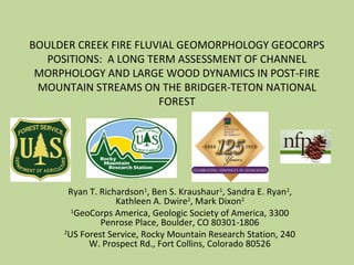
  • 1. BOULDER CREEK FIRE FLUVIAL GEOMORPHOLOGY GEOCORPS POSITIONS: A LONG TERM ASSESSMENT OF CHANNEL MORPHOLOGY AND LARGE WOOD DYNAMICS IN POST-FIRE MOUNTAIN STREAMS ON THE BRIDGER-TETON NATIONAL FOREST Ryan T. Richardson1 , Ben S. Kraushaur1 , Sandra E. Ryan2 , Kathleen A. Dwire2 , Mark Dixon2 1 GeoCorps America, Geologic Society of America, 3300 Penrose Place, Boulder, CO 80301-1806 2 US Forest Service, Rocky Mountain Research Station, 240 W. Prospect Rd., Fort Collins, Colorado 80526
  • 2.
  • 3.
  • 4.
  • 5.
  • 6.
  • 7.
  • 8.
  • 9. Project Goals Large In-stream Wood Census Channel Morphology
  • 10. Large In-Stream Wood Census • Length • Diameter • Channel Type • Structural Association • Burn/Age
  • 11. Wood Recruitment Figures from upcoming publication by Dr. Sandra Ryan
  • 15. Channel Morphology • Stream Survey – Longitudinal Profiles – Banks – Cross Sections • Instrumentation – Total Station Instrument – Prism Poles
  • 16. 0 6 12 18 243 Meterst Legend Old cutbank Logs 2001 Centerline 2001 Early banks Reach 36 2001 0 6 12 18 243 Meters t Legend New logs in 2002 Old cutbank Remained in place 2001 Centerline 2001 Early Banks Reach 36 2002 0 6 12 18 243 Meterst Legend Logs moved in 2003 Logs new in 2003 Logs in place Old cutbank Centerline Early banks Reach 36 2003 0 6 12 18 243 Meterst Legend Logs missing 2007 Logs new 2007 Logs moved 2007 Logs Inplace 2007 Old cutbank Early banks 2007_Centerline 2007_Banks Reach 36 2007 0 6 12 18 243 Meterst Legend Missing in 2008 New recruits 2008 Moved within reach 2008 Buried 2008 Remained in place 2008 2007 Banks 2007 Centerline 2008 Newly eroded area 2008 New centerline Old cutbank Reach 36 2008 0 6 12 18 243 Meterst Legend Missing in 2008 New recruits 2008 Moved within reach 2008 Buried 2008 Remained in place 2008 2007 Banks 2007 Centerline 2008 Newly eroded area 2008 New centerline Old cutbank Reach 36 2008 0 6 12 18 243 Meterst Legend New recruits 2013 Broken in 2013 Missing in 2013 Buried in 2013 Moved within reach 2013 Remained in place 2013 2013 Centerline 2013 Banks Old cutbank Reach 36 2013
  • 17. 0 6 12 18 243 Meterst Legend Old cutbank Logs 2001 Centerline 2001 Early banks Reach 36 2001 0 6 12 18 243 Meterst Legend All large wood 2013 2013 Centerline 2013 Banks Old cutbank Reach 36 2013 All existing wood
  • 20. Conclusion • Wood recruitment increases 4-7 years post fire • This increase in large in-stream wood form log jams in channel • These log jams create depositional areas that eventually cause bank migration and channel avulsions
  • 21. Acknowledgements • Geologic Society of America • GeoCorps America • Bridger Teton National Forest • Rocky Mountain Research Station • US Forest Service • National Fire Plan
  • 22. References • Rim Fire BAER Team, Soil Burn Intensity Map, http://www.inciweb.org/incident/map/3726/2/ • Mortiz, Max. Climate change and disruptions to global fire activity. Ecosphere. V3(6). June 2012. Article 25.

Editor's Notes

  1. Compares original survey to survey conducted in 2013 – this may be the only slide needed to describe this site.