Climate Scientist James Hansen's 1981 Predictions Came True. What abouot 2016
Oklahoma Drought of 2011 Compared to 20th Century Droughts
1. U.S. Department of the Interior
U.S. Geological Survey
Scientific Investigations Report 2013–5018
Prepared in cooperation with the Oklahoma Water Resources Board
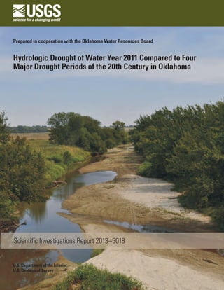
Hydrologic Drought of Water Year 2011 Compared to Four
Major Drought Periods of the 20th Century in Oklahoma
2. Cover:
North Canadian River near Calumet, Oklahoma, during drought conditions in July 2011 (photograph by J.A. Savoia, U.S. Geological Survey).
3. Hydrologic Drought of Water Year 2011
Compared to Four Major Drought Periods of
the 20th Century in Oklahoma
By Molly J. Shivers and William J. Andrews
Prepared in cooperation with the Oklahoma Water Resources Board
Scientific Investigations Report 2013–5018
U.S. Department of the Interior
U.S. Geological Survey
4. U.S. Department of the Interior
SALLY JEWELL, Secretary
U.S. Geological Survey
Suzette M. Kimball, Acting Director
U.S. Geological Survey, Reston, Virginia: 2013
This and other USGS information products are available at http://store.usgs.gov/
U.S. Geological Survey
Box 25286, Denver Federal Center
Denver, CO 80225
To learn about the USGS and its information products visit http://www.usgs.gov/
1-888-ASK-USGS
Any use of trade, product, or firm names is for descriptive purposes only and does not imply endorsement by the
U.S. Government.
Although this report is in the public domain, permission must be secured from the individual copyright owners to
reproduce any copyrighted materials contained within this report.
Suggested citation:
Shivers, M.J., and Andrews, W.J., 2013, Hydrologic drought of water year 2011 compared to four major drought
periods of the 20th century in Oklahoma: U.S. Geological Survey Scientific Investigations Report 2013-5018, 52 p.,
http://pubs.usgs.gov/sir/2013/5018/.
5. iii
Acknowledgments
The authors would like to thank several people for their contributions to the data collection and
data analysis presented in this report. Darrell Townsend and Wynema Potter of the Grand River
Dam Authority provided hydroelectric power generation data for Grand Lake, Lake Hudson, and
the Salina project on Chimney Rock Lake. Ashley Corker of the Southwestern Power Administra-
tion provided hydroelectric power generation data for Fort Gibson Lake, Keystone Lake, Lake
Eufaula, Lake Tenkiller, and Broken Bow Lake. Jennifer Rogers of the Oklahoma Municipal Power
Authority provided hydroelectric power generation data for Kaw Lake. Gary McManus of the
Oklahoma Climatological Survey provided customized maps of percentage of normal precipi-
tation and departure from normal precipitation for water year 2011. U.S. Geological Survey
personnel Jon Scott, S.J. Smith, and Joy Savoia provided low-flow and lake-level photographs
taken in the late summer of 2011.
6. iv
Contents
Abstract............................................................................................................................................................1
Introduction.....................................................................................................................................................1
Selected Consequences of the 2011 Drought...................................................................................2
Wildfires.........................................................................................................................................2
Required Water Conservation, Burn Bans, and States of Emergency................................2
Agriculture.....................................................................................................................................2
Tourism...........................................................................................................................................3
Wildlife............................................................................................................................................3
Purpose and Scope...............................................................................................................................3
Progression of Drought.........................................................................................................................3
Drought Sequence........................................................................................................................3
Progression of Water Year 2011 Streamflow...........................................................................3
Statewide Precipitation and Streamflow...........................................................................................4
Precipitation by Climate Division...............................................................................................................14
Climate Division 1 Panhandle............................................................................................................14
Climate Division 2 North Central.......................................................................................................16
Climate Division 3 Northeast..............................................................................................................16
Climate Division 4 West Central........................................................................................................16
Climate Division 5 Central...................................................................................................................16
Climate Division 6 East Central..........................................................................................................16
Climate Division 7 Southwest............................................................................................................16
Climate Division 8 South Central.......................................................................................................16
Climate Division 9 Southeast.............................................................................................................16
Streamflow of Long-Term Stations............................................................................................................16
Salt Fork Arkansas River at Tonkawa...............................................................................................20
Chikaskia River near Blackwell.........................................................................................................20
Cimarron River near Waynoka...........................................................................................................20
Cimarron River near Ripley................................................................................................................20
Illinois River near Tahlequah..............................................................................................................20
Canadian River at Calvin.....................................................................................................................26
North Canadian River near Wetumka...............................................................................................26
Salt Fork Red River at Mangum.........................................................................................................26
Red River near Gainesville, Texas.....................................................................................................26
Washita River near Dickson...............................................................................................................26
Blue River near Blue...........................................................................................................................26
Red River at Arthur City, Texas..........................................................................................................33
Effects of Low Streamflows........................................................................................................................33
Conditions at Major Reservoirs.........................................................................................................33
Hydroelectric Power Generation......................................................................................................33
Groundwater Levels at Selected Long-term Stations............................................................................33
Summary........................................................................................................................................................41
References.....................................................................................................................................................41
Appendixes 1–4. Photographs of Selected Sites at Normal/High-Flow Conditions
and Drought/Low-Flow Conditions, 2007–12...............................................................................47
7. v
Figures
1. Schematic diagram showing sequence of drought development........................................4
2. Map showing monthly streamflow by percentile class, from U.S.
Geological Survey WaterWatch, October 2010 through September 2011...........................6
3. Barchart showing annual departure from the statewide long-term
median annual precipitation of 33.62 inches and a 5-year weighted
average for Oklahoma, water years 1925–2011........................................................................8
4. Barchart showing annual departure from the statewide long-term median
annual runoff of 2.74 inches and a 5-year weighted average for Oklahoma,
water years 1925–2011................................................................................................................11
5. Maps showing water resources regions and regional streamflow levels
in water year 2011........................................................................................................................12
6. Graph showing percentage of streamflow-gaging stations with
below-normal streamflow from January 16, 2001, through
December 31, 2011, in Oklahoma..............................................................................................13
7. Map showing National Weather Service Climate Divisions in Oklahoma.........................14
8. Maps showing percentage of normal precipitation A, and departure
from normal precipitation B, for Oklahoma, water year 2011...............................................15
9. Map showing selected long-term streamflow-gaging stations in
Oklahoma and appendix photograph locations......................................................................17
10. Barchart and graph showing streamflow data for Salt Fork Arkansas
River at Tonkawa, Oklahoma, water years 1942–2011. A, Annual departure
from long-term median annual streamflow. B, Comparison between
daily mean streamflow, water year 2011, and long-term daily mean streamflow............21
11. Barchart and graph showing streamflow data for Chikaskia River near Blackwell,
Oklahoma, water years 1937–2011. A, Annual departure from long-term
median annual streamflow. B, Comparison between daily mean streamflow,
water year 2011, and long-term daily mean streamflow.......................................................22
12. Barchart and graph showing streamflow data for Cimarron River near Waynoka,
Oklahoma, water years 1938–2011. A, Annual departure from long-term median
annual streamflow. B, Comparison between daily mean streamflow,
water year 2011, and long-term daily mean streamflow.......................................................23
13. Barchart and graph showing streamflow data for Cimarron River near Ripley,
Oklahoma, water years 1940–2011. A, Annual departure from long-term median
annual streamflow. B, Comparison between daily mean streamflow,
water year 2011, and long-term daily mean streamflow ......................................................24
14. Barchart and graph showing streamflow data for Illinois River near Tahlequah,
Oklahoma, water years 1936–2011. A, Annual departure from long-term median
annual streamflow. B, Comparison between daily mean streamflow,
water year 2011, and long-term daily mean streamflow.......................................................25
15. Barchart and graph showing streamflow data for Canadian River at Calvin,
Oklahoma, water years 1939–2011. A, Annual departure from long-term median
annual streamflow. B, Comparison between daily mean streamflow,
water year 2011, and long-term daily mean streamflow.......................................................27
16. Barchart and graph showing streamflow data for North Canadian River
near Wetumka, Oklahoma, water years 1938–2011. A, Annual departure
from long-term median annual streamflow. B, Comparison between daily
mean streamflow, water year 2011, and long-term daily mean streamflow......................28
8. vi
17. Barchart and graph showing streamflow data for Salt Fork Red River
at Mangum, Oklahoma, water years 1938–2011. A, Annual departure
from long-term median annual streamflow. B, Comparison between daily
mean streamflow, water year 2011, and long-term daily mean streamflow......................29
18. Barchart and graph showing streamflow data for Red River near
Gainesville, Texas, water years 1937–2011. A, Annual departure from
long-term median annual streamflow. B, Comparison between daily mean
streamflow, water year 2011, and long-term daily mean streamflow ................................30
19. Barchart and graph showing streamflow data for Washita River near Dickson,
Oklahoma, water years 1929–2011. A, Annual departure from long-term median
annual streamflow. B, Comparison between daily mean streamflow,
water year 2011, and long-term daily mean streamflow.......................................................31
20. Barchart and graph showing streamflow data for Blue River near Blue,
Oklahoma, water years 1937–2011. A, Annual departure from long-term
median annual streamflow. B, Comparison between daily mean streamflow,
water year 2011, and long-term daily mean streamflow.......................................................32
21. Barchart and graph showing streamflow data for Red River at Arthur City,
Texas, water years 1945–2011. A, Annual departure from long-term median
annual streamflow. B, Comparison between daily mean streamflow, water
year 2011, and long-term daily mean streamflow..................................................................34
22. Map showing locations of selected major Oklahoma lakes and reservoirs
and percentage of conservation storage as of September 29, 2011...................................36
23. Graphs showing A, Daily-mean water levels, water year 2011 and
B, Long-term daily mean water levels and all water levels measured
in a groundwater well near Fittstown, Oklahoma, water years 1958–2012........................38
24. Graphs showing A, Daily-mean water levels, water year 2011; long-term
daily mean water levels; and B, Continuously recorded water levels measured
in a groundwater well in Johnston County, Oklahoma, water years 2006–11...................39
25. Graphs showing A, Daily-mean water levels, water year 2011; B, Long-term
daily-mean water levels; and continuously recorded water levels measured
in a groundwater well near Texhoma, Oklahoma, water years 1956–2011........................40
Tables
1. Summary of precipitation at National Weather Service Climate Divisions
in Oklahoma comparing the median of mean annual precipitation
during water years 1925–2006 with average annual precipitation during
periods of previously documented hydrologic droughts and the recent
hydrologic drought period............................................................................................................9
2. Summary of streamflow conditions at selected long-term
streamflow-gaging stations in Oklahoma comparing the median of
mean annual streamflow (measure of “normal” streamflow) with average
annual streamflow during periods of previously documented hydrologic
droughts and the recent hydrologic drought period..............................................................18
3. Storage in selected major Oklahoma lakes and reservoirs on
September 29, 2011, by National Weather Service Climate Division,
and comparison with April 14, 2011, storage..........................................................................35
4. Comparison of hydroelectric power generation at selected
Oklahoma hydroelectric plants between calendar years 2010 and 2011...........................37
9. vii
Conversion Factors
Inch/Pound to SI
Multiply By To obtain
Length
inch (in.) 2.54 centimeter (cm)
inch (in.) 25.4 millimeter (mm)
foot (ft) 0.3048 meter (m)
mile (mi) 1.609 kilometer (km)
Area
square mile (mi2
) 2.590 square kilometer (km2
)
acre 0.4047 hectare (ha)
Volume
acre-foot (acre-ft) 1,233 cubic meter (m3
)
Flow rate
cubic foot per second (ft3
/s) 0.02832 cubic meter per second (m3
/s)
Energy
gigawatt-hour (GWh) 3.6 x 10¹²
joule (J)
Temperature in degrees Fahrenheit (°F) may be converted to degrees Celsius (°C) as follows:
°C=(°F-32)×.56
Vertical coordinate information is referenced to the North American Vertical Datum of 1988
(NAVD 88).
Horizontal coordinate information is referenced to the North American Datum of 1983 (NAD 83).
Altitude, as used in this report, refers to distance above the vertical datum.
Water year is the 12-month period October 1 through September 30, designated by the calendar
year in which it ends
10.
11. Hydrologic Drought of Water Year 2011 Compared to Four
Major Drought Periods of the 20th Century in Oklahoma
By Molly J. Shivers and William J. Andrews
Abstract
Water year 2011 (October 1, 2010, through September 30,
2011) was a year of hydrologic drought (based on streamflow)
in Oklahoma and the second-driest year to date (based on
precipitation) since 1925. Drought conditions worsened
substantially in the summer, with the highest monthly average
temperature record for all States being broken by Oklahoma in
July (89.1 degrees Fahrenheit), June being the second hottest
and August being the hottest on record for those months
for the State since 1895. Drought conditions continued into
the fall, with all of the State continuing to be in severe to
exceptional drought through the end of September. In addition
to effects on streamflow and reservoirs, the 2011 drought
increased damage from wildfires, led to declarations of states
of emergency, water-use restrictions, and outdoor burning
bans; caused at least $2 billion of losses in the agricultural
sector and higher prices for food and other agricultural
products; caused losses of tourism and wildlife; reduced
hydropower generation; and lowered groundwater levels in
State aquifers.
The U.S. Geological Survey, in cooperation with the
Oklahoma Water Resources Board, conducted an investigation
to compare the severity of the 2011 drought with four previous
major hydrologic drought periods during the 20th century –
water years 1929–41, 1952–56, 1961–72, and 1976–81.
The period of water years 1925–2011 was selected as the
period of record because few continuous record streamflow-
gaging stations existed before 1925, and gaps in time existed
where no streamflow-gaging stations were operated before
1925. In water year 2011, statewide annual precipitation was
the 2d lowest, statewide annual streamflow was 16th lowest,
and statewide annual runoff was 42dlowest of those 87 years
of record.
Annual area-averaged precipitation totals by the nine
National Weather Service climate divisions from water year
2011 were compared to those during four previous major
hydrologic drought periods to show how precipitation deficits
in Oklahoma varied by region. The nine climate divisions
in Oklahoma had precipitation in water year 2011 ranging
from 43 to 76 percent of normal annual precipitation, with
the Northeast Climate Division having the closest to normal
precipitation and the Southwest Climate Division having the
greatest percentage of annual deficit. Based on precipitation
amounts, water year 2011 ranked as the second driest of the
1925–2011 period, being exceeded only in one year of the
1952 to 1956 drought period.
Regional streamflow patterns for water year 2011 indicate
that streamflow in the Arkansas-White-Red water resources
region, which includes all of Oklahoma, was relatively large,
being only the 26th lowest since 1930, primarily because
of normal or above-normal streamflow in the northern part
of the region. Twelve long-term streamflow-gaging stations
with periods of record ranging from 67 to 83 years were
selected to show how streamflow deficits varied by region
in Oklahoma. Statewide, streamflow in water year 2011 was
greater than streamflows measured in years during the drought
periods of 1929–41, 1952–56, 1961–72, and 1976–81. The
hydrologic drought worsened going from the northeast toward
the southwest in Oklahoma, ranging from 140 percent (above
normal streamflow) in the northeast, to 13 percent of normal
streamflow in southwestern Oklahoma. The relatively low
streamflow in 2011 resulted in 83.3 percent of the statewide
conservation storage being available at the end of the water
year in major reservoirs, similar to conservation storage in
the preceding severe drought year of 2006. The ranking of
streamflow as the 16th smallest for the 1925–2011 period,
despite precipitation being ranked the 2d smallest, may have
been caused, in part, by the relatively large streamflow in
northeastern Oklahoma during water year 2011.
Introduction
Water year 2011 (October 1, 2010, through September
30, 2011) was a year of hydrologic drought (based on
streamflow) in Oklahoma, which had the second-driest year
to date (based on precipitation) recorded since 1925. In
Oklahoma, the drought was characterized by below-normal
12. 2 Hydrologic Drought of Water Year 2011 Compared to Four Major Drought Periods of the 20th Century in Oklahoma
precipitation beginning in the fall and persisting through most
of the remainder of the year, punctuated by some wet periods
in eastern Oklahoma in the spring and summer. Drought
conditions worsened substantially in the summer, breaking
the all-time July statewide average temperature record for
all States (89.1 degrees Fahrenheit [°F]). Statewide average
temperatures in June were the second hottest on record for
that month (83.5°F), and temperatures in August (87.7°F)
were the hottest on record for that month in Oklahoma since
1895 (Oklahoma Climatological Survey 2010a–c, 2011a–i).
Drought conditions continued into the fall, with all of the
State undergoing severe to exceptional drought through the
end of September (U.S. Drought Monitor, 2011). This drought
was caused primarily by weather patterns associated with La
Niña conditions in the Pacific Ocean (National Oceanic and
Atmospheric Administration (2011). To assist water-resource
managers in evaluating the severity of the water year 2011
hydrologic drought and in planning for future droughts, the
U.S. Geological Survey, in cooperation with the Oklahoma
Water Resources Board, conducted a study to summarize the
water year 2011 hydrologic drought and compare it to the
four previous major hydrologic drought periods of the 20th
century: (1929–41, 1952–56, 1961–72, and 1976–81).
Hydrologic drought is associated with the effects of
periods of below-normal precipitation on surface or subsurface
water supplies. The severity of hydrologic drought is defined
on a watershed or river-basin scale. Water in hydrologic
storage systems of rivers and reservoirs commonly has
multiple and competing purposes including flood control,
irrigation, recreation, navigation, hydropower generation,
and wildlife habitat. Competition for river and reservoir
water escalates during droughts, and conflicts between
water users can increase substantially (National Drought
Mitigation Center, 2012a). Some of the consequences of the
water year 2011 drought in Oklahoma are described in the
following sections.
Selected Consequences of the 2011 Drought
Wildfires
Wildfires were a notable feature of the 2011 drought.
Wildfires burned several hundred buildings and almost
300,000 acres in Oklahoma in 2011 (Cable News Network,
2011a and b; Dean and others, 2011; Olafson, 2011; Richter,
2011; National Interagency Fire Center, 2012). Additional
effects of wildfires included closure of nearby highways and
evacuations of rural and urban residents in potential wildfire
paths (Cable News Network, 2011b; Olafson, 2011;
Richter, 2011).
Required Water Conservation, Burn Bans, and
States of Emergency
Declining streamflow and lake levels and limited
pumping infrastructure caused some Oklahoma water-
suppliers to issue mandatory water-conservation measures
during the summer of 2011. On June 29, the City of Goldsby
banned all outdoor watering because of lowered production
from a city well (KWTV, 2011a). On July 7, Logan County
Rural Water District 1 banned lawn watering (KOTV, 2011).
On July 9, Oklahoma City instituted a mandatory odd/even
outdoor watering program based on dates and street addresses
(Hertneky, 2011). Oklahoma City’s outdoor watering
restrictions ended on August 11 after storms increased water
levels in the city’s water-supply lakes (Overholser and Hefner)
(KWTV, 2011b). As of September 7, 2011, 40 of 113 public
water-supply systems surveyed had declared mandatory water-
use restrictions and 45 of those systems had asked customers
to voluntarily restrict water use (Oklahoma Department of
Environmental Quality, 2011).
In Oklahoma, burn bans which prohibit outdoor
burning, but not cooking, can be issued by counties or the
Governor. Burn bans were issued locally and by the Governor
for counties across the State through the water year to
prevent wildfires (Oklahoma Office of Secretary of State,
2011a and b).
As of April 6, 2011, 47 of 77 counties in Oklahoma
had issued burn bans to prevent wildfires (KJRH, 2011).
On August 3, 2011, Governor Mary Fallin extended a
45-county burn ban issued on July 15, 2011, to all 77 counties
in Oklahoma (Hayes, 2011b). After precipitation in late
September, Governor Fallin lifted the burn ban for 33 counties
in the central and northern parts of Oklahoma (Associated
Press, 2011).
On June 24, 2011, Oklahoma Lieutenant Governor
Todd Lamb, at the request of Governor Fallin, declared a
30-day state of emergency for 33 counties in northwestern,
central, and southern parts of the State because of extreme
or exceptional drought conditions and associated wildfires
(Oklahoma Office of Secretary of State, 2011a). On September
19, 2011, Governor Fallin amended the first declaration by
issuing a 60-day state of emergency for all 77 counties in
Oklahoma for exceptional drought conditions and numerous
wildfires (Oklahoma Office of Secretary of State, 2011b).
Agriculture
In 2010, Oklahoma ranked first in production of rye,
second in production of beef cattle, and third in production
of winter wheat in the United States (Oklahoma Department
of Agriculture, Food, and Forestry, 2011). The 2011 drought
caused losses in crops and livestock in Oklahoma exceeding
$1.6 billion (Hayes, 2011c). From April through September,
soils in the State were rated as abnormally to severely dry and
many cropland areas and pasture were being rated in the fair to
13. Introduction 3
very poor range (Oklahoma Water Resources Board, 2011d–j).
Li and Hiatt (2012) estimated from satellite imagery that crop
and pasture biomass losses ranged from 1.2 to 2 tons per acre
over much of the State. Compared to 2010, production of
corn, grain sorghum, cotton, soybeans, sunflowers, and hay in
2011 decreased 61, 87, 85, 71, 69, and 61 percent, respectively
(National Agricultural Statistics Service, 2012a). Cotton
acreage harvested in Oklahoma in 2011 was the smallest since
1894 (Hayes, 2011d). Resulting high feed and hay prices and
dry ponds forced many ranchers to sell cattle, thereby causing
a reduction of about 12 percent of the State cattle inventory
by the end of 2011, which contributed to record cattle prices
by the end of the year and the smallest cattle inventories in
the State since 1968 (Hayes, 2011d; National Agricultural
Statistics Service, 2012b).
Tourism
Tourism, the third largest industry in Oklahoma,
generates more than $6.1 billion annually in expenditures and
employs nearly 76,000 people in the State (Oklahoma Tourism
and Recreation Department, 2011). Much of the tourism in
Oklahoma is associated with outdoor recreation on streams
and lakes at State parks and elsewhere (Oklahoma Tourism
and Recreation Department, 2011). Decreased streamflow
and lake levels likely decreased receipts from water-related
tourism in 2011 (Severson and Johnson, 2011). Warnings and
beach closures enacted because of potentially toxic blooms
of blue-green algae (Cyanophyta) in warm, stagnant water at
many of the State’s largest reservoirs during the summer also
decreased tourism (Murphy, 2011; Sewell, 2011; Lawrence,
2012).
Wildlife
In addition to effects on humans and livestock, the
drought conditions and wildfires of 2011 caused wildlife to
have health problems and suffer from increased mortality.
Deer in Texas and Oklahoma had lower rates of reproduction
and survival, and fawns and deer were in poorer condition,
as shown by smaller antler sizes (Medley, 2011a; Ray, 2011).
Increased numbers of dehydrated baby squirrels prematurely
left nests (Medley, 2011a). Fledgling avian wildlife such
as hawks and kites died in above-normal numbers from
hyperthermia and thirst (Medley, 2011a). The quail population
across the State in 2011 was estimated to have decreased 25
percent from the population surveyed in 2010 (Schoeling,
2011). Freshwater mussels, including three threatened species,
suffered increased mortality as streams and rivers dried up in
southeastern Oklahoma (Vaughn and Atkinson, 2012). Lack
of berries, acorns, and water caused by the drought forced
black bears in eastern Oklahoma to scavenge at higher rates in
suburbs and towns (Medley, 2011b).
Purpose and Scope
The purposes of this report are to describe and document
the water year 2011 hydrologic drought in Oklahoma and
effects of that drought and to compare the 2011 hydrologic
drought to four previous major hydrologic drought periods of
water years 1929–41, 1952–56, 1961–72, and 1976–81.
This report includes: (1) a definition of drought
sequence, (2) a presentation of monthly nationwide steamflow
displayed in U.S. Geological Survey WaterWatch graphics for
water year 2011, and (3) a comparison of annual statewide
total precipitation and statewide runoff (measurement of
streamflows greater than base flows that are related to storm
intensity) from water years 1925–2011 in Oklahoma with the
four previous major hydrologic droughts of the 20th century
highlighted. Annual area-averaged precipitation totals for
water year 2011 for the nine National Weather Service Climate
Divisions in Oklahoma are compared to precipitation during
four previous major hydrologic droughts in the 20th century to
show how precipitation deficits varied from normal by region.
Mean annual streamflows during water year 2011 at 12 long-
term streamflow-gaging stations are compared to streamflows
during four previous major hydrologic droughts of the 20th
century to show how streamflow deficits from the median
varied by region. Effects of the 2011 drought are described,
including: (1) increased wildfires, (2) increased mandates for
water conservation and outdoor burning bans, (3) reduced
crop yields and sell-offs of cattle herds, (4) reduced tourism,
(5) increased mortality of wildlife, (6) reduced streamflow
and conservation storage at major reservoirs in the State, (7)
reduced hydroelectric power generation, and (8) decreased
groundwater levels in major aquifers.
Progression of Drought
Drought Sequence
Drought-sequence development is illustrated in figure
1. A drought begins with precipitation deficiency, high
temperatures and winds, and low humidity, collectively
resulting in “meteorological” drought. As soil moisture
is reduced and plants are stressed, “agricultural” drought
occurs. If the drought continues for several seasons,
streamflow is reduced to critical levels and “hydrologic”
drought results (National Drought Mitigation Center, 2012a).
Progression of Water Year 2011 Streamflow
The WaterWatch Webpage of the U.S. Geological
Survey maps monthly streamflow across the United States
by percentile class (U.S. Geological Survey, 2012a). The 50th
percentile represents the median monthly streamflow for
the period of record, and normal streamflow is represented
by the 25th to 75th percentiles of long-term median
14. 4 Hydrologic Drought of Water Year 2011 Compared to Four Major Drought Periods of the 20th Century in Oklahoma
monthly streamflow. Figure 2 shows the ranges of streamflow
in major basins in the United States, ranging from red
tones for below long-term normal streamflow to blue tones
for above long-term normal streamflow. Streamflow in
Oklahoma was normal for most of the State from October
through December 2010, but below-normal streamflow and
much-below-normal streamflow increased from the southeast
and northwest to include much of the State through the
remainder of water year 2011 (fig. 2). The most widespread
occurrence of much-below-normal streamflow during the
water year was measured during July 2011, when much-
below-normal streamflows were measured in about two-
thirds of the State (fig. 2).
Statewide Precipitation and Streamflow
Graphs of precipitation and estimated runoff of
precipitation characterize the duration and severity
of hydrologic drought by comparing annual statewide
precipitation and runoff departures from long-term median
annual precipitation values. Annual departures are shown
as positive bars when values exceed the long-term median
annual precipitation and as negative bars when values
are less than the long-term median-annual precipitation.
Departures that are consistently negative over several
years provide a measure of drought duration or persistence,
whereas the magnitudes of individual departures provide
measures of severity.
Natural climate variability
Precipitation deficiency
(amount, intensity, timing)
Plant water stress
Reduced biomass and yield
Economic effects Social effects Environmental effects
Reduced runoff
Reduced infiltration and percolation
Reduced groundwater recharge
Reduced streamflow
Reduced inflow to reservoirs, lakes, and ponds
Reduced wetlands and wildlife habitats
Increasedevaporationandtranspiration
High temperature and winds
Low humidity
Greater sunshine
Less cloud cover
Soil water deficiency
Timeduration
Meteorological
drought
Agricultural
drought
Hydrologic
drought
(Oklahoma Water Resources Board, 2007a; modified from National Drought Mitigation Center, 2012b)
Figure 1. Sequence of drought development.
15. Introduction 5
The period of water years 1925–2011 was selected as the
period of record for long-term drought analysis. Before 1925
few continuous record streamflow-gaging stations existed,
and there were gaps when no streamflow gaging stations
were operated in many parts of the State (U.S. Geological
Survey, 2012b–c). Four previous major hydrologic drought
periods of water years 1929–41, 1952–56, 1961–72, and
1976–81 were identified from statewide runoff (Tortorelli
and others, 1991; Tortorelli, 2008).
Figures 3 and 4 show annual statewide median
precipitation and annual statewide median runoff,
respectively, during water years 1925–2011. In figure 3, the
statewide annual median precipitation for each water year of
that period (National Climatic Data Center, 2012a) is plotted
as departure from the long-term median annual precipitation
for the period (blue line), and a 5-year weighted-average
precipitation is plotted as a red line. Statewide, water year
2011 was the second driest in the 87 years of record from
1925–2011, based on precipitation (fig. 3, table 1). In figure
4, the statewide annual median runoff for each water year
of the period (U.S. Geological Survey, 2012d) is plotted as
the departure from the long-term median annual runoff for
the period (blue line), and a 5-year weighted-average runoff
is plotted as a red line. In both figures 3 and 4, selected
drought periods are indicated by differently colored bars.
Statewide runoff in water year 2011 was the 42d smallest
in the 87 years of record from 1925–2011 (fig. 4). In figures
3 and 4, wetter years have bars above the median line and
drier years have bars below the median line. The severity
of drought conditions in water year 2011 can be compared
to the four previous major hydrologic droughts by the depth
of the bars representing dry years. The severity of the water
year 2011 drought also can be compared to the four previous
major hydrologic drought periods by the 5-year weighted
average line.
Comparison of the 2011 drought with previous drought
periods is useful for putting the extent and severity of the
2011 drought in context. The hydrologic drought of water
years 1929–41 was known as the “Dust Bowl” in the Great
Plains and is documented in many references, including Hoyt
(1936, 1938), Nace and Pluhowski (1965), Egan (2006), and
National Drought Mitigation Center (2012b). The drought
of the “Dust Bowl” years was particularly severe in western
Oklahoma, with substantial runoff deficits of 2–3 inches
per year and significant wind erosion over the entire State
in 1936 (Nace and Pluhowski, 1965) (fig. 4). The 1929–41
drought led to development of nationwide soil conservation
measures (National Drought Mitigation Center, 2012b).
Despite the widely known effects of the “Dust Bowl”
of the 1930s, the lesser-known hydrologic drought of water
years 1952–56 was more severe. The drought of the mid-
1950s was the most widespread and the most severe for
all regions of Oklahoma in terms of precipitation and for
most regions in terms of runoff (Nace and Pluhowski, 1965;
Tortorelli and others, 1991) (figs. 3 and 4).
The hydrologic drought of water years 1961–72 was as
widespread and lasted longer than the drought of 1952–56 but
generally was not as severe (Tortorelli and others, 1991) (figs.
3 and 4). By 1972, many of the major reservoirs in Oklahoma
built to augment water supplies during periodic droughts had
been completed (Vance, 2007). The hydrologic drought of
water years 1976–81 also was widespread, but was neither as
severe nor as persistent as the previous three major drought
periods (Tortorelli and others, 1991) (figs. 3 and 4).
Although Tortorelli (2008) described a drought period
for water years 2002–2006, that period was neither as long-
lasting nor as severe as the four previous drought periods
of the 20th century. In 2006, however, the drought was
as severe as it had been in previous periods (figs. 3 and
4). Record large rainfalls occurred during the summer of
2007 in some parts of the state, with the subsequent years
of 2008–10 having gradual decreases in above-normal
precipitation and runoff (figs. 3 and 4). Water years 2006
and 2011 were exceptionally dry years in an otherwise
normal-to-wet period.
Based on runoff, which increases with more intensive
precipitation, water year 2011 was the 42d driest in the 87
years of record from 1925–2011 (fig. 4). Average statewide
precipitation was the 2d lowest and average annual
streamflow was the 16th lowest during the 1925–2011 study
period (tables 1 and 2; figs. 3 and 4). Drought conditions
in water year 2011 were severe, but drought duration or
persistence of water year 2011 cannot yet be characterized, as
of December 2012.
Regional streamflow patterns for water year 2011
(fig. 5) indicate that streamflow in the Arkansas-White-Red
water resources region, which includes all of Oklahoma, was
the 26th driest since 1930 (U.S. Geological Survey, 2012e).
The general pattern of greater-than-normal precipitation
in the northern tier of States and less-than-normal
precipitation in the southern tier of States is common to
seasonal precipitation patterns in autumn, winter, and spring
(National Weather Service, 2012). Normal or above-normal
precipitation in northern parts of the Arkansas-White-
Red water resources region contributed to near-normal
streamflow in the region, despite much drier conditions in the
southern part of the region. As an indicator of progression of
the hydrologic drought during water year 2011, for some days
in November 2010 almost 50 percent of long-term (having
at least 30 years of record) streamflow-gaging stations had
below-normal streamflow (fig. 6). In August 2011, near the
peak of drought conditions (fig. 2), almost 90 percent of
long-term streamflow-gaging stations in the state had below-
normal streamflow (fig. 6).
16. 6 Hydrologic Drought of Water Year 2011 Compared to Four Major Drought Periods of the 20th Century in Oklahoma
U.S. Geological Survey (2012a)
October 2010 November 2010
December 2010 January 2011
February 2011 March 2011
EXPLANATION
Percentile classes
Low <10
Much
below
normal
10–24
Below
normal
25–75
Normal
76–90
Above
normal
>90
Much
above
normal
High No data
Figure 2. Monthly streamflow by percentile class, from U.S. Geological Survey WaterWatch, October 2010 through September 2011.
17. Introduction 7
U.S. Geological Survey (2012a)
April 2011 May 2011
June 2011 July 2011
August 2011 September 2011
EXPLANATION
Percentile classes
Low <10
Much
below
normal
10–24
Below
normal
25–75
Normal
76–90
Above
normal
>90
Much
above
normal
High No data
Figure 2. Monthly streamflow by percentile class, from U.S. Geological Survey WaterWatch, October 2010 through
September 2011—Continued.
18. 8 HydrologicDroughtofWaterYear2011ComparedtoFourMajorDroughtPeriodsofthe20thCenturyinOklahoma
1920 1930 1940 1950 1960 1970 1980 1990 2000 2010
Water year
-20
-16
-12
-8
-4
0
4
8
12
16
20
24
28
Annualdeparturefrommedian
annualprecipitation,ininchesperyear Oklahoma statewide precipitation
1925–2011
droughts: 1929–41 1952–56 1961–72 1976–81
Hydrologic
AbovenormalBelownormal
Annual departure
Long-term median annual precipitation 33.62 inches
5-year weighted average
EXPLANATION
Figure 3. Annual departure from the statewide long-term median annual precipitation of 33.62 inches and a 5-year weighted average for Oklahoma, water years 1925–2011.
19. Introduction 9
Table 1. Summary of precipitation at National Weather Service Climate Divisions in Oklahoma comparing the median of mean
annual precipitation during water years 1925–2006 (measure of “normal” precipitation) with average annual precipitation during
periods of previously documented hydrologic droughts (1929–41, 1952–56, 1961–72, 1976–81) and the recent (2011) hydrologic drought
period.
[avg, average; rank, rank of driest year of drought period compared to period of record for water years 1925–2006; WY, water year; SW, statewide]
Climate
division
number
Climate
division
name
Long-term
annual
median
precipitation
(inches)
Hydrologic drought periods
1
1929–41
Lowest year/rank
1
1952–56
Lowest year/rank
WY avg annual
precipitation
(inches)
Long-term
median
precipitation
(percent)
WY avg annual
precipitation
(inches)
Long-term
median
precipitation
(percent)
SW Statewide2
33.62 1936 6 1956 1
25.24 75 18.68 56
1 Panhandle3
19.84 1937 3 1956 2
12.24 62 11.34 57
2 North Central3
28.79 1936 8 1956 1
20.16 70 15.10 52
3 Northeast3
39.96 1939 13 1956 1
30.59 77 22.90 57
4 West Central3
26.39 1940 13 1952 3
20.14 76 15.98 61
5 Central3
34.33 1936 5 1956 2
24.03 70 19.74 58
6 East Central3
43.33 1936 4 1956 1
28.11 65 23.86 55
7 Southwest3
27.88 1939 8 1956 2
18.75 67 17.45 63
8 South Central3
37.47 1939 4 1956 1
24.19 65 16.46 44
9 Southeast3
48.13 1934 3 1956 1
30.86 64 25.10 52
20. 10 Hydrologic Drought of Water Year 2011 Compared to Four Major Drought Periods of the 20th Century in Oklahoma
Table 1. Summary of precipitation at National Weather Service Climate Divisions in Oklahoma comparing the median of mean
annual precipitation during water years 1925–2006 (measure of “normal” precipitation) with average annual precipitation during
periods of previously documented hydrologic droughts (1929–41, 1952–56, 1961–72, 1976–81) and the recent (2011) hydrologic drought
period.—Continued
[avg, average; rank, rank of driest year of drought period compared to period of record for water years 1925–2006; WY, water year; SW, statewide]
Climate
division
number
Hydrologic drought periods
1
1961–72
Lowest year/rank
1
1976–81
Lowest year/rank
2011
WY avg annual
precipitation
(inches)
Rank long-
term median
precipitation
(percent)
WY avg annual
precipitation
(inches)
Long-term
median
precipitation
(percent)
WY avg annual
precipitation
(inches)
Long-term
median
precipitation
(percent)
SW 1963 4 1978 11 2
24.60 73 27.11 81 20.05 60
1 1970 6 1976 38 1
13.05 66 17.58 89 11.09 56
2 1966 7 1976 21 4
20.15 70 23.24 81 17.96 62
3 1963 2 1981 21 11
24.81 62 32.89 82 30.17 76
4 1970 5 1976 34 1
18.00 68 22.23 84 12.65 48
5 1972 10 1976 12 1
25.08 73 25.41 74 19.59 57
6 1963 5 1980 8 2
28.24 65 30.30 70 26.08 60
7 1967 3 1980 33 1
17.46 63 23.40 84 12.05 43
8 1963 8 1978 13 2
25.15 67 27.78 74 18.86 50
9 1963 9 1978 5 4
35.02 73 31.95 66 31.51 65
1
Documented drought periods are modified from Tortorelli and others (1991).
2
Ranks from Statewide Monthly Precipitation Totals, National Climatic Data Center (2012a).
3
Ranks from Climate Division Monthly Precipitation Totals, National Climatic Data Center (2012b).
21. Introduction 11
AbovenormalBelownormal
1920 1930 1940 1950 1960 1970 1980 1990 2000 2010
Water year
-4
-2
0
2
4
6
8
10Annualdeparturefrommedianannual
runoff,ininchesperyear Oklahoma statewide runoff
1925–2011
EXPLANATION
Annual departure
Long-term median annual runoff 2.74 inches
5-year weighted average
droughts: 1929–41 1952–56 1961–72 1976–81
Hydrologic
Figure 4. Annual departure from the statewide long-term median annual runoff of 2.74 inches and a 5-year weighted average for Oklahoma, water years 1925–2011.
22. 12 Hydrologic Drought of Water Year 2011 Compared to Four Major Drought Periods of the 20th Century in Oklahoma
The United States (including Puerto Rico) is divided into
21 large drainages, or water resources regions. These
hydrologic areas are based on surface topography and
contain either the drainage area of a major river, such as
the Columbia, the combined drainage areas of a series of
rivers, such as the Texas-Gulf region, which includes a
number of rivers draining into the Gulf of Mexico, or the
area of an island or island group. Water resources regions
provide a coherent, watershed-based framework for
depicting streamflow variations.
Streamflow was at record high levels (ranking 1st in 82 years)
in the water resource regions of the Souris-Red-Rainy and
Mid-Atlantic regions. Above normal and much-above normal
streamflow occurred in all northeastern, northern, and western
regions, and in the Caribbean. In contrast, streamflow was at
record low levels (ranking 82nd in 82 years) in the South
Atlantic-Gulf, Texas-Gulf, and Alaska regions, respectively.
Below-normal and much-below normals were reported in the
Lower Mississippi and Rio Grande regions.
U.S. Geological Survey (2012e)
EXPLANATION
Rank
82
Lowest
70–81
Much
below
normal
59–69
Below
normal
59–42
Normal
9–41
Above
normal
2–8
Much
above
normal
Highest
Figure 5. Water resources regions and regional streamflow levels in water year 2011.
23. Introduction 13
2001 2002 2003 2004 2005 2006 2007 2008 2009 2010 2011 2012
Year
80
60
40
20
0
Percentageofstreamflow-gagingstationswithbelow-normalstreamflow
EXPLANATION
The percent of streamflow-gaging stations with below-normal streamflow, plotted as the blue line in the above graph,
is calculated each day as the percent of streamflow-gaging stations having below-normal flow, where the lower
boundary for normal is the 25th percentile value of all historical streamflow values for all days of the year.
The percent of stations with below-normal streamflow is based only on streamflow-gaging stations in the state having
at least 30 years of record (U.S. Geological Survey, 2012f).
Figure 6. Percentage of streamflow-gaging stations with below-normal streamflow from January 16, 2001, through December 31, 2011,
in Oklahoma.
24. 14 Hydrologic Drought of Water Year 2011 Compared to Four Major Drought Periods of the 20th Century in Oklahoma
Precipitation by Climate Division
Oklahoma has nine National Weather Service Climate
Divisions (fig. 7) for which monthly area-averaged
precipitation data are available (National Climatic Data
Center, 2012a). Those data were totaled for each water year
from 1925–2011, indicating annual precipitation in Oklahoma
on a regional basis.
Precipitation in the nine climate divisions of Oklahoma
in water year 2011 was substantially less than the long-term
median annual precipitation, with 2011 being ranked as the
driest water year in Southwest, Central, West Central, and
Panhandle Oklahoma Climate Divisions and as the 11th driest
year in the Northeast Climate Division, with precipitation
amounts ranging from 43 to 76 percent of long-term annual
median amounts for the period 1925–2011 (table 1). Statewide
precipitation in water year 2011 was the second smallest in
the 87 years of record from 1925–2011, with 60 percent of
the long-term median annual precipitation falling in the State.
Only one year in the 1925–2011 period was drier—water
year 1956, which had 56 percent of the long-term median
precipitation.
Climatic variables in Oklahoma are, in part, measured by
the Oklahoma Mesonet, a statewide network of 115 automated
stations covering Oklahoma that records precipitation and
other climatic data at 5-minute intervals. At least one Mesonet
station is located in each of the 77 counties in Oklahoma.
Oklahoma Mesonet climate data have been available since
1994. In addition to data from the Mesonet, data from
National Weather Service Stations (National Climatic Data
Center, 2012a) were used for the period 1925–2011. Mesonet
data use mean annual precipitation from calendar years
1971–2000 instead of median annual precipitation from water
years 1925–2011 for comparisons of long-term data. The
1971–2000 period contained a significant wet period (fig. 3);
therefore, data presented on the Mesonet Website (fig. 8A)
indicated more severe precipitation deficits in 2011 than
indicated in table 1 of this report. The departure from normal
precipitation (fig. 8B) indicates the statewide distribution
of precipitation deficits in water year 2011, as compared to
the 1971–2000 period.
Climate Division 1 Panhandle
For Climate Division 1 Panhandle in far northwestern
Oklahoma (fig. 7), water year 2011 was the driest in 87 years
of record from 1925–2011, having received an average of
11.09 in. of precipitation (table 1). That precipitation amount
was 56 percent of the long-term median annual precipitation, a
deficit of 8.75 in. (table 1).
1 2 3
4
5
6
7
8 9
CENTRAL
NORTHEAST
PANHANDLE
SOUTHWEST
SOUTH-
EAST
SOUTH
CENTRAL
NORTH CENTRAL
EAST
CENTRAL
WEST
CENTRAL
O K L AHO MA
Albers Equal Area Conic Projection
Climate Division number
and name
5
CENTRAL
EXPLANATION
Modified from Oklahoma Climatological Survey (2000)
200 MILES0 50 100
200 KILOMETERS0 100
Figure 7. National Weather Service Climate Divisions in Oklahoma.
25. Precipitation by Climate Division 15
Figure 8. Percentage of normal precipitation, A, and departure from normal precipitation, B, for Oklahoma, water year 2011.
Figure 8. Oklahoma (A) percent of normal rainfall, water year 2011, (B) departure from normal rainfall, water year 2011.
(G. McManus, Oklahoma Climatological Survey, written commun., 2012; “normal” rainfall is defined as mean annual precipitation from calendar
years 1971–2000 in this figure)
A
B
26. 16 Hydrologic Drought of Water Year 2011 Compared to Four Major Drought Periods of the 20th Century in Oklahoma
Climate Division 2 North Central
For Climate Division 2 North Central in north-central
Oklahoma (fig. 7), water year 2011 was the fourth driest
in 87 years of record from 1925–2011, with 17.96 in. of
precipitation falling, representing 62 percent of the long-term
median annual precipitation, a deficit of 10.83 in. (table 1).
Water year 1956 was the driest year recorded for Climate
Division 2 North Central, with 15.10 in. of precipitation,
52 percent of the long-term median annual precipitation, and a
deficit of 13.69 in. (table 1).
Climate Division 3 Northeast
For Climate Division 3 Northeast in northeastern
Oklahoma (fig. 7), water year 2011 was the 11th driest in
87 years of record from 1925–2011, having received 30.17 in.
of precipitation, 76 percent of the long-term median annual
precipitation, and a deficit of 9.79 in. (table 1). Water year 1956
was the driest year recorded for Climate Division 3 Northeast,
having received 22.90 in. of precipitation, 57 percent of
the long-term median annual precipitation, and a deficit of
17.06 in. (table 1).
Climate Division 4 West Central
For Climate Division 4 West Central in west-central
Oklahoma (fig. 7), water year 2011 was the driest in 87 years
of record from 1925–2011, having received an average of
12.65 in. of precipitation (table 1). The precipitation amount
for water year 2011 in Climate Division 4 West Central was
48 percent of the long-term median annual precipitation,
representing a deficit of 13.74 in. (table 1).
Climate Division 5 Central
For Climate Division 5 Central in central Oklahoma
(fig. 7), water year 2011 was the driest in 87 years of record
from 1925–2011, having received an average of 19.59 in. of
precipitation. The precipitation amount for water year 2011 in
Climate Division 5 Central was 57 percent of the long-term
median annual precipitation, a deficit of 14.74 in. (table 1).
Climate Division 6 East Central
For Climate Division 6 East Central in east-central
Oklahoma (fig. 7), water year 2011 was the second driest in
the 87 years of record from 1925–2011, having received an
average of 26.08 in. of precipitation, 60 percent of the long-
term median annual precipitation, and a deficit of 17.25 in.
(table 1). Water year 1956 was the driest year recorded for
Climate Division 6 East Central, having received 23.86 in.
of precipitation, 55 percent of the long-term median annual
precipitation, and a deficit of 19.47 in. (table 1).
Climate Division 7 Southwest
For Climate Division 7 Southwest in southwestern
Oklahoma (fig. 7), water year 2011 was the driest in the
87 years of record from 1925–2011, receiving an average of
12.05 in. of precipitation. The precipitation amount for water
year 2011 in Climate Division 7 Southwest was 43 percent
of the long-term median annual precipitation, a deficit of
15.83 in. (table 1).
Climate Division 8 South Central
For Climate Division 8 South Central in south-central
Oklahoma (fig. 7), water year 2011 was the second driest
in the 87 years of record from 1925–2011, having received
18.86 in. of precipitation, which was 50 percent of the long-
term median annual precipitation, a deficit of 18.61 in. (table
1). Water year 1956 was the driest year recorded for Climate
Division 8 South Central, receiving an average of 16.46 in. of
precipitation, which was 44 percent of the long-term median
annual precipitation, a deficit of 21.01 in. (table 1).
Climate Division 9 Southeast
For Climate Division 9 Southeast in southeastern
Oklahoma (fig. 7), water year 2011 was the fourth driest in the
87 years of record from 1925–2011, receiving an average of
31.51 in. of precipitation, which was 65 percent of the long-
term median annual precipitation, a deficit of 16.62 in. (table
1). Water year 1956 was the driest year recorded for Climate
Division 9 Southeast, having received an average of 25.10 in.
of precipitation, which was 52 percent of the long-term
median annual precipitation, a deficit of 23.03 in. (table 1).
Streamflow of Long-Term Stations
Twelve long-term streamflow-gaging stations with
periods of record ranging from 67 to 83 years were selected
to show how streamflow deficits varied by region (fig. 9,
table 2). Two graphs are presented for each long-term station
(figs. 10–21). The first graph (A) for each station is similar
to the statewide runoff graph in figure 4. The median annual
streamflow (U.S. Geological Survey, 2012b) for each water
year of the period of record is plotted as a departure from the
long-term median annual streamflow (blue line), and a 5-year
weighted-average streamflow is plotted as a red line (all A
graphs, figs. 10–21). Wetter-than-normal years plot above
the median line and drier-than-normal years plot below the
median line. Water year 2011 can be compared to dry years
from the four previous major hydrologic droughts in the 20th
century by comparing the magnitude of the deviations from
the median value. The second graph on figures 10–21
shows comparisons of daily mean streamflow from water
27. StreamflowofLong-TermStations 17
102˚ 100˚ 98˚ 96˚
102˚ 100˚ 98˚ 96˚
94˚
38˚
36˚
34˚
36˚
34˚
Red River near
Gainesville, Texas
Red River at
Arthur City, Texas
Blue River
near Blue
Washita
River near
Dickson
Salt Fork Red
River at Mangum
North Canadian
River near Wetumka
River
Canadian River
at Calvin
Illinois River
near Tahlequah
Cimarron
River near Ripley
Salt Fork
Arkansas
River at Tonkawa
Chikaskia River
near Blackwell
Cimarron
River near
Waynoka
VerdigrisRiver
MISSOURI
Figure 9. Selected long-term streamflow-gaging stations in Oklahoma and appendix photograph locations.
28. 18 Hydrologic Drought of Water Year 2011 Compared to Four Major Drought Periods of the 20th Century in Oklahoma
Table 2. Summary of streamflow conditions at selected long-term streamflow-gaging stations in Oklahoma comparing the median of
mean annual streamflow (measure of “normal” streamflow) with average annual streamflow during periods of previously documented
hydrologic droughts (1929–41, 1952–56, 1961–72, 1976–81) and the recent (2011) hydrologic drought period.
[mi2
, square miles; N, nonregulated; R, regulated; WY, water year; ft3
/s, cubic feet per second; rank, rank of driest year of drought period compared to period of
record; avg, average; SW, statewide]
Site
number
Station
number
Station name
Contributing
drainage
area
(mi2
)
Type of
record
(N/R)
Continuous
period of
record
(complete
WY)
Years of
record
Long-term
annual
median
(ft3
/s)
SW Statewide1 1
1925–2011 87
1 07151000 Salt Fork Arkansas River at Tonkawa, Okla. 4,520 R 1942–2011 70 812
2 07152000 Chikaskia River near Blackwell, Okla. 1,859 N 1937–2011 75 499
3 07158000 Cimarron River near Waynoka, Okla. 8,504 N 1938–2011 74 223
4 07161450 Cimarron River near Ripley, Okla.2
13,053 N 1940–2011 72 1,347
5 07196500 Illinois River near Tahlequah, Okla. 959 N 1936–2011 76 950
6 07231500 Canadian River at Calvin, Okla. 23,151 N,R 1939–42,
1945–2011
71 1,439
7 07242000 North Canadian River near Wetumka, Okla. 9,391 R 1938–2011 74 692
8 07300500 Salt Fork Red River at Mangum, Okla. 1,357 N 1938–2011 74 67.7
9 07316000 Red River near Gainesville, Texas 24,846 N,R 1937–2011 75 2,508
10 07331000 Washita River near Dickson, Okla. 7,202 N,R 1929–2011 83 1,723
11 07332500 Blue River near Blue, Okla. 476 N 1937–2011 75 253
12 07335500 Red River at Arthur City, Texas 38,595 R 1945–2011 67 6,909
29. Streamflow of Long-Term Stations 19
Table 2. Summary of streamflow conditions at selected long-term streamflow-gaging stations in Oklahoma comparing the median of
mean annual streamflow (measure of “normal” streamflow) with average annual streamflow during periods of previously documented
hydrologic droughts (1929–41, 1952–56, 1961–72, 1976–81) and the recent (2011) hydrologic drought period.—Continued
[mi2
, square miles; N, nonregulated; R, regulated; WY, water year; ft3
/s, cubic feet per second; rank, rank of driest year of drought period compared to period of
record; avg, average; SW, statewide]
Site
num-
ber
Hydrologic drought periods
3
1929–41
Lowest year/rank
3
1952–56
Lowest year/rank
3
1961–72
Lowest year/rank
3
1976–81
Lowest year/rank
2011
Avg
annual
flow
(ft3
/s)
Long-term
median-
annual
stream-
flow
(percent)
Avg
annual
flow
(ft3
/s)
Long-term
median-
annual
stream-
flow
(percent)
Avg
annual
flow
(ft3
/s)
Long-term
median-
annual
stream-
flow
(percent)
Avg
annual
flow
(ft3
/s)
Long-term
median-
annual
stream-
flow
(percent)
Avg
annual
flow
(ft3
/s)
Rank long-
term
median-
annual
streamflow
(percent)
SW 1940 3 1956 1 1964 4 1981 12 16
1 NA 1954 1 1964 3 1981 14 4
95.5 12 137 17 280 34 147 18
2 4
1940 2 1954 1 1966 4 1981 8 5
76.6 15 71.0 14 97.6 20 152 30 102 20
3 4
1939 30 1956 6 1971 5 1977 21 1
174 78 53.6 24 46.7 21 134 60 31.9 14
4 4
1940 4 1953 1 1971 2 1981 12 5
307 23 235 17 294 22 455 34 312 23
5 4
1940 6 1954 1 1964 3 1981 5 63
279 29 193 20 239 25 275 29 1,333 140
6 4
1940 9 1956 7 1966 3 1981 1 4
478 33 393 27 217 15 184 13 237 16
7 4
1940 2 1956 1 1963 3 1981 5 9
157 23 156 23 166 24 178 26 215 31
8 4
1940 1 1952 5 1971 3 1981 6 2
12.3 18 17.5 26 12.5 18 22.7 34 12.4 18
9 4
1939 6 1953 3 1964 4 1983 13 1
1,010 40 651 26 654 26 1,274 51 315 13
10 4
1939 4 1956 6 1964 2 1981 8 1
391 23 440 26 340 20 495 29 316 18
11 4
1939 2 1956 1 1964 10 1980 5 4
42.9 17 30.8 12 114 45 77.7 31 69.8 28
12 NA 1952 10 1964 3 1980 4 2
4,182 61 2,754 40 2,953 43 2,008 29
1
Ranks from U.S. Geological Survey (2012a).
2
Includes streamflow record 1940–87 from nearby station 07161000, Cimarron River at Perkins, Okla.
3
Documented drought periods are modified from Tortorelli and others (1991).
4
Station records do not span entire drought period.
30. 20 Hydrologic Drought of Water Year 2011 Compared to Four Major Drought Periods of the 20th Century in Oklahoma
year 2011 (red line) (U.S. Geological Survey, 2012b) to the
long-term daily mean streamflow (blue line) (U.S. Geological
Survey, 2012b) and provides an indication of how the
streamflow deficits changed seasonally during water year
2011 compared to the period of record at that gage (all B
graphs, figs 10–21). Statewide, water year 2011 had average-
annual streamflow that was the 16th smallest of the period
1925–2011, more than was recorded during the drought
periods of 1929–41, 1952–56, 1961–72, and 1976–81 (table 2).
An average-annual streamflow ranking of only 16th smallest
for this period, despite precipitation being ranked the 2d
smallest, may be related to the relatively large streamflow in
northeastern Oklahoma during water year 2011.
Salt Fork Arkansas River at Tonkawa
Salt Fork Arkansas River at Tonkawa, Okla. (station
number 07151000) is a streamflow-gaging station in north-
central Oklahoma (fig 9). Water year 2011 was the fourth
driest in the 70 years of record at the station for the period
1942–2011, with 18 percent of long-term median annual
streamflow being recorded (table 2). Water year 1954 was
the driest year at the station, with 12 percent of long-term
median annual streamflow being recorded. Zero streamflow
was not recorded during water year 2011, similar to the
drought year 2006 (Tortorelli, 2008), with some streamflow
near the long-term daily mean streamflow being recorded
in November, May, August, and September (fig. 10). The
smallest daily mean streamflow during water year 2011 was
4 cubic feet per second (ft3
/s) recorded on September 13, 2011
(fig. 10) (U.S. Geological Survey, 2012c).
Chikaskia River near Blackwell
Chikaskia River near Blackwell, Okla. (station number
07152000) is a streamflow-gaging station in north-central
Oklahoma (fig. 9). Water year 2011 was the fifth driest
in the 75 years of record from 1937–2011 at that station,
with 20 percent of long-term median annual streamflow
being recorded (table 2). Water year 1954 was the driest
year at the station, with 14 percent of long-term median
annual streamflow being recorded. Zero streamflow was
not recorded during water year 2011 at the station, similar
to the drought year of 2006 (Tortorelli, 2008), with some
above-median streamflow recorded in February, April, and
mid-September (fig. 11). The smallest daily mean streamflow
during water year 2011 was 1.5 ft3
/s recorded on September
6, 2011 (fig. 11) (U.S. Geological Survey, 2012c).
Cimarron River near Waynoka
Cimarron River near Waynoka, Okla. (station number
07158000) is a streamflow-gaging station in northwestern
Oklahoma (fig. 9). Water year 2011 was the driest in the 74
years of record from 1938–2011, with 14 percent of the long-
term median annual streamflow being recorded (table 2).
During the drought of water year 2006, zero streamflow was
recorded at this station only during early August (Tortorelli,
2008). Zero streamflow was recorded in water year 2011
in late May and early June and from late June through
September, with above-mean streamflow recorded in early
November 2010 (fig. 12) (U.S. Geological Survey, 2012c).
Cimarron River near Ripley
Cimarron River near Ripley, Okla. (station number
07161450, formerly named Cimarron River near Perkins,
Okla., station number 0716000) is a streamflow-gaging
station in central Oklahoma (fig. 9). Water year 2011 was
the fifth driest in the 72 years of record from 1940–2011 at
that station, with 23 percent of long-term median annual
streamflow being recorded (table 2). Water year 1953 was the
driest recorded year at the streamflow-gaging station, with
17 percent of long-term median annual streamflow being
recorded. Zero streamflow was not recorded during water
year 2011, similar to the drought year of 2006, with above-
mean streamflow being measured in late May 2011 (fig. 13;
Tortorelli, 2008). The smallest daily mean streamflow during
the 2011 water year at this station was 16 ft3
/s recorded on
September 2, 2011 (fig. 13) (U.S. Geological Survey, 2012c).
Illinois River near Tahlequah
Illinois River near Tahlequah, Okla. (station number
07196500) is a streamflow-gaging station in east-central
Oklahoma (fig. 9). Water year 2011 was relatively wet, with
streamflow ranking 63d smallest in the 76 years of record
from 1936–2011 at the station, with 140 percent of long-term
median annual streamflow being recorded (table 2). Water
year 1954 was the driest year recorded at the station, with
20 percent of long-term median annual streamflow being
recorded. Zero streamflow was not recorded during water
year 2011, similar to the drought year of 2006, with some
above-mean streamflow being recorded in late February
and early March, late April, May, mid-August, and late
September of 2011 (fig. 14; Tortorelli, 2008). Large amounts
of precipitation produced substantial runoff in the watershed
upstream from the station in April and May, contributing to
the relatively large median annual streamflow at the site. The
smallest daily mean streamflow during the 2011 water year at
this station was 159 ft3
/s recorded on September 15, 2011 (fig.
14) (U.S. Geological Survey, 2012c).
Canadian River at Calvin
Canadian River at Calvin, Okla. (station number
07231500) is a streamflow-gaging station in east-central
Oklahoma (fig. 9). Water year 2011 was the fourth driest in
31. Streamflow of Long-Term Stations 21
Oct Nov Dec Jan Feb Mar Apr May June July Aug Sept Oct
10
100
1,000
10,000
100,000
2
30
40
60
200
300
400
600
2,000
3,000
4,000
6,000
20,000
30,000
40,000
60,000
Salt Fork Arkansas River at Tonkawa, Okla. 07151000
Streamflow,incubicfeetpersecond(ft3/s)
3
4
6
1
Daily mean streamflow, water year 2011
Long-term daily mean streamflow, water years 1942–2011
Regulated 1942–2011
EXPLANATION
Month
1920 1930 1940 1950 1960 1970 1980 1990 2000 2010
Water year
-1,000
-500
0
500
1,000
1,500
2,000
2,500
3,000
3,500
4,000
Annualdeparturefrommedianannualstreamflow,
incubicfeetpersecond(ft3/s)
Salt Fork Arkansas River at Tonkawa, Okla. 07151000
Regulated 1942–2011
droughts: 1952–56 1961–72 1976–81 2011
Hydrologic
Annual departure
Median annual streamflow 812 ft3/s
5-year weighted average
EXPLANATION
20
Sept
A
B
Data from U.S. Geological Survey (2012b)
Figure 10. Streamflow data for Salt Fork Arkansas River at Tonkawa, Oklahoma, water years 1942–2011. A, Annual departure from
long-term median annual streamflow, and B, Comparison between daily mean streamflow, water year 2011, and long-term daily mean
streamflow.
32. 22 Hydrologic Drought of Water Year 2011 Compared to Four Major Drought Periods of the 20th Century in Oklahoma
Oct Nov Dec Jan Feb Mar Apr May June July Aug Sept Oct
10
100
1,000
10,000
100,000
30
40
60
200
300
400
600
2,000
3,000
4,000
6,000
20,000
30,000
40,000
60,000
Streamflow,incubicfeetpersecond(ft3/s)
2
3
4
6
1
EXPLANATION
Month
Daily mean streamflow, water year 2011
Long-term daily mean streamflow, water years 1937–2011
Chikaskia River near Blackwell, Okla. 07152000
Unregulated 1937–2011
20
Annualdeparturefrommedianannualstreamflow,in
cubicfeetpersecond(ft3/s)
1920 1930 1940 1950 1960 1970 1980 1990 2000 2010
Water year
-500
0
500
1,000
1,500
2,000
Chikaskia River near Blackwell, Okla. 07152000
Unregulated 1937–2011
EXPLANATION
Annual departure
Median annual streamflow 499 ft3/s
5-year weighted average
droughts: 1929–41 1952–56 1961–72 1976–81 2011
Hydrologic
Sept
Data from U.S. Geological Survey (2012b)
A
B
Figure 11. Streamflow data for Chikaskia River near Blackwell, Oklahoma, water years 1937–2011. A, Annual departure from long-term
median annual streamflow, and B, Comparison between daily mean streamflow, water year 2011, and long-term daily mean streamflow.
33. Streamflow of Long-Term Stations 23
1920 1930 1940 1950 1960 1970 1980 1990 2000 2010
Water year
-500
-250
0
250
500
750
1,000
Annualdeparturefrommedianannualstreamflow,
incubicfeetpersecond(ft3/s)
Cimarron River near Waynoka, Okla. 07158000
Unregulated 1938–2011
droughts: 1929–41 1952–56 1961–72 1976–81 2011
Hydrologic
Annual departure
Median annual streamflow 223 ft3/s
5-year weighted average
EXPLANATION
Cimarron River near Waynoka, Okla. 07158000
Streamflow,incubicfeetpersecond(ft3/s)
Daily mean streamflow, water year 2011
Long-term daily mean streamflow, water years 1938–2011
Unregulated 1938–2011
EXPLANATION
Month
Zero flow
Zeroflow
Zeroflow
Oct Nov Dec Jan Feb Mar Apr May June July Aug Sept Oct
1
10
100
1,000
10,000
2
3
4
6
20
30
40
60
200
300
400
600
2,000
3,000
4,000
6,000
Sept
Data from U.S. Geological Survey (2012b)
A
B
Figure 12. Streamflow data for Cimarron River near Waynoka, Oklahoma, water years 1938–2011. A, Annual departure from long-term
median annual streamflow, and B, Comparison between daily mean streamflow, water year 2011, and long-term daily mean streamflow.
34. 24 Hydrologic Drought of Water Year 2011 Compared to Four Major Drought Periods of the 20th Century in Oklahoma
Oct Nov Dec Jan Feb Mar Apr May June July Aug Sept Oct
10
100
1,000
10,000
100,000
20
30
40
60
200
300
400
600
2,000
3,000
4,000
6,000
20,000
30,000
40,000
60,000 Cimarron River near Ripley, Okla. 07161450
Streamflow,incubicfeetpersecond(ft3/s)
EXPLANATION
Daily mean streamflow, water year 2011
Long-term daily mean streamflow, water years 1940–2011
Unregulated 1940–2011
1920 1930 1940 1950 1960 1970 1980 1990 2000 2010
Water year
-1,500
-500
500
1,500
2,500
Annualdeparturefrommedianannualstreamflow,
incubicfeetpersecond(ft3/s)
Cimarron River near Ripley, Okla. 07161450
Unregulated 1940–2011
EXPLANATION
Annual departure
Median annual streamflow 1,347 ft3/s
5-year weighted average
droughts: 1929–41 1952–56 1961–72 1976–81 2011
Hydrologic
Month
3,500
4,500
5,000
Sept
Data from U.S. Geological Survey (2012b)
A
B
Figure 13. Streamflow data for Cimarron River near Ripley, Oklahoma, water years 1940–2011. A, Annual departure from long-term
median annual streamflow, and B, Comparison between daily mean streamflow, water year 2011, and long-term daily mean streamflow.
35. Streamflow of Long-Term Stations 25
Data from U.S. Geological Survey (2012b)
Annualdeparturefrommedianannualstreamflow,
incubicfeetpersecond(ft3/s)
Streamflow,incubicfeetpersecond(ft3/s)
Month
Oct Nov Dec Jan Feb Mar Apr May June July Aug Sept Oct
100
1,000
10,000
100,000
1,000,000
200
300
400
600
2,000
3,000
4,000
6,000
20,000
30,000
40,000
60,000
200,000
300,000
400,000
600,000 Illinois River near Tahlequah, Okla. 07196500
EXPLANATION
Daily mean streamflow, water year 2011
Long-term daily mean streamflow, water years 1936–2011
Unregulated 1936–2011
1920 1930 1940 1950 1960 1970 1980 1990 2000 2010
Water year
-1,000
-750
-500
-250
0
250
500
750
1,000
1,250
1,500
1,750
2,000
Illinois River near Tahlequah, Okla. 07196500
Unregulated 1936–2011
EXPLANATION
Annual departure
Median annual streamflow 950 ft3/s
5-year weighted average
droughts: 1929–41 1952–56 1961–72 1976–81 2011
Hydrologic
Sept
A
B
Figure 14. Streamflow data for Illinois River near Tahlequah, Oklahoma, water years 1936–2011. A, Annual departure from long-term
median annual streamflow, and B, Comparison between daily mean streamflow, water year 2011, and long-term daily mean streamflow.
36. 26 Hydrologic Drought of Water Year 2011 Compared to Four Major Drought Periods of the 20th Century in Oklahoma
the 71 years of record from 1939–42 and 1945–2011, with
16 percent of the long-term median annual streamflow being
recorded (table 2). Water year 1981 was the driest year, with
13 percent of the long-term median annual streamflow being
recorded. Zero streamflow was not recorded in water year
2011, with some brief periods of above-mean streamflow
recorded in late April and late May at the station (fig. 15). Zero
streamflow was recorded during most of August in the drought
year of 2006 at this station (Tortorelli, 2008). The smallest
daily mean streamflow at this station during the 2011 water
year was 0.40 ft3
/s recorded on September 6, 2011 (fig. 15)
(U.S. Geological Survey, 2012c).
North Canadian River near Wetumka
North Canadian River near Wetumka, Okla. (station
number 07242000) is a streamflow-gaging station in central
Oklahoma (fig. 9). Water year 2011 was the ninth driest in the
74 years of record from 1938–2011, with 31 percent of the
long-term median annual streamflow being recorded (table
2). Water year 1956 was the driest year at the station, with
23 percent of the long-term median annual streamflow being
recorded. Zero streamflow was not recorded during water year
2011 at this station, similar to the drought year of 2006, with
some periods of streamflow near or above the long-term daily
mean streamflow being recorded in February, April and May
(fig. 16; Tortorelli, 2008). The smallest daily mean streamflow
during the 2011 water year was 34 ft3
/s recorded at this station
on August 6, 2011 (fig. 16) (U.S. Geological Survey, 2012c).
Salt Fork Red River at Mangum
Salt Fork Red River near Mangum, Okla. (station number
07300500) is a streamflow-gaging station in southwestern
Oklahoma (fig. 9). Water year 2011 was the second driest in
the 74 years of record from 1938–2011, with 18 percent of the
long-term median annual streamflow being recorded (table 2).
Water year 1940 was the driest year recorded at the station,
with 18 percent of the long-term median annual streamflow
being recorded. Zero streamflow was recorded in water year
2011 during part of October 2010 and from mid-May through
September, with short periods of above-mean streamflow
measured in October, November, and February (fig. 17) (U.S.
Geological Survey, 2012c). In the drought year of 2006, zero
flow was recorded for a shorter period, from late June through
August at this station (Tortorelli, 2008).
Red River near Gainesville, Texas
Red River near Gainesville, Tex., (station number
07316000), is a streamflow-gaging station in south-central
Oklahoma (fig. 9). Water year 2011 was the driest in the
75 years of record from 1937–2011, with 13 percent of the
long-term median annual streamflow being recorded (table 2).
Water year 2006 was the second driest year on record, with
23 percent of the long-term median annual streamflow being
recorded at this station. Zero streamflow was not recorded
during water year 2011 at this station, similar to the drought
year of 2006, but streamflow remained less than long-term
daily mean streamflow throughout water year 2011 (fig. 18)
(Tortorelli, 2008). The smallest daily mean streamflow during
the 2011 water year at the station was 24 ft3
/s recorded on
September 1, 2011 (fig. 18) (U.S. Geological Survey, 2012c).
Washita River near Dickson
Washita River near Dickson, Okla. (station number
07331000) is a streamflow-gaging station in south-central
Oklahoma (fig. 9). Water year 2011 was the driest in the
83 years of record from 1929–2011, with 18 percent of the
long-term median annual streamflow being recorded (table
2). Water year 1964 was the second driest year recorded at
this station, with 20 percent of the long-term median annual
streamflow being recorded. Zero streamflow was not recorded
during water year 2011 at this station, similar to the drought
year of 2006, with daily mean streamflow briefly equaling or
exceeding long-term daily mean streamflow in late May and
mid-August of 2011 (fig. 19) (Tortorelli, 2008). The smallest
daily mean streamflow during the 2011 water year was 1.0
ft3
/s recorded at this station on August 8, 2011 (fig. 19) (U.S.
Geological Survey, 2012c).
Blue River near Blue
Blue River near Blue, Okla. (station number 07332500)
is a streamflow-gaging station in south-central Oklahoma
(fig. 9). Water year 2011 was the fourth driest in the 75 years
of record from 1937–2011, with 28 percent of the long-term
median annual streamflow being recorded (table 2). Water
year 1956 was the driest year recorded at the station, with
12 percent of the long-term median annual streamflow being
recorded. Zero streamflow was not recorded during water year
2011 at the station, similar to the drought year of 2006, with
daily mean streamflow briefly equaling or exceeding long-
term daily mean streamflow in late December, late April, and
late May of 2011 (fig. 20) (Tortorelli, 2008). The smallest
daily mean streamflow during the 2011 water year at this
station was 0.24 ft3
/s recorded on August 29, 2011 (fig. 20)
(U.S. Geological Survey, 2012c).
Red River at Arthur City, Texas
Red River at Arthur City, Tex. (station number 07335500)
is a streamflow-gaging station in southeastern Oklahoma (fig.
9). Water year 2011 was the second driest in the 67 years of
record from 1945–2011, with 29 percent of the long-term
median annual streamflow being recorded (table 2). Water
year 2006 was the driest year on record for this station, with
37. Streamflow of Long-Term Stations 27
1920 1930 1940 1950 1960 1970 1980 1990 2000 2010
Water year
-2,000
-1,000
0
1,000
2,000
3,000
4,000
5,000
Canadian River at Calvin, Okla. 07231500
Unregulated 1939–64 Regulated 1965–2011
EXPLANATION
Annual departure
Median annual streamflow 1,439 ft3/s
5-year weighted average
droughts: 1929–41 1952–56 1961–72 1976–81 2011
Hydrologic
Annualdeparturefrommedianannualstreamflow,
incubicfeetpersecond(ft3/s)
Data from U.S. Geological Survey (2012b)
Streamflow,incubicfeetpersecond(ft3/s)
200
400
600
2,000
4,000
6,000
20,000
40,000
60,000
1
10
100
1,000
10,000
100,000
Canadian River at Calvin, Okla. 07231500
EXPLANATION
Daily mean streamflow, water year 2011
Long-term daily mean streamflow, water years 1939–42, 1945–2011
Regulated 1965–2011
20
40
60
2
4
6
Month
Oct Nov Dec Jan Feb Mar Apr May June July Aug Sept OctSept
0.1
1,000,000
0.2
0.4
0.6
200,000
400,000
600,000
A
B
Figure 15. Streamflow data for Canadian River at Calvin, Oklahoma, water years 1939–2011. A, Annual departure from long-term
median annual streamflow, and B, Comparison between daily mean streamflow, water year 2011, and long-term daily mean streamflow.
38. 28 Hydrologic Drought of Water Year 2011 Compared to Four Major Drought Periods of the 20th Century in Oklahoma
1920 1930 1940 1950 1960 1970 1980 1990 2000 2010
Water year
-1,000
-750
-500
-250
0
250
500
750
1,000
1,250
1,500
1,750
2,000
North Canadian River near Wetumka, Okla. 07242000
Regulated 1938–2011
EXPLANATION
Annual departure
Median annual streamflow 692 ft3/s
5-year weighted average
droughts: 1929–41 1952–56 1961–72 1976–81 2011
Hydrologic
Annualdeparturefrommedianannualstreamflow,
incubicfeetpersecond(ft3/s)
Streamflow,incubicfeetpersecond(ft3/s)
Month
Oct Nov Dec Jan Feb Mar Apr May June July Aug Sept Oct
10
100
1,000
10,000
100,000
20
30
40
60
200
300
400
600
2,000
3,000
4,000
6,000
20,000
30,000
40,000
60,000 North Canadian River near Wetumka, Okla. 07242000
EXPLANATION
Daily mean streamflow, water year 2011
Long-term daily mean streamflow, water years 1938–2011
Regulated 1938–2011
Sept
Data from U.S. Geological Survey (2012b)
A
B
Figure 16. Streamflow data for North Canadian River near Wetumka, Oklahoma, water years 1938–2011. A, Annual departure from
long-term median annual streamflow, and B, Comparison between daily mean streamflow, water year 2011, and long-term daily
mean streamflow.
39. Streamflow of Long-Term Stations 29
Annualdeparturefrommedianannualstreamflow,
incubicfeetpersecond(ft3/s)
Streamflow,incubicfeetpersecond(ft3/s)
Month
Oct Nov Dec Jan Feb Mar Apr May June July Aug Sept Oct
1
10
100
1,000
10,000
2
3
4
6
20
30
40
60
200
300
400
600
2,000
3,000
4,000
6,000 Salt Fork Red River at Mangum, Okla. 07300500
EXPLANATION
Daily mean streamflow, water year 2011
Long-term daily mean streamflow, water years 1938–2011
Unregulated 1938–2011
1920 1930 1940 1950 1960 1970 1980 1990 2000 2010
Water year
-100
-50
0
50
100
150
200
250
Salt Fork Red River at Mangum, Okla. 07300500
Unregulated 1938–2011
EXPLANATION
Annual departure
Median annual streamflow 67.7 ft3/s
5-year weighted average
droughts: 1929–41 1952–56 1961–72 1976–81 2011
Hydrologic
Sept
Zero flow
Zeroflow
Zeroflow
Data from U.S. Geological Survey (2012b)
A
B
Figure 17. Streamflow data for Salt Fork Red River at Mangum, Oklahoma, water years 1938–2011. A, Annual departure from long-term
median annual streamflow, and B, Comparison between daily mean streamflow, water year 2011, and long-term daily mean streamflow.
40. 30 Hydrologic Drought of Water Year 2011 Compared to Four Major Drought Periods of the 20th Century in Oklahoma
Annualdeparturefrommedianannualstreamflow,
incubicfeetpersecond(ft3/s)
Streamflow,incubicfeetpersecond(ft3/s)
Month
Oct Nov Dec Jan Feb Mar Apr May June July Aug Sept Oct
10
100
1,000
10,000
100,000
20
30
40
60
200
300
400
600
2,000
3,000
4,000
6,000
20,000
30,000
40,000
60,000 Red River near Gainesville, Texas 07316000
EXPLANATION
Daily mean streamflow, water year 2011
Long-term daily mean streamflow, water years 1937–2011
Regulated 1945–2011
1920 1930 1940 1950 1960 1970 1980 1990 2000 2010
Water year
-4,000
-2,000
0
2,000
4,000
6,000
8,000
10,000
Red River near Gainesville, Texas 07316000
Unregulated 1937–1944
Regulated 1945–2011
EXPLANATION
Annual departure
Median annual streamflow 2,508 ft3/s
5-year weighted average
droughts: 1929–41 1952–56 1961–72 1976–81 2011
Hydrologic
Sept
Data from U.S. Geological Survey (2012b)
A
B
Figure 18. Streamflow data for Red River near Gainesville, Texas, water years 1937–2011. A, Annual departure from long-term median
annual streamflow, and B, Comparison between daily mean streamflow, water year 2011, and long-term daily mean streamflow.
41. Streamflow of Long-Term Stations 31
Annualdeparturefrommedianannualstreamflow,
incubicfeetpersecond(ft3/s)
Streamflow,incubicfeetpersecond(ft3/s)
Month
10
100
1,000
10,000
100,000
20
30
40
60
200
300
400
600
2,000
3,000
4,000
6,000
20,000
30,000
40,000
60,000
Water year
Oct Nov Dec Jan Feb Mar Apr May June July Aug Sept Oct
Washita River near Dickson, Okla. 07331000
EXPLANATION
Daily mean streamflow, water year 2011
Long-term daily mean streamflow, water years 1929–2011
Regulated 1962–2011
1920 1930 1940 1950 1960 1970 1980 1990 2000 2010
-2,000
-1,000
0
1,000
2,000
3,000
4,000
5,000
6,000
Washita River near Dickson, Okla. 07331000
Unregulated 1929–1960
Regulated 1962–2011
EXPLANATION
Annual departure
Median annual streamflow 1,723 ft3/s
5-year weighted average
droughts: 1929–41 1952–56 1961–72 1976–81 2011
Hydrologic
2
3
4
6
1
Sept
Data from U.S. Geological Survey (2012b)
A
B
Figure 19. Streamflow data for Washita River near Dickson, Oklahoma, water years 1929–2011. A, Annual departure from long-term
median annual streamflow, and B, Comparison between daily mean streamflow, water year 2011, and long-term daily mean streamflow.
42. 32 Hydrologic Drought of Water Year 2011 Compared to Four Major Drought Periods of the 20th Century in Oklahoma
Annualdeparturefrommedianannualstreamflow,
incubicfeetpersecond(ft3/s)
Water year
1920 1930 1940 1950 1960 1970 1980 1990 2000 2010
-500
-250
0
250
500
750
1,000
Blue River near Blue, Okla. 07332500
Unregulated 1937–2011
EXPLANATION
Annual departure
Median annual streamflow 253 ft3/s
5-year weighted average
droughts: 1929–41 1952–56 1961–72 1976–81 2011
Hydrologic
Data from U.S. Geological Survey (2012b)
Streamflow,incubicfeetpersecond(ft3/s)
10
100
1,000
10,000
100,000
20
40
60
200
400
600
2,000
4,000
6,000
20,000
40,000
60,000
2
4
6
1
Blue River near Blue, Okla. 07332500
Month
Oct Nov Dec Jan Feb Mar Apr May June July Aug Sept OctSept
0.2
0.4
0.6
0.1
A
B
EXPLANATION
Daily mean streamflow, water year 2011
Long-term daily mean streamflow, water years 1937–2011
Unregulated 1937–2011
Figure 20. Streamflow data for Blue River near Blue, Oklahoma, water years 1937–2011. A, Annual departure from long-term median
annual streamflow, and B, Comparison between daily mean streamflow, water year 2011, and long-term daily mean streamflow.
43. Groundwater Levels at SelectedLong-Term Stations 33
26 percent of the long-term median annual streamflow being
recorded. Zero streamflow was not recorded during water
year 2011 at the station, similar to the drought year of 2006,
with daily mean streamflow briefly equaling or exceeding
long-term daily mean streamflow in early February and early
and late May of 2011 (fig. 21) (Tortorelli, 2008). The smallest
daily mean streamflow during the 2011 water year at this
station was 207 ft3
/s recorded on September 26, 2011 (fig. 21)
(U.S. Geological Survey, 2012c).
Effects of Low Streamflows
Hydrologic drought is associated with the effects
of periods of precipitation deficits on streamflow, lake
and reservoir levels, and groundwater levels. Although
all droughts start with precipitation deficits (fig. 1),
hydrologists are more concerned with how these deficits
affect the surface-water and groundwater components of
the hydrologic system. Hydrologic droughts commonly lag
meteorological and agricultural droughts. During hydrologic
droughts, precipitation deficiencies take longer to show
up in components of the hydrologic system. For example,
precipitation deficits may result in a rapid depletion of soil
moisture that has an immediate effect on agriculture (Jackson,
2006a), but the effect of drought on reservoir levels may
not affect water supply, hydroelectric power production, or
recreational uses for several months. Water in the hydrologic
storage systems of rivers and reservoirs commonly has
multiple and competing purposes including flood control,
irrigation, recreation, navigation, hydropower, and wildlife
habitat. Competition for this water escalates during drought
and conflicts between water users can increase substantially
(National Drought Mitigation Center, 2012).
Conditions at Major Reservoirs
The hydrologic drought of water year 2011 substantially
affected reservoirs in the State (table 3, fig. 22) (Oklahoma
Water Resources Board, 2010a–d, 2011a–j; U.S. Army
Corps of Engineers, 2012). On September 29, 2011, the day
before the end of the water year 2011, the statewide total
conservation storage was 83.3 percent (table 3), which was
the lowest statewide conservation storage recorded in water
year 2011 and was slightly less than the conservation storage
of 86.3 percent available at the end of water year 2006
(Tortorelli, 2008). The wettest day (having the greatest amount
of conservation storage) of water year 2011 was April 14,
2011, when the statewide total conservation storage was the
highest (100 percent; table 3). The northeastern region of the
State consistently had the highest percentage of conservation
storage, whereas the southwestern region of the State
consistently had the lowest percentage of conservation storage
(table 3). Lake Altus at Lugert (map identifier 20, fig. 22) in
the southwestern region was the reservoir with the lowest
percentage of conservation storage for the entire water year
2011 (table 3).
The condition of farm ponds across Oklahoma was more
drastically affected than the major reservoirs with hundreds of
farm ponds across Oklahoma having completely dried up by
July 2011, which, along with lack of local hay and high feed
prices caused widespread sell-offs of State cattle herds (Hayes,
2011a). In addition to low lake levels and streamflow affecting
water supplies and recreational tourism, hot, stagnant,
nutrient-enriched water caused widespread blooms of blue-
green algae (Cyanophyta) in many reservoirs throughout
the State, which may have caused some illnesses, impaired
the clarity of water, and caused economic losses to local
businesses (Cross, 2011; Lawrence, 2012; Sewell, 2011).
Hydroelectric Power Generation
Hydroelectric power generation in Oklahoma was
substantially reduced at many reservoirs during calendar year
2011 because of a reduction in available streamflow, as a result
of the hydrologic drought. Calendar year 2011 hydroelectric
power generation at stations in Oklahoma ranged from 24
to 112 percent of the calendar year 2010 power generation,
with the sum of hydroelectric power generation at nine
reservoirs declining by 42 percent in 2011 compared to 2010
(table 4). Reduced hydropower generation during droughts
in Oklahoma requires substitution of electrical generation
capacity by combustion of fossil fuels such as coal and natural
gas (Renewable Energy Policy Network for the 21st century,
2012). Greater power generation with coal and natural gas,
typically costs more than hydropower generation and creates
emissions of additional greenhouse gases and solid wastes
associated with fossil fuel combustion (Renewable Energy
Policy Network for the 21st
Century, 2012).
Groundwater Levels at Selected
Long-Term Stations
A long-term recording groundwater well that is in
hydraulic connection with a stream illustrates the effect the
water year 2011 drought had on groundwater levels in south-
central Oklahoma. The daily mean water level recorded in
a well completed to 396 feet (ft) below land surface in the
Arbuckle-Simpson aquifer near Fittstown, Okla., was several
feet above the long-term daily mean water level in September
and much of October 2010 but had decreased to about 11 ft
lower than long-term daily mean water levels by the end of
water year 2011 (fig. 23A). A well completed to 122 ft below
land surface in the Arbuckle-Simpson aquifer in an adjoining
county (Johnston) had similar changes in groundwater levels
during water year 2011, ending the year at about 5 ft lower
than long-term daily-mean water levels measured at that well
(fig. 24A). A well completed to 386 ft below land surface in
44. 34 Hydrologic Drought of Water Year 2011 Compared to Four Major Drought Periods of the 20th Century in Oklahoma
Month
Oct Nov Dec Jan Feb Mar Apr May June July Aug Sept Oct
100
1,000
10,000
100,000
1,000,000
200
300
400
600
2,000
3,000
4,000
6,000
20,000
30,000
40,000
60,000
200,000
300,000
400,000
600,000 Red River at Arthur City, Texas 07335500
EXPLANATION
Daily mean streamflow, water year 2011
Long-term daily mean streamflow, water years 1945–2011
Regulated 1945–2011
1920 1930 1940 1950 1960 1970 1980 1990 2000 2010
Water year
-10,000
-5,000
0
5,000
10,000
15,000
20,000
Red River at Arthur City, Texas 07335500
Regulated 1945–2011
EXPLANATION
Annual departure
Median annual streamflow 6,909 ft3/s
5-year weighted average
droughts: 1929–41 1952–56 1961–72 1976–81 2011
Hydrologic
Sept
Data from U.S. Geological Survey (2012b)
A
B
Annualdeparturefrommedianannualstreamflow,
incubicfeetpersecond(ft3/s)
Streamflow,incubicfeetpersecond(ft3/s)
Figure 21. Streamflow data for Red River at Arthur City, Texas, water years 1945–2011. A, Annual departure from long-term median
annual streamflow, and B, Comparison between daily mean streamflow, water year 2011, and long-term daily mean streamflow.
45. Groundwater Levels at SelectedLong-Term Stations 35
Table 3. Storage in selected major Oklahoma lakes and reservoirs on September 29, 2011, by National Weather Service Climate
Division, and comparison with April 14, 2011, storage.
[Shading indicates reservoir storage below 80 percent of total conservation storage; WY, water year; Regional totals and averages are based on conservation
storage in acre-feet for the lakes and reservoirs in each climate division; daily storage numbers above conservation storage amounts are rounded down to 100
percent, as storage above conservation storage is considered to be in the flood pool of a reservoir; *, indicates seasonal pool operation; actual storage figures/
percents may vary]
Site
number
(fig. 22)
Climate division
lake or reservoir
Conservation
storage
(acre-feet)
09/29/11
storage
(acre-feet)
Percent of conservation storage
WY end
09/29/11
WY driest
09/01/11
WY wettest
04/14/11
2 North Central
1 Fort Supply 12,221 7,958 65.1 73.1 100
2 Kaw* 437,120 374,569 85.7 86.9 92.1
Regional totals/averages 449,341 382,527 85.1 86.5 92.4
3 Northeast
3 Birch 18,221 13,611 74.7 81.0 96.3
4 Copan 34,647 30,852 89.0 94.7 100
5 Fort Gibson 365,200 353,045 96.7 98.0 100
6 Grand 1,478,860 1,495,291 100 100 100
7 Hudson 200,185 207,372 100 100 100
8 Hulah 22,565 18,395 81.5 91.5 100
9 Keystone 449,961 385,748 85.7 86.2 91.1
10 Oologah 549,300 496,410 90.4 93.3 100
11 Stiatook 323,607 220,149 68.0 62.9 84.2
Regional totals/averages 3,442,546 3,220,873 93.6 94.2 99.8
4 West Central
12 Canton 109,742 68,740 62.6 64.9 100
13 Foss 183,092 144,095 78.7 80.9 92.6
Regional totals/averages 292,834 212,835 72.7 74.9 96.1
5 Central
14 Arcadia 29,546 23,024 77.9 80.1 92.6
15 Heyburn 5,325 4,241 79.6 80.9 100
16 Thunderbird 119,600 91,350 76.4 79.6 84.7
Regional totals/averages 154,471 118,615 76.8 79.8 87.0
6 East Central
17 Eufaula* 2,253,993 1,806,690 80.2 83.0 81.9
18 Tenkiller 654,246 594,260 90.8 91.5 96.3
Regional totals/averages 2,908,239 2,400,950 82.6 84.9 85.2
7 Southwest
19 Fort Cobb 74,030 59,862 80.9 84.4 99.5
20 Altus 128,919 23,232 18.0 18.9 50.8
21 Tom Steed 97,520 58,046 59.5 63.2 82.0
Regional totals/averages 300,469 141,140 47.0 49.4 72.9
8 South Central
22 Arbuckle 72,400 58,844 81.3 84.7 96.5
23 McGee Creek 113,959 97,870 85.9 91.6 93.8
24 Texoma* 2,692,553 2,042,069 75.8 78.2 84.8
25 Waurika* 191,406 147,208 76.9 79.3 93.9
Regional totals/averages 3,070,318 2,345,991 76.4 75.7 86.0
9 Southeast
26 Broken Bow* 919,485 814,390 88.6 88.6 88.7
27 Hugo* 171,009 112,735 65.9 73.9 88.9
28 Pine Creek* 38,608 20,352 52.7 62.0 99.3
29 Sardis 274,192 246,249 89.8 92.2 94.2
30 Wister 49,441 37,364 75.6 83.0 100
Regional totals/averages 1,452,735 1,231,090 84.7 86.7 90.8
State totals 12,070,953 10,054,021 83.3 85.1 100
Resevoirs below 80 percent storage 15 10 1
47. Groundwater Levels at SelectedLong-Term Stations 37
Table 4. Comparison of hydroelectric power generation at selected Oklahoma hydroelectric plants between calendar years
2010 and 2011.
[GWh, Gigawatt-hour; CY, calendar year]
Site number
(fig. 22)
Lake hydroelectric
generation project
Climate division
Calendar year
2010 power
(GWh)
Calendar year 2011
Power
(GWh)
Percent of
CY 2010 power
2 Kaw1
2 North Central 110 26 24
5 Fort Gibson2
3 Northeast 252 158 63
6 Grand (Pensacola)3
3 Northeast 528 321 61
7 Hudson (RS Kerr)3
3 Northeast 278 171 62
7 Salina3, 4
3 Northeast 233 229 98
9 Keystone2
3 Northeast 296 68 23
17 Eufaula2
6 East Central 328 96 29
18 Tenkiller2
6 East Central 120 106 88
26 Broken Bow2
9 Southeast 108 121 112
Sum 2,253 1,297 58
1
Data from J. Rogers (Oklahoma Municipal Power Authority, written commun., 2012).
2
Data from A. Corker (Southwestern Power Administration, written commun., 2012).
3
Data from D. Townsend and W. Potter (Grand River Dam Authority, written commun., 2012).
4
Salina Pumped Storage Project, Chimney Rock Reservoir. Water used on the Salina Creek Arm of Lake Hudson, classified as offstream project.
the High Plains aquifer in the panhandle (fig. 25A) did not
have responses to wet and dry periods during the year, but the
long-term downward trend in groundwater levels recorded
since the mid-1960s continued.
The Arbuckle-Simpson aquifer is karstic, consisting
of highly permeable limestone and dolomite rocks with
relatively shallow water tables and good hydraulic connection
to local streams, which contribute to relatively rapid
responses to precipitation events and drought (Christenson
and others, 2011). The High Plains aquifer of northwestern
Oklahoma consists of layers of silty sands with some layers
of low-permeability caliche. Materials in that aquifer tend to
have relatively small permeability. Precipitation and recharge
amounts also tend to be much less in the panhandle than in
the rest of the State and water tables in the High Plains aquifer
generally are several hundred feet below land surface (Luckey
and others, 2000; Wood, 2000). All of those factors combine
to attenuate short-term water-level changes in wet and dry
periods in the High Plains aquifer. Long-term declines in
groundwater levels in the High Plains aquifer are well-known,
being caused by water withdrawals that exceed recharge in
that relatively arid area (McGuire, 2011).
48. 38 Hydrologic Drought of Water Year 2011 Compared to Four Major Drought Periods of the 20th Century in Oklahoma
Oct Nov Dec Jan Feb Mar Apr May Jun Jul Aug Sep Oct
125
120
115
110
105
100
95
90
Daily mean water level, water year 2011
Long-term daily mean water level, water years 1981–2011
Groundwater well near Fittstown, Okla.
EXPLANATION
Sep
Month
Missing
data
Data from U.S. Geological Survey (2012c)
110
100
90
80
70
65
115
120
125
1960 1965 1970 1975 1980 1985 1990 1995 2000 2005 20101958 2013
Year
EXPLANATION
Continuously recorded water level, water years 2008–12
LOESS curve of measured water levels, water years 1959–2012
1959–2012Measured water levels, water years
01N–06E–04 CAD 1
A
B
Dailywaterlevel,infeetbelowlandsurfaceWaterlevel,infeetbelowlandsurface
Figure 23. A, Daily-mean water levels, water year 2011; B, Long-term daily mean water levels and all water levels measured in a
groundwater well near Fittstown, Oklahoma, water years 1958–2012.