Using Analytics to Understand Consumers, Neighborhoods and Advertising
Final Document Finished
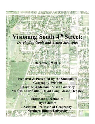
1. Visioning South 4th
Street:
Developing Goals and Action Strategies
December, 9 2014
Prepared & Presented by the Students of
Geography 690/490
Christine Anderson ∙ Susan Guderley
Mantas Laurinaitis ∙ David Long ∙ Jason Ochalek
Under the Direction of:
Ryan James
Assistant Professor of Geography
Northern Illinois University
2. Visioning South 4th Street
2
Table of Contents
Introduction to Visioning............................................................................03
Introduction.........................................................................................04
Our Study Area...................................................................................05
Steps of Visioning Document ...........................................................06
Goals....................................................................................................06
Broad Community Desires................................................................07
Study Area and Background.......................................................................08
Study Area Location ..........................................................................09
Population & Demographics.............................................................10
Employment........................................................................................13
Land Use .............................................................................................15
Public Facilities ..................................................................................16
Visioning Process ........................................................................................18
Developing a Vision ..........................................................................19
Neighborhood Goals and Action Strategies..............................................22
Neighborhood Goals ..........................................................................23
Action Strategies ................................................................................26
Implementation, Benchmarking & Conclusions.......................................31
Implementation and Benchmarking .................................................32
Conclusions.........................................................................................33
3. Visioning South 4th Street
3
Chapter One
Introduction to Visioning
Figure 1; Public Forum with Community Leaders at Northern Illinois University November 6th, 2014
4. Visioning South 4th Street
4
Introduction
The visioning statement is a broad statement of what a community, neighborhood, or city desires
out of its future development direction. Visioning statements serve as a guide for future planning,
development and investment in the community. They include descriptions of community desires
for natural areas, working landscapes, forests, recreation, built environment and other assets.
This visioning statement developed here serves as step one in a larger planning process. The
statement will aim for identifying the assets and desired neighborhood direction for the South 4th
Street area.
Broadly, vision statements address five specific questions for the community. These questions will
provide the basis for the ideas on which direction the community desires to go over the next 20
years. They provide clarity in the identification of desired themes of development and life in a
community, while city officials and residents observe and articulate current conditions and are
trajectory. A successful approach to a visioning statement begins with the following questions:
Where have we been?
This question is used to describe past trends of our community, and how current assets and
challenges come to be.
Where are we now?
This is used to describe the present condition, major assets, challenges, and opportunities.
Where are we going?
This is used to describe the current trajectory of an area; if no planning process is present
Where do we want to go?
This is used to show how we vision the possible future of an area.
How do we get there?
This identifies steps and objectives as a means to achieve the future potential.
5. Visioning South 4th Street
5
Our Study Area
We are studying an area of South DeKalb bounded by Taylor St and Fairview St from the N and
S and 4th and 1st St from the E and W. The area is zoned primarily for residential use but does
include commercial sections.
We have identified three concepts of DeKalb:
• University town
• Agricultural town
• Unique Chicago Suburb
We have identified that our study area fits into these
concepts. With the university being so close to the area it
can build off of the student base as the rest of DeKalb
does. With DeKalb’s rich agricultural history it is still
prominent in the area. With the proximity to Chicago, DeKalb has remained unique with its
agricultural history and small town atmosphere, as does our area of study.
In a larger context, population in DeKalb has historically mirrored the enrollment at Northern
Illinois University. According to the 2005 comprehensive plan of DeKalb the population has been
steadily increasing between 1990 and 2000. The city saw an 11.2% increase in population growing
from 35,076 to 39,018 in 10 years. This increase was slightly less than DeKalb County and slightly
more than the state of Illinois. As DeKalb has grown, much recent growth has been in northern
portions of town. While much of South DeKalb has been in decline our study area has remained
stable. Our task is to build off of that stability to vision future growth in the broader South 4th St
context.
6. Visioning South 4th Street
6
Steps of Visioning Document
1. Study Area Definition; The area which we are studying is bounded by Taylor and
Fairview Streets from the North and South, and 1st to 4th Streets on the West and East.
This area is on the Southern perimeter of the city of DeKalb, and has remained stable as
neighboring areas have transitioned.
2. Community Stakeholder Identification; The key stakeholders were identified as people
who can help us in the visioning process because of their interaction with the community.
3. Community Forum; Obtain input from our stakeholders through a community meeting.
This helps us understand the community goals, concerns, and viewpoints.
4. Information Evaluation; After we get the input from the stakeholders we evaluate and
synthesize specific statements into a broad vision.
5. Results Presentation; With the results compiled we are able to make a more accurate
vision statement to present to our stakeholders.
Goals
Our study will help as a part of the ongoing efforts between DeKalb and NIU to build an even
stronger connection between the two. The goals of our study are to identify the factors why the
community is doing so well, identify strengths of the community, and help us draft a vision
document for the neighborhood. This will be achieved with the help of our key stakeholders.
7. Visioning South 4th Street
7
Broad Community Desires
There have been consistent themes in the planning process in DeKalb. One overarching theme has
been that of connectivity and how it is important for the city of DeKalb and its communities.
Connectivity has impacted this area because of its relative location in the city as a whole. Another
of the main themes was sustainability. It is important for any change made to be for the long term
and work with the institutions already there.
8. Visioning South 4th Street
8
Chapter Two
Study Area and Background
Figure 2; Study Area Outlined in Red in South DeKalb, Illinois
9. Visioning South 4th Street
9
Study Area Location
The South DeKalb Study Area is a
largely residential neighborhood
encompassing approximately 170
acres, situated in south central DeKalb.
Its boundaries are formed by Taylor
Street on the north, 4th Street on the
east, Fairview Lane on the south, and
1st Street on the west. That portion of
the study fronting 4th Street also
includes clusters of car-oriented
businesses. This neighborhood is
located approximately ½-mile from the
downtown DeKalb and one-mile from
the Northern Illinois Campus and
easily accessible to both by foot, bike and car.
Population & Demographics
The 2010 population reported living within the South DeKalb Study Area was 1,157 persons.
This figure is a 6% decrease from the population reported for these same block groups by the
2000 Census. During this same time period, the City of DeKalb’s population increased by 12%,
from 39,018 to 43,862.
Figure 3; South DeKalb Study Area & Zoning Covenants
10. Visioning South 4th Street
10
Figure 4; 2000/2010 Population - Study Area & City
Figure 4 shows 2000 and 2010 population distributions by age and gender for both the study area
and City of DeKalb. The population pyramids for the City both reflect the dominant presence of
NIU students, as demonstrated by the skewed sizes of the 15-19 and 20-24 age groups. In total,
these age groups represented 42% and 40%, respectively, of the City’s 2000 and 2010
populations. In contrast, persons in these age groups only made up 11% of the study area’s
populations these same years. Within the study area, the most dominant age group is 45-49 in
2000 and 55-59 in 2010. Of the neighborhood’s total population, persons 30 years and older
made up 68% of its residents in 2000 and 67% in 2010. For the City of DeKalb, this same age
group represented only 36% of its total population in both 2000 and 2010. Further, individuals
60 years and older represented 28% (2000) and 30% (2010) of the Study Area population, but
were only 10% of the City’s population in both years.
11. Visioning South 4th Street
11
Figure 5; 2000/2010 Family/Household Composition - Study Area & City
During the period studied, the majority of households within the Study Area remained Families
(Figure 5). In 2000, 79% of its households were reported to be Families and 21% as Non-Family.
In 2010, these figures were 78% and 22%, respectively. In both 2000 and 2010, the City of
DeKalb’s population was nearly evenly divided between Family and Non-Family Households
(respectively, 50%/50% and 49%/51%).
The racial composition of the Study Area is largely white, 96% in 2000 and 91% in 2020. Only
small increases were reported for other racial groups between 2000 and 2010. The City’s
population is somewhat more diverse than the Study Area. From 2000 to 2010, the City’s Black
population increased by 4%, but all other minority groups reported smaller than 2% increases.
12. Visioning South 4th Street
12
The comparative breakdown reported in 2000 and 2010 for minority groups in both the Study
Area and the City is shown in Figure 6.
Figure 7; Hispanic Population -Study Area & City
Figure 6; 2000/2010 Racial Characteristics - Study Area & City
Figure 7; Hispanic Population - Study Area & City
13. Visioning South 4th Street
13
The Hispanic population living in the Study Area and the City both grew by 4% between 2000
and 2010. Within the Study area, the Latino population increased from 4% to 8%; the City’s
Latino population rose from 9% to 13%. (Figure 7)
Employment
According to Census.gov there are just over 21,000 DeKalb residents that are employed over the
age of 16. It is expected that many of the residents of the South DeKalb study area are employed
by one of the major employment sectors in the DeKalb area, as these are the larger dominant
bases in the city. Northern Illinois University less than 5 miles away and Kishwaukee
Community Hospital and the associated healthcare industry have a major impact on DeKalb
employment. In addition, DeKalb is home to a robust retail corridor as well a few warehousing
and manufacturing operations.
Northern Illinois University is a state public institution that employs over 3,000 people. In
addition to jobs, NIU also contributes to the educational attainment of DeKalb residents. No
doubt, this helps account for the above average rate of Bachelor’s and higher education degrees
when compared to the rest of the state. A wide variety of talent exists at NIU which employs a
balance of skilled and unskilled labor from tenured physics/engineering/business professors, to
relatively unskilled and lower paying positions. The diverse base of employment opportunities
this presents creates a jobs that appeal to multiple potential applicants. This employment center
also drives other business in the area including local food and drink establishments as well as
thriving retail corridor discussed below.
14. Visioning South 4th Street
14
Besides NIU, the DeKalb/Sycamore/Malta area is home to several other education facilities
including at least 13 elementary schools, 3 middle schools and 2 high schools. Malta, Illinois is
also home to the only community college in the area; Kishwuakee College.
In addition, another industry that employs many DeKalb residents is the healthcare industry.
KishHealth Systems is a health care network of facilities anchored by Kishwaukee Hospital
which opened a new facility in 2007. In the area surrounding this facility are many private
offices of various medical providers.
Another major employment sector of DeKalb is the retail corridor off of Sycamore Road (Illinois
Route 23). Stores in this area include Lowe’s, Target, Wal-Mart, Menard’s, Officemax, Kohl’s,
and JC Penny to name a few. While these businesses tend to employ a large number of high-
school and college age students, they are also home to several mid-management positions for
skilled and semi-skilled labor.
Due to the proximity of Interstate 88, DeKalb is also home to several warehousing operations.
Panduit is a leading technology support firm with one of the larger and older distribution centers
near I-88. Within the past ten years, Target open a new distribution center and Nestle Corp, one
of the largest food companies in the world, has a long established distribution/logistics &
trucking operation near I-88 as well.
Other employment opportunities come from one of several neighboring communities including
Rochelle, Cortland, Sycamore and many Chicago suburbs. With nearby access to I-88, residents
of the South fourth street area should have no problem finding employment within a thirty
minute drive.
15. Visioning South 4th Street
15
The diverse options for employment in DeKalb leads to multiple income levels which also affect
housing options. Some positions provide only enough income for renters in low income areas,
while other positions yield higher salaries which make traditional detached single family homes
of varying sizes more affordable. Slightly higher salaries such as those observed by many
residents of the south 4th street neighborhood have a direct impact on such areas to thrive and
survive.
Land Use
The South DeKalb Study Area is a largely residential area with an eastern border composed of an
auto-oriented commercial corridor. This pattern is shown by the South DeKalb Study Area Map
(Figure 1) which is based upon the City’s zoning districts; existing land uses appear to be
consistent with their zoning classifications.
The western half of the neighborhood, located between 1st and 2nd Streets, consists exclusively of
medium density, single-family, detached residences. East of 2nd Street, the mix of residential
units includes single-family detached, two-family and small multi-family housing types. This
area also contains two institutional uses, Lincoln Elementary School and Pine Acres Retirement
Community. The 4th Street commercial corridor extends for a length of approximately 0.6 miles
and is characterized by one-story, commercial buildings fronted by parking areas. Businesses are
distributed along both sides of 4th Street but appear to be most concentrated on the north, near the
intersection of Taylor Street. Another large commercial property, home to Lehan Drugs and a
dollar store, is located at the southern end of the corridor near Barb Boulevard. Several of the
storefronts are presently vacant.
Bordering the South DeKalb Study Area on the west and north are residential neighborhoods of
similar density. The study area’s internal street and sidewalk network provides a reasonable level
16. Visioning South 4th Street
16
of vehicular and pedestrian access to these neighborhoods but does not have as many
connections to the 4th Street business corridor and the neighborhood beyond to the east. While
there are continuous sidewalks on both sides of 4th Street, these are frequently interrupted by
large curb cuts and distant from the retail and service uses located within commercial corridor.
Immediately south of the study area, in a large super-block formed by 1st and 4th Streets, Barb
Boulevard and Fairview Drive, are located several significant educational and recreational uses.
These include: Huntley Middle School, the Barb City YMCA, and the DeKalb Park District’s
Recreation Center and soccer fields. This area also includes the Fairview Park Cemetery. The
large areas of landscaped open space associated with these uses contribute a feeling of green
space and also provide passive and active recreational areas to the residents of the adjacent
neighborhood.
Public Facilities
South DeKalb has an abundance of public facilities within walking or short driving distance
which helps to make this neighborhood an attractive area to live. Both Lincoln Elementary and
Huntley Middle Schools are within walking and biking distance of most residents’ homes and is
a valuable amenity for the families living in this neighborhood. Both of these school have
incredible reputations of understanding the community they serve and always have their doors
open for both the parents and students. Alongside the middle school, there is Kiwanis Park
Sports Facility that is owned by the park district and available to anyone in the community to use
both for fun and exercise away from their homes. The sports complex has a full acre field house
that can be used for any type of activity such as indoor soccer and also holds a full size
basketball court. The outside part of the facility has several soccer fields as well as
17. Visioning South 4th Street
17
softball/baseball field for use. All of these park district amenities are available for rent to use on
a first come first serve basis. To address the safety concern that every community has, there is
one of two DeKalb fire stations within blocks of the neighborhood as well as a police station
across from campus that can be in the area within minutes in case of an emergency. There are
also some options for medical care within this South DeKalb community. This is a valuable asset
to the residents so they could avoid heavy traffic when trying to get to Kishwaukee Hospital on
the north side of town unless there is an absolute emergency. The South DeKalb community is
an attractive well diverse neighborhood to live in with all the public amenities both the residents
and businesses could need.
18. Visioning South 4th Street
18
Chapter Three
Visioning Processes
Figure 8; Community Forum at Northern Illinois University - November 6th, 2014
19. Visioning South 4th Street
19
Developing a Vision
Central to the visioning process is the public meeting. It is here where residents, city staff,
consultants, and other key stakeholders can engage in discussions regarding neighborhood
strengths, assets, challenges, and desired development direction. According to Daniels et al.
(2007), public input in the visioning process involves several stages of meetings. To being with,
a meeting of key stakeholders (also referred to as an advisory committee) is convened to begin
developing an understanding of the neighborhood, identifying key areas for further study,
developing questions and topics to discuss with the larger community, and beginning the
dialogue of development desires and neighborhood trajectory. Following the key stakeholder
meeting, staff then synthesizes comments in to themes to present, discuss, and hold the
secondary phase of public meetings which involve the community at large. From the discussions
in the secondary meetings, staff then synthesizes the key points, identified assets, identifying
challenges, and vision for the future development direction and lifestyle of the neighborhood.
From start to finish, the vision process can take a year to complete. Given the time constraints
dictated by the semester length of the studio course, we focused on holding the key stakeholder
meeting. In this meeting, our goal was to present background information on the neighborhood,
and then begin the discussion of strengths, challenges, and desired direction of the neighborhood.
From this input, we synthesized results in to broad goals and action strategies. These results are
only meant to be preliminary, and to serve as a building block for later phases in community
study involving the entirety of the residential and business base.
Prior to the meeting, key stakeholders were identified using the methods and suggestions from
Daniels et al. (2007). For the South 4th Street neighborhood, we identified the Mayor,
20. Visioning South 4th Street
20
neighborhood alderman, police chief, fire chief, principle planner as key stakeholders from the
public services side. These stakeholders are invaluable in a vision process as they understand the
role of the neighborhood in the larger development direction of DeKalb, but also understand the
neighborhood from a public service provision/consumption standpoint, and can provide guidance
from a policy perspective. Neighborhood business owners were also identified as key
stakeholders, as they interact with the residents of the community on a daily basis, can use those
interactions to provide a “feel “ of the direction of the neighborhood, and can provide guidance
and experiential evidence of the commercial corridor assets and challenges of South 4th St. A
final groups of key stakeholders, deemed “community service providers” were identified. This
group included the school principals, day care managers, church ministers, and two realtors.
This is a group who can capture the “pulse” of the neighborhood through interactions with the
neighborhood children, community service and outreach provision through the churches, and the
identification of amenities the serve to draw potential homebuyers to the neighborhood. In all,
20 key stakeholders were identified and invited to a community meeting via personal invitations,
and then follow up e-mail and telephone calls.
The key stakeholder meeting was held on November 6, 2014 at 7 :00 pm in the Sky Room of the
Holmes Student Center on the campus of Northern Illinois University. Or the 20 invitations, five
invitees were present, representing a turn out rate of 20%. Turnout was confined to members of
the city staff/representative group of stakeholders, however, several were also residents of south
DeKalb, and thus served as informants in two key areas. After a presentation on the vision
process and neighborhood background (Chapter One and Two of this document), an open ended
interview/discussion occurred, concluding at just after 9:00 pm. Broad questions used to guide
the discussion included:
21. Visioning South 4th Street
21
1. Describe the neighborhood. How do you know when you have entered?
2. What services does the City provide to the neighborhood, and how well utilized are they?
3. What challenges to businesses face on the S. 4th St. Corridor, and what caused those
challenges to appear?
4. What can the City do help promote father growth in the corridor?
5. What are the residential and commercial assets of the neighborhood, and how can we
build upon them?
6. What is the role of the schools in creating neighborhood stability/identity?
7. How can the residential assets of the neighborhood better serve the desired development
direction of DeKalb, and the larger Communiversity vision?
8. Does the neighborhood have an identity and sense of place, and how can we stimulate
growing that identity?
From informal discussion based around those guiding questions, the following neighborhood
assets and challenges were persistently mentioned:
Assets
Low crime rate in the area, and quick
emergency response
Good public facilities, including sports
facilities
Well maintained housing, move-in ready
No stigma/ Blank slate to create identity
Highly regarded schools
Family centered layout and service
provision
Fortunate geography, with proximity to
downtown, NIU, yet removed enough to
be peaceful
Challenges
Fragile retail corridor
Decline in 4th St. traffic (Multi-
jurisdictional route)
Loss of high school
Loss of identity
Bike path condition
Building off of these themes, we developed two broad goals and vision for our neighborhood,
and outline them and offer action strategies in the next chapter.
Chapter Four
22. Visioning South 4th Street
22
Neighborhood Goals and Action Strategies
Figure 9; Google Street View looking South on South 4th Street
23. Visioning South 4th Street
23
Neighborhood Goals
Discussion of South DeKalb Community Goals
Our research and key stakeholder discussions yielded an assessment of the South DeKalb study
area’s assets and challenges. One of DeKalb’s premier new neighborhoods in the 1960’s, this
area has matured into a stable, leafy, walkable area that is transitioning from one of retired
households to young families. Its strengths include: an ample supply of affordable, well-
maintained housing; a stable, if aging, family-oriented population; well-regarded neighborhood
schools; abundant recreational facilities and open space; and a low crime rate.
However, the neighborhood also faces several challenges posing potential threats to its long-term
desirability and stability. First, there will be the need to replace of a sizable segment of its
current residents as they age and move on (thirty percent are aged 60 years or older). Second, as
long-time residents have been replaced by new families, the neighborhood’s identity and role in
the city’s history have been forgotten. Finally, the relocation of the community’s high school
further weakened the 4th Street commercial corridor. Already experiencing business losses due to
competition from other commercial areas in and out of DeKalb, it has since suffered an
additional decline in traffic. Despite this, the corridor is designed as a 5-lane state highway with
meager pedestrian facilities and little greening. As is, it is not conducive for conversion to a
neighborhood commercial destination.
To serve as a framework for our recommended action strategies, the following goals are
suggested:
24. Visioning South 4th Street
24
Goal 1: Developcommunity identity and capacity
Neighborhoods are the building blocks of a city. They contribute distinctive character, create
interest and activity and provide texture and context to the built environment. Neighborhoods
also provide an identity or “sense of place” which allows residents – newcomers and long-time
residents alike – to connect with the city, local organizations and institutions and each other, thus
forming a sense of connectedness and community. Healthy neighborhoods do all of these things,
and more, well.
While it appears that the study area has benefited from a stable population of long-time residents,
this may change rapidly as nearly one-third of its residents are now 60-years or older. With their
departure, knowledge of the neighborhood’s beginnings and original name – Bradt Park – will be
lost. To insure its continued stability and vitality, a renewed effort to recapture the
neighborhood’s identity and sense of place will serve as the backbone to community
cohesiveness. Action recommendations under this goal include creating a neighborhood
association and providing opportunities for resident interactions through both neighborhood and
city-wide events.
Goal 2: Strengthen neighborhood connectivity with City
One of the five core values stated in DeKalb’s 2005 Comprehensive Plan is Connectivity. It is
the concept that as growth and change occur in DeKalb, whether through expansion at the
periphery or via infill redevelopment, physical connections and access between neighborhoods,
business districts and employment centers must be maintained. This requires a well-designed,
city-wide network of both vehicular and non-vehicular connections like public streets, sidewalks
or pedestrian paths, and bike paths or lanes.
25. Visioning South 4th Street
25
But beyond its meaning in the physical sense, connectivity also includes the idea of belonging.
That DeKalb’s diverse neighborhoods also contribute to and enrich the city, as a whole.
Opportunities for South DeKalb to enhance its connectivity to the city involve action strategies
related to both improved physical access and a renewed sense of its role in the life of the city.
Activities such as extending and improving non-vehicular access between study area’s
residential streets and the 4th Street corridor will support internal connectivity but also invite
interaction with other neighborhoods and business districts. Creating and displaying
neighborhood identifiers will allow neighborhood residents to contribute their history and pride
in being a valued part of DeKalb.
26. Visioning South 4th Street
26
Action Strategies
Action Strategy #1: Creation of a Neighborhood Association
Addresses Goal #1
Objective 1-1: Start a core group of residents & business owners
Identify and determine either a primary issue or several smaller ideas
Jump start neighborhood activity with “kick-off” projects
Get to know local government officials & work with them supporting change &
development
Objective 1-2: Increase neighborhood involvement
Define and agree on neighborhood boundaries
Better define neighbor’s concerns, issues, & assets
Hold HOA meetings 2-4 times per year
o As the association grows, more meetings will be necessary
Write a directory with neighbors information and potential services residents may offer to
one another
o Babysitting, lawn mowing, dog walkers, snow shoveling, etc.
Objective 1-3: Discuss and establish a vision of Bradt Park
Set goals for concerns or issues the residents or businesses may have and build upon the
assets the neighborhood already has
Develop a sense of ownership and community while protecting the safety of the residents
27. Visioning South 4th Street
27
Action Strategy #2: Enhance aesthetics to increase the attractiveness of the neighborhood
Addresses Goal #2
Objective 2-1: Design what south 4th street could enhance upon to appear more aesthetically
pleasing to people visiting the retail corridor.
Find similar neighborhood plans to aid in creating ideas to achieve the objective above.
Look into what options are available for the area such as trees, flowers, benches, etc.
Accommodate these ideas to fit with the businesses already present as well as for
prospective future businesses
Objectives 2-2: Start making some temporary changes and evaluate the effectiveness
Work alongside business owners to decide on what changes would fit them best
o Would a restaurant want some new tables and chairs to place outside?
o Would retail owners be willing to landscape with plants to increase
attractiveness?
As businesses plan for changes that will fit
them, make arrangements for some of the
materials or items as funds allow such as lamp
posts, neighborhood banners, metal crated
garbage cans, etc.
After a defined amount of time, evaluate the
effectiveness from each business before
proceeding forward
Objective 2-3: As feedback emerges make more of the adjustments
permanent as funds and materials are available
Work in support with local governments to help aid the efforts in
revitalizing a main retail corridor that is in the midst of redevelopment
In response to positive feedback, research into what other natural
aesthetics and business may be a good fit for this growing corridor
28. Visioning South 4th Street
28
Action Strategy #3: Use traffic calming along the 4th street corridor
Addresses Goals #1 & #2
Objective 3-1: Design a more efficient sidewalk
and bike path plan along 4th street
Currently on the west side of south 4th
street there is no well-designed system
for sidewalks which creates a dangerous
situation for any pedestrians along this
busy road
The bike path in place is not clearly
labelled along the roads
o Either new paint marks or new
signs along the road to create safer environments for bikers and walkers
Increase the accessibility of this retail corridor beyond vehicle traffic
Objective 3-2: Use current and developing aesthetics as natural medians
As the new aesthetic plans are coming into place, the ability to utilize them as natural
medians increases
Whether the plan is to add benches and tables or trees and flowers, any of these can be
used to break up traffic on several scales
Objective 3-3: Discuss options for adjusting the main intersection with Taylor Street
Working with both the city of DeKalb and I-DOT to evaluate this intersection since south
4th is also state route 23
Since the traffic on this road is declining and the need for safety is increasing, the
demand for a better transition into this neighborhood is heightened
The road should be narrowed down for vehicle traffic but could implement a bike path as
a safe space for bicyclists and space between vehicles and pedestrians walking along
south 4th street.
29. Visioning South 4th Street
29
Action Strategy 4: The relocation of certain events to South DeKalb will help to create a
community identity and will help to connect all parts of DeKalb
Objective 4-1: Identify events that would be able to use South DeKalb as a location.
• Park district leagues
• 5K’s and different races (run/walks or biking)
• School events (elementary-high school)
• Different charity events (through NIU or DeKalb)
Objective 4-2: Work with the City of DeKalb to move Corn Fest location each year.
• South DeKalb has the space for it
• Will help to drive up business in other parts of DeKalb
• Will connect South DeKalb to the rest of DeKalb
Objective 4-3: Use events to connect all parts of DeKalb
• Will build a tie and connect the city
• Bringing events down will make people aware of Bradt park
30. Visioning South 4th Street
30
Action Strategy 5: Utilization of the open space of South DeKalb will help to create a
community identity that residents and non-residents will recognize.
Objective 5-1: Increase the usage of the South DeKalb recreation center.
Park district sporting tournaments (basketball, volleyball, dodge ball, etc.)
Charity games
Neighborhood teams
Objective 5-2: Increase the usage of the South DeKalb outdoor sports facilities.
Intramural sports (park district, locally sponsored, middle and high school teams)
o Possible sponsors such as local bike shops, sports stores, PTA, NIU, Churches
Objective 5-3: Increase the usage of the South DeKalb open areas.
Local farmers market/flea market
Movies in the park
Community wide barbecue
Outdoor/indoor festivals
o 4th of July, Church festivals, School fest, agriculture fest
Local/non-local bands
31. Visioning South 4th Street
31
Chapter Five
Implementation, Benchmarking & Conclusions
32. Visioning South 4th Street
32
Implementation and Benchmarking
The following page is a summary table providing the tasks recommended to address the two
primary areas of as identified by the visioning process: Community identity and capacity and
Strengthen connectivity to DeKalb. The table categorizes the recommended strategies, along
with the description or comment about the task to be performed. The table also suggests partner
organizations or groups who can help complete the task. Additionally, a suggested timeline when
the task should be accomplished is provided.
Task/Action Description
1 Neighborhoo
d
Association
Creating association that would work on the behalf of the community. Would have meetings and listen t
2 Aesthetics
and Traffic
Calming
Enter sign and community banners on the lighting posts and increase the number of them.
33. Visioning South 4th Street
33
3 Traffic
calming
Promote the idea of tactical urbanism to soften the South 4th street road. This may include temporal and
Better condition and longer bike paths are vital.
4 Increase in
number of
events. City-
wide
Festival to
represent S.
DeKalb
Neighborhoo
d.
Incorporate exhibitions of local artists, sports events, cooking competitions, charity events depending on
Promote best assets from the neighborhood and city of DeKalb to showcase the community.
34. Visioning South 4th Street
34
Conclusions
The Bradt Park neighborhood in the South 4th street area of DeKalb is a traditionally stable area
with several strong community assets. The research performed suggests that while this is a
neighborhood in transition and potentially suffering from a lack of identity, lower traffic volume
and disinvestment in commercial activity, the area still has many strengths. These include
desirable housing, low crime and great schools among others.
The research performed has also identified key goals and action strategies toward which to strive
in an effort to protect against the fragile nature of the area. By following the strategies outlined
herein, the residents of Bradt Park will be able to develop a sense of place and community that
will strengthen the ties within the neighborhood to ultimately enhance living conditions.
Initiatives such as establishing a homeowners association will help reinforce this sense of
community and neighborhood ownership and will ultimately lead to a closer-knit group of
residents.
In addition, the City of DeKalb can undertake several projects ranging from inexpensive to larger
scale to assist in developing a strong sense of place by establishing firm neighborhood
boundaries. Proper future development of the South 4th Street corridor will also enhance
connectivity to the rest of the city while also making the area a destination within the
community.
The City also has the ability to help with the connectivity issue by encouraging the increased use
of the parks and facilities in the area for public functions. Other ways that the city can help
would be by hosting more City wide events in the area like Cornfest, 5k type events, or other
public celebrations that will bring increased traffic to the area and to the local businesses.
35. Visioning South 4th Street
35
In conclusion, the Bradt Park area is truly one of DeKalb’s most vital and well established
neighborhoods. Despite the loss of certain assets it remains a fairly stable area and the residents
of the area are proud to call it home. With a few simple steps, Bradt Park will continue to be one
DeKalb’s most stable and enjoyable areas to live.