Geographical and Railway Features of Demodara and Namunukula, Sri Lanka
•
0 likes•263 views

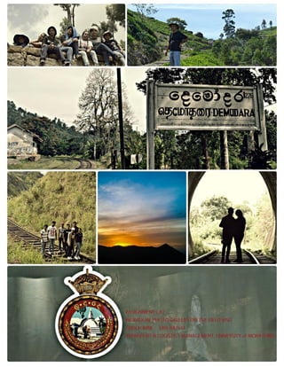
A journey to reach the pinnacles of cloudy mountains with an eternal spread of green silk below them, miniature waterfalls and endless valleys with the sublime touch of nature’s wonders. Voyage on the man-made bridges, railways and through the dark tunnels in search of the light of wisdom in the perspectives of Geography. The photographs were taken on the field observation visit to Demodara and Namunukula on 11th and 12th of August 2015 conducted by the Department of Transport and Logistic Management of University of Moratuwa for the 1st Year Undergraduates. Only the photographs with a geographical significance are attached. Every photo is displayed under a specific theme and described below relating to its geographical features.

Recommended
Recommended
More Related Content
More from University of Moratuwa / Sri Lanka Law College
More from University of Moratuwa / Sri Lanka Law College (14)
Recently uploaded
Recently uploaded (20)
Geographical and Railway Features of Demodara and Namunukula, Sri Lanka
- 2. CONTINOUS ASSIGNMENT ONE “GROUP PHOTO GALLERY ON THE FIELD VISIT” GEOGRAPHY IN TRANSPORT TRANSPORT AND LOGISTICS MANAGEMENT UNIVERSITY of MORATUWA 14th BATCH HASHAN RAHUBADDHA 141456X
- 3. INTRODUCTION OF THE PHOTO GALLERY A journey to reach the pinnacles of cloudy mountains with an eternal spread of green silk below them, miniature waterfalls and endless valleys with the sublime touch of nature’s wonders. Voyage on the man-made bridges, railways and through the dark tunnels in search of the light of wisdom in the perspectives of Geography. The following photographs were taken on the field observation visit to Demodara and Namunukula on 11th and 12th of August 2015 conducted by the department of Transport and Logistic Management of University of Moratuwa for the level one students. Only the photographs with a geographical significance are attached and All the photographs were taken by the group members . Every photo is displayed under a specific theme and described below relating to its geographical features.
- 4. 1.RIDGES, GULLIES AND SPURS #PHOTO 1
- 5. #photo 1 description Venue Haputhale mountain range Geographical features In this mountain range, four geographical features can be easily identified. The most significant is the Ridge line which is the long area of highlands, are common features in a chain of mountains or hills, which are connected with each other by a ridge. Other three geographical features are spur, gully and summit. #PHOTO 2
- 6. #photo 2 description Venue Namunukula mountain range seen from Uva Management Development Institute Geographical features In this mountain range too spurs, ridgeline and gullies are visible. Gulley is a small strip valley, usually formed by a lot of rain water following down. As shown in the picture the contours of the gully are have the “v” shape with point of “v” pointing towards the peak.
- 7. #PHOTO 3
- 8. #PHOTO 4 Geographical features In this mountain range there’s a clear peak which is known as the summit. #Photo 3 description
- 9. #Photo 4 description Venue A Mountain seen from the Sping Valley Geographical features In this mountain, spurs and gullies are visible. It’s a very much norm to see the both in the same mountain as most of the times the two go with each other. Spur is a lateral piece of land which is projecting from mountain or mountain ridge. Spurs mostly provide access for roads and walkers etc
- 10. #PHOTO 5 #Photo 5 description Venue A Mountain Range seen from Uva Management Institute Geographical features On the 21st morning, we able to watch a glorious sun rise over this mountain range where the ridges and summits can be easily recognized. No need to say where the East side is.
- 11. #PHOTO 6 #Photo 6 description Venue A Mountain Range seen from Uva Management Development Institute Geographical features The nearest mountain has a gentle slope where the tea is grown along with many other crops. There’s also an electricity transmitting tower since the slope is gradual. The mountain other side there’s clear ridge.
- 13. #Photo 7 description 3.VALLEY #PHOTO 8 Venue Haputale Mountain Range Geographical features A saddle is situated in between two hills or mountains, it differs from a valley because unlike the valley after one mountains slope ends, slope of the other mountains begins upwards.
- 14. #Photo 8 description #PHOTO 9 Venue Demodara Geographical features There’s a valley where a factory has being built in between the two hills and also there’s a river flowing beside. A river running along a valley is a norm in the geography. There’re clear spurs and gullies on the hill while man made steep slope can also be seen.
- 15. #Photo 9 description #PHOTO 10 Venue Spring Valley Geographical features Most of the upcountry residences are situated on the valleys since it’s easier to build a house on flat land such as valley than on land with a slope. So in this picture it can be seen many houses are built in the valley and less houses are built in the gentle slopes and no houses as the steep become higher.
- 16. #Photo 10 description #PHOTO 11 Venue Haputale Mountain Range Geographical features It is easy to identify valleys in this part of the country since there are many mountains range with gullies and spurs run from the ridge lines to valley bottom.
- 17. #Photo 11 description #PHOTO 12 Venue Spring Valley Geographical features Surrounded by the tea coated mountains the valley lies in between the two hills with a gentle slope. Venue Haputale Mountain Range Geographical features Beside the mountain range there lies large valley with numerous lakes #Photo 12 description
- 18. #PHOTO 13 Venue Spring Valley Geographical features Spring valley is known for three things. Tea, Springs and Valley. As the name suggest the whole area is full of valley surrounded by the mountains with tea coats. And the people have built houses in the valley as circled by pink, avoiding the risk of building houses on the slope of mountains and peaks since these areas are highly prone to earth slips. #Photo 13 description
- 20. #Photo 14 description 5. PLANTATIONS #PHOTO 15 #PHOTO 16 Venue Haputale Mountain Region Geographical features Plateau is a flat land situated on high land often surrounded slopes. Here in this picture there’s plateau with a slope by its side which leads to a valley.
- 21. #PhotoS 15, 16 descriptions Photo 15 Photo 16 This photo was taken before we pass the Ratnapura closer to the western province where the land is flat and the paddy is grown in a traditional low land cultivation The photo was taken after passing Rathnapura where the slope is become gradually steep. Here the slope is gentle, yet the paddy is grown with the measures to avoid soil erosion using contour drains. This type of cultivation is unique for the hill country. #PHOTO 17
- 22. #Photo 17 description Venue Tea estate, Haputale Geographical features This photo was taken in a mountainous area where the slope is steep. As shown by the drawing it’s clear that the cultivators has taken several measures to make sure to avoid the soil erosion so the soil won’t become fertile. A berm is a level space, shelf, separating two areas with a slope and it helps to avoid the erosion of the top soil along the steeper surfaces. Here the berm is also used as a road.
- 24. #PHOTO 20 Venue Spring Valley Geographical features Coniferous forest are made of many tree species such as pine, Cyprus, eucalyptus etc. It has got his name from its common corn shape and it was introduced to Sri Lanka during the colonial era to avoid the soil erosion in the tea estates. But after it has spread in a vast area sometimes making it a hazard since coniferous forests do not sustain a lower level plantain because of the density of the forest low level of sunlight coming in and the trees itself takes a lot of nutrition out of the soil which make it infertile. #Photos 18, 19 description
- 25. #Photo 20 description 7.SOIL EROSION #PHOTO 21 Geographical features This photo shows the burned down coniferous forest. Coniferous forests are naturally prone to wild fire in order to sustain the ecology system in balance. But sometimes men set them fire with precautions to cultivate plantation in those are. The ash that falls from the burning of the trees fall to the ground making it fertile.
- 26. #PHOTO 22 Geographical features It’s clearly evident that top layer of the mountain has washed off and only the rocks remaining. Such erosion can happen in the steeper areas of the mountains because the velocity of water flowing is high. #Photos 21 description
- 27. #Photos 22 description #PHOTO 23, 24 Venue Spring Valley Geographical features Because of the cleared vegetation and deforestation and lesser number of tea cultivation as it has shown by the picture the erosion process has taken and a gully has been formed. If a gully is created through the soil erosion the process itself is called “gully erosion”
- 28. #Photos 23,24 description Venue Spring Valley Geographical features It’s clearly evident that in these two pictures the soil has eroded leaving the rocks while where there is tea plantations no such rocks can be seen. This clearly shows when there’s deforestation or and lesser vegetation soil erosion can be severe.
- 29. #PHOTO 25,26 • More photos depicting the severe soil erosion in the Spring Valley due to its steeper slopes. This is a common hazard for all the hill country.
- 31. #Photos 27,28 description Venue Ella and Haputhale Geographical features Although there’s vegetation in these lands the earth slips have occurred due to the 90 degrees angle it holds with the road. When there’s slope the soil is eroded without the plantation but if the slope is perpendicular then the earth slips can occur when there’s heavy rain.
- 32. 8.PRECAUTIONS FOR THE SOIL EROSION #PHOTO 29
- 33. #Photos 29 description #PHOTO 30 Venue Spring valley - Namunukula Geographical features Stone ridge has been built by the men in order to protect the soil from eroding. These kind of ridges are common in the upcountry areas where the tea is grown.
- 34. #Photo 30 description #PHOTO 31 Venue Spring valley Geographical features Girls are sitting on a stone ridge in the spring valley and as it’s evident that although the slope is steeper the soil is protected by the stone ridge.
- 35. #Photo 31 description #PHOTO 32 Venue Haputale Geographical features Specially in the tea plantation they take several measures to avoid the soil erosion. As you can see in the picture contour drains and berm are used while also using the leader drains, which are built to avoid the gully erosion. They are built as stair on the naturally occurring drainages and help to water to flaw naturally rather than on the soil carrying the outer layer of it.
- 36. #Photo 32 description 9.DRAINAGE LINES (DRAWS) #PHOTO 33 Geographical features As you can see a clear cut by the road and it’s not perpendicular to the road but it has carved as a contour drains or as berms to avoid the soil erosion of the slope.
- 37. #Photo 33 description 10.RIVERS #PHOTOS 34 & 35 Venue Kottegoda Geographical features Draws can be easily identified since its contours have a v shape which the v points at the peak of the hill. And they are different from the valleys since valleys run parallel to the ridge while draws run perpendicular.
- 38. #Photos 34 & 35 description 10.CUTS #PHOTOS 36 & 37 Venue Demodara Railway bridge, Badulu oya Geographical features Along the valley created by two hills aside there flows a river and to maintain the contour line with the main railway there has been built a bridge over the river.
- 39. #Photos 36 & 37 description 10.VIADUCTS #PHOTOS 38, 39 & 40 Venue Haputale , Ella Geographical features These types of geographical features are called cuts. To do construction hills are cut according to the requirement. Usually it is used to build up a road or railway following contour lines. The road in the 36th photo was made by cutting a slope. And in the 37th photo to maintain the contour line in the railway there’s a cut being made. Venue Haputale , Ella
- 41. #Photos 38, 39 & 40 description #PHOTOS 41 & 42 Venue Demodara Nine Arch Bridge Geographical features Viaduct means a chain of bridges or long bridge, supported by a chain of aches or on spans among tall towers. The purpose of viaduct is to maintain a same level of road or railway. Mostly these are used to carry a road or railway over a valley or another road. This viaduct is called ‘nine arch bridge’. Viaduct was built up between two railway stations Ella and Demodara in Sri Lanka. It is located 3100 feet above the sea level. The height of this bridge is 99.6 ft. This bridge is built without using a single piece of steel.
- 42. #Photos 41 & 42 description #PHOTOS 43 Venue Demodara Railway bridge Geographical features This bridge is built to maintain the maintain a same level railway over the Badulu Oya and people who travel on foot also uses it for their day to day purposes.
- 43. #Photo 43 description 11. TUNNELS #PHOTOS 44, 45, 46 ,47 & 48 Venue Ella Geographical features This is very special bridge(tunnel). The railway line is run above the highway. To maintain a same level the railway was elevated.
- 45. #Photos 44, 45, 46, 47 & 48 description 11. ROADS ALIGNED WITH CONTOURS #PHOTOS 49 & 50 Venue Ella - Demodara Geographical features Underground passages are called tunnels. These tunnels are used for trains, automobiles, mountain or harbors. These are made by digging surround rocks, earth or rock. These tunnels are situated between Demodara railway station and Ella railway station. This tunnel was made to construct the railway according to the contour lines. And according to the photos each and every tunnel has its own numbering system which is very important when mapping.
- 46. #Photos 49 & 50 description #PHOTO 51 Geographical features Roads cannot be constructed in a straight line though it will be easier for the commuter if it gets done. But if the road gets straight it faces a steeper slope where some vehicles may find it harder to climb. So the road builders are following the contour lines to grant a less steep slope in a way that it does not need so much power to climb up the hill, although making the journey a bit longer. So following the contours there can be a lot of bends with a deeper slope beside the road.
- 47. #Photo 51 description 12. SPECIAL FEATURES IN RAILWAYS AND ROADS #PHOTOS 52 & 53 Venue Spring Valley, Badulla Geographical features By looking at this photograph it’s evident that the roads are constructed aligned to the same elvetaion contours.
- 49. #Photos 52 & 53 description #PHOTO 54 Venue Lellopitaiya Geographical features There’s extra lane built in this part with a wider road to overtake the other vehicle.
- 50. #Photo 54 description #PHOTO 55 Venue Ella railway station Geographical features Railways were always constructed according to contour lines. Therefore there are number of bends along railways and roads. When train is going along this line, because of center fugal force train tries to fall inward. To avoid from that, two rail lines are used as the picture given above. These lines are not allowed wheel to break connection with rail line.
- 51. #Photo 55 description #PHOTO 56, 57, 58, 59 & 60 Venue Ella Geographical features There’s an unusual rail crossing in this photograph, and one of the rail way is running towards a hill while the other one is running as usual. This special track is built to avoid the train collision. If two trains are running on the same line and about to collide the train will be averted in to this special rail line so that damages can be reduced.
- 52. #Photo 56, 57, 58, 59 & 60 description Venue Demodara Railway Station Geographical features This is the railway loop in Demodara and it’s know as “looping to loop”. This is located in Uva province. Sri Lanka. This is a one of a unique railway line in Sri Lanka. It goes directly under the railway station through a tunnel and reaches to the Demodara railway station following the gradual contours thus reducing its journey distance.