SlideShare a Scribd company logo
1 of 6
California Gulf Earthquake as recorded by the Georgia Tech Geophysics Department
Ashton Hott
CGS1061
TRACKING EARTHQUAKES WITH
COMPUTERS
Hott 1
One of the most innovative designs of our time involving the computer is the
internet. With it, people all over the world have the ability to both access information on
a global scale and to more easily communicate with anyone at any time or anywhere as
long as internet access is available. Yet as important as the internet has become, there
have been several operations that are limited for internet use, such as the study of
earthquakes. Although computers are used as replacement for old analog devices used
for measuring and tracking earthquakes, the success rate of transferring data for
evacuation methods is still underdeveloped. That being said, many seismologists are
now turning to the internet as a way to help track down earthquakes so as to formulate
a better alert system and it is all thanks to the most common use of the World Wide
Web and internet that we use today, or social media.
Why Social Media?
When it comes to earthquakes, which are unpredictable and can be devastating,
there is still much that is unknown about when one will occur; where the range of an
earthquake ends in a specific area; and for how long they happen for. This is why many
seismologist and their organizations have relied upon sensor to capture and store data
in areas where earthquakes are more prominent; to get an idea of what can be
expected from different magnitudes. The issue is that most sensors can “take [about]
twenty minutes…to relay information back to [geological organizations like the] USGS”
(Koebler). This could mean that many people are either suffering or dying during an
earthquake of extensive magnitude before ever receiving word that one is forming in the
area, let alone help for evacuation and medical purposes.
Hott 2
So how can social media help? Back in 2008, a “7.9 [magnitude] earthquake in
Wenchuan, China” was reported by one individual who was tweeting to his followers the
details of the natural disaster an hour before any information of the earthquake was
shared over television news broadcasting (Koebler). Due to the results of one man’s
quick thinking, the USGS in particular began promoting an experimental project that
would allow for the advancement of earthquake alerts by encouraging people to report
shakes and tremors on their social media pages.
This project was the USGS’ way of discovering if an algorithm could be made
from the reaction times of people with social media access if the response time far
outweighed that of their sensors, which they were excited when the results came back
with information on how social media notifications were capable of warning others within
twenty seconds of the start of an earthquake in comparison to the two to twenty minutes
it takes for the USGS to transmit similar information (Koebler). Since then, the USGS
and several professors across the United States have developed more projects that
include the use of social media along with the use of newly modified sensors that are
able to link up to computers and other devices to help collect information that produce a
condensed network that should be able to warn all citizens within that region moments
before an earthquake is about to strike the surface (Bergeron).
Hott 3
Digital Equipment used for Earthquakes
The information listed below represents several devices1 used by the United
States Geological Survey organization for the tracking of earthquakes and how that data
is stored:
 Central Site Data Acquisition System
o A tower with hardware that receives and stores data from remote devices
and sensors that relay earthquake information. This tower is also hooked
up to a terminal for administrators to run maintenance checks and to
update the tower system with more recent modifications (Monitoring, 9).
 FBA (Force Balance Accelerometer) 23
o Measures the acceleration of the ground and operates with a feedback
system (Monitoring, 9).
 STS-1
o An electronic seismometer that can accurately record earthquakes, either
large or small and localized or distant.
 Can also record Earth tides and sonic booms from space shuttles
(Monitoring, 9).
1
Each of these devices are linked solely to a local network from the Central Site Data Acquisition. To
receive more information regarding these devices, visit http://earthquake.usgs.gov.
Hott 4
New Sensors Compared to Digital Earthquake Devices
When it comes to the digital sensors and computers used to track earthquakes,
the problem is that their information cannot travel fast enough to warn against an
oncoming quake, making this equipment more ideal for surveying methods than for alert
systems. The new sensors2 far outweigh previous equipment as they can provide faster
streams of condensed data that can be managed and then transmitted back out through
the “Quake Catcher” mobile phone app or computer program to warn against a potential
earthquake in a specific area before the earthquake occurs (Bergeron). This is why
social media and the internet must play a major role for the new remote computer
sensors that are emerging. Without human interaction over the internet, these new
sensors are no more accurate than that of the original equipment used for calculating
earthquake information.
Computers help us to understand more about our world, but without the internet
as a means of basic communication, then occurrences like natural disasters can cause
more trouble and harm to a society. In the case of earthquakes, it would seem that the
best course of studying and surveying of quakes should remain with remote sensors,
while alerting programs would be best suited for sensors capable of communicating with
smaller devices and through social media coverage. With a faster success rate than that
of a sensor buried below the Earth’s surface, these newer sensors will help to play a
major role for new technology to come and may even provide information on
earthquakes in an area several hours before one occurs.
2
The new sensors are mentioned in this research assignment and can be found in the last paragraph
under “Why Social Media?”
Hott 5
Works Cited
Bergeron, Louis. “‘Citizen Seismologist’ sought to host tiny earthquake sensors on their
computers.” Stanford News. Stanford University, 07 Jul 2011. Web. 06 Jun 2015.
“Earthquake Monitoring.” USGS: science for a changing world. U.S. Geological Survey,
24 Jul 2012. p.g. 9. Web. 06 Jun 2015.
Koebler, Jason. “The USGS is Tracking Earthquakes with Twitter.” Motherboard. Vice
Media LLC, 12 Jul 2013. Web. 06 Jun 2015.

More Related Content

What's hot

IMED 2018: An intro to Remote Sensing and Machine Learning
IMED 2018: An intro to Remote Sensing and Machine LearningIMED 2018: An intro to Remote Sensing and Machine Learning
IMED 2018: An intro to Remote Sensing and Machine LearningLouisa Diggs
 
yoder_research_interests
yoder_research_interestsyoder_research_interests
yoder_research_interestsMark Yoder
 
remote sensing and (GIS)
remote sensing and (GIS) remote sensing and (GIS)
remote sensing and (GIS) Anshul Phaugat
 
Project loon by saikiran yasarapu
Project loon by saikiran yasarapuProject loon by saikiran yasarapu
Project loon by saikiran yasarapuSai Yasarapu
 

What's hot (6)

Project loon
Project loonProject loon
Project loon
 
IMED 2018: An intro to Remote Sensing and Machine Learning
IMED 2018: An intro to Remote Sensing and Machine LearningIMED 2018: An intro to Remote Sensing and Machine Learning
IMED 2018: An intro to Remote Sensing and Machine Learning
 
yoder_research_interests
yoder_research_interestsyoder_research_interests
yoder_research_interests
 
remote sensing and (GIS)
remote sensing and (GIS) remote sensing and (GIS)
remote sensing and (GIS)
 
Project loon by saikiran yasarapu
Project loon by saikiran yasarapuProject loon by saikiran yasarapu
Project loon by saikiran yasarapu
 
Google’s project loon
Google’s project loonGoogle’s project loon
Google’s project loon
 

Similar to Research Paper-Ashton Hott

IJSRED-V2I3P82
IJSRED-V2I3P82IJSRED-V2I3P82
IJSRED-V2I3P82IJSRED
 
(Big) data for env. monitoring, public health and verifiable risk assessment-...
(Big) data for env. monitoring, public health and verifiable risk assessment-...(Big) data for env. monitoring, public health and verifiable risk assessment-...
(Big) data for env. monitoring, public health and verifiable risk assessment-...BigData_Europe
 
The Emergence of Digital Mirror Worlds
The Emergence of Digital Mirror WorldsThe Emergence of Digital Mirror Worlds
The Emergence of Digital Mirror WorldsLarry Smarr
 
Project Report
Project ReportProject Report
Project ReportZoe Zontou
 
Comparison of machine learning performance for earthquake prediction in Indon...
Comparison of machine learning performance for earthquake prediction in Indon...Comparison of machine learning performance for earthquake prediction in Indon...
Comparison of machine learning performance for earthquake prediction in Indon...TELKOMNIKA JOURNAL
 
The Linux Probability Wave
The Linux Probability WaveThe Linux Probability Wave
The Linux Probability WaveRobert Berger
 
DIGITAL SOCIETY : A REVIEW OF E-SERVICE AND MOBILE TECHNOLOGY IN EARTHQUAKES ...
DIGITAL SOCIETY : A REVIEW OF E-SERVICE AND MOBILE TECHNOLOGY IN EARTHQUAKES ...DIGITAL SOCIETY : A REVIEW OF E-SERVICE AND MOBILE TECHNOLOGY IN EARTHQUAKES ...
DIGITAL SOCIETY : A REVIEW OF E-SERVICE AND MOBILE TECHNOLOGY IN EARTHQUAKES ...IJMIT JOURNAL
 
Digital society a review of e service and mobile technology in earthquakes re...
Digital society a review of e service and mobile technology in earthquakes re...Digital society a review of e service and mobile technology in earthquakes re...
Digital society a review of e service and mobile technology in earthquakes re...IJMIT JOURNAL
 
Machine Learning for Societal Applications
Machine Learning for Societal ApplicationsMachine Learning for Societal Applications
Machine Learning for Societal ApplicationsDavid Lary
 
GIS 2.0, The Disaster Cycle, and It's Implications for Humanitarian Knowledge...
GIS 2.0, The Disaster Cycle, and It's Implications for Humanitarian Knowledge...GIS 2.0, The Disaster Cycle, and It's Implications for Humanitarian Knowledge...
GIS 2.0, The Disaster Cycle, and It's Implications for Humanitarian Knowledge...Joshua Campbell
 
Twaster final project report
Twaster final project reportTwaster final project report
Twaster final project reportUgurcan Akpulat
 
Article Detail 7 - Domestic Preparedness
Article Detail 7 - Domestic PreparednessArticle Detail 7 - Domestic Preparedness
Article Detail 7 - Domestic PreparednessDiana Hopkins
 
Geospatial technologies, the evolution and impact on our daily life (by Nicol...
Geospatial technologies, the evolution and impact on our daily life (by Nicol...Geospatial technologies, the evolution and impact on our daily life (by Nicol...
Geospatial technologies, the evolution and impact on our daily life (by Nicol...Verhaert Masters in Innovation
 
Geologic Map of EuropaHow Will Climate ChangeA ect the .docx
Geologic Map of EuropaHow Will Climate ChangeA ect the .docxGeologic Map of EuropaHow Will Climate ChangeA ect the .docx
Geologic Map of EuropaHow Will Climate ChangeA ect the .docxhanneloremccaffery
 

Similar to Research Paper-Ashton Hott (20)

IJSRED-V2I3P82
IJSRED-V2I3P82IJSRED-V2I3P82
IJSRED-V2I3P82
 
Terra Seismic : Global Earthquake Prediction Systems
Terra Seismic : Global Earthquake Prediction SystemsTerra Seismic : Global Earthquake Prediction Systems
Terra Seismic : Global Earthquake Prediction Systems
 
Mlhil ljr.web.285
Mlhil ljr.web.285Mlhil ljr.web.285
Mlhil ljr.web.285
 
(Big) data for env. monitoring, public health and verifiable risk assessment-...
(Big) data for env. monitoring, public health and verifiable risk assessment-...(Big) data for env. monitoring, public health and verifiable risk assessment-...
(Big) data for env. monitoring, public health and verifiable risk assessment-...
 
The Emergence of Digital Mirror Worlds
The Emergence of Digital Mirror WorldsThe Emergence of Digital Mirror Worlds
The Emergence of Digital Mirror Worlds
 
Project Report
Project ReportProject Report
Project Report
 
Comparison of machine learning performance for earthquake prediction in Indon...
Comparison of machine learning performance for earthquake prediction in Indon...Comparison of machine learning performance for earthquake prediction in Indon...
Comparison of machine learning performance for earthquake prediction in Indon...
 
The Linux Probability Wave
The Linux Probability WaveThe Linux Probability Wave
The Linux Probability Wave
 
DIGITAL SOCIETY : A REVIEW OF E-SERVICE AND MOBILE TECHNOLOGY IN EARTHQUAKES ...
DIGITAL SOCIETY : A REVIEW OF E-SERVICE AND MOBILE TECHNOLOGY IN EARTHQUAKES ...DIGITAL SOCIETY : A REVIEW OF E-SERVICE AND MOBILE TECHNOLOGY IN EARTHQUAKES ...
DIGITAL SOCIETY : A REVIEW OF E-SERVICE AND MOBILE TECHNOLOGY IN EARTHQUAKES ...
 
DIGITAL SOCIETY : A REVIEW OF E-SERVICE AND MOBILE TECHNOLOGY IN EARTHQUAKES ...
DIGITAL SOCIETY : A REVIEW OF E-SERVICE AND MOBILE TECHNOLOGY IN EARTHQUAKES ...DIGITAL SOCIETY : A REVIEW OF E-SERVICE AND MOBILE TECHNOLOGY IN EARTHQUAKES ...
DIGITAL SOCIETY : A REVIEW OF E-SERVICE AND MOBILE TECHNOLOGY IN EARTHQUAKES ...
 
Digital society a review of e service and mobile technology in earthquakes re...
Digital society a review of e service and mobile technology in earthquakes re...Digital society a review of e service and mobile technology in earthquakes re...
Digital society a review of e service and mobile technology in earthquakes re...
 
Machine Learning for Societal Applications
Machine Learning for Societal ApplicationsMachine Learning for Societal Applications
Machine Learning for Societal Applications
 
GIS 2.0, The Disaster Cycle, and It's Implications for Humanitarian Knowledge...
GIS 2.0, The Disaster Cycle, and It's Implications for Humanitarian Knowledge...GIS 2.0, The Disaster Cycle, and It's Implications for Humanitarian Knowledge...
GIS 2.0, The Disaster Cycle, and It's Implications for Humanitarian Knowledge...
 
Twaster final project report
Twaster final project reportTwaster final project report
Twaster final project report
 
Article Detail 7 - Domestic Preparedness
Article Detail 7 - Domestic PreparednessArticle Detail 7 - Domestic Preparedness
Article Detail 7 - Domestic Preparedness
 
Geospatial technologies, the evolution and impact on our daily life (by Nicol...
Geospatial technologies, the evolution and impact on our daily life (by Nicol...Geospatial technologies, the evolution and impact on our daily life (by Nicol...
Geospatial technologies, the evolution and impact on our daily life (by Nicol...
 
GeoCosmo Earthquake Forecasting
GeoCosmo Earthquake ForecastingGeoCosmo Earthquake Forecasting
GeoCosmo Earthquake Forecasting
 
Conclusive Results
Conclusive ResultsConclusive Results
Conclusive Results
 
185-687-1-PB
185-687-1-PB185-687-1-PB
185-687-1-PB
 
Geologic Map of EuropaHow Will Climate ChangeA ect the .docx
Geologic Map of EuropaHow Will Climate ChangeA ect the .docxGeologic Map of EuropaHow Will Climate ChangeA ect the .docx
Geologic Map of EuropaHow Will Climate ChangeA ect the .docx
 

Research Paper-Ashton Hott

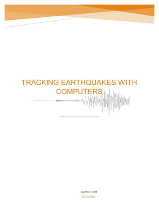
  • 1. California Gulf Earthquake as recorded by the Georgia Tech Geophysics Department Ashton Hott CGS1061 TRACKING EARTHQUAKES WITH COMPUTERS
  • 2. Hott 1 One of the most innovative designs of our time involving the computer is the internet. With it, people all over the world have the ability to both access information on a global scale and to more easily communicate with anyone at any time or anywhere as long as internet access is available. Yet as important as the internet has become, there have been several operations that are limited for internet use, such as the study of earthquakes. Although computers are used as replacement for old analog devices used for measuring and tracking earthquakes, the success rate of transferring data for evacuation methods is still underdeveloped. That being said, many seismologists are now turning to the internet as a way to help track down earthquakes so as to formulate a better alert system and it is all thanks to the most common use of the World Wide Web and internet that we use today, or social media. Why Social Media? When it comes to earthquakes, which are unpredictable and can be devastating, there is still much that is unknown about when one will occur; where the range of an earthquake ends in a specific area; and for how long they happen for. This is why many seismologist and their organizations have relied upon sensor to capture and store data in areas where earthquakes are more prominent; to get an idea of what can be expected from different magnitudes. The issue is that most sensors can “take [about] twenty minutes…to relay information back to [geological organizations like the] USGS” (Koebler). This could mean that many people are either suffering or dying during an earthquake of extensive magnitude before ever receiving word that one is forming in the area, let alone help for evacuation and medical purposes.
  • 3. Hott 2 So how can social media help? Back in 2008, a “7.9 [magnitude] earthquake in Wenchuan, China” was reported by one individual who was tweeting to his followers the details of the natural disaster an hour before any information of the earthquake was shared over television news broadcasting (Koebler). Due to the results of one man’s quick thinking, the USGS in particular began promoting an experimental project that would allow for the advancement of earthquake alerts by encouraging people to report shakes and tremors on their social media pages. This project was the USGS’ way of discovering if an algorithm could be made from the reaction times of people with social media access if the response time far outweighed that of their sensors, which they were excited when the results came back with information on how social media notifications were capable of warning others within twenty seconds of the start of an earthquake in comparison to the two to twenty minutes it takes for the USGS to transmit similar information (Koebler). Since then, the USGS and several professors across the United States have developed more projects that include the use of social media along with the use of newly modified sensors that are able to link up to computers and other devices to help collect information that produce a condensed network that should be able to warn all citizens within that region moments before an earthquake is about to strike the surface (Bergeron).
  • 4. Hott 3 Digital Equipment used for Earthquakes The information listed below represents several devices1 used by the United States Geological Survey organization for the tracking of earthquakes and how that data is stored:  Central Site Data Acquisition System o A tower with hardware that receives and stores data from remote devices and sensors that relay earthquake information. This tower is also hooked up to a terminal for administrators to run maintenance checks and to update the tower system with more recent modifications (Monitoring, 9).  FBA (Force Balance Accelerometer) 23 o Measures the acceleration of the ground and operates with a feedback system (Monitoring, 9).  STS-1 o An electronic seismometer that can accurately record earthquakes, either large or small and localized or distant.  Can also record Earth tides and sonic booms from space shuttles (Monitoring, 9). 1 Each of these devices are linked solely to a local network from the Central Site Data Acquisition. To receive more information regarding these devices, visit http://earthquake.usgs.gov.
  • 5. Hott 4 New Sensors Compared to Digital Earthquake Devices When it comes to the digital sensors and computers used to track earthquakes, the problem is that their information cannot travel fast enough to warn against an oncoming quake, making this equipment more ideal for surveying methods than for alert systems. The new sensors2 far outweigh previous equipment as they can provide faster streams of condensed data that can be managed and then transmitted back out through the “Quake Catcher” mobile phone app or computer program to warn against a potential earthquake in a specific area before the earthquake occurs (Bergeron). This is why social media and the internet must play a major role for the new remote computer sensors that are emerging. Without human interaction over the internet, these new sensors are no more accurate than that of the original equipment used for calculating earthquake information. Computers help us to understand more about our world, but without the internet as a means of basic communication, then occurrences like natural disasters can cause more trouble and harm to a society. In the case of earthquakes, it would seem that the best course of studying and surveying of quakes should remain with remote sensors, while alerting programs would be best suited for sensors capable of communicating with smaller devices and through social media coverage. With a faster success rate than that of a sensor buried below the Earth’s surface, these newer sensors will help to play a major role for new technology to come and may even provide information on earthquakes in an area several hours before one occurs. 2 The new sensors are mentioned in this research assignment and can be found in the last paragraph under “Why Social Media?”
  • 6. Hott 5 Works Cited Bergeron, Louis. “‘Citizen Seismologist’ sought to host tiny earthquake sensors on their computers.” Stanford News. Stanford University, 07 Jul 2011. Web. 06 Jun 2015. “Earthquake Monitoring.” USGS: science for a changing world. U.S. Geological Survey, 24 Jul 2012. p.g. 9. Web. 06 Jun 2015. Koebler, Jason. “The USGS is Tracking Earthquakes with Twitter.” Motherboard. Vice Media LLC, 12 Jul 2013. Web. 06 Jun 2015.