
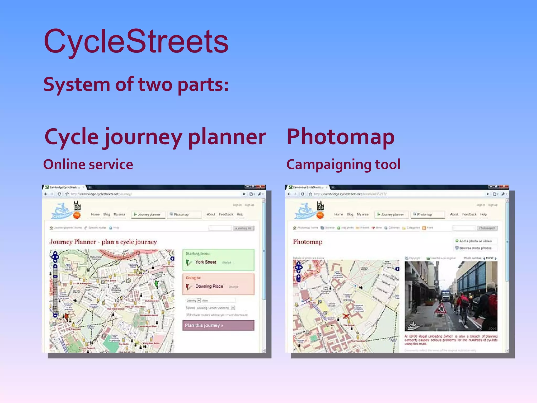
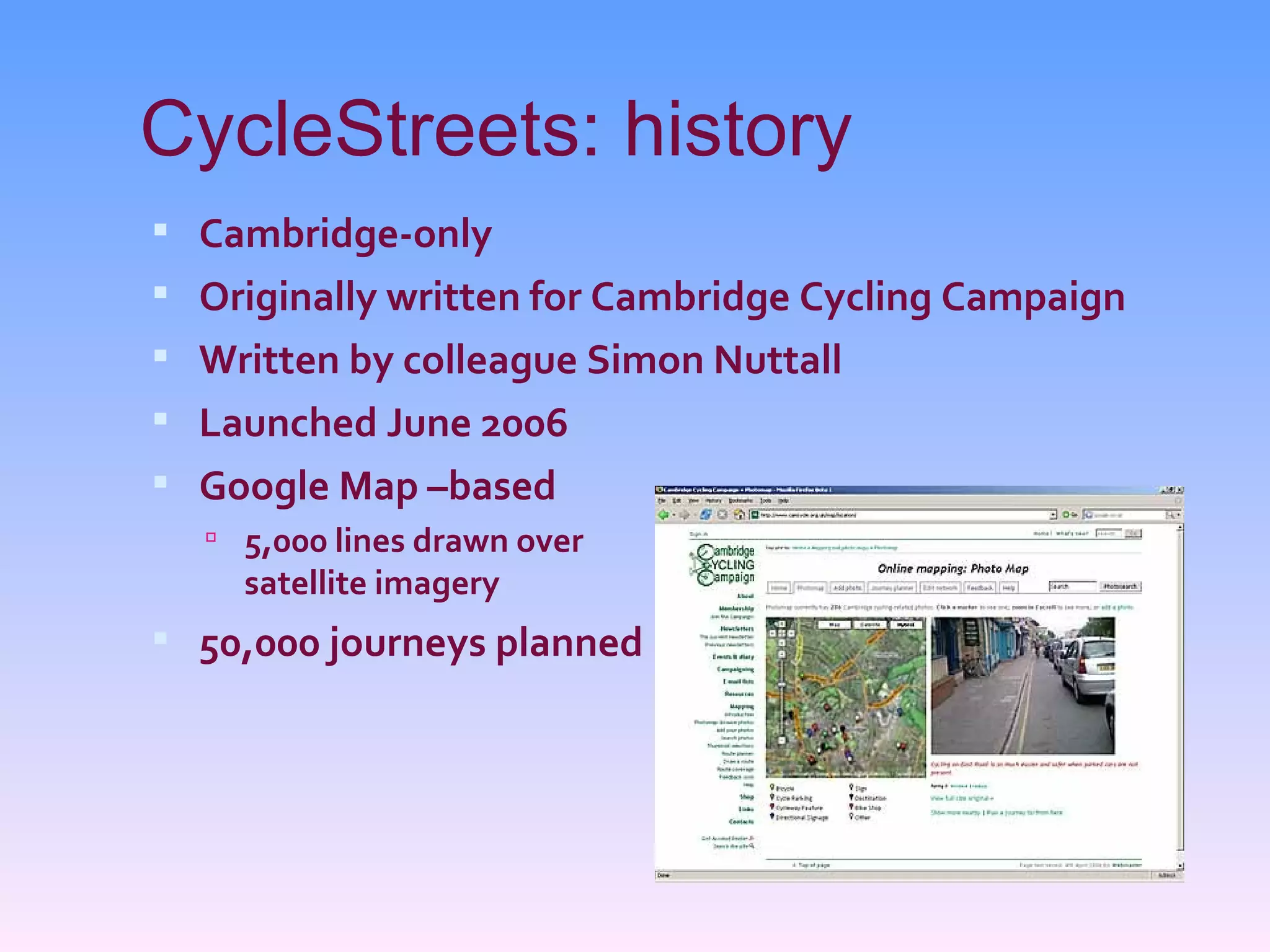
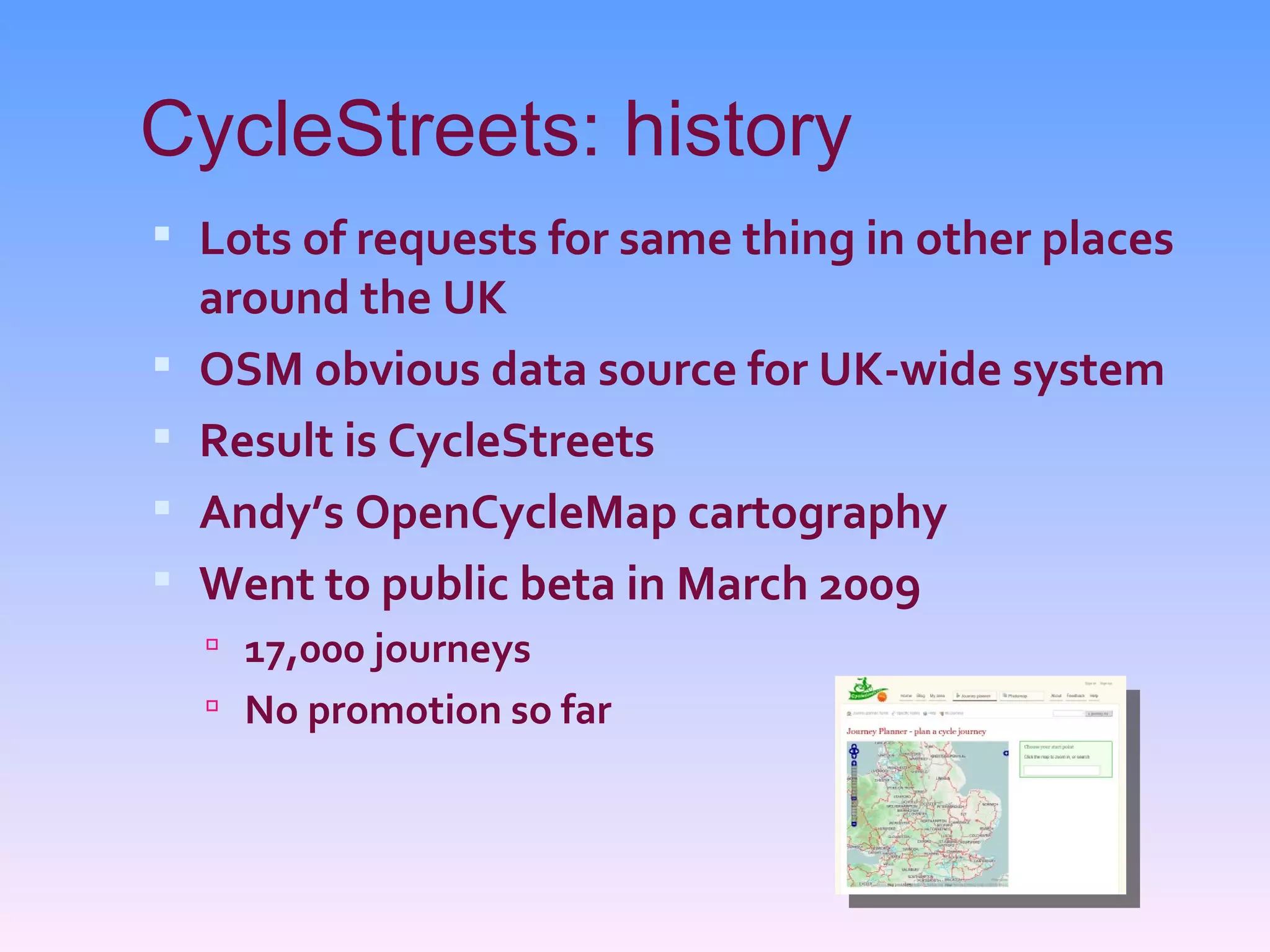

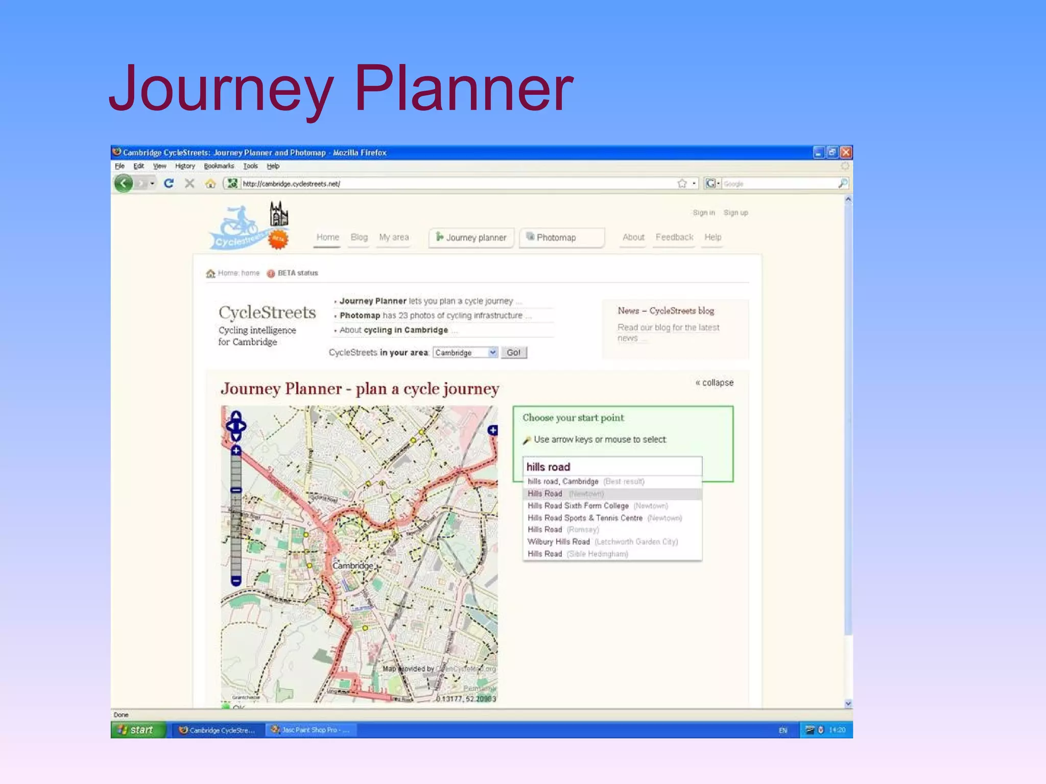
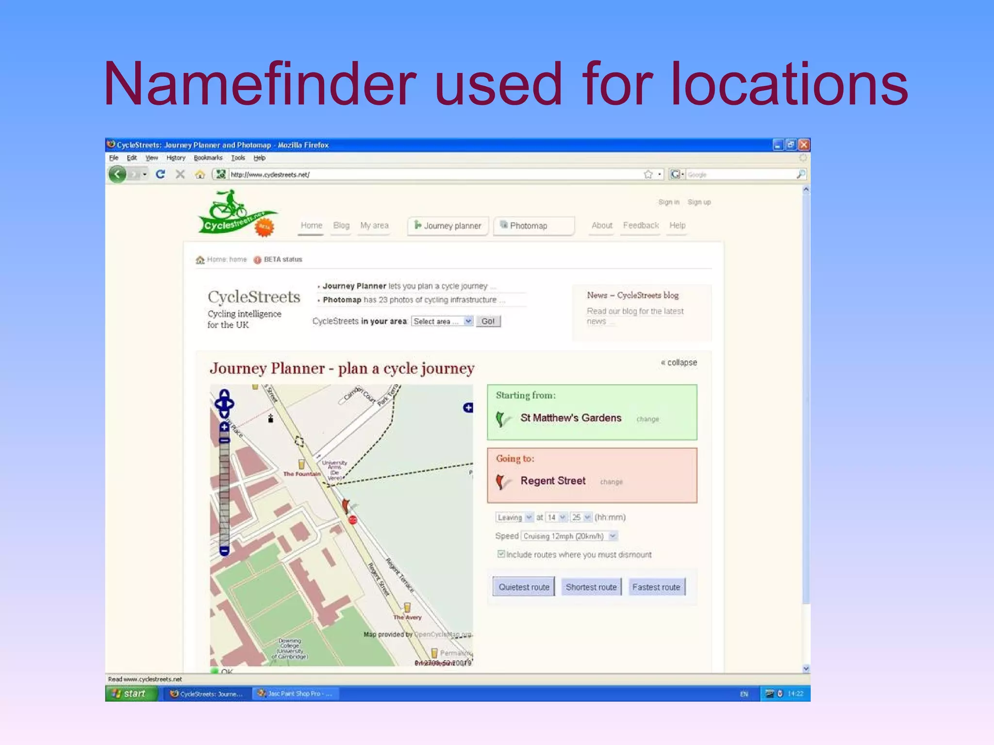
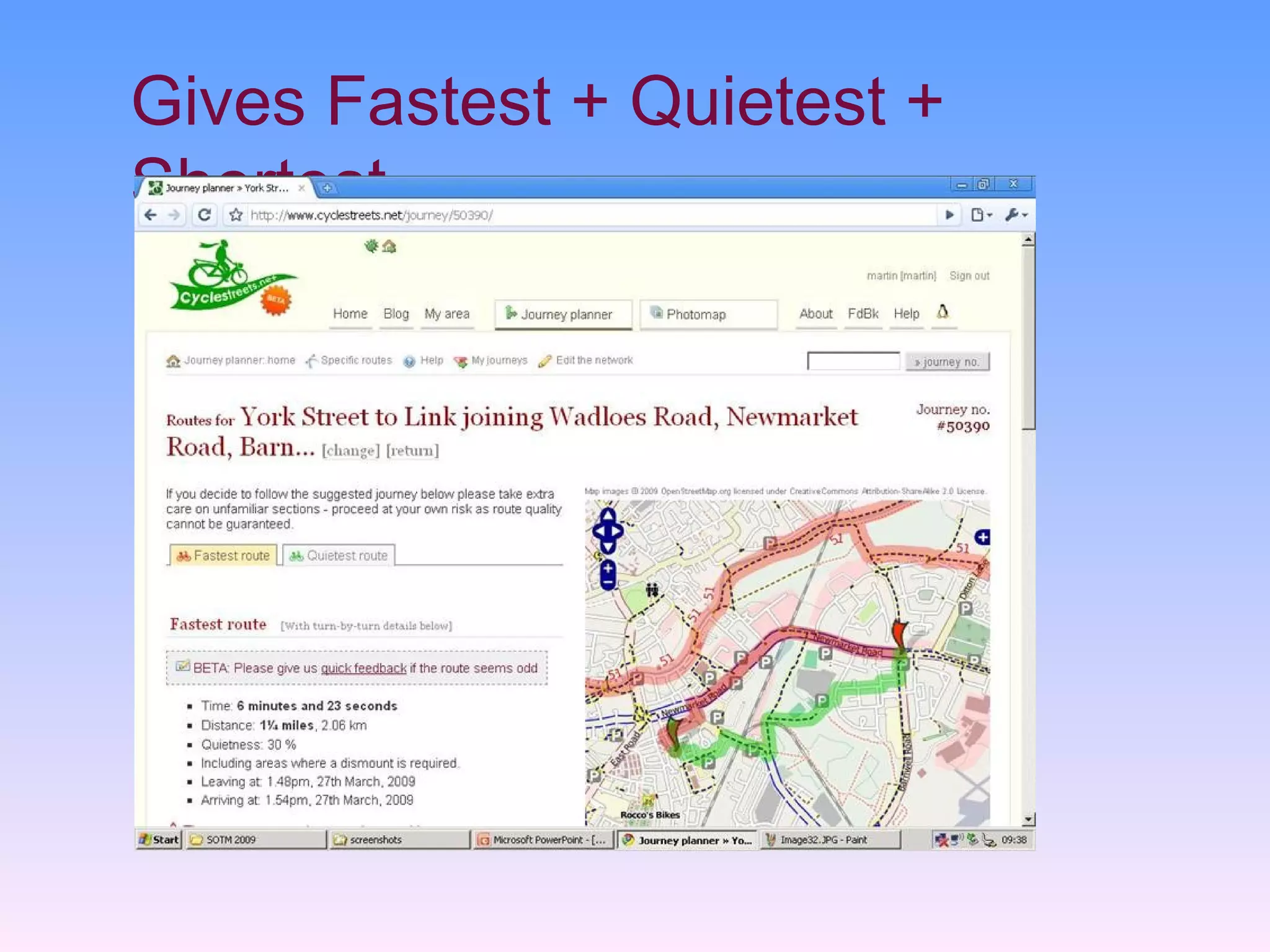
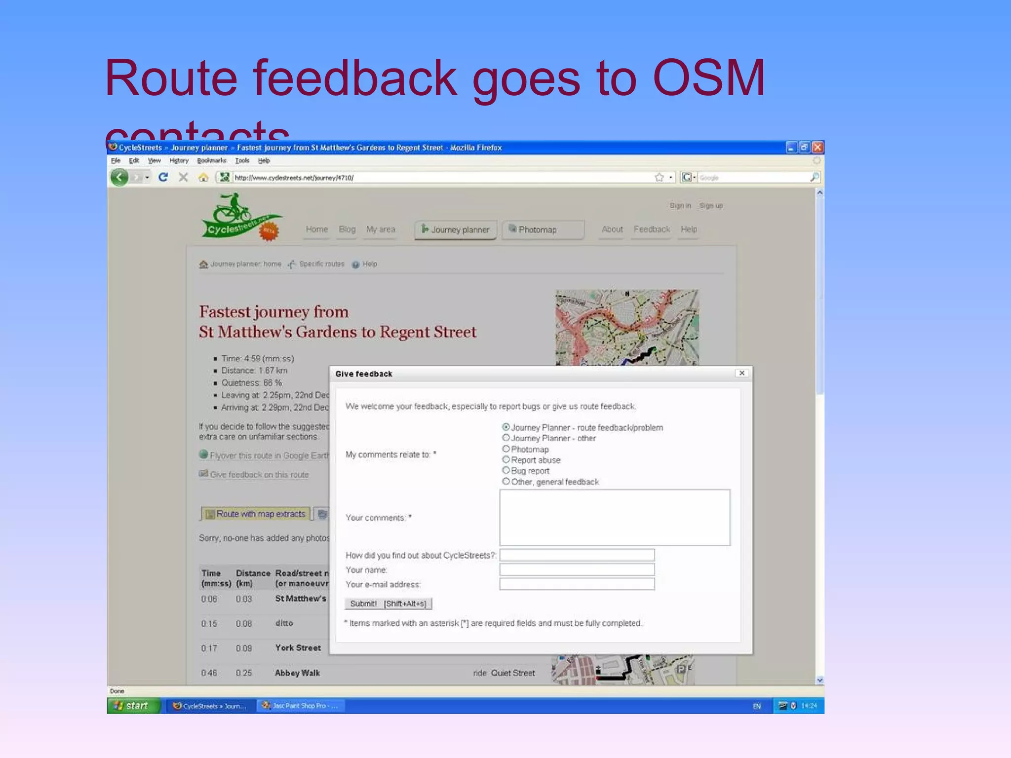
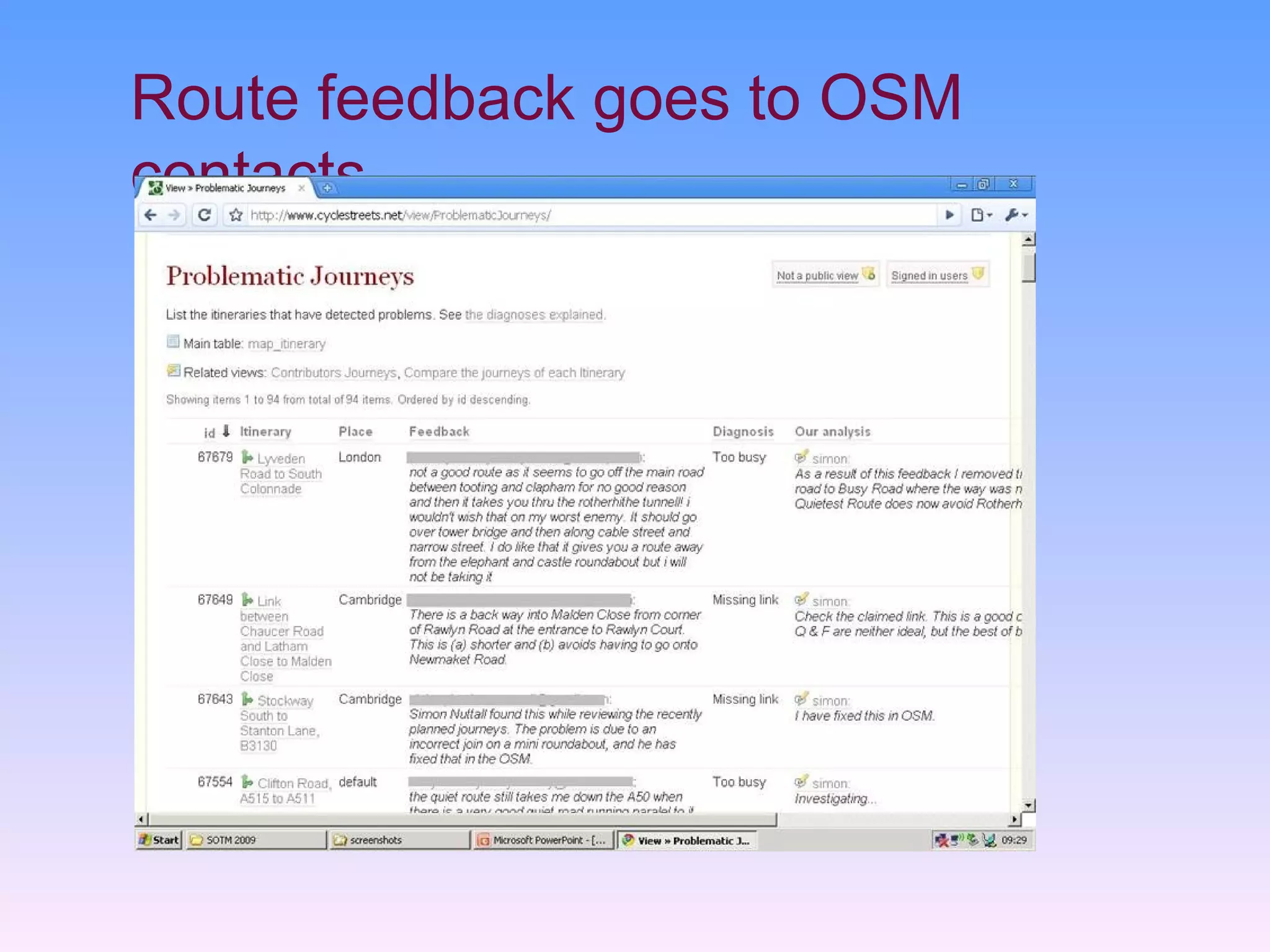


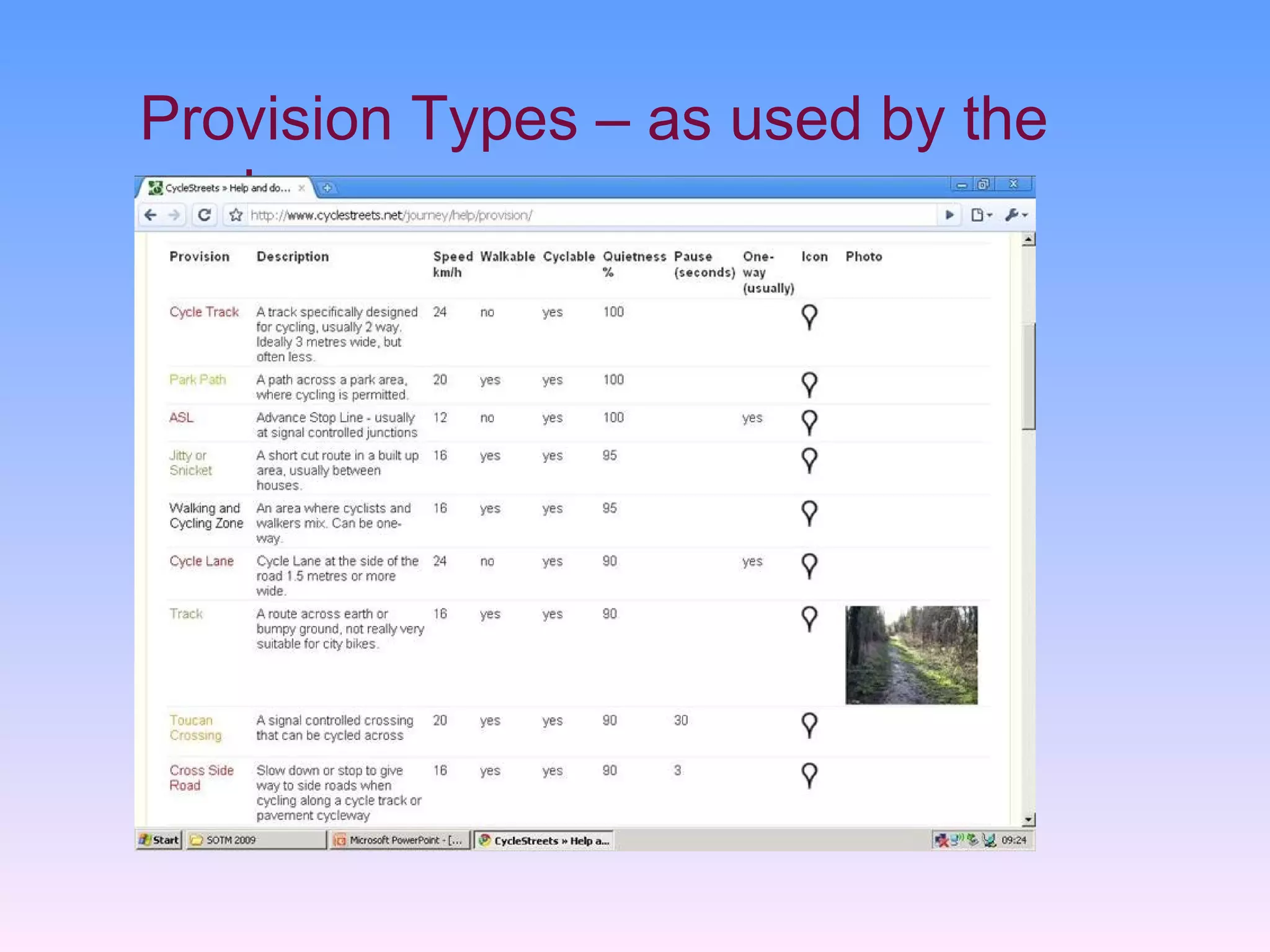

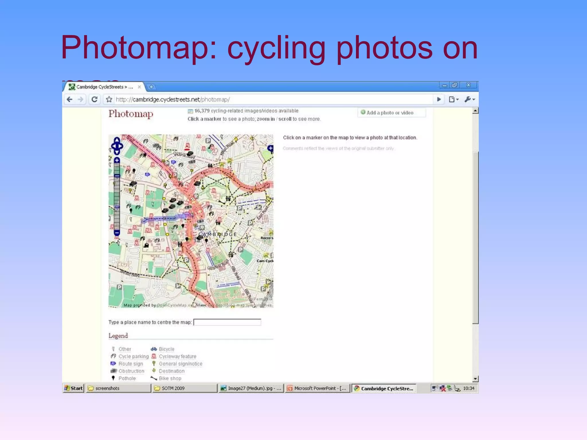
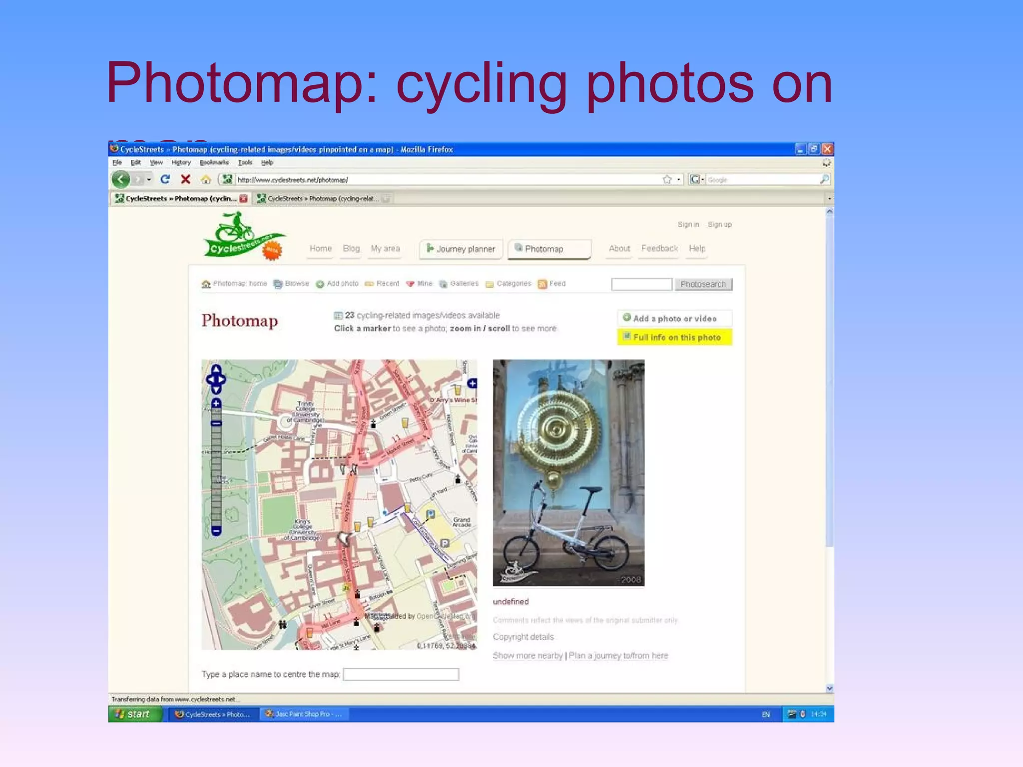

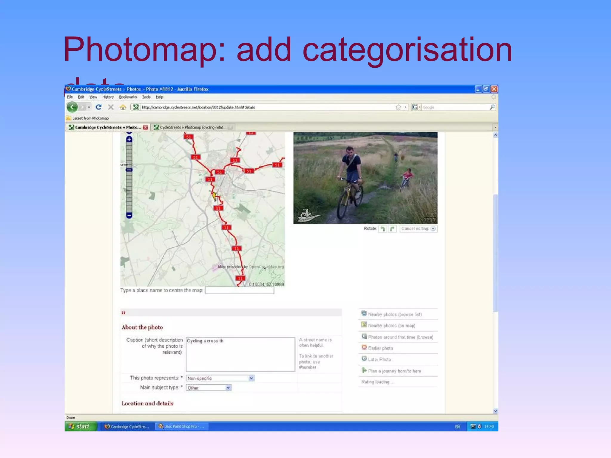
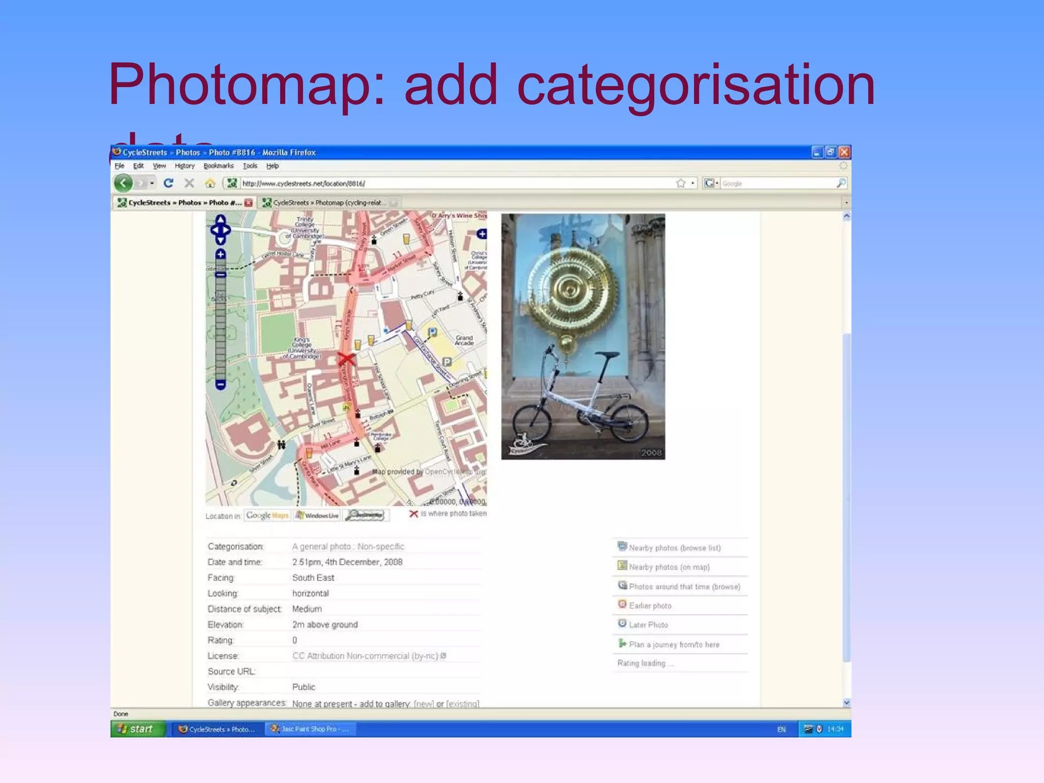
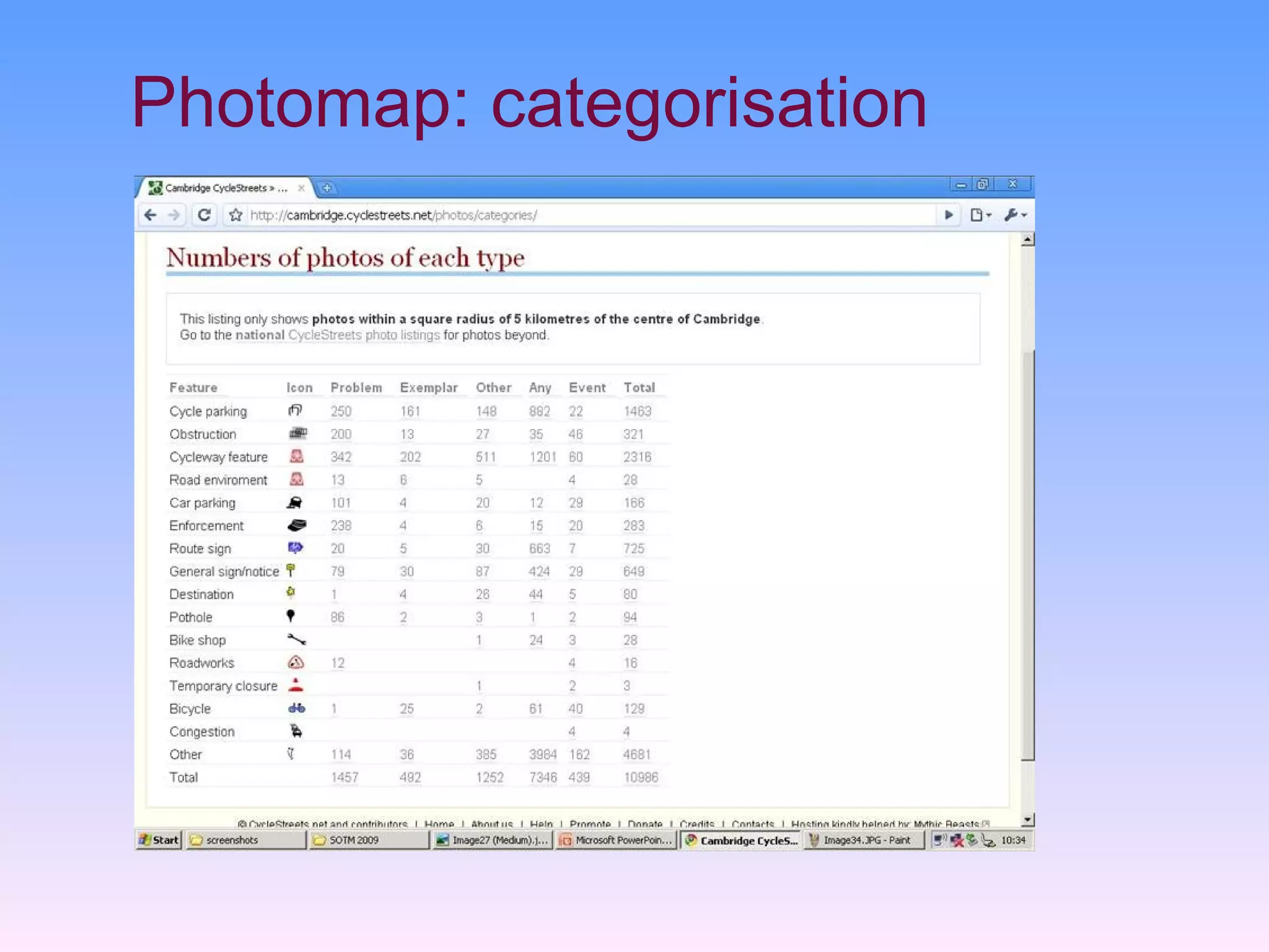


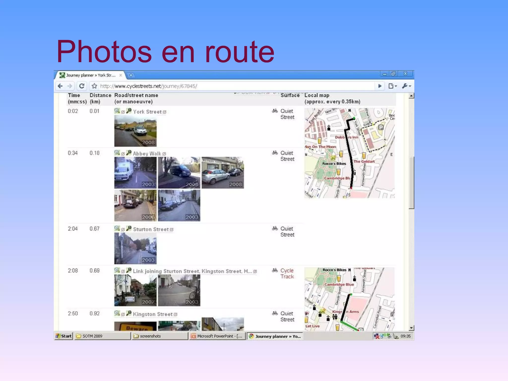


CycleStreets is a bicycle journey planner and photomap that began as a route finder for Cambridge, UK. It has expanded to cover all of the UK using OpenStreetMap data. The system includes an online route planner that provides fastest, quietest, and shortest routes. It also has a photomap where users can upload photos and categorize infrastructure issues to improve cycling conditions. CycleStreets aims to continue expanding features like showing elevation contours and integrating local authorities to address infrastructure problems identified through photos.