High-Accuracy GPS for GIS: From 1ft to 4in.

It’s now possible to obtain decimeter (10cm/4in) horizontal and vertical accuracy using a mapping-grade receiver! This presentation will cover the techniques and equipment necessary to achieve this level of accuracy. Such accuracy can be obtained in the field or back in the office after data collection. Decimeter-level accuracy addresses the area in between the survey-grade and the traditional “submeter” where GIS accuracy is typically defined. It is now possible to map locations and navigate to underground facilities, critical infrastructure, and utility features when decimeter accuracy is appropriate. Learn about the progress of Wisconsin DOT’s network of reference stations which will bring high-accuracy possibilities as well as high-productivity GNSS to all of the state once completed. The status of the network construction will also be addressed.

Recommended
More Related Content
Similar to High-Accuracy GPS for GIS: From 1ft to 4in.
Similar to High-Accuracy GPS for GIS: From 1ft to 4in. (20)
More from Wisconsin Land Information Association
More from Wisconsin Land Information Association (20)
Recently uploaded
Recently uploaded (20)
High-Accuracy GPS for GIS: From 1ft to 4in.
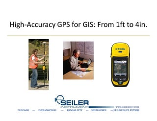
- 1. High-Accuracy GPS for GIS: From 1ft to 4in. WWW.SEILERINST.COM CHICAGO --- INDIANAPOLIS --- KANSAS CITY --- MILWAUKEE --- ST. LOUIS/ST. PETERS
- 2. GPS Resources • GPS Information: – Seiler Mapping Support http://solutions.seilerinst.com/ – Seiler Mapping Support Blog http://seilermapsupport.wordpress.com/ – Trimble Knowledge Network “TKN” www.trimble.com/tkn – National Geodetic Survey (NGS): www.ngs.noaa.gov – Wisconsin DOT WISCORS GNSS Reference Network http://wiscors.dot.wi.gov
- 3. Why High-Accuracy? • Utilities – Collecting assets/features accurately: • collecting existing features or • ‘as-built’ surveys – Relocating assets/features • Local & city government – Urban asset databases – Road centerlines • Construction – Preliminary site surveys – As-built surveys for collecting asset information – Environmental impact reports
- 4. Why Mapping-Grade? • If your applications only require 4in-12in, these systems are built for that level of accuracy. • Cost of the high-accuracy mapping systems are typically about half to a third of the cost of a survey-grade unit. • Mapping/GIS products are designed to work well with attribute-intensive GIS data collection projects. • They integrate seamlessly with ESRI software such as ArcGIS or other software to maximize focus on data and workflows.
- 5. Accuracy Levels • 12 inches – GeoXH’05 – GeoXH’08 or ProXH • 8 inches – GeoXH’05 /Pro XH with Zephyr/Tornado Antenna • 4 inches – ProXRT / GeoXH’08 with Zephyr/Tornado Antenna (close to base station) – GeoXH 6000 Handheld
- 6. GeoXH (6000) Handheld • 4 inch Horizontal accuracy after post- processing (depends on distance to base station). • 4 inch Horizontal Live in the field with VRS/RTN • 4 inch Vertical Accuracy, but first to degrade • Typically requires about 30 seconds at each point for post processing • 10 to 15 positions per feature for VRS • 3-foot Horizontal accuracy in the field with SBAS/WAAS • Integrated unit can be carried in your hand. No need for cables or a pole/backpack.
- 7. ProXH • 8 to 12 inch accuracy after post- processing • Typically requires about 30 seconds at each point • 3-foot accuracy in the field with WAAS • Use with a mobile data collector, tablet, or laptop. • Communication via Bluetooth or serial cable.
- 8. ProXH with Zephyr/Tornado • 6-12 inch accuracy after post-processing • Typically requires about 30 seconds at each point • 3-foot accuracy in the field with WAAS • Use with a mobile data collector, tablet, or laptop
- 9. ProXRT • More consistent Horizontal and Vertical accuracy because it is on a pole an external antenna. • 4 to 12 inch Horizontal accuracy after post-processing (depends on distance to base station). • 4 to 12 inch Horizontal Live in the field with VRS/RTN • 4 inch vertical accuracy, but first to degrade • Typically requires about 30 seconds plus at each point for post processing • 10 to 15 positions per feature for VRS • 3-foot Horizontal accuracy in the field with SBAS/WAAS • Omni-Star/GLONASS capable
- 11. Real-time vs. Post-processed • Post-processed differential correction is when field-collected data is corrected in the office. • It requires a base station that logs data to publicly accessible storage. • Precision results are pretty standard with respect to distance. • Real-time correction is a correction source that streams correction data to the user in real-time. • Conventional sources of this data are WAAS (SBAS), Omnistar, Beacon, and regional reference networks. • Precision results are highly variable.
- 12. Post-Processing • Pathfinder Office or GPS Analyst for ArcGIS • Results: 10 cm + 1 ppm with modern equipment
- 13. Post processed Differential • Corrections applied in Pathfinder Office software or GPS Analyst software
- 14. H-Star Processing • Corrections applied in GPS Pathfinder Office software or GPS Analyst • Multiple CORS used • Carrier phase float solution generated • One base station within 50 miles or three within 120 miles.
- 15. Why use VRS for GIS? • Do not need post-processing software • Increased accuracy – Better than SBAS/WAAS and or Beacon (these are at best 1 meter horizontal) – Doesn’t degrade with distance from the base as with post processing – You know live in the field your Horizontal and Vertical accuracy • Integrity monitoring – QA/QC increasingly important for contractors
- 16. Real-Time for GIS • 2 options for Real-Time Decimeter (4in) data collection: – Using real-time H-Star technology Geo XH or ProXRT (VRS) – OmniSTAR HP (ProXRT only) • Real-time data collection – Allows for in field verification...knowing that a feature has been captured to the desired accuracy level streamlines workflow and reduces the risk of recollecting data – For relocating assets accurately and efficiently
- 17. WISCORS Network funded by the NGS & DOT as part of the WI Height Modernization Project Currently in WISCORS To be added in 2012 Not yet constructed Other agency owned
- 18. Additional VRS/RTN’s Public Networks • Minnesota DOT • Michigan DOT • Iowa DOT • Indiana DOT • Many other states Private Networks • Trimble VRS Now, Karanet – Illinois
- 19. VRS Data Flow Reference station data streams back to server through LAN, Internet, or radio links
- 20. VRS Data Flow Roving receiver sends an NMEA string back to server using VRS cellular modem. Virtual Reference Station position is established. NMEA—GGA
- 21. VRS Data Flow Server uses VRS position to create corrected observables and VRS broadcasts them to the rover
- 23. Cellular VRS Connection • Must have cellular service in your work area – Verizon, AT&T, Sprint, T-Mobile – Data Plan is needed (differs from a voice plan) • A simple cell phone with a data plan is best – avoid Blackberries and I-Phones • Make sure “tethering” is enabled • Carry spare batteries or bring an external battery • A bluetooth cell phone is better • MiFi – Verizon, AT&T or Sprint
- 24. Datums NAD83 • Choosing the wrong datum (CORS96) can greatly shift your data! • NAD27 to NAD83 could mean an inconsistent 50 feet or more Horizontal. • “NAD83” has different versions I’m in – NAD83 (86) “NAD83” – NAD83 (91) – NAD83 (97) – NAD83 (CORS 96) – IGS09
- 25. Datum Shift • Know your correction source. • WAAS and Beacon are different! • Confirm your base station if post-processing. • Find one base station that works and stick with it for post processing • Do a test point on a certified known location/control point before starting a project.
- 26. Anything else? • Proper GPS Form • Canopy Conditions • Software Updates • Mounting Options
- 27. Questions? Travis LeMoine http://solutions.seilerinst.com http://seilermapsupport.wordpress.com/ WWW.SEILERINST.COM CHICAGO --- INDIANAPOLIS --- KANSAS CITY --- MILWAUKEE --- ST. LOUIS/ST. PETERS