TITLE PAGE
SMART INDIAHACKATHON 2026
• Problem Statement ID – S32
• Problem Statement Title-
• Theme-
• PS Category- Software
• Team ID-
• Team Name (Registered on portal)
2.
IDEA TITLE
2
@SIH Ideasubmission- Template
Your
Team
Name
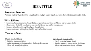
Proposed Solution
A simple, trustworthy system that brings together multiple hazard signals and turns them into clear, actionable alerts.
What It Does
• Fuses weather, river, seismic, fire, and citizen reports into real-time, confidence-scored hazard alerts
• Shows every alert with a confidence score and evidence sources for transparency
• Reduces false alarms through intelligent deduplication
• Improves accuracy with rolling reliability scoring for citizen reports
Two Interfaces
Mobile App for Citizens
• Location-aware push alerts
• Actionable guidance for evacuation, shelter, and resources
• Clear, role-based instructions
Web Console for Authorities
• Verify incoming hazard signals
• Deploy resources from a central dashboard
• Clear, role-based operational guidance
3.
TECHNICALAPPROACH
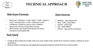
Risk Score Formula
•Risk Score = (Weather × 0.30) + (River × 0.30) + (Citizen ×
0.20) + (Infrastructure × 0.10) + (Historical × 0.10)
• Confidence is based on source count, reliability,
agreement, recency, and location accuracy
• Deterministic rule-based fusion keeps the system
transparent and explainable
3
@SIH Idea submission- Template
Your
Team
Name
Data Sources
• Weather - Open-Meteo API
• River - CWC / India-WRIS
• Seismic - USGS Feed
• Fire - NASA FIRMS
• Citizens - app reports and photos
Tech Stack
• Frontend: React Native for mobile, Next.js for web, Leaflet maps, Socket.IO for real-time updates, Firebase for push
notifications
• Backend: Node.js and Express, MongoDB with geospatial indexing, Socket.IO for live communication
4.
FEASIBILITY AND VIABILITY
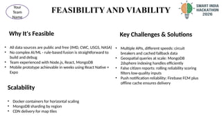
WhyIt's Feasible
• All data sources are public and free (IMD, CWC, USGS, NASA)
• No complex AI/ML - rule-based fusion is straightforward to
build and debug
• Team experienced with Node.js, React, MongoDB
• Mobile prototype achievable in weeks using React Native +
Expo
4
@SIH Idea submission- Template
Your
Team
Name
Key Challenges & Solutions
• Multiple APIs, different speeds: circuit
breakers and cached fallback data
• Geospatial queries at scale: MongoDB
2dsphere indexing handles efficiently
• False citizen reports: rolling reliability scoring
filters low-quality inputs
• Push notification reliability: Firebase FCM plus
offline cache ensures delivery
Scalability
• Docker containers for horizontal scaling
• MongoDB sharding by region
• CDN delivery for map tiles
5.
IMPACT AND BENEFITS
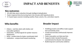
Keyoutcomes
• 40–60% false alarm reduction through intelligent deduplication
• Faster response times by turning hours into minutes with hyperlocal alerts
• 5+ hazard types covered, including weather, flood, seismic, fire, and citizen reports
5
@SIH Idea submission- Template
Your
Team
Name
Who benefits
• Citizens - real-time alerts with shelter and
evacuation guidance
• Authorities - verified signals for quicker resource
deployment
• NGOs - incident data for better coordinated relief
• Institutions - campus-level hazard monitoring
Broader impact
• Multilingual alerts and offline mode support
low-connectivity areas
• Crowd-sourced data continuously improves
accuracy
• Faster evacuation can help save lives
• Supports India's Sendai Framework
commitments for disaster risk reduction
• Builds long-term community resilience
6.
RESEARCH AND REFERENCES
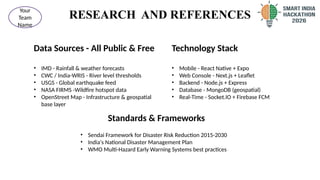
DataSources - All Public & Free
• IMD - Rainfall & weather forecasts
• CWC / India-WRIS - River level thresholds
• USGS - Global earthquake feed
• NASA FIRMS -Wildfire hotspot data
• OpenStreet Map - Infrastructure & geospatial
base layer
6
@SIH Idea submission- Template
Your
Team
Name
Technology Stack
• Mobile - React Native + Expo
• Web Console - Next.js + Leaflet
• Backend - Node.js + Express
• Database - MongoDB (geospatial)
• Real-Time - Socket.IO + Firebase FCM
Standards & Frameworks
• Sendai Framework for Disaster Risk Reduction 2015-2030
• India's National Disaster Management Plan
• WMO Multi-Hazard Early Warning Systems best practices
7.
RESEARCH AND REFERENCES
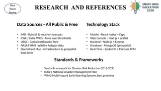
DataSources - All Public & Free
• IMD - Rainfall & weather forecasts
• CWC / India-WRIS - River level thresholds
• USGS - Global earthquake feed
• NASA FIRMS -Wildfire hotspot data
• OpenStreet Map - Infrastructure & geospatial
base layer
7
@SIH Idea submission- Template
Your
Team
Name
Technology Stack
• Mobile - React Native + Expo
• Web Console - Next.js + Leaflet
• Backend - Node.js + Express
• Database - MongoDB (geospatial)
• Real-Time - Socket.IO + Firebase FCM
Standards & Frameworks
• Sendai Framework for Disaster Risk Reduction 2015-2030
• India's National Disaster Management Plan
• WMO Multi-Hazard Early Warning Systems best practices