Understanding Coordinate Structure
Studentswill learn the layout and components of the Cartesian coordinate
system.
Identifying Quadrants
Students will identify and label the four quadrants of the coordinate plane.
Plotting Points
Students will practice plotting points using ordered pairs on the plane.
Real-Life Applications
Applying coordinate concepts to real-life tasks like mapping, navigation,
and data visualization.
Objectives of the Lesson
4.
Axes and Origin
Thecoordinate plane has two perpendicular axes,
x-axis horizontal and y-axis vertical, intersecting
at the origin (0,0).
Four Quadrants
The plane is divided into four quadrants, each
with distinct positive or negative values for x and
y coordinates.
Ordered Pairs
Points on the plane are represented by ordered
pairs (x, y), indicating horizontal and vertical
positions respectively.
Basic Structure of
the Coordinate
Plane
Quadrant I Characteristics
QuadrantI contains points with both positive x and y
coordinates, located in the upper right of the plane.
Quadrant II Characteristics
Quadrant II includes points with negative x and positive y
coordinates, found in the upper left quadrant.
Quadrant III Characteristics
Quadrant III holds points where both x and y are negative,
positioned in the lower left of the coordinate plane.
Quadrant IV Characteristics
Quadrant IV contains points with positive x and negative y
coordinates, located in the lower right quadrant of the plane.
Labeled
Quadrants
7.
Locating Points Horizontally
Identifythe x-value on the x-axis and move horizontally to that
position before plotting the point.
Locating Points Vertically
From the x-value location, move vertically to the y-value on the
y-axis to precisely plot the point.
Points in Different Quadrants
Points can lie in any quadrant or on axes, illustrating spatial
relationships in the plane.
Importance of Accurate Plotting
Accurate plotting helps interpret graphs, solve equations, and
visualize mathematical relationships clearly.
Plotting Points
on the Plane
Quadrant Characteristics
Each quadranthas unique sign characteristics for x
and y coordinates which help identify point locations.
Point Location Exercise
Students match points like (5, 6) and (-7, 2) to their
correct quadrants to reinforce learning.
Enhancing Critical Thinking
This exercise promotes critical thinking by applying
theoretical knowledge to identify point positions
practically.
Identifying
Quadrants
10.
Coordinate Plotting Practice
Studentspractice matching coordinate pairs to
labeled points on a grid to strengthen spatial
understanding.
Understanding Origin
The origin (0,0) serves as a reference point for
plotting other coordinates on the grid.
Developing Precision
This exercise enhances students' precision and
attention to detail in plotting points accurately.
Matching
Coordinates
11.
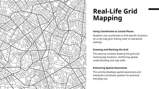
Using Coordinates toLocate Places
Students use coordinates to find specific locations
on a city map grid, linking math to real-world
settings.
Drawing and Marking the Grid
The exercise involves drawing the grid and
marking key locations, reinforcing spatial
understanding and map skills.
Enhancing Spatial Awareness
This activity develops spatial awareness and
interprets coordinate systems for practical
everyday use.
Real-Life Grid
Mapping
#2 Objectives of the Lesson, Basic Structure of the Coordinate Plane
#3
This lesson aims to provide students with a comprehensive understanding of the Cartesian coordinate plane. The objectives include helping students understand the structure of the Cartesian coordinate system, identify and label the four quadrants, plot points using ordered pairs, and apply coordinate concepts to real-life mapping tasks. These goals are designed to build foundational skills in spatial reasoning and analytical thinking, which are essential in mathematics and various real-world applications such as navigation, computer graphics, and data visualization.
#4
The Cartesian coordinate plane consists of two perpendicular lines: the x-axis, which runs horizontally, and the y-axis, which runs vertically. These axes intersect at the origin, denoted as (0, 0). The plane is divided into four quadrants, each representing a unique combination of positive and negative values for x and y. Points on the plane are represented by ordered pairs (x, y), where 'x' indicates the horizontal position and 'y' indicates the vertical position. Understanding this structure is crucial for accurately plotting and interpreting data on the coordinate plane.
#5 Labeled Quadrants, Plotting Points on the Plane
#6
The Cartesian coordinate plane is divided into four quadrants. Quadrant I contains points where both x and y are positive (+x, +y). Quadrant II contains points with negative x and positive y (-x, +y). Quadrant III includes points where both x and y are negative (-x, -y), and Quadrant IV has points with positive x and negative y (+x, -y). Recognizing these quadrants helps in determining the location of points and understanding their relationships within the plane. This knowledge is foundational for graphing equations and analyzing spatial data.
#7
To plot a point on the Cartesian coordinate plane, one must locate the x-value on the x-axis and the y-value on the y-axis. For example, Point A (2, 3) lies in Quadrant I, Point B (-4, 1) in Quadrant II, Point C (0, -2) on the y-axis, and Point D (-3, -5) in Quadrant III. This process involves moving horizontally to the x-value and then vertically to the y-value. Accurate plotting is essential for interpreting graphs, solving equations, and visualizing mathematical relationships. It also enhances students' ability to navigate and analyze spatial information.
#9
This exercise involves matching given points to their correct quadrants. Students are presented with points such as (5, 6), (-7, 2), (-3, -4), and (4, -5), and must determine whether each lies in Quadrant I, II, III, or IV. This activity reinforces understanding of quadrant characteristics and improves students' ability to analyze point locations. It also encourages critical thinking and application of theoretical knowledge in practical scenarios, making the learning experience more engaging and effective.
#10
In this exercise, students match coordinates to specific labeled points on a grid. Examples include (3, -2) as Point A, (-1, 4) as Point B, (-5, -3) as Point C, and (0, 0) as the Origin. This task helps students practice plotting and identifying points, reinforcing their understanding of coordinate pairs and spatial relationships. It also aids in developing precision and attention to detail, which are important skills in mathematics and related disciplines.
#11
This activity involves using a city map grid to locate various places based on their coordinates. For instance, the school is at (2, 5), the library at (-3, 4), the park at (-2, -3), and the grocery store at (4, -1). Students are tasked with drawing the grid and marking each location. This exercise connects mathematical concepts to real-world applications, enhancing relevance and engagement. It also fosters spatial awareness and the ability to interpret and use coordinate systems in everyday contexts.