AI-Powered Civic Issue Reporting and Resolution App for Smart Governance
An AI-driven app enabling citizens to report civic issues via photo, text, or voice with automatic location tagging, issue categorization, and smart routing to authorities for efficient resolution and transparency.
AI-Powered Civic Issue Reporting and Resolution App for Smart Governance
1.
AI-POWERED CIVIC ISSUEREPORTING APP
Problem Statement ID: TBD
Problem Statement Title: AI-Powered Civic Issue Reporting & Resolution
Theme: Smart Governance
PS Category: Software
Team ID: TBD Team Name: TBD
2.
AI-POWERED CIVIC ISSUEREPORTING APP
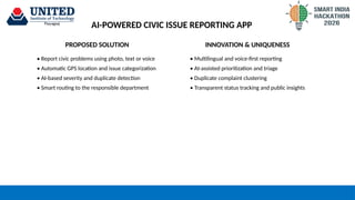
PROPOSED SOLUTION
• Report civic problems using photo, text or voice
• Automatic GPS location and issue categorization
• AI-based severity and duplicate detection
• Smart routing to the responsible department
INNOVATION & UNIQUENESS
• Multilingual and voice-first reporting
• AI-assisted prioritization and triage
• Duplicate complaint clustering
• Transparent status tracking and public insights
3.
TECHNICAL APPROACH
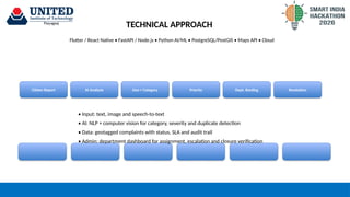
Flutter /React Native • FastAPI / Node.js • Python AI/ML • PostgreSQL/PostGIS • Maps API • Cloud
Citizen Report AI Analysis Geo + Category Priority Dept. Routing Resolution
• Input: text, image and speech-to-text
• AI: NLP + computer vision for category, severity and duplicate detection
• Data: geotagged complaints with status, SLA and audit trail
• Admin: department dashboard for assignment, escalation and closure verification
4.
FEASIBILITY AND VIABILITY
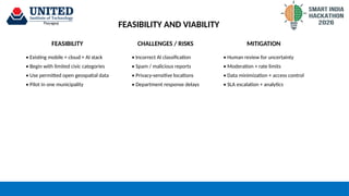
FEASIBILITYCHALLENGES / RISKS MITIGATION
• Existing mobile + cloud + AI stack
• Begin with limited civic categories
• Use permitted open geospatial data
• Pilot in one municipality
• Incorrect AI classification
• Spam / malicious reports
• Privacy-sensitive locations
• Department response delays
• Human review for uncertainty
• Moderation + rate limits
• Data minimization + access control
• SLA escalation + analytics
5.
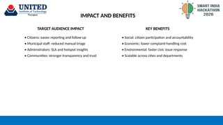
IMPACT AND BENEFITS
TARGETAUDIENCE IMPACT KEY BENEFITS
• Citizens: easier reporting and follow-up
• Municipal staff: reduced manual triage
• Administrators: SLA and hotspot insights
• Communities: stronger transparency and trust
• Social: citizen participation and accountability
• Economic: lower complaint-handling cost
• Environmental: faster civic issue response
• Scalable across cities and departments
6.
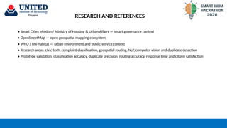
RESEARCH AND REFERENCES
•Smart Cities Mission / Ministry of Housing & Urban Affairs — smart governance context
• OpenStreetMap — open geospatial mapping ecosystem
• WHO / UN-Habitat — urban environment and public-service context
• Research areas: civic-tech, complaint classification, geospatial routing, NLP, computer vision and duplicate detection
• Prototype validation: classification accuracy, duplicate precision, routing accuracy, response time and citizen satisfaction