Adaptive Observation Strategies 
for Advanced Weather Prediction 
Center for Atmospheric Physics 
David P. Bacon, Zafer Boybeyi 
Center for Atmospheric Physics 
Science Applications International Corporation 
Michael Kaplan 
Dept. of Marine, Earth, & Atmos. Sci. 
North Carolina State University 
October 30, 2001 
David P. Bacon 
(703)676-4594 
david.p.bacon@saic.com
Weather Forecasting – A Primer 
Center for Atmospheric Physics 
• Weather forecasting relies on a system of systems: 
– In-situ observations (surface, balloon, & aircraft) 
– Remotely-sensed observations (satellite-based) 
– Data assimilation (creating a physically consistent 3-D dataset) 
– Prognostic models (extrapolation into 4-D)
Center for Atmospheric Physics 
In-situ Observations 
• Irregular spatial distribution 
– Where the people (and planes) are 
• Quasi-regular temporal distribution 
– Surface observations 
» Hourly with special reports 
for significant weather 
– Balloon observations 
» Twice-daily at 0000Z & 1200Z 
– Aircraft observations 
» Regular intervals
Remote Sensing Observation Strategies 
Center for Atmospheric Physics 
• The beginning: 
– TIROS-1 (April 1, 1960) 
» Television and InfraRed Operational Satellite 
– ATS-1 (December 6, 1966) 
» Applications Technology Satellite – Geostationary 
» Communications system test bed 
• Raster based systems 
– Vidicon tubes to CCDs
Center for Atmospheric Physics 
Data Assimilation 
• Goal: A physically consistent 3-D representation 
of the atmosphere at an instant of time 
• Requirements: Rationalize a disparate set of data that is a 
mix of irregular and grid point information at 
synoptic (0000Z & 1200Z) and asynoptic times 
• Modify large-scale effects to reflect small-scale features 
– Capture steep gradients critical to severe weather
Center for Atmospheric Physics 
Prognostic Models 
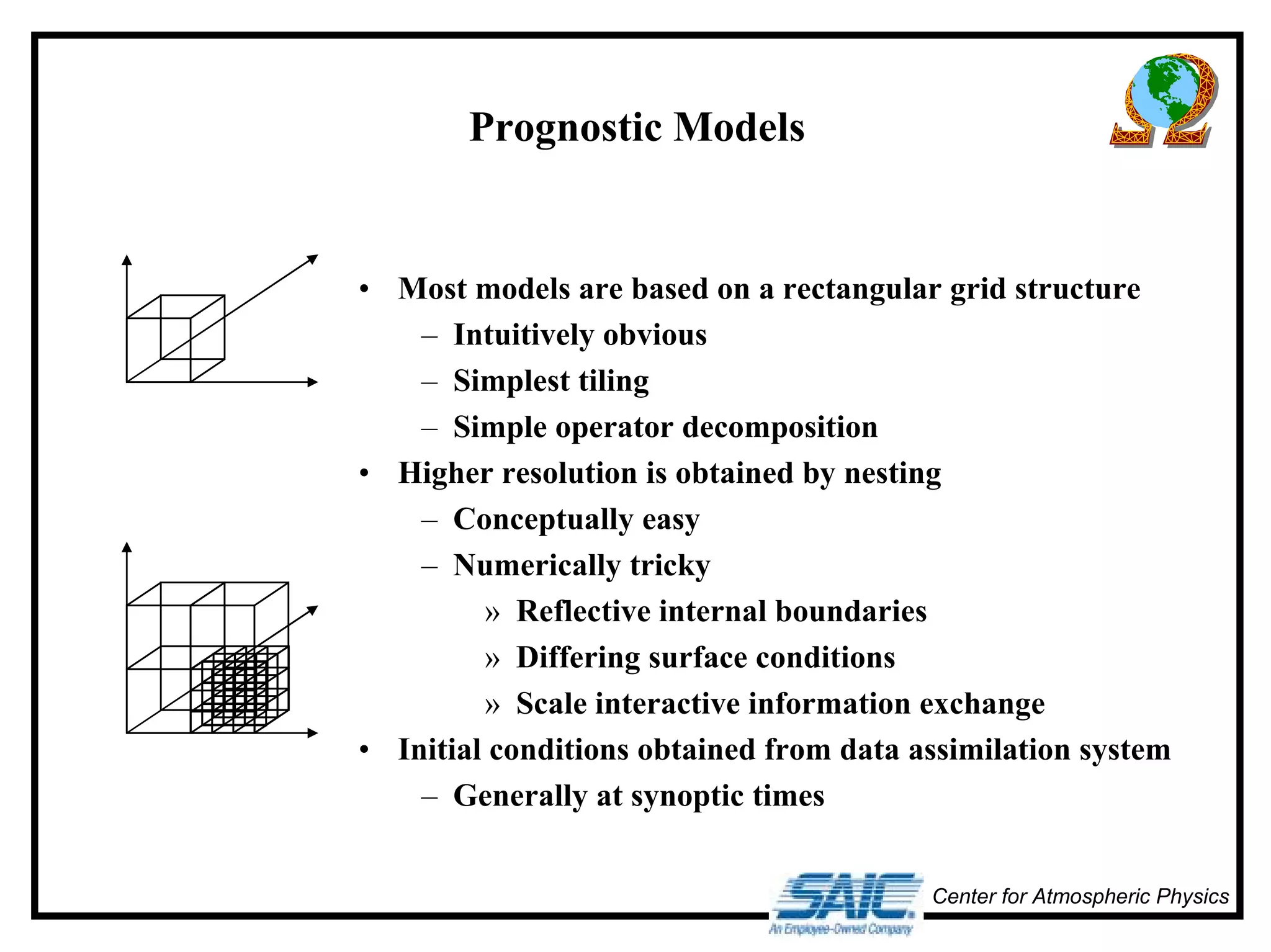
• Most models are based on a rectangular grid structure 
– Intuitively obvious 
– Simplest tiling 
– Simple operator decomposition 
• Higher resolution is obtained by nesting 
– Conceptually easy 
– Numerically tricky 
» Reflective internal boundaries 
» Differing surface conditions 
» Scale interactive information exchange 
• Initial conditions obtained from data assimilation system 
– Generally at synoptic times
Center for Atmospheric Physics 
A Vicious Circle 
• Increased horizontal (α) and vertical (β) resolution in models leads to: 
– Higher resolution initial conditions: α2β 
– Increased run-time: α2β 
– Increased output volume: α2β max(αααα,,,, ββββ) 
• Higher resolution ICs requires higher resolution observations
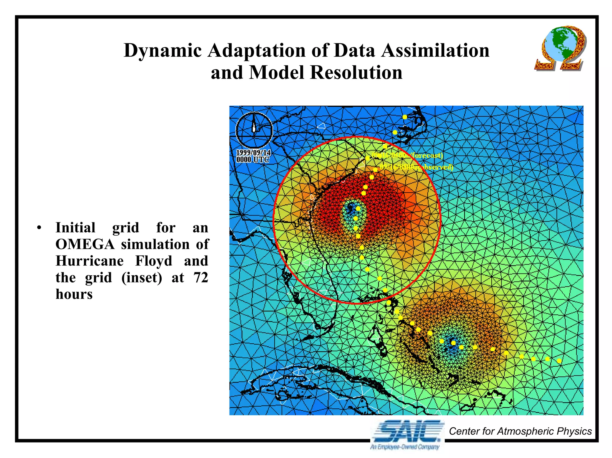
Dynamic Adaptation of Data Assimilation 
Center for Atmospheric Physics 
and Model Resolution 
• Initial grid for an 
OMEGA simulation of 
Hurricane Floyd and 
the grid (inset) at 72 
hours
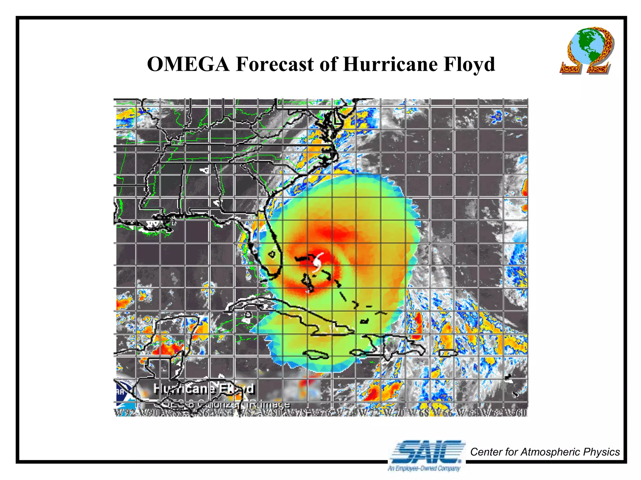
OMEGA Forecast of Hurricane Floyd 
Center for Atmospheric Physics
Center for Atmospheric Physics 
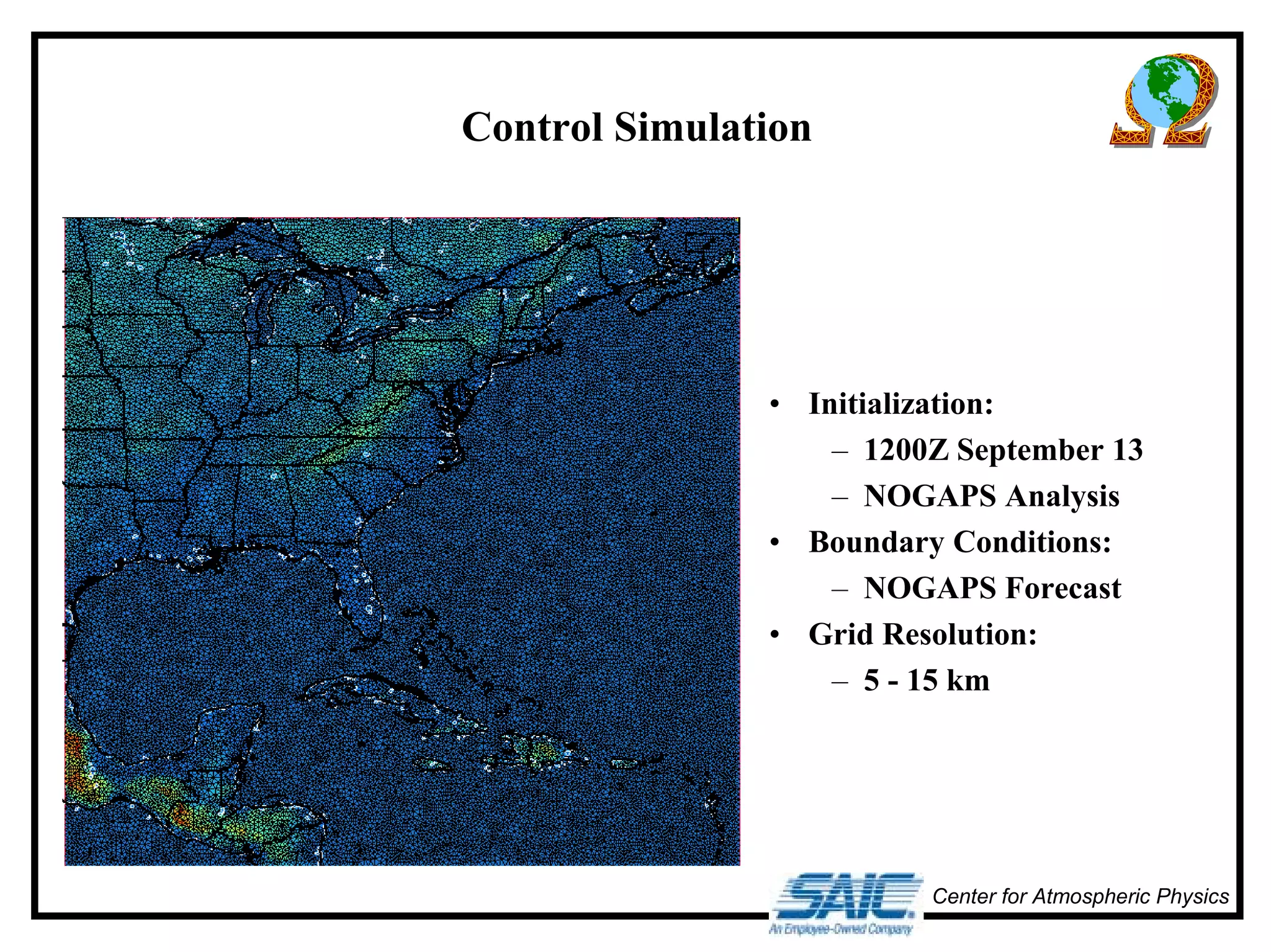
Control Simulation 
• Initialization: 
– 1200Z September 13 
– NOGAPS Analysis 
• Boundary Conditions: 
– NOGAPS Forecast 
• Grid Resolution: 
– 5 - 15 km
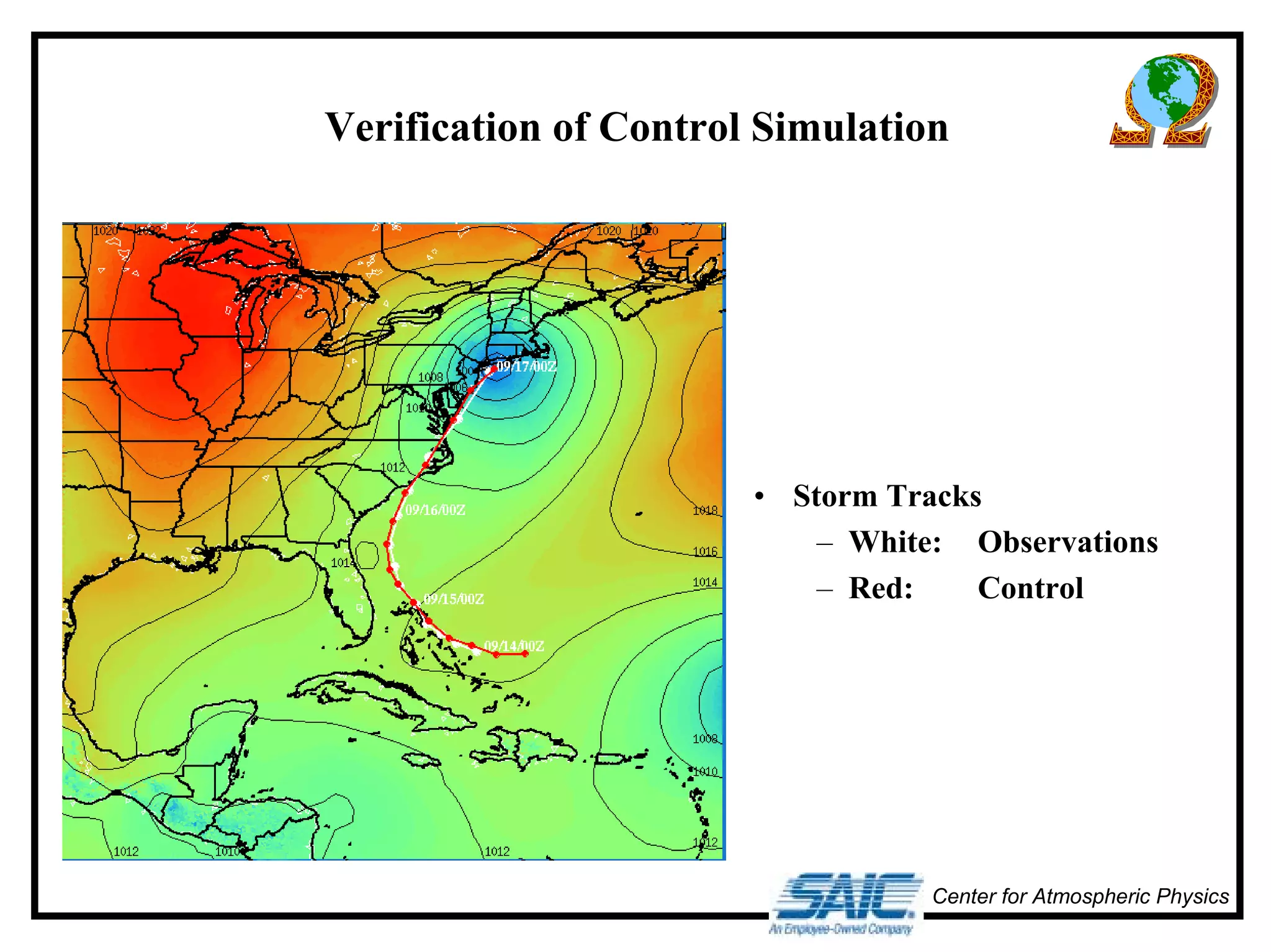
Verification of Control Simulation 
• Storm Tracks 
– White: Observations 
– Red: Control 
Center for Atmospheric Physics
Center for Atmospheric Physics 
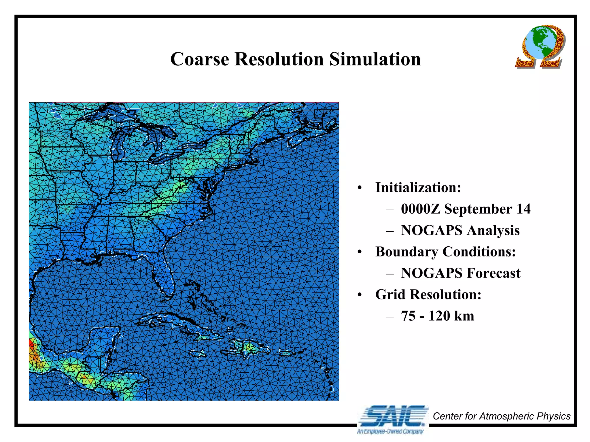
Coarse Resolution Simulation 
• Initialization: 
– 0000Z September 14 
– NOGAPS Analysis 
• Boundary Conditions: 
– NOGAPS Forecast 
• Grid Resolution: 
– 75 - 120 km
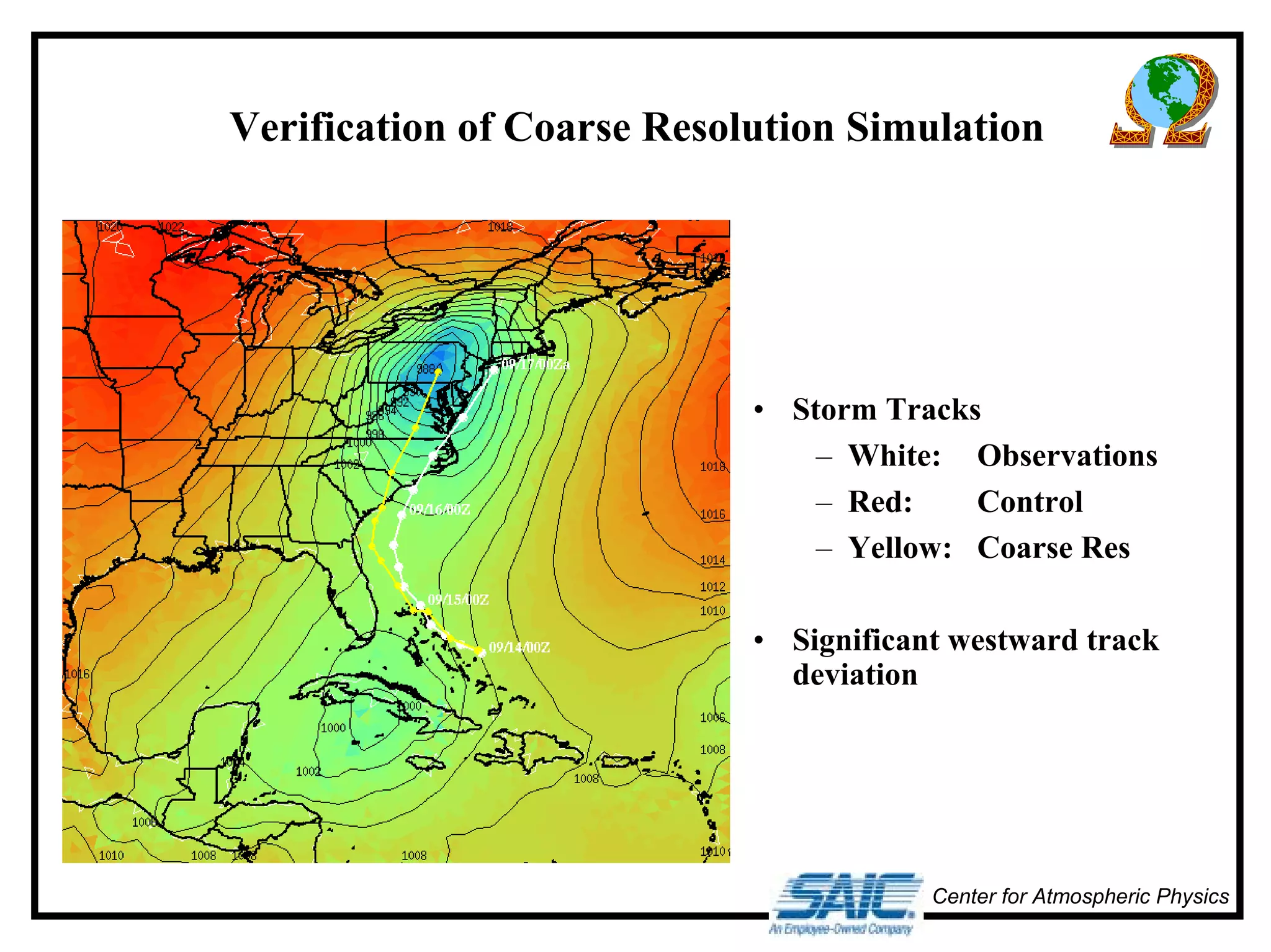
Verification of Coarse Resolution Simulation 
• Storm Tracks 
– White: Observations 
– Red: Control 
– Yellow: Coarse Res 
• Significant westward track 
deviation 
Center for Atmospheric Physics
Center for Atmospheric Physics 
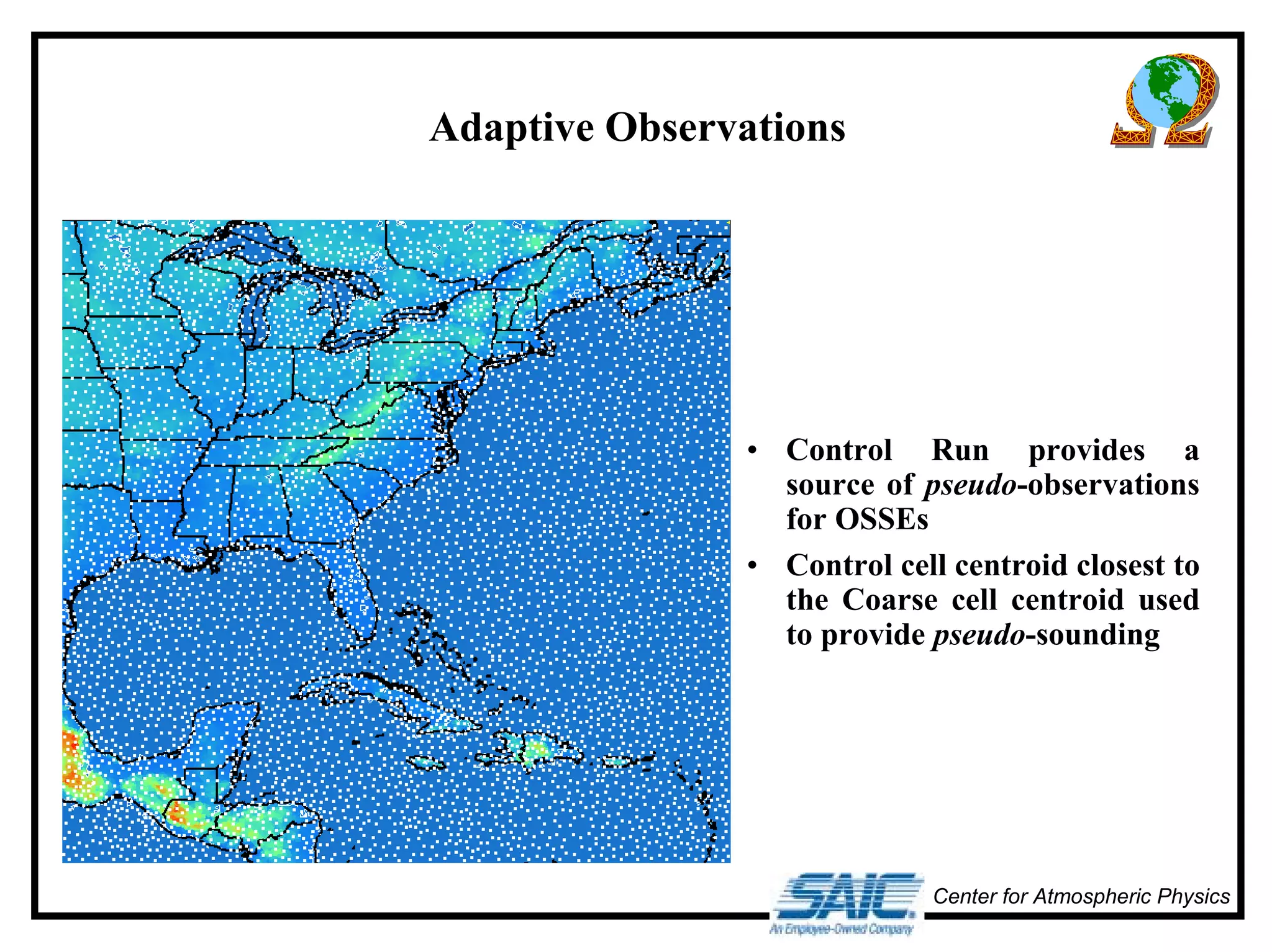
Adaptive Observations 
• Control Run provides a 
source of pseudo-observations 
for OSSEs 
• Control cell centroid closest to 
the Coarse cell centroid used 
to provide pseudo-sounding
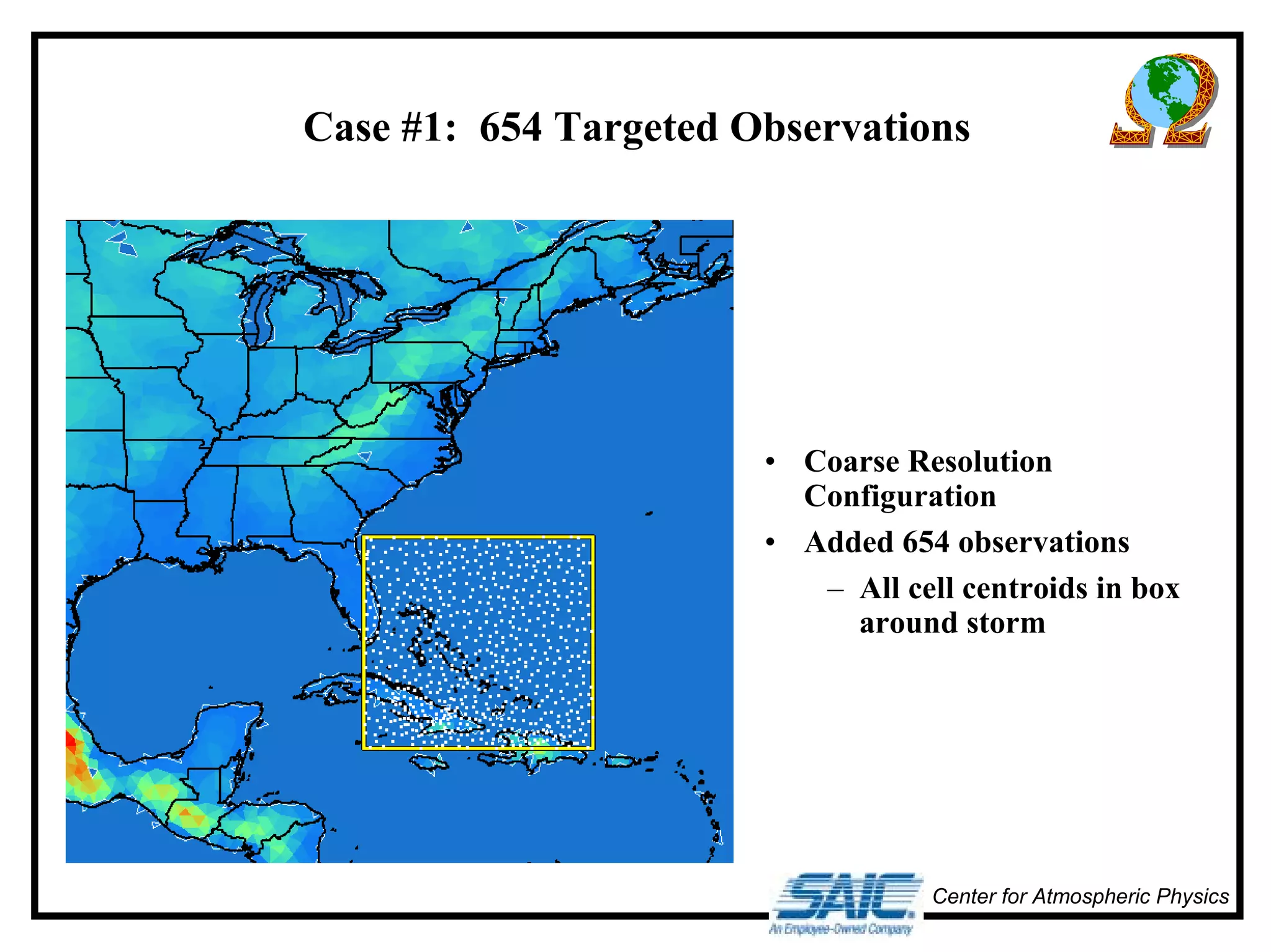
Case #1: 654 Targeted Observations 
• Coarse Resolution 
Configuration 
• Added 654 observations 
– All cell centroids in box 
around storm 
Center for Atmospheric Physics
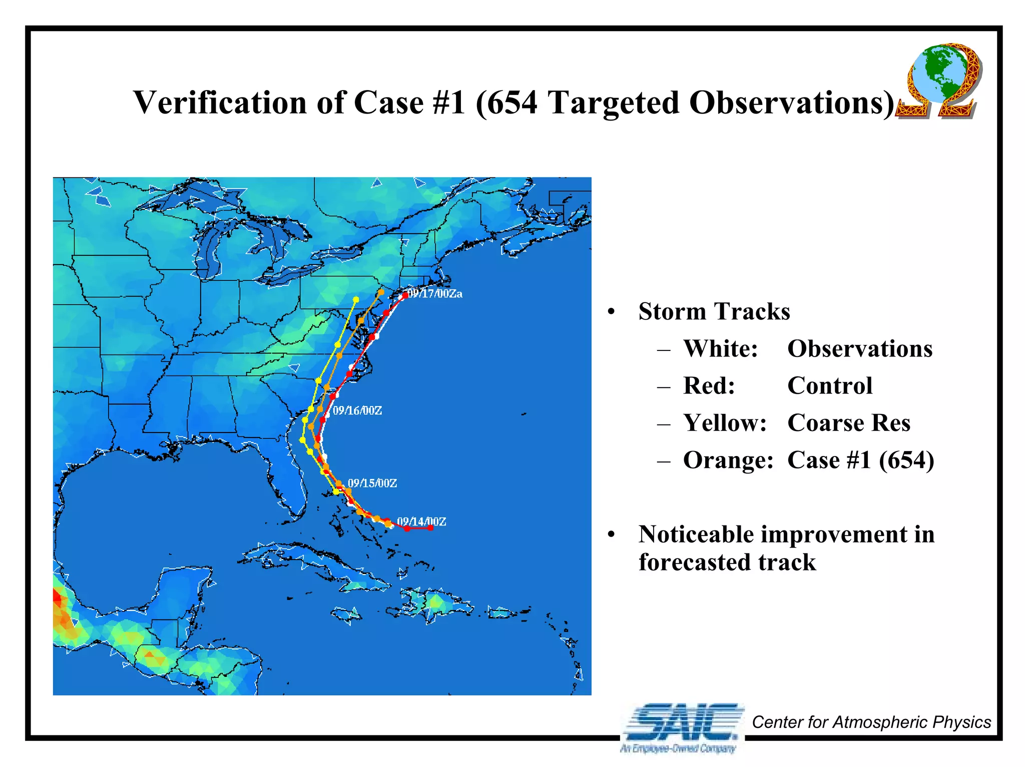
Verification of Case #1 (654 Targeted Observations) 
• Storm Tracks 
– White: Observations 
– Red: Control 
– Yellow: Coarse Res 
– Orange: Case #1 (654) 
• Noticeable improvement in 
forecasted track 
Center for Atmospheric Physics
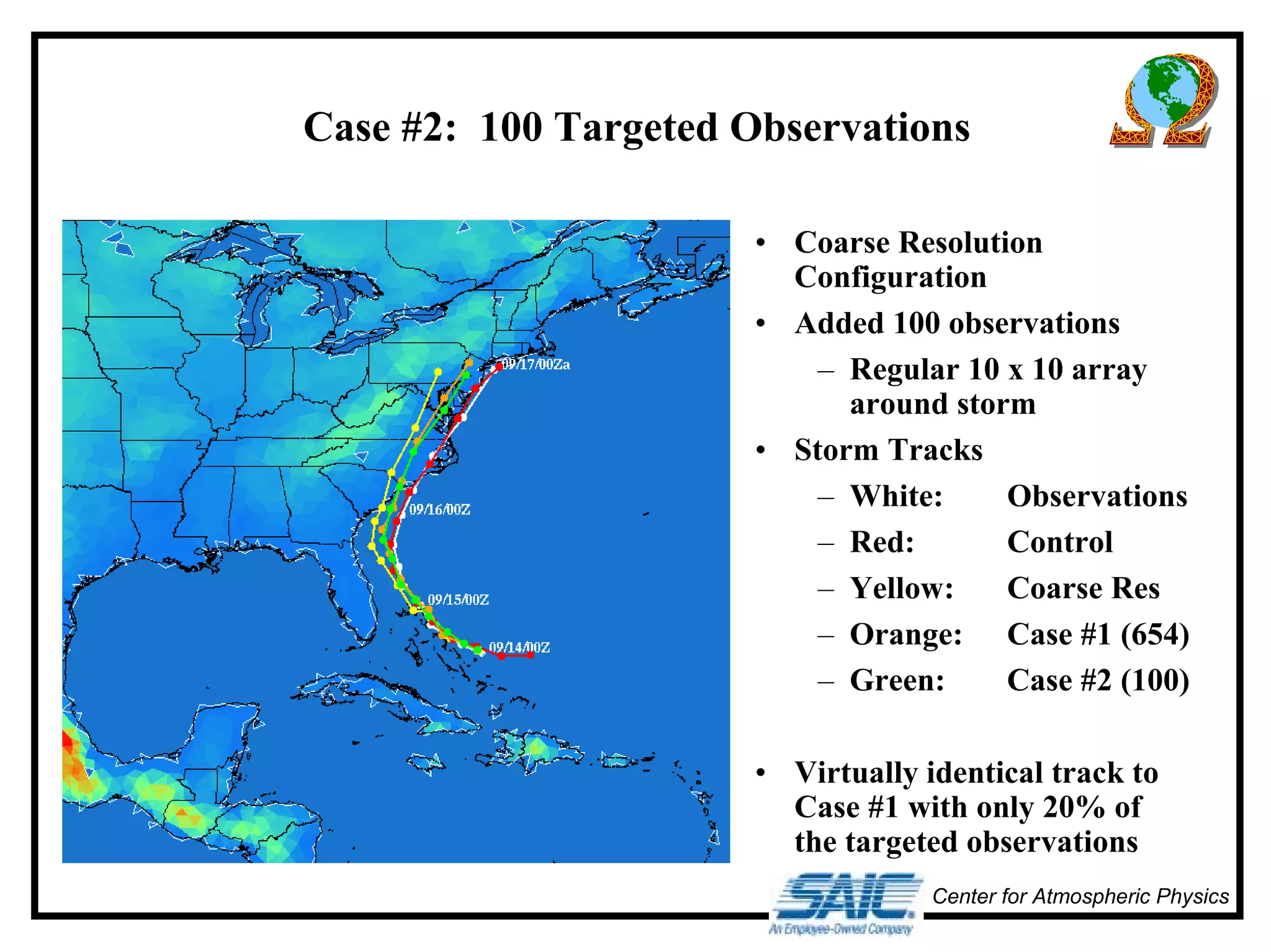
Case #2: 100 Targeted Observations 
• Coarse Resolution 
Configuration 
• Added 100 observations 
– Regular 10 x 10 array 
around storm 
• Storm Tracks 
– White: Observations 
– Red: Control 
– Yellow: Coarse Res 
– Orange: Case #1 (654) 
– Green: Case #2 (100) 
• Virtually identical track to 
Case #1 with only 20% of 
the targeted observations 
Center for Atmospheric Physics
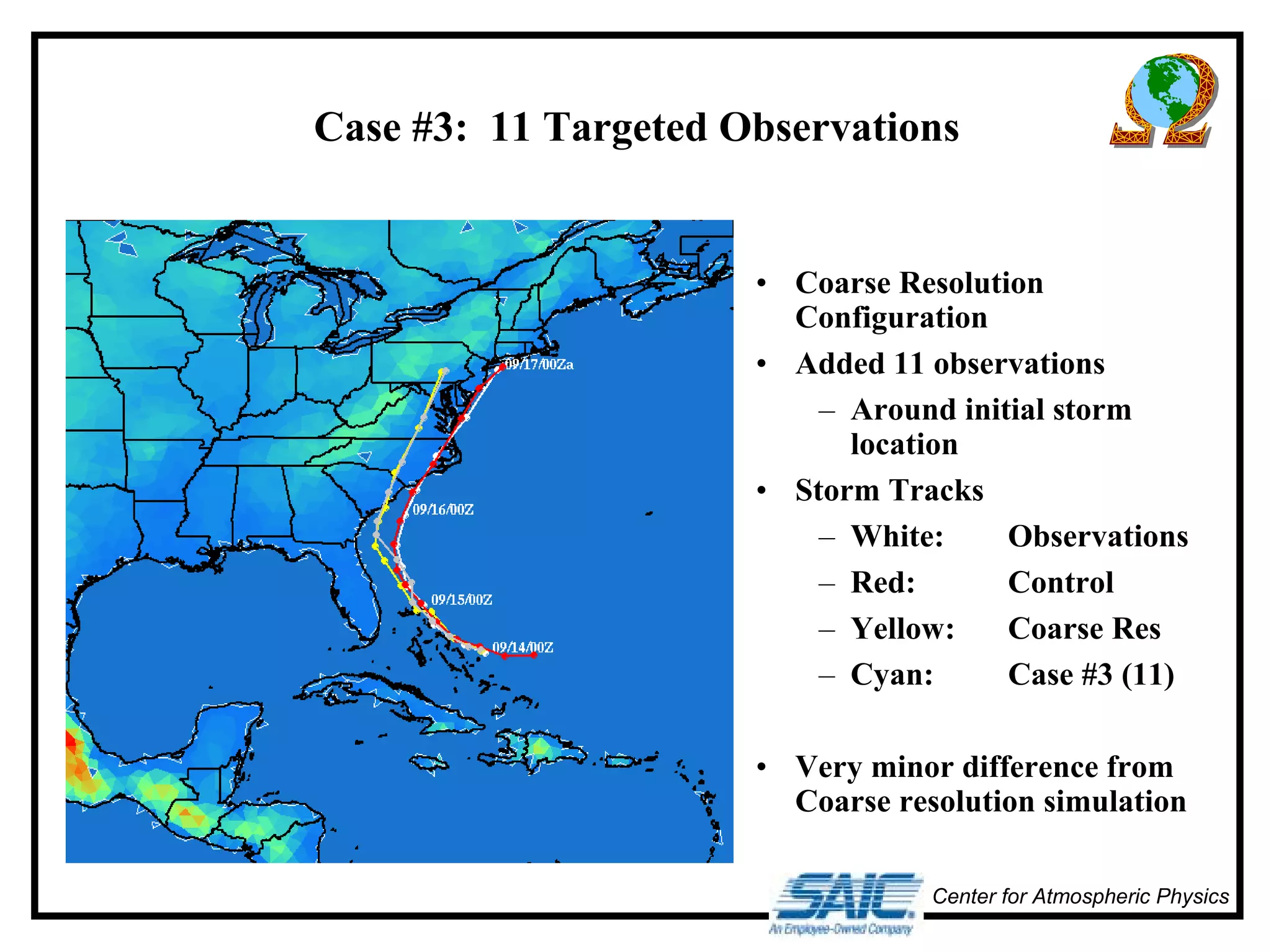
Case #3: 11 Targeted Observations 
• Coarse Resolution 
Configuration 
• Added 11 observations 
– Around initial storm 
location 
• Storm Tracks 
– White: Observations 
– Red: Control 
– Yellow: Coarse Res 
– Cyan: Case #3 (11) 
• Very minor difference from 
Coarse resolution simulation 
Center for Atmospheric Physics
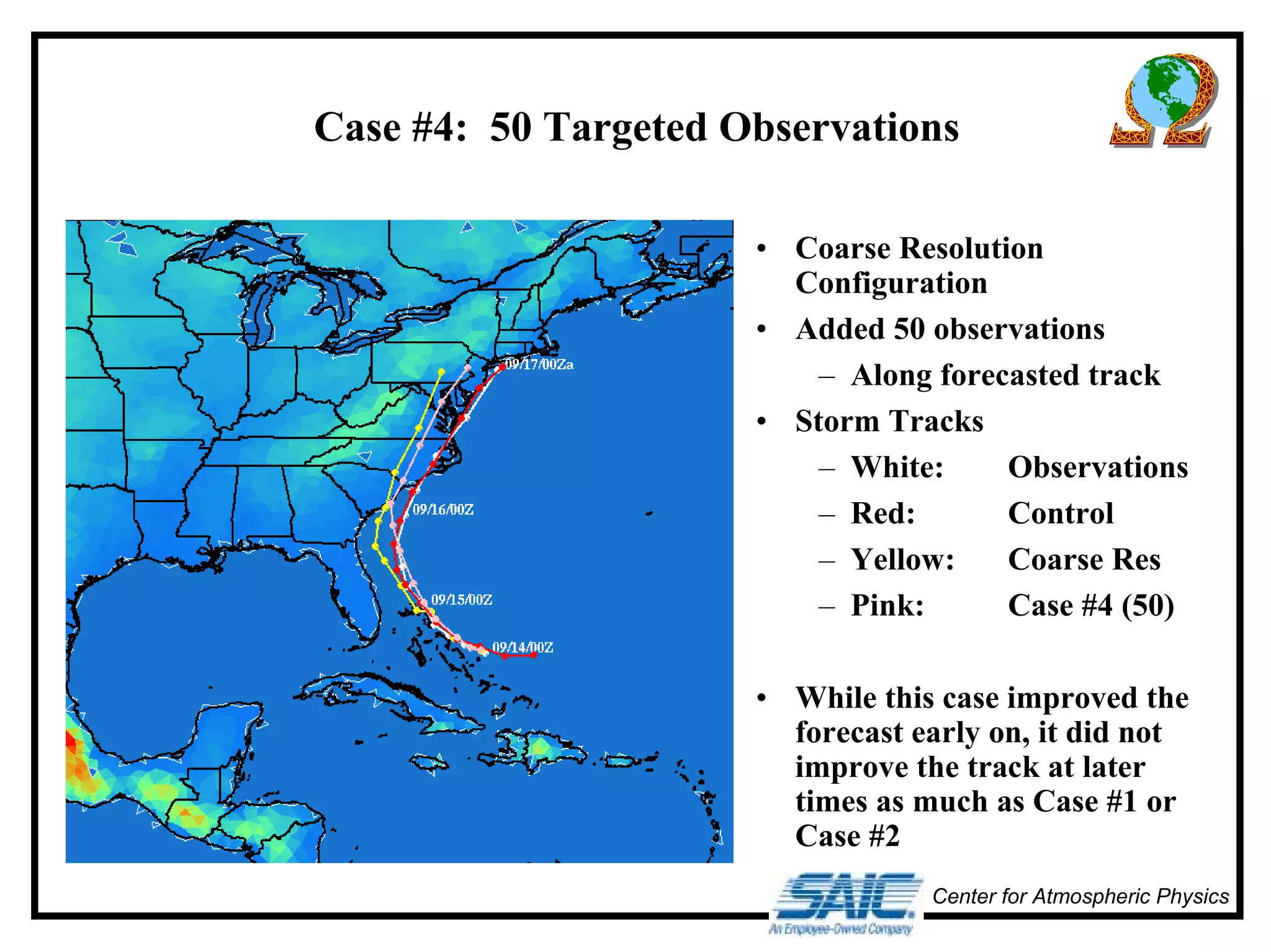
Case #4: 50 Targeted Observations 
• Coarse Resolution 
Configuration 
• Added 50 observations 
– Along forecasted track 
• Storm Tracks 
– White: Observations 
– Red: Control 
– Yellow: Coarse Res 
– Pink: Case #4 (50) 
• While this case improved the 
forecast early on, it did not 
improve the track at later 
times as much as Case #1 or 
Case #2 
Center for Atmospheric Physics
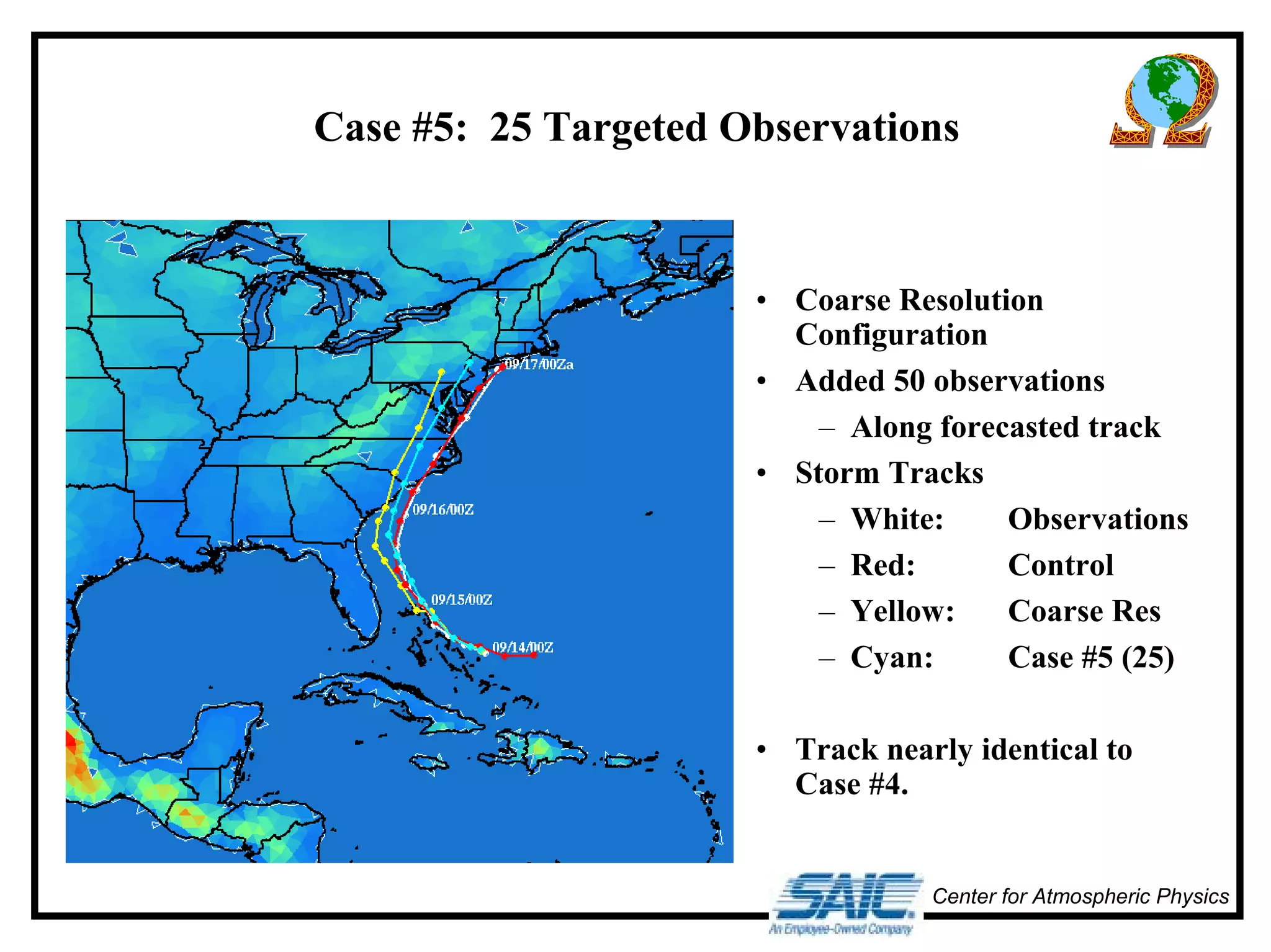
Case #5: 25 Targeted Observations 
• Coarse Resolution 
Configuration 
• Added 50 observations 
– Along forecasted track 
• Storm Tracks 
– White: Observations 
– Red: Control 
– Yellow: Coarse Res 
– Cyan: Case #5 (25) 
• Track nearly identical to 
Case #4. 
Center for Atmospheric Physics
Center for Atmospheric Physics 
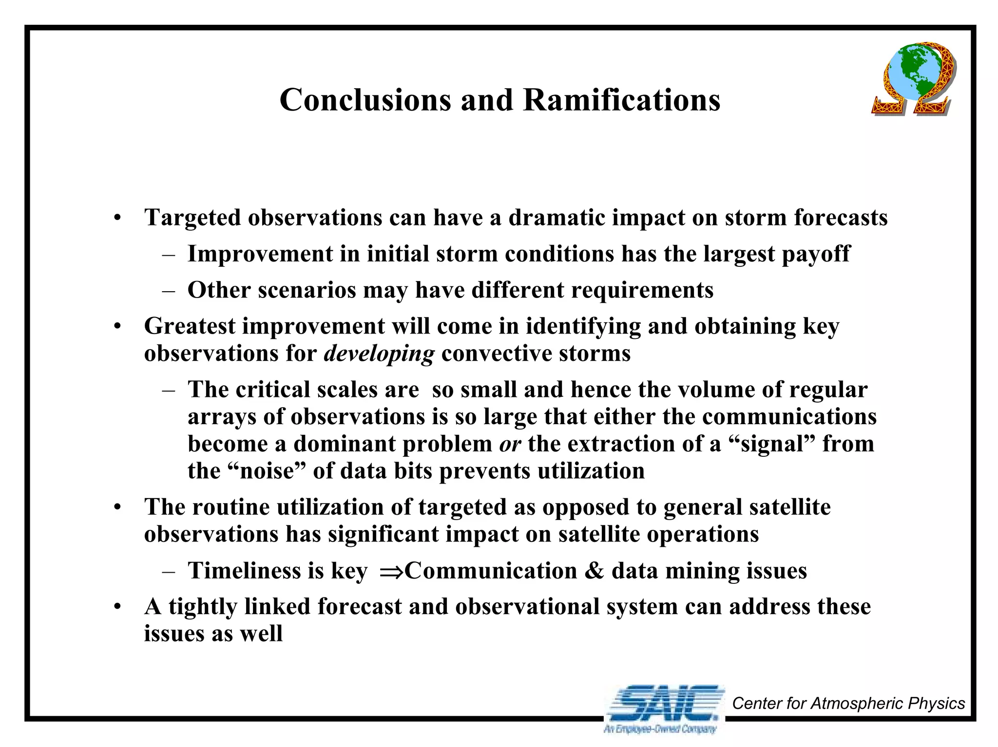
Conclusions and Ramifications 
• Targeted observations can have a dramatic impact on storm forecasts 
– Improvement in initial storm conditions has the largest payoff 
– Other scenarios may have different requirements 
• Greatest improvement will come in identifying and obtaining key 
observations for developing convective storms 
– The critical scales are so small and hence the volume of regular 
arrays of observations is so large that either the communications 
become a dominant problem or the extraction of a “signal” from 
the “noise” of data bits prevents utilization 
• The routine utilization of targeted as opposed to general satellite 
observations has significant impact on satellite operations 
– Timeliness is key ⇒Communication & data mining issues 
• A tightly linked forecast and observational system can address these 
issues as well

Advanced weatherpredictionoct01

  • 1.
    Adaptive Observation Strategies for Advanced Weather Prediction Center for Atmospheric Physics David P. Bacon, Zafer Boybeyi Center for Atmospheric Physics Science Applications International Corporation Michael Kaplan Dept. of Marine, Earth, & Atmos. Sci. North Carolina State University October 30, 2001 David P. Bacon (703)676-4594 david.p.bacon@saic.com
  • 2.
    Weather Forecasting –A Primer Center for Atmospheric Physics • Weather forecasting relies on a system of systems: – In-situ observations (surface, balloon, & aircraft) – Remotely-sensed observations (satellite-based) – Data assimilation (creating a physically consistent 3-D dataset) – Prognostic models (extrapolation into 4-D)
  • 3.
    Center for AtmosphericPhysics In-situ Observations • Irregular spatial distribution – Where the people (and planes) are • Quasi-regular temporal distribution – Surface observations » Hourly with special reports for significant weather – Balloon observations » Twice-daily at 0000Z & 1200Z – Aircraft observations » Regular intervals
  • 4.
    Remote Sensing ObservationStrategies Center for Atmospheric Physics • The beginning: – TIROS-1 (April 1, 1960) » Television and InfraRed Operational Satellite – ATS-1 (December 6, 1966) » Applications Technology Satellite – Geostationary » Communications system test bed • Raster based systems – Vidicon tubes to CCDs
  • 5.
    Center for AtmosphericPhysics Data Assimilation • Goal: A physically consistent 3-D representation of the atmosphere at an instant of time • Requirements: Rationalize a disparate set of data that is a mix of irregular and grid point information at synoptic (0000Z & 1200Z) and asynoptic times • Modify large-scale effects to reflect small-scale features – Capture steep gradients critical to severe weather
  • 6.
    Center for AtmosphericPhysics Prognostic Models • Most models are based on a rectangular grid structure – Intuitively obvious – Simplest tiling – Simple operator decomposition • Higher resolution is obtained by nesting – Conceptually easy – Numerically tricky » Reflective internal boundaries » Differing surface conditions » Scale interactive information exchange • Initial conditions obtained from data assimilation system – Generally at synoptic times
  • 7.
    Center for AtmosphericPhysics A Vicious Circle • Increased horizontal (α) and vertical (β) resolution in models leads to: – Higher resolution initial conditions: α2β – Increased run-time: α2β – Increased output volume: α2β max(αααα,,,, ββββ) • Higher resolution ICs requires higher resolution observations
  • 8.
    Dynamic Adaptation ofData Assimilation Center for Atmospheric Physics and Model Resolution • Initial grid for an OMEGA simulation of Hurricane Floyd and the grid (inset) at 72 hours
  • 9.
    OMEGA Forecast ofHurricane Floyd Center for Atmospheric Physics
  • 10.
    Center for AtmosphericPhysics Control Simulation • Initialization: – 1200Z September 13 – NOGAPS Analysis • Boundary Conditions: – NOGAPS Forecast • Grid Resolution: – 5 - 15 km
  • 11.
    Verification of ControlSimulation • Storm Tracks – White: Observations – Red: Control Center for Atmospheric Physics
  • 12.
    Center for AtmosphericPhysics Coarse Resolution Simulation • Initialization: – 0000Z September 14 – NOGAPS Analysis • Boundary Conditions: – NOGAPS Forecast • Grid Resolution: – 75 - 120 km
  • 13.
    Verification of CoarseResolution Simulation • Storm Tracks – White: Observations – Red: Control – Yellow: Coarse Res • Significant westward track deviation Center for Atmospheric Physics
  • 14.
    Center for AtmosphericPhysics Adaptive Observations • Control Run provides a source of pseudo-observations for OSSEs • Control cell centroid closest to the Coarse cell centroid used to provide pseudo-sounding
  • 15.
    Case #1: 654Targeted Observations • Coarse Resolution Configuration • Added 654 observations – All cell centroids in box around storm Center for Atmospheric Physics
  • 16.
    Verification of Case#1 (654 Targeted Observations) • Storm Tracks – White: Observations – Red: Control – Yellow: Coarse Res – Orange: Case #1 (654) • Noticeable improvement in forecasted track Center for Atmospheric Physics
  • 17.
    Case #2: 100Targeted Observations • Coarse Resolution Configuration • Added 100 observations – Regular 10 x 10 array around storm • Storm Tracks – White: Observations – Red: Control – Yellow: Coarse Res – Orange: Case #1 (654) – Green: Case #2 (100) • Virtually identical track to Case #1 with only 20% of the targeted observations Center for Atmospheric Physics
  • 18.
    Case #3: 11Targeted Observations • Coarse Resolution Configuration • Added 11 observations – Around initial storm location • Storm Tracks – White: Observations – Red: Control – Yellow: Coarse Res – Cyan: Case #3 (11) • Very minor difference from Coarse resolution simulation Center for Atmospheric Physics
  • 19.
    Case #4: 50Targeted Observations • Coarse Resolution Configuration • Added 50 observations – Along forecasted track • Storm Tracks – White: Observations – Red: Control – Yellow: Coarse Res – Pink: Case #4 (50) • While this case improved the forecast early on, it did not improve the track at later times as much as Case #1 or Case #2 Center for Atmospheric Physics
  • 20.
    Case #5: 25Targeted Observations • Coarse Resolution Configuration • Added 50 observations – Along forecasted track • Storm Tracks – White: Observations – Red: Control – Yellow: Coarse Res – Cyan: Case #5 (25) • Track nearly identical to Case #4. Center for Atmospheric Physics
  • 21.
    Center for AtmosphericPhysics Conclusions and Ramifications • Targeted observations can have a dramatic impact on storm forecasts – Improvement in initial storm conditions has the largest payoff – Other scenarios may have different requirements • Greatest improvement will come in identifying and obtaining key observations for developing convective storms – The critical scales are so small and hence the volume of regular arrays of observations is so large that either the communications become a dominant problem or the extraction of a “signal” from the “noise” of data bits prevents utilization • The routine utilization of targeted as opposed to general satellite observations has significant impact on satellite operations – Timeliness is key ⇒Communication & data mining issues • A tightly linked forecast and observational system can address these issues as well