Coastal Urban Flood Risk Management
•
3 likes•1,070 views

Reveiw 1- Deals with Background,topic,Need of study &literature review.

Recommended
Recommended
More Related Content
What's hot
What's hot (20)
Viewers also liked
Viewers also liked (17)
Similar to Coastal Urban Flood Risk Management
Similar to Coastal Urban Flood Risk Management (20)
Recently uploaded
Recently uploaded (20)
Coastal Urban Flood Risk Management
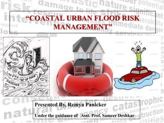
- 1. “COASTAL URBAN FLOOD RISK MANAGEMENT” Presented By, Remya Panicker Under the guidance of Asst. Prof. Sameer Deshkar
- 2. BACKGROUND •Increased flood occurrences & rising threat to life and property. •Coastal areas worst affected due to floods. •Need for integrating risk management and development approaches
- 3. ` Flood disaster trend in Asia in comparison to other disasters in last 28 years. P O ` R T
- 5. NEED OF STUDY Inter relation of factors for coastal urban vulnerability Coastal sensitivity w.r.t. climate change Why coasts for flood risk management study?
- 7. Coastal urban vulnerability Land pressure Location Infrastructure incapacity Climate sensitivity Unpreparedness Economic growth Population growth Urbanization Informal settlements High Priority Low Priority to threat Infrequency of hazardous events •Existing developments •unawareness •Lack of clear policies •Lack of policy implementation •Limited knowledge & study of climate change impacts. •High cost of hazard mapping •Limited resources •Allocation of resources Poor governance SITE: Level of stake (--) (+)DISTANCEfromphenomena CLOSE FAR RISK MATRIX:
- 8. AIM & OBJECTIVES OBJECTIVES: To study and understand various causes and consequences of floods on urban developments. Study existing regulations and plans for flood risk mitigation in coastal regions Study various aspects contributing to flood risk resiliency in urban areas Study different methods and approaches for resiliency evaluation Apply CDRI to Kochi and propose an adaptive flood risk management strategy AIM: To plan for resilient developments in coastal urban area through flood risk management approach GOAL: Sustainable development of coastal urban areas
- 9. SCOPE & LIMITATIONS Scope: •A city level study is intended to analyze the individual resiliency of the wards. •A comparative analysis with another coastal city is intended. •The study does not include the study of future climate induced changes on the coastal area under consideration. Limitation: •Data accuracy and quality. •To support the city level study, survey of city officials is intended. Questionnaires to be filled by civic officials and their understanding of questionnaire is important for accurate analysis. •The results that will be presented in this work will not be absolute values but will be broad policy guidance and scope of improvements in the respective sector of flood disaster related problems.
- 10. METHODOLOGY Resilient development through Flood risk management Study the causes and consequences of floods on urban developments Study regulations and plans for coastal areas. Study aspects of flood resiliency and approaches and methods of resiliency evaluation Apply CDRI to Kochi & Propose an adaptive flood risk management strategy OBJECTIVES AIM 1 2 3 4 •Overview of flood Lit.Review-1 Lit.Rev-2, DataCollection-1 •NDM guidelines •Kerala SDM policy,2010,Cochin disaster management studies,2005 •CRZ & Kerala state •Resiliency assessment using 5 capital approach DataCollection-2 Questionnaire filling by local authorities. Field study Comparative ward resiliency assessment DataAnalysis &proposal Selection of appropriate method for analysis. Identify flaws of existing set up Understanding the relationship of floods and urban developments Prepare a proposal RESULTS EndResult 5 •Study role of governance, communities urban services and policies in resiliency building
- 11. LITERATURE REVIEW TERMS: FLOODS,flood (vulnerability, exposure, susceptibility and risk) Disaster management and floods. Resiliency concept in Disaster management. CRZ policy.
- 12. TERMS&CONCEPTS: Source: Components of disaster risk. GTZ, Eschborn 2001.
- 13. FLOOD RISK: The measure of expected losses (death, injuries, property, livelihoods, economic activity disrupted or environment damaged) resulting from interactions between natural or human-induced hazards and vulnerable conditions occurring in a given area over specific time period. (UNISDR, 2004). FLOOOD VULNERABILITY: The conditions determined by physical, social, economic, and environmental factors or processes, which increase the susceptibility of a community to the impact of hazards. (UNISDR, 2004). FLOOD HAZARD: A potentially damaging flood event that may cause loss of life or injury, property damage, social and economic disruption or environmental degradation. Hazards can be single, sequential or combined in their origin and effects. Hazards may be characterised by their location, intensity, frequency and probability of occurrence (UNISDR, 2004). FLOOD DISASTERS: A damaging flood hazard that adversely affects human populations and the environment beyond the capacity of the community to cope using its own resources. (UNISDR, 2004).
- 14. Incremental impacts on urban systems: BUILT ENVIRONMENT: •Stress on building foundations •Road washouts •Stress on storm-water and sewage systems •Stress on water treatment systems •Disruption to shipping and ports •Increased energy demands •Increased road surface damage •Increased demand for water Impacts on urban residents: Causes & Consequences of floods on urban developments
- 15. DISASTER RISK MANAGEMENT: The systematic process of using administrative decisions, organisations, operational skills and capacities to implement policies, as well as the strategies and coping capacities of the society and communities to lessen the impacts of natural hazards and related environmental and technological disasters. This comprises all forms of activities, including structural and non-structural measures to avoid or limit the adverse effects of a hazard (UNISDR, 2004). FLOOD RISK MANAGEMENT: The management of floodplains through a systematic process requiring risk assessment, strategic planning, development of risk reduction measures and implementing activities. The process involves multiple stakeholder and sector cooperation, with the aim to reduce flood risks in a sustainable manner.
- 16. What is resiliency? Resilience is the ability to grow and thrive in the face of challenges and bounce back from adversity. It is built through a set of core competencies that enable mental toughness, optimal performance, strong leadership, and goal achievement. `
- 17. POLICY: COASTAL REGULATION ZONE Central Government declared “the coastal stretches of seas, bays, estuaries, creeks, rivers and backwaters which are influenced by tidal action (in the landward side) up to 500 metres from the High Tide Line (HTL) and the land between the Low Tide Line (LTL) and the HTL as Coastal Regulation Zone.” 200m 300m COASTLINE LTL HTL Prohibition Restriction & Regulation Towards land
- 18. Prohibited activities: Restricted activities: •Setting up of new industries •Manufacture, handling or storage of hazardous substances. •Expansion of fish processing units •Dumping or filing of city waste for land filling •Land reclamation, land filling •Construction activities in ecologically sensitive areas. •Mining •Clearance shall be given for any activity within the Coastal Regulation Zone only if it requires water front and foreshore facilities. •Construction activities related to Defence requirements for which foreshore facilities are essential. •Operational constructions for ports and harbours and light houses requiring water frontage; •Thermal power plants •All other activities with investment exceeding rupees five crores.
- 19. Classification of the CRZ – For the purpose of conserving and protecting the coastal areas and marine waters, the CRZ area shall be classified as follows, (i) CRZ-I,– A. The areas that are ecologically sensitive and the geomorphologic features which play a role in the maintaining the integrity of the coast, B. The area between Low Tide Line and High Tide Line; (ii) CRZ-II,- The areas that have been developed upto or close to the shoreline. iii) CRZ-III,- Areas that are relatively undisturbed and those do not belong to either CRZ-I or II which include coastal zone in the rural areas. (iv)CRZ-IV,- The water area from the Low Tide Line to twelve nautical miles on the seaward side;
- 20. (v) Areas requiring special consideration for the purpose of protecting the critical coastal environment and difficulties faced by local communities,- A. (i) CRZ area falling within municipal limits of Greater Mumbai; (ii) the CRZ areas of Kerala including the backwaters and backwater islands; (iii) CRZ areas of Goa. B. Critically Vulnerable Coastal Areas (CVCA) such as Sunder bans region of West Bengal and other ecologically sensitive areas identified as under Environment (Protection) Act, 1986 and managed with the involvement of coastal communities including fisher folk. ISSUES: State wise costal assessment and policy modifications. Clarity in the interpretation of clauses and terms. A clear time frame for implementation. Participation of the users in the decisions related to the use and management of the coast and its resources.
- 21. Rapid urbanisation requires the integration of flood risk management into regular urban planning and governance. Designs for flood management must be able to cope with a changing and uncertain future. An integrated strategy requires the use of both structural and non- structural measures and good metrics for “ getting the balance right”. It is impossible to eliminate entirely the risk from flooding. Many flood management measures have co-benefits over and above their flood management role. Plan to recover quickly after flooding and use the recovery to build capacity. INFERENCES:
- 22. References: •UNDP,adpc,2005,”Integrated flood risk management in Asia” •Abhas K Jha ,Robin Bloch,Jessica Lamond,2011,”Cities and Flooding -A Guide to Integrated Urban Flood Risk Management for the 21st Century” •Nicholls, R.J. Hanson, S. Herweijer, C, Patmore,OECD,2005,” Ranking of the world's cities most exposed to coastal flooding today and in the future “ •Rajib Shaw and IEDM team, "Climate disaster resilience: focus on coastal urban cities in Asia “
- 23. Thank you for your attention!!
Editor's Notes
- Urban centers concentrate people, enterprises, infrastructures and publicinstitutions, while at the same time relying for food, freshwater and other resourcesfrom areas outside of their boundaries (Satterthwaite 2011). Furthermore, urbanareas are often located in hazard-prone locations such as low-elevation coastalzones, which are at risk from sea-level rise, or in other areas at risk from fl oodingand extreme weather events (OECD 2009; WDR 2010).
- Top 20 cities ranked in terms of population exposed to coastal flooding in the 2070s(including both climate change & socio-economic change) and showing present-day exposure
- Thus” integrating risk management and development approaches is the need of the hour” for sustainable development of any climate sensitive urban area.
- OR in the terms of risk---it is the proximity to the source of floods and the concentration of (folk,work and place) that render coasts vulnerable to the slightest change in its settings.Also the climate induced indirect & indirect forcing render the coasts prone to floods.
- Regulations: (at national, state and city level).Aspects-(Governance, community characters, urban services, development policies etc.)
- Illness-water borne diseases, physical and mental instability Exposure to elements from substandard constructionDisruption of basic service provision and access to supplies.Housing instabilityProperty loss and relocationLoss of livelihoodsCommunity fragmentationExposure to flood related toxins and wastes.Disruption in availability of potable water,food,and other supplies.Water shortagesFood shortage and higher food pricesTransport, electricity disruption affecting production.Affects tourism economy
- Resiliency can best be understood as a type of response to intense stress. By definition, resilience means "bouncing back" or "returning to form." Resilience to stress is not the same as resistance to stress because resistance implies the there is no response to stress.Vulnerability of communities can be reduced through increasing the resilienceor capacity to cope in the event of flooding.Natural capital: land, rivers, vegetation and any natural resources.zsee Box 4.8zsee Chapter 11Methods of undertaking aVCA depend on:• Urban / rural area• Size of the population• Resources (human andfinancial)• Technology (eg.telephone interviews)• Time• Information required (eg.perception of risk orcensus information)68assessingflood risk 4Vulnerabilities CapacitiesPhysical / Material •••Proximity and exposureto flooding - living on afloodplain, poor housing.Poverty - few options, nofinancial savings, fewassets.Resources - limitedtechnology, skills oremployment.•••••Money, assets, land, jobsSavingsInsurance.Good healthProtected locationSkills and expertiseSocial / Organisational •••Marginalisation - peopleexcluded due to politics,religion, ethnicity or socialcustoms and norms.Organisation - limitedcommunity or legalstructures.Discrimination - lack ofsupport, reduced accessto resources and services.•••Community support,leadership, institutions.Political structures,adequate management.Community cohesiveness.Motivational /Attitudinal•••Perception of risk - denythe threat, unaware ofthe threat, misconceptionof the threat and benefitsof living or working in thefloodplain.Attitude - no confidencein their abilities, viewthemselves as dependent.Power - no influence inthe community.••••People with confidence,with dignity andindependence are betterable to cope with crisis.Ability to influence theirenvironment.Hold a strong beliefsystem and consequentlysupport structure.Aware of how disastersaffect them.Box 4.8VCA framework(Adapted from IRFC, 1993 and Anderson and Woodrow, 1998)• Financial capital: savings, income, credit, pension.• Human capital: knowledge, skills, health, physical ability.• Social capital: networks, relationships, trust, mutual exchange.• Physical capital:people have a range of assets referredto as ‘capitals’ that form insulative layers to protect against disasters.
- Environment (Protection) Act, 1986 declaring Coastal Stretches as Coastal Regulation Zone (CRZ) and Regulating Activities in the CRZ.
- Top 20 cities ranked in terms of population exposed to coastal flooding in the 2070s(including both climate change & socio-economic change) and showing present-day exposure
- For the purposes of the expression “developed area” is referred to as that areawithin the existing municipal limits or in other existing legally designated urban areaswhichar e substantially built-up and has been provided with drainage and approach roadsand other infrastructural facilities, such as water supply and sewerage mains;