SlideShare a Scribd company logo
1 of 37
Download to read offline
R a k e s h K u m a r V e r m a
A s s i s t a n t P r o f e s s o r ,
C i v i l E n g i n e e r i n g D e p a r t m e n t , P . I . E . T .
P a r u l U n i v e r s i t y
Compass Surveying
Definitions
 True Meridian
 True Bearing /Azimuth
 Magnetic Meridian
 Magnetic Bearing /Bearing
 Arbitrary Meridian
 Arbitrary Bearing.
 Grid Meridian
 Grid Bearing
TN
A
O
AZ
MN
A
MB
O
Magnetic North
Magnetic South
Magnetic
Meridian
North
South
MeridiansPrime
Meridians
Equator
λ=40
Latitudes
Longitudes
Understanding of Lat. & Long.
Equator
Equatorial Plane
Location of Man
λ
α
α- Longitude
λ- Latitude
Understanding of Lat. & Long.
Observer's Plane
(i) Whole Circle Bearing
(WCB)
(ii) Quadrantal Bearing
(QB)
 WCB  QB
Designation of Magnetic Bearing
O
NN
W
SS
E EW
SE
NW
SW
NE
O O
A
B
A
B
Clockwise rotation has to be followed
Reduced Bearing (RB) Fore And Back Bearing
 Similar to Quadrant
Bearing
 Obtained when,
 Depended on direction
of main survey line
Bearing
WCB QBConvert
N
Direction of Survey
BM
A B
BB FB
North
WCB-----QB
Reduced Bearing (RB)
O
A
φ
α
WCB reading=α=220ᵒ
QB reading=φ=220ᵒ-180ᵒ
=S 40ᵒW
N
S
EW
N
W
S
E
α
α=φ
WCBNE
180ᵒ-α=φ
WCBSE
α-180ᵒ=φ
WCBSW
360ᵒ-α=φ
WCBNW
Conversion of WCB to RB
N
W
S
E
φ
α=φ
RB NE
180ᵒ-φ1= α
RB SEφ2+180ᵒ= α
RB SW
360ᵒ- φ3=α
RBNW
Conversion of RB to WCB
φ2
φ1
φ3
Fore Bearing & Back Bearing
 Bearing taken in forward direction of survey line-
FB
 Bearing taken in backward direction of survey
line- BB
FB
BB
A
B
B
A
Magnetic Declination
 The Horizontal Angle Between the Magnetic
Meridian and True Meridian is known as
‘magnetic declination’.
 When the north end of the magnetic needle is
pointed towards the west side of the true meridian,
the position is termed ‘Declination West’ ().
 When the north end of the magnetic needle is
pointed towards the east side of the true meridian,
the position is termed ‘Declination East’
Magnetic Declination
True North
E
W
W
S
S
E
Isogonic and Agonic Lines
 Lines Passing Through Points Of Equal
Declination are known as ‘isogonic’ lines.
 The Survey of India Department has prepared a map
of India in which the isogonic and agonic lines are
shown properly as a guideline to conduct the
compass survey in different parts of the country.
Isogonic and Agonic Lines
Dip of the Magnetic
Needle
Inclination
from the
horizontal
plane
Zero
inclination at
the equator
Dip of the Magnetic Needle
Local Attraction
 Error introduced in direction of magnetic needle due to
magnetic materials such as iron ore, steel structures,
electric cables conveying current; etc.
 Then it does not show the actual north. This
phenomenon is known as ‘local attraction’.
 If
 Error compensation
 Divide equally in FB & BB
Error of local attractionFB-BB≠ 180 degrees
FB-BB= 180 degrees Free from local attraction
Example
For example, consider the case when
Observed FB of AB = 60030’
Observed BB of AB = 24000’
Calculated BB of AB = 600300 + 18000’ = 240030’
Corrected BB of AB = 1/2 (24000’ + 240030’) = 240015’
Hence, Corrected FB of AB = 240015’ – 18000’ = 60015’
Principle of Compass Surveying
 Traversing, which Involves A Series of Connected Lines.
 The magnetic bearings of the lines are measured by prismatic
compass and
 The distances of the lines are measured by chain.
 Such survey does not require the formation of a network of
triangles.
 Interior details are located by taking offsets from the main survey
lines. Sometimes subsidiary lines may be taken for locating these
details.
 Compass surveying is not recommended for areas where local
attraction is suspected due to the presence of magnetic substances
like steel structures, iron ore deposits, electric cables conveying
current, and so on.
TRAVERSING
 Well Defined Network of Connected Lines
 The sides of the traverse are known as ‘traverse legs’.
 Measurements
 A traverse may be of two types –
 Closed traverse
1. closed loop (i.e. when the finishing point coincides with the starting
point
 Open traverse
1. connected lines extends along a general direction and does not return to
the starting point,
2. Open traverse is suitable for the survey of roads, rivers, coast lines, etc
Lengths of Lines
Directions
Chain
Compass or Theodolite
Methods of Traversing
Chain traversing (by chain angle)
Compass traversing (by free needle)
Theodolite traversing (by fast needle) and
Plane table traversing (by plane table)
Check on Angular Measurements
(a) The sum of the measured Interior Angles should be
equal to (2N – 4) x 90ᵒ where N is the number of sides of
the traverse.
(b) The sum of the measured Exterior Angles should be
equal to (2N + 4) x 90ᵒ
(c) The algebraic sum of the Deflection Angles should be
equal to 360ᵒ
Right-hand deflection is considered positive and left-hand
deflection negative.
Check on Linear Measurement
(a) The lines should be measurement once each on two
different days (along opposite directions). Both
measurements should tally.
(b) Linear measurements should also be taken by the
stadia method. The measurements by chaining and by
the stadia method should tally.
Check on Open Traverse
 No Direct checks available, but following
methods can be adopted
1. Taking cut-off lines
2. Taking an auxiliary point
A
F
E
C
D
B
N
N
N
N
N
For Check
Taking Cut-off Lines
Cut-off lines are taken between some intermediate stations of the open traverse.
Let AD and DG be the cut-off lines. The lengths and magnetic bearings of the cut-off
lines are measured accurately. After plotting the traverse, the distances and bearings
are noted from the map. These distances and bearings should tally with the actual
records from the field
Taking an Auxiliary Point
A
D
C
B
E
P
N
N
N
N
N
A permanent point ‘P’ is selected on one side of it. If the survey is carried out
accurately and so is the plotting, all the measured bearings of P when plotted should
meet at the point P. The permanent point P is known as the ‘auxiliary point’
The prismatic compass The Surveyor’s compass
Types of Compass
Components of Prismatic Compass
Construction
Zero degree marked at
South and 90 degree at
North
Vanes
Eye Vane
Guide Vane
Magnetic Needle
Bubble Tube
Screw
Circular
Metal Box
Dia.-8 to
10cm
Fixed
Graduated
Plane
Sr.
No.
Base Of
Comparison Prismatic Compass Surveyor Compass
1 First look Prism at one end and slit on
other
No prism only Slit at both
end
2 Use of Tripod
Stand
May or may not use along,
Steady hold in hand also give
good results
Use of Tripod stand is
necessary
3 Observation/
Readings
Taken with help of prism
provided by eye slit
Directly read from top of
compass
4 Magnetic
Needle
Does not act as index Act as index
5 Graduation WCB system QB system
6 Graduation
marking
Appear inverted from top,
Zero at south & 180 degrees
at north
Mark directly Zero at North
and 90 degree at East
7 Graduated
circle
Attached with needle, Does
not rotate with line of sight
Permanently attached with
box, rotates with line of sight
Comparison between
Prismatic Compass and Surveyor Compass
Temporary Adjustment of Compass
Centering
Levelling
Focusing
1. Adjustment of prism
2. Bisecting/Observation of bearing
Northφ1
φ3
φ2
Determination of Reduced Bearing
A
O
C
B
Angle AOB=φ2-φ1 Angle BOC= φ3-φ2Angle AOC= φ3-φ1
North
φ3
φ2
φ1
φ4
C
AB
Field WorkIncluded Angles BAC= φ2
Included Angles ACB=φ3
Included Angles ABC=φ4
Determination of Included Angles
Dist. AB
Compass surveying

More Related Content

What's hot

Surveying & prismatic compass survey
Surveying & prismatic compass surveySurveying & prismatic compass survey
Surveying & prismatic compass surveySuman Das
 
Introduction to surveying, ranging and chaining
Introduction to surveying, ranging and chainingIntroduction to surveying, ranging and chaining
Introduction to surveying, ranging and chainingShital Navghare
 
Compass surveying
Compass surveyingCompass surveying
Compass surveyingAhmed Eid
 
Traverse Survey Part 1/2
Traverse Survey Part 1/2Traverse Survey Part 1/2
Traverse Survey Part 1/2Muhammad Zubair
 
Surveying Levelling & Contouring Unit 2 Notes updating.pptx (1).pdf
Surveying Levelling & Contouring Unit 2 Notes updating.pptx (1).pdfSurveying Levelling & Contouring Unit 2 Notes updating.pptx (1).pdf
Surveying Levelling & Contouring Unit 2 Notes updating.pptx (1).pdfDenish Jangid
 
types of bearing
types of bearingtypes of bearing
types of bearingankit5597
 
Tacheometric surveying
Tacheometric surveying Tacheometric surveying
Tacheometric surveying neharajpl
 
Curves and there application in Survey
Curves and there application in SurveyCurves and there application in Survey
Curves and there application in SurveyLord1911
 
Total station Surveying
Total station SurveyingTotal station Surveying
Total station SurveyingKiran M
 
traversing survey principles.docx
traversing survey principles.docxtraversing survey principles.docx
traversing survey principles.docxalexandermwaura
 

What's hot (20)

Surveying & prismatic compass survey
Surveying & prismatic compass surveySurveying & prismatic compass survey
Surveying & prismatic compass survey
 
Introduction to surveying, ranging and chaining
Introduction to surveying, ranging and chainingIntroduction to surveying, ranging and chaining
Introduction to surveying, ranging and chaining
 
Plane Table Surveying PPt
Plane Table Surveying PPtPlane Table Surveying PPt
Plane Table Surveying PPt
 
Compass surveying
Compass surveyingCompass surveying
Compass surveying
 
BEARING AND ITS TYPES
BEARING AND ITS TYPESBEARING AND ITS TYPES
BEARING AND ITS TYPES
 
Levelling
LevellingLevelling
Levelling
 
Traverse Survey Part 1/2
Traverse Survey Part 1/2Traverse Survey Part 1/2
Traverse Survey Part 1/2
 
Surveying Levelling & Contouring Unit 2 Notes updating.pptx (1).pdf
Surveying Levelling & Contouring Unit 2 Notes updating.pptx (1).pdfSurveying Levelling & Contouring Unit 2 Notes updating.pptx (1).pdf
Surveying Levelling & Contouring Unit 2 Notes updating.pptx (1).pdf
 
Surveying
Surveying Surveying
Surveying
 
types of bearing
types of bearingtypes of bearing
types of bearing
 
Triangulation survey
Triangulation surveyTriangulation survey
Triangulation survey
 
Theodolite survey
Theodolite surveyTheodolite survey
Theodolite survey
 
Tacheometric surveying
Tacheometric surveying Tacheometric surveying
Tacheometric surveying
 
Curves and there application in Survey
Curves and there application in SurveyCurves and there application in Survey
Curves and there application in Survey
 
Theodolite Traversing
Theodolite TraversingTheodolite Traversing
Theodolite Traversing
 
Total station Surveying
Total station SurveyingTotal station Surveying
Total station Surveying
 
traversing survey principles.docx
traversing survey principles.docxtraversing survey principles.docx
traversing survey principles.docx
 
Total Station surveying
Total Station surveyingTotal Station surveying
Total Station surveying
 
Tacheometry ppt
Tacheometry pptTacheometry ppt
Tacheometry ppt
 
Theodolite survey
Theodolite surveyTheodolite survey
Theodolite survey
 

Similar to Compass surveying

Compass surveying
Compass surveyingCompass surveying
Compass surveyingRAHUL SINHA
 
Surveying - Module II - compass surveying
Surveying - Module  II - compass surveyingSurveying - Module  II - compass surveying
Surveying - Module II - compass surveyingSHAMJITH KM
 
Compass Surveying.ppt
Compass Surveying.pptCompass Surveying.ppt
Compass Surveying.pptWaseemUllah71
 
1392741020 traverse survey
1392741020 traverse survey1392741020 traverse survey
1392741020 traverse surveyanjali adabala
 
Compass surveying (1).ppt
Compass surveying (1).pptCompass surveying (1).ppt
Compass surveying (1).pptSrini Vasan
 
Compass surveying
Compass surveyingCompass surveying
Compass surveyingUMT,Lahore
 
Chapter No. 04 - Angles and Directions.pptx
Chapter No. 04 - Angles and Directions.pptxChapter No. 04 - Angles and Directions.pptx
Chapter No. 04 - Angles and Directions.pptxSaadtariq82
 
survey 12.pdf
survey 12.pdfsurvey 12.pdf
survey 12.pdfDarSafwan
 
tangent galvanometer
tangent galvanometertangent galvanometer
tangent galvanometerilovecomputer
 
Physics Investigatory Project - Class 12 - Tangent Galvanometer
Physics Investigatory Project - Class 12 - Tangent GalvanometerPhysics Investigatory Project - Class 12 - Tangent Galvanometer
Physics Investigatory Project - Class 12 - Tangent GalvanometerDhananjay Dhiman
 
Prismetic compass ppt 3rd sem diploma and b.tech as per mdu and hsbte syllabus
Prismetic compass ppt 3rd sem diploma and b.tech as per mdu and hsbte syllabusPrismetic compass ppt 3rd sem diploma and b.tech as per mdu and hsbte syllabus
Prismetic compass ppt 3rd sem diploma and b.tech as per mdu and hsbte syllabusWarish Khan
 
CE(PC)403 Surveying & Geomatics
CE(PC)403 Surveying & GeomaticsCE(PC)403 Surveying & Geomatics
CE(PC)403 Surveying & GeomaticsBIKIMALLIK1
 
Compass survey part 2
Compass survey part 2Compass survey part 2
Compass survey part 2ArunRavi43
 
Compasssurveying 160050106053
Compasssurveying 160050106053Compasssurveying 160050106053
Compasssurveying 160050106053Sumit Nayani
 
Unit3AngularMeasurementpptx__2022_01_08_11_22_11.pptx
Unit3AngularMeasurementpptx__2022_01_08_11_22_11.pptxUnit3AngularMeasurementpptx__2022_01_08_11_22_11.pptx
Unit3AngularMeasurementpptx__2022_01_08_11_22_11.pptxOKOKILOUISmefgi
 

Similar to Compass surveying (20)

Compass surveying
Compass surveyingCompass surveying
Compass surveying
 
Surveying - Module II - compass surveying
Surveying - Module  II - compass surveyingSurveying - Module  II - compass surveying
Surveying - Module II - compass surveying
 
Compass Surveying.ppt
Compass Surveying.pptCompass Surveying.ppt
Compass Surveying.ppt
 
1392741020 traverse survey
1392741020 traverse survey1392741020 traverse survey
1392741020 traverse survey
 
Compass surveying
Compass surveyingCompass surveying
Compass surveying
 
Compass surveying (1).ppt
Compass surveying (1).pptCompass surveying (1).ppt
Compass surveying (1).ppt
 
Compass surveying.ppt
Compass surveying.pptCompass surveying.ppt
Compass surveying.ppt
 
Compass surveying
Compass surveyingCompass surveying
Compass surveying
 
Compass surveying
Compass surveyingCompass surveying
Compass surveying
 
Chapter No. 04 - Angles and Directions.pptx
Chapter No. 04 - Angles and Directions.pptxChapter No. 04 - Angles and Directions.pptx
Chapter No. 04 - Angles and Directions.pptx
 
survey 12.pdf
survey 12.pdfsurvey 12.pdf
survey 12.pdf
 
Compass Survaying
Compass SurvayingCompass Survaying
Compass Survaying
 
Traverse surveiying
Traverse surveiyingTraverse surveiying
Traverse surveiying
 
tangent galvanometer
tangent galvanometertangent galvanometer
tangent galvanometer
 
Physics Investigatory Project - Class 12 - Tangent Galvanometer
Physics Investigatory Project - Class 12 - Tangent GalvanometerPhysics Investigatory Project - Class 12 - Tangent Galvanometer
Physics Investigatory Project - Class 12 - Tangent Galvanometer
 
Prismetic compass ppt 3rd sem diploma and b.tech as per mdu and hsbte syllabus
Prismetic compass ppt 3rd sem diploma and b.tech as per mdu and hsbte syllabusPrismetic compass ppt 3rd sem diploma and b.tech as per mdu and hsbte syllabus
Prismetic compass ppt 3rd sem diploma and b.tech as per mdu and hsbte syllabus
 
CE(PC)403 Surveying & Geomatics
CE(PC)403 Surveying & GeomaticsCE(PC)403 Surveying & Geomatics
CE(PC)403 Surveying & Geomatics
 
Compass survey part 2
Compass survey part 2Compass survey part 2
Compass survey part 2
 
Compasssurveying 160050106053
Compasssurveying 160050106053Compasssurveying 160050106053
Compasssurveying 160050106053
 
Unit3AngularMeasurementpptx__2022_01_08_11_22_11.pptx
Unit3AngularMeasurementpptx__2022_01_08_11_22_11.pptxUnit3AngularMeasurementpptx__2022_01_08_11_22_11.pptx
Unit3AngularMeasurementpptx__2022_01_08_11_22_11.pptx
 

Recently uploaded

Katarzyna Lipka-Sidor - BIM School Course
Katarzyna Lipka-Sidor - BIM School CourseKatarzyna Lipka-Sidor - BIM School Course
Katarzyna Lipka-Sidor - BIM School Coursebim.edu.pl
 
Main Memory Management in Operating System
Main Memory Management in Operating SystemMain Memory Management in Operating System
Main Memory Management in Operating SystemRashmi Bhat
 
System Simulation and Modelling with types and Event Scheduling
System Simulation and Modelling with types and Event SchedulingSystem Simulation and Modelling with types and Event Scheduling
System Simulation and Modelling with types and Event SchedulingBootNeck1
 
Immutable Image-Based Operating Systems - EW2024.pdf
Immutable Image-Based Operating Systems - EW2024.pdfImmutable Image-Based Operating Systems - EW2024.pdf
Immutable Image-Based Operating Systems - EW2024.pdfDrew Moseley
 
Comparative study of High-rise Building Using ETABS,SAP200 and SAFE., SAFE an...
Comparative study of High-rise Building Using ETABS,SAP200 and SAFE., SAFE an...Comparative study of High-rise Building Using ETABS,SAP200 and SAFE., SAFE an...
Comparative study of High-rise Building Using ETABS,SAP200 and SAFE., SAFE an...Erbil Polytechnic University
 
2022 AWS DNA Hackathon 장애 대응 솔루션 jarvis.
2022 AWS DNA Hackathon 장애 대응 솔루션 jarvis.2022 AWS DNA Hackathon 장애 대응 솔루션 jarvis.
2022 AWS DNA Hackathon 장애 대응 솔루션 jarvis.elesangwon
 
Energy Awareness training ppt for manufacturing process.pptx
Energy Awareness training ppt for manufacturing process.pptxEnergy Awareness training ppt for manufacturing process.pptx
Energy Awareness training ppt for manufacturing process.pptxsiddharthjain2303
 
Levelling - Rise and fall - Height of instrument method
Levelling - Rise and fall - Height of instrument methodLevelling - Rise and fall - Height of instrument method
Levelling - Rise and fall - Height of instrument methodManicka Mamallan Andavar
 
Robotics Group 10 (Control Schemes) cse.pdf
Robotics Group 10  (Control Schemes) cse.pdfRobotics Group 10  (Control Schemes) cse.pdf
Robotics Group 10 (Control Schemes) cse.pdfsahilsajad201
 
signals in triangulation .. ...Surveying
signals in triangulation .. ...Surveyingsignals in triangulation .. ...Surveying
signals in triangulation .. ...Surveyingsapna80328
 
OOP concepts -in-Python programming language
OOP concepts -in-Python programming languageOOP concepts -in-Python programming language
OOP concepts -in-Python programming languageSmritiSharma901052
 
Artificial Intelligence in Power System overview
Artificial Intelligence in Power System overviewArtificial Intelligence in Power System overview
Artificial Intelligence in Power System overviewsandhya757531
 
Ch10-Global Supply Chain - Cadena de Suministro.pdf
Ch10-Global Supply Chain - Cadena de Suministro.pdfCh10-Global Supply Chain - Cadena de Suministro.pdf
Ch10-Global Supply Chain - Cadena de Suministro.pdfChristianCDAM
 
Mine Environment II Lab_MI10448MI__________.pptx
Mine Environment II Lab_MI10448MI__________.pptxMine Environment II Lab_MI10448MI__________.pptx
Mine Environment II Lab_MI10448MI__________.pptxRomil Mishra
 
TechTAC® CFD Report Summary: A Comparison of Two Types of Tubing Anchor Catchers
TechTAC® CFD Report Summary: A Comparison of Two Types of Tubing Anchor CatchersTechTAC® CFD Report Summary: A Comparison of Two Types of Tubing Anchor Catchers
TechTAC® CFD Report Summary: A Comparison of Two Types of Tubing Anchor Catcherssdickerson1
 
Turn leadership mistakes into a better future.pptx
Turn leadership mistakes into a better future.pptxTurn leadership mistakes into a better future.pptx
Turn leadership mistakes into a better future.pptxStephen Sitton
 
Engineering Drawing section of solid
Engineering Drawing     section of solidEngineering Drawing     section of solid
Engineering Drawing section of solidnamansinghjarodiya
 
SOFTWARE ESTIMATION COCOMO AND FP CALCULATION
SOFTWARE ESTIMATION COCOMO AND FP CALCULATIONSOFTWARE ESTIMATION COCOMO AND FP CALCULATION
SOFTWARE ESTIMATION COCOMO AND FP CALCULATIONSneha Padhiar
 
CME 397 - SURFACE ENGINEERING - UNIT 1 FULL NOTES
CME 397 - SURFACE ENGINEERING - UNIT 1 FULL NOTESCME 397 - SURFACE ENGINEERING - UNIT 1 FULL NOTES
CME 397 - SURFACE ENGINEERING - UNIT 1 FULL NOTESkarthi keyan
 
Computer Graphics Introduction, Open GL, Line and Circle drawing algorithm
Computer Graphics Introduction, Open GL, Line and Circle drawing algorithmComputer Graphics Introduction, Open GL, Line and Circle drawing algorithm
Computer Graphics Introduction, Open GL, Line and Circle drawing algorithmDeepika Walanjkar
 

Recently uploaded (20)

Katarzyna Lipka-Sidor - BIM School Course
Katarzyna Lipka-Sidor - BIM School CourseKatarzyna Lipka-Sidor - BIM School Course
Katarzyna Lipka-Sidor - BIM School Course
 
Main Memory Management in Operating System
Main Memory Management in Operating SystemMain Memory Management in Operating System
Main Memory Management in Operating System
 
System Simulation and Modelling with types and Event Scheduling
System Simulation and Modelling with types and Event SchedulingSystem Simulation and Modelling with types and Event Scheduling
System Simulation and Modelling with types and Event Scheduling
 
Immutable Image-Based Operating Systems - EW2024.pdf
Immutable Image-Based Operating Systems - EW2024.pdfImmutable Image-Based Operating Systems - EW2024.pdf
Immutable Image-Based Operating Systems - EW2024.pdf
 
Comparative study of High-rise Building Using ETABS,SAP200 and SAFE., SAFE an...
Comparative study of High-rise Building Using ETABS,SAP200 and SAFE., SAFE an...Comparative study of High-rise Building Using ETABS,SAP200 and SAFE., SAFE an...
Comparative study of High-rise Building Using ETABS,SAP200 and SAFE., SAFE an...
 
2022 AWS DNA Hackathon 장애 대응 솔루션 jarvis.
2022 AWS DNA Hackathon 장애 대응 솔루션 jarvis.2022 AWS DNA Hackathon 장애 대응 솔루션 jarvis.
2022 AWS DNA Hackathon 장애 대응 솔루션 jarvis.
 
Energy Awareness training ppt for manufacturing process.pptx
Energy Awareness training ppt for manufacturing process.pptxEnergy Awareness training ppt for manufacturing process.pptx
Energy Awareness training ppt for manufacturing process.pptx
 
Levelling - Rise and fall - Height of instrument method
Levelling - Rise and fall - Height of instrument methodLevelling - Rise and fall - Height of instrument method
Levelling - Rise and fall - Height of instrument method
 
Robotics Group 10 (Control Schemes) cse.pdf
Robotics Group 10  (Control Schemes) cse.pdfRobotics Group 10  (Control Schemes) cse.pdf
Robotics Group 10 (Control Schemes) cse.pdf
 
signals in triangulation .. ...Surveying
signals in triangulation .. ...Surveyingsignals in triangulation .. ...Surveying
signals in triangulation .. ...Surveying
 
OOP concepts -in-Python programming language
OOP concepts -in-Python programming languageOOP concepts -in-Python programming language
OOP concepts -in-Python programming language
 
Artificial Intelligence in Power System overview
Artificial Intelligence in Power System overviewArtificial Intelligence in Power System overview
Artificial Intelligence in Power System overview
 
Ch10-Global Supply Chain - Cadena de Suministro.pdf
Ch10-Global Supply Chain - Cadena de Suministro.pdfCh10-Global Supply Chain - Cadena de Suministro.pdf
Ch10-Global Supply Chain - Cadena de Suministro.pdf
 
Mine Environment II Lab_MI10448MI__________.pptx
Mine Environment II Lab_MI10448MI__________.pptxMine Environment II Lab_MI10448MI__________.pptx
Mine Environment II Lab_MI10448MI__________.pptx
 
TechTAC® CFD Report Summary: A Comparison of Two Types of Tubing Anchor Catchers
TechTAC® CFD Report Summary: A Comparison of Two Types of Tubing Anchor CatchersTechTAC® CFD Report Summary: A Comparison of Two Types of Tubing Anchor Catchers
TechTAC® CFD Report Summary: A Comparison of Two Types of Tubing Anchor Catchers
 
Turn leadership mistakes into a better future.pptx
Turn leadership mistakes into a better future.pptxTurn leadership mistakes into a better future.pptx
Turn leadership mistakes into a better future.pptx
 
Engineering Drawing section of solid
Engineering Drawing     section of solidEngineering Drawing     section of solid
Engineering Drawing section of solid
 
SOFTWARE ESTIMATION COCOMO AND FP CALCULATION
SOFTWARE ESTIMATION COCOMO AND FP CALCULATIONSOFTWARE ESTIMATION COCOMO AND FP CALCULATION
SOFTWARE ESTIMATION COCOMO AND FP CALCULATION
 
CME 397 - SURFACE ENGINEERING - UNIT 1 FULL NOTES
CME 397 - SURFACE ENGINEERING - UNIT 1 FULL NOTESCME 397 - SURFACE ENGINEERING - UNIT 1 FULL NOTES
CME 397 - SURFACE ENGINEERING - UNIT 1 FULL NOTES
 
Computer Graphics Introduction, Open GL, Line and Circle drawing algorithm
Computer Graphics Introduction, Open GL, Line and Circle drawing algorithmComputer Graphics Introduction, Open GL, Line and Circle drawing algorithm
Computer Graphics Introduction, Open GL, Line and Circle drawing algorithm
 

Compass surveying

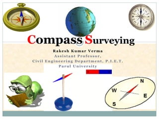
  • 1. R a k e s h K u m a r V e r m a A s s i s t a n t P r o f e s s o r , C i v i l E n g i n e e r i n g D e p a r t m e n t , P . I . E . T . P a r u l U n i v e r s i t y Compass Surveying
  • 2. Definitions  True Meridian  True Bearing /Azimuth  Magnetic Meridian  Magnetic Bearing /Bearing  Arbitrary Meridian  Arbitrary Bearing.  Grid Meridian  Grid Bearing
  • 5.
  • 7. Equatorial Plane Location of Man λ α α- Longitude λ- Latitude Understanding of Lat. & Long. Observer's Plane
  • 8. (i) Whole Circle Bearing (WCB) (ii) Quadrantal Bearing (QB)  WCB  QB Designation of Magnetic Bearing O NN W SS E EW SE NW SW NE O O A B A B Clockwise rotation has to be followed
  • 9. Reduced Bearing (RB) Fore And Back Bearing  Similar to Quadrant Bearing  Obtained when,  Depended on direction of main survey line Bearing WCB QBConvert N Direction of Survey BM A B BB FB North
  • 10. WCB-----QB Reduced Bearing (RB) O A φ α WCB reading=α=220ᵒ QB reading=φ=220ᵒ-180ᵒ =S 40ᵒW N S EW
  • 12. N W S E φ α=φ RB NE 180ᵒ-φ1= α RB SEφ2+180ᵒ= α RB SW 360ᵒ- φ3=α RBNW Conversion of RB to WCB φ2 φ1 φ3
  • 13. Fore Bearing & Back Bearing  Bearing taken in forward direction of survey line- FB  Bearing taken in backward direction of survey line- BB FB BB A B B A
  • 14. Magnetic Declination  The Horizontal Angle Between the Magnetic Meridian and True Meridian is known as ‘magnetic declination’.  When the north end of the magnetic needle is pointed towards the west side of the true meridian, the position is termed ‘Declination West’ ().  When the north end of the magnetic needle is pointed towards the east side of the true meridian, the position is termed ‘Declination East’
  • 16. Isogonic and Agonic Lines  Lines Passing Through Points Of Equal Declination are known as ‘isogonic’ lines.  The Survey of India Department has prepared a map of India in which the isogonic and agonic lines are shown properly as a guideline to conduct the compass survey in different parts of the country.
  • 18. Dip of the Magnetic Needle Inclination from the horizontal plane Zero inclination at the equator
  • 19. Dip of the Magnetic Needle
  • 20. Local Attraction  Error introduced in direction of magnetic needle due to magnetic materials such as iron ore, steel structures, electric cables conveying current; etc.  Then it does not show the actual north. This phenomenon is known as ‘local attraction’.  If  Error compensation  Divide equally in FB & BB Error of local attractionFB-BB≠ 180 degrees FB-BB= 180 degrees Free from local attraction
  • 21. Example For example, consider the case when Observed FB of AB = 60030’ Observed BB of AB = 24000’ Calculated BB of AB = 600300 + 18000’ = 240030’ Corrected BB of AB = 1/2 (24000’ + 240030’) = 240015’ Hence, Corrected FB of AB = 240015’ – 18000’ = 60015’
  • 22. Principle of Compass Surveying  Traversing, which Involves A Series of Connected Lines.  The magnetic bearings of the lines are measured by prismatic compass and  The distances of the lines are measured by chain.  Such survey does not require the formation of a network of triangles.  Interior details are located by taking offsets from the main survey lines. Sometimes subsidiary lines may be taken for locating these details.  Compass surveying is not recommended for areas where local attraction is suspected due to the presence of magnetic substances like steel structures, iron ore deposits, electric cables conveying current, and so on.
  • 23. TRAVERSING  Well Defined Network of Connected Lines  The sides of the traverse are known as ‘traverse legs’.  Measurements  A traverse may be of two types –  Closed traverse 1. closed loop (i.e. when the finishing point coincides with the starting point  Open traverse 1. connected lines extends along a general direction and does not return to the starting point, 2. Open traverse is suitable for the survey of roads, rivers, coast lines, etc Lengths of Lines Directions Chain Compass or Theodolite
  • 24. Methods of Traversing Chain traversing (by chain angle) Compass traversing (by free needle) Theodolite traversing (by fast needle) and Plane table traversing (by plane table)
  • 25. Check on Angular Measurements (a) The sum of the measured Interior Angles should be equal to (2N – 4) x 90ᵒ where N is the number of sides of the traverse. (b) The sum of the measured Exterior Angles should be equal to (2N + 4) x 90ᵒ (c) The algebraic sum of the Deflection Angles should be equal to 360ᵒ Right-hand deflection is considered positive and left-hand deflection negative.
  • 26. Check on Linear Measurement (a) The lines should be measurement once each on two different days (along opposite directions). Both measurements should tally. (b) Linear measurements should also be taken by the stadia method. The measurements by chaining and by the stadia method should tally.
  • 27. Check on Open Traverse  No Direct checks available, but following methods can be adopted 1. Taking cut-off lines 2. Taking an auxiliary point
  • 28. A F E C D B N N N N N For Check Taking Cut-off Lines Cut-off lines are taken between some intermediate stations of the open traverse. Let AD and DG be the cut-off lines. The lengths and magnetic bearings of the cut-off lines are measured accurately. After plotting the traverse, the distances and bearings are noted from the map. These distances and bearings should tally with the actual records from the field
  • 29. Taking an Auxiliary Point A D C B E P N N N N N A permanent point ‘P’ is selected on one side of it. If the survey is carried out accurately and so is the plotting, all the measured bearings of P when plotted should meet at the point P. The permanent point P is known as the ‘auxiliary point’
  • 30. The prismatic compass The Surveyor’s compass Types of Compass
  • 31. Components of Prismatic Compass Construction Zero degree marked at South and 90 degree at North
  • 32. Vanes Eye Vane Guide Vane Magnetic Needle Bubble Tube Screw Circular Metal Box Dia.-8 to 10cm Fixed Graduated Plane
  • 33. Sr. No. Base Of Comparison Prismatic Compass Surveyor Compass 1 First look Prism at one end and slit on other No prism only Slit at both end 2 Use of Tripod Stand May or may not use along, Steady hold in hand also give good results Use of Tripod stand is necessary 3 Observation/ Readings Taken with help of prism provided by eye slit Directly read from top of compass 4 Magnetic Needle Does not act as index Act as index 5 Graduation WCB system QB system 6 Graduation marking Appear inverted from top, Zero at south & 180 degrees at north Mark directly Zero at North and 90 degree at East 7 Graduated circle Attached with needle, Does not rotate with line of sight Permanently attached with box, rotates with line of sight Comparison between Prismatic Compass and Surveyor Compass
  • 34. Temporary Adjustment of Compass Centering Levelling Focusing 1. Adjustment of prism 2. Bisecting/Observation of bearing
  • 35. Northφ1 φ3 φ2 Determination of Reduced Bearing A O C B Angle AOB=φ2-φ1 Angle BOC= φ3-φ2Angle AOC= φ3-φ1
  • 36. North φ3 φ2 φ1 φ4 C AB Field WorkIncluded Angles BAC= φ2 Included Angles ACB=φ3 Included Angles ABC=φ4 Determination of Included Angles Dist. AB