
Recommended
More Related Content
What's hot
What's hot (20)
Viewers also liked
Viewers also liked (13)
Similar to 8 oceanography ppt
Similar to 8 oceanography ppt (20)
More from lorizimmerman
More from lorizimmerman (19)
Recently uploaded
Recently uploaded (20)
8 oceanography ppt
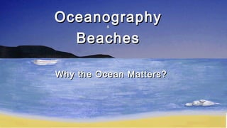
- 1. OceanographyOceanography&& BeachesBeaches Why the Ocean Matters?Why the Ocean Matters?
- 2. Follow the directions at the bottom of the page. COLOR it LAST!!! Use your textbook to find the features it asks for. Helpful Book Pages:Helpful Book Pages: Page 31Page 31 Page 449Page 449 Pages 396-397Pages 396-397
- 3. The Ocean Floor - The Vast World Ocean Origin of the OceansOrigin of the Oceans How old is the Earth? 4.6 billion years old Where did the water come from? 1. Comets and Meteorites: - Carry lots of water, which transferred to Earth upon impact 2. Volcanism: -volcanic gas has mostly water vapor and CO2 -The CO2 and other gases formed the Earth's atmosphere -As the Earth cooled, the water vapor condensed, forming the oceans.
- 4. he Blue Planethe Blue Planet arth is known as the "Blue Planet" because ~75% of it is covered y oceans. -Average Depth of the Oceans: 3800 m (3.8 km) -Where is most of the water - Northern or Southern Hemisphere? Southern -All oceans are really one big body of water. -97% of the water on Earth is found in the oceans. Only 3% is freshwater. -OCEANOGRAPHY = study of Earth's oceans
- 5. Sea Level = level of the ocean's surfaces. -Sea Level has risen and fallen by hundreds of meters due to the.. -Ice Caps melting (H2O level rises) and Glaciers expanding (H2O level falls) -Sea Level is also affected by tectonics. -TECTONICS = movement of Earth's landmasses. -Tectonics can change the level of the seafloor, thus changing sea levels. -Currently, sea level is rising 1-2mm/year due to melting glaciers
- 7. GEOGRAPHY of the OCEANS There are 4 major Oceans: -Pacific, Atlantic, Indian, & Arctic Largest = Pacific Smallest = Arctic Sea Ice: Ice is ( more / less ) dense than water, so it floats. SEAS = smaller than oceans, and partially or fully landlocked. -All seas and oceans belong to one global ocean, whose waters are thoroughly mixed.
- 8. Mapping the Ocean FloorMapping the Ocean Floor The topography of the ocean floor is as diverse as that of the continents. Bathymetry = measurement of the ocean floor (bathos = depth, metry = measurement) Began with the ship "Challenger" in the 1870s -Although today's technology is much more sophisticated!! SONAR was first used in the 1920s to map the seafloor features of the S. Atlantic Ocean. SONAR = SOund NAvigation and Ranging How does it work? Uses echoes of sound, return time, and velocity of sound in water to measure depth. -See p. 398 in text. Drain the Ocean- Nat Geo
- 9. Side-Scan Sonar = aim SONAR at angles. t is used to map underwater hills, trenches, ridges, etc. SATELLITES continually gather information about the ocean floor. -Data has shown that the ocean surface is not totally flat... -Why?? - Gravity attracts water toward regions where massive ocean floor features occur. - Mountains/Ridges have elevated water. Trenches have depressions.
- 10. SUBMERSIBLES (small underwater crafts) give us much data. Manned crafts: -Trieste - Jacques Piccard (1960) -Went to the Mariana Trench (10,912m) -Alvin - 4000m -Sea Cliff II - 6000m Unmanned crafts: called AUVs (autonomous underwater vehicles) Deep Sea Exploring
- 11. 14.1 - 14.2 Quiz: 1. Largest Ocean 2. Ocean that is on the EAST side of Africa 3. Name one place where our ocean's water came from. (there were 3) 4. What does SONAR stand for? 5. Name the 3 parts of the Continental Margin, IN ORDER, going from the beach into the ocean. 6. What is the name for the deep, very flat part of the ocean floor? 7. Which comes first: Atoll, Fringing Reef, or Barrier Reef? 8. What is the name for a dormant seamount that has been eroded? 9. What is the name for the deep cut in the ocean floor that is only found in the abyssal plain?
- 12. 1. Pacific 2. Indian 3. Any of these: meteorite, comets, volcanoes 4. Sound Navigation and Ranging 5. 3 points: IN ORDER: Cont.Shelf, Cont.Slope, Cont.Rise 6. Abyssal Plain 7. Fringing Reef 8. Guyot 9. Trench ANSWERS!!!
- 13. Types of Coral ReefsTypes of Coral Reefs Fringing- directly attached to the shore of a volcanic island. No lagoon present.
- 14. Atoll- Circular coral reef that surrounds a central lagoon of quiet water. Forms on top of the cone of a submerged volcano island.
- 15. Barrier- A lagoon of open water separates reef from the nearby land. Largest is Great Barrier Reef, Australia (1,200 mi long and 62 mi wide)
- 18. Ocean Water and Ocean Life THE COMPOSITION OF SEAWATER SALINITY •Salinity: the total amount of solid material dissolved in water. •Seawater is about 96.5 % water and 3.5 % dissolved salts. •• Average salinity: 35 ppt (3.5 %) • Most abundant salt in seawater: sodium chloride (NaCl) •Seawater also has dissolved gases (CO2) and nutrients •Sources of Sea Salts: chemical weathering of rocks and volcanism
- 19. Processes Affecting Salinity: Adding water decreases salinity: precipitation, runoff, icebergs & sea ice melting Losing water increases salinity: evaporation, formation of sea ice o How does salinity increase when sea ice forms? When ice forms, salt is left behind in the water.
- 20. OCEAN TEMPERATURE VARIATIONOCEAN TEMPERATURE VARIATION ·Surface Layer Temperatures: Varies with the amount of solar radiation received, which is a function of latitude. Middle latitudes (near the equator) have higher temperatures, and vice versa.
- 21. Temperature Variation with Depth: Colder water is denser than warmer water, so cold water will sink. Deeper = Colder! Three temperature layers: Surface layer: warmest Thermocline: (300m-1000m) a rapid change of temperature with depth. It creates a vertical barrier to many types of marine life. Bottom layer: coldest In polar regions, the surface layer & thermocline don't exist because it's too cold.
- 22. OCEAN DENSITY VARIATION Density varies with depth due to both temperature and salinity. Denser Water = ( colder or warmer ) and ( salty or fresh ) ... why floating is easier in the ocean! Density Lab
- 23. Warmup Quiz: 1) Does adding or losing water increase salinity? 2) Name one way the Earth naturally decreases salinity. 3) How does density affect ocean currents? 4) In the ocean, the deeper the water, the colder / warmer and saltier / fresher it is. 5) What are the two (2) factors that influence the density of ocean water?
- 24. Density Lab Questions 1. What is density? 2. Which has a higher density, salty water or fresh water? 3. Which has a higher density, cold water or warm water? 4. How would an increase in evaporation effect the density of ocean water? 5. Which would contain more water molecules? Explain. 6. When seawater freezes in polar regions, most of the salt is left behind. How would this effect the density of the water that is left unfrozen?
- 25. The Dynamic Ocean OCEAN CIRCULATION & WAVES AND TIDES 4 Movements of the Ocean: Waves, Tides, Currents & Upwellings WAVES = Rhythmic movement that carries energy through space or matter (water) - Generated mainly by wind - As a wave passes, water moves in a circle, returning to its original position. -The water doesn't move forward, only the energy.
- 26. ve Measurements: ighest point = crestcrest. Lowest point = troughtrough. istance from Crest to Trough = wave heightwave height. istance from Crest to Crest (or trough to trough) wavelength. Wave speed decreases with wavelength.
- 27. -- As waves reach the shallow water near a shoreline, energyenergy is lost due to frictionis lost due to friction against the seafloor. This slows the wave - Incoming wave crests catch up with slower crests, decreasing the wavelength. - Waves get higher, steeper, and unstable, causing the crests to collapse. - Collapsing wave crests = breakersbreakers. Science of Surf
- 28. OCEAN CURRENTS CURRENTCURRENT = movement of a section of water - Density CurrentDensity Current = controlled by density. Move very slowly. - Surface CurrentSurface Current = controlled by wind. Move very quickly. -Only affect the top few hundred meters of water
- 29. Currents flow westwardwestward near the equator. When they hit land, they are deflected toward the poles. This carries warm water to colder regionswarm water to colder regions of the world. When it gets to the polar regions, the water cools and is deflected back toward the equator on the other side of the ocean. This creates large GYRES!
- 30. GYRES - Continents deflect some currents so that they join other currents, causing a circular current, called a gyre. - 5 Major Gyres: North & South Pacific, North & South Atlantic, and Indian Ocean - In the Northern Hemisphere, the gyres circulate in a clockwise direction. DUE to the CORIOLIS Effect -In the Southern Hemisphere, the gyres circulate
- 31. The North Pacific Gyre
- 33. UPWELLINGUPWELLING ·· Water not only moves horizontally (currents) but itWater not only moves horizontally (currents) but it also moves vertically.also moves vertically. ·· UPWELLING =UPWELLING = upward motion of ocean waterupward motion of ocean water ·· Cold water flows upward to replaceCold water flows upward to replace warm surface water blown out towarm surface water blown out to sea by offshore winds.sea by offshore winds. ·· They mainly occur on western coasts.They mainly occur on western coasts. ·· Rich in nutrients, thus supporting lots of marine life.Rich in nutrients, thus supporting lots of marine life.
- 34. TIDES = periodic rise and fall of sea level · High Tide = highest level · Low Tide = lowest level · Tidal Cycles (High Tide Low Tide High Tide) usually = 24 hrs 50 mins -Diurnal: 1 high tide, 1 low tide every day -Semidiurnal: 2 high tides, 2 low tides every day (this is what we have in NC) -Mixed: 1 high, 1 low, 1 semi-high, 1 semi-low every day
- 35. Spring and Neap Tides: -Gravitational Pull of the Moon and the Sun -Spring Tide = High tide is highest, low tide is lowest. -Neap Tide = High tide is lower than usual, low tide higher than usual. Which is bigger - Solar or Lunar tides? Why?? -Moon is closer, so it has more gravitational pull Discovery Ed- Tides
- 36. Created by L. Zimmerman Ocean Waves The most important agent shaping coastal landforms is wave action. And WHY do you need to know this? – because North Carolina has a unique coastal barrier island and 100’s of miles of shoreline!
- 37. Created by L. Zimmerman Ocean Waves1.1. Most of the ocean’s surface waves are caused byMost of the ocean’s surface waves are caused by thethe WINDWIND.. As wind moves over the ocean, it produces waves and currents that erode the bordering land. Waves can also be produced by underwater earthquakes and the effect of the moon in producing tides.
- 38. Created by L. Zimmerman Normal winds rarely produce ocean waves higher than 15m. 2. The wind determines the size of the wave and depends on: Time Strength of the wind Fetch 3.3. FetchFetch is the length of open water over which the wind blows..
- 39. Created by L. Zimmerman 4. The distance from crest to crest is the WAVELENGTHWAVELENGTH • Each particle moves in place in a circular motion. • This motion occurs below the surface as well, in smaller and smaller circles.
- 40. Created by L. Zimmerman SURF 5. When waves enter shallow water near the shore, they dragdrag against the bottom. The waves then become unstable and water rushes toward the shore as breakingbreaking waveswaves oror surfsurf.
- 41. Created by L. Zimmerman 6.6. Wave movement toward the shore often builds up aWave movement toward the shore often builds up a strip of sediment at the coastline called astrip of sediment at the coastline called a beachbeach.. 77. Beaches are composed of whatever sediment is. Beaches are composed of whatever sediment is available, but most beaches are composed ofavailable, but most beaches are composed of sandsand..
- 42. Created by L. Zimmerman 8. Waves moving at an angle to the shoreline push water along the shore creating a longshore currentlongshore current. A longshore current is a movement of water parallel to and near the shoreline. Longshore currents transport sand in a direction parallel to the shoreline.
- 43. Created by L. Zimmerman Sand moving along a relatively straight shore keeps moving until the shoreline changes direction. This happens at bays and headlands. Here the longshore current slows and sand is deposited at the near end of the headland. 9. A long narrow deposit of sand connected at one end to the shore is called a spitspit.
- 44. Created by L. Zimmerman SPIT
- 45. Created by L. Zimmerman Long Point, Lake Erie, Canada Long Shore Current Long Shore Current
- 46. Created by L. Zimmerman Rip Currents Signs that a rip current is present are very subtle and difficult for the average beachgoer to identify. Look for differences in the water color, water motion, or incoming wave shape.
- 47. Created by L. Zimmerman Oregon Inlet – Nags Head, NC
- 48. Created by L. Zimmerman During storms waves can be much moreDuring storms waves can be much more powerful than normal.powerful than normal.
- 49. Created by L. Zimmerman 10. During these10. During these times the beachtimes the beach tends totends to erodeerode moremore and the sandand the sand is carried back intois carried back into the ocean.the ocean. There it is usuallyThere it is usually depositeddeposited asas underwater barsunderwater bars parallel to theparallel to the shore.shore.
- 50. Created by L. Zimmerman 11. If these sand bars rise above the average sea11. If these sand bars rise above the average sea level winds will help to pile up sediment.level winds will help to pile up sediment. When vegetation begins to grow and stabilize theWhen vegetation begins to grow and stabilize the offshore sediment pile, aoffshore sediment pile, a barrier islandbarrier island is created.is created.
- 51. The Barrier Islands on the Outer Banks
- 52. Created by L. Zimmerman Hatteras – Ocracoke Island, NC Pamlico Sound (Land Side) Atlantic Ocean – Sea Side Barrier Island
- 54. Wave Impact Breaking waves against land causes cracks and crevaces to open in cliffs. Water is forced into these displacing air. Air expands and disloge rock fragments & extends features.
- 55. Wave Refraction Bending of waves affecting distribution of energy along theBending of waves affecting distribution of energy along the shore.shore. Influences erosion, sediment transfer & deposition take place Concentrated at headlands
- 56. Wave-Cut Cliffs Cutting action of the surf against the base of coastal land
- 57. Platforms Flat, bench like surface is left from cutting waves.
- 58. Sea Arches Surf wears away softer rock & cave forms. When two caves connect, a sea arch is formed.
- 59. Sea Stack Sea arch falls into the ocean leaving isolated piece.
- 61. Barrier Island Narrow sandbars parallel to but separated from the coast by 3-30 km offshore (300 on US coast in NC, MA, TX, SC)
- 62. Spit Elongated ridge of sand that projects from land into theElongated ridge of sand that projects from land into the mouth of an adjacent baymouth of an adjacent bay
- 63. Bar Form across a bay where currents are weak.Form across a bay where currents are weak.
- 64. Tombolo Ridge of sand that connects an island to theRidge of sand that connects an island to the mainland or to another islandmainland or to another island
- 65. STABILIZING THE SHORE Man-made structuresMan-made structures designed to “SAVE” thedesigned to “SAVE” the beaches and/or protectbeaches and/or protect coastal erosioncoastal erosion
- 66. Created by L. Zimmerman Man-Made structures – Help or Hindrance? 12. Jetties and groinsJetties and groins are structures designed to modify or control sand movement.. Groins extend like fingers away from the shore. Jetties are built where a river empties into ocean.
- 67. Created by L. Zimmerman The Problem????
- 68. Groins and Jetties Barrier built at a right angle to shore to keep sand in place
- 69. Breakwall Barrier built perpendicular to the shore to stop incoming waves from damaging shore.
- 70. Seawall Barrier built parallel to the shore to stop incoming waves from damaging shore.
- 71. Pros & Cons to groins, breakwaters & seawalls PRO Protect shoreline & boats from wave action impact & erosion Con Temporary structure Interfere with natural process of erosion & deposition More structures must be built