
Recommended
Recommended
More Related Content
What's hot
What's hot (20)
Similar to Thematic maps, spatial variability, mobile mapping systems and its application in precision farming
Similar to Thematic maps, spatial variability, mobile mapping systems and its application in precision farming (20)
More from Dr. M. Kumaresan Hort.
More from Dr. M. Kumaresan Hort. (20)
Recently uploaded
Recently uploaded (20)
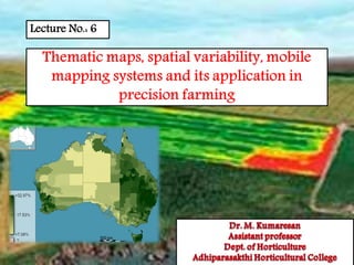
Thematic maps, spatial variability, mobile mapping systems and its application in precision farming
- 2. Thematic Maps ⦿ A thematic map shows georeferenced data, numeric or character, by colours or symbols. Specific data displayed in this manner is referred to as a theme ⦿ Different types of thematic maps, useful for showing different types of thematic variables ⦿ Commonly used to show natural resources, vegetation areas, population, types of soil, climate, temperature etc., ⦿ A thematic map is a map that highlights a particular theme or special topic such as the average distribution of rainfall in an area.
- 3. Thematic maps • A thematic map shows the spatial distribution of one or more specific data themes for standard geographic areas. • The map may be qualitative in nature (e.g., predominant farm types) or quantitative (e.g., percentage) • Data's are visualize on the basis of spatial concepts, like density, ratio, percentages, index numbers and of procedures like averaging. • To make things comparable, the data's are relate them to standard units like square kilometres, or convert them to standard situations.
- 4. Although cartographers can use these datasets in many different ways to create thematic maps, there are five thematic mapping techniques that are used most often. 1. Choropleth map • This is a map that represents quantitative data as a color and can show density, percent, average value or quantity of an event within a geographic area. • Sequential colors on these maps represent increasing or decreasing positive or negative data values. • Normally, each color also represents a range of values. TYPES OF THEMATIC MAPS
- 5. 2. Proportional or graduated symbols • Proportional or graduated symbols are the next type of map and represent data associated with point locations such as cities. • Data is displayed on these maps with proportionally sized symbols to show differences in occurrences. • Circles are most often used with these maps but squares and other geometric shapes are suitable as well.
- 6. 3. Isarithmic or contour map • Isolines that represent continuous values like precipitation levels. • These maps can also display three-dimensional values like elevation on topographic maps. Generally data for isarithmic maps is gathered via measureable points (e.g. - weather stations) or is collected by area (e.g. - tons of tomato per acre by county).
- 7. 4. DOT MAP • Is another type of thematic map and uses dots to show the presence of a theme and display a spatial design. • On these maps, a dot can represent one unit or several, depending on what is being painted with the map. 5. Dasymetric mapping • This map is a complex variation of the choropleth map and works by using statistics and extra information to combine areas with similar values
- 8. Data to display on a thematic map can be: • Nominal: distribution of a phenomenon without a measurement. Label, category. (Qualitative) • Ordinal: Ranked data. High, medium, low or how much greater than. (Quantitative) • Ratio/Interval: how much different, measured by numbers. (Quantitative)
- 9. Spatial variability • Spatial variability occurs when a quantity that is measured at different spatial locations exhibits values that differ across the locations. • Spatial variability can be assessed using spatial descriptive statistics such as the range. • Spatial variability does not have to be ignored when managing horticultural fields using precision farming techniques.
- 10. • Key applications where precision horticulture is used for more efficient management of spatial variability include variable rate application of fertilizer, herbicide, irrigation and seed. • These applications are intended to help improve the efficiency of farm input applications, leading to improved profitability and environmental quality. Spatial variability
- 11. Mobile Mapping • Mobile Mapping System is an information technology that has been developed since late 1980s with the advance and progress in mobile positioning technology, modern communication technology, spatial information technology and embedded technology, etc. • Integrating diversiform advanced technologies above-mentioned, Mobile Mapping System is capable of real time data accessing, mapping and spatial data visualization.
- 12. • Precision horticulture (precision farming, digital horticulture) has evolved from a concept ten years ago into an emerging technology today. • Its basic purpose is to manage farmland by the square meter instead of the square mile. • It is assured that precision horticulture can be described as the next great evolution in horticulture. • With Mobile Mapping System, every inch soil can be monitor and planting data in detail can be acquired anywhere anytime. Mobile Mapping
- 13. • Mobile Mapping System not only collects dynamic data about some object in moving, but also manipulates these data in order to make decision efficiently, and make these data be downloaded into a desktop GIS simultaneously by wireless or wire communication as you like. Mobile Mapping • Now Mobile Mapping System has been applied in many fields, such as intelligent transport, precision horticulture, field surveying and environment engineering and so on for outstanding real time supply is very essential in these fields and Mobile Mapping System can do.
- 14. Mobile Mapping System in Precision Horticulture • For precision farming, information technologies are so essential that Mobile Mapping System is important or beneficial. • Equipped with mapping sensors and navigation sensors, Mobile Mapping System can collect field data anytime, anywhere, in any manner. • At the same time, Mobile Mapping System can connected with a GIS or combine GIS software in its mobile terminals directly. • Thus Mobile Mapping System can monitor planting process all along. • Moreover it can contrast multi-temporal data collected or stored in database and find what changes occurred, where, when and how, then give an efficient plant plan.
- 15. Function of Mobile Mapping System in precision horticulture Improve the Accuracy of Soil Sampling • Accuracy of soil sampling refers mainly to accurate degree of the position information where the soil samples were taken. With the accurate knowledge about the coordinate location of the soil samples, a soil data layer can be developed accordingly. With the accurate position information, navigating back to those locations for re-sampling is possible. • Mobile Mapping System has equipped navigation sensors, such as GPS and INS, so the time and position information can be recorded at the same time when soil samples are taken. Consequently a soil difference map can be create, on which physical attribute of soil is described.
- 16. Plant Growth, Diseases and Insect Pests Monitor • Generally precision horticulture is raised in a large area. Hereby it is impossible for all plants growing in like manner. • Sometime only a single part suffers the diseases and insect pests. • Then it is unnecessary and even harmful for all plants to spray pesticide or other medicine in the same way. • Different solution should be taken according to the real conditions of plants. Function of Mobile Mapping System in precision horticulture
- 17. • Mobile Mapping System can finish the monitor task of all the plants. • Using the scanners, the peculiar plants can be found quickly, and its position also can be recorded. • In fact satellite remote sensing data also can provide such difference information. • Compare with Mobile Mapping System, its spatial range is much larger but space resolution is lower and forced by satellite calendar. Plant Growth, Diseases and Insect Pests Monitor Function of Mobile Mapping System in precision horticulture
- 18. Analysis of the Crop and Field Information • The purpose to get so much data about the soil, plant and so on is to master the planting conditions and to make decisions for all planting process. • Accordingly GIS and Agriculture Expert System are usually imported in precision horticulture in order to edit, process, integrate and analyze the crop and field information and get corresponding resolve scheme. • Mobile Mapping System may Load multi-source information and different types of horticultural data to master the conditions of the field. Function of Mobile Mapping System in precision horticulture
- 19. • Comparing the information or data, relationships within and between data sets can be found. That is the relationships among different factors can be made certain. By the relation, agronomist or Agriculture Expert System can make production plan. • After the production plan has been made, farmers can command the farming machines to work automatically, for these machines has been equipped intelligent implement and positioning devices. Moreover the entire process of one year farming also can be recorded and evaluated, and the experience can be analyzed to help next year work. Analysis of the Crop and Field Information Function of Mobile Mapping System in precision horticulture