Autonomous Infrastructure Inspection and Maintenance
•
2 likes•1,478 views

Presentation at the European Robotics Forum 2014, Kostas Alexis

Recommended
More Related Content
Viewers also liked
Viewers also liked (18)
Similar to Autonomous Infrastructure Inspection and Maintenance
Similar to Autonomous Infrastructure Inspection and Maintenance (20)
Recently uploaded
Recently uploaded (20)
Autonomous Infrastructure Inspection and Maintenance
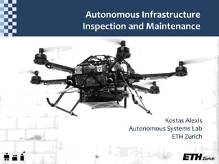
- 1. Autonomous Infrastructure Inspection and Maintenance Kostas Alexis Autonomous Systems Lab ETH Zurich
- 2. Concept Overview • Autonomous Path-Planning for Optimal Remote Structural Inspection • 3D reconstruction of the infrastructure facilities • Damage detection • Non-destructive Testing - Contact-based Inspection • Infrastructure Maintenance via Aerial Manipulation Ultimate goal: Complete Autonomous Infrastructure Inspection and Maintenance Solution Illustration of Infrastructure Inspection Scenario
- 3. Concept Overview A challenging mission! • Self-localization within complex environments • Robust and safe flight control • Efficient path-planning for remote inspection • Visual/Inertial-based environmental reconstruction • Obstacle Avoidance • Physical Interaction Control for contact-based inspection • Aerial robotic manipulation A great scientific/technological challenge with significant financial impact! Illustration of Infrastructure Inspection Scenario
- 4. Presentation Outline Autonomous Path-Planning for Remote Infrastructure Inspection 3D reconstruction of the environment State estimation and mapping Stereo-IMU Dense Reconstruction Physical Interaction Control for Contact-based Inspection Aerial robotic manipulation towards Infrastructure Maintenance
- 5. Path-planning for Infrastructure Inspection Develop algorithms that can: • Compute the path that an aerial vehicle has to follow to fully inspect a 3D structure assuming a specific visibility sensor model. • Compute such a path with minimum distance and account for vehicle limitations and constraints. • Compute inspection path in reasonable time despite its strong ND-hardness • Account for local changes of the structure and have robustness against uncertainty
- 6. Path-planning for Infrastructure Inspection Create a meta-tree structure to enable an incremental sampling-based approach to inspection path-planning Problem: given a representation of the structure, compute the optimal inspection path. Challenge: ensure full coverage and cost optimality while handling constraints and keeping the computational times low. Challenge: Have a good solution at “anytime”. Challenge: handle uncertainty. Goal: an efficient “anytime” inspection planning algorithm with performance guarantees.
- 7. Path-planning for Infrastructure Inspection Evaluation in a 2D scenario for Holonomic and Nonholonomic vehicles. Convergence plots are very promising!
- 8. Path-planning for Infrastructure Inspection Experimentally Evaluated considering both holonomic and nonholonomic vehicle trajectories. First paths are computed in a few seconds.
- 9. Path-planning for Infrastructure Inspection
- 10. State Estimation & Dense Reconstruction Fundamental requirement: Deployment of robust field robots capable of self-localization and reconstructing the model of the environment. Photo: Mine Inspection scenario M. Achtelik, M. Burri, M. Chli, P. Furgale, S. Leutenegger, S. Lynen, J. Nikolic, S. Omari, J. Rehder
- 11. State Estimation & Dense Reconstruction Visual-Inertial SLAM Sensor
- 12. State Estimation & Dense Reconstruction Tightly-coupled keyframe-based visual- inertial SLAM [1] Tight integration of IMU allows highly dynamic motions and efficient outlier rejection. • Realtime dense stereo-based 3D reconstruction – Poses: ASLam [1] – Stereo depthmap: ELAS [2] – Mapping: Octomap [3] • Efficient outlier rejection based on photoconsistency [1] S. Leutenegger et.al., “Keyframe-Based Visual-Inertial SLAM Using Nonlinear Optimization”, RSS 2013 [2] A.Geiger et.al., “Efficient Large Scale Stereo Matching”, ACCV 2010 [3[ A. Hornung et.al, “Octomap: An Efficient Probabilistic 3D Mapping Framework Based on Octrees” ,Aut. Rob. 2013
- 13. State Estimation & Dense Reconstruction
- 14. Aerial Contact-based Inspection Fully automate the process of contact-based inspection at all technologies involved: • Control • Perception • Planning This task is combined with the task of remote inspection as the selection of the “inspection through contact points” are based on the previously derived model of the environment.
- 15. Aerial Contact-based Inspection G. Darivianakis, K. Alexis, M. Burri, R. Siegwart, "Hybrid Predictive Control for Aerial Robotic Physical Interaction towards Inspection Operations", IEEE International Conference on Robotics and Automation, ICRA 2014, Hong Kong, China (accepted)
- 16. Aerial Contact-based Inspection Subject to: • Hybrid vehicle dynamics capturing all operation modes • Encoded Input/State constraints • Obstacle polyhedric constraints Hybrid Model Predictive Control problem over a prediction horizon N
- 18. Aerial Contact-based Inspection Problem: Compute the optimal route that inspects (in the sense of visiting) all the points in the structure. Challenge: close to real-time solvers. Challenge: handle non-smooth surfaces Challenge: allow for “on-the- fly” variation of the contact points
- 20. Heavy-Aerial Robotic Work-Task Execution Employ a tilt-rotor configuration to enable the execution of work-tasks that require forces exceeding the capabilities of typical MAVs. C. Papachristos et. al.
- 21. Heavy-Aerial Robotic Work-Task Execution
- 22. Summary Aerial Robots can greatly benefit Infrastructure Inspection and Maintenance It is a task that poses Great Scientific Challenges Main Areas of Scientific Research It corresponds to a market with great potential Single and Multi-robot Path-Planning for Inspection Single and Multi-robot Perception, Localization and Mapping Flight Control for Physical Interaction and Manipulation Aerial Manipulation Good time to make these systems autonomous and reliable – good time for business Aerial robot navigation and obstacle avoidance
- 23. Short list of References [1] G. Darivianakis, K. Alexis, M. Burri, R. Siegwart, "Hybrid Predictive Control for Aerial Robotic Physical Interaction towards Inspection Operations“, IEEE International Conference on Robotics and Automation (ICRA), 2014, Hong Kong, China [2] C. Papachristos, K. Alexis, A. Tzes, " Efficient Force Exertion for Aerial Robotic Manipulation: Exploiting the Thrust-Vectoring Authority of a Tri-TiltRotor UAV "IEEE International Conference on Robotics & Automation (ICRA), 2014, Hong Kong, China [3] K. Alexis, C. Huerzeler, R. Siegwart, “Hybrid Modeling and Control of a Coaxial Unmanned Rotorcraft Interacting with its Environment through Contact”, IEEE International Conference on Robotics and Automation, ICRA 2013, Karlsruhe, Germany [4] S. Leutenegger et.al., “Keyframe-Based Visual-Inertial SLAM Using Nonlinear Optimization”, RSS 2013 [5] Markus Achtelik, Sammy Omari, Roland Siegwart, Closing the MAV navigation loop: from control to localization and path-planning, IROS 2013 …and on going work…
- 24. Thank you! Questions? Kostas Alexis Autonomous Systems Lab ETH Zurich konstantinos.alexis@mavt.ethz.ch