SlideShare a Scribd company logo
1 of 8
Overview:
                       Joshua Tree National Park Field Trip
- In this lesson students will explore the varied ways in which humans have interacted within
the environment of the Joshua Tree National Park. They will also create maps, identify plant
life, wildlife, geological formations, and develop a better understanding of the ways in which
climate, physical Geography and time contribute to the different ways we use land.


Objectives:
- Students will be able to create mental maps and use spatial reasoning. They will gain an
understanding of how and why people choose specific locations for habitation. They will
develop map making skills and recognize how the subjects of keys and legends actually
appear in physical Geography. They will be able to express themselves through the creation
of maps and photographs. Reasoning skills will be increased through questions and
suppositions.

Standard:
- California state standards 4.1 and 4.2.

- National Geography standards: The World in Spatial Terms standards, 1, 2, and 3. Places and
Regions standards 4, 5, and 6. Human Systems standard 12. Environment and Society
standards 14, 15, and 16. The uses of Geography standards 17 and 18.

Specifics:
- Grade level: fourth
- Number of sessions: three, Session one 40 minutes. Session two 6 hours. Session three 45
minutes.
- Number of adults: One for every 8 to 10 students up to 60 students.

Materials:
-Map of Coachella Valley, Blank Paper, Clip Boards, Colored Pencils, Disposable Digital
Camera.
Session one:
	

   The students who are by now familiar with
the coordinate grid system and understand
different regions and their climates will locate on
a globe where the Joshua Tree National Park is
located. Based on previous instruction they will
be asked to write down what they might expect
to find when they get to the park. This list will
include physical geographic characteristics,
population density, wildlife, plant life, water
resources and climate.


  Next the students will study their Coachella
Valley maps, paying specific attention to the key,
scale, and legend. The teacher can ask them to
describe how far they think a mile is or how many
miles they think they are from a mountain range.
This will help to get them thinking spatially, they
can apply distances in their own lives like how
long it takes to get home or to the grocery store.


  During this session the teacher serves to
encourage students to ask questions and to help
them develop mental maps. The questions and
theories will then be answered when they are on
the field trip.
Session two:

Part one.
	

  Students will arrive first at Key’s Desert Queen
Ranch. Under supervision they will explore the area
and create maps. They are encouraged to list as
many man made objects as well as naturally
occurring topographical objects that they can find.
	

  They will also be encouraged to guess what the
objects were used for and why. Students will also
take photos of the objects that they mark on their
maps. These photographs will be used in session
three.


   Next a parks employee will give an historical
narrative describing the area and its inhabitants past
and present. The employee will also describe life on
the ranch and reveal the actual purpose of the
buildings and artifacts located there.


 Students will be encouraged to ask questions.
Students will also learn if they were correct in
naming the uses for the buildings and objects. This
should take approximately an hour and a half
depending on the size of the group.
Part two.


   After a half hour lunch break the students will be
taken on a short hike to Barker Dam. Along the way
they will encounter a wide variety of plants and wild
life. They are encouraged to capture as many different
plants, animals, and rock formations as they can with
their cameras. Students will also have an opportunity
to see up close petroglyphs and drawings that date
back to the areas Native american inhabitants


   Once at Barker Dam the teacher can ask
questions and answer questions that the students may
have. There are also park rangers that can provide
information about the areas physical geography and
the history of the Dam itself.


   This should take about two hours.
Part Three.                                           Session Three:
                                                      	

   While viewing the slide show students can
	

  The final stage of the trip is a visit to Key’s   demonstrate what they have learned during the
View. At an elevation of over 5,000 feet, Key’s       field trip. If there is a computer lab available
view offers a panoramic vista which includes the      students can research the plant and wildlife they
Coachella Valley, Palm Springs, The Salton Sea,       have captured in their photographs. Students can
El Centro and many other landmarks both               also print copies of their photos to accompany
natural and man made.                                 the maps they created adding representative
                                                      images to key objects on the map.


   It is here that the students can look down
                                                      	

from above and see first hand what they may
have only seen on their maps or at ground level.


   With their maps in hand they can circle
with colored pencils the things they spot. This       	

vantage point will greatly increase their spatial
understanding of Geography. They may for
instance determine for themselves why I-10
runs the way it does rather than through the
Morongo Basin. They can also take photos and
encourage one another in the hunt for new
items to circle.


   At the end of the field trip the teacher
will collect all of the digital cameras. The
teacher will create a slide show for the students
to view during session three.
California State Standards 4.1 and 4.2

- 4.1.1: Students locate Joshua Tree National Park using longitudinal and latitudinal coordinates.

- 4.1.2: Students determine which hemisphere the park and there own cities are located.

- 4.1.3: Students identify the Mojave Desert region and the vegetation, landforms, and climate of the park.

- 4.1.4: Students can locate mountains, valleys, rivers from Key’s view.

- 4.1.5: Students use and create maps and can witness the differences between the Coachella Valley and High
	

      Desert communities as well as within the Park itself

- 4.2.1: Students learn about the Native Americans who lived in the area of the park prior to settlement and
	

      also have the opportunity to see first hand the some of the art works they created.

National Geography Standards

The World in Spatial Terms:

- Standard one: Students make and use maps learning from a spatial perspective.

- Standard two: Students use mental maps to organize their questions and suppositions J.T.N.P.

- Standard three: Students will compare their own cities with those in the high desert.

Places and Regions:

- Standard five: Students will see how the lack of water resources affect how and where people settle.

- Standard six: Where the park was once home to Native Americans, then to settlers who grazed cattle it is


       now home to visitors from all around the globe and it serves many functions from simply


       looking at the rocks to actually climbing them.
Human Systems

Standard twelve:    At Key’s Ranch and Barker Dam students will see how even in the wilderness people tend to


           have a pattern of development. They will also see many vehicles, machines, wells, windmills, and


           various other artifacts that fairly recently allowed Key to live and thrive. They will also be able


           to compare Key’s experience with that of the Native Americans and with how people live


           elsewhere today.

Environment and Society

Standard Fourteen: Students will clearly see the contrast between the environment within the park and the


          environment outside of the protected area. They will also see how Key’s development


    affected the area.

Standard Fifteen: Students will see how the terrain and climate affect the ways in which people interact with


         and develop them.

Standard Sixteen:   As a land resource the Joshua Tree National Park has changed over time. Initially inhabited by


           Native tribes it was not settled as much as being used for its sheltering rocks and wildlife.


           However there are still signs of the indigenous people etched on the rocks and in pottery,


           arrowheads and make shift shelters. Then it was used by ranchers and miners who were


           trying to make a living off the land if not become rich from it. Now it is a protected National


           Park which is home to visitors from around the world and it’s uses vary as wildly as its


           landscape. Students will get a first hand account of these changes.
Expected outcome:


 I expect that students will learn to
reason spatially and apply what they witness
to the study of maps, globes, streets,
buildings, mountains, deserts, rivers, and
valleys. Hopefully they will gain an
inquisitiveness and an overwhelming need to
ask questions about their surroundings and
places beyond their immediate experience.
That they will continually develop the need
to know more. By starting out in session
one with questions, then by traveling to find
the answers to these questions students will
learn to ask more questions and understand
better how to find the answers they seek.

More Related Content

Viewers also liked

www.aulasapoio.com - Português - Oração Subordinada
www.aulasapoio.com - Português -  Oração Subordinadawww.aulasapoio.com - Português -  Oração Subordinada
www.aulasapoio.com - Português - Oração SubordinadaAulas Apoio
 
Untitled presentation
Untitled presentationUntitled presentation
Untitled presentationDiana Yepes
 
I pads powerpoint final project
I pads powerpoint final projectI pads powerpoint final project
I pads powerpoint final projectWalden University
 
iPad in Secondary Educational settings
iPad in Secondary Educational settingsiPad in Secondary Educational settings
iPad in Secondary Educational settingsSean Simper
 
Classroom Management Tips for Kids and Adolescents
Classroom Management Tips for Kids and AdolescentsClassroom Management Tips for Kids and Adolescents
Classroom Management Tips for Kids and AdolescentsShelly Sanchez Terrell
 

Viewers also liked (7)

www.aulasapoio.com - Português - Oração Subordinada
www.aulasapoio.com - Português -  Oração Subordinadawww.aulasapoio.com - Português -  Oração Subordinada
www.aulasapoio.com - Português - Oração Subordinada
 
Pres site
Pres sitePres site
Pres site
 
Untitled presentation
Untitled presentationUntitled presentation
Untitled presentation
 
I pads powerpoint final project
I pads powerpoint final projectI pads powerpoint final project
I pads powerpoint final project
 
iPad in Schools
iPad in Schools   iPad in Schools
iPad in Schools
 
iPad in Secondary Educational settings
iPad in Secondary Educational settingsiPad in Secondary Educational settings
iPad in Secondary Educational settings
 
Classroom Management Tips for Kids and Adolescents
Classroom Management Tips for Kids and AdolescentsClassroom Management Tips for Kids and Adolescents
Classroom Management Tips for Kids and Adolescents
 

Similar to Jason Curodeau

Assure Method Unit Plan Microsoft 2007
Assure Method Unit Plan Microsoft 2007Assure Method Unit Plan Microsoft 2007
Assure Method Unit Plan Microsoft 2007Marshall University
 
Reflection on teaching and learning
Reflection on teaching and  learningReflection on teaching and  learning
Reflection on teaching and learningTracie Toy
 
Social studies lesson plan #2
Social studies lesson plan #2Social studies lesson plan #2
Social studies lesson plan #2Tracie Toy
 
Social studies lesson plan #4
Social studies lesson plan #4Social studies lesson plan #4
Social studies lesson plan #4Tracie Toy
 
Year4 curriculumstatement20142015term1
Year4 curriculumstatement20142015term1Year4 curriculumstatement20142015term1
Year4 curriculumstatement20142015term1BIS Ha Noi
 
Social studies lesson plan #1
Social studies lesson plan #1Social studies lesson plan #1
Social studies lesson plan #1Tracie Toy
 
Diamond valley lake2
Diamond valley lake2Diamond valley lake2
Diamond valley lake2foreva100
 
Diamond valley lake2
Diamond valley lake2Diamond valley lake2
Diamond valley lake2foreva100
 
Ci 350 Unit Plan
Ci 350 Unit PlanCi 350 Unit Plan
Ci 350 Unit Planball130
 
Geography during science
Geography during scienceGeography during science
Geography during scienceCrystalActon
 
Native american p.p.
Native american p.p.Native american p.p.
Native american p.p.foreva100
 
Katz,Emily_CoralReef
Katz,Emily_CoralReefKatz,Emily_CoralReef
Katz,Emily_CoralReeferkatz
 

Similar to Jason Curodeau (20)

Pgqm final presentation
Pgqm final presentationPgqm final presentation
Pgqm final presentation
 
Sea world
Sea worldSea world
Sea world
 
Sea world
Sea worldSea world
Sea world
 
Assure Method Unit Plan 2
Assure Method Unit Plan 2Assure Method Unit Plan 2
Assure Method Unit Plan 2
 
Assure Method Unit Plan Microsoft 2007
Assure Method Unit Plan Microsoft 2007Assure Method Unit Plan Microsoft 2007
Assure Method Unit Plan Microsoft 2007
 
Reflection on teaching and learning
Reflection on teaching and  learningReflection on teaching and  learning
Reflection on teaching and learning
 
Social studies lesson plan #2
Social studies lesson plan #2Social studies lesson plan #2
Social studies lesson plan #2
 
Social studies lesson plan #4
Social studies lesson plan #4Social studies lesson plan #4
Social studies lesson plan #4
 
Year4 curriculumstatement20142015term1
Year4 curriculumstatement20142015term1Year4 curriculumstatement20142015term1
Year4 curriculumstatement20142015term1
 
Social studies lesson plan #1
Social studies lesson plan #1Social studies lesson plan #1
Social studies lesson plan #1
 
Geohraphy
GeohraphyGeohraphy
Geohraphy
 
Diamond valley lake2
Diamond valley lake2Diamond valley lake2
Diamond valley lake2
 
Diamond valley lake2
Diamond valley lake2Diamond valley lake2
Diamond valley lake2
 
Ci 350 Unit Plan
Ci 350 Unit PlanCi 350 Unit Plan
Ci 350 Unit Plan
 
Geography during science
Geography during scienceGeography during science
Geography during science
 
Assure Method Unit Plan 2
Assure Method Unit Plan 2Assure Method Unit Plan 2
Assure Method Unit Plan 2
 
Assure Method Unit Plan Pdf
Assure Method Unit Plan  PdfAssure Method Unit Plan  Pdf
Assure Method Unit Plan Pdf
 
Assure Method Unit Plan Pdf
Assure Method Unit Plan  PdfAssure Method Unit Plan  Pdf
Assure Method Unit Plan Pdf
 
Native american p.p.
Native american p.p.Native american p.p.
Native american p.p.
 
Katz,Emily_CoralReef
Katz,Emily_CoralReefKatz,Emily_CoralReef
Katz,Emily_CoralReef
 

Recently uploaded

4.16.24 21st Century Movements for Black Lives.pptx
4.16.24 21st Century Movements for Black Lives.pptx4.16.24 21st Century Movements for Black Lives.pptx
4.16.24 21st Century Movements for Black Lives.pptxmary850239
 
How to Add Barcode on PDF Report in Odoo 17
How to Add Barcode on PDF Report in Odoo 17How to Add Barcode on PDF Report in Odoo 17
How to Add Barcode on PDF Report in Odoo 17Celine George
 
ACC 2024 Chronicles. Cardiology. Exam.pdf
ACC 2024 Chronicles. Cardiology. Exam.pdfACC 2024 Chronicles. Cardiology. Exam.pdf
ACC 2024 Chronicles. Cardiology. Exam.pdfSpandanaRallapalli
 
GRADE 4 - SUMMATIVE TEST QUARTER 4 ALL SUBJECTS
GRADE 4 - SUMMATIVE TEST QUARTER 4 ALL SUBJECTSGRADE 4 - SUMMATIVE TEST QUARTER 4 ALL SUBJECTS
GRADE 4 - SUMMATIVE TEST QUARTER 4 ALL SUBJECTSJoshuaGantuangco2
 
USPS® Forced Meter Migration - How to Know if Your Postage Meter Will Soon be...
USPS® Forced Meter Migration - How to Know if Your Postage Meter Will Soon be...USPS® Forced Meter Migration - How to Know if Your Postage Meter Will Soon be...
USPS® Forced Meter Migration - How to Know if Your Postage Meter Will Soon be...Postal Advocate Inc.
 
ECONOMIC CONTEXT - PAPER 1 Q3: NEWSPAPERS.pptx
ECONOMIC CONTEXT - PAPER 1 Q3: NEWSPAPERS.pptxECONOMIC CONTEXT - PAPER 1 Q3: NEWSPAPERS.pptx
ECONOMIC CONTEXT - PAPER 1 Q3: NEWSPAPERS.pptxiammrhaywood
 
Visit to a blind student's school🧑‍🦯🧑‍🦯(community medicine)
Visit to a blind student's school🧑‍🦯🧑‍🦯(community medicine)Visit to a blind student's school🧑‍🦯🧑‍🦯(community medicine)
Visit to a blind student's school🧑‍🦯🧑‍🦯(community medicine)lakshayb543
 
Difference Between Search & Browse Methods in Odoo 17
Difference Between Search & Browse Methods in Odoo 17Difference Between Search & Browse Methods in Odoo 17
Difference Between Search & Browse Methods in Odoo 17Celine George
 
Science 7 Quarter 4 Module 2: Natural Resources.pptx
Science 7 Quarter 4 Module 2: Natural Resources.pptxScience 7 Quarter 4 Module 2: Natural Resources.pptx
Science 7 Quarter 4 Module 2: Natural Resources.pptxMaryGraceBautista27
 
Earth Day Presentation wow hello nice great
Earth Day Presentation wow hello nice greatEarth Day Presentation wow hello nice great
Earth Day Presentation wow hello nice greatYousafMalik24
 
Keynote by Prof. Wurzer at Nordex about IP-design
Keynote by Prof. Wurzer at Nordex about IP-designKeynote by Prof. Wurzer at Nordex about IP-design
Keynote by Prof. Wurzer at Nordex about IP-designMIPLM
 
Concurrency Control in Database Management system
Concurrency Control in Database Management systemConcurrency Control in Database Management system
Concurrency Control in Database Management systemChristalin Nelson
 
Karra SKD Conference Presentation Revised.pptx
Karra SKD Conference Presentation Revised.pptxKarra SKD Conference Presentation Revised.pptx
Karra SKD Conference Presentation Revised.pptxAshokKarra1
 
AMERICAN LANGUAGE HUB_Level2_Student'sBook_Answerkey.pdf
AMERICAN LANGUAGE HUB_Level2_Student'sBook_Answerkey.pdfAMERICAN LANGUAGE HUB_Level2_Student'sBook_Answerkey.pdf
AMERICAN LANGUAGE HUB_Level2_Student'sBook_Answerkey.pdfphamnguyenenglishnb
 
Grade 9 Quarter 4 Dll Grade 9 Quarter 4 DLL.pdf
Grade 9 Quarter 4 Dll Grade 9 Quarter 4 DLL.pdfGrade 9 Quarter 4 Dll Grade 9 Quarter 4 DLL.pdf
Grade 9 Quarter 4 Dll Grade 9 Quarter 4 DLL.pdfJemuel Francisco
 
Barangay Council for the Protection of Children (BCPC) Orientation.pptx
Barangay Council for the Protection of Children (BCPC) Orientation.pptxBarangay Council for the Protection of Children (BCPC) Orientation.pptx
Barangay Council for the Protection of Children (BCPC) Orientation.pptxCarlos105
 
Incoming and Outgoing Shipments in 3 STEPS Using Odoo 17
Incoming and Outgoing Shipments in 3 STEPS Using Odoo 17Incoming and Outgoing Shipments in 3 STEPS Using Odoo 17
Incoming and Outgoing Shipments in 3 STEPS Using Odoo 17Celine George
 

Recently uploaded (20)

4.16.24 21st Century Movements for Black Lives.pptx
4.16.24 21st Century Movements for Black Lives.pptx4.16.24 21st Century Movements for Black Lives.pptx
4.16.24 21st Century Movements for Black Lives.pptx
 
How to Add Barcode on PDF Report in Odoo 17
How to Add Barcode on PDF Report in Odoo 17How to Add Barcode on PDF Report in Odoo 17
How to Add Barcode on PDF Report in Odoo 17
 
ACC 2024 Chronicles. Cardiology. Exam.pdf
ACC 2024 Chronicles. Cardiology. Exam.pdfACC 2024 Chronicles. Cardiology. Exam.pdf
ACC 2024 Chronicles. Cardiology. Exam.pdf
 
GRADE 4 - SUMMATIVE TEST QUARTER 4 ALL SUBJECTS
GRADE 4 - SUMMATIVE TEST QUARTER 4 ALL SUBJECTSGRADE 4 - SUMMATIVE TEST QUARTER 4 ALL SUBJECTS
GRADE 4 - SUMMATIVE TEST QUARTER 4 ALL SUBJECTS
 
USPS® Forced Meter Migration - How to Know if Your Postage Meter Will Soon be...
USPS® Forced Meter Migration - How to Know if Your Postage Meter Will Soon be...USPS® Forced Meter Migration - How to Know if Your Postage Meter Will Soon be...
USPS® Forced Meter Migration - How to Know if Your Postage Meter Will Soon be...
 
ECONOMIC CONTEXT - PAPER 1 Q3: NEWSPAPERS.pptx
ECONOMIC CONTEXT - PAPER 1 Q3: NEWSPAPERS.pptxECONOMIC CONTEXT - PAPER 1 Q3: NEWSPAPERS.pptx
ECONOMIC CONTEXT - PAPER 1 Q3: NEWSPAPERS.pptx
 
FINALS_OF_LEFT_ON_C'N_EL_DORADO_2024.pptx
FINALS_OF_LEFT_ON_C'N_EL_DORADO_2024.pptxFINALS_OF_LEFT_ON_C'N_EL_DORADO_2024.pptx
FINALS_OF_LEFT_ON_C'N_EL_DORADO_2024.pptx
 
Visit to a blind student's school🧑‍🦯🧑‍🦯(community medicine)
Visit to a blind student's school🧑‍🦯🧑‍🦯(community medicine)Visit to a blind student's school🧑‍🦯🧑‍🦯(community medicine)
Visit to a blind student's school🧑‍🦯🧑‍🦯(community medicine)
 
LEFT_ON_C'N_ PRELIMS_EL_DORADO_2024.pptx
LEFT_ON_C'N_ PRELIMS_EL_DORADO_2024.pptxLEFT_ON_C'N_ PRELIMS_EL_DORADO_2024.pptx
LEFT_ON_C'N_ PRELIMS_EL_DORADO_2024.pptx
 
Difference Between Search & Browse Methods in Odoo 17
Difference Between Search & Browse Methods in Odoo 17Difference Between Search & Browse Methods in Odoo 17
Difference Between Search & Browse Methods in Odoo 17
 
Science 7 Quarter 4 Module 2: Natural Resources.pptx
Science 7 Quarter 4 Module 2: Natural Resources.pptxScience 7 Quarter 4 Module 2: Natural Resources.pptx
Science 7 Quarter 4 Module 2: Natural Resources.pptx
 
Earth Day Presentation wow hello nice great
Earth Day Presentation wow hello nice greatEarth Day Presentation wow hello nice great
Earth Day Presentation wow hello nice great
 
Keynote by Prof. Wurzer at Nordex about IP-design
Keynote by Prof. Wurzer at Nordex about IP-designKeynote by Prof. Wurzer at Nordex about IP-design
Keynote by Prof. Wurzer at Nordex about IP-design
 
Concurrency Control in Database Management system
Concurrency Control in Database Management systemConcurrency Control in Database Management system
Concurrency Control in Database Management system
 
Karra SKD Conference Presentation Revised.pptx
Karra SKD Conference Presentation Revised.pptxKarra SKD Conference Presentation Revised.pptx
Karra SKD Conference Presentation Revised.pptx
 
AMERICAN LANGUAGE HUB_Level2_Student'sBook_Answerkey.pdf
AMERICAN LANGUAGE HUB_Level2_Student'sBook_Answerkey.pdfAMERICAN LANGUAGE HUB_Level2_Student'sBook_Answerkey.pdf
AMERICAN LANGUAGE HUB_Level2_Student'sBook_Answerkey.pdf
 
Grade 9 Quarter 4 Dll Grade 9 Quarter 4 DLL.pdf
Grade 9 Quarter 4 Dll Grade 9 Quarter 4 DLL.pdfGrade 9 Quarter 4 Dll Grade 9 Quarter 4 DLL.pdf
Grade 9 Quarter 4 Dll Grade 9 Quarter 4 DLL.pdf
 
Barangay Council for the Protection of Children (BCPC) Orientation.pptx
Barangay Council for the Protection of Children (BCPC) Orientation.pptxBarangay Council for the Protection of Children (BCPC) Orientation.pptx
Barangay Council for the Protection of Children (BCPC) Orientation.pptx
 
Raw materials used in Herbal Cosmetics.pptx
Raw materials used in Herbal Cosmetics.pptxRaw materials used in Herbal Cosmetics.pptx
Raw materials used in Herbal Cosmetics.pptx
 
Incoming and Outgoing Shipments in 3 STEPS Using Odoo 17
Incoming and Outgoing Shipments in 3 STEPS Using Odoo 17Incoming and Outgoing Shipments in 3 STEPS Using Odoo 17
Incoming and Outgoing Shipments in 3 STEPS Using Odoo 17
 

Jason Curodeau

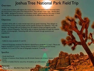
  • 1. Overview: Joshua Tree National Park Field Trip - In this lesson students will explore the varied ways in which humans have interacted within the environment of the Joshua Tree National Park. They will also create maps, identify plant life, wildlife, geological formations, and develop a better understanding of the ways in which climate, physical Geography and time contribute to the different ways we use land. Objectives: - Students will be able to create mental maps and use spatial reasoning. They will gain an understanding of how and why people choose specific locations for habitation. They will develop map making skills and recognize how the subjects of keys and legends actually appear in physical Geography. They will be able to express themselves through the creation of maps and photographs. Reasoning skills will be increased through questions and suppositions. Standard: - California state standards 4.1 and 4.2. - National Geography standards: The World in Spatial Terms standards, 1, 2, and 3. Places and Regions standards 4, 5, and 6. Human Systems standard 12. Environment and Society standards 14, 15, and 16. The uses of Geography standards 17 and 18. Specifics: - Grade level: fourth - Number of sessions: three, Session one 40 minutes. Session two 6 hours. Session three 45 minutes. - Number of adults: One for every 8 to 10 students up to 60 students. Materials: -Map of Coachella Valley, Blank Paper, Clip Boards, Colored Pencils, Disposable Digital Camera.
  • 2. Session one: The students who are by now familiar with the coordinate grid system and understand different regions and their climates will locate on a globe where the Joshua Tree National Park is located. Based on previous instruction they will be asked to write down what they might expect to find when they get to the park. This list will include physical geographic characteristics, population density, wildlife, plant life, water resources and climate. Next the students will study their Coachella Valley maps, paying specific attention to the key, scale, and legend. The teacher can ask them to describe how far they think a mile is or how many miles they think they are from a mountain range. This will help to get them thinking spatially, they can apply distances in their own lives like how long it takes to get home or to the grocery store. During this session the teacher serves to encourage students to ask questions and to help them develop mental maps. The questions and theories will then be answered when they are on the field trip.
  • 3. Session two: Part one. Students will arrive first at Key’s Desert Queen Ranch. Under supervision they will explore the area and create maps. They are encouraged to list as many man made objects as well as naturally occurring topographical objects that they can find. They will also be encouraged to guess what the objects were used for and why. Students will also take photos of the objects that they mark on their maps. These photographs will be used in session three. Next a parks employee will give an historical narrative describing the area and its inhabitants past and present. The employee will also describe life on the ranch and reveal the actual purpose of the buildings and artifacts located there. Students will be encouraged to ask questions. Students will also learn if they were correct in naming the uses for the buildings and objects. This should take approximately an hour and a half depending on the size of the group.
  • 4. Part two. After a half hour lunch break the students will be taken on a short hike to Barker Dam. Along the way they will encounter a wide variety of plants and wild life. They are encouraged to capture as many different plants, animals, and rock formations as they can with their cameras. Students will also have an opportunity to see up close petroglyphs and drawings that date back to the areas Native american inhabitants Once at Barker Dam the teacher can ask questions and answer questions that the students may have. There are also park rangers that can provide information about the areas physical geography and the history of the Dam itself. This should take about two hours.
  • 5. Part Three. Session Three: While viewing the slide show students can The final stage of the trip is a visit to Key’s demonstrate what they have learned during the View. At an elevation of over 5,000 feet, Key’s field trip. If there is a computer lab available view offers a panoramic vista which includes the students can research the plant and wildlife they Coachella Valley, Palm Springs, The Salton Sea, have captured in their photographs. Students can El Centro and many other landmarks both also print copies of their photos to accompany natural and man made. the maps they created adding representative images to key objects on the map. It is here that the students can look down from above and see first hand what they may have only seen on their maps or at ground level. With their maps in hand they can circle with colored pencils the things they spot. This vantage point will greatly increase their spatial understanding of Geography. They may for instance determine for themselves why I-10 runs the way it does rather than through the Morongo Basin. They can also take photos and encourage one another in the hunt for new items to circle. At the end of the field trip the teacher will collect all of the digital cameras. The teacher will create a slide show for the students to view during session three.
  • 6. California State Standards 4.1 and 4.2 - 4.1.1: Students locate Joshua Tree National Park using longitudinal and latitudinal coordinates. - 4.1.2: Students determine which hemisphere the park and there own cities are located. - 4.1.3: Students identify the Mojave Desert region and the vegetation, landforms, and climate of the park. - 4.1.4: Students can locate mountains, valleys, rivers from Key’s view. - 4.1.5: Students use and create maps and can witness the differences between the Coachella Valley and High Desert communities as well as within the Park itself - 4.2.1: Students learn about the Native Americans who lived in the area of the park prior to settlement and also have the opportunity to see first hand the some of the art works they created. National Geography Standards The World in Spatial Terms: - Standard one: Students make and use maps learning from a spatial perspective. - Standard two: Students use mental maps to organize their questions and suppositions J.T.N.P. - Standard three: Students will compare their own cities with those in the high desert. Places and Regions: - Standard five: Students will see how the lack of water resources affect how and where people settle. - Standard six: Where the park was once home to Native Americans, then to settlers who grazed cattle it is now home to visitors from all around the globe and it serves many functions from simply looking at the rocks to actually climbing them.
  • 7. Human Systems Standard twelve: At Key’s Ranch and Barker Dam students will see how even in the wilderness people tend to have a pattern of development. They will also see many vehicles, machines, wells, windmills, and various other artifacts that fairly recently allowed Key to live and thrive. They will also be able to compare Key’s experience with that of the Native Americans and with how people live elsewhere today. Environment and Society Standard Fourteen: Students will clearly see the contrast between the environment within the park and the environment outside of the protected area. They will also see how Key’s development affected the area. Standard Fifteen: Students will see how the terrain and climate affect the ways in which people interact with and develop them. Standard Sixteen: As a land resource the Joshua Tree National Park has changed over time. Initially inhabited by Native tribes it was not settled as much as being used for its sheltering rocks and wildlife. However there are still signs of the indigenous people etched on the rocks and in pottery, arrowheads and make shift shelters. Then it was used by ranchers and miners who were trying to make a living off the land if not become rich from it. Now it is a protected National Park which is home to visitors from around the world and it’s uses vary as wildly as its landscape. Students will get a first hand account of these changes.
  • 8. Expected outcome: I expect that students will learn to reason spatially and apply what they witness to the study of maps, globes, streets, buildings, mountains, deserts, rivers, and valleys. Hopefully they will gain an inquisitiveness and an overwhelming need to ask questions about their surroundings and places beyond their immediate experience. That they will continually develop the need to know more. By starting out in session one with questions, then by traveling to find the answers to these questions students will learn to ask more questions and understand better how to find the answers they seek.

Editor's Notes

  1. \n
  2. \n
  3. \n
  4. \n
  5. \n
  6. \n
  7. \n
  8. \n