SlideShare a Scribd company logo
1 of 6
 HYPERLINK quot;
http://www.brampton.caquot;
  quot;
_blankquot;
 City of Brampton City Engages Citizens, Delivers Better Information, with Interactive Mapping <br />The City of Brampton, Ontario, works to provide essential services to its citizens, cooperate with neighboring municipalities, and compete to attract new businesses and residents. The City wanted to make it easier for citizens to find information and engage with public services. It developed an Internet-based Citizen Services Portal (CSP), where Brampton residents and businesses can engage directly with City agencies and services; however, feedback indicated that the old mapping application was too complex. After evaluating mapping technologies, the City integrated IDV Solutions’ Visual Fusion and the Bing Maps Platform into the new CSP. Now, CSP users can find what they need, and internal users in every city department can efficiently provide up-to-date geographically based information. As a result, the City is reducing costs, providing better services, and competing more effectively.<br />SituationWith a population of more than 500,000 and an annual growth rate above 6 percent, Brampton, Ontario, is one of the fastest growing cities in Canada. The third-largest city in the Toronto metropolitan area, Brampton has a demographically young and culturally diverse population, and the city has developed an economic base that includes advanced manufacturing, information technology, and life sciences. <br />To continue to grow and promote prosperity for its citizens, the City of Brampton must compete to attract new businesses and industries in addition to new residents. As Brampton grows, the City has to help maintain and enhance the conditions that make Brampton an attractive place to live and work. “Citizens—especially an emerging demographic group of young, mobile information workers—expect the same level of customer service that they get in the private commercial sector,” says Robert Meikle, Chief Information Officer at the City of Brampton. <br />The City of Brampton provides its half-million residents with essential services such as fire; planning and zoning; public works and transportation; economic development; parks and recreation; and visitor support. The City also coordinates services and cooperates with neighboring municipalities. <br />Figure 1. IDV mapping tool on the City’s CSP Portal. By expanding the menus in the right-hand pane of the map interface, site visitors can click on options to expose the locations of City facilities, services, and activities, such as road construction and closures. By resting the pointer on an icon, users expose a pane with more details, such as schedules and location information.<br />While the City continually works to enhance the services it delivers, Mayor Susan Fennell wanted to go further. She wanted to fundamentally change how Brampton citizens engage with the City and the services it provides. She wanted City service agencies to be transparent and responsive, and she wanted it to be more convenient for citizens to find and use the information and services they need. <br />Toward that vision, the City began a year-long project to remake its website into the Brampton Citizen Services Portal (CSP), which it built with Microsoft Office SharePoint Server 2007. The City launched the CSP in 2009, and Brampton residents and businesses began using it to engage with City agencies and services. They can find information, apply for permits, register and pay for services, and contact City staff. <br />The city’s website included a geographic information system (GIS)–based mapping application that provided the public with a way to access spatial information visually, whether they were trying to locate a public jogging trail, find the nearest police station, or look up property information. However, the application was complex, and some users complained that it was difficult to find the information they wanted. <br />“To be honest, the GIS-based interface was not easy to use,” says Bill Latchford, Manager of IT System Operations at the City of Brampton. “We had to handle a lot of support calls, and we actually held public education sessions about how to find things with the maps.”<br />It was also difficult and time consuming to publish new information with the application, a task that could be completed only by GIS and IT staff. As a result, information was not always published in a timely manner, and GIS and IT staff were often being distracted from higher value tasks.<br />The City wanted to make it much simpler for the public to use maps on the CSP; at the same time, it wanted to make it easier for internal business users to publish and manage mapping information. To help streamline IT management, the City wanted its mapping solution to integrate directly with the Office SharePoint Server 2007 environment that supports the CSP.<br />SolutionThe City of Brampton utilized the expertise of Infusion Development to architect and implement the core CSP Portal Platform, and then the City used a mapping solution called Visual Fusion developed by Microsoft Gold Certified Partner IDV Solutions to create interactive mapping applications for the CSP that work with the tools in Office SharePoint Server 2007. “The implementation of the Visual Fusion product was completed within a relatively short timeline, with one dedicated City IT developer and in just three months,” says Alber Hanna, Manager of CSP Program at the City of Brampton. <br />By integrating information and services with Bing Maps, we’re taking a big step toward making Brampton more competitive.Bill LatchfordManager of IT System Operations, City of Brampton<br />The City’s IT department evaluated several mapping options, including Google Maps and Bing Maps Platform from Microsoft. The City chose Bing Maps for two primary reasons: Bing Maps would integrate easily with Office SharePoint Server 2007 and Visual Fusion, and its datasets are very accurate. <br />“Our internal mapping data is accurate to within a foot, and Bing Maps fit seamlessly with our data,” says Latchford. “Our decision makers put pressure on us to deliver, but they gave us the opportunity to make the common-sense decisions and move on. So choosing Bing Maps was easy.”<br />With Bing Maps and Visual Fusion, the City can maintain detailed, complex, and accurate geographic databases, while making it easy for business users to publish the data. GIS specialists manage the City’s core internal geographic data sets, such as the citywide property fabric, aerial photos, and street network, updating the data directly into the GIS database. Internal business users at Brampton can then combine built-in functionalities in Office SharePoint Server 2007 with Visual Fusion to display information with a spatial context. <br />Now, when a public user opens the mapping application on the CSP, he or she can navigate a visual map interface that shows the boundaries of the City of Brampton. The user can zoom out to see Brampton in a regional or even global context, or zoom in to street level, choosing between roadmap and aerial photo views. From a right-hand pane, users can expand menus and find options to expose different data layers over the map interface. <br />For example, from the Roadworks menu, Brampton residents or visitors can click options to locate road closures, construction projects, or street-sweeping schedules. By resting the pointer above an icon that locates a road closure, a site visitor exposes a pane with the location and schedule of the closure. Clicking the icon opens a larger pane with details on the closure, including the schedule and contact information (Figure 1). Other menus locate property boundaries, zoning bylaws, economic development areas, schools, hospitals, police and fire stations, parks, transit routes, City council districts, and other civic facilities, services, and features, all with opportunities to quickly explore more detailed information. <br />Internal users in almost every City department can publish new information to the mapping application without support from GIS or IT staff, and without needing GIS software installed on their computer. They can use data from infinite sources, including web feeds, GISs, and other databases, and with Visual Fusion, they can spatially enable data in a SharePoint list and integrate it directly with the Bing Maps application programming interface. <br />BenefitsThe City of Brampton is using its Visual Fusion and Bing Maps solution to deliver timely, accurate information in a visual format. Now, whether a Brampton resident is planning a bus route to work or researching zoning codes, he or she can find the information quickly. City departments can publish timely information to the mapping application without IT help, reducing costs and saving time. The City is serving its citizens more effectively, and helping Brampton to attract the residents and businesses it needs to remain dynamic and prosperous. <br />”Making all this intelligence available on the City’s portal promotes the Brampton brand and attracts investors,” says Susan Fennell, Mayor of the City of Brampton. “We’re committed to providing Bramptonians with the services they need to enjoy an exceptional quality of life.”<br />More Efficient OperationBecause internal business users can publish information to the Bing Maps application on the CSP without relying on GIS and IT support, and without needing licensed GIS software or the training required to operate it, the City is saving time and money. For instance, the city saves approximately U.S.$6,000 per user for software and training. “Now, people can just spatially enable a SharePoint list and post the data on the map themselves. The only thing the IT staff needs to do is make sure they’re following standards,” says Latchford. “People can focus on doing their job and making the information available to whoever needs it.” <br />Citizens—especially an emerging demographic group of young, mobile information workers—expect the same level of customer service that they get in the private commercial sectorRobert MeikleChief Information Officer,City of Brampton<br />Since the City zoning department began publishing zoning information on the mapping application, Plan Examiners have reported that the amount of time they have to spend assisting permit applicants has dropped by 50 percent, time they can now use to process more permits. Because Bing Maps was easy to deploy and will be easy to manage, modify, and update, IT and GIS staff can focus their efforts on higher-value tasks, and the City of Brampton can enhance the value of its investment in the CSP and Office SharePoint Server 2007. <br />Better Services Delivered FasterBecause they now have easy access to accurate information, residents and businesses in Brampton can get projects planned, approved, and initiated quickly, increasing the return on their investments. <br />“In the past, if you wanted, say, zoning information about a property, you had to come in, fill out a form and come back in 5 to 10 days,” says Latchford. “Now, the most current information is available at your fingertips on the web, and even if you come into the office, you can walk out with what you need in minutes.” <br />Engaged CitizensWith the CSP and Bing Maps, the City of Brampton is beginning a true dialog with its citizens. By introducing a new, easy-to-use interface for its mapping application, Brampton has increased public traffic to the CSP. Additionally, because it is so easy to publish information to the Bing Maps application, internal users in every City department are updating the application more often, which means the public receives fresher and more detailed information. If a zoning bylaw is changed at a council meeting, for example, the information will be updated on the mapping application in three days or less. <br />“We are tracking an overall increase of approximately 300 percent in site visits in just six months after launch, without any marketing efforts,” says Hanna. “We profoundly believe that by architecting an intuitive and service-oriented public portal and by utilizing solutions such as Visual Fusion and Bing Maps, it will invite more citizens and casual surfers to experience our portal firsthand.”<br />Staff in the City’s Economic Development Office have installed a business directory in the mapping application. They intend to eventually allow Brampton businesses to manage some of their own information in the directory. <br />“The Mayor has given us a tremendous amount of positive feedback on the site,” says Latchford. “She wanted to change how citizens of Brampton engage with their City, and Visual Fusion and Bing Maps have been a huge part of fulfilling that strategy.” <br />Competitive CityBy making information more available, and delivering services more efficiently, Brampton can compete more effectively with neighboring cities to attract and serve new residents and new businesses. Businesses researching economic development initiatives in Brampton can find accurate, up-to-date information quickly and easily. Real estate agents can use the mapping application to print and distribute relevant zoning information to potential property buyers. <br />“We want to attract new business to Brampton.” says Latchford. “By integrating information and services with Bing Maps, we’re taking a big step toward making Brampton more competitive.”<br />
City of Brampton Engages Citizens with Interactive Mapping

More Related Content

Viewers also liked

Integrating Excel Files in Visual Fusion
Integrating Excel Files in Visual FusionIntegrating Excel Files in Visual Fusion
Integrating Excel Files in Visual FusionIDV Solutions
 
Maritime Administration Case Study
Maritime Administration Case StudyMaritime Administration Case Study
Maritime Administration Case StudyIDV Solutions
 
Visual fusion 5_spatial
Visual fusion 5_spatialVisual fusion 5_spatial
Visual fusion 5_spatialIDV Solutions
 
Visual Fusion application wins GITA Innovators award for 2011
Visual Fusion application wins GITA Innovators award for 2011Visual Fusion application wins GITA Innovators award for 2011
Visual Fusion application wins GITA Innovators award for 2011IDV Solutions
 
Visual Fusion 4.5 Overview
Visual Fusion 4.5 OverviewVisual Fusion 4.5 Overview
Visual Fusion 4.5 OverviewIDV Solutions
 
Visual fusion 5_wms_feeds
Visual fusion 5_wms_feedsVisual fusion 5_wms_feeds
Visual fusion 5_wms_feedsIDV Solutions
 

Viewers also liked (8)

Integrating Excel Files in Visual Fusion
Integrating Excel Files in Visual FusionIntegrating Excel Files in Visual Fusion
Integrating Excel Files in Visual Fusion
 
Maritime Administration Case Study
Maritime Administration Case StudyMaritime Administration Case Study
Maritime Administration Case Study
 
Visual fusion 5_spatial
Visual fusion 5_spatialVisual fusion 5_spatial
Visual fusion 5_spatial
 
ENGlobal Case Study
ENGlobal Case StudyENGlobal Case Study
ENGlobal Case Study
 
Visual Fusion application wins GITA Innovators award for 2011
Visual Fusion application wins GITA Innovators award for 2011Visual Fusion application wins GITA Innovators award for 2011
Visual Fusion application wins GITA Innovators award for 2011
 
Visual Fusion 4.5 Overview
Visual Fusion 4.5 OverviewVisual Fusion 4.5 Overview
Visual Fusion 4.5 Overview
 
Visual fusion 5_wms_feeds
Visual fusion 5_wms_feedsVisual fusion 5_wms_feeds
Visual fusion 5_wms_feeds
 
BP Case Study
BP Case StudyBP Case Study
BP Case Study
 

Similar to City of Brampton Engages Citizens with Interactive Mapping

Microsoft Redlands Case Study
Microsoft Redlands Case StudyMicrosoft Redlands Case Study
Microsoft Redlands Case StudyStephen Alderman
 
Km4City: how to make smart and resilient your city, beginner document
Km4City: how to make smart and resilient your city, beginner documentKm4City: how to make smart and resilient your city, beginner document
Km4City: how to make smart and resilient your city, beginner documentPaolo Nesi
 
2012_Macon End of Year Report
2012_Macon End of Year Report2012_Macon End of Year Report
2012_Macon End of Year ReportCode for America
 
FIWARE Tech Summit - City Enabler - Changing the Way to Give Value to Your Da...
FIWARE Tech Summit - City Enabler - Changing the Way to Give Value to Your Da...FIWARE Tech Summit - City Enabler - Changing the Way to Give Value to Your Da...
FIWARE Tech Summit - City Enabler - Changing the Way to Give Value to Your Da...FIWARE
 
Significance of statistics analytics in urban making plans
Significance of statistics analytics in urban making plansSignificance of statistics analytics in urban making plans
Significance of statistics analytics in urban making planslucyaddison1
 
10549227d cybercity digitalcity
10549227d cybercity digitalcity10549227d cybercity digitalcity
10549227d cybercity digitalcitylsgi4321
 
Transportation: Creating value from data and committed leadership
Transportation: Creating value from data and committed leadershipTransportation: Creating value from data and committed leadership
Transportation: Creating value from data and committed leadershipThe Economist Media Businesses
 
CPaaS.io - Toolbox for City Planners
CPaaS.io - Toolbox for City PlannersCPaaS.io - Toolbox for City Planners
CPaaS.io - Toolbox for City PlannersStephan Haller
 
Future of Citizen Engagement & Asset Management with CitySourced and Cityworks
Future of Citizen Engagement & Asset Management with CitySourced and CityworksFuture of Citizen Engagement & Asset Management with CitySourced and Cityworks
Future of Citizen Engagement & Asset Management with CitySourced and Cityworksandrewkkirk
 
Example of business plan
Example of business planExample of business plan
Example of business planEdebex.com
 
Transforming City with Internet of Things
Transforming City with Internet of ThingsTransforming City with Internet of Things
Transforming City with Internet of ThingsRofiqi Setiawan
 
MyCity Mobile Presentation
MyCity Mobile PresentationMyCity Mobile Presentation
MyCity Mobile PresentationMyCity
 
My city online - Making the case for municipal web portals
My city online - Making the case for municipal web portalsMy city online - Making the case for municipal web portals
My city online - Making the case for municipal web portalsSmart Cities Project
 
Avolve EPR: Case Study ~ Canadian Cities Rely on ProjectDox®
Avolve EPR: Case Study ~ Canadian Cities Rely on ProjectDox®Avolve EPR: Case Study ~ Canadian Cities Rely on ProjectDox®
Avolve EPR: Case Study ~ Canadian Cities Rely on ProjectDox®jherding
 
Better Community Connections Through Big Data and Analytics
Better Community Connections Through Big Data and AnalyticsBetter Community Connections Through Big Data and Analytics
Better Community Connections Through Big Data and AnalyticsSAP Analytics
 
BlackBerry Helps Connect The City of Waterloo
BlackBerry Helps Connect The City of WaterlooBlackBerry Helps Connect The City of Waterloo
BlackBerry Helps Connect The City of WaterlooBlackBerry
 
Public grievance redressal system
Public grievance redressal systemPublic grievance redressal system
Public grievance redressal systemCharles D'souza
 

Similar to City of Brampton Engages Citizens with Interactive Mapping (20)

Microsoft Redlands Case Study
Microsoft Redlands Case StudyMicrosoft Redlands Case Study
Microsoft Redlands Case Study
 
Km4City: how to make smart and resilient your city, beginner document
Km4City: how to make smart and resilient your city, beginner documentKm4City: how to make smart and resilient your city, beginner document
Km4City: how to make smart and resilient your city, beginner document
 
Smart City Services
Smart City ServicesSmart City Services
Smart City Services
 
2012_Macon End of Year Report
2012_Macon End of Year Report2012_Macon End of Year Report
2012_Macon End of Year Report
 
Enterprise Geographic Information System (EGIS) Implementation Phase 3
Enterprise Geographic Information System (EGIS) Implementation Phase 3Enterprise Geographic Information System (EGIS) Implementation Phase 3
Enterprise Geographic Information System (EGIS) Implementation Phase 3
 
FIWARE Tech Summit - City Enabler - Changing the Way to Give Value to Your Da...
FIWARE Tech Summit - City Enabler - Changing the Way to Give Value to Your Da...FIWARE Tech Summit - City Enabler - Changing the Way to Give Value to Your Da...
FIWARE Tech Summit - City Enabler - Changing the Way to Give Value to Your Da...
 
Significance of statistics analytics in urban making plans
Significance of statistics analytics in urban making plansSignificance of statistics analytics in urban making plans
Significance of statistics analytics in urban making plans
 
C³PO Project Leaflet
C³PO Project LeafletC³PO Project Leaflet
C³PO Project Leaflet
 
10549227d cybercity digitalcity
10549227d cybercity digitalcity10549227d cybercity digitalcity
10549227d cybercity digitalcity
 
Transportation: Creating value from data and committed leadership
Transportation: Creating value from data and committed leadershipTransportation: Creating value from data and committed leadership
Transportation: Creating value from data and committed leadership
 
CPaaS.io - Toolbox for City Planners
CPaaS.io - Toolbox for City PlannersCPaaS.io - Toolbox for City Planners
CPaaS.io - Toolbox for City Planners
 
Future of Citizen Engagement & Asset Management with CitySourced and Cityworks
Future of Citizen Engagement & Asset Management with CitySourced and CityworksFuture of Citizen Engagement & Asset Management with CitySourced and Cityworks
Future of Citizen Engagement & Asset Management with CitySourced and Cityworks
 
Example of business plan
Example of business planExample of business plan
Example of business plan
 
Transforming City with Internet of Things
Transforming City with Internet of ThingsTransforming City with Internet of Things
Transforming City with Internet of Things
 
MyCity Mobile Presentation
MyCity Mobile PresentationMyCity Mobile Presentation
MyCity Mobile Presentation
 
My city online - Making the case for municipal web portals
My city online - Making the case for municipal web portalsMy city online - Making the case for municipal web portals
My city online - Making the case for municipal web portals
 
Avolve EPR: Case Study ~ Canadian Cities Rely on ProjectDox®
Avolve EPR: Case Study ~ Canadian Cities Rely on ProjectDox®Avolve EPR: Case Study ~ Canadian Cities Rely on ProjectDox®
Avolve EPR: Case Study ~ Canadian Cities Rely on ProjectDox®
 
Better Community Connections Through Big Data and Analytics
Better Community Connections Through Big Data and AnalyticsBetter Community Connections Through Big Data and Analytics
Better Community Connections Through Big Data and Analytics
 
BlackBerry Helps Connect The City of Waterloo
BlackBerry Helps Connect The City of WaterlooBlackBerry Helps Connect The City of Waterloo
BlackBerry Helps Connect The City of Waterloo
 
Public grievance redressal system
Public grievance redressal systemPublic grievance redressal system
Public grievance redressal system
 

More from IDV Solutions

ConTgo to debut bidirectional mobile mapping communications
ConTgo to debut bidirectional mobile mapping communicationsConTgo to debut bidirectional mobile mapping communications
ConTgo to debut bidirectional mobile mapping communicationsIDV Solutions
 
DHS - St Clair Vitual cities
DHS - St Clair Vitual citiesDHS - St Clair Vitual cities
DHS - St Clair Vitual citiesIDV Solutions
 
Noodles & Co Webcast
Noodles & Co WebcastNoodles & Co Webcast
Noodles & Co WebcastIDV Solutions
 
Visual fusion 5_flexible_icon_pack
Visual fusion 5_flexible_icon_packVisual fusion 5_flexible_icon_pack
Visual fusion 5_flexible_icon_packIDV Solutions
 
Visual fusion 5_visual_rollups
Visual fusion 5_visual_rollupsVisual fusion 5_visual_rollups
Visual fusion 5_visual_rollupsIDV Solutions
 
Visual fusion 5_extreme_sp_map_integration
Visual fusion 5_extreme_sp_map_integrationVisual fusion 5_extreme_sp_map_integration
Visual fusion 5_extreme_sp_map_integrationIDV Solutions
 
Visual fusion 5_city_of_brampton3
Visual fusion 5_city_of_brampton3Visual fusion 5_city_of_brampton3
Visual fusion 5_city_of_brampton3IDV Solutions
 
Visual fusion 5_city_of_brampton2
Visual fusion 5_city_of_brampton2Visual fusion 5_city_of_brampton2
Visual fusion 5_city_of_brampton2IDV Solutions
 
Visual fusion 5_city_of_brampton1
Visual fusion 5_city_of_brampton1Visual fusion 5_city_of_brampton1
Visual fusion 5_city_of_brampton1IDV Solutions
 
Visual fusion 5_extrusions
Visual fusion 5_extrusionsVisual fusion 5_extrusions
Visual fusion 5_extrusionsIDV Solutions
 
Visual Fusion 5_SP_Alert_Geofence
Visual Fusion 5_SP_Alert_GeofenceVisual Fusion 5_SP_Alert_Geofence
Visual Fusion 5_SP_Alert_GeofenceIDV Solutions
 
Visual fusion5editinterface
Visual fusion5editinterfaceVisual fusion5editinterface
Visual fusion5editinterfaceIDV Solutions
 
Visual fusion5geodata
Visual fusion5geodataVisual fusion5geodata
Visual fusion5geodataIDV Solutions
 
Visual Fusion 5 Generalization
Visual Fusion 5 GeneralizationVisual Fusion 5 Generalization
Visual Fusion 5 GeneralizationIDV Solutions
 
Visual Fusion 5 Timeline
Visual Fusion 5 TimelineVisual Fusion 5 Timeline
Visual Fusion 5 TimelineIDV Solutions
 
Visual Fusion 5 Generalization
Visual Fusion 5 GeneralizationVisual Fusion 5 Generalization
Visual Fusion 5 GeneralizationIDV Solutions
 
Visual Fusion 5 Feedback
Visual Fusion 5 FeedbackVisual Fusion 5 Feedback
Visual Fusion 5 FeedbackIDV Solutions
 
Visual fusion5labels
Visual fusion5labelsVisual fusion5labels
Visual fusion5labelsIDV Solutions
 

More from IDV Solutions (20)

Fetch! core deck
Fetch! core deckFetch! core deck
Fetch! core deck
 
Fetch! brochure
Fetch! brochureFetch! brochure
Fetch! brochure
 
ConTgo to debut bidirectional mobile mapping communications
ConTgo to debut bidirectional mobile mapping communicationsConTgo to debut bidirectional mobile mapping communications
ConTgo to debut bidirectional mobile mapping communications
 
DHS - St Clair Vitual cities
DHS - St Clair Vitual citiesDHS - St Clair Vitual cities
DHS - St Clair Vitual cities
 
Noodles & Co Webcast
Noodles & Co WebcastNoodles & Co Webcast
Noodles & Co Webcast
 
Visual fusion 5_flexible_icon_pack
Visual fusion 5_flexible_icon_packVisual fusion 5_flexible_icon_pack
Visual fusion 5_flexible_icon_pack
 
Visual fusion 5_visual_rollups
Visual fusion 5_visual_rollupsVisual fusion 5_visual_rollups
Visual fusion 5_visual_rollups
 
Visual fusion 5_extreme_sp_map_integration
Visual fusion 5_extreme_sp_map_integrationVisual fusion 5_extreme_sp_map_integration
Visual fusion 5_extreme_sp_map_integration
 
Visual fusion 5_city_of_brampton3
Visual fusion 5_city_of_brampton3Visual fusion 5_city_of_brampton3
Visual fusion 5_city_of_brampton3
 
Visual fusion 5_city_of_brampton2
Visual fusion 5_city_of_brampton2Visual fusion 5_city_of_brampton2
Visual fusion 5_city_of_brampton2
 
Visual fusion 5_city_of_brampton1
Visual fusion 5_city_of_brampton1Visual fusion 5_city_of_brampton1
Visual fusion 5_city_of_brampton1
 
Visual fusion 5_extrusions
Visual fusion 5_extrusionsVisual fusion 5_extrusions
Visual fusion 5_extrusions
 
Visual Fusion 5_SP_Alert_Geofence
Visual Fusion 5_SP_Alert_GeofenceVisual Fusion 5_SP_Alert_Geofence
Visual Fusion 5_SP_Alert_Geofence
 
Visual fusion5editinterface
Visual fusion5editinterfaceVisual fusion5editinterface
Visual fusion5editinterface
 
Visual fusion5geodata
Visual fusion5geodataVisual fusion5geodata
Visual fusion5geodata
 
Visual Fusion 5 Generalization
Visual Fusion 5 GeneralizationVisual Fusion 5 Generalization
Visual Fusion 5 Generalization
 
Visual Fusion 5 Timeline
Visual Fusion 5 TimelineVisual Fusion 5 Timeline
Visual Fusion 5 Timeline
 
Visual Fusion 5 Generalization
Visual Fusion 5 GeneralizationVisual Fusion 5 Generalization
Visual Fusion 5 Generalization
 
Visual Fusion 5 Feedback
Visual Fusion 5 FeedbackVisual Fusion 5 Feedback
Visual Fusion 5 Feedback
 
Visual fusion5labels
Visual fusion5labelsVisual fusion5labels
Visual fusion5labels
 

City of Brampton Engages Citizens with Interactive Mapping

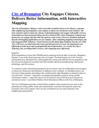
  • 1. HYPERLINK quot; http://www.brampton.caquot; quot; _blankquot; City of Brampton City Engages Citizens, Delivers Better Information, with Interactive Mapping <br />The City of Brampton, Ontario, works to provide essential services to its citizens, cooperate with neighboring municipalities, and compete to attract new businesses and residents. The City wanted to make it easier for citizens to find information and engage with public services. It developed an Internet-based Citizen Services Portal (CSP), where Brampton residents and businesses can engage directly with City agencies and services; however, feedback indicated that the old mapping application was too complex. After evaluating mapping technologies, the City integrated IDV Solutions’ Visual Fusion and the Bing Maps Platform into the new CSP. Now, CSP users can find what they need, and internal users in every city department can efficiently provide up-to-date geographically based information. As a result, the City is reducing costs, providing better services, and competing more effectively.<br />SituationWith a population of more than 500,000 and an annual growth rate above 6 percent, Brampton, Ontario, is one of the fastest growing cities in Canada. The third-largest city in the Toronto metropolitan area, Brampton has a demographically young and culturally diverse population, and the city has developed an economic base that includes advanced manufacturing, information technology, and life sciences. <br />To continue to grow and promote prosperity for its citizens, the City of Brampton must compete to attract new businesses and industries in addition to new residents. As Brampton grows, the City has to help maintain and enhance the conditions that make Brampton an attractive place to live and work. “Citizens—especially an emerging demographic group of young, mobile information workers—expect the same level of customer service that they get in the private commercial sector,” says Robert Meikle, Chief Information Officer at the City of Brampton. <br />The City of Brampton provides its half-million residents with essential services such as fire; planning and zoning; public works and transportation; economic development; parks and recreation; and visitor support. The City also coordinates services and cooperates with neighboring municipalities. <br />Figure 1. IDV mapping tool on the City’s CSP Portal. By expanding the menus in the right-hand pane of the map interface, site visitors can click on options to expose the locations of City facilities, services, and activities, such as road construction and closures. By resting the pointer on an icon, users expose a pane with more details, such as schedules and location information.<br />While the City continually works to enhance the services it delivers, Mayor Susan Fennell wanted to go further. She wanted to fundamentally change how Brampton citizens engage with the City and the services it provides. She wanted City service agencies to be transparent and responsive, and she wanted it to be more convenient for citizens to find and use the information and services they need. <br />Toward that vision, the City began a year-long project to remake its website into the Brampton Citizen Services Portal (CSP), which it built with Microsoft Office SharePoint Server 2007. The City launched the CSP in 2009, and Brampton residents and businesses began using it to engage with City agencies and services. They can find information, apply for permits, register and pay for services, and contact City staff. <br />The city’s website included a geographic information system (GIS)–based mapping application that provided the public with a way to access spatial information visually, whether they were trying to locate a public jogging trail, find the nearest police station, or look up property information. However, the application was complex, and some users complained that it was difficult to find the information they wanted. <br />“To be honest, the GIS-based interface was not easy to use,” says Bill Latchford, Manager of IT System Operations at the City of Brampton. “We had to handle a lot of support calls, and we actually held public education sessions about how to find things with the maps.”<br />It was also difficult and time consuming to publish new information with the application, a task that could be completed only by GIS and IT staff. As a result, information was not always published in a timely manner, and GIS and IT staff were often being distracted from higher value tasks.<br />The City wanted to make it much simpler for the public to use maps on the CSP; at the same time, it wanted to make it easier for internal business users to publish and manage mapping information. To help streamline IT management, the City wanted its mapping solution to integrate directly with the Office SharePoint Server 2007 environment that supports the CSP.<br />SolutionThe City of Brampton utilized the expertise of Infusion Development to architect and implement the core CSP Portal Platform, and then the City used a mapping solution called Visual Fusion developed by Microsoft Gold Certified Partner IDV Solutions to create interactive mapping applications for the CSP that work with the tools in Office SharePoint Server 2007. “The implementation of the Visual Fusion product was completed within a relatively short timeline, with one dedicated City IT developer and in just three months,” says Alber Hanna, Manager of CSP Program at the City of Brampton. <br />By integrating information and services with Bing Maps, we’re taking a big step toward making Brampton more competitive.Bill LatchfordManager of IT System Operations, City of Brampton<br />The City’s IT department evaluated several mapping options, including Google Maps and Bing Maps Platform from Microsoft. The City chose Bing Maps for two primary reasons: Bing Maps would integrate easily with Office SharePoint Server 2007 and Visual Fusion, and its datasets are very accurate. <br />“Our internal mapping data is accurate to within a foot, and Bing Maps fit seamlessly with our data,” says Latchford. “Our decision makers put pressure on us to deliver, but they gave us the opportunity to make the common-sense decisions and move on. So choosing Bing Maps was easy.”<br />With Bing Maps and Visual Fusion, the City can maintain detailed, complex, and accurate geographic databases, while making it easy for business users to publish the data. GIS specialists manage the City’s core internal geographic data sets, such as the citywide property fabric, aerial photos, and street network, updating the data directly into the GIS database. Internal business users at Brampton can then combine built-in functionalities in Office SharePoint Server 2007 with Visual Fusion to display information with a spatial context. <br />Now, when a public user opens the mapping application on the CSP, he or she can navigate a visual map interface that shows the boundaries of the City of Brampton. The user can zoom out to see Brampton in a regional or even global context, or zoom in to street level, choosing between roadmap and aerial photo views. From a right-hand pane, users can expand menus and find options to expose different data layers over the map interface. <br />For example, from the Roadworks menu, Brampton residents or visitors can click options to locate road closures, construction projects, or street-sweeping schedules. By resting the pointer above an icon that locates a road closure, a site visitor exposes a pane with the location and schedule of the closure. Clicking the icon opens a larger pane with details on the closure, including the schedule and contact information (Figure 1). Other menus locate property boundaries, zoning bylaws, economic development areas, schools, hospitals, police and fire stations, parks, transit routes, City council districts, and other civic facilities, services, and features, all with opportunities to quickly explore more detailed information. <br />Internal users in almost every City department can publish new information to the mapping application without support from GIS or IT staff, and without needing GIS software installed on their computer. They can use data from infinite sources, including web feeds, GISs, and other databases, and with Visual Fusion, they can spatially enable data in a SharePoint list and integrate it directly with the Bing Maps application programming interface. <br />BenefitsThe City of Brampton is using its Visual Fusion and Bing Maps solution to deliver timely, accurate information in a visual format. Now, whether a Brampton resident is planning a bus route to work or researching zoning codes, he or she can find the information quickly. City departments can publish timely information to the mapping application without IT help, reducing costs and saving time. The City is serving its citizens more effectively, and helping Brampton to attract the residents and businesses it needs to remain dynamic and prosperous. <br />”Making all this intelligence available on the City’s portal promotes the Brampton brand and attracts investors,” says Susan Fennell, Mayor of the City of Brampton. “We’re committed to providing Bramptonians with the services they need to enjoy an exceptional quality of life.”<br />More Efficient OperationBecause internal business users can publish information to the Bing Maps application on the CSP without relying on GIS and IT support, and without needing licensed GIS software or the training required to operate it, the City is saving time and money. For instance, the city saves approximately U.S.$6,000 per user for software and training. “Now, people can just spatially enable a SharePoint list and post the data on the map themselves. The only thing the IT staff needs to do is make sure they’re following standards,” says Latchford. “People can focus on doing their job and making the information available to whoever needs it.” <br />Citizens—especially an emerging demographic group of young, mobile information workers—expect the same level of customer service that they get in the private commercial sectorRobert MeikleChief Information Officer,City of Brampton<br />Since the City zoning department began publishing zoning information on the mapping application, Plan Examiners have reported that the amount of time they have to spend assisting permit applicants has dropped by 50 percent, time they can now use to process more permits. Because Bing Maps was easy to deploy and will be easy to manage, modify, and update, IT and GIS staff can focus their efforts on higher-value tasks, and the City of Brampton can enhance the value of its investment in the CSP and Office SharePoint Server 2007. <br />Better Services Delivered FasterBecause they now have easy access to accurate information, residents and businesses in Brampton can get projects planned, approved, and initiated quickly, increasing the return on their investments. <br />“In the past, if you wanted, say, zoning information about a property, you had to come in, fill out a form and come back in 5 to 10 days,” says Latchford. “Now, the most current information is available at your fingertips on the web, and even if you come into the office, you can walk out with what you need in minutes.” <br />Engaged CitizensWith the CSP and Bing Maps, the City of Brampton is beginning a true dialog with its citizens. By introducing a new, easy-to-use interface for its mapping application, Brampton has increased public traffic to the CSP. Additionally, because it is so easy to publish information to the Bing Maps application, internal users in every City department are updating the application more often, which means the public receives fresher and more detailed information. If a zoning bylaw is changed at a council meeting, for example, the information will be updated on the mapping application in three days or less. <br />“We are tracking an overall increase of approximately 300 percent in site visits in just six months after launch, without any marketing efforts,” says Hanna. “We profoundly believe that by architecting an intuitive and service-oriented public portal and by utilizing solutions such as Visual Fusion and Bing Maps, it will invite more citizens and casual surfers to experience our portal firsthand.”<br />Staff in the City’s Economic Development Office have installed a business directory in the mapping application. They intend to eventually allow Brampton businesses to manage some of their own information in the directory. <br />“The Mayor has given us a tremendous amount of positive feedback on the site,” says Latchford. “She wanted to change how citizens of Brampton engage with their City, and Visual Fusion and Bing Maps have been a huge part of fulfilling that strategy.” <br />Competitive CityBy making information more available, and delivering services more efficiently, Brampton can compete more effectively with neighboring cities to attract and serve new residents and new businesses. Businesses researching economic development initiatives in Brampton can find accurate, up-to-date information quickly and easily. Real estate agents can use the mapping application to print and distribute relevant zoning information to potential property buyers. <br />“We want to attract new business to Brampton.” says Latchford. “By integrating information and services with Bing Maps, we’re taking a big step toward making Brampton more competitive.”<br />