ENG 5 Q4 WEEk 1 DAY 1 Restate sentences heard in one’s own words. Use appropr...
Ggreta flyer
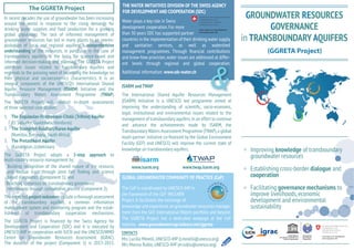
1. THE WATER INITIATIVES DIVISION OF THE SWISS AGENCY
The GGRETA Project
around the world in response to the rising demands for
drinking water supplies and food production for a growing
groundwater resources has led in many places to an overexploitation of local and regional aquifers. A comprehensive
understanding of the resources, in particular in the case of
Water plays a key role in Swiss
development cooperation. For more
than 30 years SDC has supported partner
countries in the implementation of their drinking water supply
and sanitation services, as well as watershed
and know-how provision, water issues are addressed at differ-
responds to the pressing need of increasing the knowledge on
their physical and socioeconomics characteristics. It is an
integral component of the UNESCO’s International Shared
Aquifer Resource Management (ISARM) Initiative and the
(TWAP).
of three selected case studies:
GROUNDWATER RESOURCES
GOVERNANCE
in TRANSBOUNDARY AQUIFERS
(GGRETA Project)
Additional information: www.sdc-water.ch
ISARM and TWAP
The International Shared Aquifer Resources Management
(ISARM) Initiative is a UNESCO led programme aimed at
legal, institutional and environmental issues related to the
1.
2.
(
3.
Improving knowledge
groundwater resources
2-step approach to
·
www.isarm.org
www.twap.isarm.org
cooperation
·
mechanisms through consultative process (Component 2).
The expected project outcomes include a thorough assessment
-
knowledge and experience on groundwater resources managewww.groundwatercop.iwlearn.net/ggreta
CONTACTS
dialogue and
Facilitating governance mechanisms to
improve livelihoods, economic
development and environmental
2. The
Aquifer
Stampriet
Aquifer
(GGRETA)
(GGRETA)
E A
Aquifer
The Esquipulas – Ocotepeque - Citala Aquifer System
,
Guatemala.
, Namibia
-
14°40'N
18°0'E
89°0'W
Ü
Chiquimula - Copán Ruinas
19°0'E
20°0'E
21°0'E
Ncojane basin
Ü
23°0'S
89°10'W
23°0'S
89°20'W
14°40'N
89°30'W
The shallow aquifer
14°30'N
14°30'N
H o n d u r a s
24°0'S
24°0'S
G u a t e m a l a
B o t s w a n a
will require
SE Kalahari/Karoo Basin
N a m i b i a
14°20'N
14°20'N
25°0'S
Ostua-Metapán
25°0'S
Esquipulas-Ocotepeque-Citalá
E l
S a l v a d o r
5
10
15
Kilometers
Map coordinate system: WGS 1984
89°20'W
National Geographic, Esri, DeLorme, NAVTEQ, UNEP-WCMC,
USGS, NASA, ESA, METI, NRCAN, GEBCO, NOAA, iPC
89°10'W
89°0'W
14°10'N
14°10'N
0
26°0'S
A f r i c a
26°0'S
S o u t h
0
20
40
60
80
Kilometers
Map coordinate system: WGS 1984
18°0'E
National Geographic, Esri, DeLorme, NAVTEQ, UNEP-WCMC,
USGS, NASA, ESA, METI, NRCAN, GEBCO, NOAA, iPC
19°0'E
20°0'E
21°0'E
The climate of the