SlideShare a Scribd company logo
1 of 38
Download to read offline
My Orienteering Mapping
Across America
Sitting at a computer, downloading and merging information from Open Street Map files, USGS LiDAR, Strava Heatmaps and air photos to start new
orienteering maps: it is fun and interesting. It is an unusual but satisfying hobby.
Here are some samples from many states.
I hope you enjoy the trip.
Gord Hunter
Alabama
This is a potential map for a Boy
Scout camp in southern Alabama
Note: This is not a ‘final’ orienteering map.
It has been made from Open Street Map and free LiDAR data
to show that orienteering maps can be made inexpensively and
easily in these areas.
Arkansas
A park on the outskirts
of Little Rock
Note: This is not a ‘final’ orienteering map.
It has been made from Open Street Map
and free LiDAR data to show that
orienteering maps can be made
inexpensively and easily in these areas.
California
This wild park is along
the Pacific Ocean near
Newport Beach CA.
There is room to show
about 2/3 of it here.
Note: This is not a ‘final’ orienteering map.
It has been made from Open Street Map and free LiDAR
data to show that orienteering maps can be made
inexpensively and easily in these areas.
District of Columbia
Okay, so we may never get to go
orienteering here but it was fun to
study the detail to make this map. The
White House: It is amazing how much
goes on in such a relatively small
building.
Florida:
A lot of the terrain in this state is
very flat. Here, I chose a contour
interval of .5 meter to bring out
what contour detail there was. This
ranch is near Green Cove Springs
FL.
Note: This is not a ‘final’ orienteering map.
It has been made from Open Street Map and free LiDAR data
to show that orienteering maps can be made inexpensively
and easily in these areas.
Florida:
University of Florida. Many colleges
and universities in the United States
have excellent map detail already
on Open Street Map. It makes the
job of creating an orienteering map
so much easier when that
information is available for import
to OCAD.
Note: This is not a ‘final’ orienteering map.
It has been made from Open Street Map and free LiDAR data
to show that orienteering maps can be made inexpensively
and easily in these areas.
Florida
Epcot at Walt Disney World. Of course, the
orienteering map is oriented to north. The
Disney oblique image is oriented so it looks
best to them.
Georgia:
Northern Georgia is quite
hilly, but this is in southern
Georgia. The contour
interval is 1 meter.
Note: This is not a ‘final’ orienteering map.
It has been made from Open Street Map and free LiDAR data
to show that orienteering maps can be made inexpensively
and easily in these areas.
Hawai’i:
The images of Diamond Head from afar are well
known. The orienteering map of the inside of the
Diamond Head crater is not so well known.
Idaho:
City of Rocks. I started this map only
to compare it to another City of Rocks
in another state which you will see
later.
Illinois:
Continuing with the
rock theme this is
Rock Cut State Park,
near Rockford IL
Note: This is not a ‘final’ orienteering map.
It has been made from Open Street Map
and free LiDAR data to show that
orienteering maps can be made
inexpensively and easily in these areas.
Indiana:
The University of Notre Dame
Note: This is not a ‘final’ orienteering map.
It has been made from Open Street Map and
free LiDAR data to show that orienteering
maps can be made inexpensively and easily in
these areas.
Kentucky:
Davies County High School. The Open
Street Map file yielded very little
information so using the OCAD New
Map Wizard I put the school campus
and surrounding area air photo in
background. The next step is to trace in
details.
Massachusetts:
This is only a portion of a huge wooded
area popular with mountain bikers and
hikers. I think it would be great for
orienteering, too. It’s near Fall River MA
Note: This is not a ‘final’ orienteering map.
It has been made from Open Street Map
and free LiDAR data to show that
orienteering maps can be made
inexpensively and easily in these areas.
Maine:
Colby College
Note: This is not a ‘final’ orienteering map.
It has been made from Open Street Map
and free LiDAR data to show that
orienteering maps can be made
inexpensively and easily in these areas.
Michigan:
Iron Mountain. This town is loaded with
terrain. However, orienteers have yet to be
spotted in the area.
Minnesota:
St John’s University. I
made this map because I
had seen on the Internet
that the school’s outdoor
ed department had an
orienteering program. I
also saw the map they
were using was awful. I
suggested to a nearby
club that we could give
them something much
better in return for a good
orienteering venue but
the idea went nowhere.
Note: This is not a ‘final’ orienteering map.
It has been made from Open Street Map and
free LiDAR data to show that orienteering maps
can be made inexpensively and easily in these
areas.
Montana:
Crosscut XC Ski Area. No LiDAR was available, so
contours were traced in from USGS topo sheet.
Note the 40 feet (13 m) interval.
Note: This is not a ‘final’
orienteering map.
It has been made from Open
Street Map and free LiDAR data
to show that orienteering maps
can be made inexpensively and
easily in these areas.
North Carolina:
Shoal Falls. The purple
lines in the background
are from Strava Heatmap.
They show the cumulative
tracks of folks visiting the
area who were recording
their route with gps
devices.
Note: This is not a ‘final’ orienteering map.
It has been made from Open Street Map and
free LiDAR data to show that orienteering
maps can be made inexpensively and easily
in these areas.
New Jersey:
Norval Green. This seems to have
outstanding orienteering potential. It
reminds me of the nearby Harriman
State Park in New York
Note: This is not a ‘final’ orienteering map.
It has been made from Open Street Map
and free LiDAR data to show that
orienteering maps can be made
inexpensively and easily in these areas.
New Mexico:
City of Rocks (the other one)
Those tight brown circles besides being
contour lines they are rock pillars.
Note: This is not a ‘final’ orienteering map.
It has been made from Open Street Map
and free LiDAR data to show that
orienteering maps can be made
inexpensively and easily in these areas.
New Mexico:
A picnic area and surrounding open
terrain outside of Albuquerque, NM
New York:
Part of Wellesley Island State
Park in the St Lawrence River.
(This is one I have visited. It has
great terrain)
Ohio:
Ohio University. Those air photos fall
into the correct place on demand
using the OCAD New Map Wizard and
On-line Map Service function.
Ohio:
Dow Lake Park near Athens OH.
I was in an orienteering competition here back in
1974. These LiDAR contours would add
considerably more detail to a new map if anyone
ever wanted to make one.
New
Contours
1974
map
Air Photo
Oklahoma
Sequoyah State Park, near Tulsa. Just
waiting to be discovered by orienteering.
Note: This is not a ‘final’ orienteering
map.
It has been made from Open Street Map
and free LiDAR data to show that
orienteering maps can be made
inexpensively and easily in these areas.
Rhode Island:
The Open Street Map base with
the LiDAR contours and
additional detail make for an
interesting start to a new map if
anyone wants it.
Note: This is not a ‘final’ orienteering
map.
It has been made from Open Street Map
and free LiDAR data to show that
orienteering maps can be made
inexpensively and easily in these areas.
Tennessee:
Have you heard of
‘Dollywood’? It is a popular
theme park. Looks as if it has
some pretty good spur/ re-
entrant terrain, too. (The main
part of the Dollywood Theme
Park is not on this snippet of
map.)
Note: This is not a ‘final’ orienteering map.
It has been made from Open Street Map and
free LiDAR data to show that orienteering
maps can be made inexpensively and easily
in these areas.
Texas:
Southwest Regional Park. A Facebook
friend lived until recently in a home
on this map. It looks like a nice area
for orienteering but . . . . no apparent
interest.
Note: This is not a ‘final’ orienteering map.
It has been made from Open Street Map and
free LiDAR data to show that orienteering
maps can be made inexpensively and easily in
these areas.
Texas
Forney Park. Credit the late Ed Hicks for the
start of this map. A young map working on
an Eagle Scout project had reached out for
help. Ed helped and I tried to step in to
extend that help. Unfortunately, local
advice did not come forward and the scout
ended up discarding the map and setting
compass bearing courses.
Texas
River Ranch County Park. ‘Why isn’t this
already an orienteering venue?’ you might ask.
I don’t know. I think it is a new park but it is
well-located 25 miles from Austin, 40 miles
from Ft Hood. The park extends beyond the
boundaries of this map.
Texas:
Bastrop State Park, east of Austin. I was in an
orienteering event here back in 1995.It was well
worth the trip. Unfortunately, the park suffered a
devastating fire back a few years ago. The park is
coming back very slowly.
Virginia:
First Landing State Park.
I wonder what those
flat areas between the
ridges are like. Swampy,
I bet.
Vermont:
Part of Colchester Pond map.
A group of ESL students are
learning some orienteering
on this map this summer.
Note: This is not a ‘final’ orienteering map.
It has been made from Open Street Map
and free LiDAR data to show that
orienteering maps can be made
inexpensively and easily in these areas.
Washington:
Carkeek Park. Contour lines traced from
USGS topo. One of my nephews went on
a fitness kick and was running these
trails. I sent him a map to aid his
exploring.
Wisconsin:
UW Arboretum in Madison
Wisconsin:
Milwaukee County Park
Note: These are not a ‘final’ orienteering
map.
They have been made from Open Street
Map and free LiDAR data to show that
orienteering maps can be made
inexpensively and easily in these areas.
Want to start your own map? There are lots of ways to do it but one of the best aids I have
found is the USGS National Map Viewer. This map will tell you where their free LiDAR is
located. If the area is green the LiDAR is there. There are other, locally based sources of LiDAR,
too. For instance, in Florida I check with the counties and the Water Management Districts.

More Related Content

What's hot

Global Positioning System
Global Positioning SystemGlobal Positioning System
Global Positioning SystemRishi Shukla
 
Global positioning system (GPS)
Global positioning system (GPS)Global positioning system (GPS)
Global positioning system (GPS)Gautham Reddy
 
Land navigation part 1
Land navigation part 1Land navigation part 1
Land navigation part 1Will Rhee
 
GPS (Global Positioning System)
GPS (Global Positioning System)GPS (Global Positioning System)
GPS (Global Positioning System)TANMAY SHARMA
 
Global Positioning System (GPS)
Global Positioning System (GPS) Global Positioning System (GPS)
Global Positioning System (GPS) richard_craig
 
GPS DOCUMENT
GPS DOCUMENTGPS DOCUMENT
GPS DOCUMENTTuhin_Das
 
Land navigation part 1
Land navigation part 1Land navigation part 1
Land navigation part 1fnacampanha
 
Drone flight data processing
Drone flight data processingDrone flight data processing
Drone flight data processingDany Laksono
 
Land navigation part 2
Land navigation part 2Land navigation part 2
Land navigation part 2fnacampanha
 
Gps (global positioning system)
Gps (global positioning system)Gps (global positioning system)
Gps (global positioning system)mustahsanbsphy873
 
Global positioning system ppt
Global positioning system pptGlobal positioning system ppt
Global positioning system pptSwapnil Ramgirwar
 
Global Positioning System
Global Positioning SystemGlobal Positioning System
Global Positioning SystemGaurav Raj
 
Lidar- light detection and ranging
Lidar- light detection and rangingLidar- light detection and ranging
Lidar- light detection and rangingKarthick Subramaniam
 
Presentation on GPS by Harvendra Singh
Presentation on GPS by Harvendra SinghPresentation on GPS by Harvendra Singh
Presentation on GPS by Harvendra SinghSelf employed
 

What's hot (20)

Global Positioning System
Global Positioning SystemGlobal Positioning System
Global Positioning System
 
Global positioning system (GPS)
Global positioning system (GPS)Global positioning system (GPS)
Global positioning system (GPS)
 
Land navigation part 1
Land navigation part 1Land navigation part 1
Land navigation part 1
 
GPS (Global Positioning System)
GPS (Global Positioning System)GPS (Global Positioning System)
GPS (Global Positioning System)
 
Global Positioning System (GPS)
Global Positioning System (GPS) Global Positioning System (GPS)
Global Positioning System (GPS)
 
GPS DOCUMENT
GPS DOCUMENTGPS DOCUMENT
GPS DOCUMENT
 
EL GPS
EL GPSEL GPS
EL GPS
 
Land navigation part 1
Land navigation part 1Land navigation part 1
Land navigation part 1
 
Global positioning system
Global positioning systemGlobal positioning system
Global positioning system
 
Gps
GpsGps
Gps
 
Drone flight data processing
Drone flight data processingDrone flight data processing
Drone flight data processing
 
Land navigation part 2
Land navigation part 2Land navigation part 2
Land navigation part 2
 
gps technology
gps technologygps technology
gps technology
 
Gps (global positioning system)
Gps (global positioning system)Gps (global positioning system)
Gps (global positioning system)
 
Global positioning system ppt
Global positioning system pptGlobal positioning system ppt
Global positioning system ppt
 
Global Positioning System
Global Positioning SystemGlobal Positioning System
Global Positioning System
 
Lidar- light detection and ranging
Lidar- light detection and rangingLidar- light detection and ranging
Lidar- light detection and ranging
 
Presentation on GPS by Harvendra Singh
Presentation on GPS by Harvendra SinghPresentation on GPS by Harvendra Singh
Presentation on GPS by Harvendra Singh
 
Google earth
Google earthGoogle earth
Google earth
 
Gps
GpsGps
Gps
 

More from Gord Hunter

2012 Mad Trapper Rogaine promo.pptx
2012 Mad Trapper Rogaine promo.pptx2012 Mad Trapper Rogaine promo.pptx
2012 Mad Trapper Rogaine promo.pptxGord Hunter
 
Orienteering with the Girls
Orienteering with the GirlsOrienteering with the Girls
Orienteering with the GirlsGord Hunter
 
Advice for Orienteering Coaches
Advice for Orienteering CoachesAdvice for Orienteering Coaches
Advice for Orienteering CoachesGord Hunter
 
Instructions for north florida jrotc orienteering championships
Instructions  for  north florida  jrotc orienteering championshipsInstructions  for  north florida  jrotc orienteering championships
Instructions for north florida jrotc orienteering championshipsGord Hunter
 
Safety brief and notes for 2021 Florida JROTC Orienteering Championships
Safety brief and notes for 2021 Florida JROTC Orienteering ChampionshipsSafety brief and notes for 2021 Florida JROTC Orienteering Championships
Safety brief and notes for 2021 Florida JROTC Orienteering ChampionshipsGord Hunter
 
Life and times of jim hunter
Life and times of jim hunterLife and times of jim hunter
Life and times of jim hunterGord Hunter
 
Livelox as a Training Aid
Livelox as a Training AidLivelox as a Training Aid
Livelox as a Training AidGord Hunter
 
Norval green demo
Norval green demoNorval green demo
Norval green demoGord Hunter
 
The anatomy of an orienteering course
The anatomy of an orienteering courseThe anatomy of an orienteering course
The anatomy of an orienteering courseGord Hunter
 
Orienteering: What's It All About?
Orienteering: What's It All About?Orienteering: What's It All About?
Orienteering: What's It All About?Gord Hunter
 
Orienteering: That sounds like fun
Orienteering: That sounds like funOrienteering: That sounds like fun
Orienteering: That sounds like funGord Hunter
 
2014 Suncoast Orienteering Championships instructions
2014 Suncoast Orienteering Championships   instructions2014 Suncoast Orienteering Championships   instructions
2014 Suncoast Orienteering Championships instructionsGord Hunter
 
Orienteering comes to Dade Park
Orienteering comes to Dade ParkOrienteering comes to Dade Park
Orienteering comes to Dade ParkGord Hunter
 
2013 Suncoast JROTC Team Orienteering Championships
2013 Suncoast JROTC Team Orienteering Championships2013 Suncoast JROTC Team Orienteering Championships
2013 Suncoast JROTC Team Orienteering ChampionshipsGord Hunter
 
2012 Florida Orienteering Championships
2012 Florida Orienteering Championships2012 Florida Orienteering Championships
2012 Florida Orienteering ChampionshipsGord Hunter
 
2012 12 08 Florida Orienteering Championships
2012 12 08 Florida Orienteering Championships2012 12 08 Florida Orienteering Championships
2012 12 08 Florida Orienteering ChampionshipsGord Hunter
 
Orienteering: What's That? - A Look Back
Orienteering: What's That? - A Look BackOrienteering: What's That? - A Look Back
Orienteering: What's That? - A Look BackGord Hunter
 
A Look Back at My Sisters' Early Years
A Look Back at My Sisters' Early YearsA Look Back at My Sisters' Early Years
A Look Back at My Sisters' Early YearsGord Hunter
 

More from Gord Hunter (18)

2012 Mad Trapper Rogaine promo.pptx
2012 Mad Trapper Rogaine promo.pptx2012 Mad Trapper Rogaine promo.pptx
2012 Mad Trapper Rogaine promo.pptx
 
Orienteering with the Girls
Orienteering with the GirlsOrienteering with the Girls
Orienteering with the Girls
 
Advice for Orienteering Coaches
Advice for Orienteering CoachesAdvice for Orienteering Coaches
Advice for Orienteering Coaches
 
Instructions for north florida jrotc orienteering championships
Instructions  for  north florida  jrotc orienteering championshipsInstructions  for  north florida  jrotc orienteering championships
Instructions for north florida jrotc orienteering championships
 
Safety brief and notes for 2021 Florida JROTC Orienteering Championships
Safety brief and notes for 2021 Florida JROTC Orienteering ChampionshipsSafety brief and notes for 2021 Florida JROTC Orienteering Championships
Safety brief and notes for 2021 Florida JROTC Orienteering Championships
 
Life and times of jim hunter
Life and times of jim hunterLife and times of jim hunter
Life and times of jim hunter
 
Livelox as a Training Aid
Livelox as a Training AidLivelox as a Training Aid
Livelox as a Training Aid
 
Norval green demo
Norval green demoNorval green demo
Norval green demo
 
The anatomy of an orienteering course
The anatomy of an orienteering courseThe anatomy of an orienteering course
The anatomy of an orienteering course
 
Orienteering: What's It All About?
Orienteering: What's It All About?Orienteering: What's It All About?
Orienteering: What's It All About?
 
Orienteering: That sounds like fun
Orienteering: That sounds like funOrienteering: That sounds like fun
Orienteering: That sounds like fun
 
2014 Suncoast Orienteering Championships instructions
2014 Suncoast Orienteering Championships   instructions2014 Suncoast Orienteering Championships   instructions
2014 Suncoast Orienteering Championships instructions
 
Orienteering comes to Dade Park
Orienteering comes to Dade ParkOrienteering comes to Dade Park
Orienteering comes to Dade Park
 
2013 Suncoast JROTC Team Orienteering Championships
2013 Suncoast JROTC Team Orienteering Championships2013 Suncoast JROTC Team Orienteering Championships
2013 Suncoast JROTC Team Orienteering Championships
 
2012 Florida Orienteering Championships
2012 Florida Orienteering Championships2012 Florida Orienteering Championships
2012 Florida Orienteering Championships
 
2012 12 08 Florida Orienteering Championships
2012 12 08 Florida Orienteering Championships2012 12 08 Florida Orienteering Championships
2012 12 08 Florida Orienteering Championships
 
Orienteering: What's That? - A Look Back
Orienteering: What's That? - A Look BackOrienteering: What's That? - A Look Back
Orienteering: What's That? - A Look Back
 
A Look Back at My Sisters' Early Years
A Look Back at My Sisters' Early YearsA Look Back at My Sisters' Early Years
A Look Back at My Sisters' Early Years
 

Recently uploaded

JORNADA 2 LIGA MUROBASQUETBOL1 2024.docx
JORNADA 2 LIGA MUROBASQUETBOL1 2024.docxJORNADA 2 LIGA MUROBASQUETBOL1 2024.docx
JORNADA 2 LIGA MUROBASQUETBOL1 2024.docxArturo Pacheco Alvarez
 
Project & Portfolio, Market Analysis: WWE
Project & Portfolio, Market Analysis: WWEProject & Portfolio, Market Analysis: WWE
Project & Portfolio, Market Analysis: WWEDeShawn Ellis
 
Turkey Vs Georgia Vincenzo Montella's Squad Selection for Turkey's Euro 2024 ...
Turkey Vs Georgia Vincenzo Montella's Squad Selection for Turkey's Euro 2024 ...Turkey Vs Georgia Vincenzo Montella's Squad Selection for Turkey's Euro 2024 ...
Turkey Vs Georgia Vincenzo Montella's Squad Selection for Turkey's Euro 2024 ...Eticketing.co
 
Benifits of Individual And Team Sports-Group 7.pptx
Benifits of Individual And Team Sports-Group 7.pptxBenifits of Individual And Team Sports-Group 7.pptx
Benifits of Individual And Team Sports-Group 7.pptxsherrymieg19
 
Clash of Titans_ PSG vs Barcelona (1).pdf
Clash of Titans_ PSG vs Barcelona (1).pdfClash of Titans_ PSG vs Barcelona (1).pdf
Clash of Titans_ PSG vs Barcelona (1).pdfMuhammad Hashim
 
Italy Vs Albania Euro Cup 2024 Italy's Strategy for Success.docx
Italy Vs Albania Euro Cup 2024 Italy's Strategy for Success.docxItaly Vs Albania Euro Cup 2024 Italy's Strategy for Success.docx
Italy Vs Albania Euro Cup 2024 Italy's Strategy for Success.docxWorld Wide Tickets And Hospitality
 
Spain Vs Italy Showdown Between Italy and Spain Could Determine UEFA Euro 202...
Spain Vs Italy Showdown Between Italy and Spain Could Determine UEFA Euro 202...Spain Vs Italy Showdown Between Italy and Spain Could Determine UEFA Euro 202...
Spain Vs Italy Showdown Between Italy and Spain Could Determine UEFA Euro 202...World Wide Tickets And Hospitality
 
DONAL88 >LINK SLOT PG SOFT TERGACOR 2024
DONAL88 >LINK SLOT PG SOFT TERGACOR 2024DONAL88 >LINK SLOT PG SOFT TERGACOR 2024
DONAL88 >LINK SLOT PG SOFT TERGACOR 2024DONAL88 GACOR
 
PGC _ 3.1 _ Powerpoint (2024) scorm ready.pptx
PGC _ 3.1 _ Powerpoint (2024) scorm ready.pptxPGC _ 3.1 _ Powerpoint (2024) scorm ready.pptx
PGC _ 3.1 _ Powerpoint (2024) scorm ready.pptxaleonardes
 
PPT on INDIA VS PAKISTAN - A Sports Rivalry
PPT on INDIA VS PAKISTAN - A Sports RivalryPPT on INDIA VS PAKISTAN - A Sports Rivalry
PPT on INDIA VS PAKISTAN - A Sports Rivalryanirbannath184
 
BADMINTON EQUIPMENTS / EQUIPMENTS GROUP9.pptx
BADMINTON EQUIPMENTS / EQUIPMENTS GROUP9.pptxBADMINTON EQUIPMENTS / EQUIPMENTS GROUP9.pptx
BADMINTON EQUIPMENTS / EQUIPMENTS GROUP9.pptxvillenoc6
 

Recently uploaded (12)

NATIONAL SPORTS DAY WRITTEN QUIZ by QUI9
NATIONAL SPORTS DAY WRITTEN QUIZ by QUI9NATIONAL SPORTS DAY WRITTEN QUIZ by QUI9
NATIONAL SPORTS DAY WRITTEN QUIZ by QUI9
 
JORNADA 2 LIGA MUROBASQUETBOL1 2024.docx
JORNADA 2 LIGA MUROBASQUETBOL1 2024.docxJORNADA 2 LIGA MUROBASQUETBOL1 2024.docx
JORNADA 2 LIGA MUROBASQUETBOL1 2024.docx
 
Project & Portfolio, Market Analysis: WWE
Project & Portfolio, Market Analysis: WWEProject & Portfolio, Market Analysis: WWE
Project & Portfolio, Market Analysis: WWE
 
Turkey Vs Georgia Vincenzo Montella's Squad Selection for Turkey's Euro 2024 ...
Turkey Vs Georgia Vincenzo Montella's Squad Selection for Turkey's Euro 2024 ...Turkey Vs Georgia Vincenzo Montella's Squad Selection for Turkey's Euro 2024 ...
Turkey Vs Georgia Vincenzo Montella's Squad Selection for Turkey's Euro 2024 ...
 
Benifits of Individual And Team Sports-Group 7.pptx
Benifits of Individual And Team Sports-Group 7.pptxBenifits of Individual And Team Sports-Group 7.pptx
Benifits of Individual And Team Sports-Group 7.pptx
 
Clash of Titans_ PSG vs Barcelona (1).pdf
Clash of Titans_ PSG vs Barcelona (1).pdfClash of Titans_ PSG vs Barcelona (1).pdf
Clash of Titans_ PSG vs Barcelona (1).pdf
 
Italy Vs Albania Euro Cup 2024 Italy's Strategy for Success.docx
Italy Vs Albania Euro Cup 2024 Italy's Strategy for Success.docxItaly Vs Albania Euro Cup 2024 Italy's Strategy for Success.docx
Italy Vs Albania Euro Cup 2024 Italy's Strategy for Success.docx
 
Spain Vs Italy Showdown Between Italy and Spain Could Determine UEFA Euro 202...
Spain Vs Italy Showdown Between Italy and Spain Could Determine UEFA Euro 202...Spain Vs Italy Showdown Between Italy and Spain Could Determine UEFA Euro 202...
Spain Vs Italy Showdown Between Italy and Spain Could Determine UEFA Euro 202...
 
DONAL88 >LINK SLOT PG SOFT TERGACOR 2024
DONAL88 >LINK SLOT PG SOFT TERGACOR 2024DONAL88 >LINK SLOT PG SOFT TERGACOR 2024
DONAL88 >LINK SLOT PG SOFT TERGACOR 2024
 
PGC _ 3.1 _ Powerpoint (2024) scorm ready.pptx
PGC _ 3.1 _ Powerpoint (2024) scorm ready.pptxPGC _ 3.1 _ Powerpoint (2024) scorm ready.pptx
PGC _ 3.1 _ Powerpoint (2024) scorm ready.pptx
 
PPT on INDIA VS PAKISTAN - A Sports Rivalry
PPT on INDIA VS PAKISTAN - A Sports RivalryPPT on INDIA VS PAKISTAN - A Sports Rivalry
PPT on INDIA VS PAKISTAN - A Sports Rivalry
 
BADMINTON EQUIPMENTS / EQUIPMENTS GROUP9.pptx
BADMINTON EQUIPMENTS / EQUIPMENTS GROUP9.pptxBADMINTON EQUIPMENTS / EQUIPMENTS GROUP9.pptx
BADMINTON EQUIPMENTS / EQUIPMENTS GROUP9.pptx
 

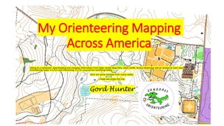
My Orienteering Mapping across America

  • 1. My Orienteering Mapping Across America Sitting at a computer, downloading and merging information from Open Street Map files, USGS LiDAR, Strava Heatmaps and air photos to start new orienteering maps: it is fun and interesting. It is an unusual but satisfying hobby. Here are some samples from many states. I hope you enjoy the trip. Gord Hunter
  • 2. Alabama This is a potential map for a Boy Scout camp in southern Alabama Note: This is not a ‘final’ orienteering map. It has been made from Open Street Map and free LiDAR data to show that orienteering maps can be made inexpensively and easily in these areas.
  • 3. Arkansas A park on the outskirts of Little Rock Note: This is not a ‘final’ orienteering map. It has been made from Open Street Map and free LiDAR data to show that orienteering maps can be made inexpensively and easily in these areas.
  • 4. California This wild park is along the Pacific Ocean near Newport Beach CA. There is room to show about 2/3 of it here. Note: This is not a ‘final’ orienteering map. It has been made from Open Street Map and free LiDAR data to show that orienteering maps can be made inexpensively and easily in these areas.
  • 5. District of Columbia Okay, so we may never get to go orienteering here but it was fun to study the detail to make this map. The White House: It is amazing how much goes on in such a relatively small building.
  • 6. Florida: A lot of the terrain in this state is very flat. Here, I chose a contour interval of .5 meter to bring out what contour detail there was. This ranch is near Green Cove Springs FL. Note: This is not a ‘final’ orienteering map. It has been made from Open Street Map and free LiDAR data to show that orienteering maps can be made inexpensively and easily in these areas.
  • 7. Florida: University of Florida. Many colleges and universities in the United States have excellent map detail already on Open Street Map. It makes the job of creating an orienteering map so much easier when that information is available for import to OCAD. Note: This is not a ‘final’ orienteering map. It has been made from Open Street Map and free LiDAR data to show that orienteering maps can be made inexpensively and easily in these areas.
  • 8. Florida Epcot at Walt Disney World. Of course, the orienteering map is oriented to north. The Disney oblique image is oriented so it looks best to them.
  • 9. Georgia: Northern Georgia is quite hilly, but this is in southern Georgia. The contour interval is 1 meter. Note: This is not a ‘final’ orienteering map. It has been made from Open Street Map and free LiDAR data to show that orienteering maps can be made inexpensively and easily in these areas.
  • 10. Hawai’i: The images of Diamond Head from afar are well known. The orienteering map of the inside of the Diamond Head crater is not so well known.
  • 11. Idaho: City of Rocks. I started this map only to compare it to another City of Rocks in another state which you will see later.
  • 12. Illinois: Continuing with the rock theme this is Rock Cut State Park, near Rockford IL Note: This is not a ‘final’ orienteering map. It has been made from Open Street Map and free LiDAR data to show that orienteering maps can be made inexpensively and easily in these areas.
  • 13. Indiana: The University of Notre Dame Note: This is not a ‘final’ orienteering map. It has been made from Open Street Map and free LiDAR data to show that orienteering maps can be made inexpensively and easily in these areas.
  • 14. Kentucky: Davies County High School. The Open Street Map file yielded very little information so using the OCAD New Map Wizard I put the school campus and surrounding area air photo in background. The next step is to trace in details.
  • 15. Massachusetts: This is only a portion of a huge wooded area popular with mountain bikers and hikers. I think it would be great for orienteering, too. It’s near Fall River MA Note: This is not a ‘final’ orienteering map. It has been made from Open Street Map and free LiDAR data to show that orienteering maps can be made inexpensively and easily in these areas.
  • 16. Maine: Colby College Note: This is not a ‘final’ orienteering map. It has been made from Open Street Map and free LiDAR data to show that orienteering maps can be made inexpensively and easily in these areas.
  • 17. Michigan: Iron Mountain. This town is loaded with terrain. However, orienteers have yet to be spotted in the area.
  • 18. Minnesota: St John’s University. I made this map because I had seen on the Internet that the school’s outdoor ed department had an orienteering program. I also saw the map they were using was awful. I suggested to a nearby club that we could give them something much better in return for a good orienteering venue but the idea went nowhere. Note: This is not a ‘final’ orienteering map. It has been made from Open Street Map and free LiDAR data to show that orienteering maps can be made inexpensively and easily in these areas.
  • 19. Montana: Crosscut XC Ski Area. No LiDAR was available, so contours were traced in from USGS topo sheet. Note the 40 feet (13 m) interval. Note: This is not a ‘final’ orienteering map. It has been made from Open Street Map and free LiDAR data to show that orienteering maps can be made inexpensively and easily in these areas.
  • 20. North Carolina: Shoal Falls. The purple lines in the background are from Strava Heatmap. They show the cumulative tracks of folks visiting the area who were recording their route with gps devices. Note: This is not a ‘final’ orienteering map. It has been made from Open Street Map and free LiDAR data to show that orienteering maps can be made inexpensively and easily in these areas.
  • 21. New Jersey: Norval Green. This seems to have outstanding orienteering potential. It reminds me of the nearby Harriman State Park in New York Note: This is not a ‘final’ orienteering map. It has been made from Open Street Map and free LiDAR data to show that orienteering maps can be made inexpensively and easily in these areas.
  • 22. New Mexico: City of Rocks (the other one) Those tight brown circles besides being contour lines they are rock pillars. Note: This is not a ‘final’ orienteering map. It has been made from Open Street Map and free LiDAR data to show that orienteering maps can be made inexpensively and easily in these areas.
  • 23. New Mexico: A picnic area and surrounding open terrain outside of Albuquerque, NM
  • 24. New York: Part of Wellesley Island State Park in the St Lawrence River. (This is one I have visited. It has great terrain)
  • 25. Ohio: Ohio University. Those air photos fall into the correct place on demand using the OCAD New Map Wizard and On-line Map Service function.
  • 26. Ohio: Dow Lake Park near Athens OH. I was in an orienteering competition here back in 1974. These LiDAR contours would add considerably more detail to a new map if anyone ever wanted to make one. New Contours 1974 map Air Photo
  • 27. Oklahoma Sequoyah State Park, near Tulsa. Just waiting to be discovered by orienteering. Note: This is not a ‘final’ orienteering map. It has been made from Open Street Map and free LiDAR data to show that orienteering maps can be made inexpensively and easily in these areas.
  • 28. Rhode Island: The Open Street Map base with the LiDAR contours and additional detail make for an interesting start to a new map if anyone wants it. Note: This is not a ‘final’ orienteering map. It has been made from Open Street Map and free LiDAR data to show that orienteering maps can be made inexpensively and easily in these areas.
  • 29. Tennessee: Have you heard of ‘Dollywood’? It is a popular theme park. Looks as if it has some pretty good spur/ re- entrant terrain, too. (The main part of the Dollywood Theme Park is not on this snippet of map.) Note: This is not a ‘final’ orienteering map. It has been made from Open Street Map and free LiDAR data to show that orienteering maps can be made inexpensively and easily in these areas.
  • 30. Texas: Southwest Regional Park. A Facebook friend lived until recently in a home on this map. It looks like a nice area for orienteering but . . . . no apparent interest. Note: This is not a ‘final’ orienteering map. It has been made from Open Street Map and free LiDAR data to show that orienteering maps can be made inexpensively and easily in these areas.
  • 31. Texas Forney Park. Credit the late Ed Hicks for the start of this map. A young map working on an Eagle Scout project had reached out for help. Ed helped and I tried to step in to extend that help. Unfortunately, local advice did not come forward and the scout ended up discarding the map and setting compass bearing courses.
  • 32. Texas River Ranch County Park. ‘Why isn’t this already an orienteering venue?’ you might ask. I don’t know. I think it is a new park but it is well-located 25 miles from Austin, 40 miles from Ft Hood. The park extends beyond the boundaries of this map.
  • 33. Texas: Bastrop State Park, east of Austin. I was in an orienteering event here back in 1995.It was well worth the trip. Unfortunately, the park suffered a devastating fire back a few years ago. The park is coming back very slowly.
  • 34. Virginia: First Landing State Park. I wonder what those flat areas between the ridges are like. Swampy, I bet.
  • 35. Vermont: Part of Colchester Pond map. A group of ESL students are learning some orienteering on this map this summer. Note: This is not a ‘final’ orienteering map. It has been made from Open Street Map and free LiDAR data to show that orienteering maps can be made inexpensively and easily in these areas.
  • 36. Washington: Carkeek Park. Contour lines traced from USGS topo. One of my nephews went on a fitness kick and was running these trails. I sent him a map to aid his exploring.
  • 37. Wisconsin: UW Arboretum in Madison Wisconsin: Milwaukee County Park Note: These are not a ‘final’ orienteering map. They have been made from Open Street Map and free LiDAR data to show that orienteering maps can be made inexpensively and easily in these areas.
  • 38. Want to start your own map? There are lots of ways to do it but one of the best aids I have found is the USGS National Map Viewer. This map will tell you where their free LiDAR is located. If the area is green the LiDAR is there. There are other, locally based sources of LiDAR, too. For instance, in Florida I check with the counties and the Water Management Districts.