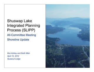
4. Background
§ Unprecedented increase in the scale and scope of
development on the Shuswap Lake System.
§ Minimal base line bio-physical information for the
Shuswap Lake System to track changes over time,
consider cumulative impacts and assist directing
land / foreshore use planning.
5. § FHIM project initiated in 2007.
§ Key partners CSRD, other local
governments and MOE.
§ Funded by the Real Estate Foundation,
Fraser Salmon and Watersheds Program,
DFO and MOE (“in kind support”). Total
project costs approx $100,000 to date.
6. § Substantial modification of riparian and
foreshore adjoining private land and IR
§ Many modifications lie with sensitive
habitats.
§ Significant non compliance with BMP, OS
and Guidelines. Works without Approvals
§ Extensive unauthorized use and trespass of
crown foreshore.
13. Removal of Emergent Vegetation
More chronic in small bay areas coinciding with high boat traffic.
Often associated with stripping of larger cobble beaches.
33. Next Steps
§ Phase 2 of shoreline restorations planned
for late summer/fall 2012
34. Sicamous
Narrows
Inventory
Project
Keith
Weir,
BC
Ministry
of
Forests,
Lands
and
Natural
Resource
OperaDons
35.
36. What
is
the
Project?
• An
inventory
of
all
commercial/strata
marinas,
private
docks
and
uDlity
sites.
• InformaDon
collected
will
focus
on
safety,
environmental
and
social
issues
related
to
these
works.
37. Why?
• Data
gathered
may
be
used
for
various
purposes:
1. To
check
for
consistency
with
Sicamous
Narrows
management
plan
and
legal
documents
authorizing
the
use
and
occupaDon
of
Crown
land
2. Evaluate
impacts
to
the
environment.
3. Aid
in
future
management
strategies.
38. Next
Steps
• Consolidate
informaDon
gathered
in
the
field.
• Develop
strategy,
based
on
idenDfied
impacts.
• Present
SLIPP
Steering
CommiVee
with
findings
and
recommendaDons.
• Implement
strategy
to
address
idenDfied
issues.