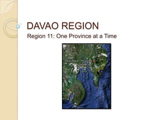
SlideShare a Scribd company logo
1 of 26
DAVAO REGION
Region 11: One Province at a Time
DAVAO DEL NORTE
Davao del Norte
GEOGRAPHY
   Boundaries
    ◦ North: Agusan del Sur
    ◦ South: Davao City, Davao
      Gulf
    ◦ East: Compostela Valley
    ◦ West: Bukidnon
Davao del Norte
BASICS
 3,463 square km
 Capital: Tagum
 8 municipalities, 3 cities
    ◦ Island Garden City of Samal
Davao del Norte
INDUSTRIES
   Minerals
    ◦ Marble, limestone, guano
 Paddy rice
 Corn
 Coconut
 Bananas
    ◦ Leading producer of Cavendish banana in
      the country (Banana Capital of the
      Philippines)
    ◦ Banana chip processing industry
Davao del Norte
INDUSTRIES
 Small-scale gold mining
 Fish from Davao Gulf
    ◦   Brackish water milkfish
    ◦   Tilapia
    ◦   Shrimp
    ◦   Crab
    ◦   Freshwater catfish
Davao del Norte
TOURISM
   Island Garden
    City of Samal
    ◦ Main tourist
      attraction
    ◦ 118 km stretch
      white sand
      beaches
    ◦ “Vanishing Island,”
      Sanipaan Shoal
      Actually vanishes in
       high tide
    ◦ Dive spots in
      Talikud and Ligid
      Islands
    ◦ Mt. Puting Bato
DAVAO ORIENTAL
Davao Oriental
GEOGRAPHY
   Boundaries
    ◦ North: Agusan
      del Sur
    ◦ South: Davao Gulf
    ◦ East: Pacific Ocean
    ◦ West: Compostela Valley
Davao Oriental
BASICS
 5,164 square km
 Largest province in
  Region 11
 Capital: Tagum
 8 municipalities, 3 cities
    ◦ Island Garden City of Samal
Davao Oriental
INDUSTRIES
   Copra
    ◦ Copra production
      capital of the
      Philippines
   Durian, mango, pom
    elo
   Grain milling
   Lumber
   Tiles
   Fishing
   Mining
    ◦ Copper, nickel
DAVAO DEL SUR
Davao del Sur
GEOGRAPHY
   Boundaries:
    ◦ North: Davao del
      Norte
    ◦ South: Celebes
      Sea
    ◦ East: Davao Gulf
    ◦ West: North
      Cotabato, Sultan
      Kudarat and South
      Cotabato
Davao del Sur
BASICS
 3,934 square km
 14 municipalities and 2 cities
    ◦ 1 independent city: Davao City
      highly urbanized
    ◦ 1 component city: Digos
      Digos used to be the capital of Davao del Sur
       before the split of Davao into 3 provinces in
       1976
Davao del Sur
INDUSTRIES
 Coconut as major commercial
  crop
 Rice
 Corn
 Bananas
 Logging
 Fishing @ Davao Gulf
    ◦ 11 coastal municipalities
Davao del Sur
INDUSTRIES
   Davao City
    ◦ Largest city in the
      Philippines in terms of
      land area
    ◦ 2008 Most Livable City
      (Dept. of Tourism)
    ◦ Main commercial
      center
    ◦ Fruit cultivation
      Leading
       exporter, worldwide
Davao del Sur
INDUSTRIES
 Lanzones
 Mining
    ◦ gold, silver, lead, coppe
      r,
         chromium
Davao del Sur
INDUSTRIES
   Durian
    Monument at
    the Davao City
    International
    Airport
    ◦ A symbol of
      Davao City’s
      status as top
      producer of
      said fruit
Davao del Sur
SPOTLIGHT ON DAVAO CITY
   Why is it that the
    people of Davao
    seem to be some of
    the most
    disciplined, making
    Davao an overall
    clean and safe
    place?                Mayor Sara Duterte
Davao del Sur
SPOTLIGHT ON DAVAO CITY
 Smoking ban
 No fireworks on
  New Year!
 Efficient garbage
  collection
  scheme
COMPOSTELA VALLEY
Compostela Valley
GEOGRAPHY
   Boundaries
    ◦ North: Agusan del Sur
    ◦ West: Davao del
      Norte to the west
    ◦ East/South: Davao
      Oriental
Compostela Valley
BASICS
 Formerly part of Davao del
  Norte, became independent
  in 1998
 3rd newest province
    ◦ following Dinagat Islands and
      Zamboanga Sibugay)
 4,667 square kilometers
 Capital: Nabunturan
 11 municipalities
Compostela Valley
INDUSTRIES
 Rice
 Coconut
 Cacao
 Coffee
 Papaya
 Mango
 Pineapple
 Durian
 Banana
Compostela Valley
INDUSTRIES
 Logging
 Mining
    ◦ Mostly gold
    ◦ Illegal mining
Compostela Valley
TRAGEDY
   In December
    2012, a series of
    typhoons and
    landslides struck
    Compostela
    Valley
    ◦ Typhoon Pablo
      Flash floods

More Related Content

What's hot

What's hot (20)

Region 5 - Bicol Region Philippines
Region 5 - Bicol Region PhilippinesRegion 5 - Bicol Region Philippines
Region 5 - Bicol Region Philippines
 
REGION 11: DAVAO REGION
REGION 11: DAVAO REGIONREGION 11: DAVAO REGION
REGION 11: DAVAO REGION
 
REGION 10: NORTHERN MINDANAO
REGION 10: NORTHERN MINDANAOREGION 10: NORTHERN MINDANAO
REGION 10: NORTHERN MINDANAO
 
Region VI Philippines
Region VI PhilippinesRegion VI Philippines
Region VI Philippines
 
ARMM Region Soc.Stud10
ARMM Region Soc.Stud10ARMM Region Soc.Stud10
ARMM Region Soc.Stud10
 
Car region
Car regionCar region
Car region
 
It's all about Northern Mindanao-Philippines
It's all about Northern Mindanao-PhilippinesIt's all about Northern Mindanao-Philippines
It's all about Northern Mindanao-Philippines
 
Region12 by Benola, Annah Lou and Sunshine A. Sinoy
Region12 by Benola, Annah Lou and Sunshine A. SinoyRegion12 by Benola, Annah Lou and Sunshine A. Sinoy
Region12 by Benola, Annah Lou and Sunshine A. Sinoy
 
NCR - NATIONAL CAPITAL REGION
NCR - NATIONAL CAPITAL REGIONNCR - NATIONAL CAPITAL REGION
NCR - NATIONAL CAPITAL REGION
 
MIMAROPA, Region IV - B
MIMAROPA, Region IV - BMIMAROPA, Region IV - B
MIMAROPA, Region IV - B
 
Cordillera administrative region
Cordillera administrative regionCordillera administrative region
Cordillera administrative region
 
MIMAROPA Region IV-B
MIMAROPA Region IV-BMIMAROPA Region IV-B
MIMAROPA Region IV-B
 
Region x northern mindanao by bumanglag and ternio
Region x  northern mindanao by bumanglag and ternioRegion x  northern mindanao by bumanglag and ternio
Region x northern mindanao by bumanglag and ternio
 
Romblon Province
Romblon ProvinceRomblon Province
Romblon Province
 
Region V Bicol region
Region  V Bicol regionRegion  V Bicol region
Region V Bicol region
 
Region x
Region xRegion x
Region x
 
Calabarzon
CalabarzonCalabarzon
Calabarzon
 
Region IV-B Mimaropa Geography
Region IV-B Mimaropa GeographyRegion IV-B Mimaropa Geography
Region IV-B Mimaropa Geography
 
Region 3 central luzon
Region 3   central luzonRegion 3   central luzon
Region 3 central luzon
 
Region IV-B (MIMAROPA Region)
Region IV-B (MIMAROPA Region)Region IV-B (MIMAROPA Region)
Region IV-B (MIMAROPA Region)
 

Davao region

  • 1. DAVAO REGION Region 11: One Province at a Time
  • 3. Davao del Norte GEOGRAPHY  Boundaries ◦ North: Agusan del Sur ◦ South: Davao City, Davao Gulf ◦ East: Compostela Valley ◦ West: Bukidnon
  • 4. Davao del Norte BASICS  3,463 square km  Capital: Tagum  8 municipalities, 3 cities ◦ Island Garden City of Samal
  • 5. Davao del Norte INDUSTRIES  Minerals ◦ Marble, limestone, guano  Paddy rice  Corn  Coconut  Bananas ◦ Leading producer of Cavendish banana in the country (Banana Capital of the Philippines) ◦ Banana chip processing industry
  • 6. Davao del Norte INDUSTRIES  Small-scale gold mining  Fish from Davao Gulf ◦ Brackish water milkfish ◦ Tilapia ◦ Shrimp ◦ Crab ◦ Freshwater catfish
  • 7. Davao del Norte TOURISM  Island Garden City of Samal ◦ Main tourist attraction ◦ 118 km stretch white sand beaches ◦ “Vanishing Island,” Sanipaan Shoal  Actually vanishes in high tide ◦ Dive spots in Talikud and Ligid Islands ◦ Mt. Puting Bato
  • 9. Davao Oriental GEOGRAPHY  Boundaries ◦ North: Agusan del Sur ◦ South: Davao Gulf ◦ East: Pacific Ocean ◦ West: Compostela Valley
  • 10. Davao Oriental BASICS  5,164 square km  Largest province in Region 11  Capital: Tagum  8 municipalities, 3 cities ◦ Island Garden City of Samal
  • 11. Davao Oriental INDUSTRIES  Copra ◦ Copra production capital of the Philippines  Durian, mango, pom elo  Grain milling  Lumber  Tiles  Fishing  Mining ◦ Copper, nickel
  • 13. Davao del Sur GEOGRAPHY  Boundaries: ◦ North: Davao del Norte ◦ South: Celebes Sea ◦ East: Davao Gulf ◦ West: North Cotabato, Sultan Kudarat and South Cotabato
  • 14. Davao del Sur BASICS  3,934 square km  14 municipalities and 2 cities ◦ 1 independent city: Davao City  highly urbanized ◦ 1 component city: Digos  Digos used to be the capital of Davao del Sur before the split of Davao into 3 provinces in 1976
  • 15. Davao del Sur INDUSTRIES  Coconut as major commercial crop  Rice  Corn  Bananas  Logging  Fishing @ Davao Gulf ◦ 11 coastal municipalities
  • 16. Davao del Sur INDUSTRIES  Davao City ◦ Largest city in the Philippines in terms of land area ◦ 2008 Most Livable City (Dept. of Tourism) ◦ Main commercial center ◦ Fruit cultivation  Leading exporter, worldwide
  • 17. Davao del Sur INDUSTRIES  Lanzones  Mining ◦ gold, silver, lead, coppe r, chromium
  • 18. Davao del Sur INDUSTRIES  Durian Monument at the Davao City International Airport ◦ A symbol of Davao City’s status as top producer of said fruit
  • 19. Davao del Sur SPOTLIGHT ON DAVAO CITY  Why is it that the people of Davao seem to be some of the most disciplined, making Davao an overall clean and safe place? Mayor Sara Duterte
  • 20. Davao del Sur SPOTLIGHT ON DAVAO CITY  Smoking ban  No fireworks on New Year!  Efficient garbage collection scheme
  • 22. Compostela Valley GEOGRAPHY  Boundaries ◦ North: Agusan del Sur ◦ West: Davao del Norte to the west ◦ East/South: Davao Oriental
  • 23. Compostela Valley BASICS  Formerly part of Davao del Norte, became independent in 1998  3rd newest province ◦ following Dinagat Islands and Zamboanga Sibugay)  4,667 square kilometers  Capital: Nabunturan  11 municipalities
  • 24. Compostela Valley INDUSTRIES  Rice  Coconut  Cacao  Coffee  Papaya  Mango  Pineapple  Durian  Banana
  • 25. Compostela Valley INDUSTRIES  Logging  Mining ◦ Mostly gold ◦ Illegal mining
  • 26. Compostela Valley TRAGEDY  In December 2012, a series of typhoons and landslides struck Compostela Valley ◦ Typhoon Pablo  Flash floods