SlideShare a Scribd company logo
1 of 85
Download to read offline
Increase Safety
Improve Traffic Operations
Encourage Alternate Modes
Regional Transportation Commission
of Washoe County
NORTH VALLEYS
Multimodal Transportation Study
Prepared for: Prepared by:
Draft Report - January 25, 2017
D
R
A
FT
Executive Summary
Page i
North Valleys
Multimodal Transportation Study
EXECUTIVE SUMMARY
As the Reno-Sparks region recovers from the Great Recession,
employment and residential growth has expanded in the North Valleys.
Traffic volumes have been increasing with resurgence in development
and pressure on some major arterials and interchanges was now
evident. Tremendous new residential and industrial development
energy now, and for the next decade, will be centered in the North
Valleys where the developable land is located.
This North Valleys Multimodal Transportation Study focuses on
regional roadways and the most critical intersections on these
arterials. Separate from, but concurrently with this study, the Nevada
Department of Transportation (NDOT) is preparing the Reno-Sparks
Freeway Traffic Study which addresses US 395 through the North
Valleys and south to I-80, the Spaghetti Bowl, and the freeway related
congestion and safety issues. Both studies have been prepared
collaboratively with regular communication between the Regional
Transportation Commission, NDOT, local agencies, and the consulting
teams, to prepare a cohesive overall transportation improvement plan.
The resulting recommendations for regional road and intersection
improvements are listed in the Table A and will be included in the 2040
Regional Transportation Plan for implementation.
Two themes are central to this study. First, the Lemmon Drive
interchange is the “bullseye” for most traffic in the North Valleys area.
Nearly every trip west or north of this location must travel through the
interchange. A more detailed interchange alternatives analysis should
be conducted in partnership with NDOT.
Second, widening of US 395 cannot be the single solution to managing
all travel from the North Valleys to the greater Reno/Sparks urban
area. Another major connection is needed in the long-term plan and a
solution is presented within this study. The North Valleys Connector
concept presented within this report will relieve both Pyramid Highway
and US 395, the two most congested roadways in the region to further
support the traffic reduction benefit of the Pyramid – US 395
Connector project.
Executive Summary
Page ii
North Valleys
Multimodal Transportation Study
Table A. Recommendations for Regional Road & Intersection Improvements
Location Limits Type Description Planning Level Cost
Stead Blvd/Silver Lake Rd Intersection Safety and Capacity Improvements 300,000.00$
Stead Blvd Pedestrian Signal Upgrade Pedestrian Crossing Pedestrian and Safety Improvements 50,000.00$
Silver Lake Road Crossing Pedestrian Crossing Pedestrian and Safety Improvements 125,000.00$
Ural Street Crossing Pedestrian Crossing Pedestrian and Safety Improvements 125,000.00$
Lemmon Dr/Surge St Pedestrian Crossing Pedestrian and Safety Improvements 175,000.00$
N Virginia St/Golden Valley Dr Intersection Safety Improvements 225,000.00$
Sky Vista Pkwy Crossing Pedestrian Crossing Pedestrian and Safety Improvements 30,000.00$
Red Rock Rd/Moya Blvd Intersection Capacity Improvements 3,500,000.00$
Lemmon Dr Interchange Interchange Capacity Improvements 1,500,000.00$
Parr Boulevard Ferrari McLeod to Raggio Pkwy Roadway Road widening - Widen to 4 lanes 7,700,000.00$
Lemmon Drive Sky Vista Pkwy to Military Rd Roadway Road Widening - Widen to 6 lanes 5,300,000.00$
Lemmon Drive Fleetwood Dr to Deodar Way Roadway Road Widening - Widen to 4 lanes 4,300,000.00$
Military Road Lemmon Dr to Echo Ave Roadway Road Widening - Widen to 4 lanes 17,700,000.00$
Buck Drive Lemmon Dr to North Hills Blvd Roadway Road Widening - Widen to 4 lanes 1,300,000.00$
Sky Vista Pkwy Vista Knoll Dr to Silver Lake Rd Roadway Road Widening - Widen to 4 lanes 6,900,000.00$
Moya Boulevard Red Rock Rd to Echo Ave Roadway Road Widening - Widen to 4 lanes 13,700,000.00$
Red Rock Road US 395 to Evans Ranch Roadway Road Widening - Widen to 4 lanes 40,700,000.00$
Lemmon Dr / Sky Vista Pkwy Intersection Major Intersection Improvements 5,000,000.00$
N. Virginia St / Lemmon Drive Intersection Capacity Improvements 2,000,000.00$
N. Virginia St / Golden Valley Intersection Capacity Improvements 2,000,000.00$
Stead Blvd / Silver Lake Road Intersection Long Term Capacity Improvements 1,000,000.00$
Red Rock Road/Silver Lake Road Intersection Intersection Improvements 1,500,000.00$
Parr Boulevard Interchange Ramp intersections Interchange Interim Capacity Improvements 5,000,000.00$
Lemmon Drive Interchange Ramp intersections Interchange Reconstruction 35,000,000.00$
North Valleys Connector Echo Avenue to Eagle Canyon Roadway Construct New Roadway 47,500,000.00$
196,600,000.00$TOTAL
Package 1 Improvements
Package 2 Improvements
Long Term Improvements
Acknowledgements
Page iii
North Valleys
Multimodal Transportation Study
ACKNOWLEDGEMENTS
The North Valleys Multimodal Transportation Study was funded and
administered by the Regional Transportation Commission of Washoe
County (RTC), for the benefit of current North Valleys region residents,
and every community member who will walk, cycle, ride a bus, or drive
in the North Valleys over the next 20 years and beyond. Long-range
planning for numerous regionally significant major arterial roadways
and intersections is no easy task. The project team is therefore
sincerely grateful to every citizen, stakeholder, technical advisor, and
agency representative that gave of their personal time and knowledge,
to guide the study process and identify a set of well rounded multi-
modal improvements that will serve our community well into the
future. Thank you for helping shape the future of the North Valleys!
Technical Advisory Committee:
Member Agency
Lee Gibson RTC Executive Director
Amy Cummings RTC Director of Planning
Jeff Hale RTC Director of Engineering
Xuan Wang RTC Project Manager
Debra Goodwin RTC
Michelle Dennis RTC
Clara Lawson Washoe County
Kelly Mullin Washoe County
Hoang Hong NDOT
Janelle Thomas NDOT
Jeff Lerud NDOT
Mark Wooster NDOT
Randy Travis NDOT
Nick Johnson NDOT
Steve Bunnell City of Reno
William Gall City of Reno
Consulting Team:
Loren Chilson Traffic Works
Uday Maripalli Traffic Works
Rich Pettinari Traffic Works
Chad Anson CA Group
Table of Contents
Page iv
North Valleys
Multimodal Transportation Study
CONTENTS
1 Introduction...................................................................................................................................................................................... 1-1
1.1 Purpose and Goals............................................................................................................................................................................ 1-1
1.2 Vision Statement .............................................................................................................................................................................. 1-1
1.3 Study Area ........................................................................................................................................................................................ 1-1
2 Existing Conditions............................................................................................................................................................................ 2-1
2.1 Functional Classification and Roadway Characteristics.................................................................................................................... 2-1
2.2 Existing Non-Motorized Facilities..................................................................................................................................................... 2-2
2.3 Public Transit .................................................................................................................................................................................... 2-2
2.4 Collision History................................................................................................................................................................................ 2-6
2.5 Existing Traffic Operations................................................................................................................................................................ 2-9
3 Public Outreach ................................................................................................................................................................................ 3-1
3.1 TAC and Stakeholder Meetings ........................................................................................................................................................ 3-1
3.2 Public Meetings ................................................................................................................................................................................ 3-3
4 2035 Future Traffic Conditions......................................................................................................................................................... 4-1
4.1 Functional Classifications and Roadway Characteristics .................................................................................................................. 4-1
4.2 2035 Daily Traffic Volumes............................................................................................................................................................... 4-1
4.3 2035 Peak Hour Intersection Volumes............................................................................................................................................. 4-4
4.4 Year 2035 Traffic Operations............................................................................................................................................................ 4-6
5 Proposed Multimodal Improvements .............................................................................................................................................. 5-1
5.1 Short Term Multimodal Improvements............................................................................................................................................ 5-1
5.2 Long Term Improvements ................................................................................................................................................................ 5-6
6 Cost Estimates..........................................................................................................................................................................6-1
Table of Contents
Page v
North Valleys
Multimodal Transportation Study
LIST OF TABLES
TABLE 2-1. CRASH SUMMARY FROM AUGUST 2010 TO AUGUST 2015 ...................................................................................................................................2-6
TABLE 2-2. SUMMARY OF CRASHES AT STEAD BLVD/SILVER LAKE RD FROM AUG 2010 TO AUG 2015 ..................................................................................2-7
TABLE 2-3. LOS CRITERIA FOR SIGNALIZED & UN-SIGNALIZED INTERSECTIONS.......................................................................................................................2-9
TABLE 2-4. AVERAGE DAILY TRAFFIC LOS THRESHOLDS BY FACILITY TYPE.............................................................................................................................2-11
TABLE 2-5. EXISTING ROAD SEGMENT LEVEL OF SERVICE......................................................................................................................................................2-12
TABLE 2-6. EXISTING INTERSECTION LEVEL OF SERVICE.........................................................................................................................................................2-12
TABLE 3-1. PUBLIC PREFERENCES FOR SHORT TERM IMPROVEMENTS ...................................................................................................................................3-6
TABLE 4-1. ESTIMATION OF 2035 DAILY TRAFFIC VOLUMES AND GROWTH RATES (PART 1)..................................................................................................4-3
TABLE 4-2. ESTIMATION OF 2035 DAILY TRAFFIC VOLUMES AND GROWTH RATES (PART 2)..................................................................................................4-3
TABLE 4-3. 2035 ROADWAY SEGMENT LEVEL OF SERVICE SUMMARY ....................................................................................................................................4-6
TABLE 4-4. 2035 INTERSECTION LEVEL OF SERVICE SUMMARY ...............................................................................................................................................4-7
TABLE 5-1: 2035 WITH IMPROVEMENT ROADWAY LOS SUMMARY ........................................................................................................................................5-8
TABLE 5-2: BICYCLE PEDESTRIAN PROJECTS IN NORTH VALLEYS ...........................................................................................................................................5-12
TABLE 6-1: SHORT TERM IMPROVEMENTS COST ESTIMATES ..................................................................................................................................................6-1
TABLE 6-2: LONG TERM IMPROVEMENTS COST ESTIMATES....................................................................................................................................................6-2
Table of Contents
Page vi
North Valleys
Multimodal Transportation Study
LIST OF FIGURES
FIGURE 1-1. STUDY AREA............................................................................................................................................................................................................1-3
FIGURE 2-1. EXISTING PEDESTRIAN FACILITIES...........................................................................................................................................................................2-3
FIGURE 2-2. EXISTING BICYCLE FACILITIES..................................................................................................................................................................................2-4
FIGURE 2-3. TRANSIT ROUTES SERVING THE NORTH VALLEYS...................................................................................................................................................2-5
FIGURE 2-4. SUMMARY OF CRASHES FROM AUGUST 2010 TO AUGUST 2015 ..........................................................................................................................2-7
FIGURE 2-5. CRASHES BY TYPE AT STEAD BLVD/SILVER LAKE RD...............................................................................................................................................2-8
FIGURE 2-6. EXISTING AM AND PM PEAK HOUR TURNING MOVEMENT VOLUMES................................................................................................................2-10
FIGURE 3-1. A SAMPLE SLIDE FROM THE MEETING #1 PRESENTATION.....................................................................................................................................3-2
FIGURE 3-2. A SAMPLE SLIDE FROM THE MEETING #3 PRESENTATION.....................................................................................................................................3-3
FIGURE 3-3. DISPLAY SEEKING PUBLIC INPUT ON PRIORITIES....................................................................................................................................................3-4
FIGURE 3-4. COMMUNITY PRIORITIES RESULTS.........................................................................................................................................................................3-5
FIGURE 3-5. DISPLAY SEEKING PUBLIC PREFERENCES FOR SHORT TERM IMPROVEMENTS.......................................................................................................3-5
FIGURE 3-6. PUBLIC MEETING 1 PRESENTATION........................................................................................................................................................................3-6
FIGURE 3-7. DISPLAY SHOWING NORTH VALLEYS CONNECTOR CONCEPT ................................................................................................................................3-7
FIGURE 3-8. SAMPLE COMMENTS BY THE ATTENDEES ..............................................................................................................................................................3-7
FIGURE 4-1. EXAMPLE SCREENSHOT OF TURNS W32.................................................................................................................................................................4-4
FIGURE 4-2. 2035 AM AND PM PEAK HOUR TURNING MOVEMENT COUNTS ...........................................................................................................................4-5
FIGURE 5-1. PACKAGE 1 SHORT TERM IMPROVEMENTS............................................................................................................................................................5-2
FIGURE 5-2. PACKAGE 2 SHORT TERM IMPROVEMENTS............................................................................................................................................................5-4
FIGURE 5-3. RED ROCK/MOYA IMPROVEMENTS........................................................................................................................................................................5-5
FIGURE 5-4. SHORT TERM IMPROVEMENTS AT LEMMON DR. INTERCHANGE ..........................................................................................................................5-5
Table of Contents
Page vii
North Valleys
Multimodal Transportation Study
FIGURE 5-5. LONG TERM IMPROVEMENTS ................................................................................................................................................................................5-7
FIGURE 5-6. PROPOSED BIKE-PEDESTRIAN IMPROVEMENTS...................................................................................................................................................5-10
FIGURE 5-7. COMPLETE STREETS IMPROVEMENTS IN NORTH VALLEYS ..................................................................................................................................5-11
FIGURE 5-8. COMPLETE STREETS IMPROVEMENTS WITHIN PROJECT STUDY AREA ................................................................................................................5-11
FIGURE 5-9. BIKE-PED PROJECTS FROM RENO-SPARKS BICYCLE & PEDESTRIAN PLAN............................................................................................................5-12
FIGURE 5-10. PROPOSED TRANSIT STOP LAYOUT ....................................................................................................................................................................5-13
FIGURE 5-11. LEMMON DRIVE INTERCHANGE TRAFFIC CONCERNS ........................................................................................................................................5-14
FIGURE 5-12. NORTH VALLEYS CONNECTOR CONCEPT............................................................................................................................................................5-16
INTRODUCTION PAGE 1-1
North Valleys
Multimodal Transportation Study
1 INTRODUCTION
1.1 Purpose and Goals
The purpose of this multimodal study is to identify needs and long-
term transportation improvements for regional roads and
intersections in the North Valleys area. This study focuses on traffic
operations analysis and capacity improvements, safety improvements,
pedestrian and bicycle connectivity, and transit service needs.
The main objective of this study is to plan and program short-term and
long-term multimodal transportation improvements within the study
area. The study identifies a strategy for developing transportation
improvements that are coordinated with adjacent planned and existing
land uses. This work has been conducted in coordination with the
Nevada Department of Transportation (NDOT) Reno-Sparks Freeway
Traffic Study.
1.2 Vision Statement
The following vision statement was developed through a
comprehensive community involvement program.
“Develop a program of short and long-term improvements that
increase safety, improve traffic operations and freight movement,
encourage travel by alternate modes, and support future residential,
commercial, and industrial development.”
The analysis, recommendations, and action plans in this study are all
aimed at achieving this community guided vision.
1.3 Study Area
The study area consists of numerous regional roadways, key
intersections, and ramp junctions in the North Valleys Region, as
defined in Figure 1-1. The intersections and roadways highlighted in
red are part of the NDOT Reno-Sparks Freeway Traffic Study. The
intersections and roadways highlighted in blue are included in this
report. This study includes analysis of the most significant arterials in
the North Valleys region. The study roadways include:
• Parr Boulevard
• Golden Valley Road
• Lemmon Drive
• Military Road
• Sky Vista Parkway
• Stead Boulevard
• Silver Lake Road
• Moya Boulevard
• Red Rock Road
• North Virginia Street
The study includes the following intersections:
• Parr Boulevard/US 395 NB Ramps
• Parr Boulevard/US 395 SB Ramps
• Golden Valley Road/N. Virginia Street
INTRODUCTION PAGE 1-2
North Valleys
Multimodal Transportation Study
• Lemmon Drive/N. Virginia Street
• Lemmon Drive/US 395 NB Ramps
• Lemmon Drive/US 395 SB Ramps
• Lemmon Drive/Sky Vista Parkway
• Lemmon Drive/Military Road
• Stead Boulevard/Silver Lake Road
• Red Rock Road/Silver Lake Road
• Red Rock Road/Moya Boulevard
The locations of all these study intersections and roadway corridors are
shown in Figure 1-1.
INTRODUCTION PAGE 1-3
North Valleys
Multimodal Transportation Study
Figure 1-1. Study Area
EXISTING CONDITIONS PAGE 2-1
North Valleys
Multimodal Transportation Study
2 EXISTING CONDITIONS
This portion of the report discusses existing conditions for all travel in
the North Valleys region.
2.1 Functional Classification and Roadway
Characteristics
Roadway functional classification is the foundation for planning
roadway improvements and setting appropriate standards (e.g., right-
of-way requirements, roadway width, design speed, multimodal
facilities, etc.,) that apply to each roadway facility. A brief description
of the major roadways within the study area is provided below. These
descriptions are for the portions of the roadways within the study area
only.
• Parr Boulevard – is a 2-lane (north of US 395) to 3-lane (south
of US 395) roadway that is classified as a “Low Access Control
Arterial” according to the RTC’s 2035 Regional Transportation
Plan (RTP). The posted speed limit is 35 mph.
• Golden Valley Road – to the north of N. Virginia Street is a 2-
lane (south of US 395) to 4-lane (north of US 395) roadway that
is classified as a “Medium Access Control Arterial” according to
the RTC’s 2035 Regional Transportation Plan (RTP). The posted
speed limit is 35 mph.
• Lemmon Drive – is classified as a “Medium Access Control
Arterial” according to the 2035 RTP. The number of lanes on
Lemmon Drive varies throughout the study area. It is a 2-lane
roadway south of US 395, a 6-lane roadway between US 395
and Sky Vista Parkway, a 4-lane roadway between Sky Vista
Parkway and Fleetwood Drive, and a 2-lane roadway north of
Fleetwood Drive. The posted speed limit varies between 35
mph and 45 mph.
• Military Road – is classified as a “Medium Access Control
Arterial” according to the 2035 RTP. It is a 2-lane roadway with
a posted speed limit of 35 mph.
• Sky Vista Parkway – is classified as a “Medium Access Control
Arterial” between Silver Lake Road and Lemmon Drive and as a
“Low Access Control Collector” north of Silver Lake Road. It is a
2-lane roadway west of Vista Knoll Parkway and a 5-lane road
between Lemmon Drive and Vista Knoll Parkway. The posted
speed limit is 35 mph.
• Stead Boulevard – is classified as a “Medium Access Control
Arterial” according to the 2035 RTP. It is a 4-lane roadway north
of Silver Lake Road, a 5-lane roadway between Silver Lake Road
and US 395, and a 2-lane road south of US 395. The posted
speed limit is 35 mph.
• Silver Lake Road – is classified as a “Low Access Control
Collector” according to the 2035 RTP. It is a 2-lane road with a
posted speed limit of 35 mph.
• Moya Boulevard – is classified as a “Low Access Control
Arterial” according to the 2035 RTP. It is a 2-lane roadway with
a posted speed limit of 35 mph.
• Red Rock Road – is classified as a “Medium Access Control
Arterial” according to the 2035 RTP. It is a 4-lane road between
EXISTING CONDITIONS PAGE 2-2
North Valleys
Multimodal Transportation Study
US 395 and Moya Boulevard and a 2-lane road elsewhere. The
posted speed limit is 35 mph.
• N. Virginia Street – is classified as a “Medium Control Arterial”
according to the 2035 RTP, within the study area. It is a 2-lane
roadway with a posted speed limit of 35 mph.
2.2 Existing Non-Motorized Facilities
Non-motorized travel, such as walking and cycling, are important
elements of the transportation system and the provision, extent, and
quality of non-motorized facilities affect mode choice. Figure 2-1 and
Figure 2-2 summarize the existing pedestrian facilities and bicycle
facilities, respectively, within the study area.
As shown in Figure 2-1, there are currently many gaps in the sidewalk
infrastructure. There are also many gaps in the bicycle facilities and
long-term improvements are needed to enhance travel for both
modes.
2.3 Public Transit
This section documents the existing public transportation
infrastructure that serves the North Valleys region.
The RTC fixed-route services consist of RTC RIDE (23 routes), RTC RAPID
(bus rapid transit service), RTC INTERCITY, and the SIERRA SPIRIT
(downtown Reno circulator). RTC also provides complimentary ADA
paratransit service, RTC ACCESS, and has a growing vanpool program,
RTC VANPOOL, with over 100 van pools in operation. RTC RIDE is the
public transit bus system for the greater Sparks, Reno, and Washoe
County areas. The fixed-route system operates in a 90 square-mile
service area, based on a 0.75 mile distance from each fixed route
(excluding RTC INTERCITY).The fixed-route system includes a fleet of
72 buses with more than 1,000 bus stops.
In addition to fixed-route service, the RTC also provides ACCESS service
within the North Valleys Region. RTC ACCESS is the para-transit service
that provides door-to-door, prescheduled, trips for individuals with
access and functional needs who meet eligibility criteria. Trips are
reserved from one to three days in advance and the service operates
24 hours a day, seven days a week.
Fixed Routes in North Valleys
Routes 7, 15 and 17 are the fixed routes serving the North Valleys
region. Route 7 travels along Golden Valley Road, Sky Vista Parkway,
Stead Boulevard to provide connectivity between Downtown Reno and
Reno Stead Airport. Route 15 travels along Dandini Boulevard
providing connectivity between Downtown Reno and Truckee
Meadows Community College. Route 17 provides connectivity
between Downtown Reno and Lemmon Valley via N. Virginia Street
and Lemmon Drive. Figure 2-3, shows the three RTC fixed-routes
providing service in the study area. RTC RIDE is the only fixed-route bus
service operating within the study area.
EXISTING CONDITIONS PAGE 2-3
North Valleys
Multimodal Transportation Study
Figure 2-1. Existing Pedestrian Facilities
EXISTING CONDITIONS PAGE 2-4
North Valleys
Multimodal Transportation Study
Figure 2-2. Existing Bicycle Facilities
EXISTING CONDITIONS PAGE 2-5
North Valleys
Multimodal Transportation Study
Figure 2-3. Transit Routes Serving The North Valleys
EXISTING CONDITIONS PAGE 2-6
North Valleys
Multimodal Transportation Study
2.4 Collision History
Crash data obtained from the Nevada Department of Transportation
(NDOT) for the previous five year period (August 2010 to August 2015)
was used to help identify high-crash locations and attempt to identify
trends. Crash data was obtained for each study intersection.
Identifying crash types can assist in the choice of safety
countermeasures and in evaluations of countermeasure effectiveness.
Table 2-1 shows the summary of crashes at each intersection during
the past five years.
Based on the data obtained, a total of 173 crashes were reported
between August 2010 and August 2015. The majority of the crashes
were Property Damage Only (PDO) crashes, accounting for 57% of the
total crashes. 42% of the crashes resulted in injuries and 1% resulted
in a fatality. About 8% of the crashes (14 out of 173) involved cyclists
or pedestrians. The location with highest bicycle and pedestrian
crashes is the Stead Boulevard/Silver Lake Road intersection. The Stead
Boulevard/Silver Lake Road intersection was evaluated further and is
discussed in the following section. Figure 2-4 shows the relative
distribution of crashes at the various intersections.
Table 2-1. Crash Summary from August 2010 to August 2015
Vehicle Bicycle Pedestrian Fatality Injury Property Damage
Parr Blvd/US 395 Ramps 9 3 6 9
N Virginia St/Golden Valley Rd 17 1 9 9 18
N Virginia St/Lemmon Dr 5 1 4 5
Lemmon Dr/395 Ramps 15 1 5 11 16
Lemmon Dr/Sky Vista Pkwy 26 2 11 17 28
Lemmon Dr/Military Rd 18 8 10 18
Stead Blvd/Silver Lake Rd 46 3 7 2 29 25 56
Red Rock Rd/Silver Lake Rd 11 3 8 11
Red Rock Rd/Moya Blvd 12 3 9 12
TOTAL 159 5 9 2 72 99 173
Mode Involved Severity
Intersection Total
EXISTING CONDITIONS PAGE 2-7
North Valleys
Multimodal Transportation Study
Stead Boulevard/Silver Lake Road
Any intersection with over 30 crashes in a 3 year period is considered
by NDOT to be a “High Crash Location”. The Stead Boulevard/Silver
Lake Road intersection is the only intersection that experienced over
30 crashes in a 3 year time period, making it a high crash location. 56
crashes were reported at the Stead Boulevard/Silver Lake Road
intersection between August 2010 and August 2015. Table 2-2
summarizes all the reported crashes at this location.
Based on the data obtained, of the 56 crashes at this location, 4 were
reported in 2010, 11 were reported in 2011, 10 were reported in 2012,
10 were reported in 2013, 13 were reported in 2014, and 8 crashes
were reported in 2015. The historic trend shows that the number of
crashes has generally remained constant every year over the past five
year period.
Table 2-2. Summary of Crashes at Stead Blvd/Silver Lake Rd from Aug
2010 to Aug 2015
Crash Type Number PDO Injury Fatality Ped/Bike
Angle 24 9 13 2 3
Head-on 2 0 2 0 0
Non-Collision 12 3 9 0 7
Rear-End 15 10 5 0 0
Sideswipe/Overtaking 2 2 0 0 0
Unknown 1 1 0 0 0
Figure 2-4. Summary of Crashes from August 2010 to August 2015
9
18
5
16
28
18
56
11 12
0
10
20
30
40
50
60
Parr Blvd/US 395
Ramps
N Virginia St/Golden
Valley Rd
N Virginia
St/Lemmon Dr
Lemmon Dr/395
Ramps
Lemmon Dr/Sky
Vista Pkwy
Lemmon Dr/Military
Rd
Stead Blvd/Silver
Lake Rd
Red Rock Rd/Silver
Lake Rd
Red Rock Rd/Moya
Blvd
#ofCrashes
Location
EXISTING CONDITIONS PAGE 2-8
North Valleys
Multimodal Transportation Study
A majority of the crashes were angle collisions accounting for 43% of
all the crashes, followed by rear-end crashes (27%), non-collision
(single vehicle incident) crashes (21%), sideswipe/overtaking crashes
(4%), head-on crashes (3%) and the rest 2% were reported as
“unknown”. Of all the reported crashes, the majority of them were
property damage only crashes that contributed to 55% of the total.
Of the 56 crashes at this location, 7 crashes involved a pedestrian and
3 involved a bicycle. All three bicycle related crashes occurred on the
east leg of the intersection. According to the reports, of the seven
pedestrian related crashes, five of them resulted due to “Failure to
yield right-of-way”, one due to “improper crossing”, and one due to
“unknown” reasons. Figure 2-5 shows the number of crashes by type
of crash.
The majority of the angle collisions are related to drivers failing to yield
right of way and ignoring traffic signs, signals or markings. Rear-end
collisions are common at signalized intersections and the majority of
these are reported as following too closely. To address the higher than
normal incidence of collisions, safety improvements are proposed for
the Stead Boulevard/Silver Lake Road intersection and are described in
Chapter 5.
Figure 2-5. Crashes by Type at Stead Blvd/Silver Lake Rd
Angle
43%
Head-on
3%
Non-Collision
21%
Rear-End
27%
Sideswipe/
Overtaking
4%
Unknown
2%
EXISTING CONDITIONS PAGE 2-9
North Valleys
Multimodal Transportation Study
2.5 Existing Traffic Operations
Existing Traffic Volumes
Existing daily traffic volume data for all the study roadways within the
North Valleys study region were obtained from the Nevada
Department of Transportation (NDOT) Annual Traffic Report. Turning
movement counts were collected at all the study intersections on a
typical weekday, from 7:00 AM to 9:00 AM and from 4:00 PM to 6:00
PM. This data was used to identify the heaviest morning and evening
traffic conditions. At each of the study intersections, the one-hour
period with the heaviest traffic volumes (referred to as the peak hour)
was determined from the morning and evening data. The existing AM
and PM peak hour traffic volumes are shown in Figure 2-6.
Level of Service Methodology
Level of Service (LOS) is an estimate of the quality and performance of
the transportation system operations. The industry standard for
evaluating traffic conditions is the Transportation Research Board’s
(TRB) methodology outlined in the Highway Capacity Manual (HCM),
Special Report 209 (TRB 2010). Using this methodology, traffic
conditions are assessed with respect to the average intersection delay
(seconds/vehicle). The letter “A” is used to describe the least amount
of congestion and best operations, and the letter “F” indicates the
highest amount of congestion and worst operations. The HCM LOS
criteria for signalized and un-signalized intersections are shown in
Table 2-3.
Table 2-3. LOS Criteria for Signalized & Un-signalized Intersections
LOS
Rating
Brief Description
Average Delay for
Signalized Intersections
(seconds/vehicle)
Average Delay for
TWSC Intersections
(seconds/vehicle)
A Free flow conditions. 0-10 0-10
B
Stable conditions with some
affect from other vehicles.
>10-20 >10-15
C
Stable conditions with significant
affect from other vehicles.
>20-35 >15-25
D
High density traffic conditions still
with stable flow.
>35-55 >25-35
E At or near capacity flows. >55-80 >35-50
F Over capacity conditions. > 80 > 50
Source: HCM 2010; TWSC: two-way stop control; LOS ratings for TWSC and three-legged stop-control
intersections are based on the worst movement average delay; LOS is not defined for the overall intersection
EXISTING CONDITIONS PAGE 2-10
North Valleys
Multimodal Transportation Study
Figure 2-6. Existing AM and PM Peak Hour Turning Movement Volumes
EXISTING CONDITIONS PAGE 2-11
North Valleys
Multimodal Transportation Study
Roadway segments were analyzed using the Average Daily Traffic
Thresholds outlined in RTC’s 2035 Regional Transportation Plan. Using
this methodology, level of service is determined by comparing average
daily traffic volumes to the LOS threshold values shown in Table 2-4.
The 2035 Regional Transportation Plan (2035 RTP) establishes level of
service criteria for regional roadway facilities in Washoe County, the
City of Reno, and City of Sparks.
The current Level of Service policy is:
• All regional roadway facilities projected to carry less than
27,000 ADT at the latest RTP horizon – LOS D or better.
• All regional roadway facilities projected to carry 27,000 or
more ADT at the latest RTP horizon – LOS E or better.
• All intersections shall be designed to provide a level of service
consistent with maintaining the policy level of service of the
intersecting roadways.
Table 2-4. Average Daily Traffic LOS Thresholds by Facility Type
Facility Type Maximum Service Flow Rate (daily for given service level)
# of Lanes LOS A LOS B LOS C LOS D LOS E
Freeway
4 ≤ 28,600 42,700 63,500 80,000 90,200
6 ≤ 38,300 61,200 91,100 114,000 135,300
8 51,100 81,500 121,400 153,200 180,400
10 63,800 101,900 151,800 191,500 225,500
Arterial-High Access Control
2 n/a 9,400 17,300 19,200 20,300
4 n/a 20,400 36,100 38,400 40,600
6 n/a 31,600 54,700 57,600 60,900
8 n/a 42,500 73,200 76,800 81,300
Arterial-Moderate Access Control
2 n/a 5,500 14,800 17,500 18,600
4 n/a 12,000 32,200 35,200 36,900
6 n/a 18,800 49,600 52,900 55,400
8 n/a 25,600 66,800 70,600 73,900
Arterial/Collector-Low Access Control
2 n/a n/a 6,900 13,400 15,100
4 n/a n/a 15,700 28,400 30,200
6 n/a n/a 24,800 43,100 45,400
8 n/a n/a 34,000 57,600 60,600
Arterial/Collector-Ultra-Low Access Control
2 n/a n/a 6,500 13,300 14,200
4 n/a n/a 15,300 27,300 28,600
6 n/a n/a 24,100 41,200 43,000
8 n/a n/a 33,300 55,200 57,400
Source: Washoe County RTP Table 3-4.
EXISTING CONDITIONS PAGE 2-12
North Valleys
Multimodal Transportation Study
Level of Service Analysis
The existing average daily traffic volumes were compared to the daily
volume thresholds (Table 2-4) to determine existing roadway segment
level of service. The results are shown in Table 2-5. Each of the studied
roadway segments is currently operating at an acceptable level of
service based on NDOT’s reported 2014 AADTs.
Table 2-5. Existing Road Segment Level of Service
N/O = North of, S/O South of, etc.
The study intersections were analyzed using the HCM modules for
signalized intersections in Trafficware’s software program, Synchro
9.0. Level of service calculations were performed using the existing
lanes, intersection configurations, and traffic volumes collected. The
intersection Level of Service and delay results are presented in Table
2-6.
Table 2-6. Existing Intersection Level of Service
Intersection Control
2015 Existing
AM Peak PM Peak
Parr Blvd and US 395 SB
Ramps
LOS
TWSC
E F
Delay 39.5 65.9
Parr Blvd and US 395 NB
Ramps
LOS
TWSC
F F
Delay 59.2 149.3
N. Virginia St and Golden
Valley Rd
LOS
Signal
A A
Delay 7.1 8.4
N. Virginia St and
Lemmon Dr
LOS
AWSC
C A
Delay 17.8 9.0
Lemmon Dr and US 395
SB Ramps
LOS
TWSC
F F
Delay >200 >200
Lemmon Dr and US 395
NB Ramps
LOS
TWSC
D C
Delay 29.3 15.0
Lemmon Dr and Sky Vista
Pkwy
LOS
Signal
C D
Delay 22.6 38.1
Lemmon Dr and Military
Rd
LOS
Signal
B B
Delay 10.7 10.1
Stead Blvd and Silver Lake
Rd
LOS
Signal
B C
Delay 15.9 20.3
Red Rock Rd and Silver
Lake Rd
LOS
TWSC
D D
Delay 33.8 28.2
Red Rock Rd and Moya
Blvd
LOS
TWSC
B B
Delay 11.0 12.4
AADT LOS
Parr Boulevard N/O 395 Arterial 2 LAC 7,500 D
Parr Boulevard S/O 395 Arterial 2 LAC 10,500 D
Golden Valley Road N/O 395 Arterial 4 MAC 13,500 C
Golden Valley Road S/O 395 Arterial 2 MAC 6,800 C
Lemmon Drive N/O Military Road Arterial 4 MAC 9,800 B
Lemmon Drive S/O Sky Vista Pkwy Arterial 4 MAC 25,000 C
Military Road W/O Lemmon Drive Arterial 2 MAC 8,300 C
Sky Vista Parkway W/O Lemmon Drive Arterial 4 MAC 14,500 C
Stead Boulevard N/O Silver Lake Road Arterial 4 MAC 8,500 B
Stead Boulevard S/O Silver Lake Road Arterial 4 MAC 18,000 C
Silver Lake Road E/O Stead Boulevard Collector 2 LAC 6,800 C
Silver Lake Road W/O Stead Boulevard Collector 2 LAC 6,500 C
Red Rock Road N/O Moya Arterial 4 MAC 3,900 B
Moya Boulevard E/O Red Rock Road Arterial 3 LAC 4,000 C
Silver Lake Road E/O Red Rock Road Collector 2 LAC 3,300 C
N Virginia Street E/O Stead Boulevard Arterial 2/3 MAC 1,900 B
N Virginia Street E/O Lemmon Drive Arterial 2/3 MAC 4,100 B
N Virginia Street W/O Golden Valley Rd Arterial 2 MAC 4,700 B
Roadway Segment Class Lanes
Access
Control
2014 AADT
Location
EXISTING CONDITIONS PAGE 2-13
North Valleys
Multimodal Transportation Study
As shown in Table 2-6, 3 of the 11 study intersections currently operate
at unacceptable level of service conditions. The following intersections
currently operate worse than the policy LOS:
• Parr Boulevard and US 395 SB Ramps
• Parr Boulevard and US 395 NB Ramps
• Lemmon Drive and US 395 SB Ramps
Warrant Analysis at Golden Valley Rd/Beckwourth Drive
A signal warrant study was performed in order to determine whether
or not a traffic signal is currently justified at the Golden Valley
Road/Beckwourth Drive intersection. The warrant analysis was
performed based on nationally accepted standards outlined in the
current edition of the Manual on Uniform Traffic Control Devices
(MUTCD) published by the Federal Highway Administration (FHWA).
Warrants 1, 2, 3, 4, 5, 7, and 8 were analyzed. Warrant 6, Coordinated
Signal System and Warrant 9, Intersection Near a Grade Crossing were
deemed not applicable to the subject intersection. The conclusion of
this study was that a traffic signal is not justified or appropriate at the
Golden Valley Road/Beckwourth Drive intersection at this time as none
of the signal warrants are met. The full report is attached in Appendix
A.
PUBLIC OUTREACH PAGE 3-1
North Valleys
Multimodal Transportation Study
3 PUBLIC OUTREACH
A critical part of any successful regional planning study is interweaving
community and stakeholder input throughout the duration of the
study. The project team sought to engage interested citizens and key
stakeholders whenever possible and incorporate their feedback within
the study process. The project team reached out to key stakeholders
including adjacent neighborhood associations, neighborhood advisory
boards, citizen advisory boards, and numerous public agencies, in an
effort to identify current and future needs as well as gauge favorability
of potential alternatives. The project team has also engaged key local
agencies throughout the study process by meeting multiple times with
the Technical Advisory Committee (TAC) established for this project.
Two TAC meetings, one stakeholder meeting, and two community-
wide public meetings were held during the study process.
Committee members attended TAC meetings to review documents
and material presented to them and provided their input. The
committee included staff from the Washoe County Regional
Transportation Commission (RTC), the Nevada Department of
Transportation (NDOT), the City of Reno, Washoe County, and the
Federal Highway Administration. The RTC is the lead agency for this
study. Other agencies and organizations provided significant input
throughout the study. In addition to conducting TAC meetings, the
consulting team met multiple times with RTC staff to discuss specific
issues and find consensus based solutions to various challenges.
The study process included a significant public outreach effort to
identify key issues and concerns from the public’s perspective, and
have the public shape potential improvements. Public involvement
was sought primarily via participation at two public meetings that were
conducted on February 04, 2016 and June 30, 2016 at O’Brien Middle
School, which is located on Stead Boulevard in the heart of the North
Valleys study area.
3.1 TAC and Stakeholder Meetings
TAC Kick-Off Meeting
At the beginning of the project, the consultant team organized a Kickoff
Meeting, which was attended by staff members from the Regional
Transportation Commission (RTC), City of Reno, Nevada Department of
Transportation (NDOT) and Washoe County, to discuss the overall
project priorities, schedule, timeline, public involvement process,
client needs, preliminary interests, and study goals. The study purpose
and goals identified during the kick-off meeting were:
• Identify near & longer term transportation Improvements
• Address opportunities for transit, walking, & cycling
• Identify and position a near-term project for construction in
the 2016 season
• Focus on regional roads and local issues
This meeting finalized the intersections and roadway segments that
are included in this study. This meeting also identified the stakeholders
PUBLIC OUTREACH PAGE 3-2
North Valleys
Multimodal Transportation Study
for the project, which included the Golden Valley Home Owners
Association, RTC Citizens Multimodal Advisory Committee, Ward 4
Neighborhood Advisory Board, N. Valleys Neighborhood Advisory
Board, and the N. Valleys Citizens Advisory Board.
TAC & Stakeholder Meeting 1
The first TAC/stakeholder meeting was held on December 8, 2015. The
meeting began with a presentation by the project consulting team,
followed by a question-and-answer session. This meeting served as an
introduction between the consulting team staff, lead agency staff, the
TAC members, and the stakeholders. The main purpose of this meeting
was to introduce the project to the committee members and inform
them of the start of the study. While introducing the project, the
attendees were presented with the project overview, study area, scope
of work of the project, the overall vision for the project, study
approach, primary goals, public engagement and outreach process,
and the project timeline.
TAC Meeting 2
This meeting was held on January 27, 2016. Similar to the December 8
session, this meeting began with a presentation by the project
consulting team, followed by question-and-answer session. The
primary purposes of this meeting were to update the TAC on the
progress of the project, present the existing conditions technical
analysis, present potential short-term improvements, and have the
TAC comment on those potential short-term improvements. Detailed
technical information presented during this meeting included:
• Preliminary Vision Statement for the study
• Existing conditions roadway and intersection Level of Service
analysis
• Analysis of the crash history summaries and trends along the
corridor
• Development projects to be included in the travel demand
model for future traffic forecasting
• Potential short-term improvements
Post presentation, the TAC was asked to comment on the potential
short-term improvements and offer new ones. The TAC was also
Figure 3-1. A Sample Slide from the Meeting #1 Presentation
PUBLIC OUTREACH PAGE 3-3
North Valleys
Multimodal Transportation Study
informed about the first public meeting where the material from TAC
Meeting 2 would be presented to the community for comments.
TAC & Stakeholder Meeting 3
A third TAC and joint Stakeholder meeting was conducted on June 21,
2016, after the first public meeting. The first part of the presentation
included a recap of the materials presented in the first two meetings
and the summary of outcomes and comments from the first public
meeting.
The second half of the presentation informed the TAC about the:
• Package 1 Short term improvement concepts (planned for
construction in 2016)
• Contemplated Package 2 Short term improvements (to be
constructed in 2017)
• Methodology used to develop future horizon year 2035 traffic
volumes using the outputs obtained from the RTC regional
travel demand model
• Horizon year 2035 traffic volumes and operations
• Year 2035 deficiencies (both motorized and non-motorized)
• Potential long-term improvements
The primary goal of this meeting was to solicit feedback from the
TAC and stakeholders on the various short term and long term
improvements and to potentially eliminate the ones that do not
meet the goals and priorities of the project. The presentation was
followed by a question and answer session and discussion to select
appropriate short term and long term improvements.
3.2 Public Meetings
This section provides a summary of the activities undertaken to directly
engage local residents and the general public. Community supported
plans cannot be established without a free exchange of information
and public input at all stages of the planning process. In order for the
public input process to be effective, the project team organized
proactive public meetings and provided complete information for
public review and comment. Timely public notices were sent to ensure
the public’s awareness of these meetings. Citizens were encouraged to
Figure 3-2. A Sample Slide from the Meeting #3 Presentation
PUBLIC OUTREACH PAGE 3-4
North Valleys
Multimodal Transportation Study
provide input toward decisions: an approach that began early and
continued throughout the process, and ultimately created the
improvement packages.
The project team engaged the community through two open house
format public meetings. These meetings enabled the public to interact
with the project team, voice questions or concerns about the current
or future state of roadways in the North Valleys region, and submit
comments. Questions and concerns were gathered through public
comment cards. Interactive tools such as stickers and sticky notes
were used to gain input and guide decisions. Attendees were also
asked to write comments on display maps that showed the entire
North Valleys region.
Public Meeting 1
The first public meeting was held on February 4, 2016 at O’Brien
Middle School. The meeting was attended by approximately 70
community members.
The purpose of this public meeting was to introduce the study purpose,
solicit feedback from the public on their concerns regarding the issues
in North Valleys, and to gather feedback on various proposed short
term improvements. The project team presented the details of the
study including study limits, study roadways and intersections, project
goals and objectives, existing traffic volumes and traffic operations,
existing non-motorized infrastructure deficiencies, and existing
challenges. In addition to presenting information, this meeting was
designed to encourage attendees to provide feedback on various
issues and questions posed to them on the display boards.
For example, at a station dedicated to the project goals and priorities,
attendees were asked to define their two most important priorities for
this corridor. Figure 3-3 shows the question that was posed to the
attendees and Figure 3-4 shows their collective preferences.
Figure 3-3. Display Seeking Public Input on Priorities
PUBLIC OUTREACH PAGE 3-5
North Valleys
Multimodal Transportation Study
At another station, participants were presented with various potential
short-term solutions that were proposed based on existing conditions
traffic operations analysis and existing deficiencies. The attendees
were asked to pick the three highest propriety short-term
improvements. The feedback on these options was collected and the
outcome is shown in Figure 3-5. Table 3-1 shows the outcome of the
preference voting by the participants.
The majority of participants picked the Lemmon Drive/US 395
Interchange improvements, followed by intersection improvements at
the Red Rock Road/Silver Lake intersection, closing the sidewalk gaps
on Lemmon Drive, and the Parr Boulevard/US 395 Interchange
improvements. Table 3-1 shows the number of votes each
improvement received.
It should be noted that the community added the Red Rock Road/Moya
Boulevard intersection and then gave it a significant number of votes.
This location was carried forward to the Package 2 improvements and
is a great example of how community input was incorporated through
the outreach program.
Figure 3-4. Community Priorities Results
Figure 3-5. Display Seeking Public Preferences for
Short Term Improvements
PUBLIC OUTREACH PAGE 3-6
North Valleys
Multimodal Transportation Study
Table 3-1. Public Preferences for Short Term Improvements
Short-Term Improvement # Votes Percentage
Lemmon/395 SB Ramps Intersection 31 23%
Ped facilities-Lemmon Dr 14 10%
Red Rock/Silver Lake Intersection 14 10%
Parr Blvd Interchange Intersection 13 10%
Red Rock/Moya Intersection 11 8%
Silver Lake Ped Signal 10 7%
Sky Vista Pkwy Ped Signal 10 7%
Stead/Silver Lake Intersection 9 7%
Virginia/Lemmon Intersection 8 6%
Street Lighting 7 5%
Stead Blvd Ped Signal 6 4%
Lemmon/395 SB Ramps (Signing & Striping) 2 1%
Public Meeting 2
The second public meeting was held on June 30, 2016 at O’Brien
Middle School. Approximately 47 community members attended.
Similar to the first public meeting, the second was also an open house
format with a presentation and various interactive displays.
The purpose of this meeting was to present the community with the
list of short-term and long-term improvements. The attendees were
shown the list of proposed short-term improvements to be designed
and constructed in 2016/17. These short term improvements were
selected based on the community input received in Public Meeting 1.
The attendees were also presented with a list of various proposed long-
term (10 Year timeframe) improvements (discussed later in this
report).
Within the long term improvements, the public was presented with a
preliminary North Valleys Connector Concept that would potentially
provide a connection between the Lemmon Valley and Spanish Springs
areas. The attendees were asked to comment on the concept by
writing comments on sticky notes and placing them on the board or by
filling out the comment card. The North Valleys Connector Concept
generally received positive comments and the public expressed
interest in the need for such a connector. Figure 3-7 shows the North
Valleys Connector Concept that was shown to the public and Figure 3-
8 shows sample comments received.
Figure 3-6. Public Meeting 1 Presentation
PUBLIC OUTREACH PAGE 3-7
North Valleys
Multimodal Transportation Study
Figure 3-7. Display Showing North Valleys Connector Concept
Figure 3-8. Sample Comments By The
Attendees
2035 FUTURE TRAFFIC CONDITIONS PAGE 4-1
North Valleys
Multimodal Transportation Study
4 2035 FUTURE TRAFFIC CONDITIONS
This section of the report describes the future horizon year (2035)
projected traffic volumes and anticipated traffic operations if no
improvements were made. A 20-year horizon was chosen for future
conditions analysis as this is the furthest horizon scenario in the RTC
travel demand model and projecting realistic turn movements at
intersections would be difficult beyond this time frame.
4.1 Functional Classifications and Roadway
Characteristics
Depending on the amount of growth and development within the
North Valleys area, it is possible that some roadways could warrant a
change in functional classification to be consistent with capacity needs
and community expansion. Substantial increases in traffic volumes
could result in minor designations being changed to major
classifications. However, land use in the study area is expected to
generally remain consistent with current land uses. Moreover, future
residents are expected to utilize the transportation system in a similar
fashion as occurs today. Since the need for substantial capacity
improvements would likely be limited to arterial roadways, it is unlikely
that the very many functional classifications would require changes.
The nature of roadways within the study area are also expected to
generally remain similar. However, numerous roadway widening
projects are anticipated on major roadways in the study area. Elements
of these projects generally consist of road widening, signalization,
pedestrian and bike improvements, and transit enhancements. As
such, these projects should generally improve the safety and comfort
of the local roadway system.
4.2 2035 Daily Traffic Volumes
With significant continued development and land use intensification,
traffic volumes in the North Valleys region are anticipated to
substantially increase in the future. The current Washoe County RTC
travel demand model was used to estimate future traffic volumes for
the 2035 horizon year. With tremendous growth anticipated, the travel
demand model is the only source for travel forecasts that can
accurately predict significant shifts in traffic flow.
For this study, a scenario was analyzed in the 2035 RTC travel demand
model that includes all the potential and known development projects
in the North Valleys region. Traffic Works staff worked interactively
with the RTC, TMRPA, City of Reno, Washoe County and NDOT staff
while developing the methodology for including development projects
and for estimating 2035 volumes. A consensus and approval was
obtained with the project TAC regarding the projects to be included,
the traffic forecasting methodology and the resulting traffic volumes.
Year 2035 daily traffic volumes were developed using the following
approach:
Step 1: Determine the existing (2014) daily traffic volumes (AADT)
from NDOT’s Traffic Records Information Access (TRINA) database.
2035 FUTURE TRAFFIC CONDITIONS PAGE 4-2
North Valleys
Multimodal Transportation Study
Step 2: Obtain RTC’s travel demand model daily traffic volume outputs
for the 2015 and future year (2035) scenarios.
Step 3: Apply the “Difference Adjustment Method” prescribed in
NCHRP Report 255 procedures (as specified in NDOT’s Traffic
Forecasting Guidelines).
Step 4: Calculate the growth difference between the 2014 and 2035
daily traffic volumes. Determine the percent change, and percent per
year change, over the 21-year model range, by roadway segment.
Step 5: Review the growth trends and make adjustments for general
consistency throughout the roadway segments.
Step 6: The growth rates from Step 5 were compared to growth rates
calculated from NDOT’s historic counts.
Step 7: Apply the growth factors from Step 5 to 2014 AADT to obtain
2035 AADT.
The final 2035 AADT’s and growth rates/factors are shown in Table 4-
1 and Table 4-2. The 2035 design volumes are shown in the column
titled “2035 Adjusted AADT”.
2035 FUTURE TRAFFIC CONDITIONS PAGE 4-3
North Valleys
Multimodal Transportation Study
Table 4-1. Estimation of 2035 Daily Traffic Volumes and Growth Rates (Part 1)
Table 4-2. Estimation of 2035 Daily Traffic Volumes and Growth Rates (Part 2)
Parr Blvd Parr Blvd Golden Valley Rd Golden Valley Rd Golden Valley Rd Lemmon Dr Lemmon Dr Lemmon Dr Lemmon Dr Lemmon Dr Military Rd Sky Vista Pkwy
N/O 395 S/O 395 N/O 395 S/O 395 S/O Virginia N/O Military S/O Military S/O Sky Vista b/w Ramps S/O 395 W/O Lemmon W/O Lemmon
2014 NDOT AADT 7,500 10,500 13,500 6,800 2,600 9,800 17,500 25,000 15,565 4,339 8,300 14,500
2014 NDOT AWDT 7,867 11,014 14,161 7,133 2,727 10,280 18,357 26,224 16,327 4,551 8,706 15,210
2015 RTC AWDT 6,311 12,459 14,981 11,409 3,507 12,502 18,789 21,839 10,887 578 8,184 3,587
2035 RTC AWDT 22,544 21,907 23,740 20,452 5,901 37,480 52,497 55,791 30,371 6,936 20,134 20,401
Model Difference 2035-2015 16,233 9,448 8,759 9,043 2,394 24,978 33,708 33,952 19,484 6,358 11,950 16,814
20 Years Increase 16,233 9,448 8,759 9,043 2,394 24,978 33,708 33,952 19,484 6,358 11,950 16,814
2035 Adjusted AADT 22,975 19,507 21,850 15,421 4,882 33,612 49,634 57,367 34,139 10,400 19,692 30,529
2035 Adjusted AWDT 24,100 20,462 22,920 16,176 5,121 35,258 52,065 60,176 35,811 10,909 20,656 32,024
2035 Adjusted AADT-2014 NDOT AADT 15,475 9,007 8,350 8,621 2,282 23,812 32,134 32,367 18,574 6,061 11,392 16,029
% Change 206% 86% 62% 127% 88% 243% 184% 129% 119% 140% 137% 111%
% per year 9.8% 4.1% 2.9% 6.0% 4.2% 11.6% 8.7% 6.2% 5.7% 6.7% 6.5% 5.3%
21 years growth factor 3.1 1.9 1.6 2.3 1.9 3.4 2.8 2.3 2.2 2.4 2.4 2.1
Location -->
Demand Model Volumes
Difference Adjustment Method
Buck Dr Stead Blvd Stead Blvd Silver Lake Rd Silver Lake Rd Red Rock Rd Red Rock Rd Red Rock Rd Moya Blvd Silver Lake Rd N Virginia St N Virginia St N Virginia St
E/O Lemmon N/O Silver Lake S/O Silver Lake E/O Stead W/O Stead N/O Moya S/O Moya S/O Silver Lake E/O Red Rock E/O Red Rock E/O Stead E/O Lemmon E/O Golden V
2014 NDOT AADT 8,000 8,500 18,000 6,800 6,500 3,900 10,190 13,794 4,000 3,300 1,900 4,100 4,700
2014 NDOT AWDT 8,392 8,916 18,881 7,133 6,818 4,091 10,689 14,470 4,196 3,462 1,993 4,301 4,930
2015 RTC AWDT 2,444 17,346 19,410 1,089 5,871 4,723 5,081 11,834 2,087 6,907 1,562 5,132 4,776
2035 RTC AWDT 16,588 32,424 34,286 6,189 6,518 27,062 25,794 33,083 14,389 8,253 7,887 17,012 16,619
Model Difference 2035-2015 14,144 15,078 14,876 5,100 647 22,339 20,713 21,249 12,302 1,346 6,325 11,880 11,843
20 Years Increase 14,144 15,078 14,876 5,100 647 22,339 20,713 21,249 12,302 1,346 6,325 11,880 11,843
2035 Adjusted AADT 21,484 22,874 32,182 11,662 7,117 25,196 29,936 34,051 15,728 4,583 7,930 15,425 15,990
2035 Adjusted AWDT 22,536 23,994 33,757 12,233 7,465 26,430 31,402 35,719 16,498 4,808 8,318 16,181 16,773
2035 Adjusted AADT-2014 NDOT AADT 13,484 14,374 14,182 4,862 3,700 21,296 19,746 20,257 11,728 1,283 6,030 11,325 11,290
% Change 169% 169% 79% 71% 57% 546% 194% 147% 293% 39% 317% 276% 240%
% per year 8.0% 8.1% 3.8% 3.4% 2.7% 26.0% 9.2% 7.0% 14.0% 1.9% 15.1% 13.2% 11.4%
21 years growth factor 2.7 2.7 1.8 1.7 1.6 6.5 2.9 2.5 3.9 1.4 4.2 3.8 3.4
Location -->
Difference Adjustment Method
Demand Model Volumes
2035 FUTURE TRAFFIC CONDITIONS PAGE 4-4
North Valleys
Multimodal Transportation Study
4.3 2035 Peak Hour Intersection Volumes
2035 peak hour turning movement volumes were estimated by
combining the methodology described in Section 4.2 with NCHRP
Report 255 procedures. NCHRP Report 255, Highway Traffic Data for
Urbanized Area Project Planning and Design, is a document published
by the Federal Highway Administration that discusses post processing
of travel demand model outputs and developing turning movement
volumes. NCHRP 255 has standardized procedures to translate travel
demand outputs into information to support project development
decisions. These procedures account for variance in the detail and
precision of forecasts and uncertainty in land-use forecasts by
improving consistency and analytic quality of input data and output
forecasts. The growth rates (bottom lines of Table 4-1 and Table 4-2)
obtained through the methodology described in Section 4.2, were
further refined by applying these principles in developing peak hour
turning movement counts. To develop 2035 peak hour turning
movements, Turns W32, a turning movement volumes balancing tool
that incorporates NCHRP 255 procedures, was used. 2035 peak hour
turning movements were developed based on existing turning
movement counts and the growth rates obtained through the daily
volume forecasts. Turns W32 calculates future year turning
movement volumes and balances future turning movement
distribution based on current turning movement counts and the
growth rates on all the approaches of intersection. A screenshot of the
Turns W32 input page is shown in Figure 4-1. The 2035 AM and PM
peak hour turning movement volumes are shown in Figure 4-2.
Figure 4-1. Example Screenshot of Turns W32
2035 FUTURE TRAFFIC CONDITIONS PAGE 4-5
North Valleys
Multimodal Transportation Study
Figure 4-2. 2035 AM and PM Peak Hour Turning Movement Counts
2035 FUTURE TRAFFIC CONDITIONS PAGE 4-6
North Valleys
Multimodal Transportation Study
4.4 Year 2035 Traffic Operations
Roadway Segment Level of Service
The projected 2035 average daily traffic volumes were compared to
the daily volume thresholds (Table 2-4) to determine the 2035
roadway segment level of service. The results are shown in Table 4-3,
based on existing lane configurations.
By the year 2035, many of the major roadway segments in the North
Valleys region will operate at LOS “F”. Portions of Parr Boulevard,
Lemmon Drive, Military Road, Buck Drive, Red Rock Road, and Moya
Boulevard are all anticipated to operate at LOS “F” in the year 2035, if
no improvements are made. Additional capacity (travel lanes) will be
needed in these segments to provide acceptable levels of service.
Table 4-3. 2035 Roadway Segment Level of Service Summary
AADT LOS
Parr Boulevard North of US 395 Arterial LAC 22,975 F
Parr Boulevard South of US 395 Arterial LAC 19,507 F
Golden Valley Road North of US 395 Arterial MAC 21,850 C
Golden Valley Road South of US 395 Arterial MAC 15,421 D
Golden Valley Road South of Virginia St Arterial MAC 4,882 B
Lemmon Drive North of Military Rd Arterial MAC 33,612 D
Lemmon Drive
Between Military Rd
and Sky Vista Pkwy
Arterial MAC 49,634 F
Lemmon Drive
Between Sky Vista Pkwy
and US 395
Arterial MAC 57,367 F
Lemmon Drive South of US 395 Arterial MAC 10,400 C
Military Road West of Lemmon Dr Arterial MAC 19,692 F
Sky Vista Parkway West of Lemmon Dr Arterial MAC 30,529 C
Buck Drive East of Lemmon Dr Arterial MAC 21,484 F
Stead Boulevard North of Silver Lake Rd Arterial MAC 22,874 C
Stead Boulevard South of Silver Lake Rd Arterial MAC 32,182 C
Silver Lake Road East of Stead Blvd Collector LAC 11,662 D
Silver Lake Road West of Stead Blvd Collector LAC 7,117 D
Red Rock Road North of Moya Blvd Arterial MAC 25,196 F
Red Rock Road Between Moya Blvd and Arterial MAC 29,936 F
Red Rock Road South of Silver Lake Rd Arterial MAC 34,051 F
Moya Boulevard East of Red Rock Rd Arterial LAC 15,728 F
Silver Lake Road East of Red Rock Rd Collector LAC 4,583 C
N Virginia Street
Between Stead Blvd and
Lemmon Dr
Arterial MAC 7,930 C
N Virginia Street Between Lemmon Dr Arterial MAC 15,425 D
N Virginia Street East of Golden Valley Rd Arterial MAC 15,990 D
2035
Roadway Segment Class
Access
Control
Location
2035 FUTURE TRAFFIC CONDITIONS PAGE 4-7
North Valleys
Multimodal Transportation Study
Intersection Level of Service
Using the land use development assumptions, and traffic volume
forecasts, the year 2035 AM and PM peak hour traffic operations were
analyzed in detail. As a result of significant traffic volume growth,
existing peak hour factors (PHF) below 0.92 were adjusted to 0.92, or
assumed to remain the same if currently above 0.92. The 2035
intersection Level of Service and delay results, with existing lane
configurations, are presented in Table 4-4.
The 2035 peak hour LOS and delay at all the study intersections is
shown to deteriorate compared to existing conditions. As shown in
Table 4-4, all the study intersections will operate at unacceptable
levels of service except for the Lemmon Drive/Military Road
intersection, which was recently signalized. The number of
intersections operating at unacceptable levels of service is shown to
increase from three in 2016 to ten in 2035. The intersections that can
be expected to operate below the LOS standards (all at LOS “F”) and
require capacity increasing improvements include:
• Parr Boulevard Interchange Intersections
• N. Virginia Street/Golden Valley Road
• N. Virginia Street/Lemmon Drive
• Lemmon Drive Interchange Intersections
• Lemmon Drive/Sky Vista Parkway
• Stead Boulevard/Silver Lake Roads
• Red Rock Road/Silver Lake Road
• Red Rock Road/Moya Boulevard
Table 4-4. 2035 Intersection Level of Service Summary
Delay reported in average seconds per vehicle.
AM Peak PM Peak
LOS F F
Delay >500 >500
LOS F F
Delay >500 >500
LOS B F
Delay 13.5 >100
LOS F F
Delay 61.5 52.5
LOS F F
Delay >500 >500
LOS F D
Delay >100 26.0
LOS F F
Delay >100 >300
LOS D C
Delay 50.6 27.4
LOS F F
Delay >100 >300
LOS F F
Delay >500 >500
LOS F F
Delay >500 >500
2035 Baseline Conditions
TWSCRed Rock Rd and Moya Blvd
Parr Blvd and US 395 SB Ramps
Parr Blvd and US 395 NB Ramps
Lemmon Dr and US 395 SB Ramps
Lemmon Dr and US 395 NB Ramps
Lemmon Dr and Military Rd
TWSC
N. Virginia St and Lemmon Dr
TWSC
Signal
AWSC
Red Rock Rd and Silver Lake Rd
Control
TWSC
TWSC
Signal
Signal
Signal
TWSC
Stead Blvd and Silver Lake Rd
Lemmon Dr and Sky Vista Pkwy
Intersection
N. Virginia St and Golden Valley Rd
PROPOSED MULTIMODAL IMPROVEMENTS PAGE 5-1
North Valleys
Multimodal Transportation Study
5 PROPOSED MULTIMODAL IMPROVEMENTS
As discussed in Section 4.4, numerous intersections and roadway
segments will operate at unacceptable level of service conditions
unless improvements are made. Several intersections are anticipated
to operate at LOS “F” with peak hour intersection delay averaging
greater than 500 seconds per vehicle. To put that in perspective, if no
improvements are made, a vehicle arriving at one of these
intersections would experience a delay on an average of over eight
minutes. In addition, several key roadway segments are shown to
exceed capacity. The 2035 future year traffic operations analysis
clearly shows a need for a variety of capacity improvements in the
North Valleys Region.
Throughout the public outreach process, stakeholders and community
members have expressed their need for improved pedestrian and
bicycle facilities and public transit enhancements within the North
Valleys region. Balanced transportation improvements that
accommodate all modes of transportation are important in overall
community development. Improved pedestrian and cycling conditions
can benefit everybody in the community regardless of how much they
use non-motorized travel modes. Hence, this planning study
incorporated improvements for non-motorized modes and
connectivity to transit in addition to vehicular capacity improvements.
The project team developed a substantial list of short term and long
term potential improvements to address the future vehicular capacity,
bike-pedestrian, and transit needs. All these potential improvements
were proposed to the RTC, TAC members, and stakeholders, and they
were thoroughly reviewed before offering them to the public. Public
opinion was gathered to fine-tune and finalize the lists of short term
and long term improvements.
5.1 Short Term Multimodal Improvements
A variety of short term improvements were developed to address the
immediate capacity, bike, pedestrian, and safety needs in the North
Valleys region. These improvements include:
• Bicycle and Pedestrian Improvements
• Capacity Improvements
• Safety Improvements
Extensive public input was collected before finalizing the short term
improvements. Short term improvements were selected based on the
FY 2016 funding availability, public input, thorough review by the RTC
and the TAC, and feasibility of construction within a short period of
time. The following short term improvements were divided into two
packages due to timing and permit constraints.
Package 1 Improvements
Package 1 improvements were approved by the RTC Board on February
19, 2016. The first group of improvements were constructed in late
2016. Specific locations of the Package 1 improvements are shown in
Figure 5-1 and mainly consist of bike, pedestrian, and safety
improvements.
PROPOSED MULTIMODAL IMPROVEMENTS PAGE 5-2
North Valleys
Multimodal Transportation Study
Figure 5-1. Package 1 Short Term Improvements
PROPOSED MULTIMODAL IMPROVEMENTS PAGE 5-3
North Valleys
Multimodal Transportation Study
Package 1 improvements include the following:
• Stead Boulevard/Silver Lake Road: Many comments regarding
pedestrian safety at this intersection were received during the
public meetings. The improvements at this intersection
include:
o Convert permissive left turn phasing on the Stead
Boulevard approaches to protected phasing.
o Increase the left turn pocket lengths to add more
storage space.
o Install a bulb-out on the southeast quadrant to extend
the sidewalk, increase pedestrian/student standing
space, and reduce the pedestrian crossing distance.
• Stead Boulevard Pedestrian Signal: Install additional signal
heads for improved visibility.
• Silver Lake Road Crossing: Install a Rectangular Rapid Flash
Beacon (RRFB) system to enhance pedestrian safety at the
school crossing on Silver Lake Road.
• Ural Street Crossing: Install a cross walk and Rectangular Rapid
Flash Beacon (RRFB) system to enhance pedestrian safety at
the Ural Street on Stead Boulevard.
• Lemmon Drive/Surge Street: Improvements at this location
include:
o Construct a new pedestrian path through the median.
o Install RRFB systems on northbound and southbound
Lemmon Drive (divided roadway).
o Improvements to pedestrian ramps to meet ADA
requirements.
o Sidewalk extension to the RTC bus stop.
• N. Virginia Street/Golden Valley Drive: Modify the northwest
quadrant curb return for more efficient and safe truck
maneuvering.
• Sky Vista Parkway crossing: RRFB system by City of Reno.
Package 2 Improvements
The second group of improvements are anticipated to be constructed
in late 2017. Specific locations of the Package 2 improvements are
shown in Figure 5-2 and mainly focus on vehicular capacity. Bike and
pedestrian improvements will be made in conjunction with the
following intersection modifications:
• Red Rock Road/Moya Boulevard: This is one of the
intersections which is anticipated to experience increases in
traffic due to Airport Masterplan development and other
approved developments along Red Rock Road. The proposed
improvements at this intersection (shown in Figure 5-3)
include:
o Signalizing the intersection and increasing the overall
capacity by adding turn lanes and through lanes on all
three approaches.
o Install intersection safety lighting.
o Install pedestrian activated count-down pedestrian
signal heads and marked crosswalks on all three
approaches.
o Provisions for future bicycle lanes on Red Rock Road.
PROPOSED MULTIMODAL IMPROVEMENTS PAGE 5-4
North Valleys
Multimodal Transportation Study
Figure 5-2. Package 2 Short Term Improvements
PROPOSED MULTIMODAL IMPROVEMENTS PAGE 5-5
North Valleys
Multimodal Transportation Study
• Lemmon Drive Interchange: This is the highest priority
location based on community input. The proposed short term
improvements at the Lemmon Drive Interchange include:
o Signalizing both the Northbound Ramps and
Southbound Ramps intersections.
o Signal interconnect to the Sky Vista Parkway signal.
o Adding a southbound through lane at the Lemmon
Drive/US 395 SB Ramps intersection to maintain dual
left turn lanes with signalization.
o Coordinating signal timings between both the ramp
intersections and the Lemmon Drive/Sky Vista
intersection.
o Signalized pedestrian crossings and ADA accessible
ramps.
o A FASTLANE grant application was submitted in
December 2016 to fund longer term improvements at
this location (See Appendix B, Exhibit B-1).
Figure 5-4. Short Term Improvements at Lemmon Dr. Interchange
Figure 5-3. Red Rock/Moya Improvements
PROPOSED MULTIMODAL IMPROVEMENTS PAGE 5-6
North Valleys
Multimodal Transportation Study
5.2 Long Term Improvements
By the year 2035, traffic volumes are anticipated to increase by
considerable amounts throughout the North Valleys Region. Some of
the arterials and collectors connecting US 395 and the North Valleys
neighborhoods are anticipated experience close to or more than a
200% increase. While the short term improvements discussed in
Section 5.1 will help improve pedestrian safety and address some
immediate capacity needs, other long term regional improvements
such as roadway widenings and intersection improvements are also
needed to accommodate the future anticipated traffic volume
growth. The long term capacity expansion improvements proposed in
this study are shown in Figure 5-5. Note that the future freeway
widening and interchange improvements are being identified in the
Reno-Sparks Freeway Traffic Study by NDOT.
Long term improvements are subdivided into the following six
categories:
• Roadway Capacity Improvements
• Intersection Capacity Improvements
• Pedestrian and Bicycle Improvements
• Transit Improvements
• Lemmon Drive Interchange Improvements
• North Valleys Connector
Roadway Capacity Improvements
Roadway widening is proposed on the following roadway segments:
• Parr Boulevard - Ferrari McLeod to Raggio Pkwy: Widen to 4 lanes
• Lemmon Drive - Sky Vista Pkwy to Military Rd: Widen to 6 lanes
• Lemmon Drive - Fleetwood Dr to Deodar Way: Widen to 4 lanes
• Military Road - Lemmon Dr to Echo Ave: Widen to 4 lanes
• Buck Drive - Lemmon Dr to North Hills Blvd: Widen to 4 lanes
• Sky Vista Pkwy - Vista Knoll Dr to Silver Lake Rd: Widen to 4 lanes
• Moya Boulevard - Red Rock Rd to Echo Ave: Widen to 4 lanes
• Red Rock Road - US 395 to Evans Ranch: Widen to 4 lanes
With the above improvements, the only roadway segment that is
anticipated to operate at LOS “F” in 2035, but is not recommended for
widening, is the portion of Lemmon Drive between Sky Vista Parkway
and US 395. The 2035 RTP process identified the concern that
widening roadway segments beyond 6 lanes can have adverse effect
on community character and pedestrian safety. This Lemmon Drive
segment already has 6 lanes and hence is not specifically
recommended for widening. The improvements for this Lemmon
Drive segment should be addressed in conjunction with future
Lemmon Drive/US 395 Interchange improvements. Table 5-1 shows
the 2035 roadway segment LOS with the proposed widenings. In
addition to the above specified roadway capacity improvements, we
suggest that access management be improved on Buck Drive by
installing a center median and by constructing a roundabout at the
Buck Drive/North Hills Boulevard intersection.
PROPOSED MULTIMODAL IMPROVEMENTS PAGE 5-7
North Valleys
Multimodal Transportation Study
Figure 5-5. Long Term Improvements
PROPOSED MULTIMODAL IMPROVEMENTS PAGE 5-8
North Valleys
Multimodal Transportation Study
Table 5-1: 2035 With Improvement Roadway LOS Summary Intersection Capacity Improvements
As shown in Table 4-4, most of the studied intersections are
anticipated to operate at LOS “F” by the year 2035. In order to
minimize delay and avoid creating bottle necks, improvements should
be made at intersections in conjunction with roadway widening.
These improvements at key intersections will include a combination
of measures such as:
• Adding additional through lanes
• Adding additional turn lanes
• Lengthening existing turn pockets
• Upgrading intersection control
• Signal timing optimization and coordination
• Roundabouts
• High capacity interchange configurations
Long term intersection capacity improvements are needed at the
following locations (see Figure 5-5):
• N. Virginia Street/Lemmon Drive
• N. Virginia Street/Golden Valley Road
• Stead Boulevard/ Silver Lake Road
• Red Rock Road/Moya Boulevard (if not entirely completed in
Package 2)
• Red Rock Road/Silver Lake Road
• Parr Boulevard/US 395 SB Ramps
• Parr Boulevard/US 395 NB Ramps
• Lemmon Drive/Sky Vista Parkway
Roadway Segment Location AADT
2035 No
Improvements
LOS
2035 With
Improvements
LOS
Parr Boulevard North of US 395 22,975 F D
Parr Boulevard South of US 395 19,507 F D
Golden Valley Road North of US 395 21,850 C
Golden Valley Road South of US 395 15,421 D
Golden Valley Road South of Virginia St 4,882 B
Lemmon Drive North of Military Rd 33,612 D
Lemmon Drive
Between Military Rd and
Sky Vista Pkwy
49,634 F D
Lemmon Drive
Between Sky Vista Pkwy
and US 395
57,367 F
Interchange
Improvements
Lemmon Drive South of US 395 10,400 C
Military Road West of Lemmon Dr 19,692 F C
Sky Vista Parkway West of Lemmon Dr 30,529 C
Buck Drive East of Lemmon Dr 21,484 F C
Stead Boulevard North of Silver Lake Rd 22,874 C
Stead Boulevard South of Silver Lake Rd 32,182 C
Silver Lake Road East of Stead Blvd 11,662 D
Silver Lake Road West of Stead Blvd 7,117 D
Red Rock Road North of Moya Blvd 25,196 F C
Red Rock Road
Between Moya Blvd and
Silver Lake Rd
29,936 F C
Red Rock Road South of Silver Lake Rd 34,051 F D
Moya Boulevard East of Red Rock Rd 15,728 F C
Silver Lake Road East of Red Rock Rd 4,583 C
N Virginia Street
Between Stead Blvd and
Lemmon Dr
7,930 C
N Virginia Street Between Lemmon Dr 15,425 D
N Virginia Street East of Golden Valley Rd 15,990 D
PROPOSED MULTIMODAL IMPROVEMENTS PAGE 5-9
North Valleys
Multimodal Transportation Study
• Lemmon Drive/US 395 SB Ramps
• Lemmon Drive/US 395 NB Ramps
Pedestrian and Bicycle Improvements
Improving conditions and safety for bicycling and walking creates an
integrated, intermodal transportation system that provides travelers
with a real choice of transportation modes. New and improved
transportation facilities should be planned, designed, and constructed
with this in mind. Providing a high quality bicycle and pedestrian
network is one of the key goals of this study and the community has
expressed its desire to maintain and further improve bicycle and
pedestrian facilities throughout the North Valleys region.
The comprehensive plan for bicycle and pedestrian facilities in the
North Valleys region is guided by the following three planning
documents:
• North Valleys Multimodal Transportation Study (this report)
• Complete Streets Masterplan (July 2016)
• Reno Sparks Bicycle & Pedestrian Plan (October 2011)
Study Recommendations
RTC includes bicycle and pedestrian improvements to the extent
possible with all roadway widening and capacity expansion projects.
Therefore, all the roadway segments that are proposed to be widened
(listed in the Roadway Capacity Improvements section above) will
include complete streets improvements such as the construction of
bike lanes, sidewalks and/or shared-use paths, and linkages to public
transit stops. Crosswalks and pedestrian ramps are installed where
deemed appropriate during the design process.
The following roadway segments outlined for capacity expansion in
this study are also anticipated to include bike lanes and sidewalks or
other multimodal improvements:
• Parr Boulevard - Ferrari McLeod to Raggio Pkwy
• Lemmon Drive - Sky Vista Pkwy to Bernouli St
• Lemmon Drive - Fleetwood Dr to Deodar Way
• Military Road - Lemmon Dr to Echo Ave
• Buck Drive - Lemmon Dr to North Hills Blvd
• Sky Vista Pkwy - Vista Knoll Dr to Silver Lake Rd
• Moya Boulevard - Red Rock Rd to Echo Ave
• Red Rock Road - US 395 to Evans Ranch
All the intersections that are being improved (listed in the Intersection
Capacity Improvements section above) will also include pedestrian
and bicycle enhancement features such as pedestrian activated count-
down signals, ADA accessible crosswalks, and bike lane connections.
The proposed bicycle and pedestrian improvements are shown in
Figure 5-6.
PROPOSED MULTIMODAL IMPROVEMENTS PAGE 5-10
North Valleys
Multimodal Transportation Study
Figure 5-6. Proposed Bike-Pedestrian Improvements
PROPOSED MULTIMODAL IMPROVEMENTS PAGE 5-11
North Valleys
Multimodal Transportation Study
Complete Streets MasterPlan
The RTC recently adopted a Complete Streets MasterPlan outlining
which roadways in the greater Reno-Sparks metropolitan area are
best suited for multimodal enhancement. Two roadways (North
Virginia Street and Golden Valley Road) in the North Valleys study area
are listed as top candidates in that report.
Figure 5-7 shows the recommended complete streets improvements
within the overall North Valleys region and Figure 5-8 provides a
closer view of the road segments within the limits of this study.
As shown in Figure 5-8, the Complete Streets Master Plan includes
constructing sidewalks and bike lanes along N. Virginia Street from
Stead Boulevard to McCarran Boulevard. An off-street shared-use
path is also being considered on this segment. The master plan also
includes constructing bike lanes on Golden Valley Road from N.
Virginia Street to North Hills Boulevard.
Figure 5-8. Complete Streets Improvements within Project Study Area
Figure 5-7. Complete Streets Improvements in North Valleys
PROPOSED MULTIMODAL IMPROVEMENTS PAGE 5-12
North Valleys
Multimodal Transportation Study
Reno-Sparks Bicycle & Pedestrian Plan
In 2011, the RTC adopted a masterplan for the implementation of
bicycle and pedestrian focused projects to enhance multimodal travel
throughout the region. Bike/pedestrian focused projects are
prioritized relative to each other (based on proximity to schools,
community centers, transit routes, ease of implementation,
continuity/gap closure, etc.) with each update of the Regional
Transportation Plan (RTP) and the highest ranking projects are
implemented as funds become available. The most recent bicycle and
pedestrian project lists, developed as part of the 2040 RTP update (in
progress during the writing of this report), include numerous
enhancements as shown in Table 5-2 and Figure 5-9.
Table 5-2: Bicycle & Pedestrian Projects in the North Valleys
Project Name Length (Ft)
Length
(Mi)
Project Limits Improvements
Buck Dr 892 0.17
Lemmon Dr. to North Hills
Blvd.
Minor sidewalk widening
with no R/W
Carlyle Dr 2,225 0.42
Yorkshire Dr. to Yorkshire
Dr.
Sidewalk reconstruction with
no R/W
Echo Ave 6,367 1.21 Moya Blvd. to Military Rd.
Sidewalk construction with
no R/W
Golden Valley Rd 3,874 0.73
Golden Valley Rd. to W. 7th
Ave.
Sidewalk construction with
no R/W
Lancaster Dr 1,978 0.37
Yorkshire Dr. to 325' east of
Essex Way
Sidewalk reconstruction with
no R/W
Lear Blvd 9,332 1.77 Moya Blvd. to Military Rd.
Sidewalk widening with
minor R/W
Lemmon Dr 33,946 6.43 NDOT R/W to Ramsey Way
Sidewalk widening with
minor R/W. Sidewalk
Construction needed
Military Rd 13,923 2.64 Lemmon Dr. to Echo Ave.
Sidewalk widening with
minor R/W
Moya Blvd 18,201 3.45 Red Rock Rd. to Echo Ave.
Sidewalk widening with
minor R/W
Mt Charleston St 953 0.18 Stead Blvd. to Echo Ave.
Sidewalk reconstruction with
no R/W
N Virginia St 38,996 7.39 Red Rock Rd. to Panther Dr.
Major construction, relocate
street lighting, roadside
grading, R/W needed.
North Hills Blvd 5,933 1.12
Buck Dr. to 1,200' south of
Beckwourth Dr.
Sidewalk reconstruction with
no R/W
Production Dr 1,908 0.36 Resource Dr. to Lear Blvd.
Sidewalk construction with
R/W
Red Rock Rd 263,388 49.88 US 395 to State Border
Realign roadside ditches and
culverts, construct sidewalk
with no R/w
Resource Dr 1,885 0.36
Moya Blvd. to Production
Dr.
Sidewalk reconstruction with
no R/W
Silver Lake Rd 10,617 2.01
Red Rock Rd. to Sky Vista
Blvd.
Construct retaining walls,
sidewalk with R/W
Sky Vista Blvd 12,852 2.43
Lear Blvd. to Vista Knoll
Pkwy.
Sidewalk construction with
R/W
Stead Blvd 5,755 1.09 N. Virginia St. to Echo Ave.
Sidewalk reconstruction with
no R/W
Vista Knoll Pkwy 1,221 0.23
Walmart north parking
entry to Sky Vista Blvd.
Sidewalk construction with
no R/W
W Golden Valley Rd 2,704 0.51
Yorkshire Dr. to N. Virginia
St.
Sidewalk construction and
widening with minor R/W
Figure 5-9. Bike-Ped Projects From Reno-Sparks Bicycle & Pedestrian Plan
PROPOSED MULTIMODAL IMPROVEMENTS PAGE 5-13
North Valleys
Multimodal Transportation Study
Transit Improvements
Public transportation is a crucial part of reducing traffic congestion
and improving quality of life for a broad range of community
members. This section recommends improvements that would
increase safety and promote greater use of public transit services in
the North Valleys region. The transit improvement concepts are
intended to address existing deficiencies in the transit system, create
safe, accessible infrastructure, and guide an expansion of transit
services with the construction of new development.
The bike and pedestrian improvements previously discussed in this
study will immensely improve connectivity to bus stops within the
North Valleys region. Construction of new sidewalks in conjunction
with roadway widening, ADA accessible crosswalks in conjunction
with intersection improvements, and bike lanes along most
of the major roadway segments in the North Valleys area
will considerably improve multimodal access supporting
increased public transit ridership. With future projects, this
report recommends that existing transit stops be upgraded
to include shelters, seating, updated bus stop signs, and
related features to be determined during the design stage
based on future needs and available funding. An example of
a fully upgraded bus stop is shown in Figure 5-10. New short
term transit improvements may be included in the Short
Range Transit Plan, which is currently under development
by the RTC.
With the build-out of North Valleys region, the RTC may deem it
necessary or beneficial to enhance transit services. Currently,
convenient access to transit is limited to a few major roadways in the
North Valleys region. The RTC will monitor the potential for increase
in ridership as the planned developments in the North Valleys are
constructed. New stop locations can be determined when the need
arises, however, locating stops near high density housing and high
employment developments would be beneficial because of adjacent
land use and population density. Proposed long term transit
improvements within the North Valleys region will be discussed in the
2040 Regional Transportation Plan which is currently in development
by the RTC.
Figure 5-10. Proposed Transit Stop Layout
PROPOSED MULTIMODAL IMPROVEMENTS PAGE 5-14
North Valleys
Multimodal Transportation Study
Lemmon Drive Interchange Improvements
Both Lemmon Drive ramp terminal intersections are
anticipated to operate at LOS “F” before the year 2035.
The Lemmon Drive/US 395 SB Ramps intersection is
already operating at LOS “F”. Figure 5-11 shows the
anticipated traffic operations issues at this
interchange. The four major issues that need to be
addressed at this interchange are:
• AM Peak Hour Volumes – 2,200 left turning
vehicles from Lemmon Drive to the US 395 SB
on-ramp during the AM peak hour.
• PM Peak Hour Volumes – 3,000 right turning
vehicles from the US 395 NB off-ramp to
Lemmon Drive during the PM peak hour.
• Lemmon Drive/Sky Vista Parkway intersection
– Anticipated to operate at LOS “F” with an
average delay greater than 300 seconds causing the queues
from the intersection to spill back into the interchange area
and eventually on to the freeway.
• Short distance between the US 395 NB off-ramp and the
Lemmon Drive/Sky Vista Parkway intersection can cause
traffic friction and create awkward weaving conditions.
The short term improvement of signalizing the ramp intersections,
including signal timing coordination, will improve conditions for about
10 years, beyond which, major capacity improvements will be needed
to accommodate future anticipated traffic volume growth. Various
conceptual interchange improvement alternatives were presented to
the RTC staff, TAC and stakeholders. The merits and demerits of each
alternative was discussed in detail during TAC & Stakeholder Meeting
3. The concepts are provided in Appendix B, attached. The
alternatives included redirecting/splitting some of the Lemmon Drive
traffic to other existing/proposed new roadways/interchanges.
Considering the cost, scale, and considerable time needed for
reconfiguring the Lemmon Drive interchange, it is highly
recommended an interchange alternatives study be initiated soon to
determine the most effective and cost efficient alternative for solving
Figure 5-11. Lemmon Drive Interchange Traffic Concerns
PROPOSED MULTIMODAL IMPROVEMENTS PAGE 5-15
North Valleys
Multimodal Transportation Study
the long term Lemmon Drive interchange and Sky Vista intersection
issues.
An application for the Fostering Advancements in Shipping and
transportation for the Long-term Achievement of National Efficiencies
(FASTlane) grant was submitted by RTC and NDOT requesting federal
funds for Lemmon Drive interchange improvements. The grant
included adding a third left turn lane on the Lemmon Drive
southbound approach, constructing a third lane on the southbound
on-ramp, and extending an auxiliary lane from the Lemmon Drive
southbound on-ramp to Golden Valley Road (See Appendix B, Exhibit
B-1).
North Valleys Connector
During Public Meeting 1, community members expressed an interest
in having a roadway connection between the North Valleys and
Spanish Springs areas. Considering the tremendous anticipated
growth in both the North Valleys and Spanish Springs regions, a
connection between these two growth centers would reroute some
traffic away from US 395, Pyramid Highway, and the Spaghetti Bowl.
Responding to the public comments received, a preliminary concept
for a North Valleys Connector was presented to the public during
Public Meeting 2 and the attendees were asked to comment on its
alignment and value. The public expressed even greater interest
during the second public meeting and 100% the comments received
on this concept were affirmative. Figure 5-12 shows a conceptual
alignment of the North Valleys Connector. A feasibility and alignment
study should be conducted in order to accurately determine the
feasibility and cost benefit of this regional connector. Travel demand
forecasts indicate that this roadway would attract at least 10,000 cars
per day. This project would complement the Pyramid-395 Connector
project which is expected to carry over 60,000 cars per day.
PROPOSED MULTIMODAL IMPROVEMENTS PAGE 5-16
North Valleys
Multimodal Transportation Study
Figure 5-12. North Valleys Connector Concept
COST ESTIMATES PAGE 6-1
North Valleys
Multimodal Transportation Study
6 COST ESTIMATES
This chapter presents preliminary cost estimates for the proposed
short term and long term improvements. The preliminary estimates
provided throughout this chapter are presented in 2016 construction
dollar values. The quantities have been generalized based on planning
level conceptual designs for the long term improvements. It is not
feasible at this time to address all the specific items that would be
included in construction ready documents. More accurate cost
estimates are presented for the Package 1 and Package 2 short term
improvements as they are better defined and anticipated to be built
within next couple of years.
The unit prices utilized for these estimates are founded on the
standard RTC planning level estimates which have a long history of
overall accuracy within the RTC Program of Projects (POP) amounts.
Generally speaking, construction costs have been on the rise over the
past few years, therefore many of the units costs have been increased
to fall in line with the current construction environment. Soft costs
(engineering, specialty consultant services, construction
administration, etc.) and contingency were added to the total to
complete the budget. Should these prices be extended into future
years, it would be advisable to include a 3.5% per year increase to allow
for inflation and other pricing fluctuations. Cost estimates for the short
term improvements are shown in Table 6-1 and planning level cost
estimates for the long term improvements are shown in Table 6-2.
Table 6-1: Short Term Improvements Cost Estimates
Location Type Cost Estimate
Package 1 Improvements
Stead Blvd/Silver Lake Rd Intersection $300,000.00
Stead Blvd Pedestrian
Signal Upgrade
Pedestrian
Crossing
$50,000.00
Silver Lake Road Crossing
Pedestrian
Crossing
$125,000.00
Ural Street Crossing
Pedestrian
Crossing
$125,000.00
Lemmon Dr/Surge St
Pedestrian
Crossing
$175,000.00
N Virginia St/Golden Valley Dr Intersection $225,000.00
Total $1,000,000.00
Package 2 Improvements
Red Rock Rd/Moya Blvd Intersection $3,500,000.00
Lemmon Dr Interchange Interchange $1,500,000.00
Total $5,000,000.00
COST ESTIMATES PAGE 6-2
North Valleys
Multimodal Transportation Study
Table 6-2: Long Term Improvements Cost Estimates
Location Limits Type Description Planning Level Cost
Parr Boulevard Ferrari McLeod to Raggio Pkwy Roadway Road widening - Widen to 4 lanes 7,700,000.00$
Lemmon Drive Sky Vista Pkwy to Military Rd Roadway Road Widening - Widen to 6 lanes 5,300,000.00$
Lemmon Drive Fleetwood Dr to Deodar Way Roadway Road Widening - Widen to 4 lanes 4,300,000.00$
Military Road Lemmon Dr to Echo Ave Roadway Road Widening - Widen to 4 lanes 17,700,000.00$
Buck Drive Lemmon Dr to North Hills Blvd Roadway Road Widening - Widen to 4 lanes 1,300,000.00$
Sky Vista Pkwy Vista Knoll Dr to Silver Lake Rd Roadway Road Widening - Widen to 4 lanes 6,900,000.00$
Moya Boulevard Red Rock Rd to Echo Ave Roadway Road Widening - Widen to 4 lanes 13,700,000.00$
Red Rock Road US 395 to Evans Ranch Roadway Road Widening - Widen to 4 lanes 40,700,000.00$
Lemmon Dr / Sky Vista Pkwy Intersection Major Intersection Improvements 5,000,000.00$
N. Virginia St / Lemmon Drive Intersection Capacity Improvements 2,000,000.00$
N. Virginia St / Golden Valley Intersection Capacity Improvements 2,000,000.00$
Stead Blvd / Silver Lake Road Intersection Long Term Capacity Improvements 1,000,000.00$
Red Rock Road/Silver Lake Road Intersection Intersection Improvements 1,500,000.00$
Parr Boulevard Interchange Ramp intersections Interchange Interim Capacity Improvements 5,000,000.00$
Lemmon Drive Interchange Ramp intersections Interchange Reconstruction 35,000,000.00$
North Valleys Connector Echo Avenue to Eagle Canyon Roadway Construct New Roadway 47,500,000.00$
196,600,000.00$TOTAL
Appendix A 
Golden Valley Road/Beckwourth Drive – Traffic Signal 
Warrant Analysis Report 
Traffic Engineering, Transportation Planning, & Forensic Services
Traffic Works, LLC
5482 Longley Lane, Suite B, Reno, Nevada 89511
775.322.4300
www.Traffic-Works.com
January 2, 2017
Rebecca Kapuler
Planner
Regional Transportation Commission of Washoe County
1105 Terminal Way, Suite 211
Reno, NV 89502
Golden Valley Road/Beckwourth Drive – Traffic Signal Warrant Analysis
This report documents the signal warrant analysis/engineering study performed to determine whether or
not a traffic signal is justified at the Golden Valley Road/Beckwourth Drive intersection in Reno, NV. The
following warrant analysis gives consideration to relevant prior actions and existing conditions.
INTRODUCTION
A traffic signal warrant study was completed for the Golden Valley Road/Beckwourth Drive intersection
based on nationally accepted standards outlined in the current edition of the Manual on Uniform Traffic
Control Devices (MUTCD) published by the Federal Highway Administration (FHWA). FHWA’s MUTCD
warrants are considered the nationally accepted standard in guiding the determination of what conditions
“warrant” the installation of a traffic signal. The Manual recommends that traffic control signals should
not be installed unless one or more of the signal warrants are met. This analysis utilized the set of
guidelines specified in the MUTCD to evaluate the following warrants:
 Warrant 1, Eight-Hour Vehicle Volume
 Warrant 2, Four-Hour Vehicle Volume
 Warrant 3, Peak-Hour
 Warrant 4, Pedestrian Volume
 Warrant 5, School Crossing
 Warrant 7, Crash Experience
 Warrant 8, Roadway Network
Warrant 6, Coordinated Signal System and Warrant 9, Intersection Near a Grade Crossing were deemed
not applicable to the subject intersection.
Golden Valley Road/Beckwourth Drive - Signal Warrant Analysis
January 2, 2017
Page 2 of 12
DATA COLLECTION
Eight (8) hours of intersection turning movement volumes were collected using video recording
technology on Tuesday, December 15, 2016 (average midweek day) at the study intersection. A
pneumatic tube counter was installed on Beckwourth Drive to collect 24 hours of data and to determine
the eight highest volume hours. The analysis utilizes data from the following eight highest hours:
 9:00 AM to 10:00 AM – Morning Peak
 11:00 AM to 1:00 PM – Noon Peak
 2:00 PM to 7:00 PM – Evening Peak
Table 1 shows the combined major street volume and the highest minor street volume used in the
analysis. All turning movement data is provided in Attachment A.
Table 1: Major and Minor Street Volumes
Time
Combined Major
Street Volume
Highest Minor Street
Volume
9 AM - 10 AM 755 200
11 AM - 12 PM 927 84
12 PM - 1 PM 1098 101
2 PM - 3 PM 807 75
3 PM - 4 PM 1032 154
4 PM - 5 PM 955 162
5 PM - 6 PM 944 135
6 PM - 7 PM 771 92
We requested and obtained the most recent 3-year (May 1, 2014 to May 1, 2016) accident history data
for the intersection (extending 500 feet from the intersection on each approach) from the Nevada
Department of Transportation (NDOT). The NDOT crash data is provided in Attachment B and discussed in
the Warrant 7 analysis.
North Valleys Transportation Study January 25, 2017

More Related Content

What's hot

BRAC in VA - by Peggy Tadej - VA BRAC
BRAC in VA - by Peggy Tadej - VA BRACBRAC in VA - by Peggy Tadej - VA BRAC
BRAC in VA - by Peggy Tadej - VA BRACMobility Lab
 
State Bridge Profile Louisiana 2014
State Bridge Profile Louisiana 2014State Bridge Profile Louisiana 2014
State Bridge Profile Louisiana 2014artba
 
CONSTITUTION TUNNEL 2013 FINANCIAL STARTS
CONSTITUTION TUNNEL 2013 FINANCIAL STARTSCONSTITUTION TUNNEL 2013 FINANCIAL STARTS
CONSTITUTION TUNNEL 2013 FINANCIAL STARTSConstitutionTunnel
 
New Jersey State Bridge Profile 2014
New Jersey State Bridge Profile 2014New Jersey State Bridge Profile 2014
New Jersey State Bridge Profile 2014artba
 
Rik Mikals Resume
Rik Mikals ResumeRik Mikals Resume
Rik Mikals ResumeRik Mikals
 
Reconstruction of the Congress Parkway Bridge Over the South Branch of the Ch...
Reconstruction of the Congress Parkway Bridge Over the South Branch of the Ch...Reconstruction of the Congress Parkway Bridge Over the South Branch of the Ch...
Reconstruction of the Congress Parkway Bridge Over the South Branch of the Ch...Daniel X. O'Neil
 
Build a Better Boulevard: Presentation of Recommendations for Transportation ...
Build a Better Boulevard: Presentation of Recommendations for Transportation ...Build a Better Boulevard: Presentation of Recommendations for Transportation ...
Build a Better Boulevard: Presentation of Recommendations for Transportation ...Demetri Baches
 

What's hot (9)

Texas Transportation Researcher Vol. 51, No. 1 - 2015
Texas Transportation Researcher Vol. 51, No. 1 - 2015Texas Transportation Researcher Vol. 51, No. 1 - 2015
Texas Transportation Researcher Vol. 51, No. 1 - 2015
 
BRAC in VA - by Peggy Tadej - VA BRAC
BRAC in VA - by Peggy Tadej - VA BRACBRAC in VA - by Peggy Tadej - VA BRAC
BRAC in VA - by Peggy Tadej - VA BRAC
 
State Bridge Profile Louisiana 2014
State Bridge Profile Louisiana 2014State Bridge Profile Louisiana 2014
State Bridge Profile Louisiana 2014
 
CONSTITUTION TUNNEL 2013 FINANCIAL STARTS
CONSTITUTION TUNNEL 2013 FINANCIAL STARTSCONSTITUTION TUNNEL 2013 FINANCIAL STARTS
CONSTITUTION TUNNEL 2013 FINANCIAL STARTS
 
New Jersey State Bridge Profile 2014
New Jersey State Bridge Profile 2014New Jersey State Bridge Profile 2014
New Jersey State Bridge Profile 2014
 
Rik Mikals Resume
Rik Mikals ResumeRik Mikals Resume
Rik Mikals Resume
 
Guide to HamptonRoadsPerforms.org
Guide to HamptonRoadsPerforms.orgGuide to HamptonRoadsPerforms.org
Guide to HamptonRoadsPerforms.org
 
Reconstruction of the Congress Parkway Bridge Over the South Branch of the Ch...
Reconstruction of the Congress Parkway Bridge Over the South Branch of the Ch...Reconstruction of the Congress Parkway Bridge Over the South Branch of the Ch...
Reconstruction of the Congress Parkway Bridge Over the South Branch of the Ch...
 
Build a Better Boulevard: Presentation of Recommendations for Transportation ...
Build a Better Boulevard: Presentation of Recommendations for Transportation ...Build a Better Boulevard: Presentation of Recommendations for Transportation ...
Build a Better Boulevard: Presentation of Recommendations for Transportation ...
 

Viewers also liked

Comparison quantitative and qualitative
Comparison quantitative and qualitativeComparison quantitative and qualitative
Comparison quantitative and qualitativeDavid Ngilangwa
 
Comparative essay practice classical civs
Comparative essay practice classical civsComparative essay practice classical civs
Comparative essay practice classical civsAshley Birmingham
 
2011 Transportation Research Board Conference - Evaluating the Effectiveness ...
2011 Transportation Research Board Conference - Evaluating the Effectiveness ...2011 Transportation Research Board Conference - Evaluating the Effectiveness ...
2011 Transportation Research Board Conference - Evaluating the Effectiveness ...Sean Barbeau
 
Land-Based Transport Governance in the Philippines: Focus on Metro Manila
Land-Based Transport Governance in the Philippines: Focus on Metro ManilaLand-Based Transport Governance in the Philippines: Focus on Metro Manila
Land-Based Transport Governance in the Philippines: Focus on Metro ManilaAlthea Muriel Pineda
 
Smarter Traffic Management and Smarter Transportation Systems
Smarter Traffic Management and Smarter Transportation SystemsSmarter Traffic Management and Smarter Transportation Systems
Smarter Traffic Management and Smarter Transportation SystemsAlejandro Melchor III
 
A Draft Report of my Final Thesis
A Draft Report of my Final ThesisA Draft Report of my Final Thesis
A Draft Report of my Final Thesisguest164f40b
 
Writing a Comparative Essay
Writing a Comparative EssayWriting a Comparative Essay
Writing a Comparative Essaymburdett10
 
comparison & contrast paragraph
 comparison & contrast paragraph comparison & contrast paragraph
comparison & contrast paragraphGuler Ekincier
 
Forward Thinking: A Study In Transportation, Land Use And Urban Design In Nag...
Forward Thinking: A Study In Transportation, Land Use And Urban Design In Nag...Forward Thinking: A Study In Transportation, Land Use And Urban Design In Nag...
Forward Thinking: A Study In Transportation, Land Use And Urban Design In Nag...Willy Prilles
 
A Study on Traffic Management along EDSA in Metro Manila
A Study on Traffic Management along EDSA in Metro ManilaA Study on Traffic Management along EDSA in Metro Manila
A Study on Traffic Management along EDSA in Metro Manilaharoldtaylor1113
 
Example of compare & contrast paragraphs(1)
Example of compare & contrast paragraphs(1)Example of compare & contrast paragraphs(1)
Example of compare & contrast paragraphs(1)Abdullah Khalifah
 
Year end accomplishment report ( 2014 2015 ) by Dan Landicho
Year end accomplishment report ( 2014 2015 )  by Dan LandichoYear end accomplishment report ( 2014 2015 )  by Dan Landicho
Year end accomplishment report ( 2014 2015 ) by Dan LandichoDan Landicho Jr
 
Accomplishment samples
Accomplishment samplesAccomplishment samples
Accomplishment samplesEca Flow
 
Collecting Qualitative Data
Collecting Qualitative DataCollecting Qualitative Data
Collecting Qualitative Datahighness85
 
Future of the City: Challenges of Scaling Up Good Practices in Urban Transport
Future of the City: Challenges of Scaling Up Good Practices in Urban TransportFuture of the City: Challenges of Scaling Up Good Practices in Urban Transport
Future of the City: Challenges of Scaling Up Good Practices in Urban TransportWRI Ross Center for Sustainable Cities
 
Urban design Case study GOA PANJIM
Urban design Case study GOA PANJIMUrban design Case study GOA PANJIM
Urban design Case study GOA PANJIMLalith Aditya
 
Thesis
ThesisThesis
Thesisnone
 
Sampling Methods in Qualitative and Quantitative Research
Sampling Methods in Qualitative and Quantitative ResearchSampling Methods in Qualitative and Quantitative Research
Sampling Methods in Qualitative and Quantitative ResearchSam Ladner
 

Viewers also liked (20)

FY2013 Valdosta-Lowndes MPO Annual Report Summary
FY2013 Valdosta-Lowndes MPO Annual Report SummaryFY2013 Valdosta-Lowndes MPO Annual Report Summary
FY2013 Valdosta-Lowndes MPO Annual Report Summary
 
Comparison quantitative and qualitative
Comparison quantitative and qualitativeComparison quantitative and qualitative
Comparison quantitative and qualitative
 
Comparative essay practice classical civs
Comparative essay practice classical civsComparative essay practice classical civs
Comparative essay practice classical civs
 
2011 Transportation Research Board Conference - Evaluating the Effectiveness ...
2011 Transportation Research Board Conference - Evaluating the Effectiveness ...2011 Transportation Research Board Conference - Evaluating the Effectiveness ...
2011 Transportation Research Board Conference - Evaluating the Effectiveness ...
 
Land-Based Transport Governance in the Philippines: Focus on Metro Manila
Land-Based Transport Governance in the Philippines: Focus on Metro ManilaLand-Based Transport Governance in the Philippines: Focus on Metro Manila
Land-Based Transport Governance in the Philippines: Focus on Metro Manila
 
Smarter Traffic Management and Smarter Transportation Systems
Smarter Traffic Management and Smarter Transportation SystemsSmarter Traffic Management and Smarter Transportation Systems
Smarter Traffic Management and Smarter Transportation Systems
 
A Draft Report of my Final Thesis
A Draft Report of my Final ThesisA Draft Report of my Final Thesis
A Draft Report of my Final Thesis
 
Writing a Comparative Essay
Writing a Comparative EssayWriting a Comparative Essay
Writing a Comparative Essay
 
comparison & contrast paragraph
 comparison & contrast paragraph comparison & contrast paragraph
comparison & contrast paragraph
 
Forward Thinking: A Study In Transportation, Land Use And Urban Design In Nag...
Forward Thinking: A Study In Transportation, Land Use And Urban Design In Nag...Forward Thinking: A Study In Transportation, Land Use And Urban Design In Nag...
Forward Thinking: A Study In Transportation, Land Use And Urban Design In Nag...
 
A Study on Traffic Management along EDSA in Metro Manila
A Study on Traffic Management along EDSA in Metro ManilaA Study on Traffic Management along EDSA in Metro Manila
A Study on Traffic Management along EDSA in Metro Manila
 
Example of compare & contrast paragraphs(1)
Example of compare & contrast paragraphs(1)Example of compare & contrast paragraphs(1)
Example of compare & contrast paragraphs(1)
 
Year end accomplishment report ( 2014 2015 ) by Dan Landicho
Year end accomplishment report ( 2014 2015 )  by Dan LandichoYear end accomplishment report ( 2014 2015 )  by Dan Landicho
Year end accomplishment report ( 2014 2015 ) by Dan Landicho
 
Accomplishment samples
Accomplishment samplesAccomplishment samples
Accomplishment samples
 
Collecting Qualitative Data
Collecting Qualitative DataCollecting Qualitative Data
Collecting Qualitative Data
 
Future of the City: Challenges of Scaling Up Good Practices in Urban Transport
Future of the City: Challenges of Scaling Up Good Practices in Urban TransportFuture of the City: Challenges of Scaling Up Good Practices in Urban Transport
Future of the City: Challenges of Scaling Up Good Practices in Urban Transport
 
Quantitative Techniques
Quantitative TechniquesQuantitative Techniques
Quantitative Techniques
 
Urban design Case study GOA PANJIM
Urban design Case study GOA PANJIMUrban design Case study GOA PANJIM
Urban design Case study GOA PANJIM
 
Thesis
ThesisThesis
Thesis
 
Sampling Methods in Qualitative and Quantitative Research
Sampling Methods in Qualitative and Quantitative ResearchSampling Methods in Qualitative and Quantitative Research
Sampling Methods in Qualitative and Quantitative Research
 

Similar to North Valleys Transportation Study January 25, 2017

MSI Developer Council Presentation - February 2017: Regional Transportation D...
MSI Developer Council Presentation - February 2017: Regional Transportation D...MSI Developer Council Presentation - February 2017: Regional Transportation D...
MSI Developer Council Presentation - February 2017: Regional Transportation D...Brad Howard
 
Trending developments vol 6 issue 03
Trending developments vol 6 issue 03Trending developments vol 6 issue 03
Trending developments vol 6 issue 03froed
 
Reston Transportation Funding Plan: Community Meeting: Nov. 7, 2016
Reston Transportation Funding Plan: Community Meeting: Nov. 7, 2016Reston Transportation Funding Plan: Community Meeting: Nov. 7, 2016
Reston Transportation Funding Plan: Community Meeting: Nov. 7, 2016Fairfax County
 
What’s Next … Identifying the Needs of Ports-to-Plains
What’s Next … Identifying the Needs of Ports-to-PlainsWhat’s Next … Identifying the Needs of Ports-to-Plains
What’s Next … Identifying the Needs of Ports-to-PlainsPorts-To-Plains Blog
 
Dranesville District 2018 Paving and Restriping
Dranesville District 2018 Paving and RestripingDranesville District 2018 Paving and Restriping
Dranesville District 2018 Paving and RestripingFairfax County
 
Arlington, Virginia's Transportation Future
Arlington, Virginia's Transportation FutureArlington, Virginia's Transportation Future
Arlington, Virginia's Transportation FutureMobility Lab
 
Bus Stop Safety and Accessibility Improvements: Springfield and Mount Vernon ...
Bus Stop Safety and Accessibility Improvements: Springfield and Mount Vernon ...Bus Stop Safety and Accessibility Improvements: Springfield and Mount Vernon ...
Bus Stop Safety and Accessibility Improvements: Springfield and Mount Vernon ...Fairfax County
 
Economic Ecosystems - Mass Transit In The North Bay
Economic Ecosystems - Mass Transit In The North BayEconomic Ecosystems - Mass Transit In The North Bay
Economic Ecosystems - Mass Transit In The North BayJoshua Dopkowski
 
Draft Scenario 5 23-13
Draft Scenario 5 23-13Draft Scenario 5 23-13
Draft Scenario 5 23-13Roar Media
 
Sunrise Valley Dr. Sidewalk Improvements -River Birch Rd. to Legacy Circle
Sunrise Valley Dr. Sidewalk Improvements -River Birch Rd. to Legacy CircleSunrise Valley Dr. Sidewalk Improvements -River Birch Rd. to Legacy Circle
Sunrise Valley Dr. Sidewalk Improvements -River Birch Rd. to Legacy CircleFairfax County
 
Sindiong Project Examples
Sindiong Project ExamplesSindiong Project Examples
Sindiong Project ExamplesSteveSindiong
 
Bus Stop Safety and Accessibility Improvements: Hunter Mill, Braddock and Lee...
Bus Stop Safety and Accessibility Improvements: Hunter Mill, Braddock and Lee...Bus Stop Safety and Accessibility Improvements: Hunter Mill, Braddock and Lee...
Bus Stop Safety and Accessibility Improvements: Hunter Mill, Braddock and Lee...Fairfax County
 

Similar to North Valleys Transportation Study January 25, 2017 (20)

2014-IrishtownGreenway-Final-WEB-LOWRES
2014-IrishtownGreenway-Final-WEB-LOWRES2014-IrishtownGreenway-Final-WEB-LOWRES
2014-IrishtownGreenway-Final-WEB-LOWRES
 
convert_255356
convert_255356convert_255356
convert_255356
 
MSI Developer Council Presentation - February 2017: Regional Transportation D...
MSI Developer Council Presentation - February 2017: Regional Transportation D...MSI Developer Council Presentation - February 2017: Regional Transportation D...
MSI Developer Council Presentation - February 2017: Regional Transportation D...
 
Trending developments vol 6 issue 03
Trending developments vol 6 issue 03Trending developments vol 6 issue 03
Trending developments vol 6 issue 03
 
LRTP Freight Projects, October 22, 2014
LRTP Freight Projects, October 22, 2014LRTP Freight Projects, October 22, 2014
LRTP Freight Projects, October 22, 2014
 
Reston Transportation Funding Plan: Community Meeting: Nov. 7, 2016
Reston Transportation Funding Plan: Community Meeting: Nov. 7, 2016Reston Transportation Funding Plan: Community Meeting: Nov. 7, 2016
Reston Transportation Funding Plan: Community Meeting: Nov. 7, 2016
 
2040 RTP Rollout Event Presentation
2040 RTP Rollout Event Presentation2040 RTP Rollout Event Presentation
2040 RTP Rollout Event Presentation
 
What’s Next … Identifying the Needs of Ports-to-Plains
What’s Next … Identifying the Needs of Ports-to-PlainsWhat’s Next … Identifying the Needs of Ports-to-Plains
What’s Next … Identifying the Needs of Ports-to-Plains
 
Dranesville District 2018 Paving and Restriping
Dranesville District 2018 Paving and RestripingDranesville District 2018 Paving and Restriping
Dranesville District 2018 Paving and Restriping
 
Arlington, Virginia's Transportation Future
Arlington, Virginia's Transportation FutureArlington, Virginia's Transportation Future
Arlington, Virginia's Transportation Future
 
Corpus Christi, TX R/UDAT Project: The Harbor Bridge
Corpus Christi, TX R/UDAT Project: The Harbor BridgeCorpus Christi, TX R/UDAT Project: The Harbor Bridge
Corpus Christi, TX R/UDAT Project: The Harbor Bridge
 
Bus Stop Safety and Accessibility Improvements: Springfield and Mount Vernon ...
Bus Stop Safety and Accessibility Improvements: Springfield and Mount Vernon ...Bus Stop Safety and Accessibility Improvements: Springfield and Mount Vernon ...
Bus Stop Safety and Accessibility Improvements: Springfield and Mount Vernon ...
 
Economic Ecosystems - Mass Transit In The North Bay
Economic Ecosystems - Mass Transit In The North BayEconomic Ecosystems - Mass Transit In The North Bay
Economic Ecosystems - Mass Transit In The North Bay
 
APWA mid atlantic awards
APWA mid atlantic awardsAPWA mid atlantic awards
APWA mid atlantic awards
 
130423 pubmtgppt2
130423 pubmtgppt2130423 pubmtgppt2
130423 pubmtgppt2
 
Draft Scenario 5 23-13
Draft Scenario 5 23-13Draft Scenario 5 23-13
Draft Scenario 5 23-13
 
Sunrise Valley Dr. Sidewalk Improvements -River Birch Rd. to Legacy Circle
Sunrise Valley Dr. Sidewalk Improvements -River Birch Rd. to Legacy CircleSunrise Valley Dr. Sidewalk Improvements -River Birch Rd. to Legacy Circle
Sunrise Valley Dr. Sidewalk Improvements -River Birch Rd. to Legacy Circle
 
How the West was One Gold Rush Survival Kit
How the West was One Gold Rush Survival KitHow the West was One Gold Rush Survival Kit
How the West was One Gold Rush Survival Kit
 
Sindiong Project Examples
Sindiong Project ExamplesSindiong Project Examples
Sindiong Project Examples
 
Bus Stop Safety and Accessibility Improvements: Hunter Mill, Braddock and Lee...
Bus Stop Safety and Accessibility Improvements: Hunter Mill, Braddock and Lee...Bus Stop Safety and Accessibility Improvements: Hunter Mill, Braddock and Lee...
Bus Stop Safety and Accessibility Improvements: Hunter Mill, Braddock and Lee...
 

More from This Is Reno

Former Washoe County Sheriff's Sergeant's court statement, pre-sentencing
Former Washoe County Sheriff's Sergeant's court statement, pre-sentencingFormer Washoe County Sheriff's Sergeant's court statement, pre-sentencing
Former Washoe County Sheriff's Sergeant's court statement, pre-sentencingThis Is Reno
 
Sparks Fire Dept. investigative report into Timothy Egan dropping a senior ci...
Sparks Fire Dept. investigative report into Timothy Egan dropping a senior ci...Sparks Fire Dept. investigative report into Timothy Egan dropping a senior ci...
Sparks Fire Dept. investigative report into Timothy Egan dropping a senior ci...This Is Reno
 
Reno Council Member's Petition lawsuit against the City of Reno
Reno Council Member's Petition lawsuit against the City of RenoReno Council Member's Petition lawsuit against the City of Reno
Reno Council Member's Petition lawsuit against the City of RenoThis Is Reno
 
Washoe County Commissioner Jeanne Herman floats new resolution to overhaul el...
Washoe County Commissioner Jeanne Herman floats new resolution to overhaul el...Washoe County Commissioner Jeanne Herman floats new resolution to overhaul el...
Washoe County Commissioner Jeanne Herman floats new resolution to overhaul el...This Is Reno
 
Sheriff’s deputy, county investigator sue Reno Police Department, former chief
Sheriff’s deputy, county investigator sue Reno Police Department, former chiefSheriff’s deputy, county investigator sue Reno Police Department, former chief
Sheriff’s deputy, county investigator sue Reno Police Department, former chiefThis Is Reno
 
City of Reno Placemaking Phase I presentation
City of Reno Placemaking Phase I presentationCity of Reno Placemaking Phase I presentation
City of Reno Placemaking Phase I presentationThis Is Reno
 
Dennis Carry Affidavit in Support of Warrant
Dennis Carry Affidavit in Support of Warrant Dennis Carry Affidavit in Support of Warrant
Dennis Carry Affidavit in Support of Warrant This Is Reno
 
Reno Council member Devon Reese's ethics violations
Reno Council member Devon Reese's ethics violationsReno Council member Devon Reese's ethics violations
Reno Council member Devon Reese's ethics violationsThis Is Reno
 
Vegas physician, America's Frontline Doctors sued after Reno man died from ta...
Vegas physician, America's Frontline Doctors sued after Reno man died from ta...Vegas physician, America's Frontline Doctors sued after Reno man died from ta...
Vegas physician, America's Frontline Doctors sued after Reno man died from ta...This Is Reno
 
City of Reno Police Chief Community Survey
City of Reno Police Chief Community SurveyCity of Reno Police Chief Community Survey
City of Reno Police Chief Community SurveyThis Is Reno
 
Viral video of Reno-area Sikhs partying with sex workers in Costa Rica subjec...
Viral video of Reno-area Sikhs partying with sex workers in Costa Rica subjec...Viral video of Reno-area Sikhs partying with sex workers in Costa Rica subjec...
Viral video of Reno-area Sikhs partying with sex workers in Costa Rica subjec...This Is Reno
 
This Is Reno’s second public records lawsuit against the City of Reno and Ren...
This Is Reno’s second public records lawsuit against the City of Reno and Ren...This Is Reno’s second public records lawsuit against the City of Reno and Ren...
This Is Reno’s second public records lawsuit against the City of Reno and Ren...This Is Reno
 
Joey Gilbert threatens youth soccer league, gets savage response
Joey Gilbert threatens youth soccer league, gets savage responseJoey Gilbert threatens youth soccer league, gets savage response
Joey Gilbert threatens youth soccer league, gets savage responseThis Is Reno
 
Reno Police Audit 2021
Reno Police Audit 2021Reno Police Audit 2021
Reno Police Audit 2021This Is Reno
 
Reno Police Audit 2021 (draft version)
Reno Police Audit 2021 (draft version)Reno Police Audit 2021 (draft version)
Reno Police Audit 2021 (draft version)This Is Reno
 
Court awards attorney fees to This Is Reno in public records lawsuit against ...
Court awards attorney fees to This Is Reno in public records lawsuit against ...Court awards attorney fees to This Is Reno in public records lawsuit against ...
Court awards attorney fees to This Is Reno in public records lawsuit against ...This Is Reno
 
Former employee fires back after being sued by Community Health Alliance
Former employee fires back after being sued by Community Health AllianceFormer employee fires back after being sued by Community Health Alliance
Former employee fires back after being sued by Community Health AllianceThis Is Reno
 
Community Health Alliance's amended lawsuit against its former employee
Community Health Alliance's amended lawsuit against its former employeeCommunity Health Alliance's amended lawsuit against its former employee
Community Health Alliance's amended lawsuit against its former employeeThis Is Reno
 
Community Health Alliance in Reno sues former employee (original complaint)
Community Health Alliance in Reno sues former employee (original complaint)Community Health Alliance in Reno sues former employee (original complaint)
Community Health Alliance in Reno sues former employee (original complaint)This Is Reno
 
Civil rights lawsuit filed against Truckee Meadows Community College
Civil rights lawsuit filed against Truckee Meadows Community CollegeCivil rights lawsuit filed against Truckee Meadows Community College
Civil rights lawsuit filed against Truckee Meadows Community CollegeThis Is Reno
 

More from This Is Reno (20)

Former Washoe County Sheriff's Sergeant's court statement, pre-sentencing
Former Washoe County Sheriff's Sergeant's court statement, pre-sentencingFormer Washoe County Sheriff's Sergeant's court statement, pre-sentencing
Former Washoe County Sheriff's Sergeant's court statement, pre-sentencing
 
Sparks Fire Dept. investigative report into Timothy Egan dropping a senior ci...
Sparks Fire Dept. investigative report into Timothy Egan dropping a senior ci...Sparks Fire Dept. investigative report into Timothy Egan dropping a senior ci...
Sparks Fire Dept. investigative report into Timothy Egan dropping a senior ci...
 
Reno Council Member's Petition lawsuit against the City of Reno
Reno Council Member's Petition lawsuit against the City of RenoReno Council Member's Petition lawsuit against the City of Reno
Reno Council Member's Petition lawsuit against the City of Reno
 
Washoe County Commissioner Jeanne Herman floats new resolution to overhaul el...
Washoe County Commissioner Jeanne Herman floats new resolution to overhaul el...Washoe County Commissioner Jeanne Herman floats new resolution to overhaul el...
Washoe County Commissioner Jeanne Herman floats new resolution to overhaul el...
 
Sheriff’s deputy, county investigator sue Reno Police Department, former chief
Sheriff’s deputy, county investigator sue Reno Police Department, former chiefSheriff’s deputy, county investigator sue Reno Police Department, former chief
Sheriff’s deputy, county investigator sue Reno Police Department, former chief
 
City of Reno Placemaking Phase I presentation
City of Reno Placemaking Phase I presentationCity of Reno Placemaking Phase I presentation
City of Reno Placemaking Phase I presentation
 
Dennis Carry Affidavit in Support of Warrant
Dennis Carry Affidavit in Support of Warrant Dennis Carry Affidavit in Support of Warrant
Dennis Carry Affidavit in Support of Warrant
 
Reno Council member Devon Reese's ethics violations
Reno Council member Devon Reese's ethics violationsReno Council member Devon Reese's ethics violations
Reno Council member Devon Reese's ethics violations
 
Vegas physician, America's Frontline Doctors sued after Reno man died from ta...
Vegas physician, America's Frontline Doctors sued after Reno man died from ta...Vegas physician, America's Frontline Doctors sued after Reno man died from ta...
Vegas physician, America's Frontline Doctors sued after Reno man died from ta...
 
City of Reno Police Chief Community Survey
City of Reno Police Chief Community SurveyCity of Reno Police Chief Community Survey
City of Reno Police Chief Community Survey
 
Viral video of Reno-area Sikhs partying with sex workers in Costa Rica subjec...
Viral video of Reno-area Sikhs partying with sex workers in Costa Rica subjec...Viral video of Reno-area Sikhs partying with sex workers in Costa Rica subjec...
Viral video of Reno-area Sikhs partying with sex workers in Costa Rica subjec...
 
This Is Reno’s second public records lawsuit against the City of Reno and Ren...
This Is Reno’s second public records lawsuit against the City of Reno and Ren...This Is Reno’s second public records lawsuit against the City of Reno and Ren...
This Is Reno’s second public records lawsuit against the City of Reno and Ren...
 
Joey Gilbert threatens youth soccer league, gets savage response
Joey Gilbert threatens youth soccer league, gets savage responseJoey Gilbert threatens youth soccer league, gets savage response
Joey Gilbert threatens youth soccer league, gets savage response
 
Reno Police Audit 2021
Reno Police Audit 2021Reno Police Audit 2021
Reno Police Audit 2021
 
Reno Police Audit 2021 (draft version)
Reno Police Audit 2021 (draft version)Reno Police Audit 2021 (draft version)
Reno Police Audit 2021 (draft version)
 
Court awards attorney fees to This Is Reno in public records lawsuit against ...
Court awards attorney fees to This Is Reno in public records lawsuit against ...Court awards attorney fees to This Is Reno in public records lawsuit against ...
Court awards attorney fees to This Is Reno in public records lawsuit against ...
 
Former employee fires back after being sued by Community Health Alliance
Former employee fires back after being sued by Community Health AllianceFormer employee fires back after being sued by Community Health Alliance
Former employee fires back after being sued by Community Health Alliance
 
Community Health Alliance's amended lawsuit against its former employee
Community Health Alliance's amended lawsuit against its former employeeCommunity Health Alliance's amended lawsuit against its former employee
Community Health Alliance's amended lawsuit against its former employee
 
Community Health Alliance in Reno sues former employee (original complaint)
Community Health Alliance in Reno sues former employee (original complaint)Community Health Alliance in Reno sues former employee (original complaint)
Community Health Alliance in Reno sues former employee (original complaint)
 
Civil rights lawsuit filed against Truckee Meadows Community College
Civil rights lawsuit filed against Truckee Meadows Community CollegeCivil rights lawsuit filed against Truckee Meadows Community College
Civil rights lawsuit filed against Truckee Meadows Community College
 

Recently uploaded

11042024_First India Newspaper Jaipur.pdf
11042024_First India Newspaper Jaipur.pdf11042024_First India Newspaper Jaipur.pdf
11042024_First India Newspaper Jaipur.pdfFIRST INDIA
 
Geostrategic significance of South Asian countries.ppt
Geostrategic significance of South Asian countries.pptGeostrategic significance of South Asian countries.ppt
Geostrategic significance of South Asian countries.pptUsmanKaran
 
Power in International Relations (Pol 5)
Power in International Relations (Pol 5)Power in International Relations (Pol 5)
Power in International Relations (Pol 5)ssuser583c35
 
12042024_First India Newspaper Jaipur.pdf
12042024_First India Newspaper Jaipur.pdf12042024_First India Newspaper Jaipur.pdf
12042024_First India Newspaper Jaipur.pdfFIRST INDIA
 
13042024_First India Newspaper Jaipur.pdf
13042024_First India Newspaper Jaipur.pdf13042024_First India Newspaper Jaipur.pdf
13042024_First India Newspaper Jaipur.pdfFIRST INDIA
 
Political-Ideologies-and-The-Movements.pptx
Political-Ideologies-and-The-Movements.pptxPolitical-Ideologies-and-The-Movements.pptx
Political-Ideologies-and-The-Movements.pptxSasikiranMarri
 

Recently uploaded (6)

11042024_First India Newspaper Jaipur.pdf
11042024_First India Newspaper Jaipur.pdf11042024_First India Newspaper Jaipur.pdf
11042024_First India Newspaper Jaipur.pdf
 
Geostrategic significance of South Asian countries.ppt
Geostrategic significance of South Asian countries.pptGeostrategic significance of South Asian countries.ppt
Geostrategic significance of South Asian countries.ppt
 
Power in International Relations (Pol 5)
Power in International Relations (Pol 5)Power in International Relations (Pol 5)
Power in International Relations (Pol 5)
 
12042024_First India Newspaper Jaipur.pdf
12042024_First India Newspaper Jaipur.pdf12042024_First India Newspaper Jaipur.pdf
12042024_First India Newspaper Jaipur.pdf
 
13042024_First India Newspaper Jaipur.pdf
13042024_First India Newspaper Jaipur.pdf13042024_First India Newspaper Jaipur.pdf
13042024_First India Newspaper Jaipur.pdf
 
Political-Ideologies-and-The-Movements.pptx
Political-Ideologies-and-The-Movements.pptxPolitical-Ideologies-and-The-Movements.pptx
Political-Ideologies-and-The-Movements.pptx
 

North Valleys Transportation Study January 25, 2017

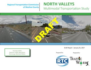
  • 1. Increase Safety Improve Traffic Operations Encourage Alternate Modes Regional Transportation Commission of Washoe County NORTH VALLEYS Multimodal Transportation Study Prepared for: Prepared by: Draft Report - January 25, 2017 D R A FT
  • 2. Executive Summary Page i North Valleys Multimodal Transportation Study EXECUTIVE SUMMARY As the Reno-Sparks region recovers from the Great Recession, employment and residential growth has expanded in the North Valleys. Traffic volumes have been increasing with resurgence in development and pressure on some major arterials and interchanges was now evident. Tremendous new residential and industrial development energy now, and for the next decade, will be centered in the North Valleys where the developable land is located. This North Valleys Multimodal Transportation Study focuses on regional roadways and the most critical intersections on these arterials. Separate from, but concurrently with this study, the Nevada Department of Transportation (NDOT) is preparing the Reno-Sparks Freeway Traffic Study which addresses US 395 through the North Valleys and south to I-80, the Spaghetti Bowl, and the freeway related congestion and safety issues. Both studies have been prepared collaboratively with regular communication between the Regional Transportation Commission, NDOT, local agencies, and the consulting teams, to prepare a cohesive overall transportation improvement plan. The resulting recommendations for regional road and intersection improvements are listed in the Table A and will be included in the 2040 Regional Transportation Plan for implementation. Two themes are central to this study. First, the Lemmon Drive interchange is the “bullseye” for most traffic in the North Valleys area. Nearly every trip west or north of this location must travel through the interchange. A more detailed interchange alternatives analysis should be conducted in partnership with NDOT. Second, widening of US 395 cannot be the single solution to managing all travel from the North Valleys to the greater Reno/Sparks urban area. Another major connection is needed in the long-term plan and a solution is presented within this study. The North Valleys Connector concept presented within this report will relieve both Pyramid Highway and US 395, the two most congested roadways in the region to further support the traffic reduction benefit of the Pyramid – US 395 Connector project.
  • 3. Executive Summary Page ii North Valleys Multimodal Transportation Study Table A. Recommendations for Regional Road & Intersection Improvements Location Limits Type Description Planning Level Cost Stead Blvd/Silver Lake Rd Intersection Safety and Capacity Improvements 300,000.00$ Stead Blvd Pedestrian Signal Upgrade Pedestrian Crossing Pedestrian and Safety Improvements 50,000.00$ Silver Lake Road Crossing Pedestrian Crossing Pedestrian and Safety Improvements 125,000.00$ Ural Street Crossing Pedestrian Crossing Pedestrian and Safety Improvements 125,000.00$ Lemmon Dr/Surge St Pedestrian Crossing Pedestrian and Safety Improvements 175,000.00$ N Virginia St/Golden Valley Dr Intersection Safety Improvements 225,000.00$ Sky Vista Pkwy Crossing Pedestrian Crossing Pedestrian and Safety Improvements 30,000.00$ Red Rock Rd/Moya Blvd Intersection Capacity Improvements 3,500,000.00$ Lemmon Dr Interchange Interchange Capacity Improvements 1,500,000.00$ Parr Boulevard Ferrari McLeod to Raggio Pkwy Roadway Road widening - Widen to 4 lanes 7,700,000.00$ Lemmon Drive Sky Vista Pkwy to Military Rd Roadway Road Widening - Widen to 6 lanes 5,300,000.00$ Lemmon Drive Fleetwood Dr to Deodar Way Roadway Road Widening - Widen to 4 lanes 4,300,000.00$ Military Road Lemmon Dr to Echo Ave Roadway Road Widening - Widen to 4 lanes 17,700,000.00$ Buck Drive Lemmon Dr to North Hills Blvd Roadway Road Widening - Widen to 4 lanes 1,300,000.00$ Sky Vista Pkwy Vista Knoll Dr to Silver Lake Rd Roadway Road Widening - Widen to 4 lanes 6,900,000.00$ Moya Boulevard Red Rock Rd to Echo Ave Roadway Road Widening - Widen to 4 lanes 13,700,000.00$ Red Rock Road US 395 to Evans Ranch Roadway Road Widening - Widen to 4 lanes 40,700,000.00$ Lemmon Dr / Sky Vista Pkwy Intersection Major Intersection Improvements 5,000,000.00$ N. Virginia St / Lemmon Drive Intersection Capacity Improvements 2,000,000.00$ N. Virginia St / Golden Valley Intersection Capacity Improvements 2,000,000.00$ Stead Blvd / Silver Lake Road Intersection Long Term Capacity Improvements 1,000,000.00$ Red Rock Road/Silver Lake Road Intersection Intersection Improvements 1,500,000.00$ Parr Boulevard Interchange Ramp intersections Interchange Interim Capacity Improvements 5,000,000.00$ Lemmon Drive Interchange Ramp intersections Interchange Reconstruction 35,000,000.00$ North Valleys Connector Echo Avenue to Eagle Canyon Roadway Construct New Roadway 47,500,000.00$ 196,600,000.00$TOTAL Package 1 Improvements Package 2 Improvements Long Term Improvements
  • 4. Acknowledgements Page iii North Valleys Multimodal Transportation Study ACKNOWLEDGEMENTS The North Valleys Multimodal Transportation Study was funded and administered by the Regional Transportation Commission of Washoe County (RTC), for the benefit of current North Valleys region residents, and every community member who will walk, cycle, ride a bus, or drive in the North Valleys over the next 20 years and beyond. Long-range planning for numerous regionally significant major arterial roadways and intersections is no easy task. The project team is therefore sincerely grateful to every citizen, stakeholder, technical advisor, and agency representative that gave of their personal time and knowledge, to guide the study process and identify a set of well rounded multi- modal improvements that will serve our community well into the future. Thank you for helping shape the future of the North Valleys! Technical Advisory Committee: Member Agency Lee Gibson RTC Executive Director Amy Cummings RTC Director of Planning Jeff Hale RTC Director of Engineering Xuan Wang RTC Project Manager Debra Goodwin RTC Michelle Dennis RTC Clara Lawson Washoe County Kelly Mullin Washoe County Hoang Hong NDOT Janelle Thomas NDOT Jeff Lerud NDOT Mark Wooster NDOT Randy Travis NDOT Nick Johnson NDOT Steve Bunnell City of Reno William Gall City of Reno Consulting Team: Loren Chilson Traffic Works Uday Maripalli Traffic Works Rich Pettinari Traffic Works Chad Anson CA Group
  • 5. Table of Contents Page iv North Valleys Multimodal Transportation Study CONTENTS 1 Introduction...................................................................................................................................................................................... 1-1 1.1 Purpose and Goals............................................................................................................................................................................ 1-1 1.2 Vision Statement .............................................................................................................................................................................. 1-1 1.3 Study Area ........................................................................................................................................................................................ 1-1 2 Existing Conditions............................................................................................................................................................................ 2-1 2.1 Functional Classification and Roadway Characteristics.................................................................................................................... 2-1 2.2 Existing Non-Motorized Facilities..................................................................................................................................................... 2-2 2.3 Public Transit .................................................................................................................................................................................... 2-2 2.4 Collision History................................................................................................................................................................................ 2-6 2.5 Existing Traffic Operations................................................................................................................................................................ 2-9 3 Public Outreach ................................................................................................................................................................................ 3-1 3.1 TAC and Stakeholder Meetings ........................................................................................................................................................ 3-1 3.2 Public Meetings ................................................................................................................................................................................ 3-3 4 2035 Future Traffic Conditions......................................................................................................................................................... 4-1 4.1 Functional Classifications and Roadway Characteristics .................................................................................................................. 4-1 4.2 2035 Daily Traffic Volumes............................................................................................................................................................... 4-1 4.3 2035 Peak Hour Intersection Volumes............................................................................................................................................. 4-4 4.4 Year 2035 Traffic Operations............................................................................................................................................................ 4-6 5 Proposed Multimodal Improvements .............................................................................................................................................. 5-1 5.1 Short Term Multimodal Improvements............................................................................................................................................ 5-1 5.2 Long Term Improvements ................................................................................................................................................................ 5-6 6 Cost Estimates..........................................................................................................................................................................6-1
  • 6. Table of Contents Page v North Valleys Multimodal Transportation Study LIST OF TABLES TABLE 2-1. CRASH SUMMARY FROM AUGUST 2010 TO AUGUST 2015 ...................................................................................................................................2-6 TABLE 2-2. SUMMARY OF CRASHES AT STEAD BLVD/SILVER LAKE RD FROM AUG 2010 TO AUG 2015 ..................................................................................2-7 TABLE 2-3. LOS CRITERIA FOR SIGNALIZED & UN-SIGNALIZED INTERSECTIONS.......................................................................................................................2-9 TABLE 2-4. AVERAGE DAILY TRAFFIC LOS THRESHOLDS BY FACILITY TYPE.............................................................................................................................2-11 TABLE 2-5. EXISTING ROAD SEGMENT LEVEL OF SERVICE......................................................................................................................................................2-12 TABLE 2-6. EXISTING INTERSECTION LEVEL OF SERVICE.........................................................................................................................................................2-12 TABLE 3-1. PUBLIC PREFERENCES FOR SHORT TERM IMPROVEMENTS ...................................................................................................................................3-6 TABLE 4-1. ESTIMATION OF 2035 DAILY TRAFFIC VOLUMES AND GROWTH RATES (PART 1)..................................................................................................4-3 TABLE 4-2. ESTIMATION OF 2035 DAILY TRAFFIC VOLUMES AND GROWTH RATES (PART 2)..................................................................................................4-3 TABLE 4-3. 2035 ROADWAY SEGMENT LEVEL OF SERVICE SUMMARY ....................................................................................................................................4-6 TABLE 4-4. 2035 INTERSECTION LEVEL OF SERVICE SUMMARY ...............................................................................................................................................4-7 TABLE 5-1: 2035 WITH IMPROVEMENT ROADWAY LOS SUMMARY ........................................................................................................................................5-8 TABLE 5-2: BICYCLE PEDESTRIAN PROJECTS IN NORTH VALLEYS ...........................................................................................................................................5-12 TABLE 6-1: SHORT TERM IMPROVEMENTS COST ESTIMATES ..................................................................................................................................................6-1 TABLE 6-2: LONG TERM IMPROVEMENTS COST ESTIMATES....................................................................................................................................................6-2
  • 7. Table of Contents Page vi North Valleys Multimodal Transportation Study LIST OF FIGURES FIGURE 1-1. STUDY AREA............................................................................................................................................................................................................1-3 FIGURE 2-1. EXISTING PEDESTRIAN FACILITIES...........................................................................................................................................................................2-3 FIGURE 2-2. EXISTING BICYCLE FACILITIES..................................................................................................................................................................................2-4 FIGURE 2-3. TRANSIT ROUTES SERVING THE NORTH VALLEYS...................................................................................................................................................2-5 FIGURE 2-4. SUMMARY OF CRASHES FROM AUGUST 2010 TO AUGUST 2015 ..........................................................................................................................2-7 FIGURE 2-5. CRASHES BY TYPE AT STEAD BLVD/SILVER LAKE RD...............................................................................................................................................2-8 FIGURE 2-6. EXISTING AM AND PM PEAK HOUR TURNING MOVEMENT VOLUMES................................................................................................................2-10 FIGURE 3-1. A SAMPLE SLIDE FROM THE MEETING #1 PRESENTATION.....................................................................................................................................3-2 FIGURE 3-2. A SAMPLE SLIDE FROM THE MEETING #3 PRESENTATION.....................................................................................................................................3-3 FIGURE 3-3. DISPLAY SEEKING PUBLIC INPUT ON PRIORITIES....................................................................................................................................................3-4 FIGURE 3-4. COMMUNITY PRIORITIES RESULTS.........................................................................................................................................................................3-5 FIGURE 3-5. DISPLAY SEEKING PUBLIC PREFERENCES FOR SHORT TERM IMPROVEMENTS.......................................................................................................3-5 FIGURE 3-6. PUBLIC MEETING 1 PRESENTATION........................................................................................................................................................................3-6 FIGURE 3-7. DISPLAY SHOWING NORTH VALLEYS CONNECTOR CONCEPT ................................................................................................................................3-7 FIGURE 3-8. SAMPLE COMMENTS BY THE ATTENDEES ..............................................................................................................................................................3-7 FIGURE 4-1. EXAMPLE SCREENSHOT OF TURNS W32.................................................................................................................................................................4-4 FIGURE 4-2. 2035 AM AND PM PEAK HOUR TURNING MOVEMENT COUNTS ...........................................................................................................................4-5 FIGURE 5-1. PACKAGE 1 SHORT TERM IMPROVEMENTS............................................................................................................................................................5-2 FIGURE 5-2. PACKAGE 2 SHORT TERM IMPROVEMENTS............................................................................................................................................................5-4 FIGURE 5-3. RED ROCK/MOYA IMPROVEMENTS........................................................................................................................................................................5-5 FIGURE 5-4. SHORT TERM IMPROVEMENTS AT LEMMON DR. INTERCHANGE ..........................................................................................................................5-5
  • 8. Table of Contents Page vii North Valleys Multimodal Transportation Study FIGURE 5-5. LONG TERM IMPROVEMENTS ................................................................................................................................................................................5-7 FIGURE 5-6. PROPOSED BIKE-PEDESTRIAN IMPROVEMENTS...................................................................................................................................................5-10 FIGURE 5-7. COMPLETE STREETS IMPROVEMENTS IN NORTH VALLEYS ..................................................................................................................................5-11 FIGURE 5-8. COMPLETE STREETS IMPROVEMENTS WITHIN PROJECT STUDY AREA ................................................................................................................5-11 FIGURE 5-9. BIKE-PED PROJECTS FROM RENO-SPARKS BICYCLE & PEDESTRIAN PLAN............................................................................................................5-12 FIGURE 5-10. PROPOSED TRANSIT STOP LAYOUT ....................................................................................................................................................................5-13 FIGURE 5-11. LEMMON DRIVE INTERCHANGE TRAFFIC CONCERNS ........................................................................................................................................5-14 FIGURE 5-12. NORTH VALLEYS CONNECTOR CONCEPT............................................................................................................................................................5-16
  • 9. INTRODUCTION PAGE 1-1 North Valleys Multimodal Transportation Study 1 INTRODUCTION 1.1 Purpose and Goals The purpose of this multimodal study is to identify needs and long- term transportation improvements for regional roads and intersections in the North Valleys area. This study focuses on traffic operations analysis and capacity improvements, safety improvements, pedestrian and bicycle connectivity, and transit service needs. The main objective of this study is to plan and program short-term and long-term multimodal transportation improvements within the study area. The study identifies a strategy for developing transportation improvements that are coordinated with adjacent planned and existing land uses. This work has been conducted in coordination with the Nevada Department of Transportation (NDOT) Reno-Sparks Freeway Traffic Study. 1.2 Vision Statement The following vision statement was developed through a comprehensive community involvement program. “Develop a program of short and long-term improvements that increase safety, improve traffic operations and freight movement, encourage travel by alternate modes, and support future residential, commercial, and industrial development.” The analysis, recommendations, and action plans in this study are all aimed at achieving this community guided vision. 1.3 Study Area The study area consists of numerous regional roadways, key intersections, and ramp junctions in the North Valleys Region, as defined in Figure 1-1. The intersections and roadways highlighted in red are part of the NDOT Reno-Sparks Freeway Traffic Study. The intersections and roadways highlighted in blue are included in this report. This study includes analysis of the most significant arterials in the North Valleys region. The study roadways include: • Parr Boulevard • Golden Valley Road • Lemmon Drive • Military Road • Sky Vista Parkway • Stead Boulevard • Silver Lake Road • Moya Boulevard • Red Rock Road • North Virginia Street The study includes the following intersections: • Parr Boulevard/US 395 NB Ramps • Parr Boulevard/US 395 SB Ramps • Golden Valley Road/N. Virginia Street
  • 10. INTRODUCTION PAGE 1-2 North Valleys Multimodal Transportation Study • Lemmon Drive/N. Virginia Street • Lemmon Drive/US 395 NB Ramps • Lemmon Drive/US 395 SB Ramps • Lemmon Drive/Sky Vista Parkway • Lemmon Drive/Military Road • Stead Boulevard/Silver Lake Road • Red Rock Road/Silver Lake Road • Red Rock Road/Moya Boulevard The locations of all these study intersections and roadway corridors are shown in Figure 1-1.
  • 11. INTRODUCTION PAGE 1-3 North Valleys Multimodal Transportation Study Figure 1-1. Study Area
  • 12. EXISTING CONDITIONS PAGE 2-1 North Valleys Multimodal Transportation Study 2 EXISTING CONDITIONS This portion of the report discusses existing conditions for all travel in the North Valleys region. 2.1 Functional Classification and Roadway Characteristics Roadway functional classification is the foundation for planning roadway improvements and setting appropriate standards (e.g., right- of-way requirements, roadway width, design speed, multimodal facilities, etc.,) that apply to each roadway facility. A brief description of the major roadways within the study area is provided below. These descriptions are for the portions of the roadways within the study area only. • Parr Boulevard – is a 2-lane (north of US 395) to 3-lane (south of US 395) roadway that is classified as a “Low Access Control Arterial” according to the RTC’s 2035 Regional Transportation Plan (RTP). The posted speed limit is 35 mph. • Golden Valley Road – to the north of N. Virginia Street is a 2- lane (south of US 395) to 4-lane (north of US 395) roadway that is classified as a “Medium Access Control Arterial” according to the RTC’s 2035 Regional Transportation Plan (RTP). The posted speed limit is 35 mph. • Lemmon Drive – is classified as a “Medium Access Control Arterial” according to the 2035 RTP. The number of lanes on Lemmon Drive varies throughout the study area. It is a 2-lane roadway south of US 395, a 6-lane roadway between US 395 and Sky Vista Parkway, a 4-lane roadway between Sky Vista Parkway and Fleetwood Drive, and a 2-lane roadway north of Fleetwood Drive. The posted speed limit varies between 35 mph and 45 mph. • Military Road – is classified as a “Medium Access Control Arterial” according to the 2035 RTP. It is a 2-lane roadway with a posted speed limit of 35 mph. • Sky Vista Parkway – is classified as a “Medium Access Control Arterial” between Silver Lake Road and Lemmon Drive and as a “Low Access Control Collector” north of Silver Lake Road. It is a 2-lane roadway west of Vista Knoll Parkway and a 5-lane road between Lemmon Drive and Vista Knoll Parkway. The posted speed limit is 35 mph. • Stead Boulevard – is classified as a “Medium Access Control Arterial” according to the 2035 RTP. It is a 4-lane roadway north of Silver Lake Road, a 5-lane roadway between Silver Lake Road and US 395, and a 2-lane road south of US 395. The posted speed limit is 35 mph. • Silver Lake Road – is classified as a “Low Access Control Collector” according to the 2035 RTP. It is a 2-lane road with a posted speed limit of 35 mph. • Moya Boulevard – is classified as a “Low Access Control Arterial” according to the 2035 RTP. It is a 2-lane roadway with a posted speed limit of 35 mph. • Red Rock Road – is classified as a “Medium Access Control Arterial” according to the 2035 RTP. It is a 4-lane road between
  • 13. EXISTING CONDITIONS PAGE 2-2 North Valleys Multimodal Transportation Study US 395 and Moya Boulevard and a 2-lane road elsewhere. The posted speed limit is 35 mph. • N. Virginia Street – is classified as a “Medium Control Arterial” according to the 2035 RTP, within the study area. It is a 2-lane roadway with a posted speed limit of 35 mph. 2.2 Existing Non-Motorized Facilities Non-motorized travel, such as walking and cycling, are important elements of the transportation system and the provision, extent, and quality of non-motorized facilities affect mode choice. Figure 2-1 and Figure 2-2 summarize the existing pedestrian facilities and bicycle facilities, respectively, within the study area. As shown in Figure 2-1, there are currently many gaps in the sidewalk infrastructure. There are also many gaps in the bicycle facilities and long-term improvements are needed to enhance travel for both modes. 2.3 Public Transit This section documents the existing public transportation infrastructure that serves the North Valleys region. The RTC fixed-route services consist of RTC RIDE (23 routes), RTC RAPID (bus rapid transit service), RTC INTERCITY, and the SIERRA SPIRIT (downtown Reno circulator). RTC also provides complimentary ADA paratransit service, RTC ACCESS, and has a growing vanpool program, RTC VANPOOL, with over 100 van pools in operation. RTC RIDE is the public transit bus system for the greater Sparks, Reno, and Washoe County areas. The fixed-route system operates in a 90 square-mile service area, based on a 0.75 mile distance from each fixed route (excluding RTC INTERCITY).The fixed-route system includes a fleet of 72 buses with more than 1,000 bus stops. In addition to fixed-route service, the RTC also provides ACCESS service within the North Valleys Region. RTC ACCESS is the para-transit service that provides door-to-door, prescheduled, trips for individuals with access and functional needs who meet eligibility criteria. Trips are reserved from one to three days in advance and the service operates 24 hours a day, seven days a week. Fixed Routes in North Valleys Routes 7, 15 and 17 are the fixed routes serving the North Valleys region. Route 7 travels along Golden Valley Road, Sky Vista Parkway, Stead Boulevard to provide connectivity between Downtown Reno and Reno Stead Airport. Route 15 travels along Dandini Boulevard providing connectivity between Downtown Reno and Truckee Meadows Community College. Route 17 provides connectivity between Downtown Reno and Lemmon Valley via N. Virginia Street and Lemmon Drive. Figure 2-3, shows the three RTC fixed-routes providing service in the study area. RTC RIDE is the only fixed-route bus service operating within the study area.
  • 14. EXISTING CONDITIONS PAGE 2-3 North Valleys Multimodal Transportation Study Figure 2-1. Existing Pedestrian Facilities
  • 15. EXISTING CONDITIONS PAGE 2-4 North Valleys Multimodal Transportation Study Figure 2-2. Existing Bicycle Facilities
  • 16. EXISTING CONDITIONS PAGE 2-5 North Valleys Multimodal Transportation Study Figure 2-3. Transit Routes Serving The North Valleys
  • 17. EXISTING CONDITIONS PAGE 2-6 North Valleys Multimodal Transportation Study 2.4 Collision History Crash data obtained from the Nevada Department of Transportation (NDOT) for the previous five year period (August 2010 to August 2015) was used to help identify high-crash locations and attempt to identify trends. Crash data was obtained for each study intersection. Identifying crash types can assist in the choice of safety countermeasures and in evaluations of countermeasure effectiveness. Table 2-1 shows the summary of crashes at each intersection during the past five years. Based on the data obtained, a total of 173 crashes were reported between August 2010 and August 2015. The majority of the crashes were Property Damage Only (PDO) crashes, accounting for 57% of the total crashes. 42% of the crashes resulted in injuries and 1% resulted in a fatality. About 8% of the crashes (14 out of 173) involved cyclists or pedestrians. The location with highest bicycle and pedestrian crashes is the Stead Boulevard/Silver Lake Road intersection. The Stead Boulevard/Silver Lake Road intersection was evaluated further and is discussed in the following section. Figure 2-4 shows the relative distribution of crashes at the various intersections. Table 2-1. Crash Summary from August 2010 to August 2015 Vehicle Bicycle Pedestrian Fatality Injury Property Damage Parr Blvd/US 395 Ramps 9 3 6 9 N Virginia St/Golden Valley Rd 17 1 9 9 18 N Virginia St/Lemmon Dr 5 1 4 5 Lemmon Dr/395 Ramps 15 1 5 11 16 Lemmon Dr/Sky Vista Pkwy 26 2 11 17 28 Lemmon Dr/Military Rd 18 8 10 18 Stead Blvd/Silver Lake Rd 46 3 7 2 29 25 56 Red Rock Rd/Silver Lake Rd 11 3 8 11 Red Rock Rd/Moya Blvd 12 3 9 12 TOTAL 159 5 9 2 72 99 173 Mode Involved Severity Intersection Total
  • 18. EXISTING CONDITIONS PAGE 2-7 North Valleys Multimodal Transportation Study Stead Boulevard/Silver Lake Road Any intersection with over 30 crashes in a 3 year period is considered by NDOT to be a “High Crash Location”. The Stead Boulevard/Silver Lake Road intersection is the only intersection that experienced over 30 crashes in a 3 year time period, making it a high crash location. 56 crashes were reported at the Stead Boulevard/Silver Lake Road intersection between August 2010 and August 2015. Table 2-2 summarizes all the reported crashes at this location. Based on the data obtained, of the 56 crashes at this location, 4 were reported in 2010, 11 were reported in 2011, 10 were reported in 2012, 10 were reported in 2013, 13 were reported in 2014, and 8 crashes were reported in 2015. The historic trend shows that the number of crashes has generally remained constant every year over the past five year period. Table 2-2. Summary of Crashes at Stead Blvd/Silver Lake Rd from Aug 2010 to Aug 2015 Crash Type Number PDO Injury Fatality Ped/Bike Angle 24 9 13 2 3 Head-on 2 0 2 0 0 Non-Collision 12 3 9 0 7 Rear-End 15 10 5 0 0 Sideswipe/Overtaking 2 2 0 0 0 Unknown 1 1 0 0 0 Figure 2-4. Summary of Crashes from August 2010 to August 2015 9 18 5 16 28 18 56 11 12 0 10 20 30 40 50 60 Parr Blvd/US 395 Ramps N Virginia St/Golden Valley Rd N Virginia St/Lemmon Dr Lemmon Dr/395 Ramps Lemmon Dr/Sky Vista Pkwy Lemmon Dr/Military Rd Stead Blvd/Silver Lake Rd Red Rock Rd/Silver Lake Rd Red Rock Rd/Moya Blvd #ofCrashes Location
  • 19. EXISTING CONDITIONS PAGE 2-8 North Valleys Multimodal Transportation Study A majority of the crashes were angle collisions accounting for 43% of all the crashes, followed by rear-end crashes (27%), non-collision (single vehicle incident) crashes (21%), sideswipe/overtaking crashes (4%), head-on crashes (3%) and the rest 2% were reported as “unknown”. Of all the reported crashes, the majority of them were property damage only crashes that contributed to 55% of the total. Of the 56 crashes at this location, 7 crashes involved a pedestrian and 3 involved a bicycle. All three bicycle related crashes occurred on the east leg of the intersection. According to the reports, of the seven pedestrian related crashes, five of them resulted due to “Failure to yield right-of-way”, one due to “improper crossing”, and one due to “unknown” reasons. Figure 2-5 shows the number of crashes by type of crash. The majority of the angle collisions are related to drivers failing to yield right of way and ignoring traffic signs, signals or markings. Rear-end collisions are common at signalized intersections and the majority of these are reported as following too closely. To address the higher than normal incidence of collisions, safety improvements are proposed for the Stead Boulevard/Silver Lake Road intersection and are described in Chapter 5. Figure 2-5. Crashes by Type at Stead Blvd/Silver Lake Rd Angle 43% Head-on 3% Non-Collision 21% Rear-End 27% Sideswipe/ Overtaking 4% Unknown 2%
  • 20. EXISTING CONDITIONS PAGE 2-9 North Valleys Multimodal Transportation Study 2.5 Existing Traffic Operations Existing Traffic Volumes Existing daily traffic volume data for all the study roadways within the North Valleys study region were obtained from the Nevada Department of Transportation (NDOT) Annual Traffic Report. Turning movement counts were collected at all the study intersections on a typical weekday, from 7:00 AM to 9:00 AM and from 4:00 PM to 6:00 PM. This data was used to identify the heaviest morning and evening traffic conditions. At each of the study intersections, the one-hour period with the heaviest traffic volumes (referred to as the peak hour) was determined from the morning and evening data. The existing AM and PM peak hour traffic volumes are shown in Figure 2-6. Level of Service Methodology Level of Service (LOS) is an estimate of the quality and performance of the transportation system operations. The industry standard for evaluating traffic conditions is the Transportation Research Board’s (TRB) methodology outlined in the Highway Capacity Manual (HCM), Special Report 209 (TRB 2010). Using this methodology, traffic conditions are assessed with respect to the average intersection delay (seconds/vehicle). The letter “A” is used to describe the least amount of congestion and best operations, and the letter “F” indicates the highest amount of congestion and worst operations. The HCM LOS criteria for signalized and un-signalized intersections are shown in Table 2-3. Table 2-3. LOS Criteria for Signalized & Un-signalized Intersections LOS Rating Brief Description Average Delay for Signalized Intersections (seconds/vehicle) Average Delay for TWSC Intersections (seconds/vehicle) A Free flow conditions. 0-10 0-10 B Stable conditions with some affect from other vehicles. >10-20 >10-15 C Stable conditions with significant affect from other vehicles. >20-35 >15-25 D High density traffic conditions still with stable flow. >35-55 >25-35 E At or near capacity flows. >55-80 >35-50 F Over capacity conditions. > 80 > 50 Source: HCM 2010; TWSC: two-way stop control; LOS ratings for TWSC and three-legged stop-control intersections are based on the worst movement average delay; LOS is not defined for the overall intersection
  • 21. EXISTING CONDITIONS PAGE 2-10 North Valleys Multimodal Transportation Study Figure 2-6. Existing AM and PM Peak Hour Turning Movement Volumes
  • 22. EXISTING CONDITIONS PAGE 2-11 North Valleys Multimodal Transportation Study Roadway segments were analyzed using the Average Daily Traffic Thresholds outlined in RTC’s 2035 Regional Transportation Plan. Using this methodology, level of service is determined by comparing average daily traffic volumes to the LOS threshold values shown in Table 2-4. The 2035 Regional Transportation Plan (2035 RTP) establishes level of service criteria for regional roadway facilities in Washoe County, the City of Reno, and City of Sparks. The current Level of Service policy is: • All regional roadway facilities projected to carry less than 27,000 ADT at the latest RTP horizon – LOS D or better. • All regional roadway facilities projected to carry 27,000 or more ADT at the latest RTP horizon – LOS E or better. • All intersections shall be designed to provide a level of service consistent with maintaining the policy level of service of the intersecting roadways. Table 2-4. Average Daily Traffic LOS Thresholds by Facility Type Facility Type Maximum Service Flow Rate (daily for given service level) # of Lanes LOS A LOS B LOS C LOS D LOS E Freeway 4 ≤ 28,600 42,700 63,500 80,000 90,200 6 ≤ 38,300 61,200 91,100 114,000 135,300 8 51,100 81,500 121,400 153,200 180,400 10 63,800 101,900 151,800 191,500 225,500 Arterial-High Access Control 2 n/a 9,400 17,300 19,200 20,300 4 n/a 20,400 36,100 38,400 40,600 6 n/a 31,600 54,700 57,600 60,900 8 n/a 42,500 73,200 76,800 81,300 Arterial-Moderate Access Control 2 n/a 5,500 14,800 17,500 18,600 4 n/a 12,000 32,200 35,200 36,900 6 n/a 18,800 49,600 52,900 55,400 8 n/a 25,600 66,800 70,600 73,900 Arterial/Collector-Low Access Control 2 n/a n/a 6,900 13,400 15,100 4 n/a n/a 15,700 28,400 30,200 6 n/a n/a 24,800 43,100 45,400 8 n/a n/a 34,000 57,600 60,600 Arterial/Collector-Ultra-Low Access Control 2 n/a n/a 6,500 13,300 14,200 4 n/a n/a 15,300 27,300 28,600 6 n/a n/a 24,100 41,200 43,000 8 n/a n/a 33,300 55,200 57,400 Source: Washoe County RTP Table 3-4.
  • 23. EXISTING CONDITIONS PAGE 2-12 North Valleys Multimodal Transportation Study Level of Service Analysis The existing average daily traffic volumes were compared to the daily volume thresholds (Table 2-4) to determine existing roadway segment level of service. The results are shown in Table 2-5. Each of the studied roadway segments is currently operating at an acceptable level of service based on NDOT’s reported 2014 AADTs. Table 2-5. Existing Road Segment Level of Service N/O = North of, S/O South of, etc. The study intersections were analyzed using the HCM modules for signalized intersections in Trafficware’s software program, Synchro 9.0. Level of service calculations were performed using the existing lanes, intersection configurations, and traffic volumes collected. The intersection Level of Service and delay results are presented in Table 2-6. Table 2-6. Existing Intersection Level of Service Intersection Control 2015 Existing AM Peak PM Peak Parr Blvd and US 395 SB Ramps LOS TWSC E F Delay 39.5 65.9 Parr Blvd and US 395 NB Ramps LOS TWSC F F Delay 59.2 149.3 N. Virginia St and Golden Valley Rd LOS Signal A A Delay 7.1 8.4 N. Virginia St and Lemmon Dr LOS AWSC C A Delay 17.8 9.0 Lemmon Dr and US 395 SB Ramps LOS TWSC F F Delay >200 >200 Lemmon Dr and US 395 NB Ramps LOS TWSC D C Delay 29.3 15.0 Lemmon Dr and Sky Vista Pkwy LOS Signal C D Delay 22.6 38.1 Lemmon Dr and Military Rd LOS Signal B B Delay 10.7 10.1 Stead Blvd and Silver Lake Rd LOS Signal B C Delay 15.9 20.3 Red Rock Rd and Silver Lake Rd LOS TWSC D D Delay 33.8 28.2 Red Rock Rd and Moya Blvd LOS TWSC B B Delay 11.0 12.4 AADT LOS Parr Boulevard N/O 395 Arterial 2 LAC 7,500 D Parr Boulevard S/O 395 Arterial 2 LAC 10,500 D Golden Valley Road N/O 395 Arterial 4 MAC 13,500 C Golden Valley Road S/O 395 Arterial 2 MAC 6,800 C Lemmon Drive N/O Military Road Arterial 4 MAC 9,800 B Lemmon Drive S/O Sky Vista Pkwy Arterial 4 MAC 25,000 C Military Road W/O Lemmon Drive Arterial 2 MAC 8,300 C Sky Vista Parkway W/O Lemmon Drive Arterial 4 MAC 14,500 C Stead Boulevard N/O Silver Lake Road Arterial 4 MAC 8,500 B Stead Boulevard S/O Silver Lake Road Arterial 4 MAC 18,000 C Silver Lake Road E/O Stead Boulevard Collector 2 LAC 6,800 C Silver Lake Road W/O Stead Boulevard Collector 2 LAC 6,500 C Red Rock Road N/O Moya Arterial 4 MAC 3,900 B Moya Boulevard E/O Red Rock Road Arterial 3 LAC 4,000 C Silver Lake Road E/O Red Rock Road Collector 2 LAC 3,300 C N Virginia Street E/O Stead Boulevard Arterial 2/3 MAC 1,900 B N Virginia Street E/O Lemmon Drive Arterial 2/3 MAC 4,100 B N Virginia Street W/O Golden Valley Rd Arterial 2 MAC 4,700 B Roadway Segment Class Lanes Access Control 2014 AADT Location
  • 24. EXISTING CONDITIONS PAGE 2-13 North Valleys Multimodal Transportation Study As shown in Table 2-6, 3 of the 11 study intersections currently operate at unacceptable level of service conditions. The following intersections currently operate worse than the policy LOS: • Parr Boulevard and US 395 SB Ramps • Parr Boulevard and US 395 NB Ramps • Lemmon Drive and US 395 SB Ramps Warrant Analysis at Golden Valley Rd/Beckwourth Drive A signal warrant study was performed in order to determine whether or not a traffic signal is currently justified at the Golden Valley Road/Beckwourth Drive intersection. The warrant analysis was performed based on nationally accepted standards outlined in the current edition of the Manual on Uniform Traffic Control Devices (MUTCD) published by the Federal Highway Administration (FHWA). Warrants 1, 2, 3, 4, 5, 7, and 8 were analyzed. Warrant 6, Coordinated Signal System and Warrant 9, Intersection Near a Grade Crossing were deemed not applicable to the subject intersection. The conclusion of this study was that a traffic signal is not justified or appropriate at the Golden Valley Road/Beckwourth Drive intersection at this time as none of the signal warrants are met. The full report is attached in Appendix A.
  • 25. PUBLIC OUTREACH PAGE 3-1 North Valleys Multimodal Transportation Study 3 PUBLIC OUTREACH A critical part of any successful regional planning study is interweaving community and stakeholder input throughout the duration of the study. The project team sought to engage interested citizens and key stakeholders whenever possible and incorporate their feedback within the study process. The project team reached out to key stakeholders including adjacent neighborhood associations, neighborhood advisory boards, citizen advisory boards, and numerous public agencies, in an effort to identify current and future needs as well as gauge favorability of potential alternatives. The project team has also engaged key local agencies throughout the study process by meeting multiple times with the Technical Advisory Committee (TAC) established for this project. Two TAC meetings, one stakeholder meeting, and two community- wide public meetings were held during the study process. Committee members attended TAC meetings to review documents and material presented to them and provided their input. The committee included staff from the Washoe County Regional Transportation Commission (RTC), the Nevada Department of Transportation (NDOT), the City of Reno, Washoe County, and the Federal Highway Administration. The RTC is the lead agency for this study. Other agencies and organizations provided significant input throughout the study. In addition to conducting TAC meetings, the consulting team met multiple times with RTC staff to discuss specific issues and find consensus based solutions to various challenges. The study process included a significant public outreach effort to identify key issues and concerns from the public’s perspective, and have the public shape potential improvements. Public involvement was sought primarily via participation at two public meetings that were conducted on February 04, 2016 and June 30, 2016 at O’Brien Middle School, which is located on Stead Boulevard in the heart of the North Valleys study area. 3.1 TAC and Stakeholder Meetings TAC Kick-Off Meeting At the beginning of the project, the consultant team organized a Kickoff Meeting, which was attended by staff members from the Regional Transportation Commission (RTC), City of Reno, Nevada Department of Transportation (NDOT) and Washoe County, to discuss the overall project priorities, schedule, timeline, public involvement process, client needs, preliminary interests, and study goals. The study purpose and goals identified during the kick-off meeting were: • Identify near & longer term transportation Improvements • Address opportunities for transit, walking, & cycling • Identify and position a near-term project for construction in the 2016 season • Focus on regional roads and local issues This meeting finalized the intersections and roadway segments that are included in this study. This meeting also identified the stakeholders
  • 26. PUBLIC OUTREACH PAGE 3-2 North Valleys Multimodal Transportation Study for the project, which included the Golden Valley Home Owners Association, RTC Citizens Multimodal Advisory Committee, Ward 4 Neighborhood Advisory Board, N. Valleys Neighborhood Advisory Board, and the N. Valleys Citizens Advisory Board. TAC & Stakeholder Meeting 1 The first TAC/stakeholder meeting was held on December 8, 2015. The meeting began with a presentation by the project consulting team, followed by a question-and-answer session. This meeting served as an introduction between the consulting team staff, lead agency staff, the TAC members, and the stakeholders. The main purpose of this meeting was to introduce the project to the committee members and inform them of the start of the study. While introducing the project, the attendees were presented with the project overview, study area, scope of work of the project, the overall vision for the project, study approach, primary goals, public engagement and outreach process, and the project timeline. TAC Meeting 2 This meeting was held on January 27, 2016. Similar to the December 8 session, this meeting began with a presentation by the project consulting team, followed by question-and-answer session. The primary purposes of this meeting were to update the TAC on the progress of the project, present the existing conditions technical analysis, present potential short-term improvements, and have the TAC comment on those potential short-term improvements. Detailed technical information presented during this meeting included: • Preliminary Vision Statement for the study • Existing conditions roadway and intersection Level of Service analysis • Analysis of the crash history summaries and trends along the corridor • Development projects to be included in the travel demand model for future traffic forecasting • Potential short-term improvements Post presentation, the TAC was asked to comment on the potential short-term improvements and offer new ones. The TAC was also Figure 3-1. A Sample Slide from the Meeting #1 Presentation
  • 27. PUBLIC OUTREACH PAGE 3-3 North Valleys Multimodal Transportation Study informed about the first public meeting where the material from TAC Meeting 2 would be presented to the community for comments. TAC & Stakeholder Meeting 3 A third TAC and joint Stakeholder meeting was conducted on June 21, 2016, after the first public meeting. The first part of the presentation included a recap of the materials presented in the first two meetings and the summary of outcomes and comments from the first public meeting. The second half of the presentation informed the TAC about the: • Package 1 Short term improvement concepts (planned for construction in 2016) • Contemplated Package 2 Short term improvements (to be constructed in 2017) • Methodology used to develop future horizon year 2035 traffic volumes using the outputs obtained from the RTC regional travel demand model • Horizon year 2035 traffic volumes and operations • Year 2035 deficiencies (both motorized and non-motorized) • Potential long-term improvements The primary goal of this meeting was to solicit feedback from the TAC and stakeholders on the various short term and long term improvements and to potentially eliminate the ones that do not meet the goals and priorities of the project. The presentation was followed by a question and answer session and discussion to select appropriate short term and long term improvements. 3.2 Public Meetings This section provides a summary of the activities undertaken to directly engage local residents and the general public. Community supported plans cannot be established without a free exchange of information and public input at all stages of the planning process. In order for the public input process to be effective, the project team organized proactive public meetings and provided complete information for public review and comment. Timely public notices were sent to ensure the public’s awareness of these meetings. Citizens were encouraged to Figure 3-2. A Sample Slide from the Meeting #3 Presentation
  • 28. PUBLIC OUTREACH PAGE 3-4 North Valleys Multimodal Transportation Study provide input toward decisions: an approach that began early and continued throughout the process, and ultimately created the improvement packages. The project team engaged the community through two open house format public meetings. These meetings enabled the public to interact with the project team, voice questions or concerns about the current or future state of roadways in the North Valleys region, and submit comments. Questions and concerns were gathered through public comment cards. Interactive tools such as stickers and sticky notes were used to gain input and guide decisions. Attendees were also asked to write comments on display maps that showed the entire North Valleys region. Public Meeting 1 The first public meeting was held on February 4, 2016 at O’Brien Middle School. The meeting was attended by approximately 70 community members. The purpose of this public meeting was to introduce the study purpose, solicit feedback from the public on their concerns regarding the issues in North Valleys, and to gather feedback on various proposed short term improvements. The project team presented the details of the study including study limits, study roadways and intersections, project goals and objectives, existing traffic volumes and traffic operations, existing non-motorized infrastructure deficiencies, and existing challenges. In addition to presenting information, this meeting was designed to encourage attendees to provide feedback on various issues and questions posed to them on the display boards. For example, at a station dedicated to the project goals and priorities, attendees were asked to define their two most important priorities for this corridor. Figure 3-3 shows the question that was posed to the attendees and Figure 3-4 shows their collective preferences. Figure 3-3. Display Seeking Public Input on Priorities
  • 29. PUBLIC OUTREACH PAGE 3-5 North Valleys Multimodal Transportation Study At another station, participants were presented with various potential short-term solutions that were proposed based on existing conditions traffic operations analysis and existing deficiencies. The attendees were asked to pick the three highest propriety short-term improvements. The feedback on these options was collected and the outcome is shown in Figure 3-5. Table 3-1 shows the outcome of the preference voting by the participants. The majority of participants picked the Lemmon Drive/US 395 Interchange improvements, followed by intersection improvements at the Red Rock Road/Silver Lake intersection, closing the sidewalk gaps on Lemmon Drive, and the Parr Boulevard/US 395 Interchange improvements. Table 3-1 shows the number of votes each improvement received. It should be noted that the community added the Red Rock Road/Moya Boulevard intersection and then gave it a significant number of votes. This location was carried forward to the Package 2 improvements and is a great example of how community input was incorporated through the outreach program. Figure 3-4. Community Priorities Results Figure 3-5. Display Seeking Public Preferences for Short Term Improvements
  • 30. PUBLIC OUTREACH PAGE 3-6 North Valleys Multimodal Transportation Study Table 3-1. Public Preferences for Short Term Improvements Short-Term Improvement # Votes Percentage Lemmon/395 SB Ramps Intersection 31 23% Ped facilities-Lemmon Dr 14 10% Red Rock/Silver Lake Intersection 14 10% Parr Blvd Interchange Intersection 13 10% Red Rock/Moya Intersection 11 8% Silver Lake Ped Signal 10 7% Sky Vista Pkwy Ped Signal 10 7% Stead/Silver Lake Intersection 9 7% Virginia/Lemmon Intersection 8 6% Street Lighting 7 5% Stead Blvd Ped Signal 6 4% Lemmon/395 SB Ramps (Signing & Striping) 2 1% Public Meeting 2 The second public meeting was held on June 30, 2016 at O’Brien Middle School. Approximately 47 community members attended. Similar to the first public meeting, the second was also an open house format with a presentation and various interactive displays. The purpose of this meeting was to present the community with the list of short-term and long-term improvements. The attendees were shown the list of proposed short-term improvements to be designed and constructed in 2016/17. These short term improvements were selected based on the community input received in Public Meeting 1. The attendees were also presented with a list of various proposed long- term (10 Year timeframe) improvements (discussed later in this report). Within the long term improvements, the public was presented with a preliminary North Valleys Connector Concept that would potentially provide a connection between the Lemmon Valley and Spanish Springs areas. The attendees were asked to comment on the concept by writing comments on sticky notes and placing them on the board or by filling out the comment card. The North Valleys Connector Concept generally received positive comments and the public expressed interest in the need for such a connector. Figure 3-7 shows the North Valleys Connector Concept that was shown to the public and Figure 3- 8 shows sample comments received. Figure 3-6. Public Meeting 1 Presentation
  • 31. PUBLIC OUTREACH PAGE 3-7 North Valleys Multimodal Transportation Study Figure 3-7. Display Showing North Valleys Connector Concept Figure 3-8. Sample Comments By The Attendees
  • 32. 2035 FUTURE TRAFFIC CONDITIONS PAGE 4-1 North Valleys Multimodal Transportation Study 4 2035 FUTURE TRAFFIC CONDITIONS This section of the report describes the future horizon year (2035) projected traffic volumes and anticipated traffic operations if no improvements were made. A 20-year horizon was chosen for future conditions analysis as this is the furthest horizon scenario in the RTC travel demand model and projecting realistic turn movements at intersections would be difficult beyond this time frame. 4.1 Functional Classifications and Roadway Characteristics Depending on the amount of growth and development within the North Valleys area, it is possible that some roadways could warrant a change in functional classification to be consistent with capacity needs and community expansion. Substantial increases in traffic volumes could result in minor designations being changed to major classifications. However, land use in the study area is expected to generally remain consistent with current land uses. Moreover, future residents are expected to utilize the transportation system in a similar fashion as occurs today. Since the need for substantial capacity improvements would likely be limited to arterial roadways, it is unlikely that the very many functional classifications would require changes. The nature of roadways within the study area are also expected to generally remain similar. However, numerous roadway widening projects are anticipated on major roadways in the study area. Elements of these projects generally consist of road widening, signalization, pedestrian and bike improvements, and transit enhancements. As such, these projects should generally improve the safety and comfort of the local roadway system. 4.2 2035 Daily Traffic Volumes With significant continued development and land use intensification, traffic volumes in the North Valleys region are anticipated to substantially increase in the future. The current Washoe County RTC travel demand model was used to estimate future traffic volumes for the 2035 horizon year. With tremendous growth anticipated, the travel demand model is the only source for travel forecasts that can accurately predict significant shifts in traffic flow. For this study, a scenario was analyzed in the 2035 RTC travel demand model that includes all the potential and known development projects in the North Valleys region. Traffic Works staff worked interactively with the RTC, TMRPA, City of Reno, Washoe County and NDOT staff while developing the methodology for including development projects and for estimating 2035 volumes. A consensus and approval was obtained with the project TAC regarding the projects to be included, the traffic forecasting methodology and the resulting traffic volumes. Year 2035 daily traffic volumes were developed using the following approach: Step 1: Determine the existing (2014) daily traffic volumes (AADT) from NDOT’s Traffic Records Information Access (TRINA) database.
  • 33. 2035 FUTURE TRAFFIC CONDITIONS PAGE 4-2 North Valleys Multimodal Transportation Study Step 2: Obtain RTC’s travel demand model daily traffic volume outputs for the 2015 and future year (2035) scenarios. Step 3: Apply the “Difference Adjustment Method” prescribed in NCHRP Report 255 procedures (as specified in NDOT’s Traffic Forecasting Guidelines). Step 4: Calculate the growth difference between the 2014 and 2035 daily traffic volumes. Determine the percent change, and percent per year change, over the 21-year model range, by roadway segment. Step 5: Review the growth trends and make adjustments for general consistency throughout the roadway segments. Step 6: The growth rates from Step 5 were compared to growth rates calculated from NDOT’s historic counts. Step 7: Apply the growth factors from Step 5 to 2014 AADT to obtain 2035 AADT. The final 2035 AADT’s and growth rates/factors are shown in Table 4- 1 and Table 4-2. The 2035 design volumes are shown in the column titled “2035 Adjusted AADT”.
  • 34. 2035 FUTURE TRAFFIC CONDITIONS PAGE 4-3 North Valleys Multimodal Transportation Study Table 4-1. Estimation of 2035 Daily Traffic Volumes and Growth Rates (Part 1) Table 4-2. Estimation of 2035 Daily Traffic Volumes and Growth Rates (Part 2) Parr Blvd Parr Blvd Golden Valley Rd Golden Valley Rd Golden Valley Rd Lemmon Dr Lemmon Dr Lemmon Dr Lemmon Dr Lemmon Dr Military Rd Sky Vista Pkwy N/O 395 S/O 395 N/O 395 S/O 395 S/O Virginia N/O Military S/O Military S/O Sky Vista b/w Ramps S/O 395 W/O Lemmon W/O Lemmon 2014 NDOT AADT 7,500 10,500 13,500 6,800 2,600 9,800 17,500 25,000 15,565 4,339 8,300 14,500 2014 NDOT AWDT 7,867 11,014 14,161 7,133 2,727 10,280 18,357 26,224 16,327 4,551 8,706 15,210 2015 RTC AWDT 6,311 12,459 14,981 11,409 3,507 12,502 18,789 21,839 10,887 578 8,184 3,587 2035 RTC AWDT 22,544 21,907 23,740 20,452 5,901 37,480 52,497 55,791 30,371 6,936 20,134 20,401 Model Difference 2035-2015 16,233 9,448 8,759 9,043 2,394 24,978 33,708 33,952 19,484 6,358 11,950 16,814 20 Years Increase 16,233 9,448 8,759 9,043 2,394 24,978 33,708 33,952 19,484 6,358 11,950 16,814 2035 Adjusted AADT 22,975 19,507 21,850 15,421 4,882 33,612 49,634 57,367 34,139 10,400 19,692 30,529 2035 Adjusted AWDT 24,100 20,462 22,920 16,176 5,121 35,258 52,065 60,176 35,811 10,909 20,656 32,024 2035 Adjusted AADT-2014 NDOT AADT 15,475 9,007 8,350 8,621 2,282 23,812 32,134 32,367 18,574 6,061 11,392 16,029 % Change 206% 86% 62% 127% 88% 243% 184% 129% 119% 140% 137% 111% % per year 9.8% 4.1% 2.9% 6.0% 4.2% 11.6% 8.7% 6.2% 5.7% 6.7% 6.5% 5.3% 21 years growth factor 3.1 1.9 1.6 2.3 1.9 3.4 2.8 2.3 2.2 2.4 2.4 2.1 Location --> Demand Model Volumes Difference Adjustment Method Buck Dr Stead Blvd Stead Blvd Silver Lake Rd Silver Lake Rd Red Rock Rd Red Rock Rd Red Rock Rd Moya Blvd Silver Lake Rd N Virginia St N Virginia St N Virginia St E/O Lemmon N/O Silver Lake S/O Silver Lake E/O Stead W/O Stead N/O Moya S/O Moya S/O Silver Lake E/O Red Rock E/O Red Rock E/O Stead E/O Lemmon E/O Golden V 2014 NDOT AADT 8,000 8,500 18,000 6,800 6,500 3,900 10,190 13,794 4,000 3,300 1,900 4,100 4,700 2014 NDOT AWDT 8,392 8,916 18,881 7,133 6,818 4,091 10,689 14,470 4,196 3,462 1,993 4,301 4,930 2015 RTC AWDT 2,444 17,346 19,410 1,089 5,871 4,723 5,081 11,834 2,087 6,907 1,562 5,132 4,776 2035 RTC AWDT 16,588 32,424 34,286 6,189 6,518 27,062 25,794 33,083 14,389 8,253 7,887 17,012 16,619 Model Difference 2035-2015 14,144 15,078 14,876 5,100 647 22,339 20,713 21,249 12,302 1,346 6,325 11,880 11,843 20 Years Increase 14,144 15,078 14,876 5,100 647 22,339 20,713 21,249 12,302 1,346 6,325 11,880 11,843 2035 Adjusted AADT 21,484 22,874 32,182 11,662 7,117 25,196 29,936 34,051 15,728 4,583 7,930 15,425 15,990 2035 Adjusted AWDT 22,536 23,994 33,757 12,233 7,465 26,430 31,402 35,719 16,498 4,808 8,318 16,181 16,773 2035 Adjusted AADT-2014 NDOT AADT 13,484 14,374 14,182 4,862 3,700 21,296 19,746 20,257 11,728 1,283 6,030 11,325 11,290 % Change 169% 169% 79% 71% 57% 546% 194% 147% 293% 39% 317% 276% 240% % per year 8.0% 8.1% 3.8% 3.4% 2.7% 26.0% 9.2% 7.0% 14.0% 1.9% 15.1% 13.2% 11.4% 21 years growth factor 2.7 2.7 1.8 1.7 1.6 6.5 2.9 2.5 3.9 1.4 4.2 3.8 3.4 Location --> Difference Adjustment Method Demand Model Volumes
  • 35. 2035 FUTURE TRAFFIC CONDITIONS PAGE 4-4 North Valleys Multimodal Transportation Study 4.3 2035 Peak Hour Intersection Volumes 2035 peak hour turning movement volumes were estimated by combining the methodology described in Section 4.2 with NCHRP Report 255 procedures. NCHRP Report 255, Highway Traffic Data for Urbanized Area Project Planning and Design, is a document published by the Federal Highway Administration that discusses post processing of travel demand model outputs and developing turning movement volumes. NCHRP 255 has standardized procedures to translate travel demand outputs into information to support project development decisions. These procedures account for variance in the detail and precision of forecasts and uncertainty in land-use forecasts by improving consistency and analytic quality of input data and output forecasts. The growth rates (bottom lines of Table 4-1 and Table 4-2) obtained through the methodology described in Section 4.2, were further refined by applying these principles in developing peak hour turning movement counts. To develop 2035 peak hour turning movements, Turns W32, a turning movement volumes balancing tool that incorporates NCHRP 255 procedures, was used. 2035 peak hour turning movements were developed based on existing turning movement counts and the growth rates obtained through the daily volume forecasts. Turns W32 calculates future year turning movement volumes and balances future turning movement distribution based on current turning movement counts and the growth rates on all the approaches of intersection. A screenshot of the Turns W32 input page is shown in Figure 4-1. The 2035 AM and PM peak hour turning movement volumes are shown in Figure 4-2. Figure 4-1. Example Screenshot of Turns W32
  • 36. 2035 FUTURE TRAFFIC CONDITIONS PAGE 4-5 North Valleys Multimodal Transportation Study Figure 4-2. 2035 AM and PM Peak Hour Turning Movement Counts
  • 37. 2035 FUTURE TRAFFIC CONDITIONS PAGE 4-6 North Valleys Multimodal Transportation Study 4.4 Year 2035 Traffic Operations Roadway Segment Level of Service The projected 2035 average daily traffic volumes were compared to the daily volume thresholds (Table 2-4) to determine the 2035 roadway segment level of service. The results are shown in Table 4-3, based on existing lane configurations. By the year 2035, many of the major roadway segments in the North Valleys region will operate at LOS “F”. Portions of Parr Boulevard, Lemmon Drive, Military Road, Buck Drive, Red Rock Road, and Moya Boulevard are all anticipated to operate at LOS “F” in the year 2035, if no improvements are made. Additional capacity (travel lanes) will be needed in these segments to provide acceptable levels of service. Table 4-3. 2035 Roadway Segment Level of Service Summary AADT LOS Parr Boulevard North of US 395 Arterial LAC 22,975 F Parr Boulevard South of US 395 Arterial LAC 19,507 F Golden Valley Road North of US 395 Arterial MAC 21,850 C Golden Valley Road South of US 395 Arterial MAC 15,421 D Golden Valley Road South of Virginia St Arterial MAC 4,882 B Lemmon Drive North of Military Rd Arterial MAC 33,612 D Lemmon Drive Between Military Rd and Sky Vista Pkwy Arterial MAC 49,634 F Lemmon Drive Between Sky Vista Pkwy and US 395 Arterial MAC 57,367 F Lemmon Drive South of US 395 Arterial MAC 10,400 C Military Road West of Lemmon Dr Arterial MAC 19,692 F Sky Vista Parkway West of Lemmon Dr Arterial MAC 30,529 C Buck Drive East of Lemmon Dr Arterial MAC 21,484 F Stead Boulevard North of Silver Lake Rd Arterial MAC 22,874 C Stead Boulevard South of Silver Lake Rd Arterial MAC 32,182 C Silver Lake Road East of Stead Blvd Collector LAC 11,662 D Silver Lake Road West of Stead Blvd Collector LAC 7,117 D Red Rock Road North of Moya Blvd Arterial MAC 25,196 F Red Rock Road Between Moya Blvd and Arterial MAC 29,936 F Red Rock Road South of Silver Lake Rd Arterial MAC 34,051 F Moya Boulevard East of Red Rock Rd Arterial LAC 15,728 F Silver Lake Road East of Red Rock Rd Collector LAC 4,583 C N Virginia Street Between Stead Blvd and Lemmon Dr Arterial MAC 7,930 C N Virginia Street Between Lemmon Dr Arterial MAC 15,425 D N Virginia Street East of Golden Valley Rd Arterial MAC 15,990 D 2035 Roadway Segment Class Access Control Location
  • 38. 2035 FUTURE TRAFFIC CONDITIONS PAGE 4-7 North Valleys Multimodal Transportation Study Intersection Level of Service Using the land use development assumptions, and traffic volume forecasts, the year 2035 AM and PM peak hour traffic operations were analyzed in detail. As a result of significant traffic volume growth, existing peak hour factors (PHF) below 0.92 were adjusted to 0.92, or assumed to remain the same if currently above 0.92. The 2035 intersection Level of Service and delay results, with existing lane configurations, are presented in Table 4-4. The 2035 peak hour LOS and delay at all the study intersections is shown to deteriorate compared to existing conditions. As shown in Table 4-4, all the study intersections will operate at unacceptable levels of service except for the Lemmon Drive/Military Road intersection, which was recently signalized. The number of intersections operating at unacceptable levels of service is shown to increase from three in 2016 to ten in 2035. The intersections that can be expected to operate below the LOS standards (all at LOS “F”) and require capacity increasing improvements include: • Parr Boulevard Interchange Intersections • N. Virginia Street/Golden Valley Road • N. Virginia Street/Lemmon Drive • Lemmon Drive Interchange Intersections • Lemmon Drive/Sky Vista Parkway • Stead Boulevard/Silver Lake Roads • Red Rock Road/Silver Lake Road • Red Rock Road/Moya Boulevard Table 4-4. 2035 Intersection Level of Service Summary Delay reported in average seconds per vehicle. AM Peak PM Peak LOS F F Delay >500 >500 LOS F F Delay >500 >500 LOS B F Delay 13.5 >100 LOS F F Delay 61.5 52.5 LOS F F Delay >500 >500 LOS F D Delay >100 26.0 LOS F F Delay >100 >300 LOS D C Delay 50.6 27.4 LOS F F Delay >100 >300 LOS F F Delay >500 >500 LOS F F Delay >500 >500 2035 Baseline Conditions TWSCRed Rock Rd and Moya Blvd Parr Blvd and US 395 SB Ramps Parr Blvd and US 395 NB Ramps Lemmon Dr and US 395 SB Ramps Lemmon Dr and US 395 NB Ramps Lemmon Dr and Military Rd TWSC N. Virginia St and Lemmon Dr TWSC Signal AWSC Red Rock Rd and Silver Lake Rd Control TWSC TWSC Signal Signal Signal TWSC Stead Blvd and Silver Lake Rd Lemmon Dr and Sky Vista Pkwy Intersection N. Virginia St and Golden Valley Rd
  • 39. PROPOSED MULTIMODAL IMPROVEMENTS PAGE 5-1 North Valleys Multimodal Transportation Study 5 PROPOSED MULTIMODAL IMPROVEMENTS As discussed in Section 4.4, numerous intersections and roadway segments will operate at unacceptable level of service conditions unless improvements are made. Several intersections are anticipated to operate at LOS “F” with peak hour intersection delay averaging greater than 500 seconds per vehicle. To put that in perspective, if no improvements are made, a vehicle arriving at one of these intersections would experience a delay on an average of over eight minutes. In addition, several key roadway segments are shown to exceed capacity. The 2035 future year traffic operations analysis clearly shows a need for a variety of capacity improvements in the North Valleys Region. Throughout the public outreach process, stakeholders and community members have expressed their need for improved pedestrian and bicycle facilities and public transit enhancements within the North Valleys region. Balanced transportation improvements that accommodate all modes of transportation are important in overall community development. Improved pedestrian and cycling conditions can benefit everybody in the community regardless of how much they use non-motorized travel modes. Hence, this planning study incorporated improvements for non-motorized modes and connectivity to transit in addition to vehicular capacity improvements. The project team developed a substantial list of short term and long term potential improvements to address the future vehicular capacity, bike-pedestrian, and transit needs. All these potential improvements were proposed to the RTC, TAC members, and stakeholders, and they were thoroughly reviewed before offering them to the public. Public opinion was gathered to fine-tune and finalize the lists of short term and long term improvements. 5.1 Short Term Multimodal Improvements A variety of short term improvements were developed to address the immediate capacity, bike, pedestrian, and safety needs in the North Valleys region. These improvements include: • Bicycle and Pedestrian Improvements • Capacity Improvements • Safety Improvements Extensive public input was collected before finalizing the short term improvements. Short term improvements were selected based on the FY 2016 funding availability, public input, thorough review by the RTC and the TAC, and feasibility of construction within a short period of time. The following short term improvements were divided into two packages due to timing and permit constraints. Package 1 Improvements Package 1 improvements were approved by the RTC Board on February 19, 2016. The first group of improvements were constructed in late 2016. Specific locations of the Package 1 improvements are shown in Figure 5-1 and mainly consist of bike, pedestrian, and safety improvements.
  • 40. PROPOSED MULTIMODAL IMPROVEMENTS PAGE 5-2 North Valleys Multimodal Transportation Study Figure 5-1. Package 1 Short Term Improvements
  • 41. PROPOSED MULTIMODAL IMPROVEMENTS PAGE 5-3 North Valleys Multimodal Transportation Study Package 1 improvements include the following: • Stead Boulevard/Silver Lake Road: Many comments regarding pedestrian safety at this intersection were received during the public meetings. The improvements at this intersection include: o Convert permissive left turn phasing on the Stead Boulevard approaches to protected phasing. o Increase the left turn pocket lengths to add more storage space. o Install a bulb-out on the southeast quadrant to extend the sidewalk, increase pedestrian/student standing space, and reduce the pedestrian crossing distance. • Stead Boulevard Pedestrian Signal: Install additional signal heads for improved visibility. • Silver Lake Road Crossing: Install a Rectangular Rapid Flash Beacon (RRFB) system to enhance pedestrian safety at the school crossing on Silver Lake Road. • Ural Street Crossing: Install a cross walk and Rectangular Rapid Flash Beacon (RRFB) system to enhance pedestrian safety at the Ural Street on Stead Boulevard. • Lemmon Drive/Surge Street: Improvements at this location include: o Construct a new pedestrian path through the median. o Install RRFB systems on northbound and southbound Lemmon Drive (divided roadway). o Improvements to pedestrian ramps to meet ADA requirements. o Sidewalk extension to the RTC bus stop. • N. Virginia Street/Golden Valley Drive: Modify the northwest quadrant curb return for more efficient and safe truck maneuvering. • Sky Vista Parkway crossing: RRFB system by City of Reno. Package 2 Improvements The second group of improvements are anticipated to be constructed in late 2017. Specific locations of the Package 2 improvements are shown in Figure 5-2 and mainly focus on vehicular capacity. Bike and pedestrian improvements will be made in conjunction with the following intersection modifications: • Red Rock Road/Moya Boulevard: This is one of the intersections which is anticipated to experience increases in traffic due to Airport Masterplan development and other approved developments along Red Rock Road. The proposed improvements at this intersection (shown in Figure 5-3) include: o Signalizing the intersection and increasing the overall capacity by adding turn lanes and through lanes on all three approaches. o Install intersection safety lighting. o Install pedestrian activated count-down pedestrian signal heads and marked crosswalks on all three approaches. o Provisions for future bicycle lanes on Red Rock Road.
  • 42. PROPOSED MULTIMODAL IMPROVEMENTS PAGE 5-4 North Valleys Multimodal Transportation Study Figure 5-2. Package 2 Short Term Improvements
  • 43. PROPOSED MULTIMODAL IMPROVEMENTS PAGE 5-5 North Valleys Multimodal Transportation Study • Lemmon Drive Interchange: This is the highest priority location based on community input. The proposed short term improvements at the Lemmon Drive Interchange include: o Signalizing both the Northbound Ramps and Southbound Ramps intersections. o Signal interconnect to the Sky Vista Parkway signal. o Adding a southbound through lane at the Lemmon Drive/US 395 SB Ramps intersection to maintain dual left turn lanes with signalization. o Coordinating signal timings between both the ramp intersections and the Lemmon Drive/Sky Vista intersection. o Signalized pedestrian crossings and ADA accessible ramps. o A FASTLANE grant application was submitted in December 2016 to fund longer term improvements at this location (See Appendix B, Exhibit B-1). Figure 5-4. Short Term Improvements at Lemmon Dr. Interchange Figure 5-3. Red Rock/Moya Improvements
  • 44. PROPOSED MULTIMODAL IMPROVEMENTS PAGE 5-6 North Valleys Multimodal Transportation Study 5.2 Long Term Improvements By the year 2035, traffic volumes are anticipated to increase by considerable amounts throughout the North Valleys Region. Some of the arterials and collectors connecting US 395 and the North Valleys neighborhoods are anticipated experience close to or more than a 200% increase. While the short term improvements discussed in Section 5.1 will help improve pedestrian safety and address some immediate capacity needs, other long term regional improvements such as roadway widenings and intersection improvements are also needed to accommodate the future anticipated traffic volume growth. The long term capacity expansion improvements proposed in this study are shown in Figure 5-5. Note that the future freeway widening and interchange improvements are being identified in the Reno-Sparks Freeway Traffic Study by NDOT. Long term improvements are subdivided into the following six categories: • Roadway Capacity Improvements • Intersection Capacity Improvements • Pedestrian and Bicycle Improvements • Transit Improvements • Lemmon Drive Interchange Improvements • North Valleys Connector Roadway Capacity Improvements Roadway widening is proposed on the following roadway segments: • Parr Boulevard - Ferrari McLeod to Raggio Pkwy: Widen to 4 lanes • Lemmon Drive - Sky Vista Pkwy to Military Rd: Widen to 6 lanes • Lemmon Drive - Fleetwood Dr to Deodar Way: Widen to 4 lanes • Military Road - Lemmon Dr to Echo Ave: Widen to 4 lanes • Buck Drive - Lemmon Dr to North Hills Blvd: Widen to 4 lanes • Sky Vista Pkwy - Vista Knoll Dr to Silver Lake Rd: Widen to 4 lanes • Moya Boulevard - Red Rock Rd to Echo Ave: Widen to 4 lanes • Red Rock Road - US 395 to Evans Ranch: Widen to 4 lanes With the above improvements, the only roadway segment that is anticipated to operate at LOS “F” in 2035, but is not recommended for widening, is the portion of Lemmon Drive between Sky Vista Parkway and US 395. The 2035 RTP process identified the concern that widening roadway segments beyond 6 lanes can have adverse effect on community character and pedestrian safety. This Lemmon Drive segment already has 6 lanes and hence is not specifically recommended for widening. The improvements for this Lemmon Drive segment should be addressed in conjunction with future Lemmon Drive/US 395 Interchange improvements. Table 5-1 shows the 2035 roadway segment LOS with the proposed widenings. In addition to the above specified roadway capacity improvements, we suggest that access management be improved on Buck Drive by installing a center median and by constructing a roundabout at the Buck Drive/North Hills Boulevard intersection.
  • 45. PROPOSED MULTIMODAL IMPROVEMENTS PAGE 5-7 North Valleys Multimodal Transportation Study Figure 5-5. Long Term Improvements
  • 46. PROPOSED MULTIMODAL IMPROVEMENTS PAGE 5-8 North Valleys Multimodal Transportation Study Table 5-1: 2035 With Improvement Roadway LOS Summary Intersection Capacity Improvements As shown in Table 4-4, most of the studied intersections are anticipated to operate at LOS “F” by the year 2035. In order to minimize delay and avoid creating bottle necks, improvements should be made at intersections in conjunction with roadway widening. These improvements at key intersections will include a combination of measures such as: • Adding additional through lanes • Adding additional turn lanes • Lengthening existing turn pockets • Upgrading intersection control • Signal timing optimization and coordination • Roundabouts • High capacity interchange configurations Long term intersection capacity improvements are needed at the following locations (see Figure 5-5): • N. Virginia Street/Lemmon Drive • N. Virginia Street/Golden Valley Road • Stead Boulevard/ Silver Lake Road • Red Rock Road/Moya Boulevard (if not entirely completed in Package 2) • Red Rock Road/Silver Lake Road • Parr Boulevard/US 395 SB Ramps • Parr Boulevard/US 395 NB Ramps • Lemmon Drive/Sky Vista Parkway Roadway Segment Location AADT 2035 No Improvements LOS 2035 With Improvements LOS Parr Boulevard North of US 395 22,975 F D Parr Boulevard South of US 395 19,507 F D Golden Valley Road North of US 395 21,850 C Golden Valley Road South of US 395 15,421 D Golden Valley Road South of Virginia St 4,882 B Lemmon Drive North of Military Rd 33,612 D Lemmon Drive Between Military Rd and Sky Vista Pkwy 49,634 F D Lemmon Drive Between Sky Vista Pkwy and US 395 57,367 F Interchange Improvements Lemmon Drive South of US 395 10,400 C Military Road West of Lemmon Dr 19,692 F C Sky Vista Parkway West of Lemmon Dr 30,529 C Buck Drive East of Lemmon Dr 21,484 F C Stead Boulevard North of Silver Lake Rd 22,874 C Stead Boulevard South of Silver Lake Rd 32,182 C Silver Lake Road East of Stead Blvd 11,662 D Silver Lake Road West of Stead Blvd 7,117 D Red Rock Road North of Moya Blvd 25,196 F C Red Rock Road Between Moya Blvd and Silver Lake Rd 29,936 F C Red Rock Road South of Silver Lake Rd 34,051 F D Moya Boulevard East of Red Rock Rd 15,728 F C Silver Lake Road East of Red Rock Rd 4,583 C N Virginia Street Between Stead Blvd and Lemmon Dr 7,930 C N Virginia Street Between Lemmon Dr 15,425 D N Virginia Street East of Golden Valley Rd 15,990 D
  • 47. PROPOSED MULTIMODAL IMPROVEMENTS PAGE 5-9 North Valleys Multimodal Transportation Study • Lemmon Drive/US 395 SB Ramps • Lemmon Drive/US 395 NB Ramps Pedestrian and Bicycle Improvements Improving conditions and safety for bicycling and walking creates an integrated, intermodal transportation system that provides travelers with a real choice of transportation modes. New and improved transportation facilities should be planned, designed, and constructed with this in mind. Providing a high quality bicycle and pedestrian network is one of the key goals of this study and the community has expressed its desire to maintain and further improve bicycle and pedestrian facilities throughout the North Valleys region. The comprehensive plan for bicycle and pedestrian facilities in the North Valleys region is guided by the following three planning documents: • North Valleys Multimodal Transportation Study (this report) • Complete Streets Masterplan (July 2016) • Reno Sparks Bicycle & Pedestrian Plan (October 2011) Study Recommendations RTC includes bicycle and pedestrian improvements to the extent possible with all roadway widening and capacity expansion projects. Therefore, all the roadway segments that are proposed to be widened (listed in the Roadway Capacity Improvements section above) will include complete streets improvements such as the construction of bike lanes, sidewalks and/or shared-use paths, and linkages to public transit stops. Crosswalks and pedestrian ramps are installed where deemed appropriate during the design process. The following roadway segments outlined for capacity expansion in this study are also anticipated to include bike lanes and sidewalks or other multimodal improvements: • Parr Boulevard - Ferrari McLeod to Raggio Pkwy • Lemmon Drive - Sky Vista Pkwy to Bernouli St • Lemmon Drive - Fleetwood Dr to Deodar Way • Military Road - Lemmon Dr to Echo Ave • Buck Drive - Lemmon Dr to North Hills Blvd • Sky Vista Pkwy - Vista Knoll Dr to Silver Lake Rd • Moya Boulevard - Red Rock Rd to Echo Ave • Red Rock Road - US 395 to Evans Ranch All the intersections that are being improved (listed in the Intersection Capacity Improvements section above) will also include pedestrian and bicycle enhancement features such as pedestrian activated count- down signals, ADA accessible crosswalks, and bike lane connections. The proposed bicycle and pedestrian improvements are shown in Figure 5-6.
  • 48. PROPOSED MULTIMODAL IMPROVEMENTS PAGE 5-10 North Valleys Multimodal Transportation Study Figure 5-6. Proposed Bike-Pedestrian Improvements
  • 49. PROPOSED MULTIMODAL IMPROVEMENTS PAGE 5-11 North Valleys Multimodal Transportation Study Complete Streets MasterPlan The RTC recently adopted a Complete Streets MasterPlan outlining which roadways in the greater Reno-Sparks metropolitan area are best suited for multimodal enhancement. Two roadways (North Virginia Street and Golden Valley Road) in the North Valleys study area are listed as top candidates in that report. Figure 5-7 shows the recommended complete streets improvements within the overall North Valleys region and Figure 5-8 provides a closer view of the road segments within the limits of this study. As shown in Figure 5-8, the Complete Streets Master Plan includes constructing sidewalks and bike lanes along N. Virginia Street from Stead Boulevard to McCarran Boulevard. An off-street shared-use path is also being considered on this segment. The master plan also includes constructing bike lanes on Golden Valley Road from N. Virginia Street to North Hills Boulevard. Figure 5-8. Complete Streets Improvements within Project Study Area Figure 5-7. Complete Streets Improvements in North Valleys
  • 50. PROPOSED MULTIMODAL IMPROVEMENTS PAGE 5-12 North Valleys Multimodal Transportation Study Reno-Sparks Bicycle & Pedestrian Plan In 2011, the RTC adopted a masterplan for the implementation of bicycle and pedestrian focused projects to enhance multimodal travel throughout the region. Bike/pedestrian focused projects are prioritized relative to each other (based on proximity to schools, community centers, transit routes, ease of implementation, continuity/gap closure, etc.) with each update of the Regional Transportation Plan (RTP) and the highest ranking projects are implemented as funds become available. The most recent bicycle and pedestrian project lists, developed as part of the 2040 RTP update (in progress during the writing of this report), include numerous enhancements as shown in Table 5-2 and Figure 5-9. Table 5-2: Bicycle & Pedestrian Projects in the North Valleys Project Name Length (Ft) Length (Mi) Project Limits Improvements Buck Dr 892 0.17 Lemmon Dr. to North Hills Blvd. Minor sidewalk widening with no R/W Carlyle Dr 2,225 0.42 Yorkshire Dr. to Yorkshire Dr. Sidewalk reconstruction with no R/W Echo Ave 6,367 1.21 Moya Blvd. to Military Rd. Sidewalk construction with no R/W Golden Valley Rd 3,874 0.73 Golden Valley Rd. to W. 7th Ave. Sidewalk construction with no R/W Lancaster Dr 1,978 0.37 Yorkshire Dr. to 325' east of Essex Way Sidewalk reconstruction with no R/W Lear Blvd 9,332 1.77 Moya Blvd. to Military Rd. Sidewalk widening with minor R/W Lemmon Dr 33,946 6.43 NDOT R/W to Ramsey Way Sidewalk widening with minor R/W. Sidewalk Construction needed Military Rd 13,923 2.64 Lemmon Dr. to Echo Ave. Sidewalk widening with minor R/W Moya Blvd 18,201 3.45 Red Rock Rd. to Echo Ave. Sidewalk widening with minor R/W Mt Charleston St 953 0.18 Stead Blvd. to Echo Ave. Sidewalk reconstruction with no R/W N Virginia St 38,996 7.39 Red Rock Rd. to Panther Dr. Major construction, relocate street lighting, roadside grading, R/W needed. North Hills Blvd 5,933 1.12 Buck Dr. to 1,200' south of Beckwourth Dr. Sidewalk reconstruction with no R/W Production Dr 1,908 0.36 Resource Dr. to Lear Blvd. Sidewalk construction with R/W Red Rock Rd 263,388 49.88 US 395 to State Border Realign roadside ditches and culverts, construct sidewalk with no R/w Resource Dr 1,885 0.36 Moya Blvd. to Production Dr. Sidewalk reconstruction with no R/W Silver Lake Rd 10,617 2.01 Red Rock Rd. to Sky Vista Blvd. Construct retaining walls, sidewalk with R/W Sky Vista Blvd 12,852 2.43 Lear Blvd. to Vista Knoll Pkwy. Sidewalk construction with R/W Stead Blvd 5,755 1.09 N. Virginia St. to Echo Ave. Sidewalk reconstruction with no R/W Vista Knoll Pkwy 1,221 0.23 Walmart north parking entry to Sky Vista Blvd. Sidewalk construction with no R/W W Golden Valley Rd 2,704 0.51 Yorkshire Dr. to N. Virginia St. Sidewalk construction and widening with minor R/W Figure 5-9. Bike-Ped Projects From Reno-Sparks Bicycle & Pedestrian Plan
  • 51. PROPOSED MULTIMODAL IMPROVEMENTS PAGE 5-13 North Valleys Multimodal Transportation Study Transit Improvements Public transportation is a crucial part of reducing traffic congestion and improving quality of life for a broad range of community members. This section recommends improvements that would increase safety and promote greater use of public transit services in the North Valleys region. The transit improvement concepts are intended to address existing deficiencies in the transit system, create safe, accessible infrastructure, and guide an expansion of transit services with the construction of new development. The bike and pedestrian improvements previously discussed in this study will immensely improve connectivity to bus stops within the North Valleys region. Construction of new sidewalks in conjunction with roadway widening, ADA accessible crosswalks in conjunction with intersection improvements, and bike lanes along most of the major roadway segments in the North Valleys area will considerably improve multimodal access supporting increased public transit ridership. With future projects, this report recommends that existing transit stops be upgraded to include shelters, seating, updated bus stop signs, and related features to be determined during the design stage based on future needs and available funding. An example of a fully upgraded bus stop is shown in Figure 5-10. New short term transit improvements may be included in the Short Range Transit Plan, which is currently under development by the RTC. With the build-out of North Valleys region, the RTC may deem it necessary or beneficial to enhance transit services. Currently, convenient access to transit is limited to a few major roadways in the North Valleys region. The RTC will monitor the potential for increase in ridership as the planned developments in the North Valleys are constructed. New stop locations can be determined when the need arises, however, locating stops near high density housing and high employment developments would be beneficial because of adjacent land use and population density. Proposed long term transit improvements within the North Valleys region will be discussed in the 2040 Regional Transportation Plan which is currently in development by the RTC. Figure 5-10. Proposed Transit Stop Layout
  • 52. PROPOSED MULTIMODAL IMPROVEMENTS PAGE 5-14 North Valleys Multimodal Transportation Study Lemmon Drive Interchange Improvements Both Lemmon Drive ramp terminal intersections are anticipated to operate at LOS “F” before the year 2035. The Lemmon Drive/US 395 SB Ramps intersection is already operating at LOS “F”. Figure 5-11 shows the anticipated traffic operations issues at this interchange. The four major issues that need to be addressed at this interchange are: • AM Peak Hour Volumes – 2,200 left turning vehicles from Lemmon Drive to the US 395 SB on-ramp during the AM peak hour. • PM Peak Hour Volumes – 3,000 right turning vehicles from the US 395 NB off-ramp to Lemmon Drive during the PM peak hour. • Lemmon Drive/Sky Vista Parkway intersection – Anticipated to operate at LOS “F” with an average delay greater than 300 seconds causing the queues from the intersection to spill back into the interchange area and eventually on to the freeway. • Short distance between the US 395 NB off-ramp and the Lemmon Drive/Sky Vista Parkway intersection can cause traffic friction and create awkward weaving conditions. The short term improvement of signalizing the ramp intersections, including signal timing coordination, will improve conditions for about 10 years, beyond which, major capacity improvements will be needed to accommodate future anticipated traffic volume growth. Various conceptual interchange improvement alternatives were presented to the RTC staff, TAC and stakeholders. The merits and demerits of each alternative was discussed in detail during TAC & Stakeholder Meeting 3. The concepts are provided in Appendix B, attached. The alternatives included redirecting/splitting some of the Lemmon Drive traffic to other existing/proposed new roadways/interchanges. Considering the cost, scale, and considerable time needed for reconfiguring the Lemmon Drive interchange, it is highly recommended an interchange alternatives study be initiated soon to determine the most effective and cost efficient alternative for solving Figure 5-11. Lemmon Drive Interchange Traffic Concerns
  • 53. PROPOSED MULTIMODAL IMPROVEMENTS PAGE 5-15 North Valleys Multimodal Transportation Study the long term Lemmon Drive interchange and Sky Vista intersection issues. An application for the Fostering Advancements in Shipping and transportation for the Long-term Achievement of National Efficiencies (FASTlane) grant was submitted by RTC and NDOT requesting federal funds for Lemmon Drive interchange improvements. The grant included adding a third left turn lane on the Lemmon Drive southbound approach, constructing a third lane on the southbound on-ramp, and extending an auxiliary lane from the Lemmon Drive southbound on-ramp to Golden Valley Road (See Appendix B, Exhibit B-1). North Valleys Connector During Public Meeting 1, community members expressed an interest in having a roadway connection between the North Valleys and Spanish Springs areas. Considering the tremendous anticipated growth in both the North Valleys and Spanish Springs regions, a connection between these two growth centers would reroute some traffic away from US 395, Pyramid Highway, and the Spaghetti Bowl. Responding to the public comments received, a preliminary concept for a North Valleys Connector was presented to the public during Public Meeting 2 and the attendees were asked to comment on its alignment and value. The public expressed even greater interest during the second public meeting and 100% the comments received on this concept were affirmative. Figure 5-12 shows a conceptual alignment of the North Valleys Connector. A feasibility and alignment study should be conducted in order to accurately determine the feasibility and cost benefit of this regional connector. Travel demand forecasts indicate that this roadway would attract at least 10,000 cars per day. This project would complement the Pyramid-395 Connector project which is expected to carry over 60,000 cars per day.
  • 54. PROPOSED MULTIMODAL IMPROVEMENTS PAGE 5-16 North Valleys Multimodal Transportation Study Figure 5-12. North Valleys Connector Concept
  • 55. COST ESTIMATES PAGE 6-1 North Valleys Multimodal Transportation Study 6 COST ESTIMATES This chapter presents preliminary cost estimates for the proposed short term and long term improvements. The preliminary estimates provided throughout this chapter are presented in 2016 construction dollar values. The quantities have been generalized based on planning level conceptual designs for the long term improvements. It is not feasible at this time to address all the specific items that would be included in construction ready documents. More accurate cost estimates are presented for the Package 1 and Package 2 short term improvements as they are better defined and anticipated to be built within next couple of years. The unit prices utilized for these estimates are founded on the standard RTC planning level estimates which have a long history of overall accuracy within the RTC Program of Projects (POP) amounts. Generally speaking, construction costs have been on the rise over the past few years, therefore many of the units costs have been increased to fall in line with the current construction environment. Soft costs (engineering, specialty consultant services, construction administration, etc.) and contingency were added to the total to complete the budget. Should these prices be extended into future years, it would be advisable to include a 3.5% per year increase to allow for inflation and other pricing fluctuations. Cost estimates for the short term improvements are shown in Table 6-1 and planning level cost estimates for the long term improvements are shown in Table 6-2. Table 6-1: Short Term Improvements Cost Estimates Location Type Cost Estimate Package 1 Improvements Stead Blvd/Silver Lake Rd Intersection $300,000.00 Stead Blvd Pedestrian Signal Upgrade Pedestrian Crossing $50,000.00 Silver Lake Road Crossing Pedestrian Crossing $125,000.00 Ural Street Crossing Pedestrian Crossing $125,000.00 Lemmon Dr/Surge St Pedestrian Crossing $175,000.00 N Virginia St/Golden Valley Dr Intersection $225,000.00 Total $1,000,000.00 Package 2 Improvements Red Rock Rd/Moya Blvd Intersection $3,500,000.00 Lemmon Dr Interchange Interchange $1,500,000.00 Total $5,000,000.00
  • 56. COST ESTIMATES PAGE 6-2 North Valleys Multimodal Transportation Study Table 6-2: Long Term Improvements Cost Estimates Location Limits Type Description Planning Level Cost Parr Boulevard Ferrari McLeod to Raggio Pkwy Roadway Road widening - Widen to 4 lanes 7,700,000.00$ Lemmon Drive Sky Vista Pkwy to Military Rd Roadway Road Widening - Widen to 6 lanes 5,300,000.00$ Lemmon Drive Fleetwood Dr to Deodar Way Roadway Road Widening - Widen to 4 lanes 4,300,000.00$ Military Road Lemmon Dr to Echo Ave Roadway Road Widening - Widen to 4 lanes 17,700,000.00$ Buck Drive Lemmon Dr to North Hills Blvd Roadway Road Widening - Widen to 4 lanes 1,300,000.00$ Sky Vista Pkwy Vista Knoll Dr to Silver Lake Rd Roadway Road Widening - Widen to 4 lanes 6,900,000.00$ Moya Boulevard Red Rock Rd to Echo Ave Roadway Road Widening - Widen to 4 lanes 13,700,000.00$ Red Rock Road US 395 to Evans Ranch Roadway Road Widening - Widen to 4 lanes 40,700,000.00$ Lemmon Dr / Sky Vista Pkwy Intersection Major Intersection Improvements 5,000,000.00$ N. Virginia St / Lemmon Drive Intersection Capacity Improvements 2,000,000.00$ N. Virginia St / Golden Valley Intersection Capacity Improvements 2,000,000.00$ Stead Blvd / Silver Lake Road Intersection Long Term Capacity Improvements 1,000,000.00$ Red Rock Road/Silver Lake Road Intersection Intersection Improvements 1,500,000.00$ Parr Boulevard Interchange Ramp intersections Interchange Interim Capacity Improvements 5,000,000.00$ Lemmon Drive Interchange Ramp intersections Interchange Reconstruction 35,000,000.00$ North Valleys Connector Echo Avenue to Eagle Canyon Roadway Construct New Roadway 47,500,000.00$ 196,600,000.00$TOTAL
  • 58. Traffic Engineering, Transportation Planning, & Forensic Services Traffic Works, LLC 5482 Longley Lane, Suite B, Reno, Nevada 89511 775.322.4300 www.Traffic-Works.com January 2, 2017 Rebecca Kapuler Planner Regional Transportation Commission of Washoe County 1105 Terminal Way, Suite 211 Reno, NV 89502 Golden Valley Road/Beckwourth Drive – Traffic Signal Warrant Analysis This report documents the signal warrant analysis/engineering study performed to determine whether or not a traffic signal is justified at the Golden Valley Road/Beckwourth Drive intersection in Reno, NV. The following warrant analysis gives consideration to relevant prior actions and existing conditions. INTRODUCTION A traffic signal warrant study was completed for the Golden Valley Road/Beckwourth Drive intersection based on nationally accepted standards outlined in the current edition of the Manual on Uniform Traffic Control Devices (MUTCD) published by the Federal Highway Administration (FHWA). FHWA’s MUTCD warrants are considered the nationally accepted standard in guiding the determination of what conditions “warrant” the installation of a traffic signal. The Manual recommends that traffic control signals should not be installed unless one or more of the signal warrants are met. This analysis utilized the set of guidelines specified in the MUTCD to evaluate the following warrants:  Warrant 1, Eight-Hour Vehicle Volume  Warrant 2, Four-Hour Vehicle Volume  Warrant 3, Peak-Hour  Warrant 4, Pedestrian Volume  Warrant 5, School Crossing  Warrant 7, Crash Experience  Warrant 8, Roadway Network Warrant 6, Coordinated Signal System and Warrant 9, Intersection Near a Grade Crossing were deemed not applicable to the subject intersection.
  • 59. Golden Valley Road/Beckwourth Drive - Signal Warrant Analysis January 2, 2017 Page 2 of 12 DATA COLLECTION Eight (8) hours of intersection turning movement volumes were collected using video recording technology on Tuesday, December 15, 2016 (average midweek day) at the study intersection. A pneumatic tube counter was installed on Beckwourth Drive to collect 24 hours of data and to determine the eight highest volume hours. The analysis utilizes data from the following eight highest hours:  9:00 AM to 10:00 AM – Morning Peak  11:00 AM to 1:00 PM – Noon Peak  2:00 PM to 7:00 PM – Evening Peak Table 1 shows the combined major street volume and the highest minor street volume used in the analysis. All turning movement data is provided in Attachment A. Table 1: Major and Minor Street Volumes Time Combined Major Street Volume Highest Minor Street Volume 9 AM - 10 AM 755 200 11 AM - 12 PM 927 84 12 PM - 1 PM 1098 101 2 PM - 3 PM 807 75 3 PM - 4 PM 1032 154 4 PM - 5 PM 955 162 5 PM - 6 PM 944 135 6 PM - 7 PM 771 92 We requested and obtained the most recent 3-year (May 1, 2014 to May 1, 2016) accident history data for the intersection (extending 500 feet from the intersection on each approach) from the Nevada Department of Transportation (NDOT). The NDOT crash data is provided in Attachment B and discussed in the Warrant 7 analysis.