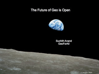
The Future of Geo is Open
•Download as PPT, PDF•
5 likes•1,901 views

Keynote presentation for the FOSS4G-Europe 2017 , Paris

Recommended
Recommended
More Related Content
What's hot
What's hot (20)
Similar to The Future of Geo is Open
Similar to The Future of Geo is Open (20)
Recently uploaded
Recently uploaded (20)
The Future of Geo is Open
- 1. Images: NASA
- 2. Thank you to all our colleagues in “GeoForAll” initiative http://www.geoforall.org
- 3. In the technology world outputs are fast but the results and impacts for Education and Capacity development are in the long term (sometimes even generations) Image acknowledgement: GODAN Success Stories
- 4. Future is unpredictable There are many Future(s)! Future(s) is created by the decisions made by everyone everyday Image acknowledgement: GODAN Success Stories
- 5. Life experiences provide bigger learning experiences than any university Government Hospital, Thiruvananthapuram, India mage acknowledgement: The New Indian Express Community Volunteering Sharing
- 6. June 2010 Open Source Geospatial Lab founding meeting at UoN “We did not have any funding that time but we have amazing people”
- 7. GeoForAll – Making geospatial education and opportunities accessible to all Thanks to Daria Svidzinska for creating the space-time map of GeoForAll Same age as my son
- 8. Our amazing team who make this happen
- 9. ICA- OSGeo MoU Prof. Georg Gartner (ICA President) and Arnulf Christl (OSGeo President) shake hands after signing the MoU at Intergeo 2011 in Germany (Sep 2011)
- 11. alt.ac.uk GeoForAll happened because of Serendipity
- 12. GeoForAll is based on Open Principles in Science and Education • Free and Open source software • Open data • Open standards • Open access to research publications • Open education resources
- 13. Why - Social Responsibility Making resources including software and data openly available offers an opportunity for knowledge to be shared widely so as to increase learning opportunities. Example – Collaborating with educational initiatives like gvSIG Batoví For details contact: Sergio Acosta y Lara sacosta@dntopografia.gub.uy Alvaro Anguix aanguix@gvsig.com https://www.youtube.com/watch?v=orwN9K07XPo
- 14. Building bridges and Empowering communities
- 15. alt.ac.uk Why is Openness Important? Openness is fundamental in helping achieve SDG 2030 aims
- 17. How can we ensure Zero Hunger for all?
- 18. http://www.godan.info/documents/godan-success-stories-issue-1 How can we use technological developments and Open Data to help the small hold farmers?
- 19. AgMarknet: Surpassing the middleman (http://agmarknet.gov.in/)
- 20. Develop an innovative solution to reduce waste and achieve ZERO HUNGER By bringing together teams of students and researchers to find solutions for local farming in growing cities, using open agriculture and nutrition data. Teams should use: some aspect of the OpenCitySmart Design and NASA’s open source virtual globe technology, WebWorldWind as a source of open data. Details of the open data tools can be accessed through: http://eurochallenge.como.polimi.it World Wind
- 21. An example of a Food Security Application http://www.trilogis.it/eLocust3D/ The goal of this application is to help FAO (Food and Agriculture Organisation of the United Nations) providing support to national locust operators in Africa and Middle East. Desert locusts are a huge problem for the population and due to their ability to change their behaviours and habits. These locusts are hard to limit as they form swarms and move rapidly (about 20km/h). Moreover, they can consume (in 1km² swarm) as much food as 35,000 people eat in a single day. Nicola Dorigatti, Nicola Meneghinii World Wind
- 22. alt.ac.uk Education + Empowerment = GeoForAll
- 23. Science is NOT proprietary! Transparency of research is fundamental for scientific advancement (no “black boxes” or proprietary barriers) and geospatial science should always be open.
- 24. Vision 2030 Science should always be open Geospatial Science should be fully build on Open Principles Transparency of research is fundamental (no black boxes or proprietary barriers). Geospatial Science = Open Geospatial Science Open Geospatial Labs are being established worldwide to scale up research and teaching globally as part of the ICA-OSGeo MoU http://bookshop.europa.eu/en/open-innovation-open-science-open-to-the-world-pbKI0416263
- 25. STEM education using Open Principles Students learning map production using free and open technologies like QGIS and open data (Photos thanks to Edward and GeoForAll colleagues in Tanzania)
- 26. We want to create opportunities for high quality science education and empowerment for all economic backgrounds
- 27. We will create opportunities for high quality science education and empowerment for all economic backgrounds Thanks to Work done by our Sergio Acosta Y Lara and our GeoForAll colleagues in Uruguay
- 28. School learners experiencing geoinformatics at GeoForAll lab at the University of Pretoria, August 2016 Thank you to Victoria Rautenbach for making this possible
- 29. Wealth Inequalities are increasing Billions of families are struggling for basic human needs and basic facilities (food, clean water, sanitation, access to electricity, education opportunities) hence the global focus on UN SDGs very important priority
- 30. We want to ensure that Future Scientists and change makers can be from here also Image thanks to Victoria Rautenbach
- 31. Thanks to Silvana Comboim and colleagues
- 32. Represents the individual content creator on the World Wide Web Why- Open Principles in Science and Education? helps create quality STEM education opportunities for all helps develop creative and open minds in students which is critical for building open innovation contributes to building up Open Knowledge for the benefit of the whole society and for our future generations.
- 33. Over 12,000 schools About 6 million students About 200,000 teachers https://itschool.gov.in/glance.php Why Openness in Education Important? Good example of impact of openness in Education from my state Kerala in India
- 34. A Small Circle in Asia Contains More Than Half the World's Population – But How many GI Scientists are from here? http://science.howstuffworks.com/environmental/earth/geophysics/small-circle-asia-more-half-worlds-population.htm For decades high cost proprietary GIS reduced the education and entrepreneurship opportunities in GIS for the economically poor. But now Thanks to the Open Source Geospatial Foundation and all OSGeo volunteers , these inequalities for access to geospatial software and learning opportunities is changing fast. It is the efforts of OSGeo volunteers that helped make tools like QGIS available free to all schools worldwide forever.
- 35. Geospatial Technology – Why? Future is shaped by the decisions made by everyone everyday Thank you to all OSGeo volunteers for your work that has made possible Geo education opportunities accessible for all Be our GeoAmbassadors and let us pledge and work for open principles in science and education to eradicate extreme poverty and enable shared prosperity for all Images: NASA
Editor's Notes
- Godan exists to respond to particular challenges and foster innovations to meet them
- Local Farming is an important aspect in sustainability and hence GODAN is launching the NASA-GODAN Challenge welcoming students and researchers worldwide to come up with innovative ideas (around a collaboration on agriculture and nutrition data openness) like: mapping for optimal linking of local farming community directly with potential customers tools for visualizing spatio-temporal aspects of local farming tools for helping reducing wastage (for example linking with local food banks) etc. for helping reduce wastage and find solutions to Zero Hunger aim.