Wildlife return at the quarry "Břidla“ – possibilities of natural habitat restoration by Vilém Jurek (Czech Republic)

This project is situated to the eastern part of the Mokrá quarry near Brno. There is a unique possibility to connect mining area with surrounding nature of the southern part of Moravian karst just in that suitable place. The project was divided into three parts. The first focused on the monitoring of actual fauna and flora in the quarry and it’s closed surrounding. The results of these investigations were then assembled into the study with the aim to propose a stabilization of biodiversity and to create a mosaic of various biotopes in the second project part. The third part is highly theoretical, because the mining area is still active. However, was creating a way to inform the public about limestone quarries as hot-spots of biodiversity and about near-natural restoration of habitats in the future. The area is namely suitable for establishment of natural hiking-trail with some small artifacts related to land-art etc. The final connection of these three project parts brings interesting information from many scientific and biotechnological professions. This study can be shown as an example how to utilize theoretical scientific information from different branches of biology, ecology and nature protection in a reclamation proposal. The project won the 1st Prize in National Quarry Life Award in 2014 in the Czech Republic. Read more: http://www.quarrylifeaward.com/project/wildlife-return-quarry-bridla-possibilities-natural-habitat-restoration-priklady-moznosti

Recommended
Recommended
More Related Content
What's hot
What's hot (20)
Viewers also liked
Viewers also liked (20)
Similar to Wildlife return at the quarry "Břidla“ – possibilities of natural habitat restoration by Vilém Jurek (Czech Republic)
Similar to Wildlife return at the quarry "Břidla“ – possibilities of natural habitat restoration by Vilém Jurek (Czech Republic) (20)
More from Quarry Life Award by HeidelbergCement
More from Quarry Life Award by HeidelbergCement (19)
Recently uploaded
Recently uploaded (20)
Wildlife return at the quarry "Břidla“ – possibilities of natural habitat restoration by Vilém Jurek (Czech Republic)
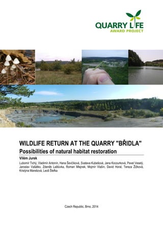
- 1. WILDLIFE RETURN AT THE QUARRY "BŘIDLA" Possibilities of natural habitat restoration Vilém Jurek Lubomír Tichý, Vladimír Antonín, Hana Ševčíková, Svatava Kubešová, Jana Kocourková, Pavel Veselý, Jaroslav Vašátko, Zdeněk Laštůvka, Roman Mlejnek, Mojmír Vlašín, David Horal, Tereza Žižková, Kristýna Marešová, Leoš Štefka Czech Republic, Brno, 2014
- 2. ABSTRACT Our project is focused on the eastern part of the Břidla quarry, which is a component of the Mokrá mining area. The topic of this project is Increase biodiversity knowledge in quarries. We deal with the spatial and temporal treatment of the mined out area in the central part of the Břidla quarry, which were chosen by the contracting authority as a location of interest. We propose the renewal and strengthening of the diversity in the section where an original inadequate reclamation of the late eighties of the last century is located. The starting point of this project is the use of current and future possibilities of life restoration in the quarry. We combine several approaches to regeneration and strengthening the environment of quarry with maximum utilization of mining needs. We propose a number of measures and interventions so that the excavation voids are in the future naturally incorporated into the landscape of the Moravian Karst as well as into the life of the population. The study is divided into four sections. The first part is experimental and discusses the results of a detailed biomonitoring conducted throughout the mining area of the Mokrá quarry. Thanks to a large number of scientists in our team a number of important representatives of fungi, lower and higher plants and animals were described. On the basis of monitoring results the experts then selected relevant representatives of fauna and flora of the Mokrá quarry. They subsequently described their ecological requirements and suggested optimum conditions in which these flagship species can survive. In the second part we incorporated the individual outputs into a design of working solutions of reclamation of exhausted Břidla quarry. This resulted in a study proposing technical adjustments of the quarry. These are then the basis for the creation of suitable ecological conditions for fifteen different habitats. For each of them we then developed technological and biological plan of modifications. In the third part of the study we examined the societal impact of reclamation procedures we described. We designed a nature trail which will be based on the principle of controlled tours with an instructor, using educational display boards, illustrative objects in the field, worksheets, rest areas and small artefacts placed in the area of the quarry. The fourth part of the study describes the long-term possibilities of opening of the mining area to the public in the time after the cancellation of the mining area. The resulting text is a comprehensive basis for designing reclamation procedures after mining termination, using a part of Quarry Džungle in Mokrá near Brno as a case study. In a way this could be a methodology of how to proceed with the multi-purpose use of excavation voids, with the focus on nature conservation, not only in this particular quarry. First of all, we aim to create as colourful mosaic of habitats as possible, designed on the basis of biological monitoring. A unique benefit of this project is therefore the utilization of results of various scientific and technical disciplines, addressing the issue of overburden emplacement, and society-wide employment of the exhausted and reclaimed area. INTRODUCTION The eastern part of Břidla quarry was chosen by the contracting authority of the project Quarry Life Award as an object suitable for resolving future reclamation after mining completion. The unique environmental conditions we propose here enable a relatively small area to restore natural communities of deciduous forests and South Moravian forest-steppes, as well as to restore aquatic and species-rich wetland vegetation. Our study provides a comprehensive approach to the fields of ecological restoration, biology of post-industrial areas, and environmental education. The study is approached from several perspectives. First and foremost, we want to enhance biodiversity through the return of important species that are found in the quarry and its surroundings. 2
- 3. The process of restoring the habitats involve 15 experts from different disciplines who would under normal circumstances never met. The project also addresses possibilities of providing information to the public by controlled excursions and education. This final report can be seen as a case study of possible measures and various approaches to restoring an area damaged by mining. This is not a reclamation project per se, but a proposed solution of a near-natural reclamation adapted for a part of the Břidla quarry. This text is formally divided into four consecutive sections – biomonitoring of the mining area of the Mokrá quarry, long-term vision of the Břidla quarry, an overview of key species, and suggestions of habitats in the area of question and of society-wide of the reclaimed area. Each of these sections has its appendix which gives more information about the study. OBJECTIVES The aim of our project is the environmental restoration of mining areas and the subsequent society-wide utilization of the Břidla quarry after mining completion. This newly formed area may in the future become an interesting place with a diverse mosaic of habitats, where it will be possible to show that mining can be, under certain conditions, a benefit and enrichment of the landscape. In this study we aimed to stabilize and strengthen the diversity of quarry through the creation of new habitats or the expansion and enrichment of already existing habitats. We have suggested procedures that will create optimum habitat conditions for the life of endangered plants and animals. We gained insight into what lives and grows here and what potential for species do individual habitats have. An approximate technical solution of the excavation voids is also a part of our study. We suggested modifying the water area and the original inadequate reclamation in order for the right conditions for the occurrence of the largest number of species to come about. We focused primarily on those habitats where we can expect the occurrence of rarer species found in the previous research. Together with the practical steps of restoration ecology we also subsequently proposed educational use of the reclaimed space. The material also includes a long-term vision of a sensitive and safe social use of the site at the time when the part of mine will not be a mining area any more. BASIC INFORMATION The Mokrá quarry is situated in a valuable area of southern part of Moravian Karst. From the biodiversity point of view the quarry is unique due to limestone bedrock, which is connected with the rich communities of deciduous forests and dry grasslands. A substantial part of the quarry floor also consists of aquatic and wetland vegetation, which is also home to many different species of animals. Before the extraction began, there had been predominantly a system of thermophilous oak or oak-hornbeam wood with small forestless communities. Our project is situated in the eastern part of the mining area of Mokrá limestone quarry (county Brno-Venkov, South Moravian Region, cadastral community Hostěnice and Mokrá near Brno – see Map of localization, Fig. A1 in Appendix A. The part in question is called "eastern quarry" or "Břidla quarry", and its area is about 20 hectares. The area has an elongated shape stretching from south to north and is constituted by a flat bottom of quarry with adjacent slopes with prevailing western and eastern aspect (Fig. A2 in Appendix A). The altitude here ranges from 350 to 450 meters above sea level. The site which this study focuses on has an area of approx. 4 ha and is inclined in southern and south-south-western direction. It is marked with a red frame in Fig. A2 in Appendix A. 3
- 4. No intensive mining is currently taking place in this mining area; the mining is limited to occasional mining of slate. There is a plan for the future to connect the eastern quarry with the middle one, in the north-west area of Břidla. The bottom of the quarry is almost without any presence of trees. There are isolated occurrences of self-seeded groups of Pinus sylvestris, Populus ×canadensis, and wetter places of various species of willows (Salix caprea, S. viminalis, S. alba, S. fragilis). An initial succession stage with self-seeded Pinus sylvestris is developing on the slopes. Behind the edges there are diverse forest covers – from the oak-hornbeam woods to non-native pine and larch forests. An important part of the quarry is the body of water, which is pumped into a lake as a wastewater from the quarry's bottom. The lake is fenced in for safety reasons. Near the lake there is a body of the original inadequate reclamation from the late eighties. It is a sloped dumping site with terraces. The body is wooded with Betula pendula, Pinus nigra, Pinus sylvestris, Acer pseudoplatanus and Tilia cordata. The surface had been grassed over with clover-grass mixture (Trifolium pratensis, T. repens, Medicago sativa etc.). In the north-eastern part of quarry another recultivation area can be found. It had originally been an equivalent of the body near the lake. This soil pile was however re-reclaimed in 2006 by using near-natural reclamation methods. As a result, in these areas there is a functional habitat with steppe grasslands, scree slope, thermophilous shrubbery and a cascade of pools. Above this reclamation body there is an area where the forest vegetaion was restored in 2010 with a rich mixture of native trees (Quercus petraea, Carpinus betulus, Acer pseudoplatanus, Acer platanoides, Acer campestre, Tilia cordata, Sorbus aucuparia, Cornus mas, Crateagus monogyna, Corillus avenalla). At the western boundary of the area of Břidla quarry, a transitional dumping site is located. The flat area consists of xerophytic communities with representation of narrow-leaved grasses. Invasive and rapidly-colonizing plants: Robinia pseudoacacia, Acer negundo, Populus xcanadensis, Solidago canadensis, Lupinus polyphyllus (esp. in the north-west area), Aster lanceolatus, Calamagrostis epigejos. METHODS The result of our project is a study, which was divided into four parts: 1. Biomonitoring of the mining area of the Mokrá quarry. 2. Long-term spatial and temporal vision of the Mokrá quarry. 3. A proposal of technical solution and arrangement of habitats in the selected part of the Břidla 4 quarry. 4. Society-wide employment of the reclaimed space. 1. Biomonitoring of the mining area of the Mokrá quarry This part of the study is devoted to monitoring of the Mokrá mining area. We created a multidisciplinary team of specialists for different groups of organisms (fungi, lichens, bryophytes, tracheophytes, birds, reptiles, amphibians, butterflies, beetles, molluscs and mammals). The monitoring phase took the form of continuous observations in the field. Work started in early spring time and lasted until September 2014. An entire growing season was therefore covered. In the course of monitoring experts were sending us messages with interesting findings, some of which are published on the QLA website. The output of the experts is not a complete inventory, but only a selection of a few key species that are, based on the experts' considerations, important to the quarry and its surroundings. The experts then stated for each species its location, whether it is threatened, its
- 5. ecological and biological characteristics and the wildlife management of this species. Habitats which should appear in our area of interest were selected on the basis of these key species. 2. Long-term spatial and temporal vision of the Břidla quarry Our study focuses only on a very small part of the quarry, which is elaborated in detail. This chapter, however, introduces our general view of the Břidla quarry at a time when its space is exhausted and enclosed by leeward slopes. The detailed habitats are not elaborated here, neither are the resulting terrain morphology or exact vegetation structure after its reclamation, because the exact appearance of the quarry, the number and location of dumping sites, and the geological and hydrological conditions are not yet known. This chapter therefore only generally defines the environment within which we then deal with the area of interest in detail. 3. A proposal of technical solution and arrangement of habitats in the selected part of the Břidla quarry In the case of habitat design around the lake it was important for us to gain information about the area and future plans concerning its utilization. We conducted a terrain reconnaissance, delimited borders of interventions and, based on the advice of experts, identified those habitats in which key species may occur in the future. We also built on our experience in the field of ecological and landscape restoration. We consulted the issue of the current state and future development with the representatives of the quarry management. We were introduced to the current plan of excavation. With these materials we could begin to create special, temporal and functional structure of habitats, depending on the spatial arrangement of the site. We created a description of the situation, the technical and biological procedures and after-care of the habitats. In the description of the situation are briefly described both the current and the planned habitat along with the aim of our proposal. In the technical procedure we outlined proposed landscaping, remediation, and models of future habitats and buildings. The conception of biological modification defines all the biological and biotechnological procedures – planting of trees, mulching, seed production etc. The after-care then encapsulates subsequent process of interventions in the next 10-20 years. The output of this section is a proposal of habitats written in text form, supplemented by a graphical part with sketches and maps. 4. Society-wide employment of the reclaimed space In the last part of our study we look into the potential societal employment of the mine area. We dealt here with the issue of giving a controlled access to the Břidla quarry to the experts and other visitors such as school excursions. With the participation of specialists from the field of environmental education, we proposed several approaches to the issue of how to use the part of the quarry not only in the environmental sense, but in the educational as well. We used methods of environmental interpretation and our experience from NGOs. Given the existence of the mining area, we proposed solutions which conform to the safety needs of visitors according to the rules valid in actively mined territories. The result is a visitor and educational concept which proposes various options for society-wide use of the space in the medium term. In the long term, it will be possible to conduct other events which will make the quarry area more attractive to the general public. 5
- 6. RESULTS In this section we present in summary all our results. A detailed elaboration of some parts of the project is then located in the Appendices. 1. Biomonitoring of the mining area of the Mokrá quarry Biomonitoring in the quarry have been under way since the beginning of our project. During the growing season, we were in regular contact with team members who send us interesting discoveries; some of them are published on the QLA website. Scientific research has brought data about 28 key species which may be interesting from a scientific or conservation point of view. We used much of the data about individual species as a basis for the proposed reclamation of the quarry. A detailed listing of species are listed in Appendix B. 2. Long-term spatial and temporal vision of the Břidla quarry After the extraction ends, and after the remediation and reclamation of the quarry, the Břidla quarry will take a form of a deep valley with south to north orientation. A rough estimate of future appearance of the quarry is outlined in Fig. A2 in Appendix A. The quarry comes into consideration as a space for a combination of spontaneous and controlled succession. In the case of controlled succession, we propose to employ near-natural methods of reclamation and biological conservation. While the slopes should be covered mainly by forest vegetation (scree deciduous forests), the bottom of the quarry, due to unique geological conditions, enables the creation of small lakes and water bodies in combination with wetlands and dry grasslands in elevated locations (see Fig. A3 in Appendix A). In both figures we marked only the basic characteristics of vegetation, namely: dry grasses and sparse shrubs; shrubs and forest cover on sloped dumping sites; waterlogged forests, alder and willows; wetlands, ponds and water bodies. Areas of flat nature will for some time form xerophytic habitats of dry grasses and sparse shrubs. If, however, the transition towards forest is undesirable, it will be crucial to regularly maintain the grass with extensive methods of conservation management (mowing grass, removing shrubs). In the case of long-term plan it is necessary to annually disposal of invasive plans that could threaten the natural evolution 6 of communities. At the bottom of the quarry, after appropriate terrain modelling, aquatic and hygrophilous communities can be present. Those are currently represented by: a cascade of pools in the northeastern part of the quarry, a lake at the bottom of the quarry and a lake in the southern part. Due to the low permeability of the geological strata in this part of the quarry, it would be possible here to plan additional lakes and pools in order to create a varied mosaic of communities. The bottom of the quarry, where a large deep lake regularly forms, offers a great potential for a future body of water. This could be partly left to develop in a natural way, and partly used for swimming and recreation after the cancellation of mining area. Various ways to model the final quarry slopes and the subsequent development of strata are outlined in Fig. A4, Appendix A. Slopes on both sides of the quarry are also potential place for establishing dumping areas or they could be left to spontaneous development. In Fig. A5, Appendix A it is possible
- 7. to see how a dumping area can become a destructive element in the habitat space diversity, or, on the contrary, it can become a source of new habitats potentially suitable for rare plant and animal species. In a quarry or its immediate vicinity there are several examples of successful near-natural habitat restoration. These can be used as examples for restoration planning. (1) In the north of the Břidla quarry there is a reclaimed backfill with a cover of thermophilic shrubbery, xerophylic vegetation and wetland and aquatic vegetation. (2) Another way to restore forest vegetation is a forest reclamation of backfills in the south-east corner of Břidla. An oak forest is established here. This will in the future connect to the indigenous oak cover, which used to be located here before the extraction. (3) At the mine disposal site there are maintained trial experimental areas testing various ways of increasing diversity of the forest undergrowth on a newly established habitats. The Břidla quarry is not mined out yet, and its final appearance may be considerably different from the projected form. The primary object of our study is therefore an area around the lake (marked with red rectangle in Fig. A2, Appendix A), where there is an inappropriate terraced reclamation from the last century. It is a mined out and stabilized area, where there were no expectations of additional mining or morphological changes of relief. It is therefore possible here to plan final adjustments of slopes, dumping sites and subsequent reclamation of the area 2. A proposal of technical solution and distribution of habitats in a selected part of the Břidla quarry On the basis of consultations with members of the team, we evaluated the original reclamation from the 90s as being inadequate. Although it is already a stabilized habitat, its long-term potential in terms of biodiversity is very small. For future development of the eastern part of Břidla it is essential to develop communities that are more suitable for the habitat and biogeographic conditions. We were therefore deciding for one of two options: (1) either regenerate the inadequate reclamation using biological methods or (2) fully remodel the reclamation body using material from overburden, and only then apply the biological methods to the newly established environment, in order to achieve higher species diversity in the area. Eventually, we chose the second option. Its outcomes are: more space for creativity in designing a rich mosaic of habitats; no valuable habitat will be destroyed; it also allows for dumping the tailings of new overburden, which is an issue that constitutes long-term 7 problem in this quarry. A dumping site will be created under our proposal, which will take form of an embankment cone running from the original terraced backfill in west-east direction (see Fig. A6 in Appendix A). Two oppositely facing slopes will be created, along with a plateau of a dumping site, at a height of about 20-25 m above the bottom of the quarry. Thusly formed dumping site functions as a "sponge" that absorbs most of the rainwater. Those are then released in the form of a spring. Because the limestone layers in this part of quarry are impermeable, it can be assumed that at the foot of the northern part of the dumping site a shallow pond with stagnant water will be created. This will become a part of already existing series of northern cascade of small pools. From the south an existing lake will adjoin the dumping site. This lake currently serves as a breeding tank. In order to allot at least a small portion of this lake for aquatic and wetland communities, we propose to separate the shallow water body north of an island by a strip of land, in order to prevent fish getting into this part of tank. It is important to maintain the lake in its current form as a water source for the quarry operation. That is why we also propose only sensitive adjustment
- 8. of the vegetation without any other technical landscaping. We should also anticipate of a certain changes in the access routes to the lake and the dumping site, and in walkways at the top of the dumping site and in the quarry. Overall, we propose to create 15 of local near-nature habitats, in which we expect at least partly different species of plants and animals to occur. We recommend to use planting stock from local sources, or alternatively from sources in habitats with same or similar conditions. For non-forest habitat we recommend well-established and relatively cheap methods of mulching with hay from steppe vegetation. These can be conveniently accompanied by manually collected seeds of grasses, herbs and trees. The collected seeds will be processed (by drying, cleaning, husking, creating mixtures), and the resulting mixture will be used for direct sowing and undersowing in mulch. For forest habitats we recommend to work exclusively with native species of trees, in two phases. In the first time period a forest cover will be planted. This forest will probably not be very heterogeneous, because newly established dumping sites are always liable to dry out, and seedlings die in large quantities. Only after the stabilization of the forest cover in 10 to 15 years is it advisable to loosen the cover, supplement it by other species and support the recovery of the forest undergrowth. In aquatic and wetland communities a gradual increase in the number of plant species is ensured especially by waterfowl. Yet even here we plan to set up small artificial alder and willow enclaves. With these proposed technical and biological changes a unique ecological diversity of habitats may arise here. Detailed overview of interventions including illustrative examples is given in Appendix C. 4. Society-wide employment of the reclaimed space We do not want our study to be "canned" nature reserve permanently screened from the public gaze. The nature of Central Europe has long formed in coexistence with human activities in the landscape. That is why our study has a social dimension as well. In the medium term of 10-15 years, we propose to present the uniqueness of mining area, where nature returns to its original state, to a wider professional community. We expect that in that time this part of quarry will still be a component of mining area of the Mokrá quarry. That is why are our proposed activities limited to presence of organized groups (such as elementary or high schools, or interest groups) coming to visit the Mokrá quarry under the guidance of an instructor or an expert. For these purposes it would be appropriate to construct certain visitor infrastructure (paths, resting places, points of scenic view), which could be used for interpretation and field demonstration of landscape modelling and nature reconstruction. A part of the educational process can also be a small geopark with rock samples or an educational path. This should be designed for a wider age group, the worksheets will then be of several types intended for different target groups. A more detailed description of particular educational tools is given in Appendix D. In the long term of 25-50 years we can expect that this area will be exhausted and the mining area cancelled. At that time a great opportunity for the owner of the quarry arises – they can make the site more attractive, bring here population from the surrounding area and offer them a combination of mineral resources mining, nature conservation and recreational use of the site. A large lake with clean water is likely to come into existence at the bottom of the quarry, part of which may be devoted to recreational purposes. Establishing a nature trail from Hostěnice to Mokrá comes into consideration. This trail would lead along the edge and across the bottom of a deep valley (formerly quarry) with examples of karst phenomena and artificial landscape that was returned back to nature. The area of the bottom of the quarry offers the possibility to be used as an art space with stone artefacts, mazes etc. The quarry area can be maintained in a form of sparse forest for a long period of time by the means of extensive sheep pasture. 8
- 9. DISCUSSION An expert scientific research showed a great potential of the Mokrá quarry for nature conservation. There are unusually many rare and endangered plant and animal species. The reason for this is a combination of leaving the quarry to natural succession, creating new habitats and suitable maintenance of existing parts of the quarry. In the Czech Republic there are few such species-rich mining areas, such as the one in Mokrá. Therefore, the restoration of natural environment has a great potential in this quarry and it would be a pity not to seize the opportunity. The main advantage of the natural environment surrounding the quarry are (1) its connection to the preserved forests of Moravian Krast Landscape Protected Area, (2) the existence of steppe and forest-steppe communities at the upper edge of the quarry, and (3) a well-developed aquatic and wetland vegetation in the lakes and pools of the quarry. In the case of the area of our interest, as well as for the Břidla quarry as a whole, we therefore propose ecological restoration in the form of near-nature reclamation based on a principle of a controlled succession. In our proposal we chose accelerating, or conversely blocking of succession, but in some cases we recommend using the potential of spontaneous succession. Accelerating succession must be used where it was necessary to skip the complicated and lengthy development of primary succession. We proposed blocking of succession in those places where a rapid development of vegetation usually also means immediate wide onset of invasive plant species. Those are a major factor determining the further development of vegetation in virtually all artificially disturbed area. Plant invasions threaten controlled as well as spontaneous succession and are undesirable elements not only in mining landscape. In the overall concept of near-nature quarry restoration we often gave preference to processes that are neither expensive nor time consuming. In the case of our study we even interconnect interests of nature conservation with the needs of miners, because we recommend to use overburden material to create new habitats. We do not propose creating forests with economic function, nor do we propose creating farmland. In the case of the recovery of the Břidla quarry it is more important for us to increase the diversity of the territory and its stabilization. We tried to work out the technical modification and the biological restoration of selected area in detail, because these steps can be implemented in short term of 5-10 years. In broad terms we also outlined educational and recreational use of the quarry, even though the completion date of individual activities is a question of quite remote future. The entire site of Břidla quarry could be, after the completion of mining, incorporated back into the Moravian Krast Landscape Protected Area. Given the success of reclamation of the natural environment of similar quarries, we can expect that it would be possible for this locality to become a small nature reserve. CONCLUSIONS The Břidla quarry is, for many reasons, an area greatly suitable for near-natural reclamation. Our study focused on a stabilized, mined out part of the quarry. In this area we propose to create 15 different types of habitats, which a specialized team of researchers from various fields marked as interesting for the occurrence of key species of plants and animals. Based on their recommendations and on our own experience, we compiled an approximate shape of area modelling and follow-up distribution of individual habitats. The appendices discusses in more detail their characteristics, appearance and environmental potential. We also offer the possibility of educational and leisure use of the site, which however to a large extent depend on the speed of reclamation in the whole area of the Břidla quarry and on the date of termination of mining activities in this part of the quarry. We perceive the Břidla quarry as a great 9
- 10. opportunity, where the interests of limestone mining, nature conservation and community use may intersect in a single, aesthetically very pleasing environment. Project team: Wildlife return at the quarry "Břidla" – Possibilities of natural habitat restoration 10
- 11. Fig. A1: An approximate plan of the Břidla quarry after mining and reclamation. dry grasslands, scattered shrubs shrublands and deciduous forests mainly on soil dumps wet forests, alders, willows wetland, pools, lakes profile from Fig. A2 Mokrá quarry An area of our detailed interest Appendix A - Visual documentation
- 12. Fig. A2: A potential profile of the Břidla quarry (25-50 years) with main vegetation types. It is an approximate drawing of the vegetation cover of the whole quarry. Our study describe in detail only right site of the image. Rocky outcrop Covered rocky outcrop Bushes rocky outcrop soil dump quarry bottom pont lake dry grassland scree forest dry grassland dry grassland termophilous forest oak-hornbeam forest willow, alder, wettland Fig. A3: Ideas of final technical reclamation of artificial slopes after the Břidla quarry excavation. Ends of working levels (a) can remain unmanaged. Erosion and an establishment of gravel piles can run without vegetation 100- 150 let (b). Faster and more efficient growing will be rather problematic, because plants will be continually destroied by falling stony fragments. Artificial sloping of stairs can help with visual removal of quarry view (c, d). In case, when the stairs will be filled by small dumps (e), while the total removal of stairs will mean the slower vegetation develop with prevailing species of shrubs, herbs, and with prevalence of dry grassland species of bushes, herbs and grasses (f). a) b) c) d) e) f)
- 13. Fig. A4: We tried to demonstrate the impact of reclamation type on the resulting quarry space and the diversity of natural habitats. The quarry filled by some soil dump (a) decreases the diversity of natural environment. The quarry without any deposition (b) creates relatively natural conditions, which are environmentaly acceptable for many endangered species. In our experiences, the combination of abandoned quarry with some slopy dumps (c) create many unique habitats. Resulting biodiversity of such locality is then much higher than in previous cases. a) b) c) Final slopes Soil dump Rocky outcrops rocky terrases Rocky outcrops Rocky outcrops Screes Wettland Rocky outcrops Rocky dry soils deep wet soils Wetlands and pools rocky terrases outcrops Screes
- 14. Fig. A5: Examples of the Břidla quarry reclamations, which are useful for a restoration using natural and modified succession. (a) Woodland at the soil dump about 300 far from the quarry. „Scelet” of the deciduous forest planted from middle of 90ties was enriched by species from thin soil layer taken from stable oak-hornbeam forest. More tree species were added. Total number of vascular plants increased almost two times to about 60 species / 100 m2. (b) Reclaimed soil dump at the northern part of the quarry was reclaimed to the forem of dry grassland and open bushland vegetation, also with water and wetland vegetation at bottom. The final view and number of species after 10 years of reclamation is excellent. © Other type of restoration of forest vegetation is represented by reclamation of old soil dump in the nort-eastern part of the Břidla quarry. Trampled soil of the old dump had to be firstly aerated. Later the oak forest was establish there. It will be in contact with former oak-hornbeam forests in the future.
- 15. Fig. A6: Detailed map of biotopes and panoramic view at the locality from the west.
- 16. Fig. A7: Long-term vision (50 years) of the Břidla quarry utilisation after finalisation of reclamation and closing of mining area. An approximate analogy of the similar view to the quarry after 50 years can be found in Růženin lom quarry at the Hády hill (see the photo in left-down corner). Explanation of coloured areas can be found at the Fig. A1. Dashed lines show walking paths, solid lines are vehicle accessible roads. panoramic view 1 panoramic view 2 trail Mokrá-Hostěnice (Říčka valley) lake 1 lake 2 artistic area geoparc swimming, recreation
- 17. Fig. A8 and A9: Photo of the study site in Břidla quarry.
- 18. Fig. A10 and A11: Photo of the study site in Břidla quarry.
- 19. Appendix B Key species found at the Mokrá quarry and its surroundings This set of species can`t be understood as a complete list of rare or even endangered plants and animals. The list represents only key species selected by experts that occur in the quarry or its immediate surroundings and have some indicative character for the habitat type. 1 Fungus Thelephora caryophyllea Place of discovery: Forest reclamation over the stone crushers. Endangerment: Critically endangered species (Red list of fungi /macromycetes/ Czech Republic). Ecological characteristics: Probably mycorrhizal symbiont of pine stands in warmer areas where it grows on bare soil. Management at the Mokrá quarry: Stabilization of open habitats with pine trees. Aleurodiscus disciformis Place of discovery: Edge of oak and oak-hornbeam forest. Endangerment: Critically endangered species (Red list of fungi /macromycetes/ Czech Republic). Ecological characteristics: Saprotrophic fungi bound on the bark of live oaks in warmer regions, especially in sparse deciduous forests, isolated on trees and on the edge of the forest. Management at the Mokrá quarry: Promoting of the natural composition of deciduous forests (oak, hornbeam). Creolophus cirrhatus Place of discovery: Hornbeam forest cover, 500 m from the western quarry. Endangerment: Nearly threatened species (Red list of fungi /macromycetes/ Czech Republic). Ecological characteristics: Parasitic and later saprotrophic fungi growing on living trees or relatively freshly dead woods of deciduous trees. Management at the Mokrá quarry: Preservation of places with fallen trunks and branches.
- 20. Hygrocybe reidii Place of discovery: Non-forest habitat in the western part of the quarry. Endangerment: Critically endangered species (Red list of fungi /macromycetes/ Czech Republic). Ecological characteristics: Saprotrophic fungi growing on poor and drier habitats (meadows, pastures), but also in deciduous forests. Management at the Mokrá quarry: Restauration of open non-forest habitats without fertilizers or other chemicals. 2 Bryophytes Aneura pinguis Place of discovery: This species has not been detected in the area of the Mokrá quarry, but it is known from wetland habitats at Růženin quarry about 20 km west. Due to very similar conditions we expect it can be found on analogous sites in wetlands of the Mokrá quarry. Endangerment: Not known. Ecological characteristics: In the Czech Republic this species is growing in both acidic and limestone substrate at wet places (streams, meadows or peatbogs). Management at the Mokrá quarry: The target habitat is wetland vegetation (shallow lake edges with stable moist soil). Create a shallow edge zone, where shallow layer of water will be sometimes there will be wet or soil. Calliergonella cuspidata Place of discovery: It occurs in the peripheral part of the quarry. It can grow in places that are dry for part of the year. Endangerment: Not known. Ecological characteristics: The species is widespread in moist to wet habitats. Management at the Mokrá quarry: The target habitat is wetland vegetation (shallow lake edges where stable moist soil). We recommend creating a shallow edge zone, where shallow water sometimes floods a soil.
- 21. Metzgeria furcata Place of discovery: It occurs quite frequently in forested areas of the Mokrá quarry at rocks and tree trunks. Endangerment: Not known. Ecological characteristics: Smaller liverwort, which can be found on limestone and silicate rocks and stones, but also on the bark of deciduous trees. Management at the Mokrá quarry: Target habitat is deciduous forest with scattered boulders or outcrops of limestone rocks. Pterygoneurum ovatum Place of discovery: It occurs at the site of the overburden from the 80s. Endangerment: It grows in warm areas of the Czech and Moravian thermophyticum on calcareous background (sunny spots). Ecological characteristics: Open dry grasslands with bare soil patches. Management at the Mokrá quarry: The target habitat is dry grasslands with bare soil gaps. 3 Vascular plants Lithospermum purpurocaeruleum Place of discovery: Locality named “Mezi lomy”. Endangerment: Nearly Threatened. Ecological characteristics: Forest margins, bushes and undergrowth of thermophilous oak forests. Management at the Mokrá quarry: It grows on intermittently cut areas. Rosa gallica Place of discovery: Southern and central part of the locality ‘Mezi lomy’. Endangerment: Endangered. Ecological characteristics: Low rambling bush with the occurrence at steppic and forest-steppic habitats. Management at the Mokrá quarry: It grows on intermittently cut areas, at the edge of roads etc. It is a characteristic species of thermophilous forest edges. Occasionally it also grows at slightly ruderal and disturbed habitats.
- 22. Gentianella ciliata Place of discovery: Central part of the locality “Mezi lomy”. Endangerment: Endangered species. Ecological characteristics: It grows in calcareous dry grasslands. Management at the Mokrá quarry: It occur at old overburden areas with sparsely vegetated area. This species disperses and germinates very well. It expands easily to similar habitats. Pulsatilla grandis Place of discovery: It occurs on the steppe in the southern part of the locality “Mezi lomy” (on the edge of thermophilous oak forests). Endangerment: Endangered species. Ecological characteristics: It is a rare spring plant of pastures, dry grasslands and rocky outcrops growing on both acidic and basic substrates. Management at the Mokrá quarry: It is known that this species can be successfully integrated into the emerging xerophilous communities. Cephalanthera damasonium Place of discovery: Forest in the northern part of the site Mezi lomy and northern edge of the Mokrá quarry. Endangerment: Nearly Threatened. Ecological characteristics: This orchid is found in preserved deciduous forests. It has the ability to expand into the newly established deciduous forests. Management at the Mokrá quarry: The species also occurs in newly established stands of deciduous forests at artificial soil dumps. To improve the condition of the habitat it will be appropriate to gradually eliminate coniferous forests in the lower part of the quarry. Cytisus procumbens Place of discovery: The upper part of the locality “Mezi lomy”. Endangerment: Endangered. Ecological characteristics: The species grows on the edges of the steppes, forest steppes and in open forests. Management at the Mokrá quarry: It grows on intermittently cut areas on the original habitats undisturbed by mining. It can also occur on rocky surfaces after overburden or mining, but its spontaneous dispersal is difficult and works on very short distances. 4
- 23. 5 Moths and butterflies Limenitis camilla Place of discovery: It occurs in the periphery of the forest above the northern edge of the quarry. Endangerment: This butterfly lives on sunny places in woodlands. Possible threats are related to the increase of the area of "dark" forests replacing open dry grasslands and wetlands. Ecological characteristics: It is the indicator species of natural open forest, where the Lonicera xylosteum occurs as a feeding plant. Management at the Mokrá quarry: It needs open forests, sunny forest edges surrounding roads, forest glades and clearings. Chamaesphecia euceraeformis Place of discovery: Caterpillars of the clearwing were found on the exposed surfaces eastern of the quarry at roots of Euphorbia epithymoides. Endangerment: This clearwing is known only from the southern part of the Moravian Karst (Lysa hora, U Brněnky, Hády). It also occurs in surrounding of Vienna, Bratislava and the southernmost Slovakia. Ecological characteristics: Butterfly with special morphology and life cycle. Its characteristic is more like a mimicry wasps or other representative Hymenoptera. Management at the Mokrá quarry: Euphorbia epithymoides in Central Europe is the only host plant of this clearwing. Its presence is a crucial condition for the occurrence of this species. Therefore, it is necessary to promote the distribution of Euphorbia epithymoides. Chersotis margaritaceap Place of discovery: It occurs in the peripheral and unused areas of the Mokrá quarry. Endangerment: In the Czech Republic this butterfly occurs most often at the Pavlovské kopce Hills and in the Bohemian karst. In the Moravian karst it is known from Hády at Brno, Lysá hora hill, Býčí skála rocks and Macocha hillsides. Ecological characteristics: This moth is related to the limestone formations. Management at the Mokrá quarry: It requires a sunny limestone rocks and debris. The caterpillars live on Galium spp.
- 24. 6 Beetles Cicindela sylvatica Place of discovery: The species was found at the sunny path at the edge of the forest in the north-western part of the quarry. Endangerment: Nearly Threatened (Red list of threatened species of the Czech Republic. Invertebrates). Ecological characteristics: It lives on dry places – forest roads and clearings at hilly surface. Management at the Mokrá quarry: Maintain sparse forests and forest edges. The species dislike overgrown forest paths and clearings. Carabus auronitens Place of discovery: Forests in the western part of the quarry. Endangerment: It is a common species of the Czech fauna. It occurs in forests and foothills of middle altitudes. It indicates a preserved natural forest communities. Ecological characteristics: It hides under stones, bark, rotting wood and moss during the day. Management at the Mokrá quarry: It needs to create a lot of hiding places in the form of retention of wood and stone complement. Trechus austriacus Place of discovery: Near the edge of the forest in the northern part of the quarry; open place. Endangerment: This species is very rare in the Moravian karst. Other recent findings are known only from Býčí skála rock, which has a stable population at about 1 km from the entrance to the cave. Ecological characteristics: It lives in dry to semi-moist habitats. It often inhabits burrows of mammals, entrance of the caves, old cellars and ruins. Management at the Mokrá quarry: Sites with stone rubble near the forest edges. Meloe proscarabaeus Place of discovery: Light place over the edge of the quarry in its western part. Endangerment: Endangered (Red list of threatened species in the Czech Republic. Invertebrates). Ecological characteristics: It is xerophilous and thermophilous species of beetle searching for light habitats – steppic grasslands, forest edges etc. Management at the Mokrá quarry: Keep place without shadow.
- 25. 7 Reptiles and Amphibians Coronerlla austriaca Place of discovery: It inhabits mainly the edges of habitats with forest steppe character in the Mokrá quarry – sunny, rocky and bushy slopes. Endangerment: It belongs to the rarer reptiles. Its area of distribution is not continuous in the Czech Republic and it depends mainly on suitable habitats. Ecological characteristics: It avoids large forest complexes. In forest landscapes it can expand on non-forest clearings along railways and power lines. It often inhabits abandoned and even active quarries. Management at the Mokrá quarry: Habitats colonised by this snake are usually heterogeneous, with many burrows, holes and heterogeneous vegetation cover. It provides a large part of the quarry, especially the part which is not currently mined. The favourite food o its snake are lizards. Snake needs to build a wall from free stones with a height of about 1 meter, which supports the heat and shelter for it. Bufo viridis Place of discovery: We can find this species in most parts of the quarry Břidla, where it searches for barren rubble and gravel. Endangerment: Because of the high intensity of agriculture this toad continually disappearing from the agricultural landscape and the town. Paradoxically sand pits and quarries are the main refuge, where toads live. Ecological characteristics: This species is typical for steppe ecosystems. The toad occurred in the agricultural landscape in warmer regions in the past where surface area of fields and forests interspersed. It occurs in the water only during the breeding season – from April to August. Toad needs shallow waters without aquatic plants, where it lays its eggs. It is able to reproduce well in ponds, puddles or larger variety of flooded areas. It tolerates heat and drought best of our amphibians. Management at the Mokrá quarry: Support of pools and ponds without fishes. Birds Falco peregrinus Place of discovery: It flights over the whole quarry. Endangerment: Critically Endangered (Red List of Threatened Species in the Czech Republic – Vertebrates). After almost complete extinction in 80 years the population grows slowly in the Czech Republic since the mid-90s. The current population is around 50-60 breeding pairs. Ecological characteristics: It nests on rock walls. Management at the Mokrá quarry: This species needs the installation of nesting boxes for falcons.
- 26. Lullula arborea Place of discovery: In the quarry Mokrá; 2-3 pairs; it nests regularly. Endangerment: Endangered (Red List of Threatened Species in the Czech Republic – Vertebrates). Ecological characteristics: It inhabits steppe habitats. Management at the Mokrá quarry: Keeping steppe areas. Bubo bubo Place of discovery: In the quarry Mokrá; one pair is usually nested. Nesting was not confirmed in 2014. Endangerment: Endangered (Red List of Threatened Species in the Czech Republic – Vertebrates). Ecological characteristics: It nests on rock walls. Management at the Mokrá quarry: This species needs to install nesting boxes. 8 Mammals Martes mertes Place of discovery: Original inappropriate reclamation, wooded area. Two young martens were captured by digital scouting camera. Endangerment: Least Concern (Red List of Threatened Species in the Czech Republic – Vertebrates). Ecological characteristics: Marten searches for any forest environment, rather coniferous or mixed forests, colder and wetter places. Management at the Mokrá quarry: Greater incidence individuals may endanger populations of birds and other mammals. In the area of the quarry it is necessary to reduce coniferous (pine) forests. Vulpes vulpes Place of discovery: Original inappropriate reclamation, wooded area. Fox was captured by digital scouting camera. Endangerment: Least Concern (Red List of Threatened Species in the Czech Republic – Vertebrates). Ecological characteristics: Linked to the occurrence in forest. Management at the Mokrá quarry: Greater number of individuals may endanger populations of birds and other mammals. In the area of the quarry it is necessary to reduce coniferous (pine) forests.
- 27. APPENDIX C Overview of suitable habitats for the proposed Břidla quarry Lake Description of the situation: The lake is situated in the southern part of studied area. It is necessary to preserve its character especially from technical reasons (water pumping station etc.). The wire fence is built around all the lake for the safety. Regeneration of different woody species can be found at shores around the whole lake – for example Pinus sylvestris, Populus ×canadinensis, Salix caprea, S. viminalis, S. alba, S. fragilis. Lake shores are stony, gentler in the northern part. Several species of fishes were introduced. Target habitats: Littoral zone of herbs and grasses, willow thickets. Technical process: We propose to connect the area of small isle inside the lake with surrounding shores and isolate the small part from the rest of the lake. We also recommend to model selected parts of shores with the aim to create the most diverse morphology – turns, gravel piles etc. Biological processes: We propose a reduction of Pinus sylvestris and Populus ×canadensis invasions. The develop of vegetation can remain as a spontaneous succession. We also propose to add a small plantation of alder and willow thickets. Management of habitats: The care expects regular elimination of invasive plants. Pinus sylvestris expansion should be cut in period of 3-5 years. The lake hasn’t its own feeder stream and it is maintained by pumping of the water from the quarry. It will be necessary to invent the strategy how the water level will be stabilised even after the end of quarry mining. Fig. C1 and C2: Current situation near the lake in Břidla quarry. Isle Description of the situation: It is located in the northern part of the lake. It rises over the water level more than 1.5 m. Individuals of Pinus sylvestris, Populus ×canadinensis, Salix fragilis, S. alba and S. caprea appear there. It has stony character. No water birds were found there. Target habitats: Open willow thickets. 1
- 28. Technical process: We propose to consider the isle as a part of the dam dividing the lake from newly created shallow pool. Biological processes: It is necessary to reduce invasive pines and poplars. Willows and other woods may remain. The newly created biotope can be afforested by willow thickets. We suggest experimental transfer of one tussock of Typha angustifolia, which occurs in shallow pools and wet places in surrounding of the lake. Management of habitats: The isle remains without other management after finishing proposed vegetation modifications. Fig. C3: Current stage of the isle in the Břidla quarry. Wetland Description of the situation: The lake has the most shallow part in its northern section in surroundings of the isle. The water level fluctuates here depending on rainfall and water consumption of the mining technology. Lake shores start to dry repeatedly during the summer. Therefore, populations of Phragmites australis and Typha angustifolia are scattered. Target habitats: Species-rich wetland with littoral zone, varied lake shallow bottom and lake shores. Technical process: We propose to make deeper lake bottom with gentle slopes (between 0.2 and 1.0 m). Shores in the northern part should gradually continue to periodically flooded gravel beach. Bigger solitaire stones will be installed around shores into shallow water to support populations of Chara species. Biological processes: Individuals of pines and poplars should be removed, while we recommend preserving current thickets of willows. To enforce natural succession we recommend the reintroduction of some dominant plant species like Phragmites australis, Typha latifolia, T. angustifolia, Schoenoplectus tabernaemontani etc., which grow in the closed surrounding. Management of habitats: Elimination of alien plants. Other management won’t be probably necessary. 2
- 29. Fig. C4 and C5: Shallow pool with Chara species in north-eastern part of Břidla quarry. Alder forests Description of the situation: This site is located between western shore of the lake and current gravel road. It is mostly a narrow zone, where we can find dense growths of pines, poplars and willows, with some additional tree species as Populus tremula, Betulus pendula. Target habitats: Alder thickets and forest. Technical process: Terrain modification of this stand should be limited to the preparation of locally deeper soils for establishment of alder thickets. Biological processes: Eradication of pine and poplar expansion. Willows, birches and aspens should remain untouched. The new plantation of alder should be done in small patches with edges of Frangula alnus shrubs. Management of habitats: Adler seedlings have to be protected against deer by individual protection. Elimination of alien plants will be also necessary. After the establishment of alder thicket we could try to artificially support the herb layer. Fig. C6: Example of 20 years old alder forest at the Růženin lom quarry, Hády near Brno. 3
- 30. Soil dumps Description of the situation: We propose to modify this area by soil dump in the form of artificial outcrop with northern, western and southern slopes and a Plato on the top. We expect the deposition of waste soil material from newly opened parts of the quarry. Currently an unsuitable reclamation from eighties exists on this place. Target habitats: Dry grassland, dry scrubland, stony screes and screes, scree forest, some type of oak-hornbeam forest. Technical process: We propose to make a soil dump with triangular base, from which mostly two steep slopes will run. A small Plato at the top of the dump can be accessible from the quarry surrounding in the future. Plato and slopes of the pile will be differentiated for different types of biotopes and protected against erosion. Biological processes: We propose to establish various biotopes on different parts of the soil dump see below). The Plato should remain without afforestation, because it will be a suitable place for a nice view to the whole quarry. Only grassland vegetation with small groups of shrubs are useful for this part of the re-naturalisation project. Management of habitats: The whole area will be suitable for spontaneous distribution of alien plants, which should be continually eradicated in first years of the possible realisation of the project. Fig. C7: Example of soil dumps in Mokrá mining area. Dry grasslands and open dry scrublands Description of the situation: We would like to situate this biotope to the upper part of the soil dump on its south-western slopes. Target habitats: Steppic dry grassland and open scrublands. Technical process: The whole area should be covered by the nutrient-poor soil with some ratio of gravel. Some isolated stones can be installed within the area. Biological processes: We recommend the use of the hay from steppic grasslands as mulch covering the bare soil. They will contain some seeds of dry grassland species and will protect the soil against the extreme drought. The species spectra can be enriched by additional sowing by thermophilous species collected from stabilised grasslands in closed surroundings of the quarry area. Some thermophilous woody species like Sorbus torminalis, Acer campestre, Corylus avellana, Crateagus monogyna, C. 4
- 31. leavigata, Cornus mas, Prunus spinosa, Ligustrum vulgare, Lonicera xylosteum can be planted. Suitable biotope for reptiles could be a small dead wood pile installed on sunny place. Management of habitats: Additional care will be focused especially on tree and shrub plantation. Dry grassland should be regularly mown at least once a year. Fig. C8: Example of spontaneously developed dry grassland at former soil removals in Mokrá mining area. Scree forest Description of the situation: Northern slopes are the shadiest part of the pile with potentially nutrient-rich soils. It is suitable biotope for the maple, hornbeam and lime forests. Target habitats: Scree forest with maple, hornbeam and lime. Technical process: Steep slope should remain covered by deep soils with some proportion of stones. Biological processes: Such area should be rapidly afforested due to a high potential for spontaneous dispersal of alien species. Suitable woody species: Acer platanoides, A. pseudoplatanus, A. campestre, Tilia cordata, Quercus petraea, Carpinus betulus, Sorbus torminalis, Ulmus minor, Cornus sanguinea, Crateagus monogyna etc. Some artificial slowly-growing grassland vegetation can be established in first years of tree plantation due to protection of the area against alien species. We support the idea of new establishment of species-rich forest herb layer after 10-15 years when the plantation creates suitable shadow for forest plants. Management of habitats: We expect the basic care about tree seedlings in first years after successful planting. The second stage of biological reclamation (after 10 years of plantation) should support species rich forest understory (typical forest herbal species). Fig. C9: Example of 15-years old ‘scree forest’ established at the soil dump in Mokrá mining area with the management focused on establishment of new species-rich herb layer typical for old oak-hornbeam forests in natural stands. 5
- 32. Rubbles and artificial rocky protrusions Description of the situation: We recommend establishing some patches of rubbles in the warmest part of the slope. Target habitats: Scree communities. Technical process: Some selected small area can be covered by gravel, and later by stones of different sizes. No additional soil should be used. Biological processes: Gravel surface can be covered by mulch from hay mown in steppic grasslands. Also some artificial sowing of thermophilous species collected in closed surrounding can be used for better establishment of species rich, but sparse vegetation in this biotope. Prevailed part of this area should remain without vegetation. Holes between stones should be used as shelters for various types of animals. Management of habitats: Not necessary for this type of biotope. Fig. C10 and C11: Example of thermophilous scrubland at reclaimed soil dump. Dry shrubby vegetation Description of the situation: We suggest establishing also some dry shrubby vegetation in some part of the proposed pile, which should be combined with the vegetation of dry grassland biotopes. Target habitats: Scrubland vegetation. Technical process: Such kind of shrubby vegetation needs dry and sunny stand with a little bit deeper soil profile than grassland vegetation. It means that sufficient potential places for this biotope are situated in the upper part of the pile. If we would like to have open patches in the scrubland vegetation, stony gravel with may help with it. Biological processes: Herb layer will be supressed in such type of vegetation after several years. Therefore, it is better to focus on the rich composition of woody species: Crateagus monogyna, C. leavigata, Cornus mas, Corylus avellana, Prunus spinosa, Rhamnus catharticus, Ligustrum vulgare, Rosa canina, R. micranta, R. rubiginosa etc. Management of habitats: Regular care of seedling plantations is necessary in first years of afforestation. Later only irregular check of alien plants and density regulation of the vegetation is necessary. 6
- 33. Fig. C12 and C13: Example of thermophilous scrubland at reclaimed soil dump. Thermophilous oak forests Description of the situation: Proposed suitable area has southern exposition and borders with scree forest at the northern part of the pile. Our task is to create opened oak forest with Sorbus torminalis and species rich understory. Target habitats: Sub-thermophilous and thermophilous oak forests (with Quercus pubescens). Technical process: The area will be partly covered by stony material; the rest should be covered by nutrient-poor soils with gravel, which was removed from an area of former deciduous forests before mining. Biological processes: Recommended woody species: Quercus pubescens, Quercus petraea, Sorbus torminalis, Acer campestre, Corylus avellana, Cornus mas, Rhamus cathartica, Euonymus verrucosa and Ligustrum vulgare. Rare species should be planted directly from seed collection in surrounding of the Mokrá quarry. Subsequently it will be necessary to support an understory of the oak forest vegetation including thermophilous species. Management of habitats: We recommend the care about tree seedlings by mowing, even though the plantation of trees should be combined with some establishment of dry grassland vegetation, which could eliminate an expansion of productive grasses (Calamagrostis epigejos) and supplemented the future understory of species-rich oak forests. Fig. C14: Thermophilous oak forest at the edge of Mokrá mining area. 7
- 34. The upper platform Description of the situation: We expect that the upper part of the soil dump will be created as a flat platform in a shape of rectangle. Vegetation of this part should be subordinated to the function of this platform as an important view point to the whole quarry. We propose an installation of panoramic board, benches and hand rail around free platform edges. The area can be enriched by some plantation of traditional orchard, by some stony monuments, artistic works or geopark with examples of rocks. Target habitats: Dry grassland, scattered shrubs. Technical process: The platform should be flatty with a gentle slope oriented to the west. Some gentle hollows and hills can be modelled here to make surface more various. Biological processes: The Plato will be sown by species-rich mixture of seeds of species typical for dry grassland vegetation on limestone. Some scattered groups of shrubs will be added. Management of habitats: Mowing of grasslands will be necessary. 8 Fig. C15: Example of lovely view in Růženin lom quarry, Hády near Brno. Fig. C16: View to the Břidla quarry from the area of former reclamation over the lake. Old reclamation Description of the situation: We would like to protect some part of former reclamation. This type of reclamation contrasts with our proposal. If it will be realised, there will remain a part, which will contrast with the rest of the quarry area. It can be used for a comparison of biodiversity richness in contrast to an expense of reclamation. Target habitats: Cultural forest. Technical process: The area should be protected during the technical reclamation to preserve the locality, its geomorphology and vegetation. Biological processes: Without vegetation changes. Management of habitats: We propose to leave the area without any changes. The informative board can be installed there.
- 35. Fig. C17: Bottom part of the former reclamation. Fig. C18: Inside the old reclamation. Rocky outcrop Description of the situation: It is located at the northernmost part of our studied area. We propose to protect this biotope during the reclamation, because it represents a typical biotope of limestone quarries. Target habitats: Vegetation of rocks. Technical process: We recommend detaching this part of the quarry from other area during the technical reclamation to protect it against random disturbances. Biological processes: Vegetation of upper part of the outcrop should be checked and all alien species shold be removed. Management of habitats: Probably without any management. Fig. C19: Current view of the rocky outcrop. Restoration of deciduous forest on quarry border Description of the situation: Woodland plantation at the western part of an area of our interest consists of adult trees of Pinus sylvestris, Larix deccidua, Quercus rubra and partly also Picea abies. This biotope has poorly artificial structure without any relation to aims of this project. Therefore, we propose re-naturalisation of this plantation to the form of deciduous (possibly coppice) forest. Target habitats: Deciduous forest. 9
- 36. Technical process: Surface modelling needn’t be necessary. Biological processes: We propose to change mixed cultural forest to the form of oak-hornbeam forest with a proper structure of coppice forest. We recommend to eliminate non-native trees Larix deccidua, Quercus rubra and Picea abies, which will be replaced Quercus petraea, Carpinus betulus, Sorbus torminalis and Acer campestre. Forest edge will be covered by Ligustrum vulgare, Viburnum opulus, Crataegus laevigata, Crataegus monogyna, Euonymus verrucosa etc. Management of habitats: A plantation of tree seedlings must be protected individually against deer. 10 Fig. C20: Current view of the woodland with Quercus rubra and Picea excelsa in closed surrounding of the Břidla quarry. Fig. C21: An example of former oak-hornbeam coppice forest in Moravian karst. The small pool at the northern foot of soil dump Description of the situation: The soil dump will start to be a big reservoir of a rainfall water. If the conditions of the water absorption will remain the same as at the rest of the quarry, the water will flow out from the pile continually even in periods of the drought. We expect to catch this water to a small pool with the depth of 1 m with gentle slopes. Such similar biotope works perfectly over 10 years about 100 m far from this place and we hope that similar conditions will help with an establishment of a new similar reservoir for invertebrates. Target habitats: Water and wetland vegetation. Technical process: We propose the creation of terrain depression, which will be filled by continually incoming water from the dump. The pool bottom can be covered by a layer of the clay to reduce soaking the water into the limestone background. Biological processes: No biological modifications are expected. Management of habitats: Without any management.
- 37. Fig. C22 and C23: An example of artificial pools bellow the soil dump in north-eastern part of the Břidla quarry. Paths and surroundings Description of the situation: The network of gravel roads must be preserved. Therefore, if some parts of the soil dump will cover roads, they should be recovered at similar direction. Roads will have probably important function in the future and all parts of the quarry should remain accessible even after its reclamation. Target habitats: Trampled vegetation. Technical process: Roads can be hardened by a thin gravel. We propose to make a small walls constructed from free stones to establish suitable refuge for some animals (mostly insects, but also possibly for reptiles. Biological processes: Some parts may be mulched and sown by seeds collected from the quarry surrounding. Such occasionally used roads can completely hide, but their function remains untouched. Management of habitats: A control of alien and expansive plants must be repeated. Fig. C24: Example of gravel modification of the road from a former sedimentation basin in Oslavany. Even through the hardened surface still has technically the same quality, from the vegetation point of view the road represents currently a biotope of narrow-leaved dry grassland vegetation with a presence of thermophilous species. 11
- 38. Appendix D Educational component of project Proposed future educational and leisure activities Visitors' utilities - educational trail (medium-term vision of 10-15 years) The trail is designed to be an educational project with fixed contents led by an instructor or an expert. It will be located in the Břidla quarry and its surroundings. We propose to place interactive display boards along the trail. These would be focused on the topics of reclamation and near-natural restoration of disturbed areas (example of display boards is at the end of appendix). In several places, it is possible to place benches, and on the top of the backfill a small seating area could be created. The top of the dumping site itself can serve as a vantage point of the area of the Břidla quarry. It would be therefore necessary for guard rails to be placed, along with a display board pointing to and explaining interesting parts of the quarry. Visitors would be able to observe newly established habitats from here. After the cancellation of the mining area, the educational trail may serve as a part of a proposed new nature trail leading from Hostěnice to Mokrá. Geopark - rock samples (medium-term vision of 10-15 years) We propose to create a geopark located near the educational trail mentioned above. Displayed pieces of stones can exemplify rocks occurring in the Moravian Karst and its vicinity - granodiorites, conglomerates, sandstones, various types of limestones etc. For a teacher, geological history of Earth is a demanding part of biology curriculum. This natural classroom may serve them as a facilitation of teaching. The quarry as an art space (long-term vision of 20-40 years) We propose to use the quarry as a space where artistic artifacts made from a variety of products of nature could be placed. The default theme will be land art. In this section of quarry, abstract sculptures from local materials can be created, as well as stone walls and spirals, wooden dams and pyramids, mazes, branch xylophones, various gaming elements etc. Many of these can be components of an experiential learning trail. As a part of the art space we suggest organising sculpture symposiums and workshops. 1
- 39. Fig. D1 and D2: Example of land art (artefact and photos by Vilém Jurek). Nature trail Mokrá-Hostěnice (long-term vision of 20-40 years) This nature trail can lead solely outside of the mining area. We propose to interconnect in here natural karst phenomena (sinkholes, grikes, dolines) with artificial human activities (medieval quarries, contemporary quarrying, overgrown reclaimed slopes). In the future, the trail can be used as a component in leisure time activities in the border parts of the quarry Břidla after its cancellation and reclamation. Making the quarry accessible (long-term vision of 20-40 years) An abandoned quarry represents a very pleasant place where many people will want to return. That is why we propose to make the area accessible to the public after the mining area is cancelled. The access of vehicles should be, however, prohibited. Comfortable trails or paths can be created in the quarry, and connected to an already existing network of hiking trails. For safety reasons, it would be appropriate to separate the trails from perpendicular walls by banks. Thanks to the dumping areas, most of the slopes will not be high or dangerous, though. Natural swimming pool (long-term vision of 20-40 years) Large accumulation of water in this part of the quarry indicates that the area of prospective lake will be quite extensive. Not only is the lake a great potential for the natural environment, but also offers the possibility of seasonal use as a natural swimming pool. A greater distance from Brno, and maintained swimming pool in the village Mokrá lead us to assumption that the area will not be overused, and therefore this form of recreational use will not interfere with biological diversity. 2
- 40. Educational trail - elaboration of materials Worksheets and tour organisation We assume that the target group of the educational trail will be elementary school students from 5th to 9th grades, as well as high schoolers and adults (e.g. college students). Visitors will receive a worksheet when entering, in which they will fill answers to simple tasks. The worksheet will serve as a trail guidebook, and at the same time it will contain information about basic safety precautions while moving around the quarry. The worksheet will also be a methodological tool for the group guide. Fig. D3: Examples of worksheets to tutorials Rezekvítek NGO and The Local Chapter of the Czech Union for Nature Conservation Land Trust Hády Methodology We propose to compile a methodology for the guides, which will elaborate on how to work with all the target groups of the excursions. It will deal with the instructional elements, their themes and how to work with them. An inseparable part of the methodology will be safety instructions for moving around the quarry. Suitable topics for the educational trail Biodiversity of the quarry - plant and animal species: why do some interesting species live and grow in the quarry; what is biodiversity; what kind of habitats can be found in the quarry Břidla. 3
- 41. Ecological restoration and reclamation in a quarry: what is restoration; how does a natural succession work; near-nature restoration; specific examples of these phenomena. Geology, archaeology and history of the quarry and its surroundings geological history of the quarry and its surroundings; minerals and rocks; things of interest in the Moravian Karst; archaeological findings in the quarry; history of the quarry and mining in Mokrá. Mining: which rocks are being mined and for what purpose; the production technology of cement and lime. People, nature, and quarries (discussion): Is mining a blot on the landscape? Abandoned quarries as unique spaces. 4
- 42. Fig. D4: Proposal of a display board for nature trail