Wildfire Risk Saliency and Housing Development
•
0 likes•156 views

Wildfire-Workshop-Presentation-Shawn-McCoy
![Heightened costs due to fire a function of (1) Development (2) Fire frequency and severity
1] Rapid, unprecedented expansion of
the WUI “Wildland-Urban Interface”
30.8 million units in 1990
43.4 million units in 2010
(Radeloff et al., 2018)
2] Fire frequency and severity is increasing
a) Changes in global climates
(Abatzogluou and Williams, 2016)
b) Human influence
(Syphard et al., 2018) climate vs. human influence
(Syphyard et al., 2007) for anthropogenic ignition
(Spyratos et al., 2007) for landscape flammability
and development
Brings “development” to the
forefront of this discussion.
We tackle a very specific angle
related to fire risk perceptions
and the rate of development in
the WUI.](data:image/gif;base64,R0lGODlhAQABAIAAAAAAAP///yH5BAEAAAAALAAAAAABAAEAAAIBRAA7)
Recommended
Recommended
More Related Content
Similar to Wildfire Risk Saliency and Housing Development
Similar to Wildfire Risk Saliency and Housing Development (20)
More from OECD Environment
More from OECD Environment (20)
Recently uploaded
Recently uploaded (20)
Wildfire Risk Saliency and Housing Development
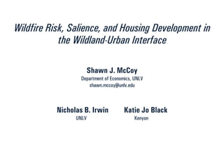
- 1. Wildfire Risk, Salience, and Housing Development in the Wildland-Urban Interface Shawn J. McCoy Department of Economics, UNLV shawn.mccoy@unlv.edu Nicholas B. Irwin Katie Jo Black UNLV Kenyon
- 2. Heightened costs due to fire a function of (1) Development (2) Fire frequency and severity 1] Rapid, unprecedented expansion of the WUI “Wildland-Urban Interface” 30.8 million units in 1990 43.4 million units in 2010 (Radeloff et al., 2018) 2] Fire frequency and severity is increasing a) Changes in global climates (Abatzogluou and Williams, 2016) b) Human influence (Syphard et al., 2018) climate vs. human influence (Syphyard et al., 2007) for anthropogenic ignition (Spyratos et al., 2007) for landscape flammability and development Brings “development” to the forefront of this discussion. We tackle a very specific angle related to fire risk perceptions and the rate of development in the WUI.
- 3. Overview Broadly: Drivers of development in wildfire-risk areas of the U.S. Question: What is the link between fire-risk saliency and development? Background: Risk perceptions inexorably linked to willingness to undertake a risky decision. Natural disasters: evidence that in absence of recent event agent’s may hold inaccurate beliefs regarding disaster risk. Challenge: Finding exogenous (random) variation in saliency Solution: Recent large-scale wildfires as a source of randomness Estimation: “What is the impact of a recent fire on the rate of construction in wildfire risk areas?” “How do the impacts of fire vary over time?”
- 4. Data: Wildfire burn scars (GEOMAC & MTBS) Risk (COWRAP)
- 5. Data: Residential Units (CoreLogic)
- 6. Data: Residential Units (CoreLogic)
- 7. Data: Residential Units (CoreLogic)
- 8. Data: Residential Units (CoreLogic)
- 9. Data: Residential Units (CoreLogic)
- 10. Data: Residential Units (CoreLogic)
- 11. Data: Residential Units (CoreLogic)
- 12. DATA: Latent RiskHow we construct our panel data set: For every county “c” … 𝐷𝑒𝑣 𝑔𝑐𝑡 𝐹𝑖𝑟𝑒𝑠 𝑐𝑡 New houses in group “g” of county “c” in time “t” Number of fires in county “c” in time “t”
- 13. DATA: Latent RiskBaseline Econometric Model: Set-up 𝐸 𝐷𝑒𝑣 𝑔𝑐𝑡|𝑥 𝑔𝑐𝑡 = 𝑒𝑥𝑝൫𝛽1 𝐹𝑖𝑟𝑒𝑠 𝑐𝑡−1 × 𝐻𝑖𝑔ℎ 𝑅𝑖𝑠𝑘 𝑔𝑐 + 𝛽2 𝐹𝑖𝑟𝑒𝑠 𝑐𝑡−1+. . . ൯… + 𝛼 𝑔𝑐 + 𝜂 𝑡 + 𝜀 𝑔𝑐𝑡 . Poisson Fixed-Effects Estimation Strategy What are we testing for? What are we estimating? “Testing for / estimating the differential development response to fire in high-risk vs. low-risk areas over time.” See. Hallstrom and Smith (2005) among others… Idea: Agents in the market where are disaster occurred are exposed to the information conveyed by the shock, but consider the information relevant to the risky area.
- 14. DATA: Latent RiskIsolating saliency effects Main Challenge: Does our High Risk vs. Low Risk comparison isolate pure saliency effects? No, for these reasons: -The fires damage the landscape -Loss of recreational use near the burn -Dis-amenity effects associated with the burn scar -Visual dis-amenities associated with seeing a burned area (All of these could deter development) But: McCoy and Walsh (JEEM, 2018) show that these effects aren’t present once we omit properties within 5km of the burn irrespective of their risk classification.
- 15. DATA: Latent RiskSaliency specification: Re-construct our data after excluding these areas
- 16. DATA: Latent RiskSummary of Main Results Finding 1: Evidence that fire induced changes in saliency deter the rate of new construction in fire-risk areas (e.g. statistically significant reductions in new housing units in high risk vs. low risk areas one year after a fire). Finding 2: Effects are short-lived: After two years, development rates in high risk areas are the same as they were before a fire Evidence that in the absence of a recent fire, perceived risks might diverge from actual risks. Policy Implication: Policy intervention targeting saliency welfare improving? Raises another question: What is the expected magnitude of the reduction in at risk housing from policies targeting risk saliency?
- 17. DATA: Latent RiskSummarizing the policy implications of our findings Approach: We have already estimated the saliency effects of a wildfire Estimates represent a plausible upper bound on the strength of the saliency effects of a man-made policy Counterfactual Simulation: (a) assume “fires” happened in every time period (year) for years that there was not actually a fire (e.g. proxy for the presence of “information based policies” with hypothetical fires) (b) adjust development rates based on our model estimates (c) compare how development really looked vs. how it would have looked in the presence of these additional “fires”
- 18. Main result a b d c 2.6 years a = 35,928 homes b = 53,317 homes c = 49,670 homes